

Historical information
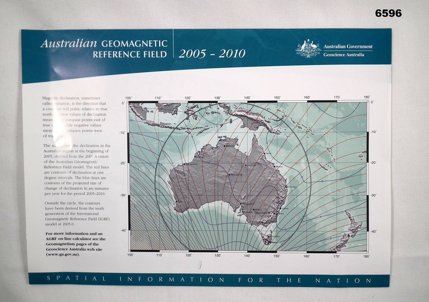
Front side shows a map of australia with red lines of Magnetic Declination and blue lines depicting contours of the projected rate of declination change 2005 - 2010.
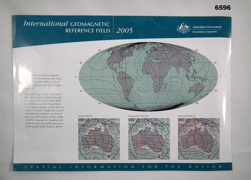
The reverse side shows a world map with lines of magnetic declination at five-degree intervals. There are also three smaller Australian maps showing contours of "Total Field", "Horizontal Field (H)" and "Vertical Field (V)."
Magnetic information was used extensively on the majority of maps produced by the Royal Australian Survey Corps, both topographic and aeronautical.
Physical description
Single A4 size sheet printed in colour on both sides