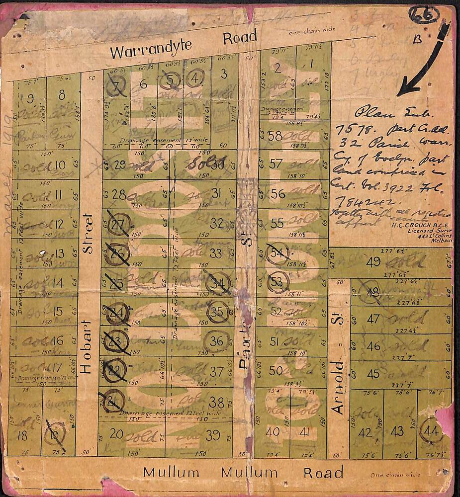
Map, Residential Subdivision Allotment Layout on Mullum Mullum Road, Hobart Street, Paxton Street, Arnold Street and Warrandyte Road, Ringwood, Vic. (Undated, circa 1920)
Untitled image
Reuse this media
Can you reuse this media without permission?Yes
Conditions of use
Attribution-NonCommercial-ShareAlike 4.0 International (CC BY-NC-SA 4.0)
This media item is licensed under Attribution-NonCommercial-ShareAlike 4.0 International (CC BY-NC-SA 4.0). You may share (i.e. copy, distribute, transmit) and rework (i.e. alter, transform, build upon) this item provided that you attribute the content source and copyright holder, and identify any alterations; do not use the content for commercial purposes; and distribute the reworked content under the same or similar license.
Attribution
Please acknowledge the item’s source, creator and title (where known)
Map on cardboard backing clipped from Subdivision Plan 7578 - Part of Crown Allotment 32, Parish of Warrandyte, County of Evelyn.
Inscriptions & markings
H.C. Crouch, Licensed Surveyor, 443 Lt Collins Street, Melbourne. Includes handwritten real estate sales notations and Certificate of Title reference - Vol 3922 Fol 784242.
