Historical information
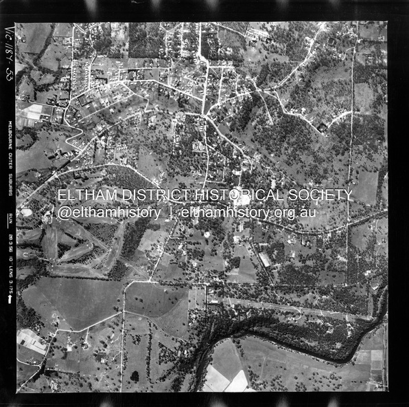
Centred on 20 Panorama Avenue, Lower Plenty bounded by Rattray Road to north, Yarra River to south, Bolton Street to east and Heidelberg Golf Club to west.
Historic Aerial Imagery
Source: Landata.vic.gov.au
Aerial Photo Details:
Project No : 250
Project : MELBOURNE OUTER SUBURBS PROJECT
Run : 16A
Frame : 53
Date : 02/1956
Film Type : B/W
Camera : EAG9
Flying Height : 10000
Scale : 12000
Film Number : 1187
GDA2020 : 37°43'47"S, 145°07'25"E
MGA2020 : 334645, 5822519 (55)
Melways : 21 D9 (ed. 42)
Physical description
Electronic PDF file