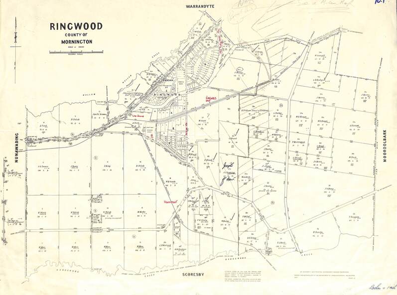
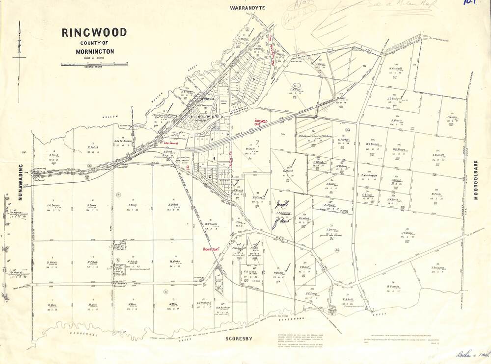
Map - 1957 Reproduction of Plan of Survey, Parish of Ringwood, County of Mornington
Untitled image
Reuse this media
Can you reuse this media without permission?Yes
Conditions of use
Attribution-NonCommercial-ShareAlike 4.0 International (CC BY-NC-SA 4.0)
This media item is licensed under Attribution-NonCommercial-ShareAlike 4.0 International (CC BY-NC-SA 4.0). You may share (i.e. copy, distribute, transmit) and rework (i.e. alter, transform, build upon) this item provided that you attribute the content source and copyright holder, and identify any alterations; do not use the content for commercial purposes; and distribute the reworked content under the same or similar license.
Attribution
Please acknowledge the item’s source, creator and title (where known)
Updated original 1878 map with names of early selectors in area bounded by Nunawading, Warrandyte, Scoresby and Mooroolbark, and Mullum Mullum & Dandenong Creeks.
Inscriptions & markings
Authorised by W.M. Houston, Government Printer, Melbourne. Drawn and reproduced at the Department of Lands and Survey, Melbourne - 1957.