Card - Double-sided Display, Land Subdivision Map Samples
Side 1 - Ringwood East
Reuse this media
Can you reuse this media without permission?Yes
Conditions of use
Attribution-NonCommercial-ShareAlike 4.0 International (CC BY-NC-SA 4.0)
This media item is licensed under Attribution-NonCommercial-ShareAlike 4.0 International (CC BY-NC-SA 4.0). You may share (i.e. copy, distribute, transmit) and rework (i.e. alter, transform, build upon) this item provided that you attribute the content source and copyright holder, and identify any alterations; do not use the content for commercial purposes; and distribute the reworked content under the same or similar license.
Attribution
Please acknowledge the item’s source, creator and title (where known)
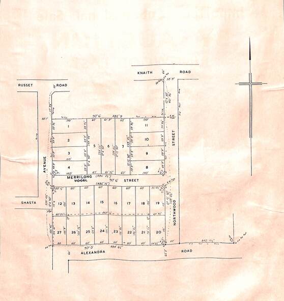
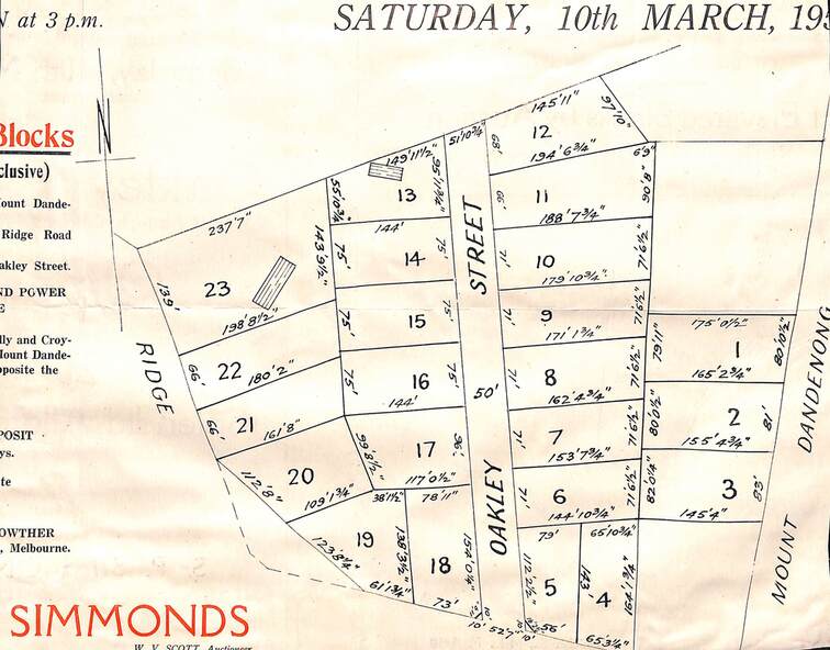
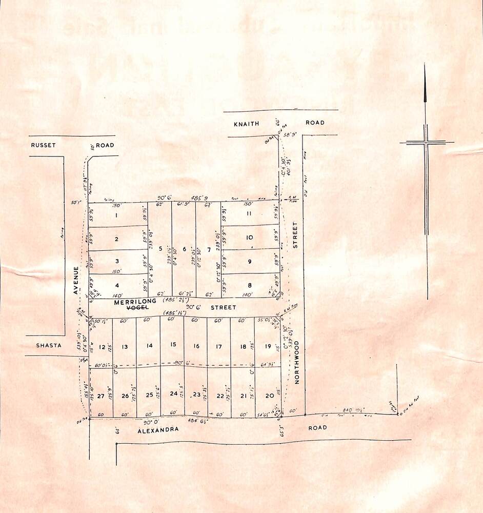
Side 1 - Layout of 20 residential allotments in Shasta Avenue, Merrilong Street, Northwood Street and Alexandra Road, Ringwood East, Victoria (Undated). Side 2 - Extract from Land Auction advertisement for sale of 23 allotments in Ridge Road, Oakley Street and Mount Dandenong Tourist Road, Mount Dandenong, Victoria - circa 1950s.

