Map - Survey Plans, Township of East Ringwood, Victoria - circa 1870s - 1950s
Map 1 Subdivision Plan
Reuse this media
Can you reuse this media without permission?Yes
Conditions of use
Attribution-NonCommercial-ShareAlike 4.0 International (CC BY-NC-SA 4.0)
This media item is licensed under Attribution-NonCommercial-ShareAlike 4.0 International (CC BY-NC-SA 4.0). You may share (i.e. copy, distribute, transmit) and rework (i.e. alter, transform, build upon) this item provided that you attribute the content source and copyright holder, and identify any alterations; do not use the content for commercial purposes; and distribute the reworked content under the same or similar license.
Attribution
Please acknowledge the item’s source, creator and title (where known)
Can you reuse this media without permission?No (with exceptions, see below)
Conditions of use
All rights reserved
This media item is licensed under "All rights reserved". You cannot share (i.e. copy, distribute, transmit) or rework (i.e. alter, transform, build upon) this item, or use it for commercial purposes without the permission of the copyright owner. However, an exception can be made if your intended use meets the "fair dealing" criteria. Uses that meet this criteria include research or study; criticism or review; parody or satire; reporting news; enabling a person with a disability to access material; or professional advice by a lawyer, patent attorney, or trademark attorney.
Attribution
Please acknowledge the item’s source, creator and title (where known)
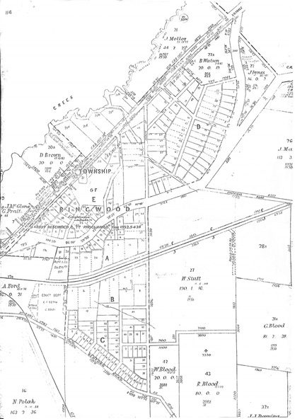
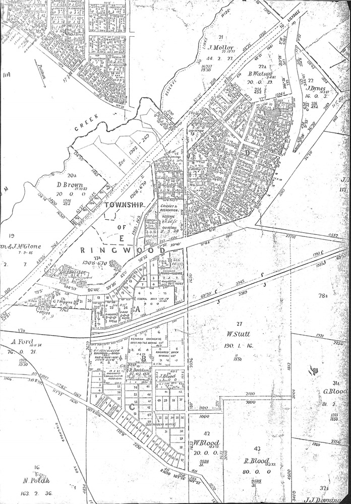
Photocopies of two 1878 Land Survey maps with names of early selectors and names and dates detailing subsequent land purchases to circa 1950s.
Inscriptions & markings
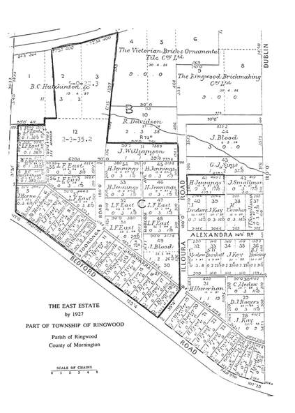
Third map (digitised copy only) "The East Estate by 1927" (from A South Australian Colonist of 1836 and His Descendants by Sir Ronald East - page 147). Includes Bedford Road and Illoura Avenue, Ringwood East.


