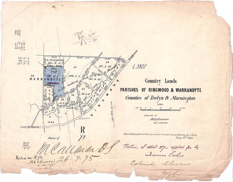
Map, Country Lands, Parishes of Ringwood & Warrandyte, Counties of Evelyn and Mornington - 1868
Untitled image
Reuse this media
Can you reuse this media without permission?Yes
Conditions of use
Attribution-NonCommercial-ShareAlike 4.0 International (CC BY-NC-SA 4.0)
This media item is licensed under Attribution-NonCommercial-ShareAlike 4.0 International (CC BY-NC-SA 4.0). You may share (i.e. copy, distribute, transmit) and rework (i.e. alter, transform, build upon) this item provided that you attribute the content source and copyright holder, and identify any alterations; do not use the content for commercial purposes; and distribute the reworked content under the same or similar license.
Attribution
Please acknowledge the item’s source, creator and title (where known)
Blue shaded area marked on Department of Lands & Survey map highlighting portion of allotment 27B applied for by James Forbes. Torn edges.
Inscriptions & markings
L3922. Photo-lighographed at DL&S, Melbourne by J. Noone, June 8th, 1868. Signature of Assistant Surveyor M. Callanan dated 26.7.1875. Noted on R72 by H. Robinson, 1.10.1875.