Physical description
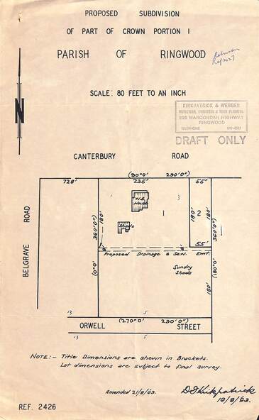
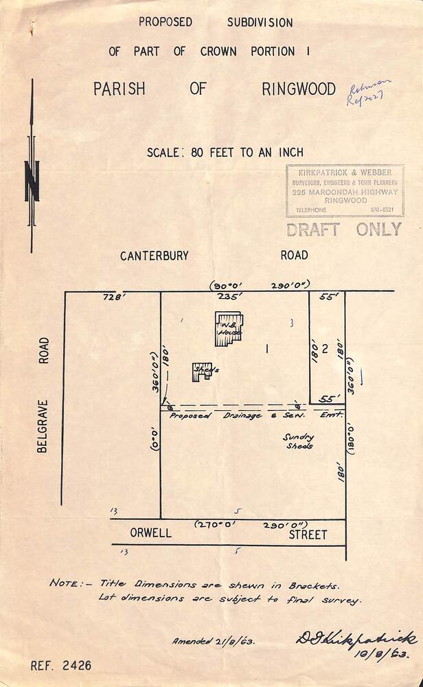
Diagram showing layout of property fronting Canterbury Road and backing onto Orwell Street, later Shortland Street, Ringwood.
Inscriptions & markings
Rubber stamped Kirkpatrick & Webber, Surveyors, Engineers & Town Planners, 225 Maroondah Highway Ringwood, Telephone 870-0321. "Draft Only". Allotment 1 includes location of weatherboard house and sheds, and proposed drainage and sewerage easement. Note:- Title dimensions are shown in brackets. Lot dimensions are subject to final survey. Signed by D. Kirkpatrick, 16/8/1963. Amended 21/8/1963.