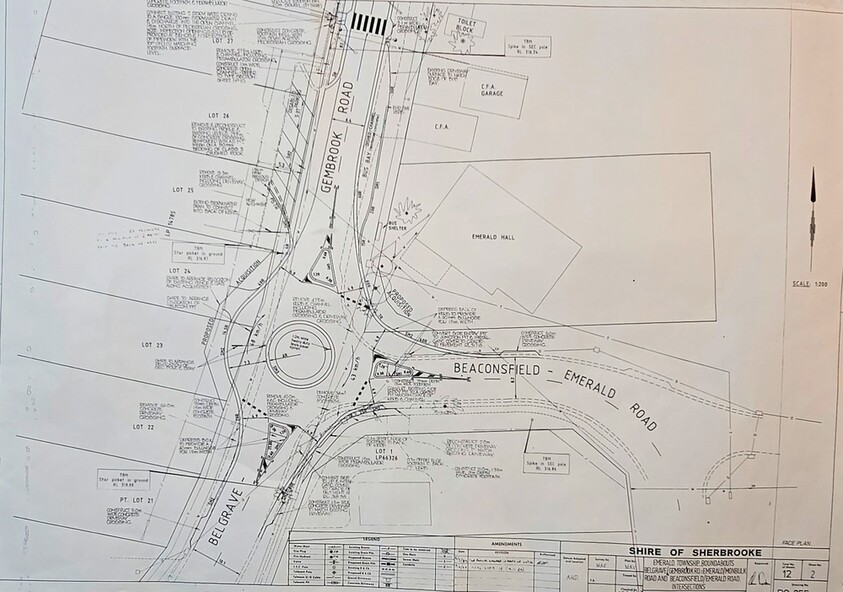
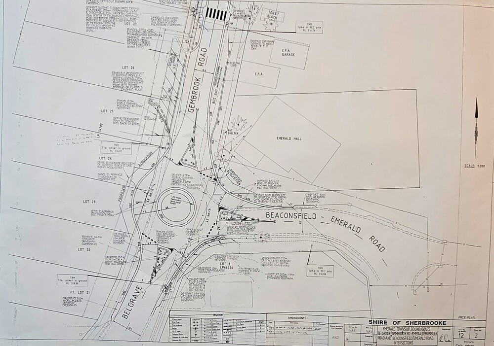
Map - Surveyors Map of new roundabout to be installed at the intersection of Belgrave-Gembrook Rd. and Beaconsfield-Emerald Rd., Emerald 1989, Shire of Sherbrook, Roundabout at intersection of Belgrave-Gembrook Rd., and Beaconsfield-Emerald Rd., Emerald, drawn 1989 - surveyors map, c1989
Image of Surveyors Map of new roundabout to be installed at the intersection of Belgrave-Gembrook Rd. and Beaconsfield-Emerald Rd., Emerald 1989
Reuse this media
Can you reuse this media without permission?Yes
Conditions of use
Public domain
This media item is listed as being within the public domain. As such, this item may be used by anyone for any purpose.
Attribution
Please acknowledge the item’s source, creator and title (where known)