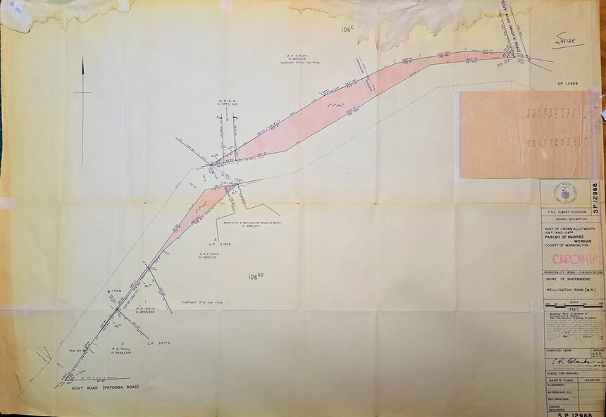
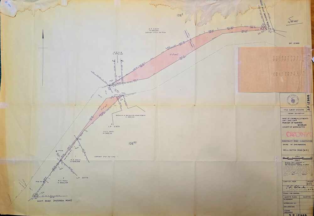
Physical description
Image of Surveyors map outlining part of Wellington Rd., Near Magpie Rd., Clematis 1972
Inscriptions & markings
Title Survey Division/Crown Description/Part of Crown Allotments 106E and 106G2/Parish of Narree Worran, County of Mornington/Cardinia/Shire of Sherbrooke, Wellington Road/Rossley Paul Gardiner of Kirkpatrick & Webber, 289 Maroondah Hwy, Ringwood/Signed S.R. Clarke 21.6.72/B.A. Gibson C/T 8047/414 subtract 0.01 1/2 for Title