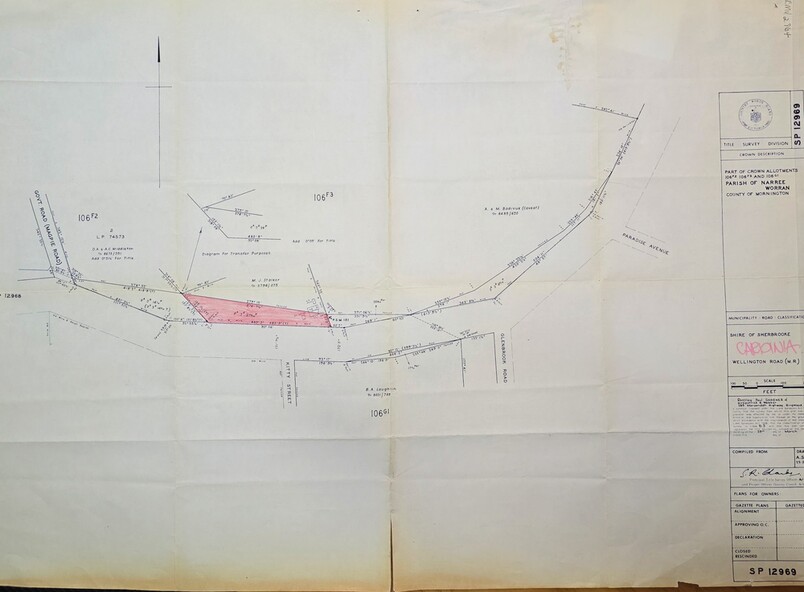
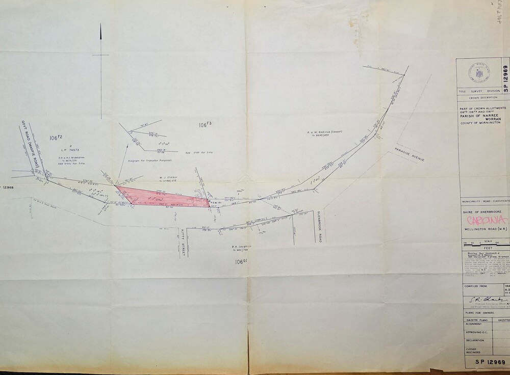
Map - Surveyors map of Wellington Rd. near Magpie Rd., and Paradise Rd., Clematis, Part of Crown allotments 106F2 and 106G1, survey map of Wellington Rd., near Magpie Rd. and Paradise Rd., Clematis 1972, c1972
Image of Surveyors map of Wellington Rd. near Magpie Rd., and Paradise Rd., Clematis
Reuse this media
Can you reuse this media without permission?Yes
Conditions of use
Public domain
This media item is listed as being within the public domain. As such, this item may be used by anyone for any purpose.
Attribution
Please acknowledge the item’s source, creator and title (where known)
Image of Surveyors map outlining part of Wellington Rd., Near Magpie Rd. and Paradise Rd., Clematis 1972
Inscriptions & markings
Title Survey Division/Crown Description/Part of Crown Allotments 106F2 and 106G1/Parish of Narree Worran, County of Mornington/Cardinia/Shire of Sherbrooke, Wellington Road/Rossley Paul Gardiner of Kirkpatrick & Webber, 289 Maroondah Hwy, Ringwood/Signed S.R. Clarke 21.6.72