Physical description
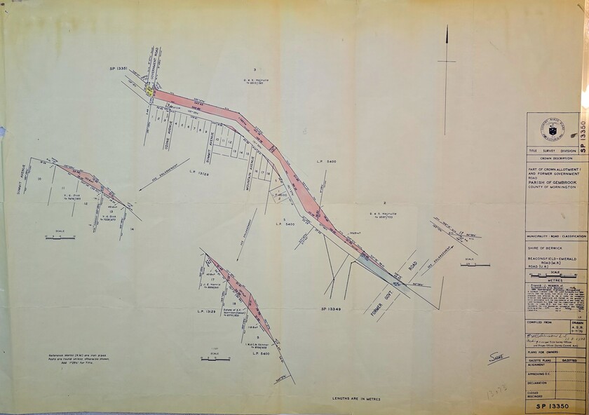
Image of Surveyors map indicating changes to Beaconsfield-Emerald Rd., near Summit Ave., Emerald
Inscriptions & markings
Title Survey Division/Crown Description/Part of Crown Allotment and Former Government Rd., Parish of Gembrook, County of Mornington