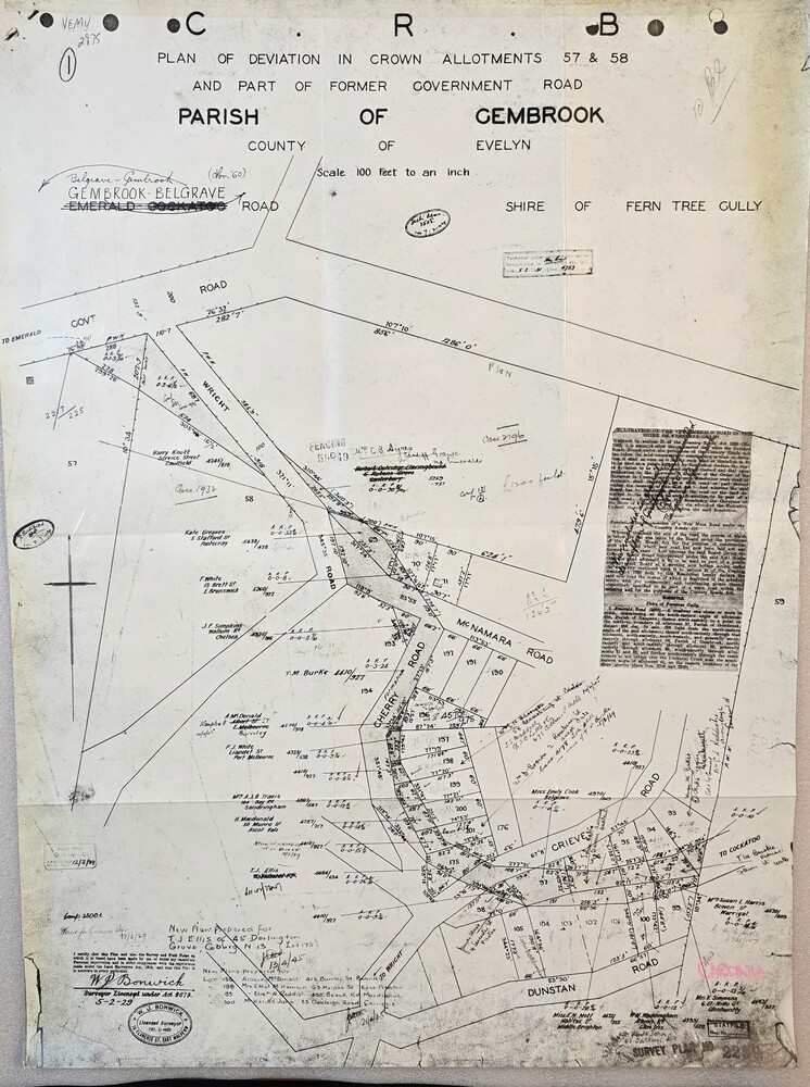
Map - Image of Plan of Deviation in Crown Allotments 57 & 58, Belgrave-Gembrook Rd., near Wright Rd. 1929, Plan of Deviation in Crown Allotments 57 & 58, Belgrave-Gembrook Rd., near Wright Rd. 1929, c1929
Image of Plan of Deviation in Crown Allotments 57 & 58, Belgrave-Gembrook Rd., near Wright Rd. 1929
Reuse this media
Can you reuse this media without permission?Yes
Conditions of use
Public domain
This media item is listed as being within the public domain. As such, this item may be used by anyone for any purpose.
Attribution
Please acknowledge the item’s source, creator and title (where known)
Crown survey map showing plan of deviation in crown allotments 57 & 58, Belgrave-Gembrook Rd., near Wrights Rd., Parish of Gembrook
Inscriptions & markings
CRB/Plan of Deviation in Crown Allotments 57 & 58 and Part of Former Government Road/Parish of Gembrook, County of Evelyn/Belgrave-Gembrook Rd./Scale 100 foot to an inch/Certification of Plan (Signed) W.P. BONWICK, Surveyor Licensed under Act 2679/5-2-29/Survey Plan No. 2239
