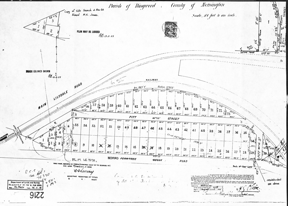
Document, Map - Parish of Ringwood, County of Mornington (Plan of Subdivision, Part of Crown Portion 11) - 1888
Untitled image
Reuse this media
Can you reuse this media without permission?Yes
Conditions of use
Attribution-NonCommercial-ShareAlike 4.0 International (CC BY-NC-SA 4.0)
This media item is licensed under Attribution-NonCommercial-ShareAlike 4.0 International (CC BY-NC-SA 4.0). You may share (i.e. copy, distribute, transmit) and rework (i.e. alter, transform, build upon) this item provided that you attribute the content source and copyright holder, and identify any alterations; do not use the content for commercial purposes; and distribute the reworked content under the same or similar license.
Attribution
Please acknowledge the item’s source, creator and title (where known)
A4 photocopy showing numbered allotments abutting the railway line, fronting Pitt Street, and Bedford Road (previously Ferntree Gully Road)
Inscriptions & markings
Map accuracy certification date - 27th August 1888. Road name amended from Ferntree Gully Road to Bedford Road 8.4.1930. Later re-subdivision notations included on 26.2.1946.
