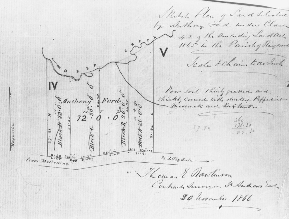
Document, Ford's land at Heatherdale Road, north side of Whitehorse Road, 1866
Untitled image
Reuse this media
Can you reuse this media without permission?Yes
Conditions of use
Attribution-NonCommercial-ShareAlike 4.0 International (CC BY-NC-SA 4.0)
This media item is licensed under Attribution-NonCommercial-ShareAlike 4.0 International (CC BY-NC-SA 4.0). You may share (i.e. copy, distribute, transmit) and rework (i.e. alter, transform, build upon) this item provided that you attribute the content source and copyright holder, and identify any alterations; do not use the content for commercial purposes; and distribute the reworked content under the same or similar license.
Attribution
Please acknowledge the item’s source, creator and title (where known)
Note written on document reads: "Sketch plan of land selected by Anthony Ford under Clause 42 of the amending Land Act 1865 in the Parish of Ringwood. Signed by Thomas E Rawlinson, Contract Surveyor, 20 November, 1866.
