


Historical information
This series of photos documents some of the destruction from the January 1971 flood at Orbost. This flood was a record Snowy River flood and isolated the district through road and bridge destruction.
Significance
These photos are significant because they document aspects of the record 1971 flood at Orbost, and are of good quality.
Physical description
A series of b/w photos from the 1971 record flood in Orbost.
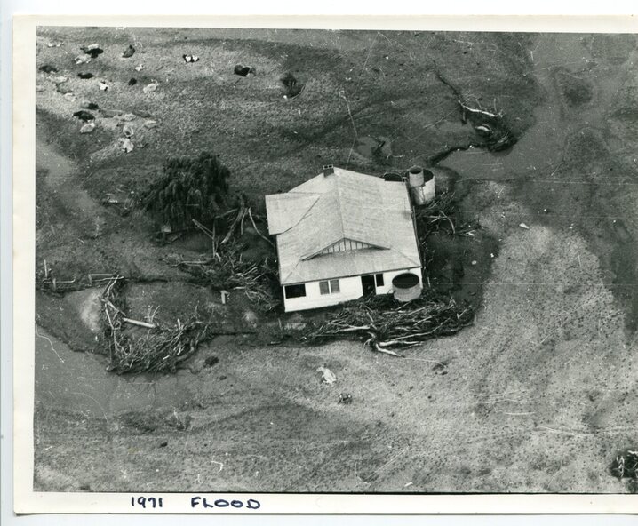
2733.1 A b/w aerial photograph of a farm house with debris around, cattle in the background. Inscription: 1971 FLOOD.
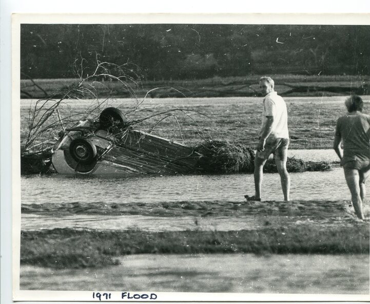
2733.2 A b/w photo of 2 people walking towards an upturned vehicle in floodwaters. Inscription: 1971 FLOOD.
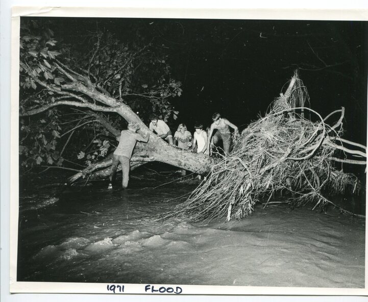
2733.3 A b/w photo taken at night time. Five people beside and climbing on a tree which has been uprooted, with water flowing underneath. Inscription: 1971 FLOOD.
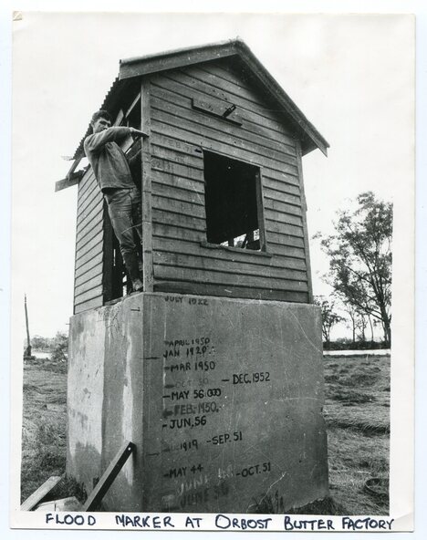
2733.4 A b/w photo of a man standing in doorway of the old pumphouse for the Butter Factory. He is leaning out of the doorway and pointing to a mark on the wall (presumably the height of the 1971 flood). Inscription: FLOOD MARKER AT ORBOST BUTTER FACTORY.
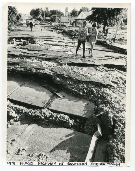
2733.5 A b/w photo of a man and woman walking on a road towards a section of the road which has been broken-up by a flood waters. Inscription: 1971 FLOOD HIGHWAY AT SOUTHERN END OF TOWN.
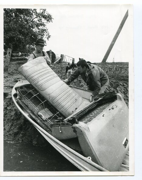
2733.6 A b/w photo of two men with a boat hauled up on an eroded bank. They appear to be loading or unloading car seats. Inscription on back: 1971 FLOOD CLEANING UP.
Inscriptions & markings
2733.1 1971 FLOOD.
2733.2 1971 FLOOD.
2733.3 1971 FLOOD.
2733.4 FLOOD MARKER AT ORBOST BUTTER FACTORY.
2733.5 1971 FLOOD HIGHWAY AT SOUTHERN END OF TOWN.
2733.6 1971 FLOOD CLEANING UP.