


Historical information
This collection of 16 photos of map production on the AUTOMAP 2 computer-based system in Air Survey and Cartographic Squadrons, was most likely taken in 1990. The AUTOMAP 2 system was an upgrade to the AUTOMAP 1 system, comprising Intergraph graphic edit workstation terminals networked to VAX 750/785 main frame computers. Unlike AUTOMAP 1, operators could display digital topographic features on monitors for editing. Successful adaptation of this system meant RASvy was at the forefront of digital mapping/cartographic systems in Australia and overseas. The system comprised Input (Wild B8 Aviograph feature extraction) Raster Scanning (digitising from compilation sheets, Graphic Edit (cartographic completion) and Plot Verification Sub Systems. The system was operational from 1984 to its ‘Newheart’ upgrade in 1993. Throughout its life, the system was progressively refined with productivity gains, achieved from award winning technical development in-house by talented and innovative Army Survey Regiment personnel. Refer to Item 6223.23P for more photos of the AUTOMAP 2 System and examples of topographic digital data. Additional information on topographic digital data and its use in military operations is provided in the video included in Item 6010 titled An Introduction to Topographic Mapping circa 1991.
Physical description
This is a set of 16 photograph of AUTOMAP 2 production at the Army Survey Regiment at Fortuna, Bendigo, c1990. The photographs are on 35mm colour positive film and scanned at 2400 dpi. They are part of the Army Survey Regiment’s Collection.
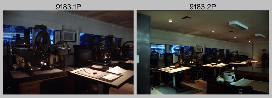
.1) - Photo, colour, c1990, AUTOMAP 2 Wild B8 Aviograph stereoplotter.
.2) - Photo, colour, c1990, Four Wild B8 Aviograph stereoplotters, data storage tapes in foreground.
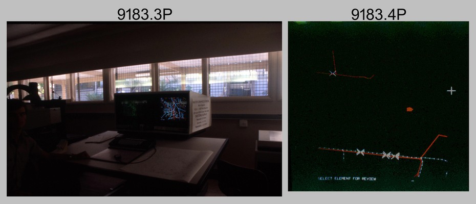
.3) - Photo, colour, c1990, AUTOMAP 2 Graphic Edit Workstation.
.4) - Photo, colour, c1990, AUTOMAP 2 - cultural digital data.
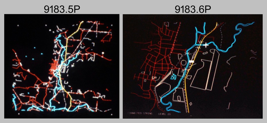
.5) - Photo, colour, c1990, AUTOMAP 2 - drainage and cultural digital data.
.6) - Photo, colour, c1990, AUTOMAP 2 - drainage and cultural digital data, enlargement of previous view.
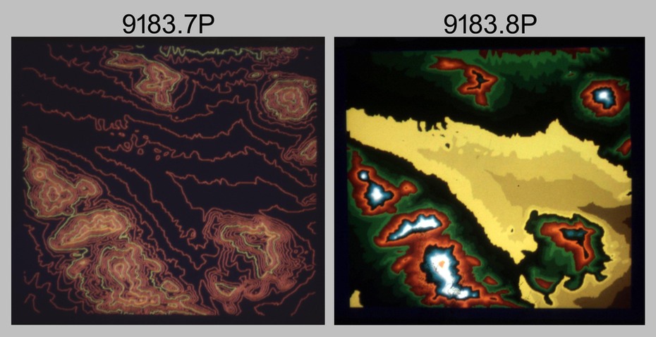
.7) - Photo, colour, c1990, AUTOMAP 2 - contour digital data.
.8) - Photo, colour, c1990, AUTOMAP 2 - contour digital data with coloured elevation tints.
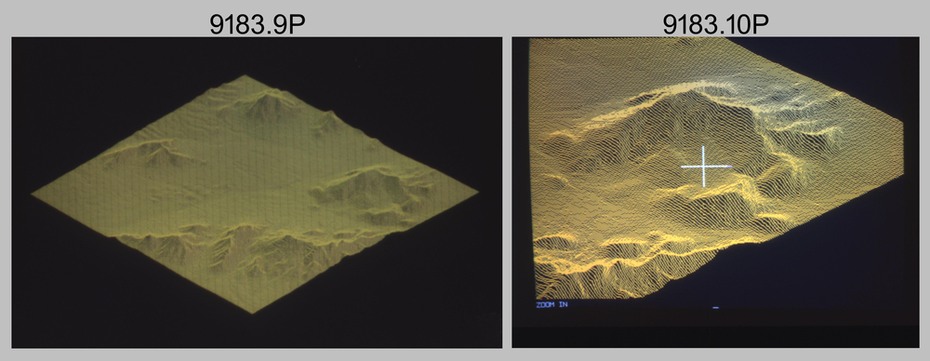
.9) & .10) - Photo, colour, c1990, AUTOMAP 2 - perspective view of 3D digital terrain model.
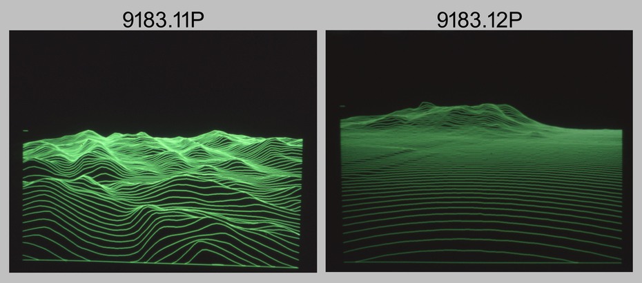
.11) & .12) - Photo, colour, c1990, AUTOMAP 2 – low profile view of 3D digital terrain model.
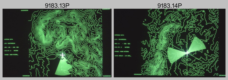
.13) & .14) - Photo, colour, c1990, AUTOMAP 2 – line of sight view sheds from defined point.
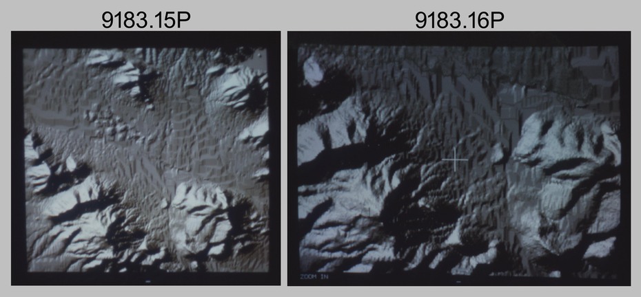
.15) & .16) - Photo, colour, c1990, AUTOMAP 2 – analytical hill shading samples generated from 3D digital terrain model.
Inscriptions & markings
There are no annotations.