Showing 34 items with the theme 'Land And Ecology'
-
 Koorie Heritage Trust / NGV Australia / State Library Victoria
Koorie Art and Artefacts
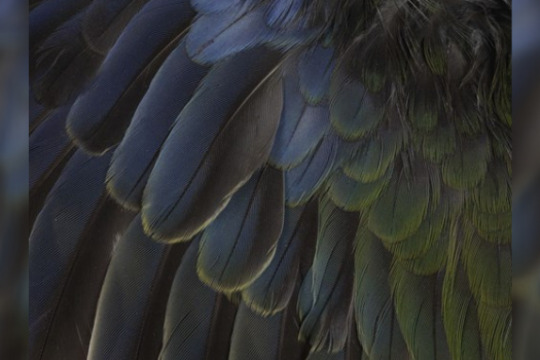
Koorie makers of art and artefacts draw upon rich and ancient cultural traditions. There are 38 Aboriginal Language Groups in Victoria, each with unique traditions and stories. These unique traditions include the use of geometric line or free flowing curving lines in designs.
This selection of artworks and objects has been chosen from artworks made across the range of pre-contact, mission era and contemporary times and reflects the richness and diverse voices of Koorie Communities. It showcases prehistoric stone tools, works by 19th century artists William Barak and Tommy McRae right through to artworks made in the last few years by leading and emerging Aboriginal artists in Victoria.
The majority of the items here have been selected from the extensive and significant collections at the Koorie Heritage Trust in Melbourne. The Trust’s collections are unique as they concentrate solely on the Aboriginal culture of south-eastern Australia (primarily Victoria). Over 100,000 items are held in trust for current and future generations of Koorie people and provide a tangible link, connecting Community to the past.
Within the vibrant Koorie Community, artists choose their own ways of expressing identity, cultural knowledge and inspiration. In a number of short films Uncle Wally Cooper, Aunty Linda Turner and Aunty Connie Hart practice a range of traditional techniques and skills. These short documentaries show the strength of Koorie culture today and the connection with past traditions experienced by contemporary Koorie artists.
Taungurung artist Mick Harding draws upon knowledge from his Country about deberer, the bogong moth: "The long zigzag lines represent the wind currents that deberer fly on and the gentle wavy lines inside deberer demonstrate their ability to use those winds to fly hundreds of kilometres to our country every year."
Koorie artists today also draw inspiration from the complex and changing society we are all part of. Commenting on his artwork End of Innocence, Wiradjuri/Ngarigo artist Peter Waples-Crowe explains: "I went on a trip to Asia early in the year and as I wandered around Thailand and Hong Kong I started to think about Aboriginality in a global perspective. This series of works are a response to feeling overwhelmed by globalisation, consumerism and celebrity."
Koorie culture is strong, alive and continues to grow.
CULTURAL WARNING: Aboriginal and Torres Strait Islander users are warned that this material may contain images and voices of deceased persons, and images of places that could cause sorrow.
-
Digital Stories of the Land
Stories of the Land is a collection produced as part of the Australian Centre for the Moving Image (ACMI) digital storytelling program.
These stories explore the land as a thread that connects people to their surroundings. The personal narratives provide a way for understanding place on its own terms and often those terms can be challenging; drought bushfires and isolation for those who live on the land.
People across Victoria have shared stories as part of this ACMI collection capturing the essence of the land as a setting to their lives inextricably linked to the experiences and events that have shaped them.
-
 Lauren McAlary
Collecting Fire: A new kind of practice
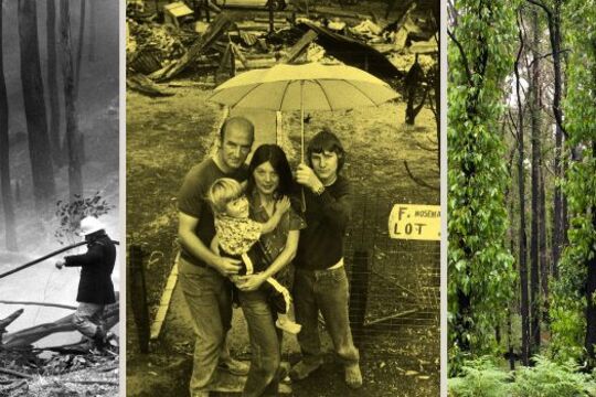
The fires of February 2009 left an indelible mark on the histories of Victoria’s community collecting organisations; whether through blackened ash markings or by the absence of once cherished objects and ephemera.
This exploration of Victoria’s collecting response to the Black Saturday bushfires is inspired by Liza Dale‐Hallett, Rebecca Carland and Peg Fraser’s reflections on the Victorian Bushfires Collection project, in 'Sites of Trauma: Contemporary Collecting and Natural Disaster'.
-
Ash Wednesday 30
On 16 February 1983 the Ash Wednesday bushfires burned approximately 210,000 hectares of land, 2,080 homes were destroyed and 75 people, including 47 Victorians, lost their lives.
Among the 47 Victorians killed were volunteer Country Fire Authority (CFA) firefighters from Panton Hill, Nar Nar Goon, Narre Warren and Wallacedale brigades.
Many businesses, stores, equipment, machinery, stock and other assets were lost. The total cost of the property damage in Victoria was estimated to be over $200 million.
These web pages were created to commemorate the 30th anniversary of the Ash Wednesday Bushfires in 2013.
The Victorian Government invited people to share their stories of recovery, healing and hope as a tribute to those who experienced a natural disaster, and as an inspiration to all Victorians.
A collection of selected stories and short films have now been published here.
-
 Museums Victoria
Time Flies in Museum Collections: Ornithology in Victoria
Natural science collections are vast treasure troves of biological data which inform current research and conservation.
Alongside bird skins, nests, eggs and DNA samples sits a magnificent collection of rare books, illustrations and images which charts the history of amateur and professional ornithology in Victoria.
Whilst the big names such as John Gould (1804–1881), are represented, the very local, independent bird observers such as John Cotton (1801-1849) and Archibald James Campbell (1853–1929) made some of the most enduring contributions.
The collections also document the bird observers themselves; their work in the field, building collections, their efforts to publish and the growth of their ornithological networks. Captured within records are changes in ornithological methods, particularly the way data is captured and published.
However the data itself remains as relevant today as it did when first recorded, 160 years of collecting gives us a long-term picture of birdlife in Victoria through space and time.
-
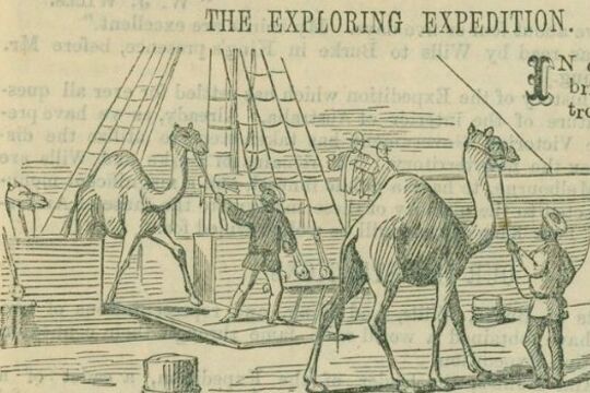
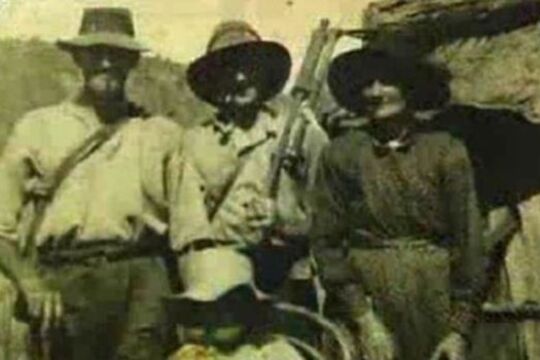
Burke and Wills: Have Camels Will Travel
Dromedary camels were introduced to Australia in 1840. The first significant shipment, however, was made to service the Burke and Wills expedition, which was the first exploring party to use camels, as well as horses, for transporting supplies.
In 1858, George Landells, who had worked as a horse trader in India, wrote to the Victorian Government explaining how the camel was ideally suited to the Australian landscape. He offered to travel to India and purchase camels on behalf of the Victorian government for use in exploration, and as the basis of a breeding stud. The government’s Board of Science and Zoological Gardens Committee agreed that the camel would be useful on the Australian continent, and Landells was authorised to borrow money from the Indian Government and make the purchase.
Landells traveled through India, Pakistan and Afghanistan to source the animals, engaging eight camel drivers to assist him on the journey from Karachi to Melbourne in December 1859, arriving mid-June 1860.
He was hailed for his travels through the ‘very unsettled’ lands by the English Scindian Newspaper, and similarly lauded in Melbourne where the ‘exotic’ animals caused a sensation, as did their handlers, identified variously as Indians, Sepoys, and Malays.
Partly in response to his fame, Landells was appointed second in command of the Burke and Wills expedition. He was also appointed officer in charge of the camels.
Landells recruited John Drakeford and John King, who had helped him bring the animals from Karachi to Melbourne, and four of the eight handlers: Samla (described by Becker as a Hindu), Dost Mahomet (or Botan), from Guznee; Esau Khan (or Hissand or Isaah), Belooch, who came from Mahadpoor in the Punjab, and another man from Kelat.
The expedition party departed Melbourne with 26 camels. As the expedition progressed, Landells and Burke disagreed over their treatment and Landells resigned in Menindee.
Four of the 26 camels were left at Menindee. Dost Mahomet stayed with 16 at the Coopers Creek depot. Burke and Wills took six animals with them on their trek to the Gulf and John King, travelled with them, to care for. Some of the animals strayed or were lost, others were abandoned. Burke, Wills, Charlie Gray and John King ate the last of them, as they struggled back from the Gulf of Carpentaria.
However the Burke and Wills Expedition was not the end of the story. Camels had proved their worth in negotiating the harsh and dry Australian interior and camels became an increasingly important form of transport in the Australian inland. Between 1870 and 1900, over 15,000 camels and 2000 cameleers were brought to Australia. The cameleers were commonly known as “Afghans” although small in number, they made a vital contribution to Australia’s exploration and development.
Feral camels now roam across outback Australia. In response, markets for live camels and camel meat have developed. It is more than likely that the descendents of Landells’ camels are among those that now roam the Australian continent.
-
Women on Farms
In 1990, a group of rural and farming women met in Warragul for what was to be the inaugural Women on Farms Gathering.
A group of local women had developed the idea while involved in a Women on Farms Skill Course. It was to prove inspirational, and the gatherings have been held annually ever since, throughout regional Victoria.
The Women on Farms Gathering provides a unique opportunity for women to network, increase their skills base in farming and business practices, share their stories and experience a wonderful sense of support, particularly crucial due to the shocking rural crises of the last decade. Importantly, the gatherings help promote and establish the notion of rural women as farmers, business women and community leaders.
The relationship between Museums Victoria and the Women on Farms Gathering is a model of museums working with living history.
-
 Paige Gleeson
Making Do on ‘the Susso’: The material culture of the Great Depression
There are currently 5.25 trillion pieces of plastic in our oceans. The demands on renewable sources like timber, clean water and soil are so great they are now being used at almost twice the rate that the earth can replenish them. Finite resources like fossil fuel are consumed at an alarming rate, changing the earth’s climate and pushing animal species to the brink of extinction. Current patterns of consumption are exceeding the capacity of the earth’s ability to provide into the future.
All over the world, environmental movements concerned with sustainability have sprung up in response. Conscious consumers are advocating for their right to repair their own electronic devices, fighting a culture of planned obsolesce and disposability. Others are championing the repair, reuse and recycling of clothing and household goods to extend their lives. Reducing waste in the kitchen and promoting food options with lower environmental impact has become increasingly popular.
Climate change may be a uniquely twenty-first century challenge, but sustainability has a history. In 2021 many people are making a conscious choice to embrace anti-consumerism, but during the Great Depression of the 1930s it was necessity that drove a philosophy of mend and make do.
In 1929 stock markets crashed and sent economies around the western world into free fall, triggering the Great Depression. Australia’s economic dependence on wool and wheat exports meant that it was one of the worst affected countries in the world. The impact of the Depression on the everyday lives of Australians was immense. Not everyone was effected with the same severity, but few escaped the poverty and austerity of the years 1929-1933 unscathed.At the height of the Depression in 1932 Australia had an unemployment rate of 29%, and thousands of desperate people around the country queued for the dole. Aboriginal Australians were not eligible for the dole, and had to rely solely on government issued rations.
-
But That's Another Story
This innovative collaboration between community museums and local artists captures the unique living memories and rich cultural heritage of communities along the Murray River between Wodonga and Corryong.
Seven short films were created as part of the project:
Nox-All Rabbits: How do you deal with a plague of rabbits? With Nox-All. Rabbiting was a way of life in Victoria, especially during the plague of 1932. Rabbits were a source of food and income (the felt from their pelts used in Akubra hats), and thought by some to be "better than chickens".
Jim Simpson's knitted war trophy: During World War II Jim Simpson's aircraft was shot down over Germany and he became a prisoner of war at Stalag IVB. Jim's ingenuity helped to keep prisoners warm, and ultimately resulted in an extraordinary memorial.
Old time music in the blood: Nariel Creek residents have music in the blood, so much so that they've been told their accordion style is special, using all four fingers at once. The Nariel old time style of Australian traditional music and dance continues with the Nariel Creek Folk Festival.
A history of engine power: Watch out... refurbishing engines can become an addiction. The gem of this collection of over 150 engines is an 1866 Ransom Sims engine, one of only 5 in the world, which has been lovingly restored.
The Saleyards Made Wodonga: Cattle were one of the biggest industries in Wodonga, and the saleyards a focal point town, not least because plum pudding was served in the luncheon room all year round.
The Icon of Wodonga: You need more than a trickle of water to fight a fire. The Wodonga water tower was welcomed as it brought the 'luxury' of water to town, and when it was decommissioned the community rallied to prevent its demolition.
The Saw Doctor's Wagon: The 'Sharpening King' and his family travelled throughout eastern Australia sharpening knives in their 'road urchin'. A circus-like wagon, the urchin was first pulled by horses, then a Chevron truck, and finally, by a David Brown tractor.
Participating museums: Granya Pioneer Museum, Man From Snowy River Museum, Tallangatta & District Heritage Group, Wodonga Historical Society.
Supported by: the Commonwealth Government’s Regional Arts Fund, Regional Arts Victoria, National Museum of Australia, City of Wodonga, Shire of Towong, Museums Australia (Vic) and Arts Victoria. Auspice organisation: Murray Arts
-
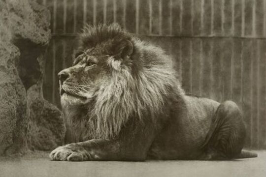
Melbourne Zoo and You: 150 years
In the early 1900s, a trip to Melbourne Zoological Gardens may have involved a ride on Queenie the elephant, throwing peanuts to the bears in the bear pit and watching Mollie the orang-utan smoke a cigarette in her small enclosure!
Things are different these days.
Nowadays, a visit to Melbourne Zoo could include viewing endangered Asian elephant calves, Mali and Ongard, foraging and roaming in the Trail of the Elephants habitat; viewing baby Dewi in the Orang-utan Sanctuary; listening to a keeper explain the Zoo’s breeding program for the endangered Lord Howe Island stick insect or even enjoying a twilight concert in the grounds.
The Zoo has been part of the experiences and memories of the Victorian public for 150 years, and in this story we celebrate, explore and remember the animal stars of yesterday and today, visitor experiences through the generations and stories of the keepers who have cared for the animals since it opened in 1862.
Visitor encounters and expectations of the Zoo have evolved over the years along with the Zoo’s practices. It has transformed from its early days of collecting and displaying species for public viewing to its current role in fighting extinction through local and global breeding and conservation programs.
Zoos Victoria’s commitment to fighting extinction is also explored through the Melbourne Zoo’s breeding programs for threatened and endangered species and their international conservation work outside the zoo walls.
For more on the history of Melbourne Zoo listen to Queenie, Choi and friends , a wonderful radio documentary by Hindsight, Radio National.
For further information, read:
150 years Melbourne Zoo, Zoos Victoria, Bounce Books, 2012
Almost Human: Reminiscences of Melbourne Zoo, A.A.W Wilkie, Whitcombe and Tombs, 1920
The Zoo Story, Catherine de Courcy, Penguin, 1995
Queenie’s Last Ride, Mary O’Brien, The Age, August 9, 2006
Melbourne Zoo: Acclimatisation to Conservation, Mark Kellet, Australian Heritage Magazine, 2009
Evolution of a Zoo: History of Melbourne Zoo 1857 - 1900, Catherine de Courcy, Quiddlers Press, 2003
-
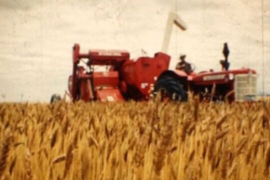 Malcolm McKinnon
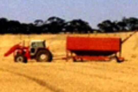
John Teasdale – Chronicle of a Country Life
These little films from Victoria's Western Plains are about the actual and the everyday.
They have no hint of sensationalism in them. They are plain and utterly honest. They tell us about tractors and farming machinery. About fire and flood and snow. We glimpse Anzac Day and are touched by the irony of people remembering in a time and place few people remember or think about today. But there is no sentimentality in these films either. They are just plain good. - Martin Flanagan.
John Teasdale (1936 – 2004) was a farmer at Rupanyup in the Victorian Wimmera. He was also a keen and highly accomplished cinematographer, filming consistently for over 50 years to create a long-term record of working life on a family farm and of community life in a particular part of rural Victoria.
When television arrived in Australia in 1956, John successfully applied to the ABC to become a 'stringer' cameraman, shooting regional footage that was frequently included in state-wide news broadcasts and in segments produced particularly for regional viewers. John continued in this role for thirty years, until changing technology eventually made the role of 'regional stringers' obsolete.
The Teasdale film collection constitutes a nationally significant record of working and community life in a small Australian dry-land farming community, reflecting enormous changes in farming practices as well as transformations in the character and scale of community life in and around Rupanyup. At a time when many dry-land farming communities are actively reinventing themselves as their underlying social and economic structures change dramatically, John Teasdale’s films provide a critical point of reference and affirmation.
Artist and filmmaker Malcolm McKinnon, with the support of John Teasdale’s family, is undertaking ongoing work to interpret and celebrate this rich and resonant archive.
-
Pangerang Country with Freddie Dowling
Indigenous Warning: Please be aware that this story contains imagery and representation of people that may be deceased, and images of places that could cause sorrow.
In this story Freddie Dowling, Pangerang Elder, introduces us to several Pangerang stories and sites.
The Pangerang people were a nation of sub-clans who occupied much of what is now North Eastern Victoria stretching along the Tongala (Murray) River to Echuca and into the areas of the southern Riverina in New South Wales. Their land includes the Wangaratta, Yarrawonga and Shepparton areas through which the Kialla (Goulburn) and Torryong (Ovens) Rivers flow. The approximate boundaries are south to Mansfield, west to Echuca, east to Chiltern and north to near Narrandera in New South Wales.
Freddie Dowling learnt the stories of the indigenous people of this area from his grandmother, Annie Lewis, and his father, Frank ‘Munja’ Dowling.
The Pangerang words used in this story were written down by Annie Lewis in 1900. She learned them from her mother, Luana ‘Lily’ Milawa. Freddie remembers that both his grandmother and father spoke these words. His father also taught him to speak while hunting and travelling in the bush of their country.
The word Pangerang is often written and known as Bangerang, and Banerang, 'because, in our language, "puh" and "buh" sound similar' (Freddie Dowling).
-
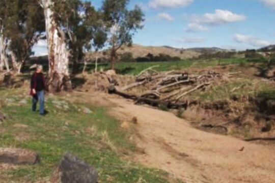
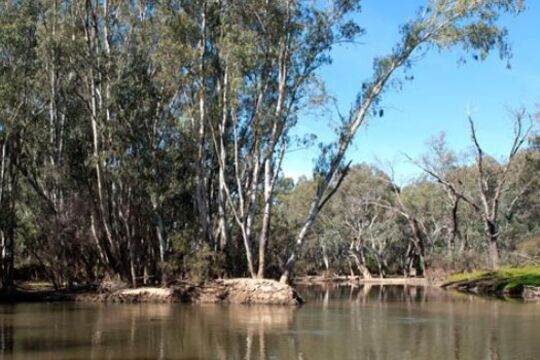
Murray Darling Palimpsest #5
Mildura is situated just south-east of the confluence of two of Australia’s great rivers: the Darling and the Murray.
As water and land use creep up to the top of our national agenda, the Mildura region emerges as one of Australia’s most contested places, with small ‘block’ farmers, multinational companies, State and Federal politics, among others, entering the debate.
As such, it was perhaps the most natural place for the biennial Palimpsest expositions and symposiums to arise. Following on from Mildura’s famous sculpture triennials, Palimpsest plays on the idea of the landscape as palimpsest, written and rewritten over both physically and with layers of meaning. Palimpsest engages directly with land, land use, water and issues of sustainability, involving artists, and scientists and other experts, spearheading the creative exploration of key environmental issues.
-
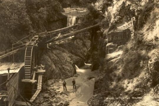
Walhalla: fires, floods and tons of gold
In a remote, steep, and heavily timbered valley in the Victorian Alps, in the summer of 1862-63, a small party of prospectors found encouraging signs of gold at the fork of a tributary of the Thomson River. It was December. By February of the next year an immense quartz reef had been discovered.
This reef – Cohen’s Reef - yielded over 50 tonnes of gold, making Walhalla one of Victoria’s richest and most vibrant towns, and home to thousands: with hotels, shops, breweries, churches, school, jail and its own newspaper. It also had its own photographic studio, headed by the Lee brothers.
Several albums still survive of Walhalla at its peak, providing a fascinating, evocative photographic record of a 19th century mining town; capturing a moment that was to be shortlived.
In 1910 the railway arrived, but too late: the gold was disappearing. The town emptied out and began its long sleep, until the 1980s when restorations began in earnest, and electricity finally arrived in 1998.
William Joseph Bessell (ex Councillor of the Shire of Walhalla) was presented this series of photos in 1909 on the eve of his departure from Walhalla.
-
Savoy Ladies Group
The Italian community of Myrtleford, in the picturesque Ovens Valley in alpine North Eastern Victoria, arrived mainly to work in the tobacco industry which once thrived in the area. The region now has a distinctive Italian-Australian culture with settled second, third and fourth generation Italian families.
Tobacco farming was a lonely experience for many of the Italian women who migrated to Myrtleford. Unlike their husbands, the women stayed largely on the farms and lacked social contact outside of their immediate circle. Once their children grew up and mechanisation changed the labour requirements on the farms, women were frequently on their own.
The Myrtleford Savoy Ladies Group was founded in 1983 by nuns concerned about the social isolation of women in the area. It has been a great success, forming a network of companionship amongst women of Italian heritage to this day.
Cultural Warning: Aboriginal and Torres Strait Islander users of this website are warned that this story contains images of deceased persons and places that could cause sorrow.
-
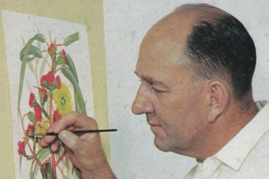 Amanda Ahmed and Mali Moir
An Eye for Eucalypts
In his hometown of Ararat, Stan Kelly (1911 – 2001) was known as an engine driver and as a talented painter of plants and flowers. A determined amateur, Stan painted at home on a small table and shared his talent by teaching botanical art in Ararat. Today, many Australians travelling overseas carry his artwork in their pocket.
Kelly is now recognised as one of Australia’s premier botanical illustrators, especially respected for his works on eucalypts. His first book, Australian Eucalypts in Colour, was published in 1949. His most celebrated work, Eucalypts Volumes I & II, was first published in 1969 and became a core reference for students of Australian botany.
Kelly received an Order of Australia Medal in 1980. In 2009, he was posthumously honoured when a selection of his botanical illustrations was adapted for the ‘N’ series Australian passport.
The Langi Morgala Museum in Ararat houses a permanent exhibit on Stan Kelly and his work, including a fine collection of his paintings.
A collection of over 500 of Kelly’s watercolour paintings is held by the National Herbarium of Victoria, Royal Botanic Gardens Melbourne.