Showing 53 items matching "cave hill"
-
 Eltham District Historical Society Inc
Photograph, Pound Bend tunnel, Warrandyte, Warrandyte Mystery Tour, 29 May 1994, 29/05/1994
[article by Bettina Woodburn in EDHS Newsletter No. 97, July 1994:] THE WARRANDYTE MYSTERY TOUR MAY 29TH 1994 - Members of the Eltham Historical Society met at the Old Post Office, now converted into the Warrandyte Historical Museum, for a picnic lunch on the sunny back verandah overlooking the shimmering Yarra River. Interesting photographs and artefacts filled various rooms outlining the history of this area, and told tales of Aboriginal and more recent neighbours of the Eltham Shire. The weather was calm, cloudy mostly with only occasional sunny patches, but it wasn't cold, although the autumnal leaf colours had changed to wintry brown. "All Aboard" and we set off in the Warrandyte Community Bus (with the School Bus sign displayed at the rear) to learn about local places of "Pride and Joy” from Bruce our guide and Tom the driver. Almost directly opposite we entered Whipstick Gully to explore the first of the district's hidden treasures - the Victory, one of the largest of the six or so major mines, past the old quarry now used for abseiling practice. By torchlight we entered the rocky hillside and saw the seams of quartz the miners had followed in their search for gold. Stamping batteries, and there was one in this gully, converted discarded rock into 'road metal'. Warrandyte is proud to be the first declared Goldfield in 1851, and one of the longest surviving, into the 1920s. A pleasant drive across the Bridge and along Bradley's Lane to Norman's Reserve brought us to see another Tunnel at Pound Bend through which the Yarra was diverted to allow about three miles of river-bed to be used for prospecting for alluvial gold. Still on this side of the river we visited the Old Slab Hut in Castles Road. This remnant of miners' housing is preserved because it had been incorporated into a weatherboard house, and saved from the bulldozers - a last minute reprieve, for preservation, by the National Trust. Devastating bush fires have destroyed other old cottages built of wattle and daub, with bark roofs and stone fire-places. The Cairn commemorating the disclosure of Gold Discovery at Warrandyte on June 30th 1851 beside Anderson's Creek Road was our next point of historical interest. We drove on to South Warrandyte and circled back to above the ford on Anderson's Creek to the entrance of the 4th Hill Mine. Again we crept along with our torches, careful of the low roof-rock, and side shafts. At a junction in a large cavity we were able to stand, look up a long air-vent which some 'cavers' climb down, and marvel at, and experience an aspect of a miner's life. Outside we heard the same bird songs, the trills and bell-pealing, saw the same straggly eucalypts, and a silver leafed wattle in flower, native grasses and ferns, and the neat present day houses, often of Warrandyte stone, perhaps veneered only. The day ended pleasantly, seeing more of the Yarra from Everard Drive, and the water rushing out of the Tunnel at Pound Bend, before returning to afternoon tea or coffee at the Museum. A great day for all concerned - many thanks to the Organisers.Two colour photographswarrandyte, activities, pound bend -
 Federation University Historical Collection
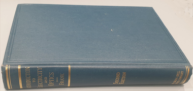
Book, Nathaniel Frank, Introduction to Electricity and Optics, 1950
Dark Blue synthetic hard caver book of 440 pages with gold lettering embossed on the spine. non-fictionelectricity, optics, force, electrostatic, charg and capacity, electric currents, magnetic field, alternating current circuits, electromagnetic waves, radiation, conduction, dielectrics, geometrical optics, interference, heat radiation, diffraction -
 Flagstaff Hill Maritime Museum and Village
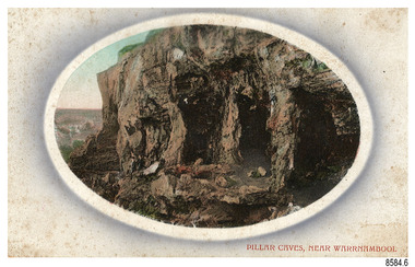
Postcard - Scenic, Warrnambool, Pillar Caves, near Warrnambool, 1902-1929
The nine postcards in this set were donated together and date to the early 1900s. All but one postcard in this set shows images of Warrnambool, in the Western District of Victoria; the other has a London image. The postcards were all printed in Great Britain according to that country’s postal regulations. The fronts of all cards have titles printed in red. Most of the images on the cards are attributed to photographer Joseph Jordan and belong to the Jordan Series. The back of these cards has an outline for a postage stamp, a vertical dividing line and a heading on each side of the line to separate the Correspondence from the Address. Postcards or ‘correspondence cards’ appeared in Britain in 1894. They were plain cards with a space for the message on one side and an address on the other; regulations didn’t allow anything but the address to be written on the ‘address’ side. In 1902 the British regulations then allowed a picture to be printed on the front and the address on the back, so messages had to be written on the picture side. Soon, the regulations changed and the back was divided for a message and the address. Pliiar Caves, near Warrnambool – The formation at the front of the cave resembles the pillars of a porch, giving the cave its name. Local social media discussion locates the caves near Lake Gillear, east of Warrnambool. The area was popular with young lads as a place to explore and to go rabbiting. The caves in this area are home to colonies of bats and have been a source of bat feces or bat guano, which is an enriching additive to soil. The 19th century sailing ships in the Nitrogen or Guano trade collected large quantities of guano from caves and popular bird nesting locations to sell as a rich fertiliser, due to its high nitrogen and phosphorus properties. Joseph Jordan - Joseph Jordan was born in 1841 in Leicester England. When he was 16 he joined the 7th Queen's Own Hussars and was sent to India at the outbreak of the mutiny. He took part in the relief of Lucknow and remained in India for eleven years. It was during this time that he became interested in photography. He was posted to New Zealand and later came to Victoria, becoming a sergeant major of the Mounted Rifles. In the mid-1880s he came to the Western district where he was responsible for establishing units of the Mounted Rifles in various country towns such as Dunkeld, Mortlake, Panmure, Bushfield, Koroit etc. He resigned from the army in 1889 and set up a professional photography studio in Liebig Street, Warrnambool. He became very well known in the Western District for family photographs, official photographs of local councillors and groups as well as views of local scenery. In 1891 he photographed the wrecked barque ‘Fiji’ at ‘Wrecks Beach’ near Princetown. His business was taken over by his son Arthur around 1917. Joseph was a keen rifle shot and in 1924 he donated the "Jordan Shield" as a prize to the Victorian Rifle Association. He was made a "Life Honorary Member" of the Warrnambool Returned Soldiers League and in 1933 he was recognised as being the oldest living soldier in Victoria. Joseph died in 1935 aged 95.The image of the Pillar Caves rock formation with figures on it suggests that the location was a popular place to visit. The choice of subject for this postcard indicates the popularity of Warrnambool's natural environment as a tourist attraction at a time when ships called coastal traders brought passengers and cargo to the Port of Warrnambool from ports along Victoria's southwest coast. The presence of bats in local caves also connects the postcard to the 19th century Nitro Trade and Guano Trade, when bat guano was collected and sold for plant fertiliser around the world. Joseph Jordan is a significant figure in Warrnambool history as he helped to establish early units of the Mounted Rifles (G Company) in local towns during the late 1880's and later, photographed local scenes, groups and citizens of early Warrnambool.Postcard, one of nine, landscape orientation, coloured print within an oval border and mauve-toned shading. The cameo image shows figures on the high, grass-topped cliff, one between the likeness of pillars in the cave entry, and others walking on the rocks nearby. The background below is rough ground. There is no correspondence written on the card. The back has inscriptions and outlines for a postage stamp. Jordan Series, printed in Great Britain.Front, in red: “PILLAR CAVES, NEAR WARRNAMBOOL” Back in black: “Jordan Series” “POST CARD” “PRINTED IN GREAT BRITAIN” “For correspondence” “The Address only to be written here”flagstaff hill maritime museum, flagstaff hill maritime village, flagstaff hill maritime museum and village, maritime museum, warrnambool, great ocean road, warrnambool and district, warrnambool scenes, local scenes, views of warrnambool, joseph jordan, jordan series, jordan photography, postcard, souvenir, correspondence, cameo postcard, landscape, rock formation, pillar caves, pillars cave, lake gillear, rebbiting, bats, guano, nitro trade, fertilizers -
 Federation University Historical Collection
Reports, Big Cat sightings (dates), 1989
Research of dated sightngs of Big cats in Victoria from 1868-1989. australian mythical animals collection, david waldron, dse, big cats, panthers pumas, nuggety, gippsland, black cats, tasmanian tiger, marysville, wood's point, thylacine, south gippsland, felid, gippsland big cat, kelvin healey, peter hall, sherbrooke forest, woodside, walaces flat, mountain lion, heyfield, mt taylor, walhalla, mt selma, warrnambool, kyneton, korumburra, canadian forest, grampians, panton hill, beaconsfield, apollo bay, forrest, victoria valley, rapanyup, dargo, inglewood, doncaster east, tidal river, cape bridgewater, walkerville, dooen, st arnaud, lake bung bong, mitta mitta, moliagul, emerald, kinglake, cape otway, dereel, leonard's hill, daylesford, korweinguboora, lal lal, noojee, eltham, lancefield, trentham, daisy hill, tanjil south, wonthaggi, cockatoo, warrenheip, greendale, howqua, lake buchan, melville caves, portland, mt elephant, morwell, navarre, yarram, yandoit, moonambel, maryborough, taravale, coghill's creek, trentham, carisbrook, inglewood, warrenmang, yarragon, creswick, emerald, stawel, clunes, majorca, heathcote, talbot, daylesford, newham, broadford, peter chapple -
 National Vietnam Veterans Museum (NVVM)
Domestic Object, Tea Cup
... Object Domestic Object Caves Long hai Hills ...Ceramic tea cup. grey glaze with blue Asian patterntea cup, ceramics -
 Bendigo Historical Society Inc.
Document - LONG GULLY HISTORY GROUP COLLECTION: HISTORY OF THE FIELD (GOLD)
Three pages of History of the Field, A Brief History of Mining in Bendigo. The history starts in 1851 when gold was discovered along the Bendigo Creek to 1992 when Bendigo Mining NL purchased the licences and infrastructure from WMC. There are four small photos: Two men working a puddling machine; Victoria Hill - 1850's Open Cut; Victoria Hill Quartz Mine, and the Central Deborah Mine. There is also a web address in the top right corner.bendigo, history, long gully history group, the long gully history group - history of the field (gold), mrs margaret kennedy, mrs farrell, edward nucella emmett, cave and amos, victoria quartz, new chum railway, bendigo amalgamated gold mies, bendigo mines ltd, deborah mines, william burrell, wmc, williams united, charshalton, bendigo mining nl, new bendigo project, trevor clark, shelley saunders, peter wiseman, new bendigo - 10 million ounces of gold -
 National Vietnam Veterans Museum (NVVM)
Ephemera - Order of Service, framed
Operation Hammersley , 10 February until 9 March 1970, was undertaken by a combined force of: C Company, 8th Battalion, the Royal Australian Regiment (8RAR); armoured personnel carriers from 3 Cavalry Regiment; tanks from 1 Armoured Regiment; sappers from the Royal Australian Engineers; a mortar section from 8RAR’s Support Company; air support, and even a Navy destroyer off-shore to provide gunfire support. The operation aimed to protect 17 Construction Squadron, Royal Australian Engineers, at a quarry in the western foothills of the Long Hai hills. The Long Hai hills were a stronghold for the Viet Cong, who used the caves there as a bunker complex and had planted many landmines and booby traps in the area. Over two fierce weeks, 8 RAR carried out patrols and conducted ambushes, engaging VC troops and eventually capturing the bunker system. However, it was a costly campaign. In total, over 70 Australians were killed or wounded during the operation. The worst day for mine casualties in Australia's war in Vietnam occurred on 28 February 1970. It became known as 'Black Saturday". Nine members of 8RAR were killed and 29 wounded. This item is the Order of Service from the memorial service held at Nui Dat on 3 April 1970 to honour those killed at Long Hai. It was issued to the donor, National Serviceman G G Ravenscroft, who was serving in 1 Platoon, A Company 8RAR during Operation Hammersley, and received a minor shrapnel wound on Black Saturday.Two typed A-4 pages that have been folded into booklet, now flattened and framed. Listed are the prayers, Bible readings and sermon given, along with the names of the 8 fallen soldiers, and the chaplains who officiated.8rar, long hai, long hai hills, black saturday, 1970, operation hammersley, ravenscroft, geoff ravenscroft, memorial service -
 Victorian Aboriginal Corporation for Languages
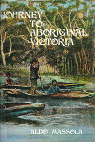
Book, Aldo Massola, Journey to Aboriginal Victoria, 1969
Looks at the Aboriginal community from the time of white contact, across many parts of Victoria. Chap.1; Melbourne - early missions, camp of Native Police, corroboree trees, canoe trees, grave &? headstone of Derrimut; quarries at Keilor, excavation sites at Green Gully &? Keilor; quarry at Mt. William, notes on inheritance of quarries Coranderrk settlement - Barraks grave, notes on his life; Chap.2; Geelong - Yawangi group of the Wothowurong tribe, camping grounds in area quarries; Notes on William Buckley, Gellibrand (a notable Aboriginal), graves in the Western Cemetery; Chap.3; Colac - war between Colac &? Geelong tribes; Mission at Birregurra, reason for failure of Buntingdale Mission; brass plate to Coc-coc-coine; reserve at Elliminyt, native ovens, camp sites, initiation site &? ritual; quarry sites, axegrinding factory, rock pecking &? engraving; dried hand &? 3 Aboriginal skulls found; Chap.4; The south-west coast - middens, camp sites notes on Framlingham Stn., fish traps at Tyrendarra; Chap.5; The far west - massacres of Aborigines near Casterton; camp sites, oven mounds; the first cricket team formed; Aboriginal cemetery; Chap.6; Hamilton - camps; Mount Rouse Station, axegrinding grooves at Nareeb Nareeb, shelters described, fish traps, massacre at Lake Condah; mission; canoes; Chap.7; Camperdown - legend about Lake Bullen Merri; obelisk erected in memory of Aborigines of district especially chief Wombeetch Puyuun; Jarcoort tribe; fish weirs, camps, intertribal fights between Booluc-burrers, Jarcoorts &? Ellengermote groups; bartering place at Mount Noorat; articles traded, legend of Flat-Top Hill; Chap.8; Ballarat - camp at Lake Wendouree; White Stone Lagoon; legends concerning Mt. Buninyong &? waterfalls at Lal-lal; camp sites; pygmy-type implements near Meredith, quarry at Glue Pot Rocks near Durdidwarrah; brass plate of King Billy; Chap.9; Ararat - Tjapwurong territory; camp sites, quarries, shield &? canoe trees; Bunyip belief at Lake Buninjon of Muk-jarawaint &? Pirtkopen-noot tribes, gives legend; stone implements; mill stones; fish weirs; stone arrangement near Lake Wongan; ground drawing of a bunyip, paintings in rock shelter near Mt. Langi Ghiran; Chap.10; Maryborough - camps, oven mounds, rock wells, stone arrangement at Carisbrook; camp sites at Mt. Franklin; Chap.11; Charlton - belief in Mindye (snake); canoe trees, ovens, camp sites, water holes, rock wells, stone implements; method of rainmaking; Chap.12; Horsham-Stawell, The Wimmera - Wotjobaluk land; camps, fish traps at Toolondo; Black Range cave paintings, Flat Rock shelters (detailed account of these paintings); Bunjils Cave; Chap.13; Horsham-Stawell, The Mallee - camp sites, implements; Ebenezer Mission, Willie Wimmera taken to England by Rev. Chase to become a missionary, died in England; Chap.14; The Murray River, Mildura Swan Hill - Battle of the Rufus; ceremonial ground, Lake Gol Gol, canoe &? shield trees; stone implements; camp sites, fire place arrangements; fish traps; oven mounds; Chap.15; The Murray River, Swan Hill-Echuca - legend about Lake Boga; camps, oven mounds, the Cohuna skull, Kow Swamp, method of burial; Chap.16; Shepparton ovens; brass plates of King Paddy of Kotupna &? King Tattambo of Mulka Stn., native well, camps; Chap.17; Wangaratta -camps, quarry, rock holes, the Faithful massacre; grinding rocks at Earlston; Chap.18; The High Plains - Ya-itma-thang; camps, Bogong moth feasts, native paths for trade &? intertribal fights, articles traded; painted shelters; Koetong Ck. Valley, near Mt. Pilot &? near Barwidgee Ck.; Chap.19; Dandenong - water holes, list of 8 holes in Beaumaris - Black Rock area; camps, middens, stone implements (microliths), legend of Angels Cave, stone axes, Native Police Force, Narre Narre Warren Station, legend about rocks on Bald Hill, kangaroo totemic site; Chap.20; Wonthaggi- Yarram - natives visit Phillip Is., murder of William Cook and Yankee by five Tasmanians (listed as Bon Small Boy, Jack Napoleon Timninaparewa, Fanny Waterpoordeyer, Matilda Nattopolenimma and Truganini) near Cape Patterson, men; camp sites, middens, legend of White Rock; Chap.21; Sale - Bairnsdale, The Lakes Country middens, camps; legend at Wulrunjeri; story of a white woman supposedly living with with the Tutangolung tribe, efforts made to prove story; canoe trees; Chap.22; Sale-Bairnsdale, The Inland Braiakolung tribe, camps, implements, canoe &? shield trees; Ramahyuck Mission, grinding rocks, fights with Omeo tribe; native tracks, death through enemy magic - procedure, belief in ghosts; Chap.23; Lakes Entrance and the Country to the east - Kroatungolung people, legend of Kalimna Valley; camps, stones of Nargun, bunyip, devils at Lake Tyers, excavation at Buchan, carbon dates; middens, ochre at Cape Conrad, stone fish-hook file at Thurra River; note on Bidwel tribe; Each chapter gives historical details, early contacts, relationships with settlers; Aboriginal place names and detailed description of sites and geographical features.b&w photographs, b&w illustrations, colour illustrationsgeelong, colac, hamilton, camperdown, ballarat, ararat, maryborough, charlton, horsham, stawell, murray river, shepparton, wangaratta, dandenong, wonthaggi, yarram, sale, bairnsdale, lakes entrance -
 The Adam Lindsay Gordon Commemorative Committee Inc.
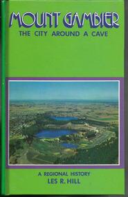
Book, Mount Gambier- The City Around a Cave- A Regional History- Les hill-Openbook Publishers-1972
-
 The Adam Lindsay Gordon Commemorative Committee Inc.
Book, Mount Gambier- The City around a Cave- A regional History- Les R Hill.- Openbook Publishers, Adelaide. 1972
-
Swan Hill Regional Art Gallery
Painting, YAXLEY, William, Newdegate cave, 2000
... Swan Hill Regional Art Gallery Horseshoe Bend Swan Hill ... -
 Ballarat Heritage Services
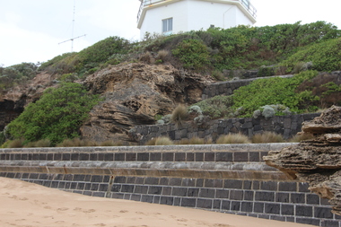
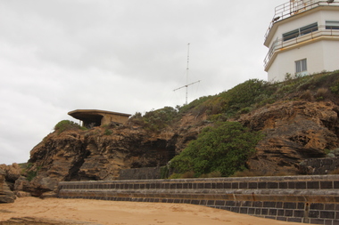
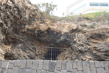
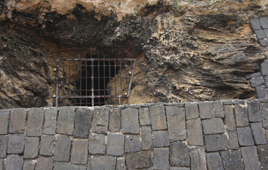
Photograph - Colour, Clare Gervasoni, Buckley's Cave, Point Lonsdale, 31/03/2015
Colour photograph of William Buckley's Grave on the coastline at Port Lonsdale. william buckley, aborigines, point lonsdale, buckley's cave -
 Ballarat Heritage Services
Photograph - Colour, Clare Gervasoni, Buckley's Cave, Point Lonsdale, 31/03/2015
Colour photograph of William Buckley's Grave on the coastline at Port Lonsdale. william buckley, aborigines, point lonsdale, buckley's cave, waddawurrung -
 Ballarat Heritage Services
Photograph - Colour, Clare Gervasoni, Buckley's Cave, Point Lonsdale, 31/03/2015
Colour photograph of William Buckley's Grave on the coastline at Port Lonsdale. william buckley, aborigines, point lonsdale, buckley's cave, waddawurrung -
 Ballarat Heritage Services
Photograph - Colour, Clare Gervasoni, Buckley's Cave, Point Lonsdale, 31/03/2015
Colour photograph of William Buckley's Grave on the coastline at Port Lonsdale. william buckley, aborigines, point lonsdale, buckley's cave, waddawurrung -
 Ballarat Heritage Services
Photograph - Colour, Clare Gervasoni, Buckley's Cave, Point Lonsdale, 31/03/2015
Colour photograph of William Buckley's Grave on the coastline at Port Lonsdale. william buckley, aborigines, point lonsdale, buckley's cave -
 Ballarat Heritage Services
Photograph - Colour, Clare Gervasoni, Buckley's Cave, Point Lonsdale, 31/03/2015
Colour photograph of William Buckley's Grave on the coastline at Port Lonsdale. william buckley, aborigines, point lonsdale, buckley's cave -
 Bendigo Historical Society Inc.
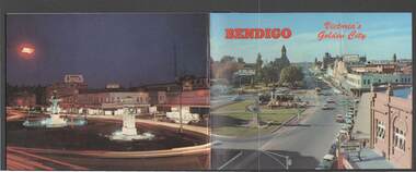
Book - BENDIGO: VICTORIA'S GOLDEN CITY
Coloured booklet of various scenes and buildings in and around Bendigo, titled Bendigo Victoria's Golden City. The front cover has a scene of Charing Cross looking towards Pall Mall. Inside the front cover is a very brief history and some Historical Buildings are mentioned. They are: Fortuna, Shamrock Hotel, Gold Mines Hotel, City Hall, Post Office, Law Courts, the Home for the Aged, Sacred Heart Cathedral, St. Paul's, Specimen Cottage, Log Lock-up and the Chinese Joss House. The coloured pictures inside are: The Central Deborah Gold Mine, Fortuna, Miner's Cottage, The Gold Mines Hotel, Victoria Hill, Bendigo Law Courts, Eaglehawk Log Lock-up, Look-out Tower Rosalind Park, Alexandra Fountain - Charing Cross, Conservatory Gardens with Law Courts in background, Inside the Conservatory, Bendigo Home & Hospital for the Aged - Victoria's 'White House', Sacred Heart Cathedral, Chinese Joss House, Chinese Joss House - Interior of the Main Temple, Bendigo Pottery - Potter at work, Bendigo Municipal Offices, Bendigo Institute of Technology at Flora Hill, Mt. Alvernia Hospital, Cobb & Co Coach, R Class Locomotive, Bendigo Tramcar, Lake Weeroona and Lake Eppalock Pumping Station. Some more attractions are mentioned inside the back cover. On the back cover is the Cenotaph - the only scale replica of the Whitehall Cenotaph - and Alexandra Fountain by night.Nucolorvue Productions Pty Ltdbendigo, tourism, photographs of bendigo icons, bendigo - victoria's golden city, fortuna, shamrock hotel, gold mines hotel, city hall, post office, law courts, home for the aged, victoria's 'white house', sacred heart cathedral, st paul's, specimen cottage, log lock-up, chinese joss house, charing cross, cenotaph, alexandra fountain, centra deborah gold mine, army cartographic unit, miner's cottage, harvey town, victoria hill, look-out tower rosalind park, conservatory gardens, conservatory, bendigo pottery, bendigo municipal offices, bendigo institute of technology, mt alvernia hospital, cobb & co coach, r class locomotive, bendigo railway station, bendigo tramcar, lake weeroona, lake eppalock pumping station, art gallery, historical museum eaglehawk, melville's caves, whitehall cenotaph, nucolorvue productins pty ltd, national library of australia -
 Bendigo Historical Society Inc.
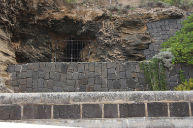
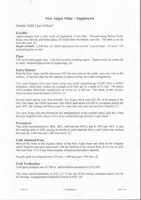
Document - NEW ARGUS MINE - NOTES ON THE NEW ARGUS MINE
... on the New Argus Mine Eaglehawk Specimen Hill Mine Mr Cave Mr Amos ...One handwritten and four typed copies of notes on the New Argus Mine at Eaglehawk. One typed copy has a locality map attached. Notes mention locality, depth of shaft, early history, prominence, amount of gold obtained and production. References; Special Edition Australian Mining Standard 1/6/1899, Mines Dept. Booklet 'Bendigo Goldfield' 1936, Mines Department Annual and Special Reports, Annals of Bendigo Mining Section 1886 - 1922 and A. Richardson. 4 Typewritten copies of this item have not been scanned.document, gold, new argus mine, new argus mine, notes on the new argus mine, eaglehawk, specimen hill mine, mr cave, mr amos, the argus mine, north specimen hill mine, adlinga and pascoe & co, new hopeful, bendigo amalgamated goldfields, special edition australian mining standard 1/6/1899, mines dept. booklet 'bendigo goldfield 1936, mines dept. annual and special reports, annals of bendigo mining section 1886 - 1922, a richardson -
 National Vietnam Veterans Museum (NVVM)
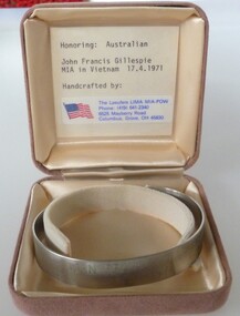
Ceremorial Object - MIA Bracelet - L/Cpl John Francis Gillespie, The Laeufers LIMA MIA-POW
The last Australian soldier to be listed as missing in action was Lance Corporal John Francis Gillespie of 8 Field Ambulance. On 17 April 1971 Gillespie was serving as a helicopter medic during a 'dustoff' (helicopter medical evacuation) operation in the Long Hai hills in Phuoc Tuy province. Four South Vietnamese Regional Force soldiers had been injured by a mine explosion and the difficult terrain demanded a helicopter evacuation. But the Long Hai hills were an insecure landing zone. The caves and dense timber of the Long Hais had long harboured a major Viet Cong base area and the dustoff operation required the protection of helicopter gunships. As the first wounded soldier was being winched up, the hovering helicopter was hit by enemy machine-gun fire. It crashed to the ground and burst into flames. Although the crew escaped, Lance Corporal Gillespie and three other soldiers were engulfed in the fireball. A helicopter crewman, Corporal Robert Stephens, repeatedly entered the burning aircraft and tried in vain to rescue Gillespie, until being forced back by the flames. Stephens was later awarded the British Empire Medal for his courage. Gillespie's body could not be recovered from the burning wreckage which was reduced to slag by the fire. Private Gillespie was listed as missing in action, apparently on a technicality because his remains could not be found. The classification was subsequently altered to killed in action.Stainless steel open ended bracelet with missing serviceman's full name and date missing. In a buff square satin lined box.MIA John Francis Gillespie 17/04/71mia, john francis gillespie, l/cpl john francis gillespie, 3170244, royal australian army medical corps, 8th field ambulance, cpl robert stephens, killed in action -
 Bendigo Historical Society Inc.
Document - LONG GULLY HISTORY GROUP COLLECTION: SOME HISTORICAL INFORMATION
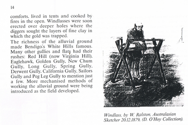
BHS Collection12 photocopied pages. Page four has acknowledgements, Page five mentions Pen-Portraist by Raly Wallace and Kevin Vallence, Page 14 mentions some rich areas: White Hills, Red Hill (now Virginia Hill), Eaglehawk, Golden Gully, New Chum Gully, Long Gully, Spring Gully, Derwent Gully, California Gully, Sailors Gully and Peg Leg Gully. There are two sketches on the page: Windless, by W. Ralston, Australasian Sketcher 20/12/1879 (D O'Hoy Collection) and a sketch of some miners in a tent with some mining equipment in front of it. There are two men in front of a fire at the front of the tent. Page 16 has a sketch of an old brick house with iron lace on the veranda and a picket fence at the front. Page 17 mentions the school and some Friendly Societies and Church. Page 22 mentions Quartz Mining. There is a Lithograph of a Quartz outcrop, New Chum Gully 1852 by George Rowe and a View of Surface Workings 1861, a Batchelder Photo. Page 23 mentions Edward Nucella Emmett, a pioneer gold digger who became involved in many important public issues. Page 25 mentions Company Mining and Crushing. It has a sketch of a Primitive Quart Crusher. Page 37 Mentions Richard Pope, a Miner who tramped from job to job in Bendigo and eventually followed the rush to Broken Hill. Page 38 mentions the Eaglehawk Brass Band and Friendly Societies in Eaglehawk. Page 39 is headed Miner's Cottage. It mentions stone miners' cottages. Page 40 has a sketch of a Georgian Style Sandstone Cottage Harvey Town. Page 41 mentions men sweeping the road to get gold, Bull Family grocery shop and a blacksmith. Page 42 is headed St. Augustine's. Page 43 has a sketch of St. Augustine's Church. Page 59 is headed Bendigo Amalgamated Goldfields (B.A.G.) Edward Clarence Dyason was largely behind a new company set up in 1917 to work the Bendigo field in an entirely new way. (B.A.G.) wished to take over all existing mining companies, and place them under a single management structure.bendigo, history, long gully history group, the long gully history group - some historical information, mr l hooley, mr l bennetts, mr w watson, mr w heraud, mr d m davies, mr w perry, mr h harvey, mr a llewellyn, mr e oates, chook temple by mr alan llewellyn, mr f cusack, tracey ipsen, ray wallace, bendigo field naturalists' club, eaglehawk tree lovers' society, bendigo historical society, university of melbourne, kevin vallence, monash university, bendigo technical college, south australian writer's fellowship, windlass, w ralston, australasian sketcher 20.12.1879, d o'hoy, mechanics institute, california gully school, bell topper hill, i.o.r. (rechabites), cobden tent, refuge tent, sutton tent, m.u.i.o.o.f.'s loyal darling, bible christian church, california hill wesleyan methodist church, saint jude's anglican church, quartz mining, e n emmett, jonathan harris, haris' claim, j hustler, george rowe, batchelder, la trobe library, cave, amos, new chum line of reef, edward nucella emmett, bendigo city council, all saints, william westgarth, latham and watson, hustler's line of reef, bell and irons, ballerstedt and son, young and company, nicholas and bassit, ensor, thomas carpenter, quartz crusher, goldfields and mineral districts of victoria, richard pope, daniel webster mine, isaac dyason, old chum mine, north old chum mine, young chum mine, george lansell, lazarus, silicosis of the lungs, eaglehawk brass band, victoria hotel, mr williams, eaglehawk branch of the australian natives association, loyal catherine lodge, mr james, odd fellows in the loyal catherine lodge branch no 4935, richard harvey, thomas harvey, moonta copper mines, harvey town, national trust of australia, eaglehawk tree lovers society, saint mungo's methodist church, clark's beehive battery, world war 1, kee-young, lady barkly hotel, prankhurst, bull family, cousin jack, st augustine's, myers, nicholls, john o'brien, around the boree log, the rev dean hayes, st kilian's, bendigo amalgamated goldfields (b.a.g.), edward clarence dyason, r h s abbott, hercules and energetic, south new moon, new chum goldfields, central red white and blue consolidated, brown john, the life and times of long gully, bendigo press, val white, megan snoop -
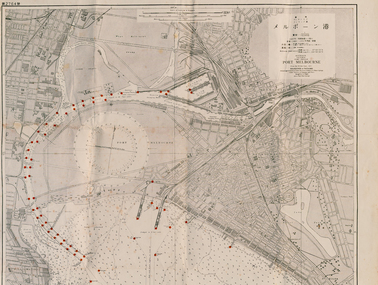 Port Melbourne Historical & Preservation Society
Map - Large map of Port Melbourne with Japanese annotation, British Chart, Port Melbourne, c 1937
Jim Sinclair was born in Cruickshank Street, Port Melbourne in 1924. During World War II Jim found this Japanese map in a network of caves near Rabaul, Papua New Guinea. He remembers '"The Japanese had linked just about every hill with a tunnel. Concreted. Most of them were packed with stuff. I used to wander through - being very careful too, mind you!. You didn't want yourself to get blown up. I found these maps. I thought that looks familiar! It's in English with Japanese stuff on it too."A large 1937 British map of Port Melbourne with Japanese printed annotations with strategic infrastructure marked. Used during World War II. Stamp on back explains age in Japanese. war - world war ii, port of melbourne, jim sinclair, japanese -
 University of Melbourne, Burnley Campus Archives
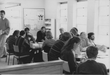
Album - Black and white and colour prints, Victorian College of Agriculture and Horticulture, Staff Photographs, c. 1990
Collection of 110 photographs and some negatives, mostly colour. Some ID photographs, some at functions or taking classses. Identified by Ala Shtrauser, Ross Payne, Andrew Smith. Found in James Pearson's former office 2015 by Ross Payne. (1) Peter McSweeney, Kevin Blaze, Ross Payne, Ed Smart, Phil Kenyon, Paula Cave, John Delpratt, Peter May, Ian Winstone. (2) Geoff Olive, Ian Winstone, John Brereton, John Delpratt, Ross Hall. (3) Peter McSweeney, Nick Bailey, Phil Kenyon, Brian Shields, Geoff Olive, Ian Winstone, John Brereton, John Delpratt, Ross Hall, James Hitchmough, David Aldous. (4) Geoff Connelan, Jamie Pearson, Ross Payne, Ed Smart, Peter May, James Hitchmough, Nick Bailey, Ross Hall, Catherine Jaggs. (5) James Will, Bata Thomas. (6) John Delpratt, John Rayner. (7) Phil Mayle, James MacIntyre (student), James Will, Jayne Lindholm. (8,19) David Aldous, Eric Littlejohn. (9) John Rayner. (10) Nick Bailey. (11) Alex Campbell. (12,13) Ala Hires (Shtrauser). (14) Michael Green. (15) Ross Hall, Peter McSweeney, James Hitchmough, Kevin Blaze. (16,44) Brian Shields. (17,18) Kylie Cannon, Karen Geyeregger, Nick Osborne, Jim Pleasance. (20) John Delpratt. (21) Ian Winstone and student working on Student Gardens. (22) Geoff Olive, Ed Smart. (23) Robina Duggan, Michèle Adler. (24) Catherine Jaggs, Peter May. (25,26) Mark MacNamara, Kelvin McKenzie, Ruth Beilin, Ed Smart. (27) Rosemary McConell, Elizabeth Hill. (28) Fred Taylor, Mike Nechwatal. (29) Claire Scott, Nick Bailey, Ross Hall. (30,66) John Brereton. (31) Rosemary McConell, Mark MacNamara. (32) Mike Nechwatel, Bata Thomas, Graham Sterry. (33) Geoff Olive, Phil Tulk. (34) Ed Smart, Ruth Beilin, Ian Winstone. (35) James Will with students. (36,37) Peter McSweeney. (38) Alex Campbell, Jamie Pearson, Ross Payne. (39) Geoff Connellan. (40) Richard Green, Darryl Gibbs. (41) John Rayner, Karen Geyeregger. (442) Ross Payne. (43) Jamie Pearson, Jim Pleasance. (45-49) Claire Scott. (50-54) Ian Winstone. (55) Michelle Dall, Kylie Cannon, James Will, Catherine Jaggs, Nick Bailey, Jamie Pearson, John Brereton, Peter May, Rosemary McConell, Ed Smart, Greg Moore, Ian Winstone, David Aldous, Brian Shields "Sept 1990". (56) Brian Shields, Peter May, Kelvin McKenzie, Fred Taylor, Phil Tulk, Richard Green, Graham Sterry, Ross Payne "Sept 1990". (57,58) James Will, Jill Kellow 1987/88 on Grampians excursion with Associate Diploma students staying in Shearers' quarters. (59,60) James Will, John Delpratt. (61,62) Denise Johnstone. (63-65) Michèle Adler, Ian Winstone, Greg Moore, Jenny Leereveld, Geoff Connellan, Catherine Jaggs, Rod McMillan, Peter Esdale, Peter Sheppard, Nick Bailey, James Hitchmough, Rosemary McConnell, David Aldous, Ruth Beilin, Clive Sorrell, Tony Westmore, Peter May, Ivo Dean, Kevin Blaze, James Will, Ross Hall, Peter McSweeney, Ed Smart, Phil Kenyon, John Delpratt, John Brereton, Geoff Olive, Darryl Gibbs. (67) David Aldous, Greg Moore, Brian Shields, Peter May. (68,69) Preparing Landscape Shed 1990's. (70) Building Quad 6. (71) Leigh Stone. (72) Pruning Day. (73,74) Staff Group , Jim Davis, Principal. (75) Peter Esdale. (76) Tess Hernan. (77) Ruth Beilin. (78) Alex Campbell. (79) Ala Hires (Shtrauser). (80) Karen Geyeregger. (81) Catherine Jaggs. (82) Mark MacNamara. (83) Peter McSweeney. (84) David Aldous. (85) Cassandra McLean. (86) Barry Dimelow. (87) Phil Tulk. (88) Corinne Leadbeatter. (89) Cinnamon Evans. (90) Martin Stevens. (91) Ian Winstone. (92) Tony Westmore. (93) Robyn Middleton. (94) Alan Shanks. (95) Robin Haylett. (96) Mike Wilson. (97) Gail Murphy. (98) Tanuja Ali. (100) Julie Cocksedge. (101) Sheh-Mae Ho,. (102) Kerry Pantzopolous. (103) Michele Dall. (104-107) James Pearson. (108) Ross Payne. (109) Robina Duggan. (110) Meg Probin, Michèle Adler, Graham Sterry. Found in Jamie Pearson's former office 2015.functions, classses, ala shtrauser, ross payne, andrew smith, james pearson, peter mcsweeney, kevin blaze, ross payne, ed smart, phil kenyon, paula cave, john delpratt, peter may, ian winstone, geoff olive, ian winstone, john brereton, john delpratt, ross hall, nick bailey, phil kenyon, brian shields, james hitchmough, david aldous, geoff connelan, catherine jaggs, james will, bata thomas, john rayner, phil mayle, james macintyre, jayne lindholm, eric littlejohn, alex campbell, ala hires, michael green, peter mcsweeney, kylie cannon, karen geyeregger, nick osborne, jim pleasance, students, robina duggan, michèle adler, mark macnamara, kelvin mckenzie, ruth beilin, rosemary mcconell, elizabeth hill, fred taylor, mike nechwatal, claire scott, graham sterry, geoff connellan, richard green, darryl gibbs, michelle dall, catherine jaggs, greg moore