Showing 61 items matching "coastal town"
-
 Flagstaff Hill Maritime Museum and Village
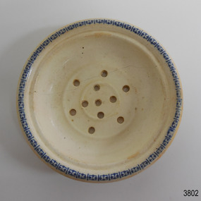
Ceramic - Soap dish, circa 1883
This ceramic soap dish was recovered from the wreck of the 1882-1883 George Roper between the late 1960’s to early 1970’s. It is one of the shipwreck artefacts in the John Chance Collection. Soap dishes were often part of a wash set that also included a water jug and wash bowl. The holes in the dish allowed water to drain out of the dish, keeping the soap dry for next use. The GEORGE ROPER 1882 - 1883 - The George Roper was a 4-masted iron sailing ship built in Liverpool, England, in 1882 for fast international trade with Australia. The large vessel was launched in February 1883. The ship was on its first trip, departing Liverpool for Melbourne, captained by John Ward and a crew of 31. She had almost reached her destination on July 4 1883, approaching Port Phillip Bay and being towed by the steam tug William. The weather changed to rough with fog and both the George Roper and the William hit the dangerous Lonsdale Reef at Port Phillip Heads. The Captain and crew were eventually rescued and taken to Queenscliff. Salvage syndicates were able to recover a lot of the cargo before the George Roper broke up and sank. Amongst the cargo was soft goods, draperies, household items, spirits of malt and distilled liquors, chemicals, dynamite, and 1,400 tons of steel rails for the Victorian Government. Also in the hold were Russell Stourbridge bricks, as paying ballast. This 1880s soap dish is an example of personal hygiene accessories and may have been part of a set comprising jug, bowl and dish.. The soap dish is also significant as it was recovered by John Chance, a diver from the wreck of the George Roper in the 1960s-70s. Items that come from several wrecks along Victoria's coast have since been donated to the Flagstaff Hill Maritime Village’s museum collection by his family, illustrating this item’s level of historical value. The soap dish is significant for its association with the barque George Roper, which is considered historically and archaeologically significant and as such, is listed on the Victorian Heritage Database, VHR S286. The George Roper is an example of a vessel built specifically for fast travel to and from Australia with a large shipment of cargo. Its cargo of steel rails adds to the historical significance of international trade to the growing colony of Australia and Victoria in particular, with rail transportation soon to become a faster and safer form of transportation between colonial towns. Divers can still access parts of the scattered wreck and other artefacts recovered in the 1970s and 1980s can be viewed in both public and private collections. Soap dish; glazed white porcelain. Round shallow bowl with blue patterned border, resembling butterflies. Two raised, concentric rings are moulded into the base. Six pierced holes are evenly spaced between the rings, five holes are in the centre of the dish.flagstaff hill, warrnambool, flagstaff hill maritime museum, maritime museum, shipwreck coast, flagstaff hill maritime village, great ocean road, john chance, west coast trader, george roper, captain john ward, russell stourbridge bricks, port phillip heads, lonsdale reef, dive wreck, vhr s286, coastal trader, ceramic, vintage, personal hygiene, bathroom accessory, soap dish -
 Flagstaff Hill Maritime Museum and Village
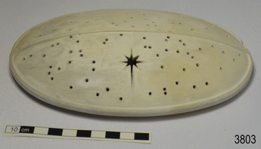
Ceramic - Cover, circa 1883
This ceramic cover was recovered from the wreck of the 1882-1883 George Roper between the late 1960’s to early 1970’s. It is one of the shipwreck artefacts in the John Chance Collection. The purpose of the cover is unclear. The holes could be for ventilation. The cover may have been used to protect food or keep it at an even temperature. It may also have been used for covering fragrant petals, allowing some scent to escape through the holes. The residue around the underside of the holes and their random placement indicate that the cover could be partially handmade. The discolouration could have come from its time in the sea. The GEORGE ROPER 1882 - 1883 - The George Roper was a 4-masted iron sailing ship built in Liverpool, England, in 1882 for fast international trade with Australia. The large vessel was launched in February 1883. The ship was on its first trip, departing Liverpool for Melbourne, captained by John Ward and a crew of 31. She had almost reached her destination on July 4 1883, approaching Port Phillip Bay and being towed by the steam tug William. The weather changed to rough with fog and both the George Roper and the William hit the dangerous Lonsdale Reef at Port Phillip Heads. The Captain and crew were eventually rescued and taken to Queenscliff. Salvage syndicates were able to recover a lot of the cargo before the George Roper broke up and sank. Amongst the cargo was soft goods, draperies, household items, spirits of malt and distilled liquors, chemicals, dynamite, and 1,400 tons of steel rails for the Victorian Government. Also in the hold were Russell Stourbridge bricks, as paying ballast. The ventilated cover is as an example of domestic ceramic ware of the 1880s. The cover also holds significance as it was recovered by John Chance, a diver from the wreck of the George Groper in the 1960s-70s. Items that come from several wrecks along Victoria's coast have since been donated to the Flagstaff Hill Maritime Village’s museum collection by his family, illustrating this item’s level of historical value. The George Roper is considered historically and archaeologically significant and as such, is listed on the Victorian Heritage Database, VHR S286. It is an example of a vessel built specifically for fast travel to and from Australia with a large shipment of cargo. The George Roper’s cargo of steel rails adds to the historical significance of international trade to the growing colony of Australia and Victoria in particular, with rail transportation soon to become a faster and safer form of transportation between colonial towns. Divers can still access parts of the scattered wreck and other artefacts recovered in the 1970s and 1980s can be viewed in both public and private collections. Cover; unglazed white ceramic, oval shape. The cover has holes randomly poked through its surface, one large hole is a six pointed star shape. Underneath there is a narrow rim placed slightly inside the edge. There is residue on the underneath around the holes. There is orange-brown discolouration and areas where the surface is lighter coloured. flagstaff hill, warrnambool, flagstaff hill maritime museum, maritime museum, shipwreck coast, flagstaff hill maritime village, great ocean road, john chance, west coast trader, george roper, w. h. potter & sons, w.t. dickson and son, captain john ward, russell stourbridge bricks, port phillip heads, lonsdale reef, dive wreck, vhr s286, coastal trader, ceramic, vintage, ventilated cover, domestic item -
 Flagstaff Hill Maritime Museum and Village
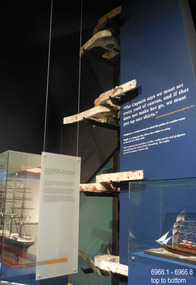
Equipment - Rudder Pintles and Gudgeons, Alexander Hall and Son, ca. 1855
This set of pairs of pintles and gudgeons was recovered from the wreck of the sailing ship Schomberg and was part of its rudder steering system. A reconstruction that includes four pairs is currently on display at Flagstaff Hill. The rudder installation of the Schomberg was almost seven metres tall. A pintle and gudgeon pair is a mechanical fitting that works like a pair of door hinges. One of the uses for this type of fitting is for ships’ rudders. On a ship, one or several gudgeons would be attached to the vertical rudder stempost on the rear of the ship’s hull. On the ship's rudder, an equal number of pintles would be fitted onto it. The rudder assembly would then fit down into the gudgeons on the ship and would be connected to its steering mechanism, allowing it to be moved from side to side and steer the vessel. The SCHOMBERG- The three-masted clipper ship Schomberg was built in 1855 by Alexander Hall and Co in Aberdeen, Scotland, for James Baines' famous Black Ball line. It measured 288 feet (88 meters) in length, with a beam of 45 feet (14 meters), a depth of 29.5 feet (8.99 meters) and 2,284 tons. The mainmast was 210 feet (64 meters) high and the ship carried 3.3 acres of sail. The wooden vessel was constructed with three skins; one planked fore and aft, and two diagonally planked. All skins were fastened together with screw-threaded trunnels (wooden rails). The Schomberg was one of only three clippers wrecked in Victorian waters that operated the England-to-Australia run. It was built to outrun Donald MacKay’s two American-built ships, the Empress of the Sea and the Lightning. It was hoped that Schomberg would make Liverpool to Melbourne voyage in sixty days, setting a record for the voyage. The Schomberg sailed from Liverpool on 6 October 1855 on her maiden voyage, under the command of Captain James Forbes. Her general cargo for Australia included jewellery, spirits, machinery, and 2,000 tons of iron rails and equipment for building the Melbourne to Geelong Railway and a bridge over the Yarra from Melbourne to Hawthorn, and17,000 letters and 31,800 newspapers. She also carried a cow for fresh milk, pens for fowls and pigs, plus 90,000 gallons of water for washing and drinking on board. There were approximately 473 passengers, including migrants for Australia, and a crew of 105. Light winds encountered at the equator dashed the expectations of a record-breaking voyage. On Christmas day the ship sighted Moonlight Head in southwest Victoria and even though there was a deadly combination of wind, currents and unmarked sand spits, the vessel continued on. Then the next day, December 26th 1855, the huge ship gently ran aground on a spit that juts into Newfield Bay, east of Curdies Inlet and the present town of Peterborough. Fortunately, the coastal trader, SS Queen, was nearby and managed to save all passengers and crew. In 1975 Flagstaff Hill’s former Director Peter Ronald and the team of divers recovered many objects and artefacts from the wreck of the Schomberg such as the ship’s fittings, equipment and personal effects including a diamond hidden for years in a communion set. This set of pintles and gudgeons is an example of steering equipment used on ships over 150 years ago, equipment that is still in use in today's shipping industry as well as many other everyday hardware applications.. The equipment is significant for its association with the ill-fated vessel Schomberg, which was wrecked in the local water in 1855 on its maiden voyage. The ship was built for speed and luxury, to sail on journeys with passengers, including migrants, travelling from Liverpool to Melbourne.Pintles and gudgeons, six pairs, plus one single pintle, from the wreck of the SCHOMBERG. Cast iron horse-shoe-shaped fittings with tapered ends. each with metal bars between the long sides. One piece of each pair has a round hollow cylinder and the other has a round solid shank. The single pintle has a tall shank with a pintle hook through it. Some pieces have remnants of grey paint.flagstaff hill, warrnambool, maritime village, maritime museum, shipwreck coast, great ocean road, schomberg, shipwreck, pintles, gudgeons, ship's rudder, ship's steering, clipper ship, james bain, black ball line, alexander hall and co., capt. james bully forbes, rudder pintles and gudgeons, rudder steering, pintles and braces, immigrant ship, maiden voyage, peterborough, 1855, marine technology -
 Flagstaff Hill Maritime Museum and Village
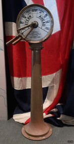
Equipment - Ship's Telegraph section, Chadburn & Sons, 1875-1898
This is the Bridge Section of a ship’s telegraph and is a Duplex Gong model, made by Chadburn & Son of Liverpool. This duplex gong model would sound two signals whenever the navigational commands were given by the ship’s pilot to change the speed or direction. The ship’s telegraph was installed on Flagstaff Hill’s exhibit of the 1909 Hobart, Tasmania, ferry “SS Rowitta” installed in 1975 and enjoyed for more than 40 years. Communication between the ship’s pilot and the engine room in the late 19th century to the mid-20th-century was made with a system called an Engine Order Telegraph (E.O.T.) or ship’s telegraph. The equipment has two parts, the Bridge Section and the Engine Room Section. The Bridge Section is usually mounted onto a pedestal, and the Engine Room Section is attached to a vertical surface. The standard marine commands are printed or stamped around the face of the dial and indicated by a pointer or arrow that is usually moved by a rotating brass section or handle. The ship’s pilot stationed on the Bridge of a vessel sends his Orders for speed and direction to the Engine Room with the E.O.T. He moves the lever or levers, depending on the number of engines the ship has, to change the indicator on the Bridge Section’s dial to point in the new direction and speed of travel. This change causes the Orders to be duplicated on the Engine Room Section’s dial and a bell or bells to signal the change at the same time. The engineer then adjusts the ship’s engines and steering equipment to follow the pilot’s Order. CHADBURN & SON, Liverpool- Chadburn Brothers, William and C.H., were joint inventors and well-established makers of optical and scientific instruments and marine gauges. The firm was granted the Prince Albert Royal Warrant in the late 19th century. In 1870 William Chadburn applied for a patent for his navigational communication device for use on ships. By 1875 Chadburn & Son was producing the brass Engine Order Telegraph in its plant at 71 Lord Street, Liverpool. In 1911 the ship RMS Titanic was launched, fitted with Chadburn & Sons E.O.T. The Chadburn Ship Telegraph Company Limited was registered in 1898 to take over Chadburn & Sons. In 1903 a large factory at Bootle, near Liverpool, and their products were being sold overseas. In 1920 electric-powered telegraphs were developed. In 1944 the name changed to Chadburn’s (Liverpool) Limited. In 1968 the company became Chadburn Bloctube Ltd. In 2000 the company, now Bloctube Marine Limited, was still manufacturing ship telegraphs. SS ROWITTA: - The 1909 steam ferry, SS Rowitta, was installed as an exhibit at Flagstaff Hill in 1975 and was enjoyed by many visitors for 40 years. Rowitta was a timber steam ferry built in Hobart in 1909 using planks of Huon and Karri wood. It was a favourite of sightseeing passengers along Tasmania’s Tamar and Derwent rivers for 30 years. Rowitta was also known as Tarkarri and Sorrento and had worked as a coastal trading vessel between Devonport and Melbourne, and Melbourne Queenscliff and Sorrento. In 1974 Rowitta was purchased by Flagstaff Hilt to convert into a representation of the Speculant, a historic and locally significant sailing ship listed on the Victorian Heritage Database. (The Speculant was built in Scotland in 1895 and traded timber between the United Kingdom and Russia. Warrnambool’s P J McGennan & Co. then bought the vessel to trade pine timber from New Zealand to Victorian ports and cargo to Melbourne. It was the largest ship registered with Warrnambool as her home port, playing a key role in the early 1900s in the Port of Warrnambool. In 1911, on her way to Melbourne, it was wrecked near Cape Otway. None of the nine crew lost their lives.) The promised funds for converting Rowitta into the Speculant were no longer available, so it was restored back to its original configuration. The vessel represented the importance of coastal traders to transport, trade and communication in Australia times before rail and motor vehicles. Sadly, in 2015 the time had come to demolish the Rowitta due to her excessive deterioration and the high cost of ongoing repairs. The vessel had given over 100 years of service and pleasure to those who knew her. This Bridge section of a ship’s Engine Order Telegraph, used with an Engine Room section, represents late-19th century change and progress in communication and navigation at sea. This type of equipment was still in use in the mid-20th century. The object is significant for its association with its maker, Chadburn & Son, of Liverpool, a well-known marine instrument maker whose work was recognised by English Royalty, and whose products were selected to supply similar equipment for use on the RMS Titanic. This ship’s telegraph is connected to the history of the Rowitta, which was a large exhibit on display at Flagstaff Hill Maritime Village from the museum’s early beginnings until the vessel’s end of life 40 years later. The display was used as an aid to maritime education. The Rowitta represents the importance of coastal traders to transport, trade and communication along the coast of Victoria, between states, and in Australia before rail and motor vehicles. The vessel was an example of a ferry built in the early 20th century that served many different roles over its lifetime of over 100 years. Bridge section of a Ship’s Telegraph or Engine Order Telegraph (E.O.T.). The round double-sided, painted glass dial is contained within a brass case behind glass. It is fitted onto an outward tapering brass pedestal with a round base. The brass indicator arrows between the handles point simultaneously to both sides of the dial when moved. An oval brass maker’s plate is attached to the top of the case. The dial’s faces have inscriptions that indicate speed and direction, and the front face and plate include the maker’s details. A serial number is stamped on the collar where the dial is fitted to the pedestal. The ship’s telegraph is a Duplex Gong model, made by Chadburn & Son of Liverpool. Dial, maker’s details: “PATENT “DUPLEX GONG” TELEGRAPH / CHADBURN & SON / TELEGRAPH WORKS / PATENTEES & MANUFACTURERS / 11 WATERLOO ROAD / LIVERPOOL” LONDON / 105 FENCHURCH STREET” “NEWCASTLE / 85 QUAY + SIDE” “GLASGOW / 69 ANDERSON QUAY” “PATENT” Dial instructions: “FULL / HALF/ SLOW / FINISHED WITH ENGINES / STOP STAND BY / SLOW / HALF / FULL / ASTERN / AHEAD” Maker’s plate: “CHADBURN / & SON / PATENT / LIVERPOOL” Serial number: “22073”flagstaff hill, warrnambool, maritime village, maritime museum, shipwreck coast, great ocean road, engine order telegraph, e.o.t., navigational instrument, communication device, ship’s telegraph, engine room section, bridge section, rms titanic, chadburn & son, chadburn brothers, william chadburn, chadburn ship telegraph company, chadburns, duplex gong, liverpool, ss rowitta, navigation, marine technology, pilot’s orders, steam power, hobart, tasmania, devonport, tasmanian-built, ferry, steam ferry, steamer, 1909, early 20th century vessel, passenger vessel, tamar trading company, launceston, george town, sorrento, tarkarri, speculant, peter mcgennan, p j mcgennan & co. port phillip ferries pty ltd, melbourne, coastal trader, timber steamer, huon, karri, freighter, supply ship, charter ferry, floating restaurant, prawn boat, lakes entrance -
 Port Melbourne Historical & Preservation Society
Book, Graham Patterson, "Coastal guide to nature and History Port Phillip Bay", 2013
"Coastal guide to nature and History Port Phillip Bay" Book with coloured photograph of rock and coastline on cover.natural environment - beaches and foreshore, natural environment, conservation, piers and wharves - railway pier, piers and wharves - station pier, piers and wharves - princes pier, coastal, port phillip bay, centenary bridge, beacons, robert harper & co ltd, liardet family -
Port Melbourne Historical & Preservation Society
Book, Jack Loney, "Bay Steamers and Coastal Ferries", 1982
"Bay Steamers and Coastal Ferries". An account of the Bay steamers and coastal ferries from the 1830s to the late 1980s, within Port Phillip Bay and along the coast as far as Portland and Lakes Entrance in Victoria and to Tasmania. Appendices (ten) listing names and details of all the ships. 92 page soft covered book, black and white photos on front and back covers, red writing on front cover.transport - ferries, piers and wharves -
Port Melbourne Historical & Preservation Society
Photograph - Volunteers planting coastal grasses, Friends of Port Melbourne Foreshore, 1990s
From a series featuring local volunteers that was displayed at the community centre, early 1990sMounted black and white photo of Friends of Port Melbourne Foreshore's volunteers: two women and two children planting coastal grasses on foreshore. Caption on paper: 'Volunteers involved in foreshore planting''7' in green on backnatural environment - beaches and foreshore, societies clubs unions and other organisations, friends of port melbournes foreshore, volunteers -
 Monbulk RSL Sub Branch
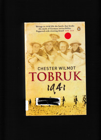
Book, Penguin, Tobruk 1941, 2009
March 1941. The Allied forces have suffered one brutal defeat after another. For Hitler's forces the conquest of Egypt, and the rich oil fields of the Middle East, lie next on the horizon. All that stand in their way are a few Australian brigades defending a town called Tobruk. For eight months the Australian Imperial Forces defended the North African coastal fortress, battling almost unbeatable odds in the dust and the heat of the Libran desert. Under the command of General Morshead, the troops used unorthodox methods and sheer grit to withstand the superior might of General Rommel's elite 'Afrika KorpsIndex, maps, p.414.non-fictionMarch 1941. The Allied forces have suffered one brutal defeat after another. For Hitler's forces the conquest of Egypt, and the rich oil fields of the Middle East, lie next on the horizon. All that stand in their way are a few Australian brigades defending a town called Tobruk. For eight months the Australian Imperial Forces defended the North African coastal fortress, battling almost unbeatable odds in the dust and the heat of the Libran desert. Under the command of General Morshead, the troops used unorthodox methods and sheer grit to withstand the superior might of General Rommel's elite 'Afrika Korpsworld war 1939 – 1945 – campaigns – north africa, siege of tobruk 1941 -
 Inverloch Historical Society
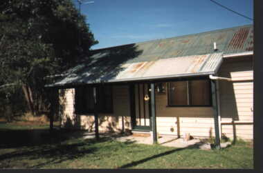
000833 - Photograph - 1997 - Inverloch - Halford St - Abraham's cottage - from K Bendle (Kath), 1997
... materials typical of the period and the coastal location of town ...Example of specific type of housing built from materials typical of the period and the coastal location of town. A small format colour print of small wooden cottage with distinctive galvanised iron roof and veranda. The building was originally painted cream and dark green. Rust is evident on the roof of the building and veranda. Photograph taken in1997 in Halford Street, in the town of Inverloch, Victoria, Australia.Handwritten label on back of photograph. -
 Peterborough History Group
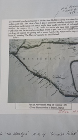
Document - Peterborough survey, Heytesbury District
About Peterborough town and the surrounding Council districts, coastal survey and mapshistory of the development of the townMaps, photocopiesflaxman hill, peterborough history, heytesbury, peterborough 3270 -
 Kew Historical Society Inc
Book, Libraries Board of South Australia, Narrative of a Survey of the Coasts of the Intertropical and Western Coasts of Australia performed between the Years 1818 and 1822 in two volumes (Vol.1), 1969
This two-volume work by Captain Phillip Parker King (1791–1856) was published in 1827, and describes the Royal Navy's 1817–22 surveying expedition to chart the coastal regions of Australia. King carried out the surveys in two successive ships, the Mermaid, which was declared unseaworthy in 1820, and the newly commissioned Bathurst. He worked on the charts, which were published by the Hydrographic Office, for two years after his return to England. He was made a Fellow of the Royal Society, and later undertook a similar surveying voyage, in which he was accompanied by Captain Fitzroy on the Beagle, around the coast of South America. The book is derived from the author's journal, and describes not only the voyages but also the towns and settlements of the region. Volume 2 continues the survey along the north and west coasts of Australia, and contains an appendix describing winds, currents, ports and islands.Facsimile Editions No.30. 2 v. : illus., fold. charts, tables. non-fictionThis two-volume work by Captain Phillip Parker King (1791–1856) was published in 1827, and describes the Royal Navy's 1817–22 surveying expedition to chart the coastal regions of Australia. King carried out the surveys in two successive ships, the Mermaid, which was declared unseaworthy in 1820, and the newly commissioned Bathurst. He worked on the charts, which were published by the Hydrographic Office, for two years after his return to England. He was made a Fellow of the Royal Society, and later undertook a similar surveying voyage, in which he was accompanied by Captain Fitzroy on the Beagle, around the coast of South America. The book is derived from the author's journal, and describes not only the voyages but also the towns and settlements of the region. Volume 2 continues the survey along the north and west coasts of Australia, and contains an appendix describing winds, currents, ports and islands.australia -- description and travel -- to 1850., hydrography -- australia., natural history -- australia. -
 Kew Historical Society Inc
Book, Libraries Board of South Australia, Narrative of a Survey of the Coasts of the Intertropical and Western Coasts of Australia performed between the Years 1818 and 1822 in two volumes (Vol.2), 1969
This two-volume work by Captain Phillip Parker King (1791–1856) was published in 1827, and describes the Royal Navy's 1817–22 surveying expedition to chart the coastal regions of Australia. King carried out the surveys in two successive ships, the Mermaid, which was declared unseaworthy in 1820, and the newly commissioned Bathurst. He worked on the charts, which were published by the Hydrographic Office, for two years after his return to England. He was made a Fellow of the Royal Society, and later undertook a similar surveying voyage, in which he was accompanied by Captain Fitzroy on the Beagle, around the coast of South America. The book is derived from the author's journal, and describes not only the voyages but also the towns and settlements of the region. Volume 2 continues the survey along the north and west coasts of Australia, and contains an appendix describing winds, currents, ports and islands.Australian Facsimile Editions No.30. 2 v. : illus., fold. charts, tables. non-fictionThis two-volume work by Captain Phillip Parker King (1791–1856) was published in 1827, and describes the Royal Navy's 1817–22 surveying expedition to chart the coastal regions of Australia. King carried out the surveys in two successive ships, the Mermaid, which was declared unseaworthy in 1820, and the newly commissioned Bathurst. He worked on the charts, which were published by the Hydrographic Office, for two years after his return to England. He was made a Fellow of the Royal Society, and later undertook a similar surveying voyage, in which he was accompanied by Captain Fitzroy on the Beagle, around the coast of South America. The book is derived from the author's journal, and describes not only the voyages but also the towns and settlements of the region. Volume 2 continues the survey along the north and west coasts of Australia, and contains an appendix describing winds, currents, ports and islands.philip parker king, natural history -- australia., australia -- description and travel -- to 1850. -
 Port Fairy Historical Society Museum and Archives
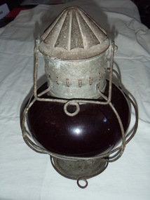
Functional object - Lamp
Port light from the s.s.Casino - authenticated by sale at Apollo bay - John McDonald purchased 2 lamps the green lamp was later broken and discarded. He planned to use them on his fishing boat "Inverness".This port lamp was used on the s.s.Casino a coastal trader that serviced the towns from Portland to Melbourne for almost 50 Years quite a significant achievement for a ship of its kind.Port Lamp - SS Casino Metal Casing - Red Glass - Kerosene Fuelledlight, s.s.casino, john mcdonald, inverness, port, kerosene lamp -
 Phillip Island Conservation Society Inc.
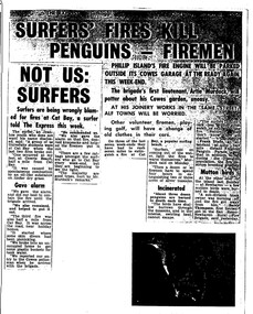
Work on paper - Photocopy of newspaper cutting, The Express, "SURFERS' FIRES KILL/ PENGUINS - FIREMEN//NOT US:/SURFERS"
Written during the 1960s when surfing was burgeoning across Australia’s coast and Phillip Island surf beaches had become extremely popular, few management strategies were in place to control interaction of the public with the delicate flora and fauna of the coastal environments. There were few good access tracks, car parks, bins, toilets etc at coastal/surfing hotspots around the Phillip Island coast. A number of management issues occurred with the influx of surfers. These included dune erosion caused by surfers climbing dunes to see the surf before going on the beach; informal parking on wildlife habitat; numerous access paths from wherever cars were parked down to the beach cutting through habitat; illegal camping on foreshores; illegal lighting of fires on beach and in dunes; surfers’ dogs let out of the car while surfers were out on the water. The dogs were uncontrolled. Certainly some surfers behaved responsibly, as is almost invariably the case these days. However, in that era of this article few people understood the delicate nature of the coastal environment and that it need to be protected through public education, infrastructure and enforcement of regulations. As now, most rural Fire services were run by dedicated volunteers who faced many challenges in their roles as Country Fire Authority firefighters. However, it was not uncommon for visitors and locals to also assist with fire-fighting efforts.The article is significant in containing quotes from both sides of the discussion who were directly involved in coastal fire incidents on Phillip Island in the 1960s. It also indicates the large number of surfers visiting Phillip Island beaches, the volunteer nature of the firefighting service and the extra challenges they faced on Phillip Island as a visitor destination. The anonymous university student surfer who is quoted, also describes possible causes of the fires, methods he and his fellow surfers used to extinguish the fires and raise the alarm, and the way they assisted the volunteer firefighters . The reference to him breaking into one of the Summerland housing estate holiday houses is also significant because that housing estate was purchased over 2 decades by successive Victorian governments to remove management issues caused to the wildlife habitat on Summerland Peninsula.Photocopy of newspaper cuttings including 2 related articles. Five columns of black text on white paper with one poorly reproduced photo bottom rightphillip island, cat bay, country fire authority, artie murdoch, alf towns, frank dixon, barry thompson, newhaven-san remo rural fire brigade, penguin parade, cowrie beach, surfers, coastal fires -
 Warrnambool and District Historical Society Inc.
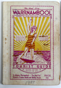
Booklet - Warrnambool Tourist Guide, Warrnambool Progress Association, Warrnambool On The Sea Tourist Guide, The Ideal City, Where to Go and What to See, 1936
Warrnambool Tourist Guide 1936This is a booklet with a buff-coloured cover featuring an illustration of a woman water skiing. The back cover has blue printing. The pages contain a fold-out map, advertisements, printed text and black and white photographs. The pages have been stapled and then glued.non-fictionWarrnambool Tourist Guide 1936tourism in warrnambool, warrnambool progress association -
 Flagstaff Hill Maritime Museum and Village
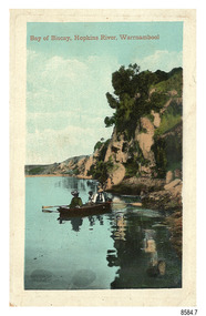
Postcard - Scenic - Warrnambool, Bay of Biscay, Hopkins River, Warrnambool, 1902-1910
The nine postcards in this set were donated together and date to the early 1900s. All but one postcard in this set shows images of Warrnambool, in the Western District of Victoria; the other has a London image. The postcards were all printed in Great Britain according to that country’s postal regulations. The fronts of all cards have titles printed in red. Most of the images on the cards are attributed to photographer Joseph Jordan and belong to the Jordan Series. The back of these cards has an outline for a postage stamp, a vertical dividing line and a heading on each side of the line to separate the Correspondence from the Address. Postcards or ‘correspondence cards’ appeared in Britain in 1894. They were plain cards with a space for the message on one side and an address on the other; regulations didn’t allow anything but the address to be written on the ‘address’ side. In 1902 the British regulations then allowed a picture to be printed on the front and the address on the back, so messages had to be written on the picture side. Soon, the regulations changed and the back was divided for a message and the address. Bay of Biscay, Hopkins River, Warrnambool – This same image was published in Table Talk on January 6th, 1910 and in The Age, on December 18, 1929, referred to a revival of fishing at the Bay of Biscay on the Hopkins River. These and similar articles showcased the Bay of Biscay as a popular boating and fishing location and well worth promoting to places outside of Warrnambool. Joseph Jordan - Joseph Jordan was born in 1841 in Leicester England. When he was 16 he joined the 7th Queen's Own Hussars and was sent to India at the outbreak of the mutiny. He took part in the relief of Lucknow and remained in India for eleven years. It was during this time that he became interested in photography. He was posted to New Zealand and later came to Victoria, becoming a sergeant major of the Mounted Rifles. In the mid-1880s he came to the Western district where he was responsible for establishing units of the Mounted Rifles in various country towns such as Dunkeld, Mortlake, Panmure, Bushfield, Koroit etc. He resigned from the army in 1889 and set up a professional photography studio in Liebig Street, Warrnambool. He became very well known in the Western District for family photographs, official photographs of local councillors and groups as well as views of local scenery. In 1891 he photographed the wrecked barque ‘Fiji’ at ‘Wrecks Beach’ near Princetown. His business was taken over by his son Arthur around 1917. Joseph was a keen rifle shot and in 1924 he donated the "Jordan Shield" as a prize to the Victorian Rifle Association. He was made a "Life Honorary Member" of the Warrnambool Returned Soldiers League and in 1933 he was recognised as being the oldest living soldier in Victoria. Joseph died in 1935 aged 95.The image of the figures in a row boat on the river suggests that the location was a popular place to visit. The choice of subject for this postcard indicates the popularity of Warrnambool's natural environment as a tourist attraction at a time when ships called coastal traders brought passengers and cargo to the Port of Warrnambool from ports along Victoria's southwest coast. Joseph Jordan is a significant figure in Warrnambool history as he helped to establish early units of the Mounted Rifles (G Company) in local towns during the late 1880's and later, photographed local scenes, groups and citizens of early Warrnambool.Postcard, one of nine, portrait orientation, coloured print within a rectangle border with an impressed line around the image and a title in red. The picture shows three figures wearing hats in a rowboat on the bank of a river beside cliffs. There is no correspondence written on the card. The back has inscriptions and outlines for a postage stamp. Jordan Series, printed in Great Britain.Front, in red: “Bay of Biscay, Hopkins River, Warrnambool” Back in green: “Jordan Series” “POST CARD” “PRINTED IN GREAT BRITAIN” “For correspondence” “The Address only to be written here”flagstaff hill maritime museum, flagstaff hill maritime village, flagstaff hill maritime museum and village, maritime museum, warrnambool, great ocean road, warrnambool and district, warrnambool scenes, local scenes, views of warrnambool, joseph jordan, jordan series, jordan photography, postcard, souvenir, correspondence, cameo postcard, bay of biscay, fishing, boating -
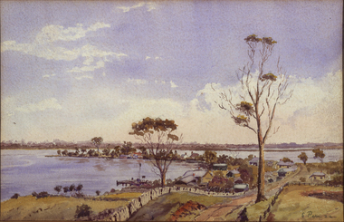 Federation University Art Collection
Painting - Watercolour, 'Metung' by Sydney Pern, 1932
Sydney PERN (c1876-23 October 1967 ) Born Battley, England Dr Sydney Pern began practicing medicine in the Victorian town of Yarram before setting up practice in Ballarat. He was a competent artist, and as an amateur anthropologist collected Aboriginal artefacts during travels in Central and Northern Australia. This item is part of the Federation University Art Collection. The Art Collection features over 2000 works and was listed as a 'Ballarat Treasure' in 2007. Unframed coastal landscape art, artwork, meetung, sydney pern, unframed -
 Warrnambool and District Historical Society Inc.
Administrative record (Collection) - Warrnambool City Council Administrative Records, Warrnambool City Council Officers, 1990s
Warrnambool City Council Records collected by a member of a Council Advisory Committee.Collection of Warrnambool City Council records of the 1990sIn folders and archival envelopes in an A3 archival boxTwo A3 archival envelopes containing information on Foreshore etc., five booklets containing reports on City Plans, Council Strategies etc and 15 Reports (Shop Trading, Coastal Wetlands, Foreshore, Landcare etc)warrnambool city council, warrnambool city council strategies and planswarrnambool city council, warrnambool city council strategies and plans -
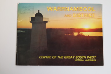 Warrnambool and District Historical Society Inc.
Booklet - Tourist Booklet, Warrnambool Chamber of Commerce and Industry, Warrnambool and District - Centre of the Great South West, Victoria, Australia, c. 1970
Warrnambool Tourist BookletThis is a booklet of 22 pages. The cover has two colour photographs and the pages contain a sketch map, printed text and colour photographs. The pages have ben stapled but the staples have been removed.non-fictionWarrnambool Tourist Bookletwarrnambool tourism, south west victoria tourist locations, warrnambool chamber of commerce -
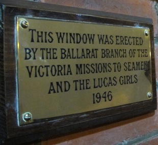 Mission to Seafarers Victoria
Plaque - Memorial Plaque, Ballarat Branch and Lucas Girls, 1946
The Ballarat Branch Committee and girls of Lucas & Co. raised the money for the memorial window in Good Chapel of Saint Peter which is dedicated to the men of the Jervis Bay and all Merchant seamen who gave their lives in the world wars. To see a picture of the actual window go to VC database Mtsv record 0035.Regionally based support across Victoria provided crucial funds to the Mission for Seafarer welfare, activities and operations. This support was very often sourced either through a country Auxiliary group based in places such as Ballarat, Camperdown, Hamilton, Bendigo and other similar towns or centres. Op shops and CWA, Church Auxiliaries and other similar charities mainly operated by the womenfolk of the respective communities, recognized the vital importance of 19th and 20th C Merchant and Military Naval services to the development of Australia. The cumulative local fundraising efforts helped maintain the work of the Coastal based Mission services to seafarers.Rectangular brass plaque mounted to wood board.This window was erected by the Ballarat Branch of the Victoria Missions to Seamen and the Lucas Girls 1946.ballarat, lucas girls, lucas & co., 1946, window, plaque, ww2, world war 2, textile company, lucas clothing factory -
Lakes Entrance Historical Society
Book, Synan Peter, Secrets of Ghost Towns of the High Country featuring 50 Ghost Towns in and around Victorias Alpine Region, 1989
A history of the Gippsland Lakes Victoria as a transport system v for trade within the Lakes and River systems and coastal and interstate trade.ships and shipping, land settlement, waterways -
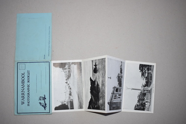 Warrnambool and District Historical Society Inc.
Souvenir - Warrnambool Photographic Booklet, 1940s
This item is a souvenir booklet that would have been purchased by a tourist in the Warrnambool district in the mid 20th century. The photographs are representative of the tourist attractions of the area – Hopkins Falls, the mouth of the Hopkins River, Shelly Beach, the Breakwater, the Botanical Gardens etc. Tourism in Warrnambool began to be important towards the end of the 19th century when the coastal scenery, the beaches and the Sea Water Baths were advertised to promote Warrnambool as a spa resort town. Today tourism is a major industry in the city. This item is of minor interest as a souvenir of the type of postcard purchased by tourists in the mid 20th century. This is a piece of blue paper folded in two with black and blue printing on the front and back covers and an image of two kookaburras on the front cover. In the back of the front cover is pasted a strip of paper containing 13 black and white photographs folded in concertina fashion to form a booklet. The front cover has an extension that fits into a slot on the back cover to enclose the photographs. There is space for a stamp and an address on the front cover and space for the name of the sender on the back cover. There is pencil writing on the space for the stamp.Warrnambool Photographic Booklet 9d. (ninepence) warrnambool souvenir, warrnambool tourist attractions -
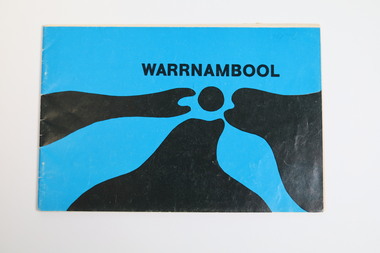 Warrnambool and District Historical Society Inc.
Booklet - Tourist booklet, Warrnambool Chamber of Commerce and Industry, Warrnambool, c. 1970
Warrnambool Tourist BookletThis is a booklet of 30 pages with a blue and black cover featuring an art work, a map, advertisements, black and white photographs and printed text. The booklet was stapled but the staples have been removed.non-fictionWarrnambool Tourist Bookletwarrnambool tourism, warrnambool tourist guides, warrnambool chamber of commerc -
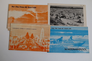 Warrnambool and District Historical Society Inc.
Booklet - Warrnambool Tourist Guides (5), Warrnambool Chamber of Commerce and Industry, Warrnambool - For the Time of Your Life, 1970-1975
Warrnambool Tourist Guides 1970-1975.1,.2,.3 - These are booklets of 36 pages with an orange cover with an illustration of two people on surf boards on the front cover and an image of a main street on the back cover. The cover has blue printing. The pages contain a map, advertisements, black and white photographs and printed text. One booklet is stapled and two have the staples removed. .4,.5 -These are booklets of 40 pages with a front cover with a photograph in blue tones of a surf patrol boat and two lifesavers and a back cover with a black and white photograph (beach scene). The pages contain a map, advertisements, black and white photographs and printed text. One booklet is stapled and one has the staples removed. non-fictionWarrnambool Tourist Guides 1970-1975warrnambool tourism, tourism in warrnambool in the 1970s -
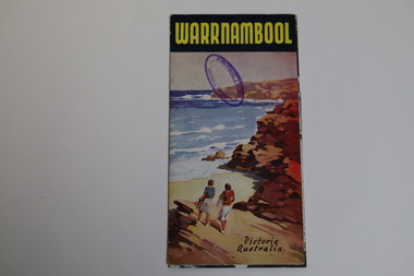 Warrnambool and District Historical Society Inc.
Pamphlet - Tourist Map and Guide, Victorian Railway Commissioners, Warrnambool Victoria Australia, c. 1950
Warrnambool Tourist Map and Guide.1 This is a single sheet of paper folded twice to make a pamphlet. It has a multi-coloured map (predominantly yellow), an illustration, several black and white photographs, printed text and coloured headings. .2 This is a single sheet of paper inserted into item 1. It is folded twice and contains black and white photographs.non-fictionWarrnambool Tourist Map and Guidetourism in warrnambool, warrnambool rail, warrnambool tourist guides -
 Glenelg Shire Council Cultural Collection
Painting, Nancy Malseed, Seal Cave, c. 1964
Acquired by Portland Council for the Encouragement of Music and the Arts (CEMA) as a winner of its annual Art Price in 1964; later presented by CEMA to Portland Town Council.View of the interior of a cave. In foreground is a triangular pool of dark blue water with lighter highlights. The walls of the cave curve up both sides of the water, meeting at the back of the cave. At back of cave is a ledge with 7 seals on it. One seal is diving into the water. The walls are painted in brown and dark blue, the seals in pale blue with highlights in white.Front: Malseed (lower right, red paint) Back: Nancy Malseed "Seal Cave" Portland Art Gallery Trust, c/c C. Woolcock (upper and mid left, black felt tip pen).sea, seals, coastal, seascape -
 Flagstaff Hill Maritime Museum and Village
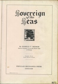
Book - "Sovereign of the Seas" book or manual for the ship model hobby enthusiast, Harold T. Bodkin, 1933, "Sovereign of the Seas", Popular Mechanics Press
Jim (James Bernard) Williams, who was the owner of this manual, was a long-time resident of Warrnambool having the opportunity to work at two notable historical businesses of the town. The first, Cramond & Dickson a drapier store established around 1852-1855 and which remained a store that traded under the same name for the longest in Victoria, before it closed its doors in 1974. The second business was Fletcher Jones a highly successful textile and clothing Australian business. Some of Jim’s spare time was devoted to the model ship making which would conjure up many fascinating stories of maritime history. In addition to Jim witnessing the tail end of ships at port in Warrnambool, his "father was as sea captain and operated his vessel in Bass Strait coastal trade between Tasmania and Victoria". The intricately detailed model made by Jim is full of precise detail. The manual and the blueprints held by Flagstaff Hill Maritime Village also reflect the intricate process and devotion to the task completed by Jim. The history of the shipwreck and maritime stories of the Victorian Southwest coast surrounding Warrnambool would have continued to inspire his passion. Three photos of the model and Jim, like the photo of Harold T. Bodkin in the manual, attest to the enthusiasm and enjoyment that was gained by him through this hobby. The manual opens to a photo of “Mr. Harold T. Bodkin adding finishing touches to model of the “Sovereign of the Seas”. The “Forward to Reader” which is on the next page is written by “E. R. HAAN, Technical Editor, Popular Mechanics Magazine. The forward explains the methodology used to achieve the fine detail that is part of the body of the model, by “applying imitation carvings”, and is cited as “a museum type of model”. The following page “Blueprints and Craftmats on the ‘Sovereign of the Seas’” discusses the availability of a set of blueprints to purchase separately. Followed by a description of the moulding process for the “miniature carvings”. “Historical Notes of Interest on the “Sovereign of the Seas (1637)” follow on the next page. The manual is divided into the following parts from pages 8 to 71: “Part I – Shaping the Hull/Part II – The Rudder, Quarter Galleries and Gunports/Part III Wales, Gunport Covers and Initial Ornamentation/Part V – Beakhead Decoration, Bulkhead and Rails, Etc./Part VI Carvings, Lanterns, Knights, Bitts and Painting/Part VII – Details of Mast Construction/Part VIII – Standing Rigging/Part IX – Running Rigging and Final Details. All of these instructions include photographs and detailed graphs. Then instructions on “How to Read and Use Ship-Model Drawings”, “The Shop-Model Maker’s Tools”, and “Simplified Ship-in-a-Bottle”. This is finished off with “Helpful Hints….” And numerous pages of advertising. Some adverts include aids for completing the “Sovereign of the Seas” model. Part I uses blue and black ink to illustrate a dramatic picture of the “Sovereign”, otherwise all print is in black ink on buff paper. This book in significant to the collection as it was donated along with other tools and blueprints which have been used by the donor of the "Sovereign of the Seas" model ship. It also connects with the wider community in that it is related to historical maritime interest and the donor, Jim Williams is also connected to other significant retail and manufacturing businesses of the past in Warrnambool. This manual has been covered with brown paper, including an extra strip for the spine. The front has a watermark at the top middle, some pencilled compass circles segmented into eight parts across the area and a small amount of script writing. The back also has the same type of compass circles and some other small shapes. There are also grease marks. The cover has a patina adding to variations of colour to the paper indicative of the book being handled often. The title page reads “Sovereign of the Seas” in an Old English font. This is followed by a lithograph print around 1 inch square of a ship at full sale. By HAROLD T. BODKIN/Charter President of the Ship Model Club of Chicago/Copyright, 1933, By Popular Mechanics Company/POPULAR MECHANICS PRESS/CHICAGO/Printed in the U.S.A. By HAROLD T. BODKIN/Charter President of the Ship Model Club of Chicago/Copyright, 1933, By Popular Mechanics Company/POPULAR MECHANICS PRESS/CHICAGO/Printed in the U.S.A.flagstaff hill, warrnambool, shipwrecked coast, flagstaff hill maritime museum, maritime museum, shipwreck coast, flagstaff hill maritime village, great ocean road, model ship, vessel sovereign of the seas, jim williams, james bernard williams, the forth tasmania, freda williams, heather williams, phyllis bowditch, fletcher jones staff 1936, 17th century sailing ship, cramond and dickson, sovereign of the seas, royal sovereign, sovereign, charles 1, fletcher jones, warrnambool breakwater -
 Flagstaff Hill Maritime Museum and Village
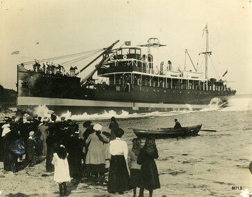
Photograph - Photograph of S. S. Eumeralla launch, 1908
This photograph was one of ten photographs donated to Flagstaff Hill Maritime Museum and Village by Fred Trewartha. Frederick John Fox Trewartha (Fred) was a well-known Warrnambool businessman. He was born in Beeac near Geelong in 1920 and came to Warrnambool with his family as a very young child. He was apprenticed to his father John, as a saddler and later opened his own shop on Raglan Parade. He then moved into working with tarpaulins and canvases for the trucking industry. Fred was keenly interested in photography (and was a member of the Warrnambool Cine Club), yachting and boat building. He kept his yacht moored at Port Fairy for many years and participated in sailing events locally and interstate. He also built boats with his sons. He had the opportunity to meet many older sailors and it's thought this photo (and others in the set) may have been given to him by one of these men. Fred Trewartha died in 2016 in Warrnambool. The Eumeralla (sometimes spelt Eumerella) was built in 1908 in Scotland by Messrs. Scott of Kinghorn on the Firth of Forth. It was a steel screw steamer and had been designed to meet the growing demand for a thoroughly up to date passenger and cargo steamer for the Melbourne to Portland service for John McIlwraith and Company in partnership with the Belfast, Koroit Steam Navigation Company and Howard Smith Company Ltd. This photograph appeared in the Leader (Melbourne) on Saturday 28th November 1908 with the headline "Launching the Eumeralla" and shows the ship being launched on October 10th, 1908, in Scotland. It was described as "Length, 190 feet; breadth, 30 feet; depth 15 feet". It went on to say it had a speed guaranteed at 11 knots and was expected in Melbourne by the following January. It could accommodate sixty saloon passengers and thirty in steerage and had electric light fitted throughout. While on the Melbourne to Portland service the Eumeralla had several mishaps. In 1909 it crashed into the breakwater at Portarlington, splintering the woodwork and leaving a gap of about 12 feet. On Saturday 9th August 1913, as it was leaving Warrnambool, it encountered heavy seas and a passenger (Frederick Mahoney) sustained fatal injuries after hitting his head on the bulwark - and the second mate was found dead after the water poured off the deck. Several other passengers were also injured. Between 1912 and 1913 it was used to carry passengers between Brisbane, Maryborough and Rockhampton before being sent back to Melbourne for an overhaul. In 1915 it was selected for the Winter service to run daily trips between Melbourne and Geelong. In 1925 it nearly sank in the Yarra (at Queens Wharf) when it developed a list and water entered the engine room. Firemen from the Eastern Hill Station, crew and wharf workers were able to stop it from sinking. Between 1928 and 1935 the Eumeralla was laid up in Hobson's Bay before being sold to a Chinese firm to be used on the short coastal run between Shanghai and Wen Chow. It was renamed "Mel Lee (Mow Lee) Number 2". It arrived on July 12th, 1935, at Tanghai (a small Chinese port to the south of Shanghai) with 400 local passengers. The population of the town turned out to welcome the new ship with a fireworks display which caused the passengers to rush across to the side of the ship nearest the scene. The steamer immediately listed to one side and sank.This photograph is significant because of its association with the coastal trader S.S. Eumeralla and its important contribution to trade along Victoria's West Coast in the early 20th century.Black and white photograph showing a crowd of people standing on a shore watching a steamer (the Eumeralla) being launched. The crew of the steamer are standing in the bow, waving at the crowd. A single oarsman is in a small rowboat nearby. On the back of the photograph, the name, address and telephone number of the donor is written in black, ballpoint pen. More writing, in cursive script (in blue ink) gives a brief description of the ship and the events depicted in the photograph.Name of donor, address and telephone number "S. S. Eumeralla / Built in Scotland / being launched/ in Scotland/ 1904"warrnambool, flagstaff hill maritime museum and village, great ocean road, portland, port fairy, eumeralla, s. s. eumeralla, eumerella, steamer eumeralla, john mcilwraith and company, belfast and koroit steam navigation company, howard smith ltd, portarlington, geelong, melbourne, mel lee no. 2, mow lee no. 2, tanghai, steamship, steamer, fred trewartha, frederick john fox trewartha -
 Flagstaff Hill Maritime Museum and Village
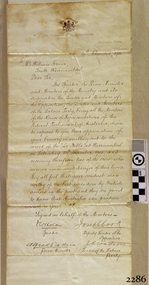
Letter - William Ferrier, 14th November 1905
... lived in coastal towns in 19th century Victoria and the effects ...The letter to William Ferrier of South Warrnambool from the Prime Minister and the Parliament of the Commonwealth recognised the significance of William’s brave and courageous lifesaving act to the people of Australia; “They all feel that your conduct was worthy of the best deeds done by British sailors in the past and they are proud to know that Australia can produce such as you.” The story of that brave rescue follows on below … The ship from which the sailors were rescued was the three-masted, iron and steel barquentine the La Bella, built in Norway in 1893. She was one of two iron and steel ships by Johan Smith, The company was one of the leading shipping families in Tvedestrand, Norway. She was significant to Norwegian shipping, being one of only 27 iron and steel ships ever built in Norway. She was registered in New Zealand and engaged from 1902 in inter-colonial trading of timber in the Pacific, between New Zealand and Australia and was often in Port Phillip Bay, Victoria. On 5th October 1905, the twelve-year-old La Bella left Lyttleton, New Zealand carrying a cargo of timber bound for Warrnambool, Australia. She was manned by a crew of twelve: the Master, (Captain Mylius, previously 1st Mate of La Bella, appointed Captain to La Bella on 6th February 1903) 2 Mates, Cook, six able seamen, one ordinary seaman and a boy. Bad weather en route caused her to shelter at Burnie on Tasmania's North West coast. On November 10th, the 37th day of her journey, La Bella approached Warrnambool. Captain Mylius steered her towards Lady Bay Channel in heavy south-west seas and evening mist. He ordered the helmsman to steer for the light. As the ship came round, a tremendous sea struck her on the port quarter, causing her to breach broadside in a north-westerly direction into breakers. The helm was brought round twice more, but each time heavy seas broke over her, the third time throwing the La Bella on to a submerged reef in Lady Bay now known as La Bella Reef (about 100 yards from the Warrnambool breakwater). The sea was so rough that it even wrenched a one-and-a-half ton anchor from its fastenings and into the sea. As Captain Mylius headed to the steel wheelhouse, intending to send up a rocket flare, a huge sea slammed the steel door into him (resulting in massive bruising front and back) Despite his injuries he still managed to set off a blue light, which he held up in his hands. La Bella’s lifeboats were filled with seawater and broke up on their chocks. The blue light was the first indication to people on the shore that there was a ship in distress. The Harbour Master, Captain Roe (who lived in the Harbour Master’s House opposite Flagstaff Hill), organised a group of volunteers to crew the lifeboat because the trained crew was unavailable; the crewmen were working on a steamer in Port Fairy at the time. He then poured oil onto the water to try and smooth the sea. At around 11 pm three of the crew took shelter in the steel forecastle but the sea crashed into it and broke it up. While the rest of the crew and onlookers watched helplessly in the moonlight the bodies were washed away into the sea, never to be seen again. Some of the crew lashed themselves to the weather rail to keep from being washed away. Watson, the ordinary seaman, became tangled in the rigging lines and was too weak to move, so the 2nd Mate, Robertson, put a line onto him so that he wouldn’t wash off. Around 11 pm three of the crew were unconscious from exhaustion. The situation on La Bella was becoming dangerous. The 2nd Mate moved to the ‘house’ and soon afterwards the ship slipped in the heavy sea. The lashings of the 1st Mate and the ‘boy’ Denham had kept them safe until about 2 am when they were washed overboard; no one was able to help. One by one, the exhausted crew were being washed overboard, too weak to hold on any longer. During the night the La Bella had broken into two and the deckhouse ran out towards the sea. Two more men drowned when trying to reach the lifeboat. By sunrise, the only survivors of the twelve were the Master, 2nd Mate and three seamen. Early in the morning, Captain Roe used the rocket apparatus on shore to try and shoot a line to the ship for a safer rescue but each attempt fell short of the target. Several attempts were made by the lifeboat to rescue the stricken sailors, but the rough conditions made this difficult for the boat to get close enough to the ship and the lifeboat had to return to shore. During a final attempt to reach the ship Captain Mylius ordered his men to jump into the sea. Leonard Robertson, 2nd mate, jumped and swam towards the lifeboat, taking hold of the boat hook offered to him. Oscar Rosenholme managed to reach the boat floating on a piece of timber from the ship’s load and a third survivor, Noake, also made the boat. Along with the lifeboat rescue crew, 25-year-old William Ferrier rowed his small dingy through the heavy seas and managed to rescue the Captain, whom he landed on the breakwater. Ferrier then returned to the ship to attempt a final rescue, losing his oars and rowlocks into the high sea. Using just a spare paddle he skulled towards the La Bella, reaching her stern in time to cut loose the lone surviving sailor, Payne, from the lashing that held him to the ship; the terrified sailor dropped from the ship and into the dingy. Shortly after the last man was rescued, the La Bella was lifted by a huge wave and crashed back down on the reef; she broke up and sank. The ordeal had lasted ten hours. The survivors were taken to the nearby Bay View Hotel and gratefully received warm food and clothing, medical attention and a place to sleep. In the following days, an unidentified body of a young person has washed ashore; it was either Watson or Denham. The body was buried in the Warrnambool cemetery with an appropriate gravestone and inscription. William Ferrier became a national hero as news of the daring rescue spread. In recognition of his bravery in the two daring rescues, he was awarded the Silver Medal for Bravery by the Royal Humane Society and was honoured in the letter from the Prime Minister and the Parliament of the Commonwealth, telegrams and a cheque for £20 from the Governor-General, over £150 subscribed by the public, including Warrnambool and district and readers of The Argus, and a gold medal from the Glenelg Dinghy Club of South Australia. Ferrier’s rescue efforts are one of the most heroic in Victoria’s shipwreck history. (William Ferrier’s son, Frank, received a similar award almost fifty years later when he helped rescue four members of the crew on the yacht Merlan after it ran on to a reef near the Point Lonsdale Lighthouse. ) The wreck of La Bella now lies on her port side in 13 metres of sheltered water inside the reef she struck. The bow section is relatively intact and part of the stern has drifted north-easterly towards the mouth of the Hopkins River. The reef the La Bella struck now bears its name. Those five rescued from the La Bella were Captain George Mylius, Leonard Robertson (2nd Mate, 21 years old), R. Payne, Oscar Rosenholme and Jack Noake. Those seven who lost their lives were Mr Coulson (1st mate), Charles Jackman (cook) Gustave Johnson, Pierre Johann and Robert Gent (all able seamen), Harry Watson (ordinary seaman) and Jack Denham (ship’s boy), Captain Mylius was found guilty of careless navigation; he had sailed into the bay without the services of a pilot. His Master Certificate was suspended for twelve months. Later he was also charged with the manslaughter of one of the crew who had died when the La Bella was wrecked but found not guilty. The event’s adverse publicity and damage to his career took a toll on his health and he died of a heart attack six months after the wreck; he was only thirty-seven. His body was buried in the Melbourne General Cemetery. The La Bella was “the best documented of all sailing ships owned in New Zealand”. Her record books, ship logs, correspondence and supporting papers are still available. At the time of the tragedy, she was owned by Messers David C.Turnbull and Co. of Timaru, New Zealand timber merchants and shipping agents, who had purchased her on 13th December 1901. A detailed account of the last journey of La Bella can be read in “Leonard Robertson, the Whangaroa & La Bella” written by Jack Churchouse, published in 1982 by Millwood Press Ltd, Wellington, NZ. As well as this letter, Flagstaff Hill’s La Bella Collection includes a photograph of the wrecked La Bella, a brass rail holder and a postcard of William Ferrier with four of the survivors. Some 15 – 17 ships are believed to have sunk in Lady Bay, but only two have been discovered on the seafloor; the “La Bella” and the “Edinburgh Castle”. Both wrecks are popular diving sites and are preserved as significant historical marine and marine archaeological sites. This original congratulatory letter sent to William Ferrier by the Prime Minister and Government of Australia demonstrates the importance attached to his efforts for Victoria and to Australia. The letter is part of the La Bella Collection and is significant at both a local and state level. Its connection to the La Bella shipwreck and the rescue of five survivors highlights the dangers of Victoria’s Shipwreck Coast. The letter to William Ferrier from the Australian Government acknowledges the bravery of ordinary Australians who risked their lives to save victims of shipwrecks along the coast. The letter is significant to the history of Warrnambool as it honours William Ferrier, a local fisherman whose descendants continue to live in the area. It highlights the way of life of people who lived in coastal towns in 19th century Victoria and the effects of shipwrecks upon them. The letter connects to the postcard of William Ferrier with four of the five rescued crew, the photograph of the wreck of the La Bella and the artefact from the wreck, the rail holder. This letter is significant because of its association with the sailing ship “La Bella”. The “La Bella” is of local and state and national significance. It is one of the only two shipwrecks discovered in Lady Bay, Warrnambool, out of the 15-17 shipwrecks in the bay. Letter to William Ferrier of South Warrnambool from the Prime Minister and Members of Parliament commending him on his bravery. The printed letterhead includes a coat of arms in the top centre and the official address. The letter is very neatly hand written in black pen and includes 4 signatures of Members of Parliament. The rectangular paper is cream coloured with some yellow/brown discolouring. It has the letterhead on the right hand side of it and the written letter begins below the letterhead. The paper has been folded so that the right side becomes the cover page of the letter. The writing is continued onto the inside right hand page of the folded paper and the writing ends here. There is more recent writing on the bottom right hand corner of the back page. The paper has been officially folded in half a total 3 times and there is heavy discolouration on the sections that form the front and back of the folded letter. There is a 4th fold line that is less pronounced that the other folds and would make the paper the size to fit into a pocket. At several fold creases the paper has worn through. The edges of the paper have minor tears. The printed coat of arms is that of the House of Representatives. Underneath is printed “The Parliament of the Commonwealth, / Parliament House / Melbourne”. The hand written, letter is dated “14th November, 1905” and addressed to “Mr. William Ferrier / South Warrnambool” The letter begins “The Speaker, the Prime Minister and Members of the Ministry and its supporters, the Leader and Members of the Opposition, the Leader and Members of the Labour Party, being all the Members of the House of Representatives of the Federal Parliament of Australia” … It continues “desire to express to you their appreciation of your bravery in skulling out to the wreck of the “La Bella” at Warrnambool on Saturday, 11th November, 1905, and recovering therefrom two of the crew who were in imminent danger of their lives. They all feel that your conduct was worthy of the best deeds done by British sailors in the past and they are proud to know that Australia can produce such as you.” The letter is “Signed on behalf of the Members – Speaker (Frederick Holder ), Deputy Leader of the Opposition (Joseph Cook ), Prime Minister (Alfred Deakin), Leader of the Labour Party ( J.C. Watson)” On the back of the letter is blue ink handwriting “OWNER / G. FERRIER / TO. BE. PHOTOGRAPHED / 27-4-76”la bella, william ferrier, bill ferrier, lady bay, 1905, 10th november 1905, 11th november 1905, parliament of the commonwealth, prime minister, australian government, new zealand, flagstaff hill, warrnambool, shipwrecked coast, flagstaff hill maritime museum, maritime museum, shipwreck coast, flagstaff hill maritime village -
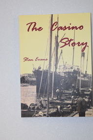 Warrnambool and District Historical Society Inc.
Book - book & bookmark, The Casino Story, 1882
... that was loved by the people in the coastal towns of Port Fairy ...History of the ship, 'Casino'.1 This is a book of 145 pages.The cover has a yellow background with an image of a ship and dark red printing. The back cover and spine have red and black printing. The pages contain black and white photographs and sketches and printed material. .2 This is a bookmark with two colour images and printed material on one side and one image and printed material on the other side.non-fictionHistory of the ship, 'Casino'the ship 'casino', warrnambool shipping history