Showing 220 items
matching conservation reports
-
 The Beechworth Burke Museum
Photograph, 25 October 1930
Taken on 25 October 1930, various houses with the Hume Dam under construction are depicted in the background. The construction of the Hume Dam took place from 1919 to 1936. At the time of construction, it was the second largest dam in the world. It was also one of the earliest civil projects developed after the Federation. Some of the Dam workers consisted of World War I veterans. Dam workers often settled their families in Mitta Junction Village and Wodonga. Archaeological surveys were completed by Austral Archaeology, which was done when the Department of Land & Water Conservation was doing work to improve Hume Dam. The archaeological report that came out of the survey recommended three sites of interest where archaeological excavation should be done: Camp Ganger’s Quarters, Stableman’s Quarters, and the Industrial Dump. The excavation uncovered artefacts. Mitta Mitta: Mitta Mitta is situated between Mount Welcome and Mount Misery. It is named after the river that explorers Hume and Hovell discovered in 1824. The town would eventually become a huge gold mining town. Mitta Mitta is called Midamodunga by the local Indigenous peoples Wodonga: Wodonga is situated on the Murray River and is part of North East Victoria. Hume and Hovell: Hamilton Hume (1979-1873) and William Hilton Hovell (1786-1875). W. H. Hovell was born in Norfolk England and Hume was born in Parramatta, New South Wales Hovell and Hume undertook an exploration journey in 1824 and thought they discovered a river, which turned out to be the Murray River. They returned home in 1825, but returned to the area in 1826 and discovered coal in the area.This photo is historically significant as it shows the Hume Dam under construction in 1930. The Dam was named after Hamilton Hume, who is an important historical figure for this area as he helped discover the area where resources were found.Sepia rectangular photograph printed unmountedReverse: 84-19-6/ 1997.3187/ The spillway [featuring trademark: kodak print] construction, houses, veterans, mitta junction village, hume dam, world war i, federation, wodonga, archaeological survey, excavation, austral archaeology, department of land & water conservation, camp ganger's quarter's, stableman's quarters, industrial dump, artefacts, mitta mitta, mount welcome, mount misery, murray river, hamilton hume, william hilton hovell, hume and hovell expedition -
 The Beechworth Burke Museum
Photograph, 25 October 1930
Taken on 25 October 1930, various houses with the Hume Dam under construction are depicted in the background. The construction of the Hume Dam took place from 1919 to 1936. At the time of construction, it was the second largest dam in the world. It was also one of the earliest civil projects developed after the Federation. Some of the Dam workers consisted of World War I veterans. Dam workers often settled their families in Mitta Junction Village and Wodonga. Archaeological surveys were completed by Austral Archaeology, which was done when the Department of Land & Water Conservation was doing work to improve Hume Dam. The archaeological report that came out of the survey recommended three sites of interest where archaeological excavation should be done: Camp Ganger’s Quarters, Stableman’s Quarters, and the Industrial Dump. The excavation uncovered artefacts. Mitta Mitta: Mitta Mitta is situated between Mount Welcome and Mount Misery. It is named after the river that explorers Hume and Hovell discovered in 1824. The town would eventually become a huge gold mining town. Mitta Mitta is called Midamodunga by the local Indigenous peoples Wodonga: Wodonga is situated on the Murray River and is part of North East Victoria. Hume and Hovell: Hamilton Hume (1979-1873) and William Hilton Hovell (1786-1875). W. H. Hovell was born in Norfolk England and Hume was born in Parramatta, New South Wales Hovell and Hume undertook an exploration journey in 1824 and thought they discovered a river, which turned out to be the Murray River. They returned home in 1825, but returned to the area in 1826 and discovered coal in the area.This photo is historically significant as it shows the Hume Dam under construction in 1930. The Dam was named after Hamilton Hume, who is an important historical figure for this area as he helped discover the area where resources were found.Black and white rectangular photograph printer unmountedReverse: 84-20-1/ 1997.3147construction, houses, veterans, mitta junction village, hume dam, world war i, federation, wodonga, archaeological survey, excavation, austral archaeology, department of land & water conservation, camp ganger's quarter's, stableman's quarters, industrial dump, artefacts, mitta mitta, mount welcome, mount misery, murray river, hamilton hume, william hilton hovell, hume and hovell expedition -
 The Beechworth Burke Museum
Photograph, 25 October 1930
Taken on 25 October 1930, various houses with the Hume Dam under construction are depicted in the background. The construction of the Hume Dam took place from 1919 to 1936. At the time of construction, it was the second largest dam in the world. It was also one of the earliest civil projects developed after the Federation. Some of the Dam workers consisted of World War I veterans. Dam workers often settled their families in Mitta Junction Village and Wodonga. Archaeological surveys were completed by Austral Archaeology, which was done when the Department of Land & Water Conservation was doing work to improve Hume Dam. The archaeological report that came out of the survey recommended three sites of interest where archaeological excavation should be done: Camp Ganger’s Quarters, Stableman’s Quarters, and the Industrial Dump. The excavation uncovered artefacts. Mitta Mitta: Mitta Mitta is situated between Mount Welcome and Mount Misery. It is named after the river that explorers Hume and Hovell discovered in 1824. The town would eventually become a huge gold mining town. Mitta Mitta is called Midamodunga by the local Indigenous peoples Wodonga: Wodonga is situated on the Murray River and is part of North East Victoria. Hume and Hovell: Hamilton Hume (1979-1873) and William Hilton Hovell (1786-1875). W. H. Hovell was born in Norfolk England and Hume was born in Parramatta, New South Wales Hovell and Hume undertook an exploration journey in 1824 and thought they discovered a river, which turned out to be the Murray River. They returned home in 1825, but returned to the area in 1826 and discovered coal in the area. This photo is historically significant as it shows the Hume Dam under construction in 1930. The Dam was named after Hamilton Hume, who is an important historical figure for this area as he helped discover the area where resources were found. Black and white rectangular photograph printer unmountedReverse: 1997.3145/ 84-20-2construction, houses, veterans, mitta junction village, hume dam, world war i, federation, wodonga, archaeological survey, excavation, austral archaeology, department of land & water conservation, camp ganger's quarter's, stableman's quarters, industrial dump, artefacts, mitta mitta, mount welcome, mount misery, murray river, hamilton hume, william hilton hovell, hume and hovell expedition -
 Orbost & District Historical Society
book / document, Far East Gippsland Tourism Strategy Oct 1987, October 1987
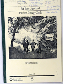
The project team for this document comprised E. Beacham, T. Claridge, B. Ebbs, C. Wilso. and J. Cristofaro.This booklet is a useful refernce tool.A document of 86 pp, titled Far East Gippsland Tourism Strategy Study Interim Report October 1987. it has a cream cover and black binding with a b/w photograph of four people in a bushland setting. It contains fold-out maps.tourism-east-gippsland -
 Orbost & District Historical Society
book, A History of the Aboriginal people of East Gippsland by Kym Thompson, January, 1985
... of the Aboriginal People of East Gippsland by Kym Thompson. It is a report... gippsland book Australian-Aborigines Land-Conservation-Council ...A manuscript book with a pink cover. A History of the Aboriginal People of East Gippsland by Kym Thompson. It is a report for the Land Conservation Council, Victoria, 1985. Contains archaeological research, history of white invasion and matters related to the preservation of sites of significance in the area. 284pp.book australian-aborigines land-conservation-council thompson-kym -
 Orbost & District Historical Society
book, Scout Camp Wall Creek, 2006
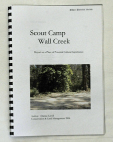
This report was written by Dianne Lavell for the Department of Conservation and Land Management. Dianne Lavell worked for the Department of Conservation and Land Management in Orbost. She was a long time resident of Orbost. A spiral bound, plastic covered book titled Scout Camp Wall Creek. It is a report on Scout Camp at Wall Creek in Orbost. It contains description and history of the site deemed to be a place of potential cultural significance. on the front cover is a coloured photo of the site.scout-camp-wall-creek -
 Orbost & District Historical Society
book, Close Family Allotment, 2006
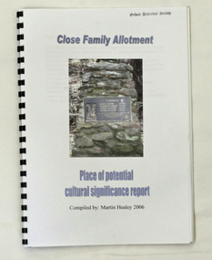
This report was compiled by Martin Healey for the Department of Conservation and Land Management, Victoria. Martin Healey, a long time Orbost resident, worked for the Department of Conservation and Land Management in Orbost.This is a useful research tool.A small spiral bound book of 30 pp with a plastic cover. It is a report written by Martin Healey and details the close Family allotments at Murrangower, east of Orbost. -
 Flagstaff Hill Maritime Museum and Village
Weapon - Cannon, circa 1825
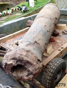
HISTORICAL INFORMATION In an article dated 26 March 1963, the Warrnambool Standard reported: “A cannon which has lain on the ocean floor since the barque, Children, was wrecked at Childer’s Cove on January 15, 1839, was raised by three Warrnambool skindivers at the week-end…The cannon, weighing about 750 lb. and 4-ft. 6-in. in length…is in excellent order considering the length of time it has remained under-water”. No conservation measures were taken at that time, other than chipping off the marine growth with hammers and cold chisels. The minutes for the 4 February 1974 meeting of the Flagstaff Hill Planning Board recorded that “a cannon recovered some time ago was lying in the garden of [one of the three original divers] and that it could be picked up at any time”. Peter Ronald, past Manager and Diver for Flagstaff Hill, notes that the CHILDREN cannon would have been recovered by the other divers around 1964. When the cannon came into care of Flagstaff Hill it was given basic conservation relevant to the time. (At the same meeting the Board was advised of the recovery of an anchor from the wreck of the CHILDREN by Flagstaff Hill divers (Peter Ronald, Colin Goodall and Gary Hayden, and Hank Howey and Andrew Coffee), and its interim relocation in the sea at the end of the Warrnambool Breakwater while awaiting conservation). The CHILDREN was owned by the pioneering Henty family of Portland. She was en route from Launceston to Adelaide, when she foundered in rough conditions at Childers Cove on 14 January 1839. The CHILDREN was a small three-masted barque, only 29 metres long and 254 tons weight, with 14 crew members and 24 passengers (including 9 children) on board. The ship was also carrying an awkwardly ballasted cargo of 1500 sheep, 8 bullocks, 7 horses, 5000 London house bricks, 6 whaling boats, and general trade goods. When the CHILDREN was driven into the limestone stack at the entrance to the cove, the seas smashed her into pieces within half an hour, and 16 lives were lost. The CHILDREN was an all-wooden ship, built in 1825 at Liverpool, and her shipwreck in 1839 is one of colonial Victoria’s earliest and most significant maritime disasters. There is little left to mark the tragedy on the seabed now, apart from some of the house bricks intended for the Henty’s Portland Bay settlement. Despite its poor condition, the CHILDREN’s signal cannon remains an important and interpretable record of her demise, (along with her anchor, the bottom half of her ship’s bell, and portions of a brass porthole - artefacts that are also in the Flagstaff Hill collection). In 2015 the CHILDREN cannon will undergo further conservation. (Conservation Management Plan for Victorian Guns and Cannon, South Western Victoria, May 2008, ref W/F/06) The shipwreck of the CHILDREN is of state significance — Victorian Heritage Register No. S116.A 1.3 metre iron 6pdr cannon recovered from the wreck of the CHILDREN. The shape of the cannon tapers from a thick round breech to a flared muzzle, with an 8 centimetre bore, and two side trunnions for pivoting on a wooden gun carriage. It was recovered from the shipwreck site of the CHILDREN by local divers in 1963. This small muzzle-loading signal cannon is in poor and unrestored condition. The cannon’s upper profile of smooth grey metal casing has corroded off, leaving an extensively oxidised rough red surface of crumbling iron. The bottom half of the cannon remains intact although the outer smooth casing also appears to be separating from the iron core of the barrel. Original grey casting is also missing from the breech and muzzle ends of the cannon. Corrosion and spalling of the upper surface layer of the cannon has removed the maker’s marks and specificationsflagstaff hill, warrnambool, shipwrecked coast, flagstaff hill maritime museum, maritime museum, shipwreck coast, flagstaff hill maritime village, great ocean road, the children, ship’s cannon, signal cannon, childers cove, 1839 shipwreck, conservation of marine artefactsm, shipwreck-coast, flagstaff-hill-maritime-village, cannon, 6pdr small bore cannon, children cannon, defence, children, shipwreck, 1839 -
 Mission to Seafarers Victoria
Decorative object - Finial, c. 1920
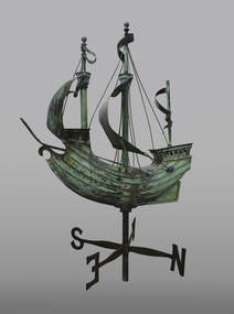
Appearances to the contrary, the item is not a weathervane but a finial. It was the gift of Mr John Sanderson (Jottings Easter 1920), from John Sanderson & Co., wool merchants, stock and station agents, commission and shipping agents before he leaves for England to become senior partner in Sanderson Murray & Elder, London, import and export agents. It was designed by Walter & Richard Butler Architects. (sketch published in Building : the magazine for the architect, builder, property owner and merchant vol.33, no 193, 12 Sept. 1923). The finial was already drawn on the sketch of the Central Institute made by Walter Butler. The maker of the finial, was Henry Alfred George Arnold Saw (born June 1881 in Hotham, Victoria was the son of Edward Saw (1854-1926) a tinsmith and Catherine Barton (1863-1907). He worked as a metal artificer for a metal-working business located opposite the Trades Hall in Lygon Street and was given the job of making the copper ship finial. Henry married Florence Charlotte Reeder and they had four children. Also known as Harry Saw according to his grandson Brian, he died on 9th February 1960. Henry and Florence both died within two months of each other in 1960. It is not clear when the ship was actually installed on the roof, the earliest photograph dating from 1927. The windvane fell or moved several times because of gale forces: - In 1995 : After the funds were raised to repair it, it was treated by sculptor David Hope, and reinstalled in the 1998 (Ship to Shore #3 Sept 1998). - In 2017: Carmela Lonetti from the Grimwade Centre for Cultural Materials Conservation (Ship to Shore Autumn 2017) - In 2019: a generous passerby donated the necessary funds for the conservation. It was sent to Grimwade Centre for Cultural Materials Conservation (Ship to Shore 2019), treated by Evan Tindal (City of Melbourne Magainze Oct. 2020). It was reinstalled over the Summer of 2019-2020 (Ship to Shore Summer 2020). The weathervane was stolen during the night of the 6-7 March 2022. Copper price surge sparks rise in theft in Victoria in 2021-22 so it's likely the vane was stolen to be melted This sculpture is closely associated with the 1917 building and described in clippings and annual reports when the building was first newly opened. It can be seen in some of the earliest photographs of the new building and in the artist/architect Butler's impressions. The galleon is often a decorative design of Mission to Seafarers wind vane (London, Adelaide).Bronze and copper sculpture fashioned as a Wind Vane in the form of a Galleon style sailing ship with 2 pennants flying and two sails rigged atop with lower cross piece with wind directions N S E W . There is a decorative ornamental pierced scrollwork ferrule / finial with reinforcing chrome steel piping armature at base of main support which attaches to the roof or a base support. See also comments below weather vane, wind vane, sculpture, galleon, sailing ship, finial, henry alfred saw, david hope, windvane, weathervane, walter richmond butler (1864–1949), richard butler, john sanderson -
 Ringwood and District Historical Society
Book, City of Knox Heritage Study 1993, 1993
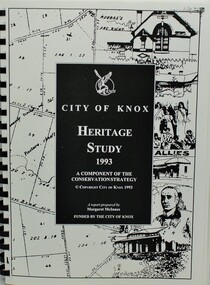
Soft covered plastic-bound book with City of Knox falcon logo - City of Knox Heritage Study 1993 - A component of the Conservation Strategy.A report prepared by Margaret McInnes - Copyright City of Knox 1993 - Funded by the City of Knox. -
 Warrnambool and District Historical Society Inc.
Book, Historic Places of South West Victoria
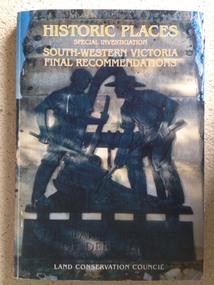
This is the third in a series of booklets produced by the Land Conservation Council in 1997 (176 pages). Booklets One and Two (1996) contained A Descriptive Report and Proposed Recommendations. The Final Recommendations include information on processes for protection of historic places, lists of significant places in the south-western region and aboriginal historic places. Attached inside the back cover are two maps showing the location of the significant places.This is a useful book as it lists the declared historic sites in the region and researchers will find the information helpful. This is a soft-cover book with a multi-coloured cover featuring a photograph of the Pioneers Memorial, Deep Lead. It has a red-coloured spine and back cover.Front Cover – Historic Places - Special Investigation - South-Western Victoria - Final Recommendations – Land Conservation Council Spine – Historic Places – South-Western Victoria – Final Recommendations – Land Conservation Council Back Cover – Historic Places, Final Rec., code used for retail sales warrnambool -
 Kiewa Valley Historical Society
Report - Alpine Study Area Volume 2 Maps, Land Conservation Council, 1970s
... . Minerals Land Conservation Council Report - Alpine Study Area ...The Victorian Environmental Assessment Council and the former Environment Conservation Council (ECC) and Land Conservation Council (LCC) have completed 36 land use investigations over more than 35 years, including 27 regional reviews. They provide a framework for use of Public Land in Victoria. The Land Conservation Council was established by the Land Conservation Act 1970.These maps provide an assessment of the Alpine area at the time the maps were created. Some of the topics eg. Rainfall and water resources may change over the years thus providing a comparative analysis. Others may provide information for future development such as mineral exploration, building of a dam / tunnel etc.Blue box shaped folder containing 9 of 10 Maps of the Alpine Study Area produced by the Land Conservation Council. Maps include 1. Public land and descriptive blocks. 2. Physiography. 3. Topography. 4. Geology (missing). 5. Rainfall and water resources. 6. Vegetation 7. Land systems. 8. Recreation. 9. Primary production. 10. Minerals Ex library item. Stamped in red "Discarded From Stock / Swan Hill Regional Libraryalpine area, maps of alpine area, land conservation council -
 Kiewa Valley Historical Society
Report - Alpine Area Proposed Recommendations, Land Conservation Council, Victoria Melbourne, April 1978, April 1978
The Land Conservation Council was established by the Land Conservation Act 1970. It makes recommendations to the Minister for Conservation with respect to the use of public land. Notices showing the boundary of the study area ... published in the Victorian Government Gazette Sept. 1973. A descriptive report was published in July 1977. Submissions (1538) on the future use of public land were received & included those representing a wide cross-section of the community. These were considered in the final report.Of interest for research on the changing ideas regarding the use of public land and the environment.Blue book bound by dark blue cloth tape. It has 92 pages with maps at the end and an empty folder inside the back cover.alpine area, land conservation council, alpine study area report -
 Kiewa Valley Historical Society
Report - Land Conservation Council x2, Land Conservation Council, Victoria Melbourne, April 1978, October 1974
... Report - Land Conservation Council x2... Conservation Council, Victoria Melbourne, April 1978 Report - Land ...Land Conservation Act 1970 established the Land Conservation Council to investigate and recommend to the Minister use of public land in Victoria. It describes and assesses the natural resources:-Physiography, Geology, Topography, Land Systems, Outdoor Recreation, Public land and blocks. Primary Production. Vegetation.North East Victoria includes the Kiewa Valley. This report gives an understanding of the development of the area.Thick heavy book with 312 pages with black and white photos. Back half has a folder with heavy cardboard attached to thick cardboard back cover. Inside folder are 9 maps with color each with a different title.Stamped on Front Cover: "Mount Beauty High School" Has a library borrowing slip at the back of the last page.land conservation council, environment, public land, kiewa valley, planning -
 Eltham District Historical Society Inc
Book, Land Conservation Council, Report on the Melbourne Study Area, December 1973
... Kinglake Thomson Valley conservation public lands This report ...This report is one of a series describings the physical nature of the land and its environment, examines the likely forms of land use, and assesses the hazards associated with these uses. It is divided into four main sections: Introduction, Characteristics of environment, main forms of land use and description of 24 specific blocks in the study area which include Torquay, Brisbane Ranges, Werribee, Wombat, Loddon, Romsey, Puckapunyal, Strathbogie, Eildon, Disappointment, Break O'Day, Black Range, Cerberean, Upper Goulburn, Kinglake, Donna Buang, Upper Yarra, Thomson, Dandenongs, Bunyip-Latrobe, Shady Creek, Tyers, Westernport and Strzelecki. The Land Conservation Act 1970 established the Land Conservation Council whose functions is to "carry out investigations and make recommendations to the Minister with respect to the use of public land in order to provide for the balanced use of land in Victoria. This report sets out to describe and assess the natural resources of the public lands in the Melbourne area and provides a factual basis on which members of the community may base submissions to the [Land Conservation] Council of Victoria.444 pagesnon-fictionThis report is one of a series describings the physical nature of the land and its environment, examines the likely forms of land use, and assesses the hazards associated with these uses. It is divided into four main sections: Introduction, Characteristics of environment, main forms of land use and description of 24 specific blocks in the study area which include Torquay, Brisbane Ranges, Werribee, Wombat, Loddon, Romsey, Puckapunyal, Strathbogie, Eildon, Disappointment, Break O'Day, Black Range, Cerberean, Upper Goulburn, Kinglake, Donna Buang, Upper Yarra, Thomson, Dandenongs, Bunyip-Latrobe, Shady Creek, Tyers, Westernport and Strzelecki. The Land Conservation Act 1970 established the Land Conservation Council whose functions is to "carry out investigations and make recommendations to the Minister with respect to the use of public land in order to provide for the balanced use of land in Victoria. This report sets out to describe and assess the natural resources of the public lands in the Melbourne area and provides a factual basis on which members of the community may base submissions to the [Land Conservation] Council of Victoria.land use, kinglake, thomson valley, conservation, public lands -
![Book - Map, Land Conservation Council, Melbourne Study Area Report, [December 1973]](/media/collectors/4f729f7b97f83e03086018a5/items/6469bc241d76dd4b008a829f/item-media/646b0013d841f8920fa4323c/item-fit-380x285.jpg) Eltham District Historical Society Inc
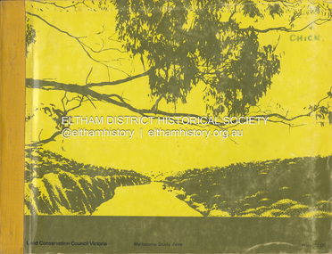
Eltham District Historical Society IncBook - Map, Land Conservation Council, Melbourne Study Area Report, [December 1973]
... The Melbourne Study Report is a series of volumes describing ...The Melbourne Study Report is a series of volumes describing the physical nature of the land and its environment, examines the likely forms of land use, and assesses the hazards associated with these uses. This is Volume 2 (coloured maps). The first page featues a black and white map described as "Shire of Diamond Valley" with public land marked in yellow. Followed by eight large fold out maps. Melbourne Study Area Public land and descriptive blocks, Population description, Geology, Physiography, topography and rainfall, vegetation and water supply. The Land Conservation Act 1970 established the Land Conservation Council whose functions is to "carry out investigations and make recommendations to the Minister with respect to the use of public land in order to provide for the balanced use of land in Victoria. This report sets out to describe and assess the natural resources of the public lands in the Melbourne area and provides a factual basis on which members of the community may base submissions to the [Land Conservation] Council of Victoria.A collection of eight large fold out coloured maps published in a bound book formnon-fictionThe Melbourne Study Report is a series of volumes describing the physical nature of the land and its environment, examines the likely forms of land use, and assesses the hazards associated with these uses. This is Volume 2 (coloured maps). The first page featues a black and white map described as "Shire of Diamond Valley" with public land marked in yellow. Followed by eight large fold out maps. Melbourne Study Area Public land and descriptive blocks, Population description, Geology, Physiography, topography and rainfall, vegetation and water supply. The Land Conservation Act 1970 established the Land Conservation Council whose functions is to "carry out investigations and make recommendations to the Minister with respect to the use of public land in order to provide for the balanced use of land in Victoria. This report sets out to describe and assess the natural resources of the public lands in the Melbourne area and provides a factual basis on which members of the community may base submissions to the [Land Conservation] Council of Victoria. maps, shire of diamond valley, population, geology, topography, rainfall, vegetation, water supply, land use, public lands -
 Eltham District Historical Society Inc
Document - Property Binder, Eltham Mall, 10-18 Arthur Street, Eltham
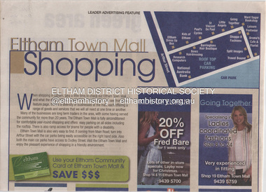
1. Eltham Town Mall Shopping, Diamond Valley Leader, October 26, 2005 [ On reverse - "Red alert for green area by Natalie Birch and Shane Woodrow about a report compiled by Environment Victoria, Melbourne's Threatened Habitats Under Threat: Development Pressures and Conservation Solutions which places the 'Nillumbik Foothills' number seven on list of most endangered by urban sprawl] 2. Advertisement: Huge Bikle Sale, Paul's Cycles, Diamond Valley Leader, February 7, 2007eltham, businesses, eltham town mall, paul's cycles, shops, brushtailed phascogale, click here to add keywords, cr greg johnson, eltham copper butterfly, environment victoria, environmental significance overlay, green wedges coalition, nillumbik shire council, powerful owl, significant landscape overlay, victorian national parks association, aroma's cafe and florist, arthur street, barringtons hair boutique, bowz hairdressing, eltham dress up box, going together, kids of eltham, leisure footwear, little angels, national australia bank, research computers, shoppe 8 fashions, split images, st vincent de paul, travel bound, ward sagar bookshop -
 Eltham District Historical Society Inc
Document - Folder, Marshall, Robert
Robert Marshall grew up on a small farm in Panton Hills in the 1950s and became an architect, designing in an Australian style, sometimes working with Alistair Knox. Marshall first stood for local council in 1974, having to overcome a childhood stutter by relaxation techniques. He was active in the formation of Nillumbik shire; after 20 years as councillor, he was elected president for 1978 and 1979. In February 1997, his adopted son Stewart Anthony Marshall died as the result of a drug mix-up. He lived in St Andrews and his business was in Hurstbridge. Contents Newspaper article: "Rob Marshall: fist of steel in a glove of green", The Valley Voice, 24 January 1979, describing Robert Marshall's childhood and his thoughts about house design and conservation. Newspaper article: "Councillor marshals energy for next round", Diamond Valley News, no date, Robert Marshall plans to stand again for council after the amalgamation of council, describing. his vision for the district citing Alistair Knox and Don Maling as pioneers. Newspaper article: "...and your new shire president", Diamond Valley News, March 1997, Former Eltham councillor Robert Marshall elected Nillumbik Shire president. Newspaper article: "Drug mix-up led to death: court told", unknown newspaper, 28 May 1997, Report of Coroners Court hearing into death of Stewart Anthony Marshall, Robert Marshall's son. Newspaper article: "Shire chief set to pay outstanding rate bill", Diamond Valley News, 30 July 1997, Robert Marshall had not paid rates in protest during government-appointed commissioners were in power but was paying off the debt. Newspaper article: "An architect for a better way of life", Diamond Valley News, 11 August 1981, Describing Robert Marshall's travels after qualifying as an architect, his early life and his philosophy on conservation. Newspaper article: "He presides over the city's last green belt. But was does Robert Marshall make the State Government see red?" The Age, 10 January 1998, Describing dispute between Nillumbik Shire president Robert Marshall and CEO Barry Rochford, and Rochford's termination package and Marshall's environmental campaigns including the old Eltham Shire Office site. Newspaper letter: "For good governance", letter from Robert Marshall, following his defeat at recent council election after 25 years in local government, comments on his actions as president and wishes new councillors well. Newspaper clippings, A4 photocopies, etcrobert marshall, panton hills victoria, alistair knox, stewart anthony marshall, ross ray qc, vauclause hospital, benny monheit, adam bernhaut, geoff pittaway, metropolitan ambulance service, ambulance service victoria, eltham gateway action group, barry rochford, eltham shire offices site, frank lynch, eltham chamber of commerce, barry miller, rob maclellan planning minister, green wedge, don maling -
 Eltham District Historical Society Inc
Book, Pat Vaughan, Management plan for the Eltham Copper Butterfly (Paralucia pyrodiscus lucida Crosby), (Lepidoptera: Lycasenidae); Arthur Rylah Institute for Environmental Researcg, Technical Report Series No. 79, July 1988
-
 Eltham District Historical Society Inc
Book, Melbourne Metropolitan Board of Works, Yarra Valley Metropolitan Park : report for proposed development : a recreation, conservation and landscape planning study for the Melbourne and Metropolitan Board of Works, Metropolitan Parks Division / by Scott and Furphy Engineers Pty Ltd, Landscape Division, November 1979
melbourne metropolitan board of works, yarra river, yarra river valley, yarra valley metropolitan park -
Glen Eira Historical Society
Document - CAULFIELD TECHNICAL SCHOOL
Three items about this school: 1/Pamphlet for 'Caulfield Technical School - Open Nights, Exhibition of Students Work and Working Display', November 1928. admission: a Shrine Button for the School's Shrine of Remembrance Fund subscription. Reverse has courses and conditions for enrolment. 2/Photocopy of Andrew Ward's Caulfield Conservation Study of Caulfield Technical School, which later became Monash University Caulfield Campus. Dated March 1995. Moderne style for one entry and Classical Revival forthe other. (5 pages) 3/'Gryphon' - Annual Magazine Caulfield Technical School 1954. 80 page book which includes photos and reports on activities, classes and students plus many pages of advertisements. Noted 'Lynette Lamb' on front cover.caulfield technical school, railway avenue, dandenong road, monash university caulfield campus, art and applied science wing, technical schools, education, universities, architectural features, modern style, classical revival style, architectural styles, windows, stairs, shows and exhibitions, ward andrew, towers, millard kenneth (editor), coleman john, vizard richard, isaac cynthia, rooke graham, russon john, magazine committee, 'gryphon', advertisements, caulfield technical college, caulfield institute of technology -
 Glen Eira Historical Society
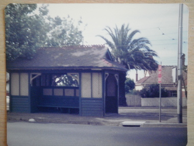
Article - Tram Shelter, Balaclava Road
Caulfield Conservation study by Andrew Ward dated October 1994 on Tram Shelter, corner of Balaclava Road and Orrong Road with a brief history and a statement of significance from the National Trust of Australia. Four black and white photos of Balaclava Road tram shelter. National Trust classification report giving detail of shelter and others on the tramway routes of Melbourne. Includes history of cable car system and reasons for tramways amalgamations. It includes architectural features. Article from the Trust News, June 2000 on history of Melbourne Tram shelters, various architectural design and features and where they were built and who designed thembalaclava road, orrong road, tram shelters, street furniture, cast iron work, verandahs, edwardian style, the prahran and malvern tramways trust, ward andrew, historic buildings, dandenong road, caulfield north, glenhuntly road, green robert -
Glen Eira Historical Society
Document - Hopetoun, Hopetoun Street, 2, Elsternwick
Two items about the inclusion of this property on the National Trust's Register: 1/1 copy of one page of typed correspondence and six page enclosure from T Chandler for Ian Wight, Assistant Administrator (Conservation) of the National Trust of Australia (Victoria), dated 19/07/1991 to the Chief Executive Officer, City of Caulfield, outlining that the Hopetoun Private Hospital has been classified in the National Trust’s Register and also noting a cc for Caulfield Historical Society. The enclosure is a six page typed classification report on Hopetoun by the National Trust and includes a reference list. 2/1 copy of one page of typed correspondence and six page enclosure from T Chandler for Ian Wight, Assistant Administrator (Conservation) of the National Trust of Australia (Victoria), dated 19/07/1991 to Kopat P/L, outlining that the Hopetoun Private Hospital has been classified in the National Trust’s Register. The enclosure is the same six page typed classification report on Hopetoun by the National Trust which includes a reference list.hopetoun private hospital, hospitals, elsternwick, charles webb and son, melrose, italianate style, architectural features, glenhuntly road, korong road, duffy frank gavan, geoghegan hanbury c, cutts joseph e, hopetoun street, koorong road, caulfield, mansions, caulfield historical society, city of caulfield, webb charles, architectural styles, hopetoun lord, webb alfred william, webb florence mabel, cordner florence mabel, o’brien annie may, reeve charles frederick, haines edith faith, thomas albert edward, kopat pty ltd, cordner l -
 Glen Eira Historical Society
Document - Kahlyn, 70 Bambra Road, Caulfield North
A three page black and white photocopy of a Caulfield Conservation Study of Kahyln House, formerly Kynaston, 70 Bambra Road, Caulfield North, by Andrew Ward in August 1994. The report describes key architectural features of Kahlyn House and gives a brief history of the property’s ownership. The study includes a photograph of the exterior of Kahlyn. The file also includes an undated, unattributed colour photograph (100mm x 150mm) of the exterior of Kahlyn. An undated, unattributed black & white photograph digital version only.danphy catherine, anderson grace, beauchamp horatio, murray reginald, murray kynaston l, holst frederick, ward andrew, hudson street, caulfield, caulfield north, bambra road, kahlyn private hospital, mansions, hospitals, houses, architectural styles, towers, victorian style, verandahs, kahyln, kynaston -
Glen Eira Historical Society
Document - Murray Street, 32, Elsternwick
Photocopy of report on brief history, condition and description of 32 Murray Street from Andrew Ward's Caulfield Conservation Study dated September 1994. Bad Photocopy of photograph in document; built 1893.doyles j w mrs, murray street, elsternwick, kooyong road, foster street, andrew kerr and co, kerr andrew, kavanagh henry, anderson william, anderson marion, ward andrew, australian financial agency and guarantee coy., houses, italianate style, architectural features, residential development, builder -
Glen Eira Historical Society
Document - Downshire Road, 31, Elsternwick
... A two page photocopy of a report from the Caulfield... VIC 3162 melbourne A two page photocopy of a report from ...A two page photocopy of a report from the Caulfield Conservation Study on 31 Downshire Road, Elsternwick, by Andrew Ward, dated 10/1994. It includes a description of the architecture of the property, a brief history of the property and a statement of the property’s significance. The study includes a black and white photograph (100mm x 155mm) of the exterior of the house.ward andrew, caulfield conservation study, downshire road, elsternwick, architectural features, verandahs, edwardian style, architectural styles, rowsell percy, rowsell james, elly patrick, jackson thomas b, rowan street, gardenvale estate subdivision, federation style, caulfield -
Glen Eira Historical Society
Document - Elizabeth Street, 37, Elsternwick
A three page copy of a Caulfield Conservation Study by Andrew Ward, dated 09/1994, on the house at 37 Elizabeth Street, Elsternwick, formerly known as Conus, then Karimba and finally renamed Lucknow. The study includes a brief description of the architectural features of the house, history of the occupancy, a statement of significance and a black and white photograph (100mm x 154mm) of the exterior of the house. The file also includes a one page research report by the Brighton Historical Society, dated 18/11/1988, on the occupancy of the house at 37 Elizabeth Street, Elsternwick and its early history. Also included is one page of unattributed, undated, handwritten working notes.karimba, lucknow, conus, elsternwick, elizabeth street, ward andrew, architectural styles, architectural features, federation style, rippon lea estate, elsternwick urban conservation area, english domestic revival, bent thomas sir, sargood frederick sir, thomson winnie, thomson mrs, segrave william, muller fritz, griffiths mrs, goold james c, montgomery winifred, asmuss henry j, officer ellen, montgomery bert, brighton historical society, bullock h, landells rosalind, meyer leopold d, goold annie, gange leslie a, gange m, edwardian style, miller fritz, meyer e c, house names -
Glen Eira Historical Society
Document - Caulfield City Rifle Club No. 119, 294 Glen Huntly Road, Elsternwick
... A two page black and white photocopy of a report from... of a report from the Caulfield Conservation Study on 294 Glen Huntly ...A two page black and white photocopy of a report from the Caulfield Conservation Study on 294 Glen Huntly Road, Caulfield City Rifle Club by Andrew Ward, 09/1994. The report includes a description of the exterior of the property, a brief overview of the history of the building and a statement of its significance. It also includes a black and white photograph (150mm x 100mm) of the exterior of the building, dated 09/1994.caulfield conservation study, architectural features, glen huntly road, ward andrew, caulfield city rifle club, pavey p a -
Federation University Historical Collection
Book - Book - Scrapbook, Ballarat College of Advanced Education: Scrapbook of newspaper cutting, Book 3; November 1977 to May 1978
Newspaper cuttings relating to Ballarat College of Advanced Education. These are from various newspapers and include The Age, Ballarat Courier, The Australian, The Herald. The cuttings cover the period from 15 November 1977 to 12 May 1978. Book with yellow cover, front. Spiral bound.employment advertisements, application for enrolment, outline of courses, $5000 for reseach at bcae, art display by bcae third year students, government to increase expenditure on bcae, $1060000 contract for bcae education building, terry lee - rock drilling championship, graduate course for librarians, business degree course, engineer off to antarctic, ron brown, more want to study in ballarat, d taylor keeock retires, stained glass windows, no jobs for many new teachers, anne vine student counsellor, gifts for research, new bcae computer has all the answers, father ray gregory lectures, mr james tye - british safety chief, tv equipment to cae, criticism rejected by barker, building over drain, vertical windmill, top facilities, 'the lost generation', coaching panel visits ballarat, endurance test for students, accident prevention seminar, jim reid, ron moulds, derek viner, harold thomas, shake-up urged in tertiary education, education report - partridge report, maureen boon wins prize, 'scrap deakin' - 12 college principals, percy cerutty's ideas transplanted, romp through war years, hitz of the blitz, orienteering - canadian forest, education no answer to unemployment, future of bcae assured, canoe class, course on hearing conservation program, billycart designs -
Federation University Historical Collection
Book, J.G. Hatfield, The Development of CSR's Hearing Conservation Programme, 11/1981
Report presented for the Ballarat College of Advanced Education School of Engineering Graduate Diploma in Occupation Hazard Management. The supervisor was Dennis Else. viosh, csr, hearing conservation, maurice oxenburgh, j.g. hatfield