Showing 129 items
matching dam building
-
 Kiewa Valley Historical Society
7 small black and white photographs of Pretty Valley, c1948
In 1947 it was proposed to construct a dam on the Pretty Valley branch of the East Kiewa River. This was part of the initial planning in 1937. The Pretty Valley Reservoir was to be part of a pumped-storage scheme with a pumping station located immediately below the main structure. Preparatory work was commenced in 1946 with erection of staff accommodation. Between 1947 and 1950 the main camp was erected, access roads, constructed and banks and benches at the dam site undertaken. Following the financial crisis in 1951, a review of the scheme was carried out and work ceased in June 1951. Construction of the dam was deleted from the programme of works and all buildings removed.A pictorial history of part of the initial planning in 1937 for a dam to be constructed at Pretty Valley as part of the Kiewa Hydro Electric Scheme.7 small black and white photographs of Pretty ValleyAll photos have a circular stamp on the back with 'Print by Willson White Albury' enclosed. Photo 1 - on the back, handwritten in ink 'New 22Kv pump line - Pretty Valley Nov. 1948'. In pencil '18'. Photo 2 - On the back, handwritten in ink 'Pretty Valley - Staff mess on right Nov. 1948'. In pencil '18'. Photo 3 - On the back, handwritten in ink 'Pretty Valley Basin - looking S.E. Nov. 1948'. In pencil '5'. Photo 4 - On the back, handwritten in ink 'New pump 22Kv line, Pretty Valley - looking towards Mt. Mackie. Nov. 1948'. In pencil '5'. Photo 5 - On the back, handwritten in ink 'Pretty Valley. Mt. Cope just out of picture extreme right. Nov. 1948'. In pencil '78'. Photo 6 - on the back, handwritten in ink 'View from Pretty Valley Ruined Castle in Background Nov. 1948'. In pencil '78'. Photo 7 - on the back, handwritten in ink 'Pretty Valley Pump line (Nov. 1948)'. In pencil'78'.construct, dam, pretty valley -
 Kiewa Valley Historical Society
5 small black and white photos of Clover Dam and Power Station, c1948
The construction of Clover Power Station was commenced in October 1942 and the power station building was completed in May, 1943. The first machine was placed in service August, 1944 and the second machine in May, 1945. The water discharges directly into Clover Dam and re-used in West Kiewa Station. Clover Dam - stripping of foundation area commenced in January 1948 but the final concrete pour was not until 14th August, 1954.Pictorial history of the early construction undertaken in the building of the Kiewa Hydro Electric Scheme. Clover power station (No. 3 Development) was the first power station to be built .5 small black and white photographsPhoto No. 1 - handwritten in ink on back ' No. 3 Power Station Clover Flat Nov. 1948 Photo No. 2 - handwritten in ink on back 'No. 3 Power Station Clover Flat Nov. 1948 Photo No. 3- handwritten in ink 'Clover Flat looking towards work area of Clover Dam. Taken near #3 PS. Nov. 1948 Photo No 4 - Handwritten in ink 'Preparation for wall of Clover Dam Dec. 1948 Photo No.5 - handwritten in ink 'Preparation for wall o f Clover Dam Dec. 1948. Photo Nos. 1,2 3, on the back have circular stamp with 'Print by Willson White Albury'. In pencil is the number '78'. Photo Nos. 4, 5, have written on the back in pencil, number '14'. construction, clover power station, clover dam, -
 Kiewa Valley Historical Society
Photograph - Folder of Photographs – Photocopied set of 10 black and white photographs (pages 19 - 28) from the display folder put together by KVHS to document life on the Kiewa Valley Hydro-electric Scheme
... Waters 9-No1 Head Race Tunnel Portal Building 10-Clover Dam ...: No K7113 Kiewa Hydro Electric Works Clover Dam Flood Waters Page ...Although the Kiewa Hydro-Electric Scheme was first proposed in 1911, construction did not commence until 1938. As part of the push to cut electricity costs and diversify supply, the Victorian Government (circa 1930) initiated the conversion from primarily brown coal supply to hydro – electricity. Field investigations during the 1940’s resulted in a new proposal for a scheme that had more than double the capacity of the 1938 scheme. The Kiewa Hydroelectric Scheme became the largest scheme of its kind in the State Of Victoria and the second largest scheme in Australia. The number of personnel involved in the planning and construction of the scheme increased dramatically. During the late 1940’s, most activity centred around the construction of the West Kiewa Power Station, Rocky Valley Reservoir, McKay Creek Power Station and the Bogong Creek Aqueduct.A common thread across all the larger hydro scheme constructions was the need for workers, both qualified and unqualified who came from around the world seeking a new life for themselves and their families. New accommodation and facilities were required for the army of workers engaged in construction in often remote and wild areas. The SEC had a high demand for timber, and set up the first of a number of sawmills at Bogong Creek in 1939 and set up the first hardwood logging in the headwaters of the Kiewa River. These new ‘towns’ such as Mt Beauty and Bogong, survived, serving the needs of operational personnel and their families, and expanding with growth of new industries. Mount Beauty, and to a lesser extent Bogong, are among these places. Large A3 size spiral bound display folder containing 21 pages of photocopied black and white photographs of various aspects of the early days of the Kiewa Valley Hydro-electric scheme including equipment, various work sites and photographs of workers and their families. 1-Allis Chalmers Tractor School 2- Gardens outside Administrative Office – Mt Beauty 3- Mt Beauty house – 1950 4-Bridge over Pretty Valley River, Bogong 5-Rocky Valley Spillway Tunnel break through 6-Ni 1 Headrace Tunnel drilling face 7-No 4 Power Station Drilling 8-Clover Dam Flood Waters 9-No1 Head Race Tunnel Portal Building 10-Clover Dam 1-STATE ELECTRICITY COMMISSION OF VICTORIA Date: 5.9.49 Time: 10amm No K5174 Kiewa Hydro Electric Works Allis Chalmers Tractor School Page number 19 2-STATE ELECTRICITY COMMISSION OF VICTORIA Date: 22.2.50 Time: 3.30pm No K5601 Kiewa Hydro Electric Works Gardens outside Administrative Office – Mt Beauty Page number 20 3-Mt Beauty house – 1950 Page number 21 4-STATE ELECTRICITY COMMISSION OF VICTORIA Date: 23.10.50 Time: 11.15am No K6331 Kiewa Hydro Electric Works Bogong-Bridge over Pretty Valley River Page number 22 5-STATE ELECTRICITY COMMISSION OF VICTORIA Date: 23.6.50 Time: 2.30pm No K5844 Kiewa Hydro Electric Works ROCKY VALLEY SPILLWAY TUNNEL BREAK THROUGH Page number 23 6-20/3/52 – No. 1 Headrace Tunnel Drilling face (E.E.E. contract) Page number 24 7-6/6/52 – No 4 Power Station – Drilling Page number 25 8-STATE ELECTRICITY COMMISSION OF VICTORIA Date: 6/6/52 Time: No K7113 Kiewa Hydro Electric Works Clover Dam Flood Waters Page number 26 9-STATE ELECTRICITY COMMISSION OF VICTORIA Date: Oct 1952 Time: No K7239 Kiewa Hydro Electric Works No. 1 HEAD RACE TUNNEL PORTAL BUILDING. Handwritten underneath – This information from Ron White-the later Principal Hydro Engineer of the SEC. Oct 1952 Location incorrect? All work on No 1 had ceased after financial crash of 1951. This photo would refer to No 4 Headrace Tunnel? Page number 27 10-STATE ELECTRICITY COMMISSION OF VICTORIA Date: Jan 1953 Time: No K7307 Kiewa Hydro Electric Works CLOVER DAM Page number 28 secv; kiewa hydro electric scheme; bogong; mt beauty; construction area -
 Kiewa Valley Historical Society
Photograph – Set of 3 black and white photographs of Bogong Village circa late 1930's - 1940's during early construction of Lake Guy ( in the foreground), Late 1930's - 1940's
In 1940 Field Headquarters for the Kiewa Scheme were established at Bogong with office, workshop facilities and accommodation for workmen, staff and some families constructed. (There had been a 'tent camp' on this site in 1939 but was destroyed by bush fires) Construction of accommodation continued until 1947. A total of 40 houses plus a hostel for single staff, post office, police station, medical centre and primary school all with water and sewerage and electricity supply. The staff hostel was known as Kiewa House and is now occupied by the Education Department. Lake Guy was named after Mr. L.T. Guy who was the Resident Engineer in charge of construction work and associated activities on the Kiewa area. He held this position from 1939 to November 1946 when he was transferred to Head Office. The Bogong Township was developed firstly as an accommodation centre (base camp) for construction workers employed under the Kiewa Hydroelectric Scheme. Due to the influx of European workers into the Township the beautification of the immediate surrounds (gardens etc.) had a distinct European flavour. This environment has been very beneficial for tourism in later years. At the completion of the scheme, in the 1960's, the village was opened to public/tourism use. Strict environmental control has not allowed for any extensive redevelopment in tourist accommodation and basically restricted it to the accommodation initially built for the construction workers. Activities such a bike riding, snow skiing, restricted horse riding and bush walking on the Alpine plains and mountains are now a viable part of the Kiewa Valley Tourist Industry. The lake is one of the many water storage reservoirs used to supply the power stations their main power to run the huge turbines generating the final product, electricity3 black and white photographs of the Bogong camp area showing the clearing of trees for the construction of the Junction Dam and Lake Guy. Some administration buildings have been constructed, but part of the tent camp can be seen to the right of the photograph in front of the buildings. bogong village; junction dam; lake guy; kiewa hydro electric scheme; secv -
 Kiewa Valley Historical Society
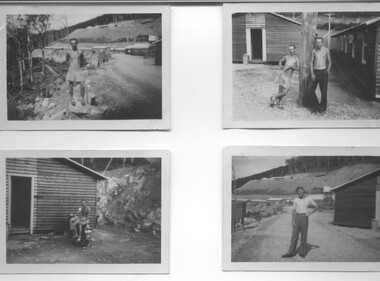
Photographs - Townships of Mt Beauty and Bogong and the Kiewa Valley, c 1940, 1950, 1960
The township of Mt. Beauty was built to provide family accommodation for personnel working on the construction of the Kiewa Scheme. construction commenced in 1946. Photo 1 is looking towards the corner of Lakeside Ave. and Kiewa Crescent. The Post Office is on the corner and the original building housing the Co op store was in Kiewa Crescent. Photo 2 is taken at a later date as the garden in front of the Post Office is well established. The Community Centre is centre left of the photo and the back buildings are the staff accommodation called "The Chalet". Photo 3. Farming country taken from Wallacedale. The Wallaces were one of he early farming families in the Kiewa Valley. Photo 4. This photo is of Junction Camp at Bogong Village and was commenced late in 1939 and by 1940 accommodated 96 men who were engaged in work on Junction Dam. Sleeping accommodation was provided in hutments, each of four rooms, each room being approx. 12 feet by 10 feet and provided for the accommodation of 2 men. This camp remained in use until November 1962.These photos have both historical and social significance. They show the type of accommodation available for workers during the construction of the SEC Kiewa Hydro Scheme as well as early streetscape views of Mt. Beauty. The Junction Camp photo also shows the state of the forest following the 1939 fires in the area.4 Black and white photographs of various sizes.Photo 1. On back, hand written in pencil: top left hand corner: "Sept 1950". Centre of photo: "Return to Gibson Envelope". Right hand side: "Cooper". Bottom left corner: "Mt. Beauty Camp SEC Kiewa Scheme". Photo 2. No inscriptions or markings. Photo 3. Back of photo handwritten in pencil: "In W>T> June 14. 1961 page31. Some of the farming country in the Kiewa Valley. This taken from the home of Mr. Geoff Wallace Wallacedale, Kergunyah where some of his 600 cattle were rounded up." Bottom right corner "Return to Gibson Envelope". There is a copyright stamp belonging to "the Herald & Weekly Times Ltd. also on the back. Photo 4. Typed on a sticker on the back of the photo "Stable attendants Cottage and Camp Sept. 1940".camp, sec kiewa scheme, kiewa, cattle, mt. beauty -
 Kiewa Valley Historical Society
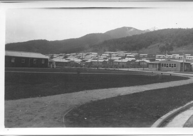
Photograph - 8 Black and white photographs - SECV, Unknown
All eight photographs have been taken at a workmen's camp erected by the State Electricity Commission to house workmen during the construction of the Kiewa Hydro Electric Scheme. These were established in close proximity to various work centres - Junction Camp at Bogong Village, three camps at Mt. Beauty, West Kiewa, Clover Dam and Clover Flat, Howman's sawmill and Howman's Gap, Rocky Valley, Langford's Gap, Pretty Valley, Mountain Creek and Big Hill. These photos have not been identified as to which camp they are taken but typical of the type of accommodation for wages personnel. They followed a general design and layout. There was a mess and recreation hall as well as a building for general trading and postal facilities (this conducted by proprietors of trading stores in Mt. Beauty and Bogong). Originally the rooms accommodated 2 men but later there was a demand for single rooms - the floor size then being 10 feet x 8 feet and furnished with a bed, small table and chair and cupboard with hanging space. The first camps were erected in 1940 and the last was removed in 1962.These photographs are of historical significance as they show the type of accommodation provided for wages personnel working on the Hydro Electric Scheme between 1940 and 1960.Eight small black and white photographs of unknown person and workmen's camp.All photos have been stamped on the back - Two "965U" in red, four "S80 " in green (indistinct) and two "141" in red.workmen's camps, kiewa hydro electric scheme, accommodation, secv, camps on kiewa hydro electric scheme, west kiewa -
 Eltham District Historical Society Inc
Film - Video (VHS), IMP Productions, The Shire of Etham - The Evergreen Shire (Series 69, Item 4), c.1985
Shire of Eltham Archives: Series 69, Item 4 This video was produced for the Shire of Eltham by IMP Productions and provides a description of the shire, 277 square km on a north/northeast axis, some 25 km northeast of the centre of Melbourne with a population of around 40,000. Scenes include Yarra River, rural settings and urban settings, housing estates, Shillinglaw Cottage, Pigeon Bank at Kangaroo Ground, the Eltham Railway Trestle Bridge with reference to the fight by locals in the 1970s to save it from replacement, Montsalvat, mudbrick making and its use as a building material, the use of mudbrick in the Eltham Community Centre blending harmoniously with the environment. Emphasises people living in the area due to the qualities of life provided. Also the Living and Learning Centre, St Andrews Markets and other local markets, the Eltham Leisure Centre, cricket and horse riding at Eltham Lower Park, the Infant Welfare Centre (part of the Eltham War Memorial), how residents are mindful of protecting their historical heritage, the CBA bank and Allwood House at Hurstbridge, Tracey Naughton about the Eltham "As we are" Community Banner project and the “River of Life banner”, the Parks and Gardens office in the former Police Residence building (now the Local History Centre), Alistair Knox Park, road planning and types of roads, tree canopy, Peck's Dam, green carparks, road drainage, Gordon Ford's garden and natural landscapes, and Were Street shops in Montmorency. Planning for shopping facilities and carparks with a population of 40,000 growing to 55,000, Arthur Street Mall and carpark, local village feel in the shopping centre. Councillors and Council staff featured include Mary Grant, Bob Manuell, Rodney Roschellor, John Cohen, Alan Baker. Also scenes of Commercial Place, Diamond Valley Railway, Eltham Galley, Riverclay and canoeing on the Yarra intermingled with images of the shire from the Shire of Eltham Pioneers Photograph collection.VHS Video cassette Converted to MP4 file format 00:11:56; 79MBshire of eltham, video recording, shire of eltham archives, alistair knox park, allwood house, arthur street, arthur street mall, bob manuell, canoeing, carparks, cba bank, commercial place, council staff, councillors, cr. mary grant, cricket, diamond valley railway, eltham community banner project, eltham community centre, eltham galley, eltham leisure centre, eltham living and learning centre, eltham lower park, eltham railway trestle bridge, eltham war memorial, gordon ford garden, horse riding, housing estates, hurstbridge, infant welfare centre, john cohen, kangaroo ground, local history centre, montmorency, montsalvat, mudbrick, parks and gardens, peck's dam, pigeon bank, police residence, river of life banner, riverclay, road drainage, road planning, rodney roschellor, shillinglaw cottage, shire of eltham pioneers photograph collection, st andrews market, tracey naughton, tree canopy, were street, yarra river, alan baker -
 Eltham District Historical Society Inc
Work on paper (item) - Photograph, 2 Metery Road, Eltham South
Robert and Ada Zull built an Alistair Knox designed house at 2 (lot 8) Metery Road, Eltham, a one acre property for their family of five in the mid 1960s. The form of the house is laid out on the cleared block. There was a dam at the bottom of the block. Susan Bennett, nee Zull's reminiscences are published in EDHS Newsletter, February and April 2020. ".. the block was big.. Building the house was slow going. The plans had to be discussed, then drawn up, finance found, council permits obtained and labourers engaged. " This series of photographs together with the account of personal remiscences provide a unique document of the construction of an Alistair Knox designed home. Knox was a pioneer in the use of mudbricks and recycled materials and is significant to his contribution of this style of architecture in Eltham and the wider Shire of Nillumbik.zull family, clearing, eltham south, 2 metery road, alistair knox, bow and arrow -
 Federation University Historical Collection
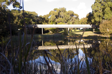
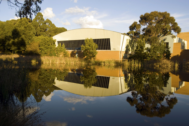
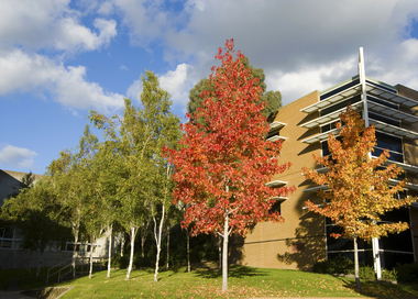
Photograph - Colour Photograph, Federation University Walkway from the Mount Helen Student Residences, 21/05/2010
Colour photograph the walkway and dam at Mpount Helen Campus.buildings, mount helen campus, bridge, walkway, dam -
 Federation University Historical Collection
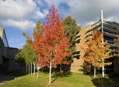
Photograph - Colour Photograph, Federation University Swimming Pool at Mount Helen Campus, 21/05/2010
... buildings mount helen campus dam swimming pool Colour photograph ...Colour photograph the walkway and dam at Mpount Helen Campus.buildings, mount helen campus, dam, swimming pool -
 Federation University Historical Collection
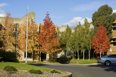
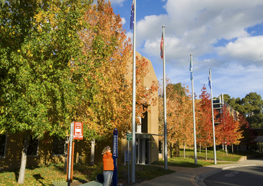
Photograph - Colour Photograph, Federation University Mount Helen Campus Entrance, 21/05/2010
Colour photograph the walkway and dam at Mpount Helen Campus.buildings, mount helen campus, the flags, autumn colouring -
 Federation University Historical Collection
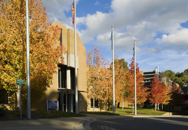
Photograph - Colour Photograph, Federation University Mount Helen Campus Entrance, 21/05/2010
Colour photograph the walkway and dam at Mpount Helen Campus.buildings, mount helen campus, the flags, autumn colouring -
 Federation University Historical Collection
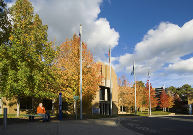
Photograph - Colour Photograph, Federation University Mount Helen Campus Entrance, 21/05/2010
Colour photograph the walkway and dam at Mpount Helen Campus.buildings, mount helen campus, the flags, autumn colouring -
 Federation University Historical Collection
Photograph - Colour Photograph, Federation University Mount Helen Campus Entrance, 21/05/2010
Colour photograph the walkway and dam at Mpount Helen Campus.buildings, mount helen campus, the flags, autumn colouring -
 Federation University Historical Collection
Photograph - Colour Photograph, Federation University Mount Helen Campus Entrance, 21/05/2010
Colour photograph the walkway and dam at Mpount Helen Campus.buildings, mount helen campus, the flags, autumn colouring -
 Federation University Historical Collection
Photograph - Colour Photograph, Federation University Mount Helen Campus Entrance, 21/05/2010
Colour photograph the walkway and dam at Mpount Helen Campus.buildings, mount helen campus, the flags, autumn colouring -
 Glenelg Shire Council Cultural Collection
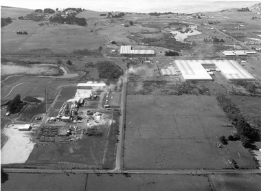
Photograph, CSR Softwoods/Dartmoor Mill, n.d
... large buildings and a dam on centre left of image. Factory... Softwoods/Dartmoor Mill. Depicts 3 large buildings and a dam ...Port of Portland Authority archives.port of portland -
 Glenelg Shire Council Cultural Collection
Photograph, CSR Softwoods/Dartmoor Mill, n.d
... large buildings and a dam on centre left of image. Factory... Softwoods/Dartmoor Mill. Depicts 3 large buildings and a dam ...Port of Portland Authority archives.port of portland -
 Glenelg Shire Council Cultural Collection
Photograph, CSR Softwoods/Dartmoor Mill, n.d
... large buildings and a dam on centre left of image. Factory... Softwoods/Dartmoor Mill. Depicts 3 large buildings and a dam ...Port of Portland Authority archives.port of portland -
 Glenelg Shire Council Cultural Collection
Photograph - Photograph - Thomas Borthwick and Sons, n.d
... , factory buildings in background. Dam on right.... in foreground. Car parks in centre, factory buildings in background. Dam ...Port of Portland Authority Archivesport of portland -
Glenelg Shire Council Cultural Collection
Photograph - Photograph - Thomas Borthwick & Sons, n.d
... park to left, factory buildings on right, dam in centre... buildings on right, dam in centre, paddocks in background ...Port of Portland Authority ArchivesBack: 40 7 3 in pencilport of portland archives, thomas borthwick and sons, abattoir -
 Halls Gap & Grampians Historical Society
Magazine - B/W, C 1915
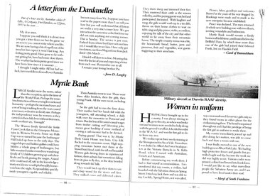
Large families were the norm, rather than the exception up to the time of the World wars. perhaps the senseless destruction of those young lives sickened humanity- perhaps the increased taxes and cost of living resulting from the wars caused a necessary reduction in family size. Perhaps the independence won by women as they carried on their daily lives without their men, made mothers say, "Enough" The Warren family farmed the fertile Fyans Creek flats in the Grampian Mountains of Western Victoria. Some say Halls Gap was so named because the bushranger Hall holed up there in the early days. The rugged slopes and hidden gullies could have hidden a whole gang of bushrangers, but little remained undiscovered to a wandering family of 12 children growing up with their flocks and herds grazing the ranges. A tired rider could nod off, safe in the knowledge a trusty stockhorse would plod steadily homeward into the night. Responsibility quickly made youngsters capable and reliable. Then Australia went to war. There were three older brothers, then the girls, then young Frank. All the men went, including Frank. So the girls had to run the farm alone. Their mother had her hands full with the youngsters, still attending school, a daily walk over the mountain to Pomonal and return. But the loss of the men's casual wages from timber cutting and labouring jobs, meant great hardship is some method of earning a cash income had to be devised. Paying guests! That was it. So Myrtle Bank Guest House was born. City folk flocked to the mountain resort. High stepping mountain horses met them at the Stawell raid-head, with the tall and beautiful Warren girls driving them in experienced fashion, their auburn hair sometimes falling from its pins to fly free, as the dray bowled along towards the hills. The would hitch up their skirts to saw and chop wood for the stoves and fires. They milked cows and delivered calves. They shore sheep and trimmed their feet. They mustered their cattle as the seasons rolled by, and the paying guests watched and participated, fascinated. With laughter and song, the girls would wash up in a tin dish, throw on their house clothes to wait on table, sing and play piano, violin, accordion, enjoying the talk of the city and that other world so far away from their mountain home. The simple country menu was a hit, and the homemade bread, butter, jams and preserves, fruit and vegetables sent guests staggering to their armchairs. Picnics, hikes, goodbyes and welcomes blurred as the years of the war dragged by. Bookings were made and remade as the new enterprise became established. Peace was declared. the men returned A whole new building rose with two floors, inviting verandahs and bathrooms. Myrtle Bank would remain a family business all its lifetime, until buried below the Bellfield Dam, by which time more than one the girls had joined their beloved Frank, lost on Flanders Field. Article in book or magazine describing life at Myrtlebank during war years Other article written from letter from soldier P Lillis to his sister 3rd article of woman from country enlisting in WAAF Submitted by Carol of Bannockburn, Submitted by D Langley Submitted by Meryl of South Frankstonaccommodation, myrtlebank, people, warren -
 Halls Gap & Grampians Historical Society
Photograph - B/W
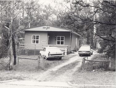
"Yarrabee" a holiday house in Halls Gap which was formerly a staff house for the construction of Bellfield Dam. A number of this houses were transported from job to job.A fibro cement house of simple rectangular construction, a low pitched roof ,sashed windows, a garage appears at the end of the driveway. Two cars are parked in driveway, gum trees surround the house. buildings, houses -
 Halls Gap & Grampians Historical Society
Photograph - B/W, C 1960s
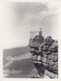
Photo is of 'The Pinnacle' lookout with Lake Bellfield in the background flanked by the Mt. William range. the photo is typical of 'tourism' photos taken by the Victorian Railways.Photo shows a man and a woman on top of a rocky outcrop that overlook a valley. A lake with a dam wall and rock tiers cut into the hillside can be seen as well as cleared areas some buildings. the lookout is enclosed with a wire fence.scenery, lookouts -
 Kiewa Valley Historical Society
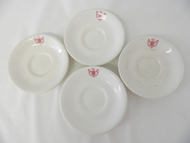
Saucer Ceramic, from 1921 to 1961
This item was used by the State Electricity Commission of Victoria in their mess rooms for their workers during the construction of the Kiewa Hydro Electricity Scheme. The imprint of the year "1921" was to identify the year that the SECV was formed and relieved the private VHEC(Victorian Hydro-Electric Company). As the scheme was of such a huge, isolated and time consuming nature the feeding of its workers was quite demanding of cutlery and crockery. The use of sturdy English cups and saucers was essential. The period of construction and the isolation of the Kiewa Valley area placed heavy demand for "solid" crockery that could wear abusive handling. This period in time was one when crockery, whether for domestic or commercial use, was imported from "mother" England. This scenario was more so for governmental bodies such as rail, jails and electricity providers than domestic users. The influx of cheaper Asian crockery had not yet begun.This type of crockery item was used by the thousands of SEC Victorian staff and construction workers involved in the building of the Kiewa Hydro Electricity Scheme, over the extensive period (1938 to 1961). This was a period when Government bodies and other semi- government organisations were still tied to the "establishments" of "mother" England. It was a period in Australia's development when the Asian influence was very weak and the established ties to England and Europe was still very strong. The majority of heavy equipment and machinery was either made in England or Europe. Local/European expertise in dam construction and water management in alpine terrain came from migrants or English and European specialist. The quality of workmanship from big steel manufacturing plants in England and Europe could not be matched from anywhere else in the developed world.This item is a white ceramic saucer (tea /coffee). It is made in England and is of strong and durable ceramic. The bottom cup indent is for either tea or coffee cups of a similar ceramic structure. The 5mm thickness of the ceramic suggests this saucer belongs to a commercial kitchen environment and not domestic. The indent bottom of the saucer is 5mm deep with a side curvature ratio of 2:5. The ceramic is glazed to a commercial standard (worker's mess). See also KVHS 0128 (A,C and D) The seal of the State Electricity Commission Of Victoria is imprinted on the top inside rim within a curved scroll. Snuggled within the borders of the scroll is a banner with the five stars of the southern cross and an arm with a closed fist projecting from the top with five lightning bolts projecting outwards. On the underside "Vitrified sold by Cafe & Hotel Supplies Pty Ltd Dunn Bennett & Co. Ltd. Burslem Made in England"saucer, plate, secv, state electricity commission of victoria, crockery, mt beauty chalet, bogong mess hall -
 Kiewa Valley Historical Society
Saucer Ceramic, from 1921 to 1961
This item was used by the State Electricity Commission of Victoria in their mess rooms for their workers during the construction of the Kiewa Hydro Electricity Scheme. The imprint of the year "1921" was to identify the year that the SECV was formed and relieved the private VHEC (Victorian Hydro-Electric Company). As the scheme was of such a huge, isolated and time consuming nature the feeding of its workers was quite demanding of cutlery and crockery. The use of sturdy English cups and saucers was essential. The period of construction and the isolation of the Kiewa Valley area placed heavy demand for "solid" crockery that could wear abusive handling. This period in time was one when crockery, whether for domestic or commercial use, was imported from "mother" England. This scenario was more so for governmental bodies such as rail, jails and electricity providers than domestic users. The influx of cheaper Asian crockery had not yet begun.This type of crockery item was used by the thousands of SEC Victorian staff and construction workers involved in the building of the Kiewa Hydro Electricity Scheme, over the extensive period (1938 to 1961). This was a period when Government bodies and other semi- government organisations were still tied to the "establishments" of "mother" England. It was a period in Australia's development when the Asian influence was very weak and the established ties to England and Europe was still very strong. The majority of heavy equipment and machinery was either made in England or Europe. Local/European expertise in dam construction and water management in alpine terrain came from migrants and specialist recruited from England and Europe. The quality of workmanship from big steel manufacturing plants in England and Europe could not be matched from anywhere else in the developed world.This item is a white ceramic saucer (tea /coffee). It is made in England and is of strong and durable ceramic. The bottom cup indent is for either tea or coffee cups of a similar ceramic structure. The 5mm thickness of the ceramic suggests this saucer belongs to a commercial kitchen environment and not domestic. The indent bottom of the saucer is 5mm deep with a side curvature ratio of 2:5. The ceramic is glazed to a commercial standard (worker's mess). See also KVHS 0128 ( A,B&D)The seal of the State Electricity Commission Of Victoria is imprinted on the top inside rim within a curved scroll. Snuggled within the borders of the scroll is a banner with the five stars of the southern cross and an arm with a closed fist projecting from the top with five lightning bolts projecting outwards. On the underside "Vitrified sold by Cafe & Hotel Supplies Pty Ltd Dunn Bennett & Co. Ltd. Burslem Made in England"saucer, plate, secv, state electricity commission of victoria, crockery, mt beauty chalet, bogong mess hall -
 Kiewa Valley Historical Society
Saucer Ceramic, Circa 1921
This item was used by the State Electricity Commission of Victoria in their mess huts/rooms for their workers during the construction of the Kiewa Hydro Electricity Scheme. The imprint of the year "1921" was to identify the year that the SECV was formed and relieved the private VHEC (Victorian Hydro-Electric Company). As the scheme was of such a huge, isolated and time consuming nature the feeding of its workers was quite demanding of cutlery and crockery. The use of sturdy English cups and saucers was essential. The period of construction and the isolation of the Kiewa Valley area placed heavy demand for "solid" crockery that could wear abusive handling. This period in time was one when crockery, whether for domestic or commercial use, was imported from "mother" England. This scenario was more so for governmental bodies such as rail, jails and electricity providers than domestic users. The influx of cheaper Asian crockery had not yet begun.This type of crockery item was used by the thousands of SEC Victorian staff and construction workers involved in the building of the Kiewa Hydro Electricity Scheme, over the extensive period (1938 to 1961). This was a period when Government bodies and other semi- government organisations were still tied to the "establishments" of "mother" England. It was a period in Australia's development when the Asian influence was very weak and the established ties to England and Europe was still very strong. The majority of heavy equipment and machinery was either made in England or Europe. Local and European expertise in dam construction and water management in alpine terrain came from migrants for England and Europe. The quality of workmanship from big steel manufacturing plants in England and Europe could not be matched from anywhere else in the developed world. These saucers were used in the mess huts including later in the Bogong mess hall and the Mount Beauty Chalet.This item is a white ceramic saucer (tea /coffee). It is made in England and is of strong and durable ceramic. The bottom cup indent is for either tea or coffee cups of a similar ceramic structure. The 5mm thickness of the ceramic suggests this saucer belongs to a commercial kitchen environment and not domestic. The indent bottom of the saucer is 5mm deep with a side curvature ratio of 2:5. The ceramic is glazed to a commercial standard (worker's mess). See also KVHS 0128 (A to C)The seal of the State Electricity Commission Of Victoria is imprinted on the top inside rim within a curved scroll. Snuggled within the borders of the scroll is a banner with the five stars of the southern cross and an arm with a closed fist projecting from the top with five lightning bolts projecting outwards. On the underside "Vitrified sold by Cafe & Hotel Supplies Pty Ltd Dunn Bennett & Co. Ltd. Burslem Made in England"saucer, plate, secv, state electricity commission of victoria, crockery, mt beauty chalet, bogong mess hall -
 Kiewa Valley Historical Society
Alex McCullough Collection - Notes and Photos on History of Mt Beauty
Alex McCullough was a resident of Mt Beauty for many years and wrote a book on the History of Mt Beauty. Mt Beauty was constructed by the State Electricity Commission of Victoria to house employees working on the Kiewa Hydro Electric Scheme. Alex was involved with many organisations in Mt Beauty and interested in history. He took many photos of events and new developments in town. He also collected individuals memoirs on life in the town.Mt Beauty's history is unique as it was built as a construction town in the late 1940s. The information in Alex's Collection records the town's development perhaps in more detail than in his book "The History of Mt Beauty". His folder includes his education, his work with the SECV (foreman working on Clover Dam), his war service, his community work (Mt Beauty & District Progress Association & Mt Beauty Neighbourhood Centre) and awards, work as Shire Councillor and Mayor, sporting (tennis & golf) interests. Alexander John McCullough 1916 - 2011's obituary is online ref. legacy.comA) Booklet - The Life of Alex McCullough B) Booklet - The Story of Kiewa by Alex McCullough C) Coloured photos 15cm x 10 cm of the renovation of the Mt Beauty Neighbourhood Centre mid 2001. Four photos are labelled by Alex McCullough on the back. Also, photos of various sizes both colored and black and white depicting sites and people in Mt Beauty. Not labelled.Also, six packets of negatives of older photos incl. Community Hall, Fire Brigade, School, School ski group, Back to Kiewa, Alpine Study, D) Alex McCulloughs 1951 Diary - Clover Dam E) Random Items from History Profile Kiewa by Alex McCullough F) Papers - 'Administration of Mt Beauty Township' - 2nd July 1957. SECV buildings in Mt Beauty shared with community groups notes re - arrangement between groups. G) Barrie Wilcox's Memories living in Marum's paddock from c1940s onwards. Written in June 1999 H) Mt Beauty website June 1998 - a lot of history I) Papers - Mt Beauty High School band developement J) The 1950s Development of the Birth of Community support organisations K) Community Centre Mt Beauty opening 3rd August 1951 L) Mt Beauty Fire Brigade History M) Folder Personal papers re Alex McCullough alex mccullough, mt beauty history, community work -
Kiewa Valley Historical Society
Meteorological Conditions - Bogong High Plains
The amount of rain and snow during the year and over the years was recorded regularly. This was done at several sites and was important for the building of the Kiewa Hydro Electric Scheme which involved dams, power stations and racelines.The KHES depended on accurate and detailed measurements of rain and snow on the Bogong High Plains in order to plan and construct high functioning infrastructure. Photocopy of pages re the Meteorological conditions on the Bogong High Plains including the decades from the 1930s to 1980s. Snow depths are also documented.kiewa hydro electric scheme, meteorological conditions on the bogong high plains, snow depth on the bogong high plains -
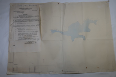 Kiewa Valley Historical Society
Plan Ref. K. 6612 with Letter attached re Public Safety in Kiewa Works Area
... included the building of Rocky Valley Dam on the Bogong High Plains... the building of Rocky Valley Dam on the Bogong High Plains near Falls ...The SECV constructed the Kiewa Hydro Electric Scheme which included the building of Rocky Valley Dam on the Bogong High Plains near Falls Creek. H.H.C. Williams, construction engineer, Kiewa wrote to the Ski Clubs at Falls Creek outlining the dangers arising with the filling of Rocky Valley Dam. He lists 5 warnings in the interest of safety.The plan and letter provide the dates for the completion of Rocky Valley dam and its effect on the people living and working in the area including miners and ski clubs. It describes some of the features of Kiewa Works Area at the time.Plan No. K 6612 of Fall Creek showing Rocky Valley Dam's shape when it is full. Letter dated 6th April 1959 from H.H.C. Williams to Ski Clubs at Falls Creek re public safety as Rocky Valley fills. Refers to roads, transmission lines, pole lines etc in the Kiewa Works Area.Written in ink at top of letter - "Secretary / Mt Beauty and District Progress Association"rocky valley dam, falls creek ski clubs, h.h.c. williams, khes 1959, safety