Showing 562 items
matching early camping
-
 Melbourne Legacy
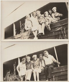
Photograph, Somers Camp, c1930
... to be a very early camp or outing for junior legatees at Somers... to be a very early camp or outing for junior legatees at Somers ...A group of photos of young people at a building believed to be at Somers Camp. The labels identify Frank Holliday, Gwen Smith, Lil Edmonds, Ned Meade, Roy Gilbert and Bill Corrie. Likely to be a very early camp or outing for junior legatees at Somers. In the early years, Legacy organised outings to the property of Legacy founder, Legatee Stan Savige, who had a place in Balnarring close to the beach. Permanent camp buildings were built in 1930. In 1930 Lord Somers (Governor of Victoria) also started a camp at a nearby property and the area was renamed Somers. Legacy Somers Camps continued intermittently at Stan's property until it was decided in 1951 to make other arrangements for holidays. This photo was with a group of photos from around the 1930s from the early days of Legacy, including cricket team, football team, and camps at Balnarring/Somers (saved as 01915 to 01934).Legatee Savige's property at Balnarring became very important for Legacy providing outings and camps for junior legatees.Black and white photo of six youths on a beach.Handwritten 'L R. F. Holliday, E. Smith, E. Meade, G. Smith, Roy Gilbert, Bill Corrie' in blue pen. Stamped 'Printed by Harringtons' in purple ink.junior legatee outing, legacy somers camp, savige property -
 Tatura Irrigation & Wartime Camps Museum
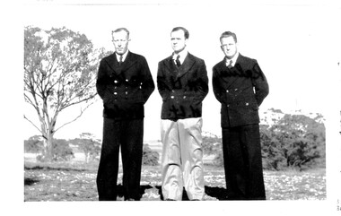
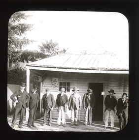
Photograph, Dhurringile POW Camp Prisoners
... Group photo taken early 1941 Dhurringile POW Camp Prisoners...Tatura Irrigation & Wartime Camps Museum 49 Hogan Street ...Group photo taken early 1941 Dhurringile POW Camp Prisoners, Lt. Gerhard Rahm., Lt. Fritz Krampe, Lt. Albrecht.Fritz Krampe3 men in uniform standing with hands behind back. Trees in back ground. photograph, otto albrecht, german lieutenants, fritz krampe, gerhard rahms -
 RSL Victoria - Anzac House Reference Library and Memorabilia Collection
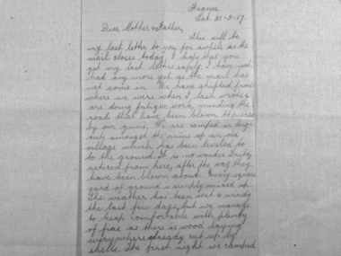
Letters of Henry George Green, Henry George Green, May 1916 to March 1917
... Geelong Camp early May 1916 until embarkation on board Orontes... Geelong Camp early May 1916 until embarkation on board Orontes ...Letters to Green's family cover two main periods: from Geelong Camp early May 1916 until embarkation on board Orontes on 16 August 1916, and from France on 7 December 1916 until 31 March 1917. Green was killed at Bullecourt on 11 April 1917.Sixty WW1 letters of Henry George Green (2198 - 46th Battalion, 4th Reinforcement).ww1, bullecourt, letters, henry george green, 46 battalion -
 Lakes Entrance Regional Historical Society (operating as Lakes Entrance History Centre & Museum)
Photograph, Carpenter family, 1950 c
... Also two black and white photographs showing early aspects... early aspects of Carpenters Camp Park Lakes Entrance 04378.1, 6 ...Also two black and white photographs showing early aspects of Carpenters Camp Park Lakes Entrance 04378.1, 6 x 9 cm and 04378.2 12 x 13 cmBlack and white photograph showing caravans and vehicles lining the gravel driveway at Carpenters Camp Park, Lakes Entrance Victoriagenealogy, houses -
 Kiewa Valley Historical Society
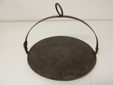
Plate Hot - Camp Fire, circa early 1900s
... This "camp fire" hot plate has been used from the early... fire" hot plate has been used from the early 1900's on camp ...This "camp fire" hot plate has been used from the early 1900's on camp drafts /droving cattle onto and from the Victorian high plains. The size of "camp" kitchens would depend on the amount of "cattle" men required to collect and move the "herd" to and from the "lush" high plains.This "camp fire" hot plate is significant because it was donated by a member of the Roper family (the Roper's of the Kiewa Valley) a "pioneer" family. This particular camp fire hot plate originated in Tasmania however the Victorian Alps are very similar to the Tasmanian mountain regions and this type of cooking utensil was, and still is, used in isolated regions e.g. large cattle properties in the Northern Territory. This Camp Fire hot plate was used on the High Plains at the Roper Hut for approximately 35 years.This open fire hot plate is made from caste iron. It has a circular flat (cooking) base, ideal for a few thick pieces of prime steak, a high semi circular handle with a large circular carry ring, to apply a thick stick or rod through it as an insulated handle (to position the hot plate where required over a fire). The "handle" can be folded down to save space when packing it in the saddle bags. The handle has a strong metal rivet on each end (is loose enough to allow it to be moved to either side e.g. flattened). One end, of the handle, has a movable sleeve to fasten the the handle in an upright positioncamp fire cooking utensils, hot plate, cast iron cooking appliance, drovers kitchen, cattlemen -
 Bendigo Historical Society Inc.
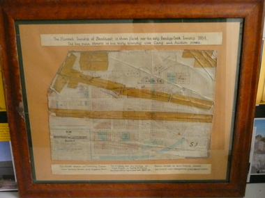
Document - PLAN OF TOWNSHIP OF SANDHURST 1854, July 25. 1854
... streets of the early township were Camp and Auction streets...- The planned township of Sandhurst is placed over the early Bendigo ...Coloured- The planned township of Sandhurst is placed over the early Bendigo creek township of 1854. The two main streets of the early township were Camp and Auction streets. The street shown as Dowling street later became Queen & Hopetoun streets. The building near the bridge at View Point is Pykes Building. The Post Office was located here in 1854 - 58. Bernal street is now Chapel street. The creeks were straightened to their present courses. Streets on map are. Pall Mall - Bridge - McCrae - Hargraves - Lyttleton - Myers - Mollison - McLaren - Mitchell - Williamson - Mundy - Bernal - Baxter - Larritt - Bramble - McIvor - Bull. Also shown on map: Bendigo Creek - Government Reserve - Present Cemetery - Proposed diversion of creek. FH 562 Deframed 2022Lithographed at Surveyor Generals Office. Melbourne. July 25. 1854. By R. Meikle.place, bendigo, original 1854 bendigo map -
 Kiewa Valley Historical Society
Photographs – Set of 9 black and white photographs and photocopies of original photographs depicting the early days of Bogong Village during the 1940’s, circa 1940's
... (SECV Official Photo) 8. Tent camp and early buildings following... (SECV Official Photo) 8. Tent camp and early buildings following ...Bogong Village, which was known as “The Junction”, is well recorded. The first tent camp was at the junction of Pretty Valley and Rocky Valley streams in the early 40’s. Further downstream were the sawmill, stables and blacksmith’s forge. Horses were the main mode of transport in the early days. The road to Bogong had reached the lookout spur just beyond Roper’s Spur track just before the 1939 fires. The early forties saw rapid growth of the village, with single and married men’s quarters, workshops, mess huts and administrative offices. The facilities necessary for communal living were quickly in place- a post office, police station, co-op store, medical centre, community hall/theatre, tennis courts and school. Much of the temporary accommodation that housed groups such as the Albion Quarrying Company were in the area now under water.Pictorial history of the early years of Bogong Village including one photo taken following the devastating fires of 1939. Photos show the terrain in which Bogong Village was built, the early construction used for the temporary buildings and the housing and the amount of infrastructure required to accommodate the needs of the residents of the area including workers, their families and other support staff. Set of 9 black and white photographs and photocopies of photographs depicting early buildings at Bogong Village . Photos show very early construction buildings as well as the village in various weather conditions, including snowing and after bush fires. (some official SECV photographs) 1. Bogong Village in heavy snow 2. Bogong Township during heavy snow (SECV Official Photo) 3. VIP Lodge at Bogong in the snow 4. Bogong Village - circa 1940’s 5. Bogong Village under street lights 6. Lewis Construction Camp (SECV Official Photo) 7. Albion Quarrying Co. Camp (SECV Official Photo) 8. Tent camp and early buildings following 1939 fires 9. Typical house – Bogong Village 1. Handwritten under photo – August 1948 2. Printed under photo: STATE ELECTRICITY COMMISSION OF VICTORIA Date: 25.8.48 Time: 9am No:K 4680 Kiewa Hydro-Electric Works. Bogong Township 3. Handwritten on back of photo- V.I.P. Lodge, Bogong 4 – 5. No markings 6. Printed under photo: STATE ELECTRICITY COMMISSION OF VICTORIA Date: 28.11.40 Time: 1.40pm No:K284 Kiewa Hydro-Electric Works. Lewis Construction Camp 7. Printed under photo: STATE ELECTRICITY COMMISSION OF VICTORIA Date: 11.1.41 Time: 10.40am No:K294 Kiewa Hydro-Electric Works. Albion Quarrying Co. Camp – Bogong. Handwritten on back of photo: On the floor of the present dam 8. No markings 9. Printed under photo: STATE ELECTRICITY COMMISSION OF VICTORIA Date: 11.1.46 Time: 1.23pm No:K2181 Kiewa Hydro-Electric Works. Bogong – Typical House bogong village; 1939 fires; kiewa hydro electric scheme; -
 Victorian Aboriginal Corporation for Languages
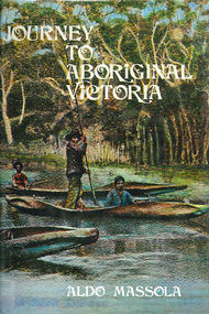
Book, Aldo Massola, Journey to Aboriginal Victoria, 1969
... contact, across many parts of Victoria. Chap.1; Melbourne - early... contact, across many parts of Victoria. Chap.1; Melbourne - early ...Looks at the Aboriginal community from the time of white contact, across many parts of Victoria. Chap.1; Melbourne - early missions, camp of Native Police, corroboree trees, canoe trees, grave &? headstone of Derrimut; quarries at Keilor, excavation sites at Green Gully &? Keilor; quarry at Mt. William, notes on inheritance of quarries Coranderrk settlement - Barraks grave, notes on his life; Chap.2; Geelong - Yawangi group of the Wothowurong tribe, camping grounds in area quarries; Notes on William Buckley, Gellibrand (a notable Aboriginal), graves in the Western Cemetery; Chap.3; Colac - war between Colac &? Geelong tribes; Mission at Birregurra, reason for failure of Buntingdale Mission; brass plate to Coc-coc-coine; reserve at Elliminyt, native ovens, camp sites, initiation site &? ritual; quarry sites, axegrinding factory, rock pecking &? engraving; dried hand &? 3 Aboriginal skulls found; Chap.4; The south-west coast - middens, camp sites notes on Framlingham Stn., fish traps at Tyrendarra; Chap.5; The far west - massacres of Aborigines near Casterton; camp sites, oven mounds; the first cricket team formed; Aboriginal cemetery; Chap.6; Hamilton - camps; Mount Rouse Station, axegrinding grooves at Nareeb Nareeb, shelters described, fish traps, massacre at Lake Condah; mission; canoes; Chap.7; Camperdown - legend about Lake Bullen Merri; obelisk erected in memory of Aborigines of district especially chief Wombeetch Puyuun; Jarcoort tribe; fish weirs, camps, intertribal fights between Booluc-burrers, Jarcoorts &? Ellengermote groups; bartering place at Mount Noorat; articles traded, legend of Flat-Top Hill; Chap.8; Ballarat - camp at Lake Wendouree; White Stone Lagoon; legends concerning Mt. Buninyong &? waterfalls at Lal-lal; camp sites; pygmy-type implements near Meredith, quarry at Glue Pot Rocks near Durdidwarrah; brass plate of King Billy; Chap.9; Ararat - Tjapwurong territory; camp sites, quarries, shield &? canoe trees; Bunyip belief at Lake Buninjon of Muk-jarawaint &? Pirtkopen-noot tribes, gives legend; stone implements; mill stones; fish weirs; stone arrangement near Lake Wongan; ground drawing of a bunyip, paintings in rock shelter near Mt. Langi Ghiran; Chap.10; Maryborough - camps, oven mounds, rock wells, stone arrangement at Carisbrook; camp sites at Mt. Franklin; Chap.11; Charlton - belief in Mindye (snake); canoe trees, ovens, camp sites, water holes, rock wells, stone implements; method of rainmaking; Chap.12; Horsham-Stawell, The Wimmera - Wotjobaluk land; camps, fish traps at Toolondo; Black Range cave paintings, Flat Rock shelters (detailed account of these paintings); Bunjils Cave; Chap.13; Horsham-Stawell, The Mallee - camp sites, implements; Ebenezer Mission, Willie Wimmera taken to England by Rev. Chase to become a missionary, died in England; Chap.14; The Murray River, Mildura Swan Hill - Battle of the Rufus; ceremonial ground, Lake Gol Gol, canoe &? shield trees; stone implements; camp sites, fire place arrangements; fish traps; oven mounds; Chap.15; The Murray River, Swan Hill-Echuca - legend about Lake Boga; camps, oven mounds, the Cohuna skull, Kow Swamp, method of burial; Chap.16; Shepparton ovens; brass plates of King Paddy of Kotupna &? King Tattambo of Mulka Stn., native well, camps; Chap.17; Wangaratta -camps, quarry, rock holes, the Faithful massacre; grinding rocks at Earlston; Chap.18; The High Plains - Ya-itma-thang; camps, Bogong moth feasts, native paths for trade &? intertribal fights, articles traded; painted shelters; Koetong Ck. Valley, near Mt. Pilot &? near Barwidgee Ck.; Chap.19; Dandenong - water holes, list of 8 holes in Beaumaris - Black Rock area; camps, middens, stone implements (microliths), legend of Angels Cave, stone axes, Native Police Force, Narre Narre Warren Station, legend about rocks on Bald Hill, kangaroo totemic site; Chap.20; Wonthaggi- Yarram - natives visit Phillip Is., murder of William Cook and Yankee by five Tasmanians (listed as Bon Small Boy, Jack Napoleon Timninaparewa, Fanny Waterpoordeyer, Matilda Nattopolenimma and Truganini) near Cape Patterson, men; camp sites, middens, legend of White Rock; Chap.21; Sale - Bairnsdale, The Lakes Country middens, camps; legend at Wulrunjeri; story of a white woman supposedly living with with the Tutangolung tribe, efforts made to prove story; canoe trees; Chap.22; Sale-Bairnsdale, The Inland Braiakolung tribe, camps, implements, canoe &? shield trees; Ramahyuck Mission, grinding rocks, fights with Omeo tribe; native tracks, death through enemy magic - procedure, belief in ghosts; Chap.23; Lakes Entrance and the Country to the east - Kroatungolung people, legend of Kalimna Valley; camps, stones of Nargun, bunyip, devils at Lake Tyers, excavation at Buchan, carbon dates; middens, ochre at Cape Conrad, stone fish-hook file at Thurra River; note on Bidwel tribe; Each chapter gives historical details, early contacts, relationships with settlers; Aboriginal place names and detailed description of sites and geographical features.b&w photographs, b&w illustrations, colour illustrationsgeelong, colac, hamilton, camperdown, ballarat, ararat, maryborough, charlton, horsham, stawell, murray river, shepparton, wangaratta, dandenong, wonthaggi, yarram, sale, bairnsdale, lakes entrance -
 The Beechworth Burke Museum
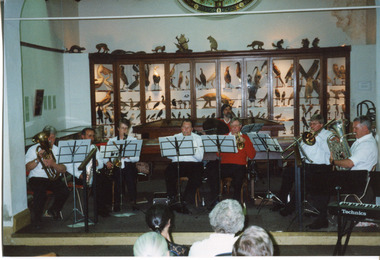
Photograph, 1999
This photograph depicts members of the Beechworth Band at a 'Liedertafel' concert in the main hall at the Burke Museum in 1999. The concert was associated with an exhibition titled, 'From the Liedertafel to the Skating Rink: Entertainment in Beechworth 1852 - early 1900s', which celebrated the rich and diverse entertainments that were a part of Beechworth life in the nineteenth and early twentieth centuries. Marching bands, choirs, circus acts, theatrical performances, races, and seasonal activities, such as Mr. Spiller's roller skating rink, founded in the late 1860s, were among the attractions on offer. 'Liedertafel' is a tradition that accompanied German settlers to Australia. It refers to a friendly society of men united by an enthusiasm for singing. The Beechworth Brass Band was formed by Mr. H. Vandenberg in 1887. The Beechworth Liedertafel was established 14 March 1894 at the London Tavern, Camp Street, Beechworth, by Mr. A.A. Billson, and a visiting conductor, Mr. H. Fielder. German clubs, complete with marching bands, athletics associations and Liedertafel choirs, were centres of social activity attracting wide audiences not limited to members of their own ethnicity. Alfred Arthur Billson was the youngest son of Mr. George Billson, who served as Beechworth’s mayor between 1869-1871. In 1872, George purchased the Oven’s Brewery in Last Street, which became Billson’s Brewery, one of the oldest continuing beverage manufacturers in Australia. An active member of Beechworth’s cultural, business and political life around the turn of the century, A.A. Billson served on Beechworth Shire Council from 1884 to 1893, and from 1895 to 1910, with three terms as president (1888–89, 1899–1901, 1908–09). He founded the Beechworth Progress Association in 1891 and produced an ‘Illustrated Guide to Beechworth and Vicinity’ to develop tourism potential. This photograph of the Beechworth Band playing at the Burke Museum is historically significant for the information it conveys about an exhibition at the Burke Museum between September and November 1999. The use of the contemporary Beechworth Band in a 'Liedertafel' performance provides insight into curatorial approaches at the turn of the twenty-first century and improves our understanding of how exhibitions use objects in the Burke Museum's Collection to tell stories about the past in the present. The image is historically and socially significant for attesting to the enduring appeal of local musical associations, which were a popular means of entertainment that fostered social connections among settlers from diverse ethnic backgrounds. Rectangular colour photograph printed on matte photographic paper. Reverse: 7029 / Label: 7029 / Source / Burke Museum / Beechworth / Band / 1999/2000 /liedertafel, beechworth band, burke museum, from the liedertafel to the skating rink, entertainment in beechworth 1852 - early 1900s, gold rush, immigration, beechworth's german heritage, london tavern beechworth, beechworth's first brick tavern, spiller's skating rink, vandenberg's beechworth brass band, protestantism, teetotallism, skating carnivals, beechworth german association, yma's, beechworth skating rink, progress societies, billson's brewery, german-australians, beechworth progess association, lodges, freemasonry, colonial australia -
 The Beechworth Burke Museum
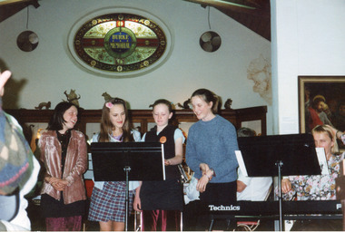
Photograph, c1999/2000
This photograph depicts female singers accompanied by members of the Beechworth Band at a 'Liedertafel' concert in the main hall at the Burke Museum in 1999. The concert related to an exhibition titled, 'From the Liedertafel to the Skating Rink: Entertainment in Beechworth 1852 - early 1900s', which celebrated the rich and diverse entertainments that were part of Beechworth life in the nineteenth and early twentieth centuries. 'Liedertafel' is a German tradition that accompanied European settlers to Australia. It refers to a friendly society of men united by an enthusiasm for singing. The Beechworth Liedertafel was established 14 March 1894 at the London Tavern, Camp Street, Beechworth, by president, Mr. A.A. Billson, and a visiting conductor, Mr. H. Fielder. The Beechworth Brass Band was formed by Mr. H. Vandenberg in 1887. Marching bands, choirs, circus acts, theatrical performances, races, and seasonal activities, such as Mr. Spiller's roller skating rink, which was founded in the late 1860s, were among the entertainments on offer in Beechworth.This photograph of the Beechworth Band playing at the Burke Museum is historically significant for the information it conveys about an exhibition at the Burke Museum between September and November 1999. The use of the contemporary Beechworth Band in a 'Liedertafel' performance provides insight into curatorial approaches at the turn of the twenty-first century and improves our understanding of how exhibitions use objects in the Burke Museum's Collection to tell stories about the past in the present. The image is historically and socially significant for attesting to the enduring appeal of local musical associations, which were a popular means of entertainment that fostered social connections among settlers from diverse ethnic backgrounds. Liedertafel choirs were originally male-only, therefore, the presence of female singers at the 1999 exhibition reflects progressive social and community values with regard to gender and inclusion.Rectangular colour photograph printed on matte photographic paper.Reverse: 7030 / Label: Burke Museum / Liedertafel Exh / Emily Messen, Luetta / Schier, Hannah / Routledge, Sarah / McKinley 2000 (?) / 2000 (?) / liedertafel, beechworth band, burke museum, exhibition 1999, from the liedertafel to the skating rink, entertainment in beechworth 1852 - early 1900s, past exhibitions, performances at the burke museum, european settlers, german community, german choral societies, brass bands, male choir, colonial passtimes, colonial entertainments, cultural traditions, gold rush, immigration, beechworth's german heritage, london tavern beechworth, camp st beechworth, beechworth historic district, beechworth's first brick tavern, spiller's skating rink, vandenberg's beechworth brass band, benevolent societies, intellectual societies, protestantism, billson brewery beechworth, teetotallism, fancy dress carnivals, skating carnivals, fundraising societies, german musicians, crimean war, beechworth german association, freemasonry, yma's, beechworth athenaeum, beechworth skating rink -
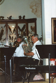 The Beechworth Burke Museum
Photograph, c1999
This photograph depicts two members of the Beechworth Band at a 'Liedertafel' concert in the main hall at the Burke Museum in 1999. The concert related to an exhibition titled, 'From the Liedertafel to the Skating Rink: Entertainment in Beechworth 1852 - early 1900s', which celebrated the rich and diverse entertainments that were a part of Beechworth life in the nineteenth and early twentieth centuries. 'Liedertafel' is a German tradition that accompanied European settlers to Australia. It refers to a friendly society of men united by an enthusiasm for singing. The Beechworth Liedertafel was established 14 March 1894 at the London Tavern, Camp Street, Beechworth, by president, Mr. A.A. Billson, and a visiting conductor, Mr. H. Fielder. The Beechworth Brass Band was formed by Mr. H. Vandenberg in 1887. Marching bands, choirs, processions, circus acts, theatrical performances, races, fancy dress and roller skating carnivals, were among the vibrant and diverse entertainments offered in Beechworth during the gold rush period. Race meetings were revived with a gala atmosphere at Baarmutha on New Year's Day and Easter Monday in the early 1880s. 'Spiller's Skating Rink', which premiered at St. Georges Hall in August 1869, was accompanied by the 'Beechworth Fire and Drum band'. In 1888, Beechworth had two skating rinks in operation, the Columbia Elite at Oddfellow's Hall, and the Beechworth Skating Rink, corner Camp and Last Streets, Beechworth. Vandenberg's Beechworth Brass Band was reported to have provided musical entertainment for patrons at both venues.This photograph of the Beechworth Band playing at the Burke Museum is historically significant for the information it conveys about an exhibition at the Burke Museum between September and November 1999. The use of the contemporary Beechworth Band in a 'Liedertafel' performance provides insight into curatorial approaches at the turn of the twenty-first century and improves our understanding of how exhibitions use objects in the Burke Museum's Collection to tell stories about the past in the present. The story of Liedertafel's and Beechworth Brass Band is historically and socially significant for understanding the role played by German immigrants in building Victorian communities. In settler communities, cultural associations centred on artistic, recreational and sporting activities not only provided a popular means of entertainment, but fostered social cohesion among settlers from diverse ethnic backgrounds.Rectangular colour photograph printed on matte photographic paper. Obverse (On keyboard): Technics / Reverse: 7028 / Label: Liedertafel / exh. / Beechworth / Band / 1999/2000 /liedertafel, beechworth band, burke museum, from the liedertafel to the skating rink, entertainment in beechworth 1852 - early 1900s, gold rush, immigration, beechworth's german heritage, london tavern beechworth, beechworth's first brick tavern, spiller's skating rink, vandenberg's beechworth brass band, protestantism, teetotallism, skating carnivals, beechworth german association, yma's, beechworth skating rink, progress societies, billson's brewery, german-australians, roller skating history -
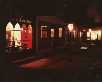 The Beechworth Burke Museum
Photograph, 1990s--estimated
Taken in 1990, this photograph depicts a row of shops in Beechworth, with the shopfront of watchmaker and jewellers, William Turner and C.F. Falck, in the foreground, and newsagent and bookseller James Ingram's shop in the background.This photograph is of social significance to the Beechworth community in depicting the Street of Shops, the creation of curator, Roy Harvey, which opened in 1979 at Burke Museum. According to the Indigo Shire Council webpage for Burke Museum, this addition 'began a new period of collecting with Roy Harvey calling to the community for donations. The response resulted in an influx of material adding to the town history/ development and local identities collections. The Shops and their contents reflect another period in museology.' The historic shopfronts in this image portray those of local settlers, William Turner and CF Falck's Watchmaker and Jeweller store, and James Ingram's news agency and bookshop. William Turner was originally a goldfields official who became a commissioner on the Ovens goldfield, and later a resident warden, at times performing magisterial duties and chairing the Local Court. Charles Frederick Falck, born in Korlin, Germany, in 1833, a skilled watchmaker and jeweller, ran the jewellery business from 1862. Along with William Turner and Melbourne barrister, George Milner Stephen, he prepared a dazzling display of gems and jewellery from Beechworth for the Royal Society's Exhibition in Melbourne in 1865. This act signposted Beechworth's progress as a nineteenth-century gold rush town with a population of around 3000. In the mid-1850s, newsagent James Ingram established a newsagency and supplied papers and stationary to the goldfields. He and bookseller R.T. Vale stocked a wide range of literary, historical and religious works, textbooks, periodicals and newspapers, as well as hosting a reading and writing room on Camp Street{?}. James Ingram was a 'devoted instigator and supporter of the town's welfare institutions', who raised funds for to establish a hospital, primary school and benevolent asylum, and assisted people who'd fallen on hard times with his wife. He was also a mainstay of the early Baptist church, holding meetings in his house. He died in 1928, six weeks short of his 100th birthday. Ingram's Rock, north-west of Beechworth near where he lived in later life, was named after him. Colour rectangular photograph printed on matte photographic paper.Obverse: FALCK 1880 / maker & Jeweller/ WARDENS OFFICE/COACHING OFFICE/ EST. ??55/ ????ON HOUSE/ JAMES INGRAM/ NEWS?????? AND BOOKSELLER/ TOYS visible above shopfront in left foreground. Reverse: Catalogue item number 3305 pencilled in top right-hand corner.beechworth, beechworth historic shops, william turner, cf falck, james ingram, turner and falck watchmaker and jeweller, james ingram newsagent and bookseller, burke museum, promoting settlement, marketing and retailing, living in country towns, making regional centres, preserving traditions and commemorating, beechworth founders, victorian gold rush towns, beechworth pioneers, ingram's rock, 1860s beechworth, street of shops, roy harvey -
 The Beechworth Burke Museum
Photograph, Unknown. After 1890
Early photo of the Bridge over Spring Creek taken along Camp Street facing East. This photograph was taken after 1890, when powerlines were beginning to be put up in regional Victoria.Black and white rectangular photograph printed on matte photographic paperbeechworth, spring creek, camp street -
The Beechworth Burke Museum
Audio - Oral History, Jennifer Williams, Mr John Clemens, 2000
Mr John Clemens was born in 1913 to Australian parents. His father worked in building roads which led to the family's move from Sunnyside Gen Willis to Beechworth. His father was part of the road making team on the Buffalo River Road between Myrtleford and Beechworth. John worked as a motor mechanic in his early years, having left school in sixth grade. He later worked carting wood (independently) and drinks for Murray Breweries/Billson's Breweries. He delivered drinks and wood to the Old Hospital after its relocation in 1940, to Bonegilla Migrants Camp and got to know most of the townspeople. He recounts his interactions with various members of the community, highlighting the importance of the Zwar Tannery, which John recounts as employing approximately 200 people (dating this recollection to approximately 1938). This oral history recording was part of a project conducted by Jennifer Williams in the year 2000 to capture the everyday life and struggles in Beechworth during the twentieth century. This project involved recording seventy oral histories on cassette tapes of local Beechworth residents which were then published in a book titled: Listen to what they say: voices of twentieth century Beechworth. These cassette tapes were digitised in July 2021 with funds made available by the Friends of the Burke.John's interview demonstrates the dynamics of the Beechworth township in the 1920s-1940s, showing the important industries and connections of the town which he was involved in. His mention of the Model T Ford, produced 1908-1927, shows his experience with early cars in the town, which were owned by the richer people. He talks about the dominance of the Zwar Bros. Tannery over the town, by employing hundreds of people (dating John's recollection to approximately 1938). John's interview shows the changed that the town has gone through through his experiences as a driver for wood and drinks. It can be interpreted as historically significant to the Beechworth local area but also to a wider audience; Zwar Tannery supplies leather to General Motors Holden, the brewery was one of the largest in the country, and the Bonegilla Migrants Camp was the largest and longest running migrant camp in Australia. John's everyday interactions with all of these places and people within makes his story significant. The project is significant for its recording of stories from members of the local Beechworth community before they are lost. It tells of the everyday stories of the people and their memories of the town. The recordings were done in 2000, with interviewees such as John being in their 80s when interviewed. The interviews were recorded to cassette, before being digitised in 2021. This is a digital copy of a recording that was originally captured on a cassette tape. The cassette tape is black with a horizontal white strip and is currently stored in a clear flat plastic rectangular container. It holds up 40 minutes of recordings on each side. john clemens, burke museum, beechworth, bonegilla migrants camp, beechworth hospital, murray breweries, billson's breweries, zwar bros. tannery -
 The Beechworth Burke Museum
Photograph, Late 1800s
This photograph was taken during the late 1800s at the Chinese camp at Beechworth, Victoria. It was in camps such as these that many would-be gold miners made their home after arriving in Australia from across Asia. After arriving in South Australia where there was no poll-tax required of migrants as was the norm in Victoria and New South Wales, those looking to settle on the gold fields walked en mass overland for hundreds of kilometres before arriving in destinations such as Beechworth. Due to widespread prejudice against Chinese gold diggers they were forced to live separate from the town and developed enclaves much like the one depicted in the photograph. As the years progressed the Chinese camp began to construct more permanent structures and included temples of worship, shops and separate burial grounds. This photograph demonstrates the early multi-cultural aspects of Australia and Victoria during the late 1800s. It also showcases pressures and prejudices specific to the Chinese migrant community and the measures taken to separate them from the rest of the predominantly white community. It also reflects the gold-rush period and one of the first draws to Australia due to its mineral wealth. Black and white rectangular photograph developed on paperObverse: None Reverse: From the/Chinese Camp/84-80-1/1997-3221chinese camp, beechworth, houses, immigrants, gold mining, gold rush, late 1800s, chinese, asia -
 The Beechworth Burke Museum
Photograph - Lantern Slide, c1900
This image shows six older Chinese men standing in a row with two younger non-Chinese men outside a small wooden business or official building in the Beechworth region, circa 1900. The two non-Chinese men are wearing clothes of the period that indicate relative prosperity (such as three piece suits, top hats, and a pocket handkerchief), whereas most of the Chinese men are wearing Western-style working clothes of the era. One Chinese man at the far right of the image is wearing similar garments to the non-Chinese men, including a bowler hat and longer, more tailored suit jacket. Chinese miners were a significant cultural group in Beechworth's gold rush period. Carole Woods' history of Beechworth, 'A Titan's Field', details that there were approximately 60 Chinese people in the area in 1855, more than 1000 in 1856 and 4700 (a quarter of the population) in 1857, despite the introduction in 1855 of official policies such as additional taxes formulated by the Victorian Government to limit access by Chinese immigrants. Most Chinese miners in the region came from southern China and had formerly worked as merchants, mechanics, farmers and shop-keepers. Chinese people were subjected to a 'protectorate' system, ostensibly to minimise the potential for conflict with other groups; this system required Chinese people to live in designated 'hygienic' camps with paid Chinese headmen who supervised the village and enforced the protectorate's rules. Chinese people were required to purchase an annual protection ticket to fund this system. The protectorate system was abolished in 1861, before this image was taken in approximately 1900, but it may still provide insight into social stratification or relationships between and within cultural groups in Beechworth resulting from such practices. Lantern slides, sometimes called 'magic lantern' slides, are glass plates on which an image has been secured for the purpose of projection. Glass slides were etched or hand-painted for this purpose from the Eighteenth Century but the process became more popular and accessible to the public with the development of photographic-emulsion slides used with a 'Magic Lantern' device in the mid-Nineteenth Century. Photographic lantern slides comprise a double-negative emulsion layer (forming a positive image) between thin glass plates that are bound together. A number of processes existed to form and bind the emulsion layer to the base plate, including the albumen, wet plate collodion, gelatine dry plate and Woodburytype techniques. Lantern slides and magic lantern technologies are seen as foundational precursors to the development of modern photography and film-making techniques.This glass slide is significant because it provides insight into Beechworth's cultural and social relationships in the early Twentieth Century, in particular the experiences of Chinese miners. It is also an example of an early photographic and film-making technology in use in regional Victoria in the time period.Thin translucent sheet of glass with a circular image printed on the front and framed in a black backing. It is held together by metals strips to secure the edges of the slide.burke museum, beechworth, lantern slide, slide, glass slide, plate, burke museum collection, photograph, monochrome, magic lantern, indigo shire, north-east victoria, nineteenth century, 1900s, twentieth century, emulsion slides, chinese, chinese miners, protectorate system, protection licence, immigration, racism, classism, social groups, cultural groups, taxes, hygiene camps -
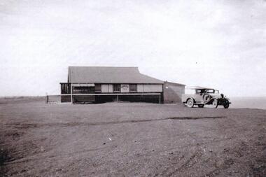
 Orbost & District Historical Society
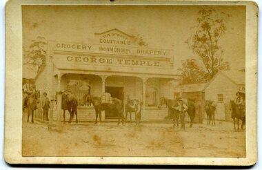
black and white photograph, C1900
This photograph shows George Temple's store which began operating C1888 opposite the post office in the main street of Orbost. The store stocked other stores at Bendoc supplying the gold fields. The men with their pack horses are on their way to the survey camp. George Temple, born in Yorkshire on 26/2/1832 was one of the earliest Orbost storekeepers. Temple's Store was on the corner of Ruskin and Nicholson Streets opposite the post office. He packed stores to the Bendoc area goldfields. The store building eventually became part of Herbert's store when he died in 1917.This item is associated with the very early history of Orbost. George and Mary Temple were early shopkeepers who operated a store opposite the Post Office for many years. Their daughters were very talented women.A faded black / white photograph of men with pack horses standing outside George Temple's store, The Orbost Equitable, in the main street. It is on a cream coloured buff card.temple-george-orbost gold-fields-bendoc -
 Orbost & District Historical Society
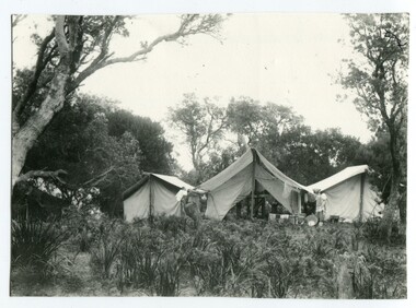
black and white photograph, first half 20th century
This photograph is linked with photograph 1168. Orbost locals have been taking camping holidays at East Cape since at least the early 20th century. From the mid-1940s about a dozen huts were located there, mostly by locals from the Orbost area, to establish what was known as the 'Conran Settlement' or 'Conran Community'. These huts were subject to permissive occupancy laws which were invoked by the State Labor Government to force their removal in 1986. (Wikipedia)Orbost locals have been camping at Cape Conran since at least the early 20th century. This campsite is from a time before Cape Conran Coastal Park a 11,700 hectare area was declared a coastal park under the National Parks Act in 1997 and camping areas were formalised.A black / white photograph showing three large tents side by side in a bush setting. The middle tent is open and set up as a kitchen and the outer two appear to be sleeping quarters. There is fishing equipment against the middle tent - nets and tin tubs.on back - " Camping at C. Conran"cape-conran recreation-camping -
 Orbost & District Historical Society
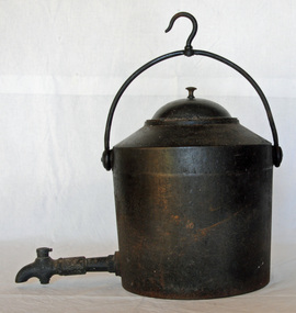
water fountain, Late 19th century
This type of cast iron kettle was used by pioneer families, mainly rural in the early 1900's upon open fires. It provided a source of boiling water, in or mainly outside the kitchen of homesteads. Early homes often had an open fire containing a fountain, buckets and kettles that hung from a hook in the fireplace. These containers supplied hot water for cooking, washing and cups of tea. The fountain was placed on hob until needed and then hung over fire.This water fountain would have been used by early settlers in Orbost before the connection of electricity.A large cast iron water fountain. It has a hook on the curved swinging handle and a tap at the front. This large cast iron camp pot or cauldron has a long tap connection located at the bottom end at the front. The tap has a simple control swivel at the end to control the water flow.On lid 1934.1 - 3 to 4 On base 1934.2 - A. Kenrick & Sons 4 Gallskettle cast-iron kenrick domestic kitchen -
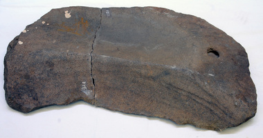 Orbost & District Historical Society
grindstone
Inspected by Joanna Freslov, archaeologist 2.6.22008. Grinding stones are slabs of stone that Aboriginal people used to grind and crush different materials. Bulbs, berries, seeds, insects and many other things were ground between a large lower stone and a smaller upper stone. This is the lower stone.Large grinding stones such as this one were designed to be left at a camp site for use the next time the group moved there. Smaller grinding stones were carried between sites. Grinding stones were not abandoned when they became worn and smooth through use. The stone would simply be roughened again so it was once again suitable for its function. This is an example of a food preparation utensil used by the Early Indigenous people of Eastern Australia.A large flat rock with grind hole in top. Rock has split. gridstone aboriginal stone-artefact -
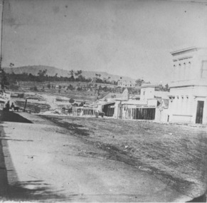 The Beechworth Burke Museum
Photograph
Taken in Beechworth, this photograph depicts the business of Camp Street looking towards the Ovens and Murray Benevolent Asylum. In the foreground of right hand side; there are row of buildings, on the left hand side; there are a two standing figures. The Ovens Benevolent Asylum (or the Ovens and Murray Hospital for the Aged) was constructed in 1862 on an elevated site overlooking the township of Beechworth. This Asylum was built in response to boom in population due to the discovery of Gold in Beechworth in 1852. This period also saw the development of additional administration buildings such as; the Court house, the Town Hall, and offices. The original Benevolent Asylum building was designed in an unusual Flemish Gothic Revival style. The single storey building is of red brick on a dressed granite base, and the main facade is dominated by four curved, Flemish gable ends, those at the extremities being added to the original central section in 1867. This facade incorporates paired windows of pointed Gothic form and dark brick diaperwork patterning. The adjacent J. A. Wallace Wing of 1899 was designed by Donald Fiddes as a separate building. Also constructed of red brick, Fiddes adopted a conservative approach, designing a simple domestic scale building with central projecting gable porch and flanking bull nosed verandahs. The Benevolent Asylum was renamed the Ovens Benevolent Home in 1935 and The Ovens and Murray Home in 1954. Many buildings have been added to this site, particularly since the 1960s, including a poorly sited addition to the front of the original building. Extensive internal renovations have also been made to the original buildings. [https://vhd.heritagecouncil.vic.gov.au/places/118]The Ovens and Murray Hospital for the Aged is of architectural significance as an unusual example of Flemish influenced design from the 1860s. Although the facade has been partly obscured, it remains intact, and, together with the more simply designed Wallace wing, are important examples of early buildings designed for the specific purpose of aged care. The Flemish gables remain as a dominant form of Beechworth's urban landscape. The Ovens and Murray Hospital for the Aged is of historical significance due to its association with the early development of Beechworth and its dominant siting within the town. It is illustrative of the civic development that took place in the town after the peak of the gold rush, when Beechworth was develpoing as the administrative centre of the north east of Victoria. [https://vhd.heritagecouncil.vic.gov.au/places/118]Black and white rectangular photograph. Image is printed on matte photographic paper. Obverse: BOOT SHOE STORE Reverse: 7770.2 / 1997.3099beechworth, burke museum, diggings, camp street, the benevolent asylum, ovens benevolent hom, gold rush -
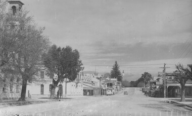 The Beechworth Burke Museum
Photograph
This photograph depicts Camp st in Beechworth looking east. This postcard is part of the Rose Series produced by Victorian photographer George Rose’s business, the Rose Stereograph Company. George Rose (1861-1942), is considered one of Australia's best photographers of the late 19th and early 20th centuries. The Rose Stereograph Company was founded in 1880 and became famous for producing stereographs, or stereoviews, which gave the illusion of being in 3D when seen through a hand-held viewer, a big craze of the era. As stereographs lost popularity in the 1920s, Rose switched to production of postcards and decorative cards, and he and the photographers who followed took thousands of scenes around Victoria as well as interstate that became iconic images of Australian life.Black and white rectangular photograph (copy) printed on gloss photographic paper. Obverse: The Rose Series P.3469 Copyright FORD STREET Reverse: BMM7744 PH150 1998.00059 beechworth, ford street, rose series, photograph, post card, black and white -
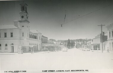 The Beechworth Burke Museum
Photograph
This copy of a postcard from the Rose series depicts Camp Street looking East. This postcard is part of the Rose Series produced by Victorian photographer George Rose’s business, the Rose Stereograph Company. George Rose (1861-1942), is considered one of Australia's best photographers of the late 19th and early 20th centuries. The Rose Stereograph Company was founded in 1880 and became famous for producing stereographs, or stereoviews, which gave the illusion of being in 3D when seen through a hand-held viewer, a big craze of the era. As stereographs lost popularity in the 1920s, Rose switched to production of postcards and decorative cards, and he and the photographers who followed took thousands of scenes around Victoria as well as interstate that became iconic images of Australian life.Black and white photograph (copy) on gloss photographic paper.Obverse: THE ROSE SERIES P.3459 COPYRIGHT CAMP STREET, LOOKING EAST, BEECHWORTH, VIC Reverse: BMM7743 PH 149 1998.00059beechworth, rose series, camp street, burke museum, black and white -
 Phillip Island and District Historical Society Inc.
Photographs, Nobbies Kiosk, Late 40's early 50's
Photograph taken on a camping trip to Phillip Island by the donor's brother.Photographs of the Kiosk and vehicle at The Nobbies. Late 40's early 50's. Two photos the same - one larger.the nobbies kiosk -
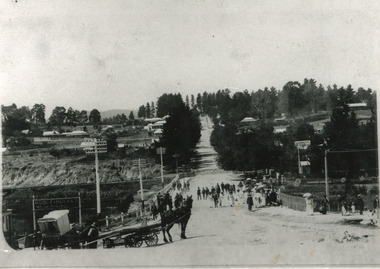
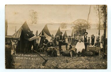 Orbost & District Historical Society
black and white photograph, July 27 1907
... . This is a pictorial record of a surveyors' camp in the early 20th century ...This is a camp of survey workers surveying the railway line . They were camped at Mossiface in 1907. It has been sent as a postcard - "Dear Miss Ross, Just a card, hoping you are well etc, trust you have not forgotten our trip. I forgot to get the name of the street in Hobart of Mr Benjamin or Temple?????? Sufficient. Yours sincerely H.R. Gordon". It has been dated September 30th 1907. There had been men surveying in East Gippsland from the late 19th century. Railway surveyors advocated two lines beyond Bairnsdale – one via Bruthen and the Tambo Valley to Omeo, the other via Swan Reach and Colquhoun to Orbost, then on to Bendoc and the border. With all the argument and feuding between the warring factions, by the end of 1891, the Parliamentary Railways Standing Committee gave up in despair of trying to reach any agreement and abandoned the idea altogether. Finally, with all problems solved, the first sod was turned at Mossiface on 9.1.1912, the government sticking to the original route in the 1890 survey .This is a pictorial record of a surveyors' camp in the early 20th century. The Bairnsdale to Orbost Railway was a significant contributor to the economy of Orbost until it closed.A black / white photograph / postcard of a group of men at a campsite. In the background is a row of tents. on the right side is a clothes line with several sheets hung over it. Two men are studying a map or chart; one man is sitting with a cloth around his shoulders while another is standing behind him cutting his hair; one man is washing cloth in a tin tub; another appears to be stirring a pot; others are sitting reading or just observing.on front - handwritten is " R.L.Y.S. SURVEY CAMP MOSSIFACE 27.7.07" on back is a letter - "Dear Miss Ross.............yours sincerely ????? Gordon"surveying-railway east-gippsland-railway mossiface-survey-camp -
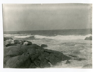 Orbost & District Historical Society
black and white photograph, early 20th century
This is a scene of Cape Conran, in Far East East Gippsland .Orbost locals have been camping and picnicking at Cape Conran since at least the early 20th century. This photograph was taken at a time before Cape Conran Coastal Park a 11,700 hectare area was declared a coastal park under the National Parks Act in 1997. A black / white photograph photograph showing the rocks and ocean at Cape Conran in Far East Gippsland. There are three people on a rock with their backs to the camera.Two women are sitting and a man is reclining.cape-conran beach-east-gippsland -
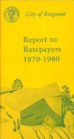 Ringwood and District Historical Society
Booklet, City of Ringwood Report to Ratepayers 1979-1980, 1979
Yellow covered community information booklet for Ringwood residents covering Council and Parliamentary contact details, Council Meeting Dates, Justices of the Peace, Council Finances, Immunizations, Major Works, Planning (Live Theatre/Functions Centre, including Floor Plan), Health and Community Services, Christmas Holiday Play Centres, Lord Mayor's Children's Camp, Rates, Municipal Elections, Dogs, Rubbish Tip, Overhanging Foliage, Vandalism, Building By-laws, Ringwood Library (28 Warrandyte Road), Golf Course, Fred Dwerryhouse Swimming Centre, Netball Complex, Growth of Ringwood Commercial Centre, McAlpin's Reserve Development Plan, Netball Complex, Citizenship Ceremonies, Mini Bikes, School Crossing Supervision, Family Fun Day, Highland Carnival. Includes three City of Ringwood Free Tipping Vouchers valid until the end of 1980 and list of tip charges from October, 1979.Mayor's Message - Cr. P. Gotlib. Inside front cover - Green tinted photograph of Ringwood Memorial Tower captioned: Ringwood - "A Happening Community". Back cover - Green and yellow diagram of Ringwood Civic Centre Development, Stage 2. Floor Plan and description of Theatre and Functions Centre expected to be completed by early 1980.rinx -
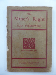 Warrnambool and District Historical Society Inc.
Book, The Miner’s Right, 1922
This book about the New South Wales goldfields was written by Rolf Boldrewood in 1890. It is retained because the author played a significant part in Warrnambool’s history. Rolf Boldrewood, the pen name of Thomas Browne, first came to the Warrnambool district in 1842, visiting the Bolden brothers’ property, Grasmere. He camped on the banks of the Merri River for about six months and described the area, including Warrnambool Bay, some years later in his book Old Melbourne Memories. In 1844 Thomas Browne established the property, Squattleseamere near Bessiebelle, north west of Portland. He remained there for ten years then moved to New South Wales. The last forty years of his life were spent writing and he became well-known for the classic Australian novel, Robbery Under Arms. This book is retained because it is a 19th century example of the writings of Rolf Boldrewood. He is important in Warrnambool’s early history as he was in the area in the early 1840s. His account of the area at that time is the most important one we have of the area that was later to be the site of the new settlement of Warrnambool.This is a soft cover book of 188 pages. The cover is brown with red edging and lettering and is partly detached from the binding. The spine is partly missing. The pages are dog-eared and there is some foxing. The text is printed in two columns to a page. Frank J. Donovanrolf boldrewood (thomas browne), bolden brothers in the warrnambool area, warrnambool history, the miners right -
 Kiewa Valley Historical Society
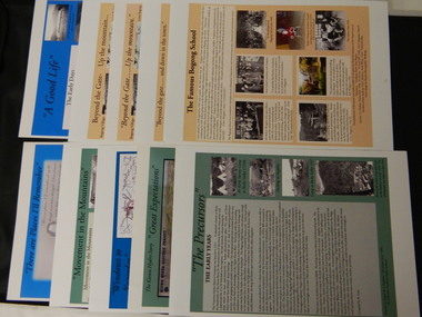
Posters - 10 in the Set, The Famous Bogong School; Beyond the Gate - (up and down); A Good Life; The Precursors; Great Expectations; Windows to Yesterday; Movement in the Mountains; Life wasn't meant to be Easy; There are Places I'll Remember, 1998
These posters were produced or a display during the Mt Beauty Music Festival in 1998. They cover the history of the Kiewa Valley from the early days, farming and the Kiewa Hydro Electric Scheme.These posters summarise the history of the Kiewa Valley and were compiled using publications, memories and documents. The posters are clear and useful for displaySee KVHS 0164 A4 glossy cardboard posters: Beige, Blue or Green with photos and writing of the history of different aspects of the Kiewa Valley. 1. Bogong 2. Mt Beauty 3. Bogong 4. The Early Days 5. The Early Years 6. The Kiewa Hydro Story 7. The Kiewa Valley Runs 8. Roads constructed 9. The 1930's 10. Pre 1930bogong state school; bogong village; secv; khes; tawonga; surveyors; mt beauty; camps; kiewa valley -
 Kiewa Valley Historical Society
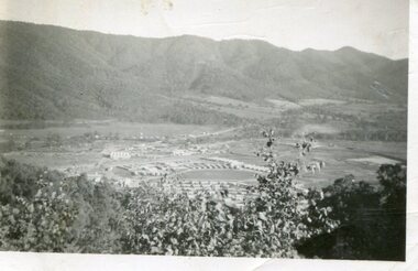
Photograph - Mount Beauty from Bogong Hill, 1950
The new State Electricity Commission construction camp at the head of the Kiewa Valley was for workmen on the second power station in the project expected to be the most modern and best equipped in Australia… In contrast to the early Kiewa days of horses and canvas tents, the new camp, with its modern amenities, compared favourably with any country town. Administration of the Kiewa Scheme was moved from Tawonga to Mount Beauty in 1946. The first house in Mount Beauty, in Hollonds Street, was occupied by the co-op store manager from November 1946. The new Mess Hall at Mt Beauty was opened with much ceremony in early November 1946. The houses up to Nelse street were erected from 1946 onward and then the township was extended beyond Nelse Street in 1950. The workmen's camp was enlarged in 1950 to the extent of providing accommodation for a total of 1,200.Shows early construction of the town of Mt. Beauty surrounded by farmland taken in 1950 during the early stages of construction of the Kiewa Hydro electric SystemBlack and white photograph - aerial view of Mt Beauty taken from Bogong Hill. Photograph framed by 6mm white boarder.Handwritten on back of photograph in black ink - Mt Beauty from Bogong Hill 1950 Printed on rear Volox 2428mt beauty, bogong hill, secv