Showing 56 items
matching holiday destinations
-
 Footscray Community Arts
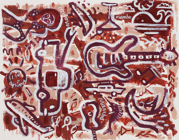
Holiday Yardage Mambo, David Bowers, (exact); 2003
MEDIUM: Acrylic on paper. DESCRIPTION: Image ranges from dark brown to pale brown with white. Light colored timber, outer frame with glass covering, white board and an inner frame. A very busy piece full of activity, starting from the bottom left we have an areoplane which is perhaps how this vacation begins, the sun sits above it and a bikini clad woman who has arrived to her destination is placed above the sun. There is cruise ship, a martini glass and a whale embracing the outer scene. Waves, a surfer, a marlin and a small guitar sit at the lower right. A large car takes the viewer to the centre of the picture where we come across a giant guitar. The music is what matters, this piece dances about the canvas in mushroom pinks and chocolates. Little outlines of fish fill the gaps. A very beachy scene. The image lyes quite flat to the eye, rough stick outlines of the images above. Signed proper left hand corner of image.bowers holiday, yardage, mambo acrylic -
 Greensborough Historical Society
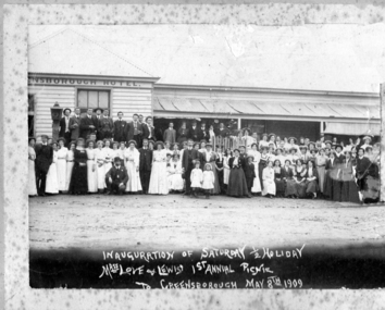
Photograph, Inauguration of Saturday half-holiday: Love and Lewis 1909, 08/05/1909
Photograph shows staff of 'Love and Lewis' (a Collingwood Store) in front of Greensborough Hotel, celebrating the inauguration of the Saturday half-day holiday on May 8th 1909. Later 'Love and Lewis' became 'Love and Pollard'.This photograph celebrates the introduction of a Saturday half-day holiday and is an example of the popularity of Greensborough as a picnic destination.Copy of black and white photograph.Caption hand written in white ink on front of photograph: 'Inauguration of Saturday 1/2 holiday. Mess Love and Lewis Ist Annual Picnic. Greensborough May 9th 1909."love and lewis, picnics, greensborough hotel, saturday half holiday -
 Greensborough Historical Society
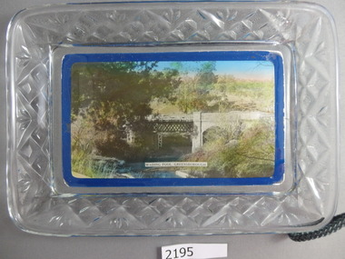
Commemorative Plate, Wading Pool Greensborough glass dish, 1940s
Plates such as this were a souvenir of a trip or holiday. Greensborough was a popular picnic destination in the mid 20th Century and this style of souvenir would have been a popular purchase. The Greensborough pool in the Plenty River was opened in the 1930s, so the plate was manufactured after this.Photograph laid on glass dish, cut glass edge."Wading Pool Greensborough" overlaid on photograph. Price written on back "2/9"greensborough swimming pool, plenty river, wading pool greensborough -
 Kiewa Valley Historical Society
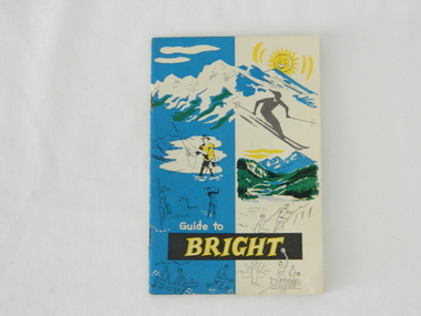
Pamphlet - Bright Tourism, Guide to Bright and District, late 1900s
This publication was produced in the early 1950s to provide the growing tourism trade (at this time), to the region with a more detailed overview of the facilities available to tourists of the region's attractions. This brochure is a very efficient and effective promotional publication. The increasing level of self promotion by local business and commerce sectors of the region the more sought after the region became and the greater the ability of the region to grow (non rural based economy). Some of the regions unique facilities and geological structures are well suited to those tourists who live in cities and "flat land" regional bush areas within Australia. This was a period when the average Australian domestic tourist was more able (finance and transport wise) to see more of their country within the short time they had for "holidays". In the late 1900s, however, with the increase to workers' recreational leave and better transportation (fares, ease of travel to overseas destinations) the local tourism numbers from other domestic locations have been steadily declining. From the 1970s onwards, the increased tourism demand from overseas tourists, for better facilities and easier access to these regional facilities, resulted in better transport, accommodation and communication, which has been a boon for all tourism within Australia. In the 21st century the world is becoming smaller and smaller for the international tourist, especially for those from crowded Asian cities. The greater attraction for "open" spaced locations such as this region are becoming a much sought after change of scenery. This pamphlet which targets the tourist, whether either from other Australian regions or the global tourist, is a good example of self promotion by a relatively small local population. This is especially significant because before the "tourist explosion" in the 1950s onward, these regional areas had a more introspective society with greater emphasis to locally established mores and values. The increased interactions with people from other areas and nations, combined with a greater global communication network is affecting those traditionally established mores to produce a some what unique social transformation which is constantly changing from one generation to the next. One important factor which tourism does bring is that it opens up the region to a wider range of people who look to the region for their own lifestyle changes.This pamphlet has a front cover in colour with the major activities in the region sketched depicting : sunshine, snow skiing, trout fishing, mountain climbing, golfing, swimming, alpine views, tennis, lawn bowls and picnics. The back cover is blank. The pamphlet is fastened together by two staples 30mm from top and bottom, and is folded with the cover slightly thicker than the fifteen pages. Thirteen pages have been printed on both sides. The first page has a black and white photograph of the hotel Alpine and the tall brick constructed Clock Tower. There are another five black and white photographs in the pamphlet.on front cover "Guide to BRIGHT"local tourism, regional information booklet, "time" related brochures, alpine local history -
 Kiewa Valley Historical Society
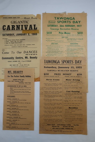
Papers - Tawonga Sports Day & Mt Beauty Carnival
Tawonga and Mt Beauty are in the Kiewa Valley and are attractive tourist destinations. The local clubs such as 'Apex' advertised and conducted programs to involve the locals and tourists and to raise moneyIn the 1960s and 1970s the Kiewa Valley held Carnivals during the Xmas school holidays. The posters list the events and entertainment for the community and visitors. Noticeably different to events held in the 2020s.1.Two Yellowed papers (posters) each titled Tawonga Sports Day - 1972 and 1977 2. Mount Beauty Gigantic Carnival 1960 and another yellowed paper (poster) advertising Mt Beauty over the Xmas Holidays (no date)tawonga sports day program, mt beauty carnival, holiday programs -
 Ballarat Tramway Museum
Postcard, Valentine & Sons Publishing Co, "City Hall and Shoppers Square Ballarat", 1905
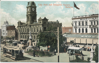
Printed colour postcard titled "City Hall and Shoppers Square Ballarat". Has an inbound tram showing the Grenville St sign on the rear, and one of the crossbench cars loading passengers outside the Town Hall. Shows Snows building, people in the median strip - busy holiday or a Sunday. Images of the front and back of the card and a close-up of the two trams in the bottom left-hand corner. Note the lamp or coloured destination sign on the roof of the inbound tram. On the rear, the postcard has been divided into two with the words "Post Card" and "Printed in Great Britain" on the top, a "Valentine Series" on the side. Addressed to Miss J Johnstone, 30 Weighbridge St, Flemington, and with the words "Dear Jeannie, / How do you like this one. / Maggie". Has a 1d Victorian stamp, cancelled in Melbourne "5" with the date "25-1-05" This is an incorrect date - electric trams did not open until August 1905. 2nd copy unused.Yields information about the intersection of Sturt and Armstrong StreetsPostcard, coloured, divided back - used.trams, tramways, sturt st, esco, town hall, cross bench tram, snows, armstrong st -
 Ballarat Tramway Museum
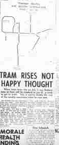
Document - Photocopy, Alan Bradley, "Tram Rises Not Happy Thought", 2003
Yields information through letters to the Editor about the impact of tram fare rises on Ballarat Residents, noting wages at the time.Photocopy, of part of the front page of The Courier, 16/6/1951, titled "Tram Rises Not Happy Thought". Gives the impact of the fare rises, doubling the weekly travel cost. Has a map showing the tramway routes and section destination to apply from 1/7/1951. The main problem was the cancellation of the concessional weekly ticket, revision of sections. Quotes Mr. T. A. Farr, Manager SEC Ballarat, notes differences in fares, penny surcharge on Sundays and holidays. On the front page are notes on the death and funeral arrangements of Ben Chifley.trams, tramways, public transport, fares, sec -
 Phillip Island Conservation Society Inc.
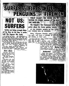
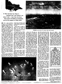
Work on paper - Photocopy of newspaper cutting, The Express, "SURFERS' FIRES KILL/ PENGUINS - FIREMEN//NOT US:/SURFERS"
Written during the 1960s when surfing was burgeoning across Australia’s coast and Phillip Island surf beaches had become extremely popular, few management strategies were in place to control interaction of the public with the delicate flora and fauna of the coastal environments. There were few good access tracks, car parks, bins, toilets etc at coastal/surfing hotspots around the Phillip Island coast. A number of management issues occurred with the influx of surfers. These included dune erosion caused by surfers climbing dunes to see the surf before going on the beach; informal parking on wildlife habitat; numerous access paths from wherever cars were parked down to the beach cutting through habitat; illegal camping on foreshores; illegal lighting of fires on beach and in dunes; surfers’ dogs let out of the car while surfers were out on the water. The dogs were uncontrolled. Certainly some surfers behaved responsibly, as is almost invariably the case these days. However, in that era of this article few people understood the delicate nature of the coastal environment and that it need to be protected through public education, infrastructure and enforcement of regulations. As now, most rural Fire services were run by dedicated volunteers who faced many challenges in their roles as Country Fire Authority firefighters. However, it was not uncommon for visitors and locals to also assist with fire-fighting efforts.The article is significant in containing quotes from both sides of the discussion who were directly involved in coastal fire incidents on Phillip Island in the 1960s. It also indicates the large number of surfers visiting Phillip Island beaches, the volunteer nature of the firefighting service and the extra challenges they faced on Phillip Island as a visitor destination. The anonymous university student surfer who is quoted, also describes possible causes of the fires, methods he and his fellow surfers used to extinguish the fires and raise the alarm, and the way they assisted the volunteer firefighters . The reference to him breaking into one of the Summerland housing estate holiday houses is also significant because that housing estate was purchased over 2 decades by successive Victorian governments to remove management issues caused to the wildlife habitat on Summerland Peninsula.Photocopy of newspaper cuttings including 2 related articles. Five columns of black text on white paper with one poorly reproduced photo bottom rightphillip island, cat bay, country fire authority, artie murdoch, alf towns, frank dixon, barry thompson, newhaven-san remo rural fire brigade, penguin parade, cowrie beach, surfers, coastal fires -
 Phillip Island Conservation Society Inc.
Work on paper - Photocopy of newspaper cutting, "PHILLIP ISLAND/A place to fall in love"
This article was written by an English visitor named Elsa Christian who was touring Australia and New Zealand with her husband Frank in their own small van. The article was published in the Australian Women’s Weekly, magazine, March 1966. Elsa writes she wanted to visit four Australian locations before she died: Ayers Rock (actually Uluru), the Snowy River project, dolphins at Coolangatta and the Penguin Parade at Phillip Island. These destinations were all very popular in the 1960s for both Australian residents and overseas visitors. Because the roads were becoming better too many locations, self guided tours in small vans for cars towing bond would caravans were becoming more popular means of seeing AustraliaThe article is significant in many ways. 1. Indicates the places English visitors commonly wish to see in Australia. 2. Describes the growing trend to self- drive van/camping holidays. 3. Gives the route taken from Melbourne to Phillip Island during the 1960s. 4. Describes the appearance of the roadsides and locations visited. 5. It is written in a descriptive and lyrical style designed to appeal to Women’s Weekly magazine readers, who were probably wondering how they could visit Phillip Island with their husbands or families themselves, and what there was to see there. 6. Gives the visitors’ view of how the Penguin Parade operated at the time. 7. Includes a description of potter and artist Eric Juckert’s renowned garden at Grossard Point, Ventnor. 8. Indicates how introduced plants such as Hawthorn pushes and Kate weed were common in the area. 9. Describes Phillip Island as “a place to fall in love” because of its natural beauty, fauna and coastal seascapes. 10. As a visitor Elsa describes the housing estates as a blot on the landscape, but also sees the value as a way of their owners escaping from the hustle and bustle of Melbourne. 11. Gives the visitors’ interpretation of the behaviour of wildlife the RC in the wild, as well as Elsa’s knowledge about some of the species she encounters.Photocopy of full page article with 5 columns of text, a map and 2 photographs. Black ink on white paper. Photographs blackened in photocopying processphillip island, cape woolamai, penguin parade, seal rocks, nobbies, township of rhyll phillip island, princes highway, dandenong, pakenham, kooweerup, carinya creek, officer, san remo, gippsland highway, holiday homes, fort dumaresq, kitty miller's beach, wreck of the speke, hereford cattle, fleetwood manor, koalas, ventnor, eric juckert, little penguin behaviour -
 Wodonga & District Historical Society Inc
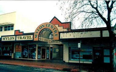
Photograph - Mylon Centre, Wodonga
In 1906 Patrick Mylon started a passenger transport service in the Albury-Wodonga border area with horses and cabs. His son Jack went into business in the late 1920s, and his grandson Bernie joined the firm early in 1970. When Patrick started with the horses and cabs, each cab carried eight passengers and he always had two horses per cab. As the business expanded, Mylons used a range of buses and coaches including Reo, Chev and Bedford vehicles. Mylon Travel Centre opened at 152 High Street, Wodonga on 21 November 1992. It allowed Mylons to extend their service for holidaymakers. Mylon’s staff can help will all holiday needs, including answering questions about destinations as well as booking tours, accommodation, concert seats and express coach bookings. The new Centre had a computerised resto ervation system with direct link-up for world-wide reservations, During more than 100 years of service to the Wodonga region and beyond, Mylon Motorways received many awards for Excellence and tourism. On July 2, 2008 the company, including its 31 buses and 45 staff members were transferred to the Dyson Group.This building was part of a major local company which serviced Wodonga for over 100 years.A colour photo depicting the front of a building and roadway.Above building: MYLON TRAVEL / MYLON CENTREmylon motorways, mylon travel centre, wodonga businesses -
 Wodonga & District Historical Society Inc
Memorabilia - Souvenir Plate Pollard Arch, Wodonga, Victoria, C. 1960s
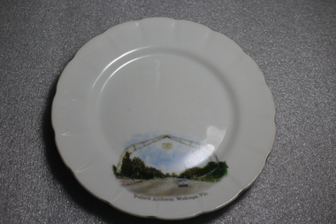
... china pieces carrying scenic views of holiday destinations were ...A wide range of souvenirs have been produced to commemorate Wodonga and its landmarks over time. These items document key changes in Wodonga and its heritage. The arch is named in honour of Cr Charles Pollard, a foundation member of the Wodonga Show Society and former Wodonga Shire councillor and president. The arch is 29 metres wide and 15 metres high and consists of two boomerangs coming together to form an archway. Originally spanning across a single carriageway of the Lincoln Causeway, the arch was opened by Princess Alexandra of Kent in 1959 and was built for £1230. When the Country Roads Board said the causeway would have to be duplicated in 1973, a new home was required for the arch. At the request of the Wodonga Show Society, the arch was moved to the entrance of the showgrounds in 1982. After development of the precinct in 2015, the Pollard Arch was erected on Hamilton Smith Drive Wodonga.Small china pieces carrying scenic views of holiday destinations were a popular kind of souvenir during much of the 20th century. These items have local and social significance as they reflect the landmarks or local features valued by the community over time.Fine china round plate, white with image of the Pollard Archway in Wodonga, Victoria in the bottom third of the plate. Inscription below the image.On bottom of image "Pollard Archway, Wodonga, Vic". Manufacturer's mark on back "St Kilda/ Fine China/ Australia / Hand Painted"souvenir, wodonga, victoria, pollard archway, landmarks wodonga -
 City of Kingston
Photograph - Colour, Paul Tresize, 1998
The name Mordialloc was derived from the name Moody Yallock, which comes from the Bunurong language. The Bunurong Peoples are the Traditional Owners of this area. The name means “high water” or “high creek”. In 1839, colonial authorities declared the mouth of the creek, and an additional 830 odd acres as an Aboriginal Reserve, although this proclamation was never gazetted. The reserved land included part of the Carrum Carrum Swamp which was abundant with wild life and natural resources. Regular encroachments, including land sales which began in 1863, were made on the land until 1878 when the Reserve was declared closed, and the land was opened up to land sales. Market gardening and suburban house lots quickly began to develop, and Mordialloc became a renowned picnic and holiday site. Mordialloc Creek is a popular bay side destination for local and visitors, and is a site for boating, kayaking, fishing and swimming, along with many other activities.Colour photograph of Mordialloc Creek, looking out to the bay. Many small fishing and leisure craft are moored on either side of the banks of the creek. To the right hand side can be seen parklands, while the left hand side has a small inlet in which more small crafts are moored.mordialloc, bunurong, traditional owners, suburbs, boats, fishing, waterways -
 City of Kingston
Photograph - Colour, 1998
The name Mordialloc was derived from the name Moody Yallock, which comes from the Bunurong language. The Bunurong Peoples are the Traditional Owners of this area. The name means “high water” or “high creek”. In 1839, colonial authorities declared the mouth of the creek, and an additional 830 odd acres as an Aboriginal Reserve, although this proclamation was never gazetted. The reserved land included part of the Carrum Carrum Swamp which was abundant with wild life and natural resources. Regular encroachments, including land sales which began in 1863, were made on the land until 1878 when the Reserve was declared closed, and the land was opened up to land sales. Market gardening and suburban house lots quickly began to develop, and Mordialloc became a renowned picnic and holiday site. Mordialloc Creek is a popular bay side destination for local and visitors, and is a site for boating, kayaking, fishing and swimming, along with many other activities.Colour photograph of Mordialloc Creek, looking inland.Small fishing and leisure boats are moored on either side of creek, with a view of the Mordialloc Bridge Hotel in the background.mordialloc, bunurong, traditional owners, suburbs, boats, fishing, waterways, hotel -
 City of Kingston
Photograph - Colour, Paul Tresize, 1998
The name Mordialloc was derived from the name Moody Yallock, which comes from the Bunurong language. The Bunurong Peoples are the Traditional Owners of this area. The name means “high water” or “high creek”. In 1839, colonial authorities declared the mouth of the creek, and an additional 830 odd acres as an Aboriginal Reserve, although this proclamation was never gazetted. The reserved land included part of the Carrum Carrum Swamp which was abundant with wild life and natural resources. Regular encroachments, including land sales which began in 1863, were made on the land until 1878 when the Reserve was declared closed, and the land was opened up to land sales. Market gardening and suburban house lots quickly began to develop, and Mordialloc became a renowned picnic and holiday site. Mordialloc Creek is a popular bay side destination for local and visitors, and is a site for boating, kayaking, fishing and swimming, along with many other activities.Colour photograph of Mordialloc Creek, looking inland. Boats are moored on either side of the creek and the Bridge Hotel is visible in the background.mordialloc, bunurong, traditional owners, suburbs, boats, fishing, waterways, hotel -
 City of Kingston
Photograph - Colour, Paul Tresize, 1998
The name Mordialloc was derived from the name Moody Yallock, which comes from the Bunurong language. The Bunurong Peoples are the Traditional Owners of this area. The name means “high water” or “high creek”. In 1839, colonial authorities declared the mouth of the creek, and an additional 830 odd acres as an Aboriginal Reserve, although this proclamation was never gazetted. The reserved land included part of the Carrum Carrum Swamp which was abundant with wild life and natural resources. Regular encroachments, including land sales which began in 1863, were made on the land until 1878 when the Reserve was declared closed, and the land was opened up to land sales. Market gardening and suburban house lots quickly began to develop, and Mordialloc became a renowned picnic and holiday site. Mordialloc Creek is a popular bay side destination for local and visitors, and is a site for boating, kayaking, fishing and swimming, along with many other activities.Colour photograph of Mordialloc Creek with boats moored on both sides of the street and Pompei's boat yard visible on the right hand side of the creek., Main Street and St Brigid's Catholic Church are visible in backgroundmordialloc, bunurong, traditional owners, suburbs, boats, fishing, waterways, hotel, church -
City of Kingston
Photograph - Colour, Paul Tresize, 1998
The name Mordialloc was derived from the name Moody Yallock, which comes from the Bunurong language. The Bunurong Peoples are the Traditional Owners of this area. The name means “high water” or “high creek”. In 1839, colonial authorities declared the mouth of the creek, and an additional 830 odd acres as an Aboriginal Reserve, although this proclamation was never gazetted. The reserved land included part of the Carrum Carrum Swamp which was abundant with wild life and natural resources. Regular encroachments, including land sales which began in 1863, were made on the land until 1878 when the Reserve was declared closed, and the land was opened up to land sales. Market gardening and suburban house lots quickly began to develop, and Mordialloc became a renowned picnic and holiday site. Mordialloc Creek is a popular bay side destination for local and visitors, and is a site for boating, kayaking, fishing and swimming, along with many other activities.Colour photograph of Mordialloc Creek with boats moored on both sides of the street and Pompei's boat yard visible on the right hand side of the creek., Main Street and St Brigid's Catholic Church are visible in background.mordialloc, bunurong, traditional owners, boats, fishing -
City of Kingston
Photograph - Colour, 29 January 1993
Bonbeach is a small beachside suburb located between Chelsea and Carrum. The station was opened in 1926 and was the last to be established in the group from Aspendale to Carrum. Urban growth began after World War II. State primary and high schools were opened in 1958 on land in Breeze Street that was once occupied by The Australian Glass Manufacturers. Immediately east of the school sites is the Patterson River Golf Club. The Bonbeach sports reserve has five ovals and is home to the Bonbeach football and baseball clubs. The suburb borders the Edithvale-Seaford Wetlands which is the remnant site of the Carrum Carrum swamp, once the home of the Bunurong people.Bonbeach was originally a seaside destination for holidaymakers and the housing comprised of holiday homes and gradually more permanent residents. It was not until 1926 that Bonbeach had its own railway station. From 1906 until the late 1940s sand was quarried on the east side of the railway line and used in the manufacture of glass. The Australian Glass Manufacturers sold this land in residential blocks and Bonbeach's permanent population spread from the coastal strip across to the other side of the railway line. Laminated colour aerial photograph of the suburb of Bonbeach and also the southern section of neighbouring Chelsea within the City of Kingston. The extent of this 1993 aerial image includes: Top left - Maury Road at the south end of the Chelsea shopping Centre; Top right - Scotch Parade Chelsea Bottom left - Monica Avenue in Bonbeach; Bottom right - Patterson River Golf Club. Landmarks include St Joseph's Church and Primary School, Chelsea Primary School, Bonbeach Station, Bonbeach Fotball Club sports playing fields and Bonbeach Life Saving Club. The Edithvale Wetlands is featured prominently to the right-hand side of the image. Black typed writing on white adhesive label: No. 6662 Black typed writing on white adhesive label: 26E/6662, 29/1/93, 4.25 pm Black typed writing on white adhesive label: 29-1-93 Black typed writing on white adhesive label: P000109 Circular yellow adhesive sticker bonbeach, chelsea -
 City of Kingston
Photograph - Digital image, Colour, City of Kingston (Graham Whitehead)
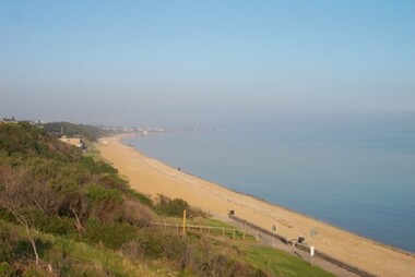
... , as well as a holiday destination. Mentone Beach Environment Colour ...Colour image of Mentone foreshore looking towards Mordialloc. The natural environment of Kingston significantly impacted its development. The bay was a source of food and income, as well as a holiday destination. Colour image of Mentone beach looking towards Mordialloc, with Mentone life saving club in distance.mentone, beach, environment -
 Wodonga & District Historical Society Inc
Memorabilia - Woodland Grove Souvenir dish made by RKG under licence for Royal Sydney China, Czechoslovakia, c. 1920, RKG, c. 1921 - 1938
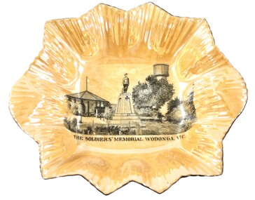
... scenic views of holiday destinations were a popular kind ...A wide range of souvenirs have been produced to commemorate Wodonga and its landmarks over time. These items document key changes in Wodonga and its heritage. The producers mark on the plate was used by the company RKG Czechoslovakia between 1921 and 1938 This plate depicts three key landmarks in Wodonga. THE SOLDIERS' MEMORIAL in Wodonga was unveiled on Tuesday 18th November 1924. It was designed by Messrs. Hosken & Co., of Hawthorn, Victoria. The monument is all of Australian workmanship. The pedestal is made of Harcourt granite, 9ft x 9ft at the base, and rising in seven courses to a height of 10ft 2in. The emblems (rising sun and wreath) are of bronze, and the lettering of the inscription and names of fallen soldiers are in raised lead letters. Originally the Memorial was completed with a full life size, 6ft in height, sculpture of an Australian soldier in Sicilian marble. The memorial bore the inscriptions: ERECTED BY THE RESIDENTS OF WODONGA AND DISTRICT IN MEMORY of the Men of this Town and District who fell in the Great War, 1914-1919, Also in grateful recognition of the men who served and returned. “Lest We Forget.” In 1982, due to frequent vandalism and high cost of materials to repair, the soldier statue was removed and later installed at the RSL Rooms. THE WATER TOWER is a major landmark of High Street, Wodonga. It began operation from 1924 until it ceased operation in 1959. It stood unused for a decade until the lower section was modified and put to use as “ The Tower’s Cobbler’s Inn” in 1962. In 1972 Wodonga City Council proposed to demolish the Tower. Their suggestion received an unfavorable response from the city’s citizens, so the Tower still stands today. THE BAND ROTUNDA was officially opened on Sunday 5th September 1920 at the naming of the triangular reserve at the corner of High and Hovell Streets as Woodland Grove. The Wodonga Band gave a public performance on this occasion. The tri-coloured ribbon, which stretched across the entrance to the Rotunda was cut by Mrs R.H Murphy, daughter of Mr. John Woodland, secretary of the Wodonga Shire Council for 35 years, after whom the area was named. The rotunda has since been moved to Martin Park, Wodonga. Small china pieces carrying scenic views of holiday destinations were a popular kind of souvenir during much of the 20th century. These items have local and social significance as they reflect the landmarks or local features valued by the community over time. An apricot irregular shaped dish made from lustre ware with a drawing of the Wodonga Soldiers Memorial, Water Tower and Rotunda. The manufacturer's mark is imprinted on the base. Text under the image says 'THE SOLDIERS' MEMORIAL. WODONGA. VICManufacturer's trademark printed on base, in orange paint, in a circular formation 'ROYAL SYDNEY CHINA / MADE IN / CZECHOSLOVAKIA', within circular formation '(crown) / RK / G' ('RK / G' within circle with handles).porcelain, wodonga, royal sydney china, soldier memorial, wodonga souvenirs -
 Warrnambool and District Historical Society Inc.
Document - Warrnambool Playground of the South Tourist Guide, Collett & Bain, 1959
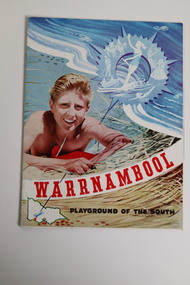
A 1959 tourist guide showcasing Warrnambool attractions.This guide gives an insight into tourist attractions and facilities in Warrnambool in the late 1950'sThis 24page paper booklet contains colour and black and white photographs and text showcasing Warrnambool as a tourist destination. The front cover has an illustration of a young man on the sand dunes, a small map of Victoria locating Warrnambool in the bottom left hand corner and stylised tourist activities in the top right hand quadrant. The rear cover has a photograph of a woman in a swimsuit holding a green surf board surrounded by stylised tourist activities printed in red ink. There is a blue banner across the bottom of the rear cover.Front cover: Warrnambool Playground of the South Rear cover: A Warrnambool Holiday for Everyonewarrnambool, warrnambool tourist guide -
 Eltham District Historical Society Inc
Photograph - Digital Photograph, Alan King, Eltham Railway Trestle Bridge, 28 December 2007
Covered under National Trust of Australia (Victoria) State Significance and Heritage Overlay, Nillumbik Planning Scheme. Published: Nillumbik Now and Then / Marguerite Marshall 2008; photographs Alan King with Marguerite Marshall.; p103 The Eltham railway trestle bridge is the only one of its kind still regularly used in Melbourne’s metropolitan railway network. Opened in 1902, it is also one of Victoria’s very few timber rail bridges that still carries trains.1 The bridge is part of the railway line extension from Heidelberg - extended to Hurstbridge in 1912. This extension resulted in one of the greatest social changes experienced in Eltham Shire, as it considerably lessened its isolation attracting tourists, artists and suburban commuters particularly after World War Two.2 The bridge has been classified by the National Trust as historically, scientifically, aesthetically and socially significant at state level. But this has not always been recognised, and in 1977, locals fought to save it from destruction. The Victorian Railways proposed to replace the bridge with an earth embankment and large culverts to avoid maintenance problems and fire. This was rejected by the Eltham Council who protested that the bridge helped maintain the area’s rural character, historic link and beauty, as well as avoiding possible serious flooding on the flood plain if a culvert was blocked. The bridge stands as part of a National Trust classified landscape which includes the Alistair Knox Park, named after the local conservationist and architect who helped to make Eltham famous for its mud-brick houses. The landscape includes tall and spreading manna gums and candlebarks, and the historic Shillinglaw Cottage. Artist Walter Withers, one of the Heidelberg School of painters, painted the bridge early in the 20th century. The 38 span single-track railway bridge over creek and road has 34 timber-beam spans and four steel-joist spans, supported by four-pile timber piers and timber abutments. It has almost 200m of timber deck. All of the timbers have been replaced over the years, but the only change to the bridge’s character was the addition of pylons and wiring for electric trains in 1923. A petition for a railway to the shire was first made in 1883. A large deputation of local citizens to the Commissioner of Railways proposed a route passing through Alphington to midway between Greensborough and Eltham up the Diamond Creek valley towards Queenstown and Kinglake. As a result the Princes Bridge-Heidelberg Railway was opened in 1888. From 1888 locals demanded a railway extension. Kangaroo Ground farmers in particular, led by Shire Councillor and Member for Evelyn, Ewen Cameron, said it would assist local farmers and orchardists send their produce to the Melbourne market. In 1890, before the severe economic Depression, an extension of the line to Hurst’s Bridge (now Hurstbridge) was included in a new Railways Bill. The parliamentary delegations were regaled with a banquet at Hurst’s barn and entertained by the Diamond Creek Brass Band, but the extension was abandoned when the Depression struck in 1892-1893. The extension of the railway to Eltham, completed in 1902, was one of the few built in those hard times. That is why the Eltham timber-trestle railway bridge is a rare example of a broad-gauge rail bridge constructed between 1893 and 1910. At the opening, despite persistent drizzle, 300 children waving flags and banners were among the large crowd welcoming the first train, carrying official dignitaries, to Eltham. It had taken 24 years to bring the railway to Eltham. From then Eltham became a popular destination for outings. Mr Orford of Eltham recalled that after the railway came to Eltham ‘the craze for picnics on weekends and holidays began…. During the wattle season, wattle trains came to Eltham frequently. The visitors roamed the creek pulling great armfuls of wattle blossom to take back with them to Melbourne’.3 In 1926 the railway line was electrified as part of the metropolitan rail network. But the Victorian Railways decided not to complete the formerly planned Diamond Valley Railway to Queenstown (now St Andrews) and Kinglake.This collection of almost 130 photos about places and people within the Shire of Nillumbik, an urban and rural municipality in Melbourne's north, contributes to an understanding of the history of the Shire. Published in 2008 immediately prior to the Black Saturday bushfires of February 7, 2009, it documents sites that were impacted, and in some cases destroyed by the fires. It includes photographs taken especially for the publication, creating a unique time capsule representing the Shire in the early 21st century. It remains the most recent comprehenesive publication devoted to the Shire's history connecting local residents to the past. nillumbik now and then (marshall-king) collection, eltham railway trestle bridge, eltham trestle bridge -
 Wodonga & District Historical Society Inc
Memorabilia - Souvenir Dish Wodonga Victoria, C. 1925 - 1935
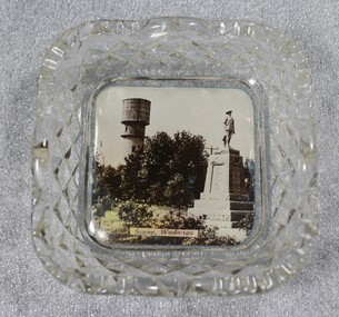
... scenic views of holiday destinations were a popular kind ...A wide range of souvenirs have been produced to commemorate Wodonga and its landmarks over time. These items document key changes in Wodonga and its heritage. The Water Tower and Soldiers Memorial have been key landmarks in the centre of the main street. The Water Tower was in operation from 1924 until it ceased operation in 1959. The original Soldier Memorial was dedicated on Tuesday 18th November, 1924.Small china and glass pieces carrying scenic views of holiday destinations were a popular kind of souvenir during much of the 20th century. These items have local and social significance as they reflect the landmarks or local features valued by the community over time.A square crystal dish with image of the Water Tower and Soldiers MemorialAt bottom of central image "Scene, Wodonga"wodonga, souvenirs, water tower, soldiers memorial -
 Melbourne Tram Museum
Document - Folder with papers, Melbourne & Metropolitan Tramways Board (MMTB), "Notices to Staff", 1924 - 1944
Light grey card folder manufactured by the Roneo Printing Works of Rumford England with the file title "Fire Switches, glued to the top of the folder on the inside back cover. Contains many memos from the MMTB Traffic Managers, Depot Managers about the arrangements for the visit of the Royal Highnesses the Duke and Duchess of York in April 1927. Also contains memo re cable tram arrangements for this event from Port Melbourne depot, arrangements for Christmas holidays and other holidays from about 1924 to 1944, including a map of the procession and printed programs by the Government Printer. Documents either typed or hand written. Other documents include (Sample only): Camberwell extra for December 1944 Shopping Week Memos re traffic arrangements and shunting of trams for the 8 hour day procession Tables for Cable car operations from Port Melbourne depot 5/7/1925 Handwritten car timetables Costs associated with the royal visit Proposed service arrangements for Coburg Lines Christmas and New Year 1929 Cuttings regarding shopping hours for 1929-1930 Football posters - special trams - 1931 and 1932 All Night services - destination rolls to specific bogie trams Memos regarding cancelling of leave in Dec. 1941 Memos regarding services to Fisherman's bend and factory hours - 1941 - 42 Holiday loading returns for Southern System - 1941 Memo re timing of trams from city terminus account 3KZ Christmas Eve Choral festivaltrams, tramways, mmtb, port melbourne depot, notices and information, cable trams, holiday arrangements, royal visit, timetables, world war 2, football, all night services -
 Falls Creek Historical Society
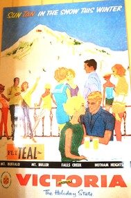
Poster - Sun Tan in the Snow - Tourism Poster
This item is from the private collection of George Shirling of Red Onion, Falls Creek. It is the sign accompanying his collection on display.. George Shirling arrived in Falls Creek in 1962. He engaged Phil Nowell to build the original Koki Alpine Lodge which opened in 1965 with 14 beds. George operated the lodge with Michael “Baldy” Blackwell as manager. He also graduated in sport psychology in 1981 and was invited to become team psychologist for the Australian Winter Olympic team which went to Albertville, France, in 1992. He later owned the Red Onion Chalet. George credited the success of Koki to “Baldy” Blackwell. “Baldy” and Phil Nowell started the Trackers Mountain Lodge in partnership during the 1980s. In 1971 George sold Koki Lodge to Sigi Doerr. In 2024 the renamed Koki Alpine resort remains a highly popular destination in Falls Creek. George Shirling passed away on 27th February 2023. He had remained actively involved in Falls Creek and was generous with his time and knowledge, always an amazing supporter of The Falls Creek Museum and Falls Creek Village.This item is significant because it promotes George Shirling's Collection.A Victorian tourism poster to promote holidays at Victoria's ski resorts. On Sign: 'SUN TAN IN THE SNOW THIS WINTER' Colour process lithograph, signed 'Wendy ?" Government of Victoria Tourist Development A.C. Brooks, Government Printer, Melb. 1960 - original 101.5cm x 64.4cmgeorge shirling, falls creek, exploding sports myths -
 Ballarat Tramway Museum
Ephemera, Topmill Pty Ltd, "Australian Trams - 1996 Calendar", 1995
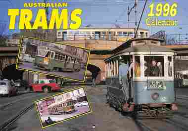
1996 Calendar" containing cull colour photographs of Sydney, Adelaide, Bendigo, Ballarat, Melbourne, Fremantle 29 and Victor Harbor. All photos by D Ellerton. Produced by Topmill Pty Ltd and distributed by Gordon & Gotch Pty Ltd. Features July - Ballarat tram 17 crossing Sturt St from Lydiard St North, 5-3-1963. Tram has the destination of Bell St. November - Bendigo 16, at Charing Cross, 11-3-1960, Eaglehawk, with the motorman selling a ticket to a passenger. Rear cover - Bendigo 17 at Eaglehawk, 11-3-1960 at the end of the double track.Demonstrates a Topmill Calendar for 1996 featuring Australian trams.Wall Calendar - heavy card covers, 12 gloss art pages inside, titled "Australian Trams - 1996 Calendar" containing full colour photos. Has a punched hole along the top edge to enable wall use. Provides dates for holidays, school holidays and Pension payment days and phases of the moon.trams, tramways, ballarat, bendigo, calendar, tram 17, tram 16 -
 Falls Creek Historical Society
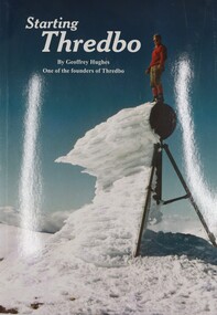
Book - Starting Thredbo, Geoffrey Hughes, 2008
... holiday destinations, Thredbo Ski Resort. A publication of 44 ...Geoffrey Hughes, one of the original founders of Thredbo first laid eyes on the vast, rich forest of Thredbo Valley in 1955 and envisioned a ski resort for all. This book documents the transformation and development of the area to become one of Australia's most popular holiday destinations, Thredbo Ski Resort.A publication of 44 pages including colour photos, illustrations and maps.non-fictionGeoffrey Hughes, one of the original founders of Thredbo first laid eyes on the vast, rich forest of Thredbo Valley in 1955 and envisioned a ski resort for all. This book documents the transformation and development of the area to become one of Australia's most popular holiday destinations, Thredbo Ski Resort.thredbo ski resort, alpine resorts australia