Showing 354 items matching " land settlement"
-
 Kew Historical Society Inc
Plan - Subdivision Plan, Normanby Heights Estate, Kew, 1919
Prue Sanderson, in her groundbreaking ‘City of Kew Urban Conservation Study : Volume 2 - Development History’ (1988), summarised the periods of urban development and subdivisions of land in Kew. The periods that she identified included 1845-1880, 1880-1893, 1893-1921, 1921-1933, 1933-1943, and Post-War Development. These periods were selected as they represented periods of rapid growth or decline in urban development. An obvious starting point for Sanderson’s groupings involved population growth and the associated economic cycles. These cycles also highlighted urban expansion onto land that was predominantly rural, although in other cases it represented the decline and breakup of large estates. A number of the plans in the Kew Historical Society’s collection can also be found in other collections, such as those of the State Library of Victoria and the Boroondara Library Service. A number are however unique to the collection.The Kew Historical Society collection includes almost 100 subdivision plans pertaining to suburbs of the City of Melbourne. Most of these are of Kew, Kew East or Studley Park, although a smaller number are plans of Camberwell, Deepdene, Balwyn and Hawthorn. It is believed that the majority of the plans were gifted to the Society by persons connected with the real estate firm - J. R. Mathers and McMillan, 136 Cotham Road, Kew. The Plans in the collection are rarely in pristine form, being working plans on which the agent would write notes and record lots sold and the prices of these. The subdivision plans are historically significant examples of the growth of urban Melbourne from the beginning of the 20th Century up until the 1980s. A number of the plans are double-sided and often include a photograph on the reverse. A number of the latter are by noted photographers such as J.E. Barnes.The Normanby Heights Estate not unusually used hyperbole to attract purchasers to the auction of 17 lots facing Argyle Street (sic), Pleasant Avenue and Normanby Road. Predictably factors appealed to included the proximity to schools etc, the availability of public utilities, friable soil, picturesque views and ‘advancing settlement’. If that were not enough, the sales pitch exhorted prospective purchasers to consider their backbone. ‘Thrift is unquestionably the Backbone of any Nation. No better form of Thrift can be encouraged in the young citizen than by investing his or her savings in a piece of land in a growing, healthy and beautiful locality. NORMANBY HEIGHTS ESTATE admirably fits the need.’ The experience of Australia at war undoubtedly contributed to the use of terms such as ‘Backbone of a Nation’ and the appeal to egalitarian principles in the choice of the term ‘young citizen’. The recognition that women had savings and might be the prospective purchaser also reflects a new sense of the rights and entitlements of women in the postwar period.subdivision plans - kew, normanby heights estate, pleasant avenue, normanby road, argyle street -
![Wallpaper sample from 'Reno', St John's Parade [Kew]](/media/collectors/550653872162f11fb04854aa/items/5670dfde2162f10b54fac48a/item-media/5797600bd0cdd1098c854c29/item-fit-380x285.jpg) Kew Historical Society Inc
Kew Historical Society IncDecorative object - Wallpaper sample from 'Reno', St John's Parade, 1850-1880
Comparatively few weatherboard houses in Kew survived from the early years of settlement into the second half of the 20th century. One such property was ‘Reno’, which once stood on the east side of St John’s Parade. Its earliest recorded owner was the architect Samuel Cocking who lived there from c.1865 until his death in 1888. The original landholding was bordered by Cotham Road, Glenferrie Road, Wellington Street, and Charles Street. The southern portion of this land included a fine orchard, with many imported trees. The old summer house, at first in the orchard, was later removed to the house garden. The MMBW Detail Plan No.1576 (1904) shows the remaining portion of the original land holding, including a semi-circular pathway at the front, and garden features such as an aviary, a fountain and grotto, and a fernery. None of these are apparent in photographs dating from the 1960s, where the garden, which once included rare plants provided by Baron Von Mueller, surrounds the cottage in a tangled frenzy. Despite a ‘local significance’ classification by the National Trust, the house was demolished in 1977.Original sample of nineteenth century wallpaper from one of the earliest homes in Kew (Victoria).Wallpaper fragment from ‘Reno’. These two samples of light brown Victorian-period wallpaper were overprinted with flowers and leaves that are outlined in maroon. Flowers and foliage are painted in blue of varying intensity, giving the impression of being hand painted. The style of this wallpaper would have been suited to a bedroom or drawing room.wallpaper, samuel cocking, reno, st john's parade, kew -
 Sunbury Family History and Heritage Society Inc.
Photograph, 13 April 2000
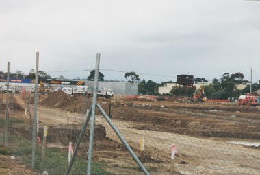
In 2000 work commenced on the further development of railway land on the west side of Sunbury station for the construction of commercial and entertainment facilities. Prior to this time the land had been undeveloped and was often used to accommodate visiting circus troupes. Cereal storage silos also occupied this area for some time. The development of this area has been a reflection of the rapid expansion of settlement within Sunbury and surrounding areas that occurred during the early years of the twentieth century.A coloured photograph of a fenced off area undergoing development with earthmoving equipment and trucks in operation and some commercial buildings visible in the middle distance.sunbury railway station -
 Sunbury Family History and Heritage Society Inc.
Photograph, September 1996
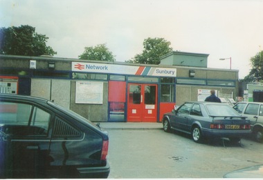
The photograph shows the railway station at Sunbury in Surrey in the United Kingdom. The town of Sunbury in Victoria was named after the English township of Sunbury-on-Thames in Middlesex by the Jackson Brothers who took up land in Sunbury, Victoria. The area was originally known as Koora Kooracup by the Wurundjeri people.Sunbury in Victoria like many other settlements in Australia were given names of towns in the United KingdomA coloured photograph of a railway station with three cars parked outside the building, which has grey walls and scarlet and blue trims. There are framed maps and notices on the exterior walls. -
 Surrey Hills Historical Society Collection
Photo, 'Spenceycroft', Canterbury Road
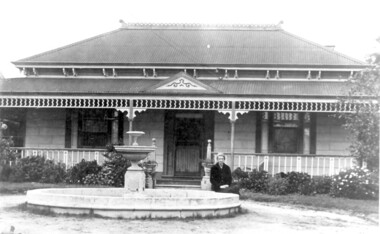
The photo is of ‘Spenceycroft’ at 654 Canterbury Road, Surrey Hills. For many years this home was hidden behind a large fence sheltering it from the noise of traffic along Canterbury Road, however it dates back to the very early days of settlement in the Surrey Hills area. Canterbury Road was then known as Delany’s Road. ‘Spenceycroft’ is thought to incorporate part of the original farmhouse built on the site by George Klepper, who planted a vineyard in the area. George’s family was one of a number of German families who settled in Surrey Hills during the later part of the 19th century. Later, the land associated with ‘Spenceycroft’ was worked as a dairy farm by James and Elizabeth Rayment. In recent years 'Spenceycroft' has been sold several times and has become increasingly derelict. Sold again in 2015 when it had become quite derelict, it was demolished and re-developed.A black & white photo of double-fronted Victorian style home with a fountain centre front and low foliage in front of the veranda. A woman is sitting by the fountain. 'spenceycroft', canterbury road, james rayment, elizabeth rayment, george klepper -
 Surrey Hills Historical Society Collection
Photograph, Grovedale Road Quarry in the 1920s - looking south, c1920
The quarry was part of John Butler Maling's property. He was one of the original settlers of the area and farmed the area between Weybridge Street and Whitehorse Road. Clay was quarried from part of this area and used to make the bricks used in the construction of his home, known as 'Ancyra'. This is still extant at the corner of Weybridge and James Streets. Maling grazed cows and used the quarry as a water source. He was the uncle of John Butler Maling, Mayor of Camberwell. He was married to Kate Conlon in 1882. They had 3 children: Silas Young, Alick and Zillah. Maling was born in c1829 in Shepreth, Cambridgeshire; he died in Surrey Hills on 9 October 1912 and is buried in Box Hill Cemetery - CE-*-0586. Mrs Kate Maling (born c1859 in Co Meath, Ireland) died at the property on 8 March 1921. She is buried in Brighton General Cemetery. Probate was valued at over 10,000 pounds and included other properties in Sandringham, Hawthorn and Macedon. At the time of her death the Surrey Hills property was described as being 23 acres with 2 brick houses, 1 cow, 2 heifers and 40 fowls or chickens. The property was subdivided after her death. The property was subdivided into 110 house blocks in c1923 - see Maling's Estate subdivision flyer on the State Library of Victoria's website. This shows that the Grovedale Park site had been acquired by Camberwell Council by this time. An attached newspaper clipping documents prices realised for a cross-section of blocks. The MMBW map of 1925, also on the SLV website, shows the outline of the clayhole / quarry. The quarry was filled in after several drownings or near drownings and the land is now occupied by a park and playground, known as Grovedale Road Park, maintained by the City of Boroondara. Beckett Park is sited on horizon to the left beyond the trees. This documents the landscape prior to close settlement and is material to early building and farming in the Surrey Hills area.Black and white photo of the quarry between Grovedale Road and James Street taken in the 1920s and looking south. In the foreground is an area of water with reeds in the LH corner. Beyond on the high banks there are single storey houses in the background and (?) some light poles. An object that looks like a tank on posts is in a cutting on the far bank.quarries, grovedale road, james street, clay quarries, farming, kate conlon, kate maling, john butler maling, ancyra -
 Surrey Hills Historical Society Collection
Photograph, Grovedale Road Quarry in the 1920s - looking north, c1920
The quarry was part of John Butler Maling's property. He was one of the original settlers of the area and farmed the area between Weybridge Street and Whitehorse Road. Clay was quarried from part of this area and used to make the bricks used in the construction of his home, known as 'Ancyra'. This is still extant at the corner of Weybridge and James Streets. Maling grazed cows and used the quarry as a water source. He was the uncle of John Butler Maling, Mayor of Camberwell. He was married to Kate Conlon in 1882. They had 3 children: Silas Young, Alick and Zillah. Maling was born in c1829 in Shepreth, Cambridgeshire; he died in Surrey Hills on 9 October 1912 and is buried in Box Hill Cemetery - CE-*-0586. Mrs Kate Maling (born c1859 in Co Meath, Ireland) died at the property on 8 March 1921. She is buried in Brighton General Cemetery. Probate was valued at over 10,000 pounds and included other properties in Sandringham, Hawthorn and Macedon. At the time of her death the Surrey Hills property was described as being 23 cres with 2 brick houses, 1 cow, 2 heifers and 40 fowls or chickens. The property was subdivided after her death. The quarry was filled in after several drownings or near drownings and the land is now occupied by a park and playground maintained by the City of Boroondara. Beckett Park is sited on horizon to the left beyond the trees. This documents the landscape prior to close settlement and is material to early building and farming in the Surrey Hills area.Black and white photo of the quarry between Grovedale Road and James Street taken in the 1920s and looking north. In the foreground is an area of water with high banks dividing the horizontal centre. Beyond are paddocks and trees behind which is a row of at least 3 single-storey houses. Light poles can be seen along a distant street. There are many mature trees in the background. The houses and trees are positioned along Whitehorse Road in the vicinity of Westminster Street. Shadows indicate the photo was taken in early morning or evening.quarries, grovedale road, james street, surrey hills, balwyn, clay quarries, ancyra, kate conlon, kate maling, john butler maling, farming -
 Surrey Hills Historical Society Collection
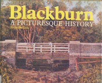
Book, Blackburn: A Picturesque History, 1978
This book focuses on the area's history and traces the development through settlement, adaptation and consolidation to the present. It discusses the history of early families, the railway, land boomers, churches and school. Robin da Costa, later Mrs Robin da Costa- Adams, came to live in Balwyn Road, Canterbury and joined the Canterbury History Group.Hardback book of 144 pages, indexed with multiple black and white photos.In Jocelyn Hall's writing: "Donated to Surrey Hills Neighbourhood Centre".(mr) james blackburn, meader's travellers' rest hotel, blackburn hotel, blackburn post office, blackburn railway station, blackburn pioneers, blackburn company, (mr) george augustus goodwin, (mr) thomas r b morton, blackburn brick works, st john's anglican church, blackburn methodist church, blackburn church of christ, blackburn presbyterian church, st thomas the apostle peace memorial church, seagoe common school, the courier blackburn, blackburn library, blackburn primary school, blackburn open-air school, blackburn creek hotel, blackburn college, blackburn kindergarten, newark grammar, blackburn hall, morton park, blackburn lake sanctuary, backhouse's dairy, blackburn lake, wandinong sanctuary, barelli bakehouse, blackburn cool store, blue moon fruit co-operative ltd, 1st blackburn scouts troop, blackburn and district tree preservation society, hotels, (ms) robin da costa -
 Surrey Hills Historical Society Collection
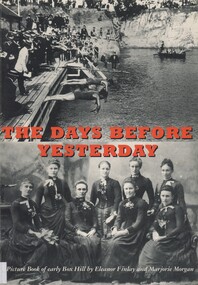
Book, The days before yesterday: a picture book of early Box Hill, 1993
This book shows a collection of pictures from the days of the earliest settlement of Box Hill through to the 1930s. They show us the clearing of land for the establishment of farms and orchards. We see the early Whitehorse Road which was known as Corduroy Road because of the logs that formed its surface.This publication, originally suggested by Betty Walters, a former Mayor of the City, portrays the evolution of the central area of the City, from the first settlers to 1930. The selection of the pictures by the authors was based on the general interest and quality of the photographs.On the front cover: "Presented to Surrey Hills / History Group / by / Marjorie Morgan"box hill, (mrs) marjorie morgan, (mrs) eleanor finlay, early settlement, 1930s -
 Surrey Hills Historical Society Collection
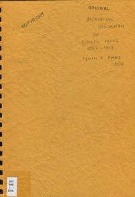
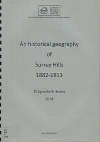
Book, An historical geography of Surrey Hills, 1882-1913, 1979
A thesis submitted for the Degree of Bachelor of Arts with Honours. This thesis presents in a description form, the development of Surrey Hills, an eastern suburb of Melbourne. The settlement and growth from a rural district in 1882 to a suburban centre in 1913.This thesis presents in a description form, the development of Surrey Hills, an eastern suburb of Melbourne. The settlement and growth from a rural district in 1882 to a suburban centre in 1913.surrey hills, geography, topography, j. knipe, land use, population -
 Surrey Hills Historical Society Collection
Book, An historical geography of Surrey Hills, 1882-1913, 1979
A thesis submitted for the Degree of Bachelor of Arts with Honours. This thesis presents in a description form, the development of Surrey Hills, an eastern suburb of Melbourne. The settlement and growth from a rural district in 1882 to a suburban centre in 1913.This thesis presents in a description form, the development of Surrey Hills. The settlement and growth from a rural district in 1882 to a suburban centre in 1913.surrey hills, geography, topography, j. knipe, land use, population -
 Port Fairy Historical Society Museum and Archives
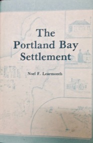
Book, The Historical Committee Of Portland, The Portland Bay Settlement, 1934
Aboriginal resistance to settlement, Native Police Force, G.A. Robinsons proposal to re-settle Flinders Island people and extracts fom his 1841 expedition report. Contents I. The early navigators and explorers II. Sealers and whalers and tales of the sea III. The Hentys and Victoria's first permanent settlement IV. Early incidents and personalities V. Under government control Vi. Social life and activities VII. The story of the press VIII. Business, professions and industry IX. Hotels and roads X. Sport XI. Environs of Portland XII. Miscellaneous historical items.8vo; pp. x, 285; frontispiece, numerous b/w illustrations, plans and maps two of which are folding, index, appendices including "List of Purchasers at original land sale", "First Election List", "Subscription lists for both First Church of England and First Presbyterian Church", original blue cloth, title in gilt on spinenon-fictionAboriginal resistance to settlement, Native Police Force, G.A. Robinsons proposal to re-settle Flinders Island people and extracts fom his 1841 expedition report. Contents I. The early navigators and explorers II. Sealers and whalers and tales of the sea III. The Hentys and Victoria's first permanent settlement IV. Early incidents and personalities V. Under government control Vi. Social life and activities VII. The story of the press VIII. Business, professions and industry IX. Hotels and roads X. Sport XI. Environs of Portland XII. Miscellaneous historical items.robinson, george augustus, 1791-1866., government policy - initial period and protectionism - 1788-1850., government policy - state and territory - victoria., law enforcement - police - native police., race relations - violent - massacres, murders, poisonings etc. - to 1900., sport., pioneers -- victoria -- portland., portland (w vic sj54-11), portland (vic.) -- history., book -
 Port Fairy Historical Society Museum and Archives
Book, Macmillan Publishers Group Australia Pty Ltd, Triumph of the nomads : a History of Ancient Australia, 1982
Argues that Australia's Indigenous people discovered the land, adapted it and mastered its climates, seasons & reserves.23.0 x 14.0cms, 938 pp. b/w illust dust jacketnon-fictionArgues that Australia's Indigenous people discovered the land, adapted it and mastered its climates, seasons & reserves.habitation - nomadism., demography - palaeodemography - aboriginal settlement of australia., reproduction - infanticide., feuds and warfare., hunting, gathering and fishing., food - plants., trade and exchange - trade routes., australiens (aborign̈es), aborigines, australian -- social life and customs., aboriginal australians -- social life and customs -- northern territory., aboriginal australians -- history., aboriginal australians -- culture -- history., aboriginal australians -- civilization -- history., aboriginal australians -- economic conditions -- history., aboriginal australians -- social life and customs., human ecology -- australia., aboriginal australians., aborigines., australiens (aborigènes), australien., australia -- history., lake mungo / walls of china (willandra sw nsw si54-08), tasmania (tas), australia - aborigines, book -
 Port Fairy Historical Society Museum and Archives
Book, Richard Osburne, The history of Warrnambool, capital of the western ports of Victoria, from 1847 (when the first government land sales took place) up to the end of 1886, 1980
The history of Warrnambool, capital of the western ports of Victoria, from 1847 (when the first government land sales took place) up to the end of 1886 / by Richard Osburne Other Authors, Fraser, Malcolm, 1930-2015, (author of introduction, etc.) Tylee Memorial Collection368 pages, unnumbered and folded leaves of plates : illustrations (some colour), maps, portraits, plans ; 19 cmnon-fictionThe history of Warrnambool, capital of the western ports of Victoria, from 1847 (when the first government land sales took place) up to the end of 1886 / by Richard Osburne Other Authors, Fraser, Malcolm, 1930-2015, (author of introduction, etc.) Tylee Memorial Collectionvictoria. warrnambool, 1847-1886. facsimiles, government policy - initial period and protectionism., settlement and contacts - 19th century., mining industry - gold., race relations - violent - massacres, religions - christianity - missions., warrnambool (vic.) -- history., framlingham / purnim (w vic sj54-11), demography - census data, book -
 Mrs Aeneas Gunn Memorial Library
Book, Penfold, Canberra's first hundred years and after, 1927
Notes on Aborigines, land grants, places and families in the federal territory, brief notes on Aboriginal names and tribal districts, quotes previous authors; early camping grounds - place names.non-fiction Notes on Aborigines, land grants, places and families in the federal territory, brief notes on Aboriginal names and tribal districts, quotes previous authors; early camping grounds - place names.canberra (act) - history, canberra - settlement and contacts -
 Ballarat Diocesan Historical Commission
Poster, Government Land Sales Poster
... Closer Settlement, Soldiers Settlement, Government Poster... of land for the purpose of closer settlement was first authorised ...Government poster advertising land sales to promote closer settlement in Portland area. The acquisition of land for the purpose of closer settlement was first authorised under the provisions of the Land Act 1898. In 1917 under the provisions of the Discharged Soldiers' Settlement Act, the scheme reverted to the Soldiers' Settlement scheme when the government undertook the settlement of discharged soldiers on lands set aside exclusively for them as a reward for their war service.closer settlement, soldiers settlement, government poster. land sales, portland. -
 Melton City Libraries
Map, Streets of Melton, 1963
... early map. DODEMAIDE Place Early land owners.... DODEMAIDE Place Early land owners - Melton Football Team had 6 ...MELTON’S STREETS Heritage Week 2014 What’s in a Name? Alphabetical List Aboriginal place names, Early Family Names and landowners, Agricultural, Shop and Commercial premises, Places and Events Melton & District Historical Society Street Naming Project 1972 – c 1998 Suburb Name – KURUNJANG - Kirkton, 1972, Brookfield, West, 1988 Melton and Town Centre - A joint collaboration with the Shire of Melton and Subdivision Developers ARNOLD Court – Family house - Arnolds Creek ALKEMADE Drive Family – Lime kilns Coimadia ALEXANDRA Street 1902 – Corination of King Edward VII and Queen Alexandra AVIATOR Place Event, location of plane crash – Jimmy Melrose 1936 Adina ?Annibee - Anniba? Agricultural Avon court .. .. BAKERY Square - Location of Jongebloed shop, bakehouse and stables BALUK Place Aboriginal BARLEYCORN Place Agricultural BILLING Place Name of Jimmy Melrose Uncle Noel Pemberton Billing BLACKWOOD Drive - Alexander Blackwood 1860c Registrar BARRIES Road C. E. Barrie “Darlingsford” farmer 1911, chaff mill owner BROOKLYN Road Staughton family residence. 1875 – Dismantled c 193? CAHILL Drive Family - Glenville Dairy CAMERON Court Family Canopus Place ? CANALLAN Drive Early Surveyor CAMPBELL Court Aviation – Melrose passenger 6th July 1936 CARBERRY Drive Michael, early landowner family CAREW Court Edward and Michael. Royal Hotel. Vera (Carew) Forran Singer - Opera CASEY Court Family CASHIN Court Family CHEVIOT Court Agriculture, breed of sheep CHESNEY Road was re named ( Minns Road being duplicated c 1973) CHRISTINA Crescent Christina McPherson, daughter of James and Mary Mary McPherson. Died 1955 aged 85 years COLLYER Close a deleted street (parallel to Yuille) re-used CORRIEDALE Road Breed of sheep CORR Court Teacher at first school, landowner CROXTON Court Name of the Hornbuckle and Knox family home DALEY Court - William Daley and family 1865 Bootmaker High Street DARLINGSFORD Boulevard - Name of early homestead Thomas B Darling 1853 DJERRIWARRH Court - Parish County of Bourke - very early map. DODEMAIDE Place Early land owners - Melton Football Team had 6 brothers playing c 1924 DONALD Court McPherson family 6 generations in Melton in 1936 DOUGAL Court DUNCAN Court .. .. DUNVEGAN Circuit Home of the McPherson family, castle Isle of Skye Name of bluestone house Smith Street (now at Willows) EMIL Court Jongebloed family EXELL Avenue Farming family Melton Sth- Closer Settlement 1907 EXFORD Road Exe former name of the Werribee river FARMER Court Name of early postmistress FERRIS Road John Ferris Farmer HANNAH Close First name of Hannah Watts – midwife HAYBALE Place Agricultural HELDER Court Early surveyor J Helder Wedge map HEWSON Street Winston Hewson Shire Engineer – check title c 1960 HENRY Street Township map c 1860 HESTON Street Heston Phoenix – C.J. Melrose plane HILDEGARDE Court Jimmy Melrose’s mothers name HOMESTEAD Close HORNBUCKLE Cres Farmers. Three members of family - Shire Presidents HURLEY Street Farmers IAIN Court Descendent of James and Mary McPherson JAMES MELROSE Drive Name appears on 2013 Melton information map JANG Place KURUN – jang KIRKTON Drive Name of the McPherson family home Toolern Vale Road KIRWIN Street Michael early landowners (deleted for freeway construction) KILPATRICKS Road Deleted when Barries Road was extended across Station Rd KOROROIT Court Early map, Parish of Kororoit. Creek name KNOX Circuit Family – Hornbuckle “Croxton Park” KURRUNJANG Drive Aboriginal name for people of the red earth – Suburb name Lara Place ? LLOYD Court Garage owners High Street. Laura lived to 100 years D 1955 LUBY Court John Luby – Crown Grant Land Title LITTLE Court MANNING Avenue Richard, hotel owner 1891 MARGARET Drive McPherson family McDONALD Street Melton South family name McKENZIE Street Township c1860 MORROW Street Early name MOWBRAY Crescent Name of English Melton, popularly believed origin of Melton MYERS Court Early setters c 1866 Crown Grant Land Title NIMMO Street Early name NIXON Street Name submitted by Mary nee Nixon Collins c1985 OLDERSHAW Road Early builder PALMERSTON Street Early township map c 1860 PEART Court Early name PENNYROYAL Avenue Plant growing by the creek. Early name used for the Toolern Toolam Creek PINKERTON Street Family name and early street map PINNACLE Crescent Agricultural - type of wheat PHOENIX Circuit C.J. Melrose Phoenix Heston Plane 2013 map PRATT Family PRIOR Court PYKE Place Brothers – early settlement 1838 RADFORD Court Land owners and business operators. Former Royal Hotel Grocer High Street demolished 1970 RAGLAN Court Hotel 19th century Lord Raglan RALEIGHS Road Oliver Reierson family (Norweigen) Shopkeeper – Dressmakers RIDDELL Drive (misspelt Riddle) Resident and land owner RODERICK Road McPherson family – a re occurring name ROLLAND Court Jones family ROSS Court Daniel. Landowner. Agnes Ross music teacher RUSSELL Court Robert. Early land surveyor of Melton 1853 RYAN Court Family early landowner. Member of the 1862 Road Board SHEBLER Place Augustus early Melton resident – Golden Fleece Hotel SHEEPFOLD Court Farming SHERWIN Court Sherwin Street earliest Township map– became Golf course SMITH Street Early township map. STRATHULLOH Circuit Strathtulloh Homestead. STAUGHTON Street Family – LARGE land owners Strachan ? SWANEY Court Marie Swaney earlier resident of Strathtulloh. SUTHERLAND Family name TOOLERN Street TOOLAM – TOOLERN Creek TULLIDGE St Road marked on 1861 map UNITT Street Early Township c 1860 WALLACE Square Cr Jack Wallace 5 terms as President 46 years unopposed WATTS Court Hannah Watts – midwife, cottage hospital WALSINGHAM Name of house of Minns family. From Walsingham Norfolk England WESTLEY Place Name of Jimmy Melrose Percival Gull Plane WESTLAKE Drive Early resident WHICKHAM Street Family Name Melton South WILSON Road Albert, Melton South YUILLE Street William Cross, early landowner, Rockbank run Zoomed in section of Melton Streets including Church and High Streetlandscapes of significance -
 Melton City Libraries
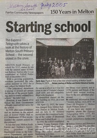
Newspaper, Melton Schools-150 years in Melton, 2005
Melton South "The establishment of a settlement of Melton South was induced by the opening of the railway in 1884. This subsequently prompted a number of industries, initially sawmills, and in the early twentieth century, chaff mills. This development coincided with the Exford ‘Closer Settlement’ estate at the beginning of the new century, boosting local population and produce, and the development of the chaff industry which employed many people in the Melton area. (Around 1912 the government had brought out English migrants to settle the Exford estate.) By c.1912 the small Melton Railway Station settlement had a boarding house (probably for chaff or sawmill employees), store, a small church and a hall. The Melton Valley Golf Club originated near the railway station in 1927 (in 1931 it moved to the present Melton links). In 1910 the community had built the large timber ‘Victoria Hall’, which became the focus of community life for several generations. In August of that same year AR Robertson MP and D McDonald applied for the establishment of a school on land set aside for that purpose by the Closer Settlement Board, near the Melton Railway Station settlement. District Inspector McRae recommended that a school for classes up to Grade 3 be established as an adjunct to the Melton State School. And so SS3717, ‘Melton Railway School’, was established in the leased Victoria Hall on 1st December 1911. Thomas Lang, head master at Melton since 1896, was in charge of both schools. As a ‘prep’ school only, it was necessary that the older Melton Railway Station settlement students travel to Melton SS430 at Unitt Street. Since 1912 local residents had been petitioning for the establishment of a separate school at Melton Railway Station on the grounds that it would be better if all children from the one home could attend the same school, and that the Victoria Hall was unsuitable as a school building. As a result an area of 2 acres - Allotment 8, Parish of Djerriwarrh, Exford Estate - was reserved for a State School on 4th March 1914. However the Department wrote that a school would not be established there in the near future, as ‘there is no likelihood in sight that the Railway Station settlement will increase in importance’. Parents persisted with their petitions to the Education Department, claiming that the Victoria Hall was too large, had no fireplace, that teachers were unable to use the wall for teaching aids, and that, being less than 20 metres away from a chaff mill employing 30 men, was too noisy. The turning point came when in 1920 the Hall Committee decided to increase its rent for the hall. In 1920 Head Teacher Lang advised the Education Department to discontinue SS3717 as an adjunct. The District Inspector supported this recommendation, and the schools separated in 1923. In April of that year 41 children, comprising Grades 1-8, moved into an almost completed brick building on the present site. On the 6th July 1923 the official opening of the school took place; after a ceremonial journey from the Hall to the school, speeches were given by the Hon AR Robertson and the Chief Inspector of Education. Everyone then journeyed back to Victoria Hall for a ‘bountiful repast’. (These dates are at odds with the date of 5th March 1925 given in Blake as the date the children occupied the new SS3717 brick school building. ) A teacher’s residence had been purchased for ₤500 in 1923, and the school’s name was changed to ‘Melton South’ in the same year. Even though the older Melton South pupils would no longer have to travel to the Unitt Street school, an additional brick room was still required at the Melton SS430 in that same year. In 1961 a new room was added to the school. In 1972, at the beginning of Melton’s boom as a satellite town, the number of enrolments was 224. The school has since shared in the exponential growth of the town of Melton, and at the time of its jubilee celebration (1983), 524 pupils were enrolled. Victoria Hall, neglected and vandalised, was demolished in 1992. It had been handed back to the Council on condition that it be replaced by a new hall, with the same name, and was commemorated by a plaque. Apart from the 1923 brick school building, and the railway station, none of the principal early Melton South public sites survive. Few early residential sites remain. (Further research will establish whether the house on the corner of Station Street and the railway line was the original teacher’s residence.)" Melton State School "On 17th May 1858 a State subsidised, combined Denominational School was opened by HT Stokes, with an attendance of about 30 children. This school was conducted in the wooden Melton Combined Protestant Church, situated on ‘a creek flat’ thought to be on the north side of Sherwin Street between Pyke and Byran Streets. It is likely that the Church had been established by 1855 and that the first minister was the Rev. Hampshire, who lived in Cambridge House on the Exford Estate. Ministers of the Protestant denominations were invited to hold services there. As there was only one resident Minister in the town (Presbyterian Mr J Lambie), laymen of the various denominations often spoke on Sundays. In 1863 this building was declared a Common School with the number 430. One of its first and most prominent headmasters was John Corr, who served from 1860 to 1864. Most of Mr Corr’s children also became teachers, including Joseph Corr, at the Rockbank school, and J Reford Corr and WS Corr, headmasters and teachers at numerous prestigious private secondary schools around Australia. John Corr purchased land alongside the school and elsewhere in and near Melton, became secretary and treasurer of the new Cemetery Trust, and by July 1861 was deputy registrar of births, deaths and marriages. He walked three miles every Sunday to teach at the Weslyan Sunday School he had established. Despite good reports from the Education Department Inspector, and burgeoning enrolments, the local school committee recommended the dismissal of, firstly, his wife (from the work mistress position), and then him from the headmaster position. Corr saw his dismissal as an attempt to redirect state aid for education from the Combined Protestant school to the support of the Free Presbyterian Minister Rev James Lambie (by one account the owner of the land on which the Common School was erected), whose son-in-law James Scott subsequently assumed responsibility for the school. Rev Lambie failed in his efforts to keep the existing school, which the Education Department Inspector and the majority of Melton citizens regarded as badly situated and badly built. Following a conditional promise of state aid, local contributors in 1868-69 raised ₤72.10.6 towards the cost of an iron-roofed bluestone rubble building 43 ft x 12 ft. This was erected on a new site of 1.5 acres (the present site). The State contributed ₤120 to the new school, which opened in 1870. A very early (c.1874) photograph of the school shows its headmaster and work mistress / assistant teacher (probably James Scott and his wife Jessie) and its (very young) scholars. Similar photos show pupils in front of the school in c.1903, and 1933. In 1877 a second bluestone room costing ₤297 was added and further land acquired from the Agricultural Society (who only needed it two days a year) to enlarge the schoolground to 3 acres. In the early 1880s an underground tank augmented the school water supply and in 1919 a five-roomed wooden residence was added. During this period the school correspondents often compained that the walls of the bluestone buildings were damp, affecting the plaster. In 1923 a brick room 26 ft 6 in by 24 ft with a fireplace and four rooms facing south, was added, and a corridor built to link the three buildings. This served adequately for the next 40 years. The school bell probably dates to 1883. The school also has a memorial gate (1951) to World War One ex-students, and an honour board to the 64 ex-students who served in the First World War. The school roll fell to 42 in the early post war-years, but was boosted by an influx of migrants, mainly from the UK, from the late 1960s. This presaged the boom in Melton’s development, and the corresponding growth of the school, with timber and temporary classrooms added to the previous masonry ones. An endowment pine plantation established in 1930 augmented the school’s fundraising activities when it was harvested in 1968. Part of the site was planted with eucalyptus trees in 1959. Famous ex-students of the early twentieth century included Hector Fraser (internationally successful shooter) and cyclist Sir Hubert Opperman". The Express Telegraph articles about the history of Melton South and Melton State Schoolseducation -
 Melton City Libraries
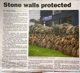
Newspaper, Stone Walls protected, 2015
Dry stone construction as a technique is used for much more than paddock walls. Across the volcanic plains of western Victoriaare marvelous sheep dips, stock loading ramps, huts, dams, retaining walls, and the rich and largely undiscovered heritage of indigenous dry stone structures. Dry stone walls indicate many aspects of our rural environment; the geological beginnings of the way the landscape was created, the patterns of early settlement by pastoralists and squatters, the types of stock that grazed the land and the methods of cattle and sheep management, of the efforts to thwart the spread of rabbits .... "For the casual but interested observer dry stone walls are good to look at, to photograph, to get up alongside and see the way they are constructed, to appreciate the varying shapes and sizes of stones and learn of the techniques of keeping often quite rounded stones in place. Apart from walls and other dry stone structures on grazing land we can also see dry stone techniques used in other places and in other phases of our history. Indigenous Australians have built, and continue to build, structures for shelter or hunting or trapping eels and fish in rivers and estuaries around the country. At spots around our coast line there is evidence of simple stone structures built by early maritime explorers. Prospectors in early mining encampments used dry stone construction to build retaining walls or the low walls of rudimentary shelters. If the future of dry stone walls in the Australian landscape is to be assured. wall owners and local governments have to accept and embrace their custodial role in assuring the preservation and celebration of walls. This is not an easy task, but, along with putting the necessary statutory mechanisms to ensure their retention, it is a task that must be pursued. The Dry Stone Walls Association of Australia has as its primary goal the increase in awareness of wall owners and local governments of the importance of dry stone walls. It also seeks to increase the level of training of skilled and semi skilled wallers, and the gaining of rudimentary skills by farmers so that they can maintain their own walls". Melton Star Weekly article about the Stone Wallslandscapes of significance -
 Melton City Libraries
Pamphlet, Dry Stone Wall Driving Trail, Unknown
"The dry stone walls provide a tangible link to the area’s white settlement, and they remain a symbol of the profound change in land usage from the original Kulin custodians to the European arrivals of the nineteenth century. The bulk of dry stone wall construction in Victoria occurred between the 1850s and 1880s. The gold rush of the early 1850s in particular inspired a flurry of construction. At this time, labour previously available for shepherding livestock dried up, as men gravitated to the goldfields to seek their fortunes. This necessitated the building of fencing to contain the district’s growing number of sheep, cattle and horses. An explosion in surveying, subdivision and the sale of Crown lands also contributed to a boost in construction. Government regulations that punished pastoralists for allowing their livestock to stray provided further incentive to fence-off previously open expanses of land. The major benefit of this type of fencing was that it utilised the materials at hand; the plentiful grey basalt that scattered the landscape. In the case of the dry stone walls built around Melton, the characteristic round or oval shape of the volcanic fieldstones on the western plains inspired some distinctive designs.54 Another advantage of dry stone walls was their ability to withstand the ravages of flood, fire and drought often experienced in the district. This durability accounts for the fact that many of these fences still exist today". Dry Stone Wall trail brochure/pamphlet for visitors provided by Melton Visitor Information Centrecouncil, landscapes of significance -
 Wodonga & District Historical Society Inc
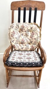
Furniture - Haeusler Family Rocking chair
The Wodonga Historical Society Haeusler Collection provides invaluable insight into life in late nineteenth and early twentieth century north east Victoria. The collection comprises manuscripts, personal artefacts used by the Haeusler family on their farm in Wodonga, and a set of glass negatives which offer a unique visual snapshot of the domestic and social lives of the Haeusler family and local Wodonga community. The Haeusler family migrated from Prussia (Germany) to South Australia in the 1840s and 1850s, before purchasing 100 acres of Crown Land made available under the Victorian Lands Act 1862 (also known as ‘Duffy’s Land Act’) in 1866 in what is now Wodonga West. The Haeusler family were one of several German families to migrate from South Australia to Wodonga in the 1860s. The Collection also depicts development of life in Wodonga through the eyes of one family, through a collection of artefacts, diaries, letters and photographs. This item is from the Hauseler Collection which documents social life of early settlers in the Wodonga community.An old wooden rocking chair, The chair was originally home manufactured from timber. The back slats have been repaired and replaced by metal slats attached at the top and base of the backrest section.early settlement wodonga, haeusler family of wodonga -
 Wodonga & District Historical Society Inc
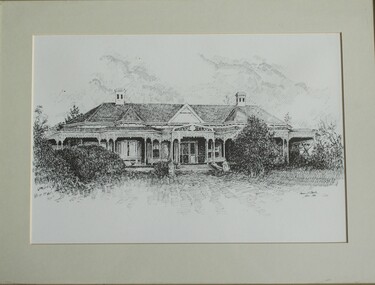
Drawing - Cambourne House, Kevin P. Clark, 1984
Cambourne homestead was built by 1903 for Rebecca S. Carkeek, who purchased the property in Wodonga in 1899. Cambourne is situated on the original Wodonga run which was established in 1836. The township of Belvoir, later renamed as Wodonga. In 1855 the pre-emptive right of 171 acres of the Wodonga run was granted and sold the following year. The allotments on which the five-acre Cambourne property developed, were purchased in 1873 and 1876, coinciding with the opening of the railway from Melbourne. The property was purchased by Rebecca Carkeek in June 1899, wife of William Carkeek, publican of Wodonga and shire councillor. Local architects Gordon and Gordon have been credited with the design of Cambourne. The house at Cambourne was built at some stage between 1900 and 1903 as a large single storey homestead. It was constructed in red brick with corrugated iron roof and encircling verandah. Cambourne is a probable work of architects Gordon and Gordon, it is amongst their best preserved and one of their few surviving buildings in Victoria. Today Cambourne remains on a reduced allotment due to the acquisition of land in 1972 by the Country Roads Board and in 2006 by Vic Roads for road works adjacent to the property.This drawing is significant as a representation of Cambourne in Wodonga. Cambourne is of historical significance due to its links with the early settlement of the district and as an example of closer settlement which occurred in regional centres of the State. Cambourne, Wodonga is also of architectural significance as a largely intact late Victorian style house with elaborate decorative cast iron work and distinctive transverse plan. As a probable work of architects Gordon and Gordon, it is amongst their best preserved and one of their few surviving buildings in Victoria. A framed drawing of historic home, Cambourne in Wodonga. The drawing has been mounted and framed.On bottom right corner" Kevin P. Clark 1984"cambourne wodonga, gordon and gordon architects, historic buildings wodonga, heritage buildings wodonga -
 Wodonga & District Historical Society Inc
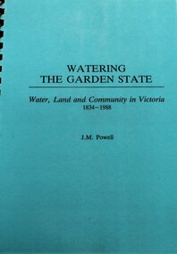
Book - Watering the Garden State - Water, Land and Community in Victoria 1834-1988, J.M. Powell
This publication traces the importance of water resources to Australian society, with reference to the state of Victoria. It relates the history from 1834 including topics such as community adaptation to settlement planning for squatters, miners, immigrants and colonials; conservation and water management; expansion and consolidation of statutory bodies following the creation of the Department of Water Resources in 1984; and finally the effects of regionalism, environmentalism, urban conflict and institutional reform. It includes an appendix containing a brief chronology of significant events regarding water from 1853 to 1987.Spiral bound booklet with laminated covernon-fiction This publication traces the importance of water resources to Australian society, with reference to the state of Victoria. It relates the history from 1834 including topics such as community adaptation to settlement planning for squatters, miners, immigrants and colonials; conservation and water management; expansion and consolidation of statutory bodies following the creation of the Department of Water Resources in 1984; and finally the effects of regionalism, environmentalism, urban conflict and institutional reform. It includes an appendix containing a brief chronology of significant events regarding water from 1853 to 1987.water resources development, water-supply -- victoria -- history., water victoria -
 Wodonga & District Historical Society Inc
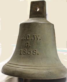
Functional object - Gordon Family Orchard Bell
The Gordons were architects and were associated with many buildings still standing in Albury and Wodonga, St Patrick's Church and the de Kerilleau Homestead among them. They established Vermont Orchard on 74 acres to the south of the Wodonga settlement. Here they grew fruit and nuts for the domestic and export market. The enterprising family also set about transforming some of the land by clearing it, creating streets and making general improvements. It was the biggest subdivision in Wodonga at the time. The 234 allotments in the Wodonga Estate were put up for sale by auction in May 1890. A total of 200 people were said to have attended. Gordon, William, Charles and Vermont streets in Wodonga are named after the family. This bell was used at the Vermont orchard to signal the beginning and end of the working day, as well as lunch breaks.The Gordon Family orchard bell is made of cast iron. It includes the inscription "J. C. W../G./1858." This is thought to represent the initials of John Gordon and sons Walter Joseph and Charles Goodwin Sylvester Gordon. There is some conjecture about this due to the date "1858". John was born in London, England in 1823 and died in 1880. Walter is generally accepted to have been born in 1857 and died 1903. In one family tree Charles is recorded as being born on 28 January 1858 but his birth was registered in 1860. The mystery of the date is therefore not fully resolved.On one side of the bell "J. C. W../G./1858."gordon family wodonga, gordon and gordon architects, vermont wodonga -
 Whitehorse Historical Society Inc.
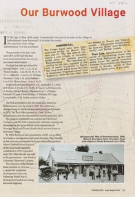
Article - The Bulletin newsletter, The Bulletin Jun - Aug 2022, Our Burwood Village, June 2022
An article about the first settlement surveyed in 1858 in the Burwood area known as Ballyshanassy. It later became Norwood and finally Burwood in 1879.An article about the first settlement surveyed in 1858 in the Burwood area known as Ballyshanassy. It later became Norwood and finally Burwood in 1879.An article about the first settlement surveyed in 1858 in the Burwood area known as Ballyshanassy. It later became Norwood and finally Burwood in 1879.ballyshanassy, albers ernest, boundary road burwood east, dempsey -
 Whitehorse Historical Society Inc.
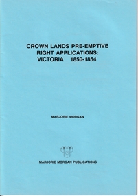
Administrative record - Crown Land Valuations and Applications, Government Printer - John FERRES, Crown Lands Pre-emptive Right Applications: Victoria 1850-1854, 1855
Contains a valuation for Crown Lands applications under pre-emptive right by Victorian county, giving names of applicants name of run, area, and remarks.Contains a valuation for Crown Lands applications under pre-emptive right by Victorian county, giving names of applicants name of run, area, and remarks. Contains a valuation for Crown Lands applications under pre-emptive right by Victorian county, giving names of applicants name of run, area, and remarks. clarke andrew, anglesey, evelyn, bourke, dalhousie, dundas, follett, grant, hampden, heytesbury, normanby, polwarth, ripon, talbot, villiers, district of murray, district of wimmera, district of western port, early settlement, mornington -
 Port Melbourne Historical & Preservation Society
Book, Life on the bend, Jul 2017
"Life on the bend" Oblong book. Front cover photographs on blue background. Back cover blue with context logo.. Book explores 8 themes including industry, early settlement, identity ."Life on the bend" social history of Fishermans Bend Melbournebuilt environment - industrial, natural environment, fishermans bend -
Lakes Entrance Historical Society
Book, Auer Valerie, Tubbut - Notes on History of Tubbut district - Prepared for School Jubilee 1941-1991, 1991
Notes on the settlement of Tubbut, East Gippsland, Victoria, particularly since 1929 when the Land Board opened this isolated area for selection. Extracts from minutes of Tubbut Hall Committee, reminiscences of school teachers, some photograph.settlers, schools -
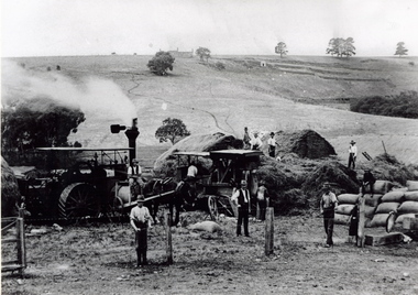 Sunbury Family History and Heritage Society Inc.
Photograph, The Nook
The photograph was taken in The Nook. Terence O'Brien rented the land from Goonawarra from the 1890s to 1905 where he grew cereal crops. The terraces on the hillside were built to grow vines when the property was one of the first vineyards in the area. The men in the image are from L-R: Mr. Heath in the white cutter owned the chaff cutter, John Leyden with hand on fence, Michael Dillon, Terence O'Brien and Phil Ratile are on top of the haystack, Andy Burke standing with hand on hip.The growing and harvesting of cereal crops was an important agricultural industry in the early days of Sunbury's settlement by both the Indigenous People and Europeans.A non-digital photograph black and white photograph of eleven men gathering hay with the aid of a steam traction engine in a wide open valley. A hillside in the distance has been terraced and there is a house on the hill in the distance.the nook, terence o'brien, andy burke, mr. heath, michael dillon, philratile, goonawarra, vineyards -
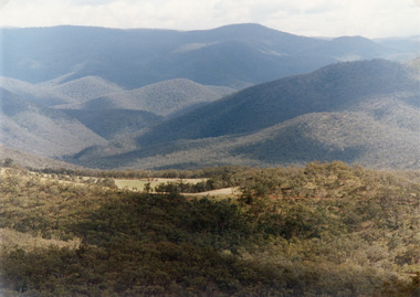 Lakes Entrance Historical Society
Photograph - Suggan Buggan, Tambo Shire, 1994 c
Also second identical copyColour photograph of the scenery in Suggan Buggan, showing very heavily forested mountainous country, a small area of cleared land centre left foreground. Suggan Buggan Victoriasettlement, agriculture, topography