
Showing 697 items matching "recreational"
-
 Eltham District Historical Society Inc
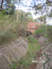
Photograph, Liz Pidgeon, Heritage Excursion; Maroondah Aqueduct, 3 September 2016, 3 September 2016
... The section of the aqueduct through the Eltham area has been abandoned since the 1980s but the open channel has largely been retained. A recreational path follows the aqueduct reserve. ...The section of the aqueduct through the Eltham area has been abandoned since the 1980s but the open channel has largely been retained. A recreational path follows the aqueduct reserve. ...Newsletter No., 229, August 2016 Heritage Excursion - Maroondah Aqueduct Walk - Saturday 3rd September The Maroondah Aqueduct was once a major link in Melbourne’s water supply system. It was built between 1886 and 1891 to transfer water from the Watts River near Healesville to the Preston Reservoir. It was 66 km in length, made up of 41 km of open channel, 10 km of tunnel through hills and 15 km of pipeline across stream valleys known as inverted siphons. The section of the aqueduct through the Eltham area has been abandoned since the 1980s but the open channel has largely been retained. A recreational path follows the aqueduct reserve. For our excursion on 3rd September we intend to walk along the section of the aqueduct adjacent to Allendale Road. This is a section not visited on previous excursions and includes the transition from open channel to the inverted siphon across the Diamond Creek valley. Apart from the aqueduct itself the main feature of the walk is the extensive views across Eltham North and Diamond Creek. Along the way we will talk about the history of the aqueduct and the area. This easy walk is about 3 km return and will take 2 to 2.5 hours. It will start at 2pm at the junction of Allendale Road with Godber Road and Zig Zag Road North, officially Diamond Creek, but on the northern boundary of Eltham. (Melway ref.12 B10). Born Digitalmaroondah aqueduct, eltham north, activities, eltham district historical society, heritage excursion -
 Eltham District Historical Society Inc
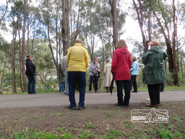
Photograph, Liz Pidgeon, Heritage Excursion; Maroondah Aqueduct, 3 September 2016, 3 September 2016
... The section of the aqueduct through the Eltham area has been abandoned since the 1980s but the open channel has largely been retained. A recreational path follows the aqueduct reserve. ...The section of the aqueduct through the Eltham area has been abandoned since the 1980s but the open channel has largely been retained. A recreational path follows the aqueduct reserve. ...Newsletter No., 229, August 2016 Heritage Excursion - Maroondah Aqueduct Walk - Saturday 3rd September The Maroondah Aqueduct was once a major link in Melbourne’s water supply system. It was built between 1886 and 1891 to transfer water from the Watts River near Healesville to the Preston Reservoir. It was 66 km in length, made up of 41 km of open channel, 10 km of tunnel through hills and 15 km of pipeline across stream valleys known as inverted siphons. The section of the aqueduct through the Eltham area has been abandoned since the 1980s but the open channel has largely been retained. A recreational path follows the aqueduct reserve. For our excursion on 3rd September we intend to walk along the section of the aqueduct adjacent to Allendale Road. This is a section not visited on previous excursions and includes the transition from open channel to the inverted siphon across the Diamond Creek valley. Apart from the aqueduct itself the main feature of the walk is the extensive views across Eltham North and Diamond Creek. Along the way we will talk about the history of the aqueduct and the area. This easy walk is about 3 km return and will take 2 to 2.5 hours. It will start at 2pm at the junction of Allendale Road with Godber Road and Zig Zag Road North, officially Diamond Creek, but on the northern boundary of Eltham. (Melway ref.12 B10). Born Digitalmaroondah aqueduct, eltham north, activities, eltham district historical society, heritage excursion, aqueduct trail -
 Eltham District Historical Society Inc
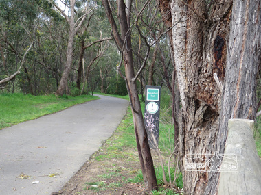
Photograph, Liz Pidgeon, Heritage Excursion; Maroondah Aqueduct, 3 September 2016, 3 September 2016
... The section of the aqueduct through the Eltham area has been abandoned since the 1980s but the open channel has largely been retained. A recreational path follows the aqueduct reserve. ...The section of the aqueduct through the Eltham area has been abandoned since the 1980s but the open channel has largely been retained. A recreational path follows the aqueduct reserve. ...Newsletter No., 229, August 2016 Heritage Excursion - Maroondah Aqueduct Walk - Saturday 3rd September The Maroondah Aqueduct was once a major link in Melbourne’s water supply system. It was built between 1886 and 1891 to transfer water from the Watts River near Healesville to the Preston Reservoir. It was 66 km in length, made up of 41 km of open channel, 10 km of tunnel through hills and 15 km of pipeline across stream valleys known as inverted siphons. The section of the aqueduct through the Eltham area has been abandoned since the 1980s but the open channel has largely been retained. A recreational path follows the aqueduct reserve. For our excursion on 3rd September we intend to walk along the section of the aqueduct adjacent to Allendale Road. This is a section not visited on previous excursions and includes the transition from open channel to the inverted siphon across the Diamond Creek valley. Apart from the aqueduct itself the main feature of the walk is the extensive views across Eltham North and Diamond Creek. Along the way we will talk about the history of the aqueduct and the area. This easy walk is about 3 km return and will take 2 to 2.5 hours. It will start at 2pm at the junction of Allendale Road with Godber Road and Zig Zag Road North, officially Diamond Creek, but on the northern boundary of Eltham. (Melway ref.12 B10). Born Digitalmaroondah aqueduct, eltham north, activities, eltham district historical society, heritage excursion, aqueduct trail -
 Eltham District Historical Society Inc
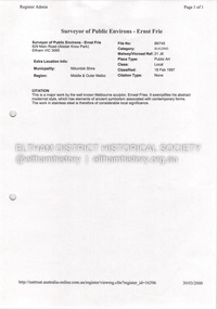
Document - Property Binder, 855 Main Road, Eltham
... Individual Research Project, Catherine Loftus-Hills 1982: To what extent is the Eltham Town Park successful in providing a recreational facility for the entire community? ...Individual Research Project, Catherine Loftus-Hills 1982: To what extent is the Eltham Town Park successful in providing a recreational facility for the entire community? ...Individual Research Project, Catherine Loftus-Hills 1982: To what extent is the Eltham Town Park successful in providing a recreational facility for the entire community? Newspaper article: Diamond Valley News, 24 August 1982, Byways of History, Early view of Little Eltham, illustrated by photograph sometime 1902-1920. Newspaper article: Diamond Valley News, 24 August 1982, Pauline thrives on work, Australian Labor Party member of Victorian parliament. Newspaper article: unidentified, undated: Many attempts to change name, letter from Frank Burgoyne. Newspaper article: unidentified, undated: Anger over park renaming. Photocopy letter from Office of the Place Names Committee to Eltham and District Historical Society, 25 February 1982, stating naming of Eltham Town Park, not Alistair Knox Park. Newspaper article: Former shire president honoured, Diamond Valley News, Tuesday September 9, 1986, p3 (on rverse page an advertisement for Research Mowers & Chainsaws National Trust Public Art Register: Citation, 18 February 1997, of major work by sculptor Ernst Frie. Newspaper article: Diamond Valley Leader, 8 June 2005, Sign not before time, erection of Welcome to Eltham Town sign made by Greg Bebbington and Hamish Knox. Newspaper article: Diamond Valley News, 9 June 2005, p3, Former shire president honoredmain road, eltham, businesses, public art, ernst frie, eltham town park, alistair knox park, j m holloway, pauline toner, catherine loftus-hills, greg bebbington, hamish knox, frank lynch, greg johnson, advertising, research mowers & chainsaws -
 Kiewa Valley Historical Society
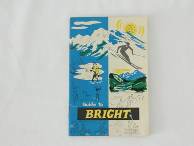
Pamphlet - Bright Tourism, Guide to Bright and District, late 1900s
... In the late 1900s, however, with the increase to workers' recreational leave and better transportation (fares, ease of travel to overseas destinations) the local tourism numbers from other domestic locations have been steadily declining. ...In the late 1900s, however, with the increase to workers' recreational leave and better transportation (fares, ease of travel to overseas destinations) the local tourism numbers from other domestic locations have been steadily declining. ...This publication was produced in the early 1950s to provide the growing tourism trade (at this time), to the region with a more detailed overview of the facilities available to tourists of the region's attractions. This brochure is a very efficient and effective promotional publication. The increasing level of self promotion by local business and commerce sectors of the region the more sought after the region became and the greater the ability of the region to grow (non rural based economy). Some of the regions unique facilities and geological structures are well suited to those tourists who live in cities and "flat land" regional bush areas within Australia. This was a period when the average Australian domestic tourist was more able (finance and transport wise) to see more of their country within the short time they had for "holidays". In the late 1900s, however, with the increase to workers' recreational leave and better transportation (fares, ease of travel to overseas destinations) the local tourism numbers from other domestic locations have been steadily declining. From the 1970s onwards, the increased tourism demand from overseas tourists, for better facilities and easier access to these regional facilities, resulted in better transport, accommodation and communication, which has been a boon for all tourism within Australia. In the 21st century the world is becoming smaller and smaller for the international tourist, especially for those from crowded Asian cities. The greater attraction for "open" spaced locations such as this region are becoming a much sought after change of scenery. This pamphlet which targets the tourist, whether either from other Australian regions or the global tourist, is a good example of self promotion by a relatively small local population. This is especially significant because before the "tourist explosion" in the 1950s onward, these regional areas had a more introspective society with greater emphasis to locally established mores and values. The increased interactions with people from other areas and nations, combined with a greater global communication network is affecting those traditionally established mores to produce a some what unique social transformation which is constantly changing from one generation to the next. One important factor which tourism does bring is that it opens up the region to a wider range of people who look to the region for their own lifestyle changes.This pamphlet has a front cover in colour with the major activities in the region sketched depicting : sunshine, snow skiing, trout fishing, mountain climbing, golfing, swimming, alpine views, tennis, lawn bowls and picnics. The back cover is blank. The pamphlet is fastened together by two staples 30mm from top and bottom, and is folded with the cover slightly thicker than the fifteen pages. Thirteen pages have been printed on both sides. The first page has a black and white photograph of the hotel Alpine and the tall brick constructed Clock Tower. There are another five black and white photographs in the pamphlet.on front cover "Guide to BRIGHT"local tourism, regional information booklet, "time" related brochures, alpine local history -
 Broadmeadows Historical Society & Museum
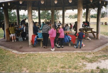
Photograph - Group Photograph, Picnic Under the Pavilion, 1990
... This photograph documents a moment from the 1990 Jacana Primary School Christmas picnic, likely held at Greenvale Reservoir Park, a popular recreational area in Melbourne’s northern suburbs. ...This photograph documents a moment from the 1990 Jacana Primary School Christmas picnic, likely held at Greenvale Reservoir Park, a popular recreational area in Melbourne’s northern suburbs. ...This photograph documents a moment from the 1990 Jacana Primary School Christmas picnic, likely held at Greenvale Reservoir Park, a popular recreational area in Melbourne’s northern suburbs. The image shows students, families, and staff gathered under a wooden pavilion, engaging in festive activities that marked the end of the school year. Jacana Primary School was established in 1959 to serve the growing suburban community of Jacana, part of Melbourne’s post-war urban expansion. The school became a central institution in the area, not only for education but also for fostering social bonds among families from diverse backgrounds. Annual events like the Christmas picnic were key to the school’s ethos, promoting inclusivity, celebration, and connection to nature. Greenvale Reservoir Park, where the picnic was likely held, offered a scenic and accessible venue for such gatherings. Its open spaces and family-friendly amenities made it an ideal location for school events, reinforcing the school’s commitment to outdoor learning and community engagement. The photograph is historically significant as it reflects broader trends in public education during the late 20th century in Melbourne’s outer suburbs—particularly the role of schools in building community identity and supporting intergenerational relationships. It also captures the spirit of Jacana Primary School before its closure in the early 2000s, preserving a visual memory of its contribution to local life.This photograph, taken during the 1990 Jacana Primary School Christmas picnic at Greenvale Reservoir Park, holds cultural and historical significance as a visual record of community life and educational values in Melbourne’s northern suburbs during the late 20th century. It captures a moment of joyful gathering under a wooden pavilion, where students, families, and staff came together to celebrate the end of the school year. Jacana Primary School, established in 1959, served as a cornerstone of the Jacana community until its closure in the early 2000s. Events such as the annual Christmas picnic were central to the school’s identity, fostering inclusiveness, friendship, and a strong sense of belonging. The choice of Greenvale Reservoir Park reflects the school’s connection to local landscapes and its commitment to accessible, outdoor learning experiences. The image is significant not only for its depiction of school traditions but also for its broader representation of how public education in Melbourne’s outer suburbs supported social cohesion, local identity, and intergenerational connection. It stands as a testament to the enduring values of joy, community, and inclusivity that defined Jacana Primary School and its legacy within the region.Photograph on glossy paper of a group children in the park.PH18289 (crossed out) PH-4209 (crossed out) PH-4868jacana primary school, christmas picnic, 1990, jacana, christmas party -
 Broadmeadows Historical Society & Museum
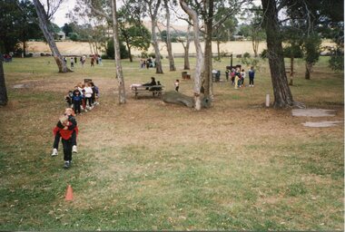
Photograph - Group Photograph, Piggyback Races, 1990
... This photograph, taken during the 1990 Jacana Primary School Christmas picnic, captures children participating in a piggyback race in a park setting—likely Greenvale Reservoir Park, a well-known recreational area in Melbourne’s northern suburbs. ...This photograph, taken during the 1990 Jacana Primary School Christmas picnic, captures children participating in a piggyback race in a park setting—likely Greenvale Reservoir Park, a well-known recreational area in Melbourne’s northern suburbs. ...This photograph, taken during the 1990 Jacana Primary School Christmas picnic, captures children participating in a piggyback race in a park setting—likely Greenvale Reservoir Park, a well-known recreational area in Melbourne’s northern suburbs. The image shows students actively engaged in playful competition, with a red cone marking the race course and groups of children and adults scattered throughout the background. Jacana Primary School, established in 1959 and closed in the early 2000s, was a central institution in the Jacana community. Events like the annual Christmas picnic were key to the school’s culture, offering students opportunities to celebrate the end of the school year through games, social interaction, and outdoor fun. These activities fostered a sense of camaraderie, physical engagement, and community spirit. The use of Greenvale Reservoir Park reflects the school’s commitment to accessible, natural spaces that supported inclusive and active learning experiences. The park’s open layout and family-friendly environment made it an ideal venue for school-wide gatherings that encouraged participation across age groups. This image is historically significant as it illustrates the role of public education in promoting social cohesion, physical wellbeing, and community identity in Melbourne’s outer suburbs during a period of suburban development. It also serves as a visual record of Jacana Primary School’s emphasis on joyful, shared experiences that extended beyond the classroom.This photograph, taken during the 1990 Jacana Primary School Christmas picnic, is a vivid representation of the school’s commitment to joyful, inclusive, and active community events. It captures children participating in a piggyback race on the grassy grounds of what is likely Greenvale Reservoir Park, with other students, families, and staff visible in the background enjoying the day’s festivities. Jacana Primary School, established in 1959 and closed in the early 2000s, played a vital role in the social and educational life of the Jacana community. Annual events such as the Christmas picnic were central to the school’s culture, offering opportunities for students to engage in physical play, build friendships, and celebrate the end of the school year in a relaxed, outdoor setting. The image is historically significant as it reflects the broader role of public education in Melbourne’s outer suburbs during a period of suburban expansion. It illustrates how schools like Jacana Primary fostered social cohesion, community identity, and intergenerational connection through shared traditions and accessible public spaces. The photograph stands as a testament to the enduring values of fun, participation, and community that defined the school’s legacy.Photograph on glossy paper of a group children in the park.PH18289 (crossed out) PH-4209 (crossed out) PH-4868jacana primary school, christmas picnic, 1990, jacana, christmas party -
 Broadmeadows Historical Society & Museum
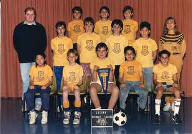
Photograph - Team Photograph, Jacana Primary School: Soccer Premiers 1990
... The sport’s popularity mirrored the cultural heritage of many students, making it both a recreational and symbolic activity. The 1990 Soccer Premiers photograph captures a moment of triumph and togetherness during this dynamic period. ...The sport’s popularity mirrored the cultural heritage of many students, making it both a recreational and symbolic activity. The 1990 Soccer Premiers photograph captures a moment of triumph and togetherness during this dynamic period. ...Jacana Primary School, established in 1959 amid Melbourne’s post-war suburban expansion, was a cornerstone of the Jacana community for over four decades. Built to serve families settling in newly developed housing estates in the northern corridor, the school quickly became a hub for education, inclusion, and community connection. Its student population reflected the area’s growing diversity, with many migrant families contributing to a vibrant and evolving school culture. By the late 1980s, Jacana Primary had earned recognition not only for its academic programs but also for its strong commitment to extracurricular activities. Soccer, in particular, emerged as a defining feature of school life. It united students across cultural and social backgrounds, fostering teamwork, resilience, and a deep sense of school pride. The sport’s popularity mirrored the cultural heritage of many students, making it both a recreational and symbolic activity. The 1990 Soccer Premiers photograph captures a moment of triumph and togetherness during this dynamic period. More than a record of athletic success, it embodies the school’s values of inclusion, participation, and community spirit. It stands as a testament to Jacana Primary’s role in nurturing personal growth and social cohesion through sport. Though Jacana Primary School closed in the early 2000s, its legacy lives on in images like this—offering a window into the lived experiences of students and the social fabric of Melbourne’s northern suburbs during a time of transformation.The 1990 Soccer Premiers photograph from Jacana Primary School is a culturally and historically significant artifact that reflects the school’s role as a vital educational and social institution in Melbourne’s northern suburbs. Established in 1959 during a period of rapid suburban development, Jacana Primary served a diverse and growing community, including many migrant families whose cultural backgrounds enriched the school’s identity. This image captures more than a moment of sporting success—it embodies the inclusive spirit, resilience, and camaraderie that defined Jacana Primary’s approach to education. Soccer was a central part of school life, bridging cultural divides and fostering a sense of belonging among students. The photograph stands as a testament to the school’s commitment to holistic development, where extracurricular activities played a key role in shaping character and community cohesion. Although Jacana Primary School closed in the early 2000s, its legacy endures through visual records like this one, offering valuable insight into the lived experiences of students and the evolving social fabric of Melbourne’s northern corridor during a transformative era.A colour photograph on Matte embossed photo paper.PH-5339(blue label) This paper/ Manufactured/ By Kodakjacana primary school, photograph, school photograph, education, soccer team, 1990, jacana -
 Melbourne Legacy
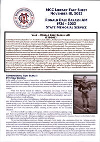
Document, MCC Library Fact Sheet Ronald Dale Barassi AM State Memorial Service, 2023
... Legacy assisted with his education and health expenses and supported him in attending youth camps and other recreational activities. A State Memorial Service for Ron was held at the Melbourne Cricket Ground on November 10. ...Legacy assisted with his education and health expenses and supported him in attending youth camps and other recreational activities. A State Memorial Service for Ron was held at the Melbourne Cricket Ground on November 10. ...A fact sheet on Ron Barassi compiled by the MCC Library for the State Memorial Service held on 10 November. It lists Ron Barassi's football career. Australian football legend, former ‘Legacy Boy’ and Ambassador, Ronald Dale Barassi, AM passed away at the age of 87 on 6 September. Ron was forever grateful for Legacy’s support to him and his mother Elza. Throughout his life, as a Legacy Ambassador, Ron generously used his well-respected status and networks to promote the important work of Legacy. Ron came into Legacy’s care as a child when his father Ronald James Barassi was killed in action at Tobruk in 1941. Ron’s father was the first VFL footballer killed in World War II. Only 5 years old at the time, Ron later rose to be a star footballer for the Melbourne Football club like his father. Legacy assisted with his education and health expenses and supported him in attending youth camps and other recreational activities. A State Memorial Service for Ron was held at the Melbourne Cricket Ground on November 10. Staff from Legacy assisted at the service by handing out programmes and encouraging attendees to sign condolence books which have since been presented to the Barassi family. Legacy was honoured by the Barassi family’s request, in lieu of flowers, that members of the public make a donation to Legacy to assist families of veterans in need, a cause very dear to Ron’s heart. A record of the life of a man helped by Legacy.White A4 paper with printing created by the MCC Library for the State Memorial Service on 10 November 2023.ron barassi, football -
 Melbourne Legacy
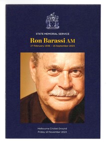
Booklet, Ronald Dale Barassi AM State Memorial Service, 2023
... Legacy assisted with his education and health expenses and supported him in attending youth camps and other recreational activities. A State Memorial Service for Ron was held at the Melbourne Cricket Ground on November 10. ...Legacy assisted with his education and health expenses and supported him in attending youth camps and other recreational activities. A State Memorial Service for Ron was held at the Melbourne Cricket Ground on November 10. ...A programme for the State Memorial Service held on 10 November 2023 for Ron Barassi at the MCG. It lists the order of service and some facts on Ron's life. Australian football legend, former ‘Legacy Boy’ and Ambassador, Ronald Dale Barassi, AM passed away at the age of 87 on 6 September. Ron was forever grateful for Legacy’s support to him and his mother Elza. Throughout his life, as a Legacy Ambassador, Ron generously used his well-respected status and networks to promote the important work of Legacy. Ron came into Legacy’s care as a child when his father Ronald James Barassi was killed in action at Tobruk in 1941. Ron’s father was the first VFL footballer killed in World War II. Only 5 years old at the time, Ron later rose to be a star footballer for the Melbourne Football club like his father. Legacy assisted with his education and health expenses and supported him in attending youth camps and other recreational activities. A State Memorial Service for Ron was held at the Melbourne Cricket Ground on November 10. Staff from Legacy assisted at the service by handing out programmes and encouraging attendees to sign condolence books which have since been presented to the Barassi family. Legacy was honoured by the Barassi family’s request, in lieu of flowers, that members of the public make a donation to Legacy to assist families of veterans in need, a cause very dear to Ron’s heart. A record of the life of a man helped by Legacy.Coloured A5 booklet x 8 pages with printing created for the State Memorial Service on 10 November 2023.ron barassi, football -
 Department of Health and Human Services
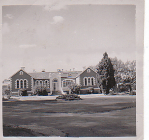
Photograph, Front of building and roundabout of Pleasant Creek Special School - Stawell - Circa 1940 to 1950
... From the 1950s to the 1980s, there were several building developments: •1957, Lonsdale Unit expanded capacity to 113 •1969, Bellfield and Fyans Units increased numbers to 196 •1977, Alexandra Unit converted to recreational and lecture room facility. •1977, Day Centre, Nurses' Home and Clinical Services Administration buildings •1985, Nara Unit closed for renovations and residents moved to the previous staff living quarters. https://www.findingrecords.dhhs.vic.gov.au/CollectionResultsPage/Pleasant-Creek-Colony...From the 1950s to the 1980s, there were several building developments: •1957, Lonsdale Unit expanded capacity to 113 •1969, Bellfield and Fyans Units increased numbers to 196 •1977, Alexandra Unit converted to recreational and lecture room facility. •1977, Day Centre, Nurses' Home and Clinical Services Administration buildings •1985, Nara Unit closed for renovations and residents moved to the previous staff living quarters. https://www.findingrecords.dhhs.vic.gov.au/CollectionResultsPage/Pleasant-Creek-Colony Front of building and roundabout of Pleasant Creek Special School - Stawell - Circa 1940 to 1950. ...Pleasant Creek Colony history in brief Warning about distressing information Patient information Disclaimer Source On this page: Pleasant Creek Colony history in brief Warning about distressing information Patient information Disclaimer Source Pleasant Creek Colony history in brief In 1861, the Pleasant Creek Hospital opened as a medical facility for the population of Stawell and district. Another building was added in 1904, Syme Ward for convalescent patients. In 1933, the facility was replaced by a newly-built hospital in the town of Stawell. In 1934, the Mental Hygiene Department acquired the old Pleasant Creek Hospital site and converted it to accommodate children with disabilities, which became Pleasant Creek Special School. The first residents (18 boys) were admitted in 1937 from Royal Park Depot. At the end of 1937, there were 98 children living at Pleasant Creek. In 1968 the Pleasant Creek Special School was renamed Pleasant Creek Training Centre, caring for people with intellectual disabilities. From the 1950s to the 1980s, there were several building developments: •1957, Lonsdale Unit expanded capacity to 113 •1969, Bellfield and Fyans Units increased numbers to 196 •1977, Alexandra Unit converted to recreational and lecture room facility. •1977, Day Centre, Nurses' Home and Clinical Services Administration buildings •1985, Nara Unit closed for renovations and residents moved to the previous staff living quarters. https://www.findingrecords.dhhs.vic.gov.au/CollectionResultsPage/Pleasant-Creek-Colony -
 Melbourne Legacy
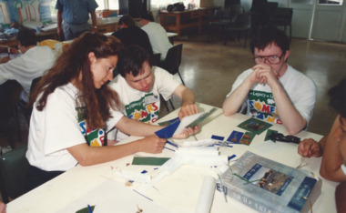
Photograph, HDC Camp 1992, 1991
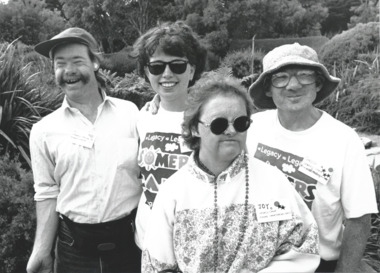
... Every month Legacy's handicapped dependents are invited to go on outings or take part in recreational and educational activities. These programmes aim to develop independence and thus lessen the need for reliance on others for simple routine functions. ...Every month Legacy's handicapped dependents are invited to go on outings or take part in recreational and educational activities. These programmes aim to develop independence and thus lessen the need for reliance on others for simple routine functions. ...Photos from a camp for handicapped dependents in January 1992. These photos show craft activities. One photo shows Chief Executive Terry Walsh with the children. Also a photo of a participant with the label 'Sharon proudly shows off her room'. Other photos from the camp are at 01561, 01562, 01563 and 01564. Some appeared in the newsletter in March 1992. The article mentions that the annual camps run for two weeks at Somers Camp (believed to be Somers School Camp). It is a wonderful gathering of Junior Legatees, Legatees, and dedicated helpers. 50 Legatees attended this camp with the personal attention almost one-to-one. With ages ranging from 22 to into the 60s, Legacy has to ensure it caters for the differing needs. Legatees headed by Camp Chief, Jim Hammon and Chairman of the Handicapped Dependents Committee, Merv Tickell, were supported by two Camp Co-Ordinators and 50 helpers known as 'leaders'. Many of the leaders are people in the workforce wishing to give something back to the community. Junior Legatees are organised into groups. They participate in horse-riding, swimming, golfing, strawberry picking, and many other activities. Every month Legacy's handicapped dependents are invited to go on outings or take part in recreational and educational activities. These programmes aim to develop independence and thus lessen the need for reliance on others for simple routine functions. Photos were in a scrapbook of photos spanning 1983 to 1992.A record of the type of activities Legacy provided for the handicapped dependents of the Legacy families. Colour photo x 6 of a HDC camp, a label and an article in the newsletter.Handwritten in blue pen 'HDC Camp -Somers / Jan 1992 / Camp Chief: L/ J Hammon / Co-ordinator Julien Hardy-Smith / PhotoEric Wadsworth / 51 J/Ls'junior legatee outing, hdc, somers camp -
 Melbourne Legacy
Photograph, HDC Camp 1992, 1992
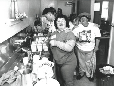
... Every month Legacy's handicapped dependents are invited to go on outing for take part in recreational and educational activities. These programmes aim to develop independence and thus lessen the need for reliance on others for simple routine functions. ...Every month Legacy's handicapped dependents are invited to go on outing for take part in recreational and educational activities. These programmes aim to develop independence and thus lessen the need for reliance on others for simple routine functions. ...Photos from a camp for handicapped dependents in January 1992. These photos show different camp activities, including arts and craft, eating meals, cleaning up in the kitchen and outside activities. Some appeared in the newsletter in March 1992. The article mentions that the annual camps run for two weeks at Somers Camp (believed to be Somers School camp). It is a wonderful gathering of Junior Legatees, Legatees, and dedicated helpers. 50 Legatees attended this camp with the personal attention almost one-to-one. With ages ranging from 22 to into the 60s, Legacy has to ensure it caters for the differing needs. Legatees headed by Camp Chief, Jim Hammon and Chairman of the Handicapped Dependents Committee, Merv Tickell, were supported by two Camp Co-Ordinators and 50 helpers known as 'leaders'. Many of the leaders are people in the workforce wishing to give something back to the community. Junior Legatees are organised into groups. They participate in horse-riding, swimming, golfing, strawberry picking, and many other activities. Every month Legacy's handicapped dependents are invited to go on outing for take part in recreational and educational activities. These programmes aim to develop independence and thus lessen the need for reliance on others for simple routine functions. Other photos from the camp are at 01560, 01561, and 01562 and 01564. Photos were in a scrapbook of photos spanning 1983 to 1992.A record of the type of activities Legacy provided for the handicapped dependents of the Legacy families. Black and white photo x 3 of a HDC camp, a label and an article in the newsletter.Handwritten in blue pen 'HDC Camp -Somers / Jan 1992 / Camp Chief: L/ J Hammon / Co-ordinator Julien Hardy-Smith / Photo Eric Wadsworth / 51 J/Ls'junior legatee outing, somers camp -
 Melbourne Legacy
Photograph, HDC Camp 1992, 1992
... Every month Legacy's handicapped dependents were invited to go on outings or take part in recreational and educational activities. These programmes aim to develop independence and thus lessen the need for reliance on others for simple routine functions. ...Every month Legacy's handicapped dependents were invited to go on outings or take part in recreational and educational activities. These programmes aim to develop independence and thus lessen the need for reliance on others for simple routine functions. ...Photos from a cam for handicapped dependents in January 1992. These photos show different camp activities, including arts and craft, eating meals, cleaning up in the kitchen and outside activities. Some appeared in the newsletter in March 1992. The article mentions that the annual camps run for two weeks at Somers Camp (believed to be Somers School Camp). It is a wonderful gathering of Junior Legatees, Legatees, and dedicated helpers. 50 Legatees attended this camp with the personal attention almost one-to-one. With ages ranging from 22 to into the 60s, Legacy has to ensure it caters for the differing needs. Legatees headed by Camp Chief, Jim Hammon and Chairman of the Handicapped Dependents Committee, Merv Tickell, were supported by two Camp Co-Ordinators and 50 helpers known as 'leaders'. Many of the leaders are people in the workforce wishing to give something back to the community. Junior Legatees are organised into groups. They participate in horse-riding, swimming, golfing, strawberry picking, and many other activities. Every month Legacy's handicapped dependents were invited to go on outings or take part in recreational and educational activities. These programmes aim to develop independence and thus lessen the need for reliance on others for simple routine functions. Other photos from the camp are at 01560, 01561, 01562 and 01563. Photos were in a scrapbook of photos spanning 1983 to 1991.A record of the type of activities Legacy provided for the handicapped dependents of the Legacy families. Black and white photo x 2 of a HDC camp, a label and an article in the newsletter.Handwritten in blue pen 'HDC Camp -Somers / Jan 1992 / Camp Chief: L/ J Hammon / Co-ordinator Julien Hardy-Smith / Photo Eric Wadsworth / 51 J/Ls'junior legatee outing, somers, somers camp -
 Kiewa Valley Historical Society
Maps - Bogong x2, Tawonga, Omeo, Dargo, Victoria and others, 1. Bogong Alpine Area; 2. Bogong 8324; 3. Tawonga Topographical; 4. Omeo 8433; 5. Dargo 8323; 6. Victoria State
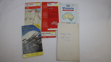
... Information for tourist in the Alpine National Park: Bogong Area. Including: recreational activities, history, weather and vegetation and a list of walks together with locality maps and photographs. ...Information for tourist in the Alpine National Park: Bogong Area. Including: recreational activities, history, weather and vegetation and a list of walks together with locality maps and photographs. ...1. Bogong Alpine Area (outdoor Leisure Map. survey & Mapping Victoria, Government of Victoria, Edition 2, reprinted 1991 with an image of Mt. Feathertop on the front. Information for tourist in the Alpine National Park: Bogong Area. Including: recreational activities, history, weather and vegetation and a list of walks together with locality maps and photographs. The front cover has an image of Mt Feathertop against a blue sky with yellow writing 'Bogong Alpine Area', there is a yellow triangular block on the right hand top corner with black writing 'Outdoor Leisure Map. On the bottom edge is a block of yellow with black writing 'Survey & Mapping Victoria' and a light green map of Victoria with 'VICMSP' printed in white. 2. 8324 Bogong Victoria, Edition 1, Commonwealth of Australia 1981. A topographical Map: 1:100,000 scale (1 cm to 1 KM). Map has a red cover with white writing together with a white block and black writing and a map insert. 3. Tawonga Topographical Map - Forests Commission Victoria, / revised 5/9/77, DEG No. 68-G/399. A Tawonga 803 folded map in a beige colour with the back blank. 4. Omeo 8433 Victoria, Edition 1, Department of Natural Resources. The map has a red and white cover with black writing and a simple map of Australia at the bottom. 5. 8323 Dargo, Edition 1, Commonwealth of Australia. A red and white cover with a map insert. 6. Victoria State Map, Hema Maps, 2002. Hema Maps, State Map, colourful cover with a map of Australia and four tourism photographs. Scale 1: 850,000 An inscription handwritten in blue pen "Trappers Gap to Mitta Mitta 1" to 1 mile". There are some pen markings and notations of tracks.maps, bogong, omeo, tawonga, dargo, victoria, bogong alpine area -
 Bendigo Historical Society Inc.
Document - Directions to Lake Eppalock with road descriptions and map
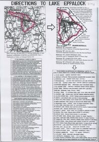
... The lake's water levels were low for approximately eight years between 2002 and 2010 during a prolonged drought, which restricted the amount of recreational activity until rainfall in the latter half of 2010 returned the lake to 100 percent capacity. ...The lake's water levels were low for approximately eight years between 2002 and 2010 during a prolonged drought, which restricted the amount of recreational activity until rainfall in the latter half of 2010 returned the lake to 100 percent capacity. ...John Perry Collection. Laminated copy of 'Directions to Lake Eppalock'. Gives directions in relationship of Lake Eppalock to Bendigo, Kyneton and Heathcote. Undated. Gives basic descriptions of bridges on lakebed, ford crossings on lakebed and inundated dwellings on lakebed. The dam was built by the State Rivers and Water Supply Commission of Victoria. The dam wall height is 45 metres (148 ft) and the main embankment is 1,041 metres (3,415 ft) long. At 100% capacity the dam wall was designed to hold back 304,651 megalitres (6.7014×10¹⁰ imp gal; 8.0480×10¹⁰ US gal) of water. The surface area of Lake Eppalock is 3,011 hectares (7,440 acres) and the catchment area is 2,124 square kilometres (820 sq mi). The controlled spillway is capable of discharging 8,040 cubic metres per second (284,000 cu ft/s). Lake Eppalock supplies both stock and domestic water to the Campaspe irrigation district. It also serves as a water supply to Bendigo and Heathcote and, in more recent times, Ballarat. The lake is a major attraction for those engaging in watersports, with a number of tourist parks and accommodation facilities available. Permissible activities on the lake include high-speed boating, water skiing, sailing, canoeing, fishing and swimming. The lake's water levels were low for approximately eight years between 2002 and 2010 during a prolonged drought, which restricted the amount of recreational activity until rainfall in the latter half of 2010 returned the lake to 100 percent capacity. Built between 1961 and 1964, Lake Eppalock remains the only water storage on the Campaspe River system.water, dam, directions, eppalock -
 Bendigo Historical Society Inc.
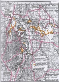
Map - Map of Lake Eppalock shoreline when empty
... The lake's water levels were low for approximately eight years between 2002 and 2010 during a prolonged drought, which restricted the amount of recreational activity until rainfall in the latter half of 2010 returned the lake to 100 percent capacity. ...The lake's water levels were low for approximately eight years between 2002 and 2010 during a prolonged drought, which restricted the amount of recreational activity until rainfall in the latter half of 2010 returned the lake to 100 percent capacity. ...John Perry Collection. Laminated copy of map detailing Lake Eppalock shoreline when empty. Circa 1951. Has colored highlighter lines following roads leading to lake shoreline and various inundated old roads and tracks on lakebed. The dam was built by the State Rivers and Water Supply Commission of Victoria. The dam wall height is 45 metres (148 ft) and the main embankment is 1,041 metres (3,415 ft) long. At 100% capacity the dam wall was designed to hold back 304,651 megalitres (6.7014×10¹⁰ imp gal; 8.0480×10¹⁰ US gal) of water. The surface area of Lake Eppalock is 3,011 hectares (7,440 acres) and the catchment area is 2,124 square kilometres (820 sq mi). The controlled spillway is capable of discharging 8,040 cubic metres per second (284,000 cu ft/s). Lake Eppalock supplies both stock and domestic water to the Campaspe irrigation district. It also serves as a water supply to Bendigo and Heathcote and, in more recent times, Ballarat. The lake is a major attraction for those engaging in watersports, with a number of tourist parks and accommodation facilities available. Permissible activities on the lake include high-speed boating, water skiing, sailing, canoeing, fishing and swimming. The lake's water levels were low for approximately eight years between 2002 and 2010 during a prolonged drought, which restricted the amount of recreational activity until rainfall in the latter half of 2010 returned the lake to 100 percent capacity. Built between 1961 and 1964, Lake Eppalock remains the only water storage on the Campaspe River system.map, eppalock, reservoir, lake, water -
 Bendigo Historical Society Inc.
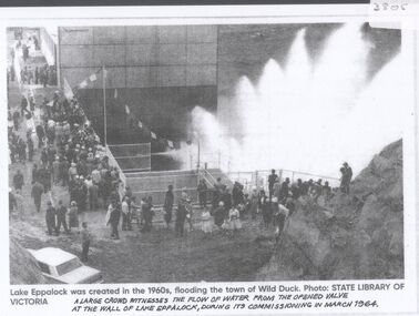
Document - Black and white laminated photo of flow of water from Lake Eppalock. 1964
... The lake's water levels were low for approximately eight years between 2002 and 2010 during a prolonged drought, which restricted the amount of recreational activity until rainfall in the latter half of 2010 returned the lake to 100 percent capacity. ...The lake's water levels were low for approximately eight years between 2002 and 2010 during a prolonged drought, which restricted the amount of recreational activity until rainfall in the latter half of 2010 returned the lake to 100 percent capacity. ...John Perry Collection. Laminated copy of photo of crowd watching flow of water from the opened valve at the wall of Lake Eppalock during its commissioning. March, 1964. Lake Eppalock was created by flooding to town of Wild Duck. The dam was built by the State Rivers and Water Supply Commission of Victoria. The dam wall height is 45 metres (148 ft) and the main embankment is 1,041 metres (3,415 ft) long. At 100% capacity the dam wall was designed to hold back 304,651 megalitres (6.7014×10¹⁰ imp gal; 8.0480×10¹⁰ US gal) of water. The surface area of Lake Eppalock is 3,011 hectares (7,440 acres) and the catchment area is 2,124 square kilometres (820 sq mi). The controlled spillway is capable of discharging 8,040 cubic metres per second (284,000 cu ft/s). Lake Eppalock supplies both stock and domestic water to the Campaspe irrigation district. It also serves as a water supply to Bendigo and Heathcote and, in more recent times, Ballarat. The lake is a major attraction for those engaging in watersports, with a number of tourist parks and accommodation facilities available. Permissible activities on the lake include high-speed boating, water skiing, sailing, canoeing, fishing and swimming. The lake's water levels were low for approximately eight years between 2002 and 2010 during a prolonged drought, which restricted the amount of recreational activity until rainfall in the latter half of 2010 returned the lake to 100 percent capacity. Built between 1961 and 1964, Lake Eppalock remains the only water storage on the Campaspe River system.water, dam, reservoir, eppalock, wild duck -
 Eltham District Historical Society Inc
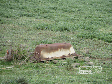
Photograph, Liz Pidgeon, Heritage Excursion; Maroondah Aqueduct, 3 September 2016, 3 September 2016
... The section of the aqueduct through the Eltham area has been abandoned since the 1980s but the open channel has largely been retained. A recreational path follows the aqueduct reserve. ...The section of the aqueduct through the Eltham area has been abandoned since the 1980s but the open channel has largely been retained. A recreational path follows the aqueduct reserve. ...Heritage Excursion - Maroondah Aqueduct Walk - Saturday 3rd September The Maroondah Aqueduct was once a major link in Melbourne’s water supply system. It was built between 1886 and 1891 to transfer water from the Watts River near Healesville to the Preston Reservoir. It was 66 km in length, made up of 41 km of open channel, 10 km of tunnel through hills and 15 km of pipeline across stream valleys known as inverted siphons. The section of the aqueduct through the Eltham area has been abandoned since the 1980s but the open channel has largely been retained. A recreational path follows the aqueduct reserve. For our excursion on 3rd September we intend to walk along the section of the aqueduct adjacent to Allendale Road. This is a section not visited on previous excursions and includes the transition from open channel to the inverted siphon across the Diamond Creek valley. Apart from the aqueduct itself the main feature of the walk is the extensive views across Eltham North and Diamond Creek. Along the way we will talk about the history of the aqueduct and the area. This easy walk is about 3 km return and will take 2 to 2.5 hours. It will start at 2pm at the junction of Allendale Road with Godber Road and Zig Zag Road North, officially Diamond Creek, but on the northern boundary of Eltham. (Melway ref.12 B10). Newsletter No., 229, August 2016 Abandoned and rusted house base probably purposed to water or feed cattle. Born Digitalmaroondah aqueduct, eltham north, activities, eltham district historical society, heritage excursion, bath, acqueduct trail -
 Eltham District Historical Society Inc
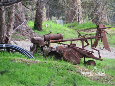
Photograph, Liz Pidgeon, Heritage Excursion; Maroondah Aqueduct, 3 September 2016, 3 September 2016
... The section of the aqueduct through the Eltham area has been abandoned since the 1980s but the open channel has largely been retained. A recreational path follows the aqueduct reserve. ...The section of the aqueduct through the Eltham area has been abandoned since the 1980s but the open channel has largely been retained. A recreational path follows the aqueduct reserve. ...Heritage Excursion - Maroondah Aqueduct Walk - Saturday 3rd September The Maroondah Aqueduct was once a major link in Melbourne’s water supply system. It was built between 1886 and 1891 to transfer water from the Watts River near Healesville to the Preston Reservoir. It was 66 km in length, made up of 41 km of open channel, 10 km of tunnel through hills and 15 km of pipeline across stream valleys known as inverted siphons. The section of the aqueduct through the Eltham area has been abandoned since the 1980s but the open channel has largely been retained. A recreational path follows the aqueduct reserve. For our excursion on 3rd September we intend to walk along the section of the aqueduct adjacent to Allendale Road. This is a section not visited on previous excursions and includes the transition from open channel to the inverted siphon across the Diamond Creek valley. Apart from the aqueduct itself the main feature of the walk is the extensive views across Eltham North and Diamond Creek. Along the way we will talk about the history of the aqueduct and the area. This easy walk is about 3 km return and will take 2 to 2.5 hours. It will start at 2pm at the junction of Allendale Road with Godber Road and Zig Zag Road North, officially Diamond Creek, but on the northern boundary of Eltham. (Melway ref.12 B10). Newsletter No., 229, August 2016 Abandoned rusty farm machinery possibly used for tilling the soil - off the Aqueduct trail Born Digitalmaroondah aqueduct, eltham north, activities, eltham district historical society, heritage excursion, aqueduct trail, farm machinery -
 Eltham District Historical Society Inc
Photograph, Liz Pidgeon, Heritage Excursion; Maroondah Aqueduct, 3 September 2016, 3 September 2016
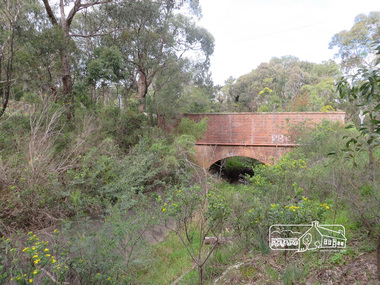
... The section of the aqueduct through the Eltham area has been abandoned since the 1980s but the open channel has largely been retained. A recreational path follows the aqueduct reserve. ...The section of the aqueduct through the Eltham area has been abandoned since the 1980s but the open channel has largely been retained. A recreational path follows the aqueduct reserve. ...Heritage Excursion - Maroondah Aqueduct Walk - Saturday 3rd September The Maroondah Aqueduct was once a major link in Melbourne’s water supply system. It was built between 1886 and 1891 to transfer water from the Watts River near Healesville to the Preston Reservoir. It was 66 km in length, made up of 41 km of open channel, 10 km of tunnel through hills and 15 km of pipeline across stream valleys known as inverted siphons. The section of the aqueduct through the Eltham area has been abandoned since the 1980s but the open channel has largely been retained. A recreational path follows the aqueduct reserve. For our excursion on 3rd September we intend to walk along the section of the aqueduct adjacent to Allendale Road. This is a section not visited on previous excursions and includes the transition from open channel to the inverted siphon across the Diamond Creek valley. Apart from the aqueduct itself the main feature of the walk is the extensive views across Eltham North and Diamond Creek. Along the way we will talk about the history of the aqueduct and the area. This easy walk is about 3 km return and will take 2 to 2.5 hours. It will start at 2pm at the junction of Allendale Road with Godber Road and Zig Zag Road North, officially Diamond Creek, but on the northern boundary of Eltham. (Melway ref.12 B10). Newsletter No., 229, August 2016 Brick bridge on Parsons road, Eltham North over the aqueduct on the aqueduct trail. Born Digitalmaroondah aqueduct, eltham north, activities, eltham district historical society, heritage excursion, parsons road, bridges, aqueduct trail -
 Kiewa Valley Historical Society
Book - Reference Cooking, SEC Cook Book of Family Favourites, Circa 1950
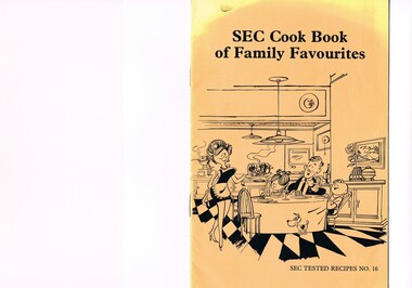
... In one way the individual did not need to be concerned with living costs, educational needs for children, and recreational amenities and therefore "normal" community survival /living methods did not apply. ...In one way the individual did not need to be concerned with living costs, educational needs for children, and recreational amenities and therefore "normal" community survival /living methods did not apply. ...This SEC cook book was produced circa 1950s when the Kiewa Hydro Electricity Scheme and its Commission was in full swing. The Commission had constructed two settlements, Mount Beauty and Bogong Village to house construction workers and their families in a "closed" community. These "closed" communities were for SEC staff and construction workers only. Entry into these villages was restricted to "SEC pass" carrying construction staff and their families. All facilities such as retail, sporting and other community services was provided by the SEC. This created an isolated community in which limited individual choice or administrative family leeway was available. It was a typical company town (live and work for the company). The Company was in the Kiewa Valley constructing power stations for the Kiewa Hydro Electricity Scheme of Victoria. In one way the individual did not need to be concerned with living costs, educational needs for children, and recreational amenities and therefore "normal" community survival /living methods did not apply. This living, although restrictive, was quite simple. When the scheme was completed, in 1961, marking the end of company town, caused some of the employees, who had enjoyed the "controlled" township environment, a fair degree of angst in having the new 'laissez-faire" controls thrust upon them. This was magnified when both Mount Beauty and Bogong Village became meshed into the Bright Shire, vis-a-vis, local government. This cook book is a prime example of " the company is looking after you" and leave the worrying to us. This environment of a "company town", which creates the atmosphere of minimal personal responsibilities, is still present in a few remote mining towns in Australia at the beginning of the 21st Century.This book is a classical example of the psychological control in which the company had its construction workers families living in. The motto of many companies who had employees in isolated regions was "keep them happy". A happy and contented worker is a more productive worker. This was a period in time (1950s to 1970s) when social psychology was gaining recognition in the Australian workforce as well as internationally. At the end of the construction of all the power stations both the Mount Beauty settlement and the Bogong Village became more integrated into the main stream of rural Australia environment. Development of tourism in the region opened up not only interaction with a greater cross section of the ever expanding type of Australian but also the overseas based non rural culture tourist or immigrant. It allowed the intermingling of ideas in a non company controlled environment. The Mount Beauty and Bogong Village has, and even up to the 3000 Millennium, the same housing construction, as was built by the SEC. There has only been a very gradual change to modern domestic architectural home styles. This SEC cookbook has a folded cover with two staples at the spine, securing eight double sided pages. The white pages contain black print and sketches(3), and one black and white photograph (of the author). The front cover is mainly orange in colour with a gradual fading into yellow(at the top). The cover is approximately 210 g/m2 in thickness and each page is approximately 90 g/m2 thick. Front cover: top of page "SEC Cook Book of Family Favourites", in the middle a sketch, black on orange background, of a smiling mother walking from the kitchen to the dining table with a steaming rolled roast and vegetables in one hand and a gravy pot in the other. The furniture and decor relates to the 1950s. Below this sketch is printed"SEC TESTED RECIPES NO. 16" Inside cover: on top of the page is a black and white sketch of a pineapple, apple pear fish with scales, bunch of grapes with leaves a pork roll (head of pig one end and a roll ending on the other, on top of this food arrangement rests a fruit pie. Below this sketch are printed in black print the books contents.The first side of the first page is a black and white photograph Mary Dunne, the SEC Home Service supervisor who provided a signed foreword. The inside back cover has a promotional segment detailing a black and white photograph of a smiling (and happy) couple in the foreground with an electric stove in the distance. The written motto below this photograph is" to Live better -and save money they'll join the Power People. "the new tariff is(1960s) - First 75kWh --6 cents per kWh Next 435 kWh---2.3 cents per kWh Balance --1.7 cents per kWh The rate per killowatt-hour for the final block drops from 2.1 cents to 1.7 cents --a reduction of 19%.cooking recipes circa 1950s, domestic food, sec victoria cook books, recipes circa 1950s -
 Melbourne Legacy
Pamphlet, Legacy does more than sell badges, c1990s
... In addition to the 3,000 Junior Legatees throughout Australia, Legacy also cares for the handicapped dependants of its "family". Recreational outings and educational programs are arranged on a monthly basis. ...In addition to the 3,000 Junior Legatees throughout Australia, Legacy also cares for the handicapped dependants of its "family". Recreational outings and educational programs are arranged on a monthly basis. ...This is an example of Melbourne Legacy promotional material that was issued to inform the public on the work of Legacy. Some of the text includes sections on How is Legacy special?; Legacy and the young; Legacy and the Aged. "Legacy and the young. Legacy is committed to the nurturing of its young members, known as Junior Legatees. Legacy helps to make sure stye get the education their fathers would have wished for them and to ensure their families enjoy a normal lifestyle. In addition to the 3,000 Junior Legatees throughout Australia, Legacy also cares for the handicapped dependants of its "family". Recreational outings and educational programs are arranged on a monthly basis. These activities aim to develop self-dependence and once a year, a two-week holiday camp is held - a highlight of the year - and lifelong friendship are often made. / For all its young members, healthy outdoor activities are arranged, financial aid, counselling, tutoring and guidance are given to ensure they are able to make the most of the opportunities open to them. Legacy and the Aged. Nowadays, the Australian population has a large proportion of elderly. The majority of Legacy widows had husbands who served in the World Wars. And so Legacy's emphasis has shifted to the needs of the ageing widows. . . Legacy widows meet for a wide range of activities, including cards, crafts, indoor bowls and theatre excursions. . . This represents a valuable social network and complements the volunteer care given by Legatees." Was in a folder with marketing material from the 1990s to 2009, see items 01240 to 01258. The collection shows the types of marketing materials that were produced and the celebrities that were helping Legacy.An example of promotional material issued by Legacy in the 1990s. It was in a collection of marketing material from the 1990s to 2000s.Colour brochure promoting Legacy folded into 8 pages.legacy promotion, fundraising -
 Eltham District Historical Society Inc
Newspaper Clipping, Eltham Plans £2.5m Community Centre Over Next 15 Years, The Age, 6 March 1963 page 7, 1963
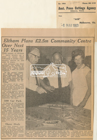
... The result of six years' work by shire officers, the plan provides for a business centre, public buildings and recreational reserves. The shire council expects that £2,500,000 will be invested by Government departments, banks, private firms and sporting bodies to implement the plan. 500 Car Park A feature of the business centre will be a quadrangle car park surrounded by shops, and with parking space for 500 cars. ...The result of six years' work by shire officers, the plan provides for a business centre, public buildings and recreational reserves. The shire council expects that £2,500,000 will be invested by Government departments, banks, private firms and sporting bodies to implement the plan. 500 Car Park A feature of the business centre will be a quadrangle car park surrounded by shops, and with parking space for 500 cars. ...Eltham Plans £2.5m Community Centre Over Next 15 Years THE people of Eltham have drawn up a plan to make their township a model community centre in the next 15 years. And yesterday the Chief Secretary (Mr Rylah) inspected the plan at the Eltham shire offices before declaring it open for public inspection In the picture (right) Mr. Rylah (centre) is shown inspecting the new plan with town planner and former councillor, Mr. Howard Bartlett, and the shire president, Cr. C. Pelling. The result of six years' work by shire officers, the plan provides for a business centre, public buildings and recreational reserves. The shire council expects that £2,500,000 will be invested by Government departments, banks, private firms and sporting bodies to implement the plan. 500 Car Park A feature of the business centre will be a quadrangle car park surrounded by shops, and with parking space for 500 cars. The public buildings will include new municipal offices, a public auditorium, a library and meeting rooms. The council plans to realign the course of Diamond Creek near the town to provide extra land for playing fields. Three Ovals The plan proposes three ovals, including improvements to an existing one, as well as a 50-metre Olympic swimming pool, tennis courts and bowling greens. In the 15 years which the shire council hopes to carry out the plan, the shire population of 18,000 is expected to increase two and a half times. Opening the display of maps and a model, Mr. Rylah said he commended the shire council's invitation to the citizens to suggest improvements to the plan. Eltham shire had grown tremendously in the past 20 years, from a sleepy country town to an important shopping centre. Digital file only of copy provided on loanauditorim, bowlong green, charis pelling, eltham community centre, rylah, howard bartlett, car park, library, forward plan -
 Flagstaff Hill Maritime Museum and Village
Leisure object - Stereoscope, H C White, Late 19th century
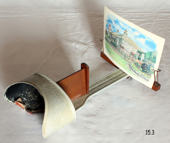
... Like television today, stereography during the second half of the 19th century was both an educational and a recreational device with a considerable impact on public knowledge and taste. ...Like television today, stereography during the second half of the 19th century was both an educational and a recreational device with a considerable impact on public knowledge and taste. ...The development of stereoscopic photography views or stereographs was immensely popular in the United States and Europe from about the mid-1850s through the early years of the 20th century. First described in 1832 by English physicist Sir Charles Wheatstone, stereoscopy was improved by Sir David Brewster in 1849. The production of the stereograph entailed making two images of the same subject, usually with a camera with two lenses placed 6 cm apart to simulate the position of the human eyes, and then mounting the positive prints side by side laterally on a stiff backing. Brewster devised a stereoscope through which the finished stereograph could be viewed; the stereoscope had two eyepieces through which the laterally mounted images, placed in a holder in front of the lenses, were viewed. The two images were brought together by the effort of the human brain to create an illusion of three-dimensionality. Stereographs were made of a wide range of subjects, the most popular being views of landscapes and monuments and composing narrative scenes of a humorous or slightly suggestive nature. Stereoscopes were manufactured for various price ranges and tastes, from the simple hand-held device introduced by Oliver Wendell Holmes who promoted stereography through articles to elaborate floor models containing large numbers of images that could be flipped into place. The stereograph became especially popular after Queen Victoria expressed interest in it when it was exhibited at the 1851 Crystal Palace Exposition. Like television today, stereography during the second half of the 19th century was both an educational and a recreational device with a considerable impact on public knowledge and taste. The Fine-art Photographers' Publishing Co. published many stereoscopic pictures from many different photographers from around the world under license. They also not only sold these images of various scenes and of famous people of the time but also were retail sellers of the viewers with the subject item having been made in the USA probably by H C White who held the patent for the subject items design from 1895 to 1902.An item that was very popular from the mid 19th century through to the beginning of the Edwardian period. Used for entertainment and also educational purposes and significant as it gives us a snapshot into the Victorian era and its social and domestic societal norms. Stereoscope viewer with adjustable view-finder that has a padded nose rest. The slide holder can move along the channel to suit the viewer. Made in London by the Fine-art Photographers' Publishing Co. Printed on metal plate "THE FINE-ART PHOTOGRAPHERS' PUBLISHING CO. 48 Rydevale Rd, LONDON, S.W." Embossed on viewing cup "U.S.A. PATENT OCT.15.1895" "CANADA / FRANCE / GERMANY / D'R''G'M' NO. 53803" "JUNE 3.1902 / FEBY 1.1896 / B.S.G.D.B. / GREAT BRITAIN / AUSTRIA / BELGIUM"warrnambool, shipwrecked-coast, flagstaff-hill, flagstaff-hill-maritime-museum, maritime-museum, flagstaff-hill-maritime-village, stereoscope, stereographs, stereoscope viewers, home entertainment -
 Ballarat Tramway Museum
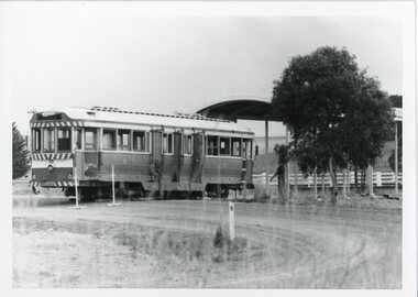
Photograph - Ballarat Tram 39, Tram 39 being returned to Ballarat from Lismore, May 1976
... When the Ballarat Tramways closed in 1971, it was sold to Lismore Lions Club and displayed in a recreational reserve. Ballarat Tramway Museum purchased the tram in 1976 and converted it into a museum display and souvenir centre. ...When the Ballarat Tramways closed in 1971, it was sold to Lismore Lions Club and displayed in a recreational reserve. Ballarat Tramway Museum purchased the tram in 1976 and converted it into a museum display and souvenir centre. ...Tram 39 was built in 1914 for the Prahran and Malvern Tramways Trust. In 1951 it was sold to the State Electricity Commission, Ballarat, and renumbered 39. When the Ballarat Tramways closed in 1971, it was sold to Lismore Lions Club and displayed in a recreational reserve. Ballarat Tramway Museum purchased the tram in 1976 and converted it into a museum display and souvenir centre. This was used until the new Museum building was opened in 2022. These photos show the process of loading the tram onto a truck in Lismore and bringing it back to Ballarat. The date of this was 9 May 1976. All photographs were taken by the donor, Campbell Duncan. Each photograph has information written on the back. .1 Lismore, 8/5/76 .2 Lismore, 8/5/76 .3 39 waits to be jacked down - truck ready to depart.9/5/76 .4 Truck has pulled out after 39 jacked up from it. Truck faces back down the driveway. 9/5/76. .5 Lismore. 9/5/76 .6 Lismore. 9/5/76 .7 Lismore. 9/5/76 .8 Lismore. 9/5/76 .9 Mair Street Ballarat East 9/5/76 .10 Mair Street Ballarat East 9/5/76 .11 Victoria Street Ballarat East 9/5/76 .12 Victoria Street Ballarat East 9/5/76 .13 Ballarat East, Victoria Street 9/5/76 .14 Victoria Street Ballarat East 9/5/76 .15 Victoria Street. Truck about to back down driveway 9/5/76. (this photo was used in Ballarat Courier of 15/5/76) See photo 10212. .16 Truck pulling out from under 39. 39's storage shed, Victoria Street Ballarat East 9/5/76. Sixteen black and white photographs taken of Tram 39 being transported from Lismore to Ballarat.Photo information on back of each phototram 39, 1914, prahran and malvern tramways trust, sec ballarat, 1951, lismore lions club, 1971, recreational reserve, ballarat tramway museum, 1976, museum display, souvenir centre, museum opened 2022, victoria street, ballarat east, may 1976 photos, photographer, campbell duncan, mair street, storage shed -
 Flagstaff Hill Maritime Museum and Village
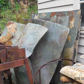
Functional object - Copper Sheet, circa 1878
... Tom Uren MHR, Minister for Territories and Local Government: “The Commonwealth recognises that shipwrecks like the LOCH ARD are our national heritage with important educational, recreational and tourist applications” (The Standard, Tuesday 8 May 1984). ...Tom Uren MHR, Minister for Territories and Local Government: “The Commonwealth recognises that shipwrecks like the LOCH ARD are our national heritage with important educational, recreational and tourist applications” (The Standard, Tuesday 8 May 1984). ...In 1984 the Commonwealth Government made available to Flagstaff Hill a collection of lead ingots and copper sheets recovered from the wreck-site of the LOCH ARD. They were presented to the Warrnambool City Council by the Hon. Tom Uren MHR, Minister for Territories and Local Government: “The Commonwealth recognises that shipwrecks like the LOCH ARD are our national heritage with important educational, recreational and tourist applications” (The Standard, Tuesday 8 May 1984). The LOCH ARD was wrecked in 1878. Unsuccessful salvage operations were then undertaken with the 90 ton paddle steamer NAPIER. In sudden bad weather this vessel too was sunk. The precise position of the LOCH ARD in the exposed and dangerous waters off Mutton Bird Island became lost to memory. The underwater location of the LOCH ARD was rediscovered in 1967 by a Warrnambool skindiver, Stan McPhee. In the two years following his find, the vessel was systematically pillaged by unauthorised salvagers. This led to the State and Federal Governments’ intervention in 1969. A roundup and seizure of recovered lead ingots and copper sheets was conducted by Commonwealth and Victorian Police. Offenders were charged and convicted. The “repossessed loot of the Tassie Boys” was placed into secure storage (Jack Loney, 1978, Wrecks & Reputations). The LOCH ARD manifest of cargo lists “Pig lead 50 tons, 994 pig & 37 rolls” and “Copper 33 plates, 53 bolts”. While the lead ingots have been subsequently described as “ballast”, the copper sheets are unlikely to have been associated with the ship’s normal complement in that way. Similar product lines in the cargo manifest are “Bar and rod iron 102 tons”, “Plate iron 3 tons” and “Zinc 12 tons”. These raw materials were used by colonial artisans such as blacksmiths and metal smelters to fashion, and repair, agricultural implements and industrial machinery. Copper was valued for its non-corrosive properties and its malleability, or ease of working. Both these qualities were useful, for example, in laying underground gas pipes that supplied lighting to residences, businesses and streetscapes in the mid-nineteenth century. As the nineteenth century progressed, the metal was also increasingly valued for its conductivity, with copper wiring linking colonial communities to each other, and the wider world, via the Telegraph system. The average weight of the copper sheets is 216 kilograms, calculated by "volume 0.1936m³ X Cu density 8930kgs/m³".The shipwreck of the Loch Ard is of significance for Victoria and is registered on the Victorian Heritage Register ( S 417). Flagstaff Hill has a varied collection of artefacts from Loch Ard and its collection is significant for being one of the largest accumulation of artefacts from this notable Victorian shipwreck. The collections object is to also give us a snapshot into history so we can interpret the story of this tragic event. The collection is also archaeologically significant as it represents aspects of Victoria's shipping history that allows us to interpret Victoria's social and historical themes of the time. The collections historically significance is that it is associated unfortunately with the worst and best-known shipwreck in Victoria's history. Large heavy sheets or panels of copper metal raised from the wreck of the LOCH ARD. The 10 sheets are of roughly similar dimensions and rectangular shape. They bear signs of prolonged submersion in seawater, with various degrees of limestone accretion, adhered marine growth, and green oxidisation. Three of the sheets are severely buckled, demonstrating the force of underwater explosives used in their salvage. One sheet appears cut or severed in a diagonal line downwards from its top left hand corner. One sheet has a 10cm X 10cm square cut out of its top right hand corner. All sheets are in sturdy, stable condition. No maker’s marks are visible. Kindly on loan from the Commonwealth of Australia.flagstaff hill, warrnambool, shipwrecked coast, flagstaff hill maritime museum, flagstaff hill maritime village, great ocean road, loch line, loch ard, captain gibbs, eva carmichael, tom pearce, glenample station, mutton bird island, loch ard gorge, sailing ship, copper sheet, manutacturing materials, metal imports, muntz -
 Eltham District Historical Society Inc
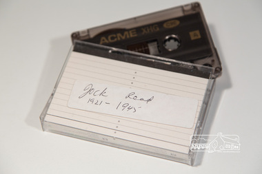
Audio - Audio Compact Cassette Tape, Audio Recording; Jock Read with Diana Bassett-Smith, 1990s
... The interview includes discussion of Jock's family history and connection to Eltham, including his attendance at Eltham State School starting 1921, childhood memories including games he played, memories of Eltham High School, recreational activities, milking, money earned, local transport, neighbours, effect of the Depression, local shops, involvement with the Church of England and more. ...The interview includes discussion of Jock's family history and connection to Eltham, including his attendance at Eltham State School starting 1921, childhood memories including games he played, memories of Eltham High School, recreational activities, milking, money earned, local transport, neighbours, effect of the Depression, local shops, involvement with the Church of England and more. ...Oral history interview with Jock Read (1915- 2010) conducted by Diana Bassett-Smith of Eltham District Historical Society. Peter Bassett-Smith and possibly Gwen Orford also in attendance. The interview includes discussion of Jock's family history and connection to Eltham, including his attendance at Eltham State School starting 1921, childhood memories including games he played, memories of Eltham High School, recreational activities, milking, money earned, local transport, neighbours, effect of the Depression, local shops, involvement with the Church of England and more. Recording contains significant amount of noise. 0:00 Introduction including the clarification of Jock's name as Frances and backstory of his parents being from England 3:15- 5:00 Commences talking about home life and childhood 3:38 Talking about family immigrating to Australia His father immigrated to Australia when he was 6 4:05 Jock was born in and lived with his parents in Brunswick before moving to Eltham during the 1920s 4:55-7:44 Permanently moved to Eltham and started at Eltham Primary School in 1921 Talking about books used at school, and games played at school such as marbles, cricket and football 8:45 Moved into Eltham High School after finishing at Eltham Primary 9:50 Week and weekend activities including: Milking cows and doing milk runs on horseback before school 13:15 Most common mode of transport was using horse drawn vehicles and walking 14:50 Discusses impact of depression on family: Father had previously started a business but the depression had a large impact on that 16:10-18:00 Facilities that Jock had • Used hurricane lamps and candles- no electricity • Woodfire • Milk and bread were delivered • Greengrocer- George Bird? 25:22 Left Eltham high school in 1930 26:00 Begins discussing involvement with the church of England 31:46 Electricity did not come to Eltham until 1926 Jock described it as an exciting event 33:00-34:00 Describing the rented house, he was living in- small wooden cottage 35:00 Discussion around starting a mail run round areas of Eltham 38:40-42:35 Enlisted in the navy during WW2 • Navel cadets in 1934 • HMAS Vampire • Served as a seaman gunner Audio Compact Cassette Tape ACME C90 XHG Converted to MP3 file; 55.1MB, 0:42:35audio cassette, audio recording, diana bassett-smith, eltham, jock read, oral history, read family, elham primary school, eltham high school, eltham primary school, 1920s, brunswick, depression, church, st margaret's church, housing, ww2, second world war -
 Sunshine and District Historical Society Incorporated
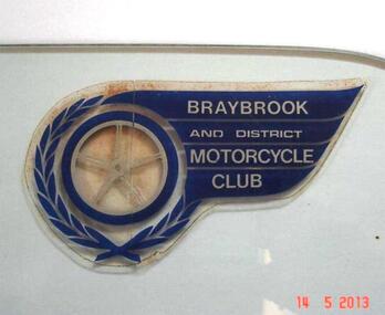
Memorabilia - Braybrook and District Motorcycle Club Sticker
... Membership mostly came from recreational motor bike riders looking for more structured competitive riding experience and enjoyment. ...Membership mostly came from recreational motor bike riders looking for more structured competitive riding experience and enjoyment. ...A meeting was held on 18th August 1947 at the East Sunshine Community Hall with the aim of forming a motor cycle club. The name BRAYBROOK MOTOR CYCLE CLUB was decided upon "as it would cater for riders and non-riding members in all surrounding districts". The first President was Don Minahan with Bert Watson as Secretary. They had been members of the Auto Cycle Union whose members became dissatisfied with the prize money awarded, so the Victorian Motorcycle Association (VMCA) was formed. The President of the VMCA (Mr. A. Clarke) attended the meeting on 3rd September 1947 which was held in the Hall behind the Sunshine Theatre. This became the regular meeting place. The new Braybrook Club affiliated with the VMCA joining clubs from Altona, Coburg, Essendon, Newport and Preston. Membership mostly came from recreational motor bike riders looking for more structured competitive riding experience and enjoyment. The club conducted its events on Sunday afternoons and as sport at that time was not permitted on Sundays, they overcame that obstacle by seeking a silver coin donation (pointing out that "two bob" was expected). The events were mainly dirt scrambles over open land which today is known as "off road". The favourite sites were Sunshine's ample open spaces such as Glengala Road and McIntyre Road, as well as Arundell Road (Keilor) and Laverton. For track racing experience the club formed a very basic dirt track on the open land in Glengala Road west of the original Sunshine Golf Club, which was very popular on Sunday afternoons for both riders and spectators. In the early 1950's Motorbike and Sidecar races were also witnessed on some Sundays, on a track near the corner of McIntyre and Furlong Roads, North Sunshine. During 1950 the Braybrook members voted in favour of allowing the Sunshine Club to amalgamate with them and form the BRAYBROOK AND DISTRICT MOTORCYCLE CLUB. The merger took place at the meeting on 10th July 1950 when office bearers were elected. The club disbanded in the mid 1960's due to the massive residential development occurring in the Sunshine district, and so activities were merged with the Newport Club. The above information is mainly compiled from Sunshine Advocate articles published on 29/8/47, 12/9/47, and 30/6/50, and from written details supplied by Mr. J. N. Willaton. Further details or corrections from interested readers are welcome.The Braybrook and District Motorcycle Club has not existed in its own right for several decades. The sticker depicting the club crest serves as a historical reminder that the club was once part of the local recreational scene.Dark blue, silver, and clear plastic sticker on right hand top corner of glass plate that previously was a side window of a car. Sticker has been left on the glass in case removal may damage it. BRAYBROOK AND DISTRICT MOTORCYCLE CLUB.Braybrook and District Motorcycle Clubmotorcycle club, sticker, club sticker, braybrook and district motorcycle club, braybrook -
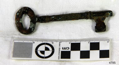 Flagstaff Hill Maritime Museum and Village
Functional object - Key, 1886
... Today the Falls of Halladale is a popular destination for recreational divers. The wreck is easily accessible by scuba divers about 300 m offshore in 3 to 15 m of water. ...Today the Falls of Halladale is a popular destination for recreational divers. The wreck is easily accessible by scuba divers about 300 m offshore in 3 to 15 m of water. ...The key was recovered from the Falls of Halladale, a four-masted iron-hulled barque that was built in 1886 for the long-distance bulk carrier trade. The vessel was built for the Falls Line (Wright, Breakenridge & Co., Glasgow, Scotland) at the shipyard of Russell & Co., Greenock on the River Clyde, she was named after a waterfall on the Halladale River in the Caithness district of Scotland. The ship's design was advanced for her time, incorporating features that improved crew safety and efficiency such as elevated bridges to allow the crew to move between forward and aft in relative safety during heavy seas. The Falls of Halladale was the seventh vessel in a series of eight similar iron-hulled sailing ships, all built by Russell & Co and all named after waterfalls in Scotland. The Falls of Halladale was preceded by the Falls of Clyde (1878), the Falls of Bruar (1879), the Falls of Dee (1882), the Falls of Afton (1882), the Falls of Foyers (1883) and the Falls of Earn (1884). The Falls of Halladale was followed by a sister ship, the Falls of Garry (1886). The Falls of Clyde is afloat today and is a major attraction at the Hawaii Maritime Centre in Honolulu. The Falls of Halladale is best known for her spectacular demise in a shipwreck near Peterborough, Victoria on the shipwreck coast of Victoria, Australia. On the night of 14 November 1908, she was sailed in dense fog directly onto the rocks due to a navigational error. The crew of 29 abandoned ship safely and all made it ashore by boat, leaving the ship foundering with her sails set. For weeks after the wreck, large crowds gathered to view the ship as she gradually broke up and then sank in the shallow water. Soon after the accident the ship's master, Capt. David Wood Thomson was brought before a Court of Marine Inquiry in Melbourne and found guilty of a gross act of misconduct, having carelessly navigated the ship, having neglected to take proper soundings, and having failed to place the ship on a port tack before it became too late to avoid the shipwreck. Capt. Thomson's punishment included a small fine and he had his Certificate of Competency as a Master suspended for six months. Today the Falls of Halladale is a popular destination for recreational divers. The wreck is easily accessible by scuba divers about 300 m offshore in 3 to 15 m of water. The hull lies on its collapsed starboard side. Some of the original cargo of 56,763 roof slates remains at the site of the wreck along with corroded masses of what used to be coils of barbed wire. Twenty-two thousand slates were salvaged in the 1980s and used to provide roofing at the Flagstaff Hill Maritime Village in Warrnambool. An anchor that was recovered in 1974 is on display at the village. The key is significant as a salvaged item from the Victorian heritage-listed Falls of Halladale wreck. As an artifact from the wrecked ship, it helps us to remember today the story of the wrecking and is an important reminder of a marine incident in Victoria's maritime history. KeyNoneflagstaff hill, warrnambool, shipwrecked coast, flagstaff hill maritime museum, maritime museum, shipwreck coast, flagstaff hill maritime village, great ocean road, falls of halladale, shipwreck peterborough, 1908 shipwreck, great clipper ships, russell & co., key
