Showing 2561 items matching " road works"
-
 Flagstaff Hill Maritime Museum and Village
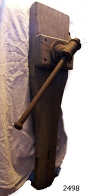
Tool - Leg Vice, Prior to 1950
A leg vice is a mechanical apparatus used to secure an object to allow work to be performed on it by a carpenter or cooper such a planning wood. Vices generally have two parallel jaws, one fixed and the other movable, threaded in and out by a screw and lever. A leg vice gives greater holding power or force to a piece of material while a carpenter works on the timber.The subject item at this time cannot be associated with an historical event, person or place, provenance is unknown, item assessed as a collection asset as it is believed to have been produced before 1950.Leg Vice metal attached to cooper's bench Noneflagstaff hill, warrnambool, flagstaff-hill-maritime-museum, maritime-museum, shipwreck-coast, flagstaff-hill-maritime-village, vice, leg vice, coopers tools, workbench vice, carpenters tools, woodworking tools -
 Flagstaff Hill Maritime Museum and Village
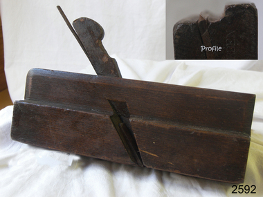
Tool - Moulding Plane, Charles Nurse, 1860-1900
The original Nurse family business began in 1841 in Maidstone Kent until 1861 where they were plane makers, moving to London in 1887 the company became C Nurse & Co. And continued until 1937 under that name at the (Invicta works). The majority of their plane making was done in London but there are Sheffield and Brighton marks on their tools as well. The company was not only wood plane makers but tool makers in general with the Charles Nurse & Co catalogue having 350 pages of tools for sale of varying types for different building trades and over 138 pages dedicated to woodworking tools. Records show that the company was at 182 Walworth Road London from 1887-1949. However, they had several retail outlets before this time and records indicate before 1887 Charles Nurse was at 32 Mill St Maidstone Kent, from 1844 -1860 but were in business before then. Also in Brighton at 135 Queens Road from 1865 -1871 and at 3 Mill Street Maidstone, again from 1872 - 1889 listed on records of the time as “plane and tool makers.”A vintage item made by a significant tool maker and retailer from the middle of the nineteenth century and into the first half of the twentieth century. These items were made commercially for firms and individuals that worked in wood and needed a tool that could produce an ornamental finish to timber. The tool was used before electric or mechanical routers or spindle moulders came into use. They were used by craftsmen to produce decorative mouldings by hand. These profiled planes came in various shapes and sizes. A significant tool that today is quite rare and sought after by collectors. It gives us a snapshot of how furniture and other decorative finishes were created on timber by the use of hand tools only. Moulding plane Side Bead - Single Box Size 5/16 Maker Charles and Co 1863 Stamped W. Burden (previous owner)flagstaff hill, warrnambool, shipwrecked-coast, flagstaff-hill, flagstaff-hill-maritime-museum, maritime-museum, shipwreck-coast, flagstaff-hill-maritime-village -
 Flagstaff Hill Maritime Museum and Village
Plane
Panel Plough Plane. Maker Atkin and Son Sheffield Works Birmingham. Stamped JBflagstaff hill, warrnambool, shipwrecked-coast, flagstaff-hill, flagstaff-hill-maritime-museum, maritime-museum, shipwreck-coast, flagstaff-hill-maritime-village -
 Flagstaff Hill Maritime Museum and Village
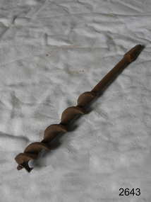
Tool - Auger Bit, William A Ives, 1860-1950
William A Ives worked in New Haven, Connecticut, and surrounding towns of Wallingford and Hamden from 1868 to 1917 and was a prolific inventor of braces and other wood boring tools between 1868 and 1884, when he received a dozen patents for these devices. William A. Ives lived in the New Haven CT area, and his first auger-making activity took place in the town of Hamden. At first in association with the Churchill family who had been manufacturing tools in the area at least as early as 1863. That firm's works had created "Augerville" in Hamden, starting earlier, possibly as early as 1830. Ives became active as part of the Hamden Manufacturing Co. until 1875 (it is thought he may also have started his own business in the interim), and the William A. Ives & amp; Co. was established by 1877. This continued, until William's death in 1888, when The Hamden Mfg. Company became its successor. Ives also registered the name "Mephisto" trademark name with the US patent office that was to be used in connection with augers, auger bits, machine bits as of June 1st, 1909, appearing on items up until at least 1922. It also appears that the trademark was licensed by the Mephisto Tool Co of Hudson New York who continued to manufacture tools under this trademark. Item is significant because its maker was the inventor of the wood auger boring bit and his patent has been used ever since on many different types of bits with little change to the original design.Auger wood screw bit W A Ives Patent Noneflagstaff hill, warrnambool, shipwrecked-coast, flagstaff-hill, flagstaff-hill-maritime-museum, maritime-museum, shipwreck-coast, flagstaff-hill-maritime-village -
 Ringwood and District Historical Society
Administrative record - Borough Of Ringwood 14th August 1950, Constitution of the East Ringwood Reserve Management Committee
The objects of the committee is to act under the authority and subject to control of the Council of the Borough of Ringwood as the Local Board of Management and to act as an advisory consultive and operational Committee, to lay out, and effect improvements and works of beautification, ornamentation and use for the benefit and enjoyment of citizens and to keep and maintain such Reserve in good order and condition and raise funds for improving and mataining such Reserve. The Committee shall consist of two Councillors and Town Clerk and two representatives from each: Football Club, Cricket Club, Tennis Club and Progress Association and 2 Citizens. -
 Ringwood and District Historical Society
Newspaper, Scrapbook Clipping, Library Collection, Ringwood, Victoria
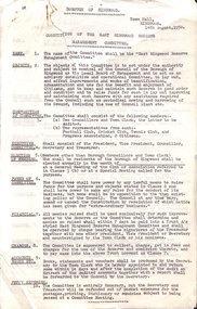
Newspaper Clipping from the ""Mail", 5 May 1998 P20. "No plans for improvement to Oban Rd's poor condition"Ringwood North residents say they are fed up with speeding traffic, "dangerous" gravel edges and deep potholes on Oban Road. Ringwood North Primary School Principal Barry Archibald said there was a great deal of concern within the school community about the condition of the road. A council spokesman said no works were planned for the unsealed section of Oban Road because "council only had a certain amount of money for grading" He said no roadworks were planned near the school either. -
 Ringwood and District Historical Society
Photograph, Duplication of the five-kilometre section of railway line between Ringwood and Croydon in 1983
Digital scanFrom Vicrail News magazine, April 1983. “Duplication of the five-kilometre section of line between Ringwood and Croydon is on the way. Several major works will be undertaken over the next few months so the two tracks can be brought into service later this year. Intensive work on this section follows completion of duplication works between Ringwood and Bayswater on the Belgrave line last December. The completion of this 5.17 kilometre section between Ringwood and Bayswater means that this Belgrave line is now duplicated as far out as Ferntree Gully. Commuters using the Belgrave line now have an improved service with the intro duction in January of an additional evening peak train to Upper Ferntree Gully, two additional peak hour services in the morning from both Belgrave and Upper Ferntree Gully, and with the additional tracks delays on one line will not affect trains travelling in the opposite direction. Commenting on the completion of this stretch of track the Minister of Transport, Mr. Crabb, said a further improvement had been made with the commissioning of boom barriers at the Bedford Road level crossing in Ringwood. "The installation is part of the State Government's $9.4 million four-year plan to equip 70 dangerous level crossings throughout the State with boom barriers", he said. Works to be carried out on the Ringwood/ Croydon section include laying of new track, station works at Croydon and installation of boom barriers at East Ringwood. Already completed are bridge works to cater for double tracks at both Mt. Dandenong and Eastfield Roads between Croydon and East Ringwood and construction of an island platform at East Ringwood station. At several locations alignment of the existing track will be slightly relocated. The new line is being constructed with concrete sleepers and heavyweight rails. The existing line will also be reconstructed using these heavy 60kg per metre rails. Engineering works to be completed include installation of overhead wiring necessary to supply power to trains, construction of two new station buildings and a new platform at Croydon, provision of boom barriers, and pedestrian boom barriers at Dublin Road level crossing. East Ringwood, and replacement of existing timber overhead wire support structures with steel structures. Other works in this program included installation of boom barriers at Bedford Road, Ringwood and Scoresby Road, Bayswater and provision of a new platform for trains going to Melbourne and Heathmont. A new timetable on the Lilydale and Belgrave lines will commence when the Ringwood—Croydon duplication track work is completed.” -
 Phillip Island and District Historical Society Inc.
Financial record, Credit account from J.Kennon & Sons for N. L. Smith, Rhyll, 23 March 1914
J.Kennon & Sons were known particularly for their use of the chrome tanning process. They were also buyers and exporters of Australian skins and wool.The firm had tanning works,, established in 1863, offices and stores in the vicinity of River Street, Richmond and a leather warehouse in Bridge Road. [ Source -Heritage Victoria https://www.google.com/url?sa=t&rct=j&q=&esrc=s&source=web&cd=&cad=rja&uact=8&ved=2ahUKEwiI7OnmofT_AhUia2wGHXNGCaUQFnoECBQQAQ&url=http%3A%2F%2Fimages.heritage.vic.gov.au%2Fattachment%2F24257&usg=AOvVaw0ER8QGZ-3eW4PAg0VM909h&opi=89978449]HistoricalCream coloured account with details eg product and amount in black ink. Includes a separate piece of paper attached to page, with a recipe for vermin destroyer typed in red ink.Credit account of N. L. Smith, Rhyll, Phillip Island. One bag of Rabbit Weevily. March 23, 1914 J. Kennon & Sons River Street, Richmondn.l.smith rhyll, j.kennon and sons, rabbit poison, account, vermin -
 Flagstaff Hill Maritime Museum and Village
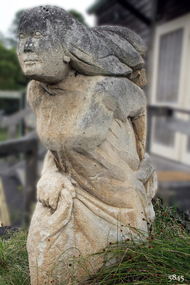
Sculpture - Limestone, Lady in the Wind
The late Robert Ulmann (1927-1999) was a well-known local Warrnambool artist, creating murals, sculptures and art works. The sculpture 'Lady in the Wind' was presented to Flagstaff Hill Maritime Village by Dr Ivor (Ivor Philip Quentin Scott 16-08/1928 - 1/11/2016) and his wife Deirdre Scott (dec.). This sculpture is significant for being a creation of Robert Ulmann, well known local Warrnambool artist. The sculpture titled "Lady in the Wind" by Robert Ulmann. Subject is a robed woman moving forward, long hair streaming behind her, clutching fabric of skirt in each hand. Created in 1975. Made of Mount Gambier stone. Plaque describing the sculpture is on a nearby wall. The sculpture was presented to Flagstaff hill by Ivor and Deirdre Scott."Robert Ulmann / "LADY IN THE WIND " ' Sculpture, Mt Gambier Stone, 1975. / Presented by Ivor and Deirdre Scott "flagstaff hill, warrnambool, shipwrecked-coast, flagstaff-hill, flagstaff-hill-maritime-museum, maritime-museum, shipwreck-coast, flagstaff-hill-maritime-village, robert ulmann, sculpture in warrnambool, lady in the wind sculpture, warrnambool artist, flagstaff hill maritime village sculpture, ivor philip quentin scott, deirdre scott, ivor scott, lady in the wind -
 Flagstaff Hill Maritime Museum and Village
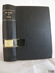
Book, The Works of Laurence Sterne
Pattison Collection This item is from the ‘Pattison Collection’, a collection of books and records that was originally owned by the Warrnambool Mechanics’ Institute, which was founded in Warrnambool in 1853. By 1886 the Warrnambool Mechanics’ Institute (WMI) had grown to have a Library, Museum and Fine Arts Gallery, with a collection of “… choice productions of art and valuable specimens in almost every branch and many wonderful national curiosities are now to be seen there, including historic relics of the town and district.” It later included a School of Design. Although it was very well patronised, the lack of financial support led the WMI in 1911 to ask the City Council to take it over. In 1935 Ralph Pattison was appointed as City Librarian to establish and organise the Warrnambool Library as it was then called. When the WMI building was pulled down in 1963 a new civic building was erected on the site and the new Warrnambool Library, on behalf of the City Council, took over all the holdings of the WMI. At this time some of the items were separated and identified as the ‘Pattison Collection’, named after Ralph Pattison. Eventually, the components of the WMI were distributed from the Warrnambool Library to various places, including the Art Gallery, Historical Society and Flagstaff Hill. Later some were even distributed to other regional branches of Corangamite Regional Library and passed to and fro. It is difficult now to trace just where all of the items have ended up. The books at Flagstaff Hill Maritime Village generally display stamps and markings from Pattison as well as a variety of other institutions including the Mechanics’ Institute itself. RALPH ERIC PATTISON Ralph Eric Pattison was born in Rockhampton, Queensland, in 1891. He married Maude Swan from Warrnambool in 1920 and they set up home in Warrnambool. In 1935 Pattison accepted a position as City Librarian for the Warrnambool City Council. His huge challenge was to make a functional library within two rooms of the Mechanics’ Institute. He tirelessly cleaned, cleared and sorted a disarrayed collection of old books, jars of preserved specimens and other items reserved for exhibition in the city’s museum. He developed and updated the library with a wide variety of books for all tastes, including reference books for students; a difficult task to fulfil during the years following the Depression. He converted all of the lower areas of the building into a library, reference room and reading room for members and the public. The books were sorted and stored using a cataloguing and card index system that he had developed himself. He also prepared the upper floor of the building and established the Art Gallery and later the Museum, a place to exhibit the many old relics that had been stored for years for this purpose. One of the treasures he found was a beautiful ancient clock, which he repaired, restored and enjoyed using in his office during the years of his service there. Ralph Pattison was described as “a meticulous gentleman whose punctuality, floorless courtesy and distinctive neat dress were hallmarks of his character, and ‘his’ clock controlled his daily routine and his opening and closing of the library’s large heavy doors to the minute.” Pattison took leave from 1942 to 1945 to serve in the Royal Australian Navy, Volunteer Reserve as Lieutenant. A few years later he converted one of the Museum’s rooms into a Children’s Library, stocking it with suitable books for the younger generation. This was an instant success. In the 1950’s he had the honour of being appointed to the Victorian Library Board and received more inspiration from the monthly conferences in Melbourne. He was sadly retired in 1959 after over 23 years of service, due to the fact that he had gone over the working age of council officers. However, he continued to take a very keen interest in the continual development of the Library until his death in 1969. The Pattison Collection, along with other items at Flagstaff Hill Maritime Village, was originally part of the Warrnambool Mechanics' Institute’s collection. The Warrnambool Mechanics’ Institute Collection is primarily significant in its totality, rather than for the individual objects it contains. Its contents are highly representative of the development of Mechanics' Institute libraries across Australia, particularly Victoria. A diversity of publications and themes has been amassed, and these provide clues to our understanding of the nature of and changes in the reading habits of Victorians from the 1850s to the middle of the 20th century. The collection also highlights the Warrnambool community’s commitment to the Mechanics’ Institute, reading, literacy and learning in the regions, and proves that access to knowledge was not impeded by distance. These items help to provide a more complete picture of our community’s ideals and aspirations. The Warrnambool Mechanics Institute book collection has historical and social significance for its strong association with the Mechanics Institute movement and the important role it played in the intellectual, cultural and social development of people throughout the latter part of the nineteenth century and the early twentieth century. The collection of books is a rare example of an early lending library and its significance is enhanced by the survival of an original collection of many volumes. The Warrnambool Mechanics' Institute’s publication collection is of both local and state significance. The Works of Laurence Sterne Author: Laurence Sterne Publisher: Routledge and Sons The label on the spine with typed text PAT 823 STE Pastedown front endpaper has a sticker from Warrnambool Public Library Front loose endpaper has a sticker from Corangamite Regional Library Service Front loose endpaper has a stamp from Corangamite Regional Library Service book, the works of laurence sterne, laurence sterne, shipwrecked-coast, flagstaff-hill, flagstaff-hill-maritime-museum, warrnambool, maritime-museum, shipwreck-coast, flagstaff-hill-maritime-village, shipwrecked-artefact, pattison collection, warrnambool library, warrnambool mechanics’ institute, ralph eric pattison, corangamite regional library service, warrnambool city librarian, mechanics’ institute library, victorian library board, warrnambool books and records, warrnambool children’s library, great ocean road -
 Flagstaff Hill Maritime Museum and Village
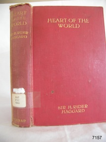
Book - Novel, H Rider Haggard, author, Heart of The World, 1894
H. Rider Haggard (1856-1925) (Sir H. Rider Haggard), a British author, wrote fiction and non-fiction works and had letters and articles published in newspapers and journals. His novel, Heart of the World, was an adventure set in Mexico. This book is part of the Pattison Collection at Flagstaff Hill. The book was published in 1895 by the British firm George G Harrap & Co. Ltd. of London, a firm that specialised in high-quality publishing with many of the books containing fine line drawings.The book has additional importance for its connection to the Pattison Collection, which, along with other items at Flagstaff Hill Maritime Village, was originally part of the Warrnambool Mechanics' Institutes’ Collection. The Warrnambool Mechanics’ Institute book collection has historical and social significance for its strong association with the Mechanics Institute movement and its important role in people's intellectual, cultural and social development throughout the latter part of the nineteenth century and the early twentieth century. The collection of books is a rare example of an early lending library and its significance is enhanced by the survival of an original collection of many volumes. The Warrnambool Mechanics' Institute’s publication collection is of both local and state significance.Heart of The World Author: H Rider Haggard (Sir H. Rider Haggard) Publisher: George G Harrap & Co. Ltd. Date: 1894 The red hardcover book has gold embossed lettering on the spine and cover. The Fly page has a logo of flying horse, it also has inscriptions on a label and stickers. This book is part of the Pattison Collection.Label "PAT FIC HAG" Sticker: "Warrnambool Public Library" covered by a sticker "Corangamite Regional Library Service" Inscription: "1300" Logo: [Flying horse or winged horse]flagstaff hill, flagstaff hill maritime museum and village, warrnambool, maritime museum, maritime village, great ocean road, shipwreck coast, pattison collection, ralph eric pattison, warrnambool mechanics’ institute, mechanics’ institute library, warrnambool library, free library, corangamite regional library service, george g. harrap and company, h rider haggard, 1985 novel, sir h. rider haggard, heart of the world, fiction, adventure, 1894, flying horse logo, winged horse logo -
 Flagstaff Hill Maritime Museum and Village
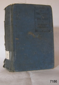
Book - Novel, H Rider Haggard, author, The Treasure of The Lake, 1926
This book is one of two that were published posthumously after the death of author Sir H Rider Haggard. H. Rider Haggard (1856-1925) was a British author who wrote fiction and non-fiction works and had letters and articles published in newspapers and journals. The book is part of Flagstaff Hill's Pattison Collection. The book was published by the British firm Hutchinson & Co. operated for almost 100 years 1887-1985, before it underwent several mergers.This book is significant for being published after the death of the author Sir H Rider Haggard. The book has additional importance for its connection to the Pattison Collection, which, along with other items at Flagstaff Hill Maritime Village, was originally part of the Warrnambool Mechanics' Institutes’ Collection. The Warrnambool Mechanics’ Institute book collection has historical and social significance for its strong association with the Mechanics Institute movement and its important role in people's intellectual, cultural and social development throughout the latter part of the nineteenth century and the early twentieth century. The collection of books is a rare example of an early lending library and its significance is enhanced by the survival of an original collection of many volumes. The Warrnambool Mechanics' Institute’s publication collection is of both local and state significance.The Treasure of The Lake Author: H Rider Haggard Publisher: Hutchinson & Co. Ltd. London Date: 1st Published in 1926 Blue fabric and board hardcover book. Inscriptions are on a label, stickers, a red stamp and handwritten. The book is part of the Pattison Collection.Label: "PAT FIC HAG" Sticker: "Warrnambool Public Library" covered by a sticker "Corangamite Regional Library Service" Red Stamp: "W'bool Public Library" Handwritten: "1303"flagstaff hill, flagstaff hill maritime museum and village, warrnambool, maritime museum, maritime village, great ocean road, shipwreck coast, pattison collection, ralph eric pattison, warrnambool mechanics’ institute, mechanics’ institute library, warrnambool library, free library, corangamite regional library service, hutchinson & co. ltd., h rider haggard, sir h rider haggard, published posthumously, 1926 -
 Flagstaff Hill Maritime Museum and Village
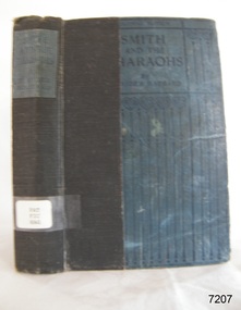
Book - Novel, H Rider Haggard, author, Smith and the Pharaohs and other tales, 1920
H. Rider Haggard (1856-1925) (Sir H. Rider Haggard), was a British author of fiction and non-fiction works and had letters and articles published in newspapers and journals. The page opposite the book's Fly page lists some of the topics Rider Haggard covered; Parliamentary Blue Book, political history, works on agriculture, country life, social history, travel, novels and romances. This edition of the book was published for Laurie's Colonial Library by the firm T. Werner Laurie Limited of London. It was made specifically for the British Colonies and India. This book is part of Flagstaff Hill's Pattison Collection.This edition of the book was published by T Werner Laurie as part of Laurie's Colonial Library, books destined only for the British Colonies and India, The book has additional importance for its connection to the Pattison Collection, which, along with other items at Flagstaff Hill Maritime Village, was originally part of the Warrnambool Mechanics' Institutes’ Collection. The Warrnambool Mechanics’ Institute book collection has historical and social significance for its strong association with the Mechanics Institute movement and its important role in people's intellectual, cultural and social development throughout the latter part of the nineteenth century and the early twentieth century. The collection of books is a rare example of an early lending library and its significance is enhanced by the survival of an original collection of many volumes. The Warrnambool Mechanics' Institute’s publication collection is of both local and state significance.Smith and the Pharaohs and other tales Author: H Rider Haggard Publisher: T Werner Laurie Ltd Date: 1st published 1920 Inscriptions include a label, stickers, stamp and a handwritten inscription. This book is part of the Pattison Collection.Label: "PAT FIC HAG" Sticker: "Warrnambool Mechanics Institute and Free Library" covered by a sticker"Corangamite Regional Library Service" Stamp: "Warrnambool Mechanics Institute" Handwritten: "1301" Fly page note: "COPYRIGHT EDITION / ALL RIGHTS RESERVED / This Edition is issued for sale and circulation in the British Colonies and India, and must not be imported into the Continent of Europe or the United States of America." flagstaff hill, flagstaff hill maritime museum and village, warrnambool, maritime museum, maritime village, great ocean road, shipwreck coast, pattison collection, ralph eric pattison, warrnambool mechanics’ institute, mechanics’ institute library, warrnambool library, free library, corangamite regional library service, smith and the pharaohs and other tales, smith and the pharohs, h rider haggard, sir h rider haggard, t werner laurie ltd, laurie's colonial library, british colonial books, 1950 -
 Flagstaff Hill Maritime Museum and Village
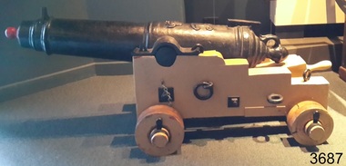
Weapon - Carronade, 1840
The carronade was designed as a short-range naval weapon with a low muzzle velocity for merchant ships, but it also found a niche role on warships. It was produced by the Carron Iron Works and was at first sold as a complete system with the gun, mounting, and shot altogether. Carronades initially became popular on British merchant ships during the American Revolutionary War. A lightweight gun that needed only a small gun crew and was devastating at short range was well suited to defending merchant ships against French and American privateers. The invention of the cannon is variously attributed to Lieutenant General Robert Melville in 1759, or to Charles Gascoigne, manager of the Carron Company from 1769 to 1779. In its early years, the weapon was sometimes called a "mellvinade" or a "gasconade". The carronade can be seen as the culmination of a development of naval guns reducing the barrel length and thereby the gunpowder charge. The Carron Company was already selling a "new light-constructed" gun, two-thirds of the weight of the standard naval gun and charged with one-sixth of the weight of the ball in powder before it introduced the carronade, which further halved the gunpowder charge. The theory of its design was to use less powder and had other advantages that were advertised in the company's sales pamphlet of the time, state. The smaller gunpowder charge reduced the barrel heating in action, also reduced the recoil. The mounting, attached to the side of the ship on a pivot, took the recoil on a slider, without altering the alignment of the gun. The pamphlet advocated the use of woollen cartridges, which eliminated the need for wadding and worming, although they were more expensive. Carronades also simplified gunnery for comparatively untrained merchant seamen in both aiming and reloading that was part of the rationale for adopting the gun. Other advantages promoted by the company were. The replacement of trunnions by a bolt underneath, to connect the gun to the mounting, reduced the width of the carriage that enhanced the wide angle of fire. A merchant ship would almost always be running away from an enemy, so a wide-angle of fire was much more important than on a warship. A carronade weighed a quarter as much as a standard cannon and used a quarter to a third of the gunpowder charge. This reduced charge allowed Carronades to have a shorter length and much lighter weight than long guns. Increasing the size of the bore and ball reduces the required length of the barrel. The force acting on the ball is proportional to the square of the diameter, while the mass of the ball rises by the cube, so acceleration is slower; thus, the barrel can be shorter and therefore lighter. Long guns were also much heavier than Carronades because they were over-specified to be capable of being double-shotted, (to load cannons with twice the shot, for increased damage at the expense of range), whereas it was dangerous to do this in a carronade. A ship could carry more carronades, or carronades of a larger calibre, than long guns, and carronades could be mounted on the upper decks, where heavy long guns could cause the ship to be top-heavy and unstable. Carronades also required a smaller gun crew, which was very important for merchant ships, and they were faster to reload. The small bore carronade and carriage is part of a collection of nineteenth Century Flagstaff Hill Guns and Cannon, which is classified as being of significance and was made a few years after the beginning of Queen Victoria's reign in 1837 and fires a 6 lb pound cannon ball. This nineteenth century artillery piece is a rare and representative item of artillery of this era, used predominately on ships, both military and merchant. The artillery piece, individually and as part of the collection, is highly significant for its historical, scientific and aesthetic reasons at the state, national and world level. This carronade represents the methods of artillery technology, its advancement and its modifications to suit dangerous situations that sailors encountered from attacks from free booters (pirates, living from plunder) or others at the time. Carronade firing a 6 lb cast iron ball, with a smooth bore barrel 6.5 cm in dia the item is mounted on stepped wooden carriage with wooden wheels. Cannon barrel can have its elevation adjusted via a wooden wedge. Gun carriage has loops for locating and holding in position to a deck by ropes. Carriage is a replica made 1982Cast into the barrel is the royal emblem of Queen Victoria (VR "Victoria Regina") indicating the carronade was cast during Queen Victoria's reign / 1840 & 4-2-0 denoting the weight of the barrel. Right hand trunnion has a serial number “8708”. Also on top of the barrel is the British "Board of Ordinance" identifying mark a broad arrow indicating the carronade was in military use. flagstaff hill, warrnambool, shipwrecked coast, flagstaff hill maritime museum, maritime museum, shipwreck coast, flagstaff hill maritime village, great ocean road, colonial defences, victoria’s coastal defences, warrnambool fortification, warrnambool garrison battery, warrnambool volunteer corps, ordinance, armaments, garrison gun, smooth bore cannon, carronade, black powder, 12 pounder, 1840, artillery, lieutenant general robert melville, charles gascoigne, carron company, mellvinade, gasconade -
 Flagstaff Hill Maritime Museum and Village
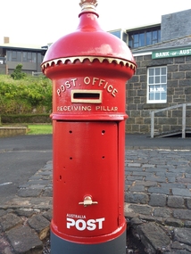
Functional object - Post Office Receiving Pillar, 1885
Post Office Receiving Pillar was Collected from Warrnambool City Council’s Scott Street Depot and transported to Flagstaff Hill, stored in the Barracks area Friends of Flagstaff Hill began the project of restoring the Post Office Receiving Pillar in early 2011. The replacement dome required a pattern to be made from paper, then timber, then someone to manufacture it. The cast iron body required sand blasting and undercoating. The pillar was installed in Flagstaff Hill Maritime Village in March 2014. A specialist visited the Village and painted the pillar with 7 coats of ‘post office red’ then completed the job with gold paint on the details. In 2015 an information plate of brass was fitted to the Pillar in the position that would have originally announced the clearing times. It was originally manufactured by G Couch, Engineer, Alliance Iron Works, Melbourne. Gordon Couch passed away in June 1896 and his Works were offered for auction in November 1897. HISTORY OF POST OFFICE RECEIVING PILLARS In 1851 ‘pillar boxes’ were installed at roadside locations in the island of Jersey, England; they had already been successful in several European countries. The use of new prepaid, adhesive postage stamps as well as the roadside pillar boxes meant there was no need for the public to take a trip to the Post Office just to post a letter. By 1855 London had installed its first six Pillar Boxes. In 1856 the pillar boxes were first introduced in Sydney. These were circular with a crown on the dome, supported by leaves. Early Victoria Mail was originally collected by ‘letter carriers’, first appointed in Melbourne in 1841, equipped with leather bag and hand bell. He wore a red coat with brass buttons and a black top hat! In 1844 two wooden receiving boxes were erected in Melbourne. The first cast iron boxes were installed in South Melbourne (Emerald Hill) and were still in service until 1967. They were a fluted circular design and made in England. In the early 1860’s the ‘low door round’ design posting box was introduced, being circular and surrounded by a crown, with two broad embossed bands around its circumference. The clearance door was in front of the box and low down. These were made in Australia. In the early 1870’s square boxes with a tapering top were being used. These too were made in Australia by different manufacturers with slight variations on style such as the orientation and number of slots. Next came the circular boxes again, similar to the ‘low door round’ but with the clearance door extending to just below the posting slot, often referred to as ‘high door round’. These boxes did not have embossed bands. In 1887 small cast iron boxes were introduced, attached to posts and poles and called ‘lamp post receivers’. Around 1930 a ‘London’ model was used in Victoria. It was copied from the flat-domed type in London but made in Tasmania. … [References: Flagstaff Hill Maritime Village records, The Argus, 11th April, 1890, The Argus, 2nd July, 1896, The Argus, 30th Nov. 1897, “Stamps.Au” http://www.stampsau.com, 4th April 2011 (Extracted from “Australian Street Posting Boxes” by Ken Sparks – out of print)] Post Office Receiving Pillar, or letterbox.1885 "High Door Round" design, restored 2014 Tall cast iron sylinder with decorative dome cap, slot in side, hinged door with handle shaped as a fist. Painted red with gold trip..Reconditioned barrel, reconstructed dome. Restored by Friends of Flagstaff Hill, 2014. Now a working letterbox. Made in Melbourne.Oval maker's plate “ - G. COUCH - / ENGINEER / ALLIANCE IRON / WORKS / MELBOURNE”flagstaff hill, warrnambool, shipwrecked coast, flagstaff hill maritime museum, maritime museum, shipwreck coast, flagstaff hill maritime village, great ocean road, post office receiving pillar, letterbox, mailbox, australia post -
 Flagstaff Hill Maritime Museum and Village
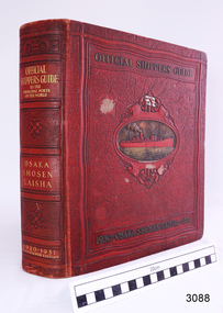
Book - Reference, M. Franklin Kline, Official Shippers Guide, 1930
This book has information about shipping companies and the world's ports. It was a handy guide for travellers of the time and included how and where to board ships going to various countries in 1930 & 1931. In effect, it was a reference work like a timetable for shippers and travellers alike.The book has maps depicting N.Y.K. shipping lines all over the world, indexes (including advertisers), and is thumb-indexed. This book is an official guide that supplies vast information for ships and shipping lines but also for tourists of the time. These types of reference works are keenly collected today.Official Shippers Guide reference book to the Principal Ports of the World, OSAKA SHOSEN KAISHA, 1930 – 1931, Seventeenth Edition, edited, compiled and designed by M. Franklin Kline. Large, hard covered, bound book with margin thumb tabs. Covers are dark red with gold lettering and embossed pattern. Centre of front cover has an oval image of a red steam ship on a gold sea. Above the ship is a white flag with a red emblem.flagstaff hill, warrnambool, flagstaff hill maritime museum, maritime museum, shipwreck coast, flagstaff hill maritime village, great ocean road, traveller's guide, shippers guide, osaka shosen kaishaguide, guide to world ports, m. franklin kline -
 Flagstaff Hill Maritime Museum and Village
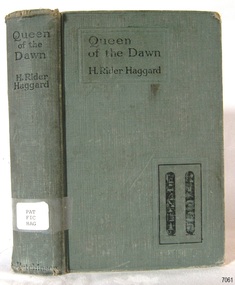
Book - Novel, H Rider Haggard, author, Queen of The Dawn, 1925
H. Rider Haggard (1856-1925), a British author, wrote fiction and non-fiction works and had letters and articles published in newspapers and journals. His novel 'Queen of the Dawn' was published in 1935. Thenovel's cover and Fly page display hieroglyphics, which suggest that this story was set in Egypt. The book is part of Flagstaff Hill's Pattison Collection. The book was published by the British firm Hutchinson & Co. operated for almost 100 years 1887-1985, before it underwent several mergers. The book has additional importance for its connection to the Pattison Collection, which, along with other items at Flagstaff Hill Maritime Village, was originally part of the Warrnambool Mechanics' Institutes’ Collection. The Warrnambool Mechanics’ Institute book collection has historical and social significance for its strong association with the Mechanics Institute movement and its important role in people's intellectual, cultural and social development throughout the latter part of the nineteenth century and the early twentieth century. The collection of books is a rare example of an early lending library and its significance is enhanced by the survival of an original collection of many volumes. The Warrnambool Mechanics' Institute’s publication collection is of both local and state significance.Queen of The Dawn: A love tale of old Egypt Author: H Rider Haggard Publisher: Hutchinson & Co 1st Published in 1925 Green hardcover book with hieroglyphics on the cover, inscriptions on the label and stamps. Part of the Pattison Collection. Label text: "PAT FIC HAG" Stamp, red ink: "W'bool Public Library" Sticker: "Corangamite Regional Library Service" Handwritten: "1298" Hieroglyphics, two, with translations: "Beautiful ascendress of pyramids" and "Great mistress of the dawn"flagstaff hill, flagstaff hill maritime museum and village, warrnambool, maritime museum, maritime village, great ocean road, shipwreck coast, pattison collection, ralph eric pattison, warrnambool mechanics’ institute, mechanics’ institute library, warrnambool library, free library, corangamite regional library service, h. rider haggard, 1925, hutchinson & co., queen of the dawn -
 Flagstaff Hill Maritime Museum and Village
Book, The Works of William Shakespeare
Pattison Collection This item is from the ‘Pattison Collection’, a collection of books and records that was originally owned by the Warrnambool Mechanics’ Institute, which was founded in Warrnambool in 1853. By 1886 the Warrnambool Mechanics’ Institute (WMI) had grown to have a Library, Museum and Fine Arts Gallery, with a collection of “… choice productions of art and valuable specimens in almost every branch and many wonderful national curiosities are now to be seen there, including historic relics of the town and district.” It later included a School of Design. Although it was very well patronised, the lack of financial support led the WMI in 1911 to ask the City Council to take it over. In 1935 Ralph Pattison was appointed as City Librarian to establish and organise the Warrnambool Library as it was then called. When the WMI building was pulled down in 1963 a new civic building was erected on the site and the new Warrnambool Library, on behalf of the City Council, took over all the holdings of the WMI. At this time some of the items were separated and identified as the ‘Pattison Collection’, named after Ralph Pattison. Eventually, the components of the WMI were distributed from the Warrnambool Library to various places, including the Art Gallery, Historical Society and Flagstaff Hill. Later some were even distributed to other regional branches of Corangamite Regional Library and passed to and fro. It is difficult now to trace just where all of the items have ended up. The books at Flagstaff Hill Maritime Village generally display stamps and markings from Pattison as well as a variety of other institutions including the Mechanics’ Institute itself. RALPH ERIC PATTISON Ralph Eric Pattison was born in Rockhampton, Queensland, in 1891. He married Maude Swan from Warrnambool in 1920 and they set up home in Warrnambool. In 1935 Pattison accepted a position as City Librarian for the Warrnambool City Council. His huge challenge was to make a functional library within two rooms of the Mechanics’ Institute. He tirelessly cleaned, cleared and sorted a disarrayed collection of old books, jars of preserved specimens and other items reserved for exhibition in the city’s museum. He developed and updated the library with a wide variety of books for all tastes, including reference books for students; a difficult task to fulfil during the years following the Depression. He converted all of the lower areas of the building into a library, reference room and reading room for members and the public. The books were sorted and stored using a cataloguing and card index system that he had developed himself. He also prepared the upper floor of the building and established the Art Gallery and later the Museum, a place to exhibit the many old relics that had been stored for years for this purpose. One of the treasures he found was a beautiful ancient clock, which he repaired, restored and enjoyed using in his office during the years of his service there. Ralph Pattison was described as “a meticulous gentleman whose punctuality, floorless courtesy and distinctive neat dress were hallmarks of his character, and ‘his’ clock controlled his daily routine and his opening and closing of the library’s large heavy doors to the minute.” Pattison took leave from 1942 to 1945 to serve in the Royal Australian Navy, Volunteer Reserve as Lieutenant. A few years later he converted one of the Museum’s rooms into a Children’s Library, stocking it with suitable books for the younger generation. This was an instant success. In the 1950’s he had the honour of being appointed to the Victorian Library Board and received more inspiration from the monthly conferences in Melbourne. He was sadly retired in 1959 after over 23 years of service, due to the fact that he had gone over the working age of council officers. However, he continued to take a very keen interest in the continual development of the Library until his death in 1969. The Pattison Collection, along with other items at Flagstaff Hill Maritime Village, was originally part of the Warrnambool Mechanics' Institute’s collection. The Warrnambool Mechanics’ Institute Collection is primarily significant in its totality, rather than for the individual objects it contains. Its contents are highly representative of the development of Mechanics' Institute libraries across Australia, particularly Victoria. A diversity of publications and themes has been amassed, and these provide clues to our understanding of the nature of and changes in the reading habits of Victorians from the 1850s to the middle of the 20th century. The collection also highlights the Warrnambool community’s commitment to the Mechanics’ Institute, reading, literacy and learning in the regions, and proves that access to knowledge was not impeded by distance. These items help to provide a more complete picture of our community’s ideals and aspirations. The Warrnambool Mechanics Institute book collection has historical and social significance for its strong association with the Mechanics Institute movement and the important role it played in the intellectual, cultural and social development of people throughout the latter part of the nineteenth century and the early twentieth century. The collection of books is a rare example of an early lending library and its significance is enhanced by the survival of an original collection of many volumes. The Warrnambool Mechanics' Institute’s publication collection is of both local and state significance. The Works of William Shakespeare Author: William Shakespeare Publisher: Chatto and Windus Date: 1876 The label on the spine with typed text PAT 822.2 SHA Front loose endpaper has a sticker from Corangamite Regional Library Service Inside front, loose endpaper has a stamp from Warrnambool Public Museum Second, inside front, loose endpaper has a stamp from Corangamite Regional Library Service book, the works of william shakespeare, william shakespeare, shipwrecked-coast, flagstaff-hill, flagstaff-hill-maritime-museum, warrnambool, maritime-museum, shipwreck-coast, flagstaff-hill-maritime-village, shipwrecked-artefact, pattison collection, warrnambool library, warrnambool mechanics’ institute, ralph eric pattison, corangamite regional library service, warrnambool city librarian, mechanics’ institute library, victorian library board, warrnambool books and records, warrnambool children’s library, great ocean road -
 Orbost & District Historical Society
black and white photograph, 1913
This photograph shows Country Roads Board men clearing a bush track at Hospital Creek. Their vehicle was bogged. The y Roads Board was formed in 1913 1910 it had become apparent that there was a need for a central roads authority to take over responsibility from the Board of Lands and Works for the care and management of the main roads of the state of Victoria. Because there was no consistent and systematic policy for road maintenance Victorian roads were in a deplorable condition. At this time the use of the motor car accentuated the demands for better roads. As a result of these needs the Country Roads Act 1912 was proclaimed in 1913 providing for the establishment of the Country Roads Board as a central road authority with responsibility for those roads within the State considered to be main roads. the C.R.B. was responsible for the construction of roads and bridges including the Snowy River road bridges in Orbost.. This is a pictorial record of transport difficulties in East Gippsland in early 20th century.A large black / white photograph of three men clearing a bush track with a motor vehicle behind them.transport roads road-maintenance country-roads-board -
 Orbost & District Historical Society
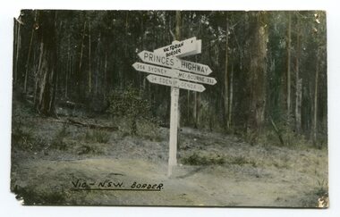
black and white photograph, first half 20th century
Prior to the sealing of the Princes Highway west of Orbost, the road surface was anything but good, even by C1917 when cars started to use the road. From Orbost the old road via Marlo to Sydenham was abandoned for the new location which traversed more rugged country via Cabbage Tree, Bell Bird and Club Terrace to Cann River, and the reason for this diversion was on account of settlements being established at Murrungowar and Club Terrace, at which latter place there was a temporary rush to obtain gold. This road was constructed by the Public Works department and a maximum grade of 1 in 19 was adopted, and as speed was not to be catered for the grade followed in and out round the spurs and gullies, resulting in a maze of turns and twists which required a good deal of skill on the part of the horse driver to negotiate." - Bairnsdale Advertiser, Friday, May 2, 1947. (More information from Newsletter February 2010)This is a pictorial record of an early road distance sign on a major highway through East Gippsland. The distances are indicated in miles, a measurement standard no longer in use.A black / white photograph postcard of the signpost at the Victorian - New South Wales border. It shows distances to Sydney and Eden on one arrow and distances to Melbourne and Genoa on another. on front - Vic - NSW Borderprinces-highway-east-gippsland road-transport road-sign -
 Orbost & District Historical Society
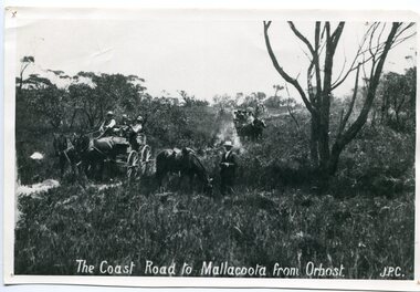
black and white photograph, late 19th century - early 20th century
Prior to the sealing of the Princes Highway west of Orbost, the road surface was anything but good, even by C1917 when cars started to use the road. From Orbost the old road via Marlo to Sydenham was abandoned for the new location which traversed more rugged country via Cabbage Tree, Bell Bird and Club Terrace to Cann River, and the reason for this diversion was on account of settlements being established at Murrungowar and Club Terrace, at which latter place there was a temporary rush to obtain gold. This road was constructed by the Public Works department and a maximum grade of 1 in 19 was adopted, and as speed was not to be catered for the grade followed in and out round the spurs and gullies, resulting in a maze of turns and twists which required a good deal of skill on the part of the horse driver to negotiate." - Bairnsdale Advertiser, Friday, May 2, 1947. (More information from Newsletter February 2010)n the late 1800's early 1900's transporting goods by road was difficult and at times impossible because roads as thoroughfares did not exist.The means of travelling along the roads in the 1800's was by bullock wagon, horse pulled dray, pack horse or simply by foot. This road is still in use in East Gippsland as a part of many four-wheel-drive touring routes.A large black / white photograph of two horse - drawn wagons on a narrow sandy bush track. It is surrounded by scrub. There is one man standing beside a horse not harnessed to a wagon.on front - "The Coast Road to Mallacoota from Orbost JPC" -
 Ringwood and District Historical Society
Photographs, East Ringwood Shops in Railway Avenue circa 1980s (6 photos), 1997
Colour photos of the Ringwood East shopping centre. Query drainage works and autumn trees.East Ringwood shops - hardware shop at roundabout (3274_001); East Ringwood shops - post office (3274_002); East Ringwood shops - Paul's supermarket (3274_003); East Ringwood shops - unknown street (3274_004); East Ringwood shops - Lawrence Grove corner (3274_005); East Ringwood shops - Wright Bros (3274_006) -
 Ringwood and District Historical Society
Land Sale Documents, Board of Land and Works, Documents pertaining to application for a land grant around Ringwood Lake in 1874, 30-May-1870 and 25-Mar-1874
This concerns the application and granting of land to Anthony Ford around the Ringwood lake area in 1874. Includes details of improvements made to the area, including a dwelling. The land is described as being very poor and not worth the labour of cultivation. 8pp.Documents pertaining to application for a land grant around Ringwood Lake in 1874. Copied documents, cream paper. 8pp. +Additional Keywords: Ford, Anthony / Kennedy, James -
 Ringwood and District Historical Society
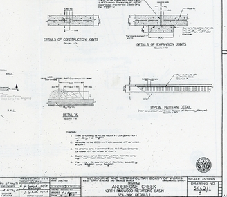
Plan - plans, Metropolitan board of Works, Metropolitan Board of Works plans of North Ringwood retarding basin, energy dissipaters and spillway details, 1979, 31-May-79
Plans made by the Metropolitan Board of Works in May 1979 detailing 1. energy dissipaters for existing drains at the North Ringwood Retarding basin. 2 spillway details2 A3 pages with drawings of Melbourne Metropolitan Board of Works of the North Ringwood retarding basin -
 Ringwood and District Historical Society
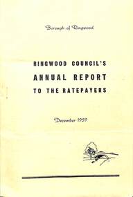
Pamphlet, F.P. Dwerryhouse, Town Clerk and Treasurer, Ringwood Council's Annual Report To The Ratepayers (December 1959), 1959
Borough of Ringwood community information report issued December 1959, including financial summary and sections covering Private Street Construction, Sewerage, Projected Works, Fire Hazards, Dog Nuisance, and an obituary section covering the death during the year of Cr. H.E. Parker, former Mayor, and Mr. Alfred Kelly, Town Clerk.rinx -
 Ringwood and District Historical Society
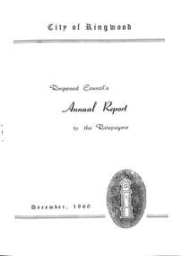
Pamphlet, F.P. Dwerryhouse, Town Clerk and Treasurer, Ringwood Council's Annual Report To The Ratepayers (December 1960), 1960
City of Ringwood community information report issued December 1960, including financial summary and sections covering Private Street Construction, Sewerage, Projected Works, Re-valuation, Fire Hazards, Dog Nuisance, and list of Council Representatives.rinx -
 Ringwood and District Historical Society
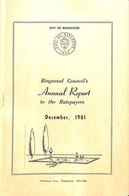
Pamphlet, F.P. Dwerryhouse, Town Clerk and Treasurer, Ringwood Council's Annual Report To The Ratepayers (December 1961), 1961
City of Ringwood community information report issued December 1961, including financial summary and sections covering Re-Valuation, Sanitary Charge, Garbage Removal Charge, Private Street Construction, New Works, Sewerage, Street Lighting, Planning Scheme, Fire Hazards, Fly Control, Dog Nuisance, and list of Council Representatives.rinx -
 Ringwood and District Historical Society
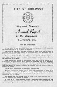
Pamphlet, F.P. Dwerryhouse, Town Clerk and Treasurer, Ringwood Council's Annual Report To The Ratepayers (December 1962), 1962
City of Ringwood community information report issued December 1962, including financial summary and sections covering Valuations, Private Street Construction, Other New Works, Sewerage, Planning Scheme, Annual Special Clearance of Refuse, Elderly Citizens' Village, Elderly Citizens' Clubrooms, Fire Hazards, and list of Council Representatives.Vale - ex-Cr. A.T. Miles, Mr. A.F.B. Long, Mr. F.R. Lucas.rinx -
 Ringwood and District Historical Society
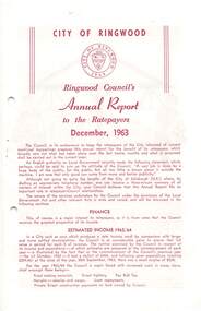
Pamphlet, Ringwood Council's Annual Report To The Ratepayers (December 1963)
City of Ringwood community information report issued December 1963, including financial summary and sections covering Valuations, Private Street Construction, Other New Works, Planning Scheme, Elderly Citizen' Village and Clubrooms, Cool Store Site, Wantirna Road (bridge) Widening, Fire Hazards, Fly Control, Dogs, Refuse, Garbage Removal, Immunization, and List of Council Representatives.Tributes to the late Frank Russell Lucas, original Borough Engineer, and ex-Councillor R.O. Spencer.rinx -
 Ringwood and District Historical Society
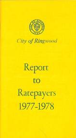
Booklet, City of Ringwood Report to Ratepayers 1977-1978, 1977
Yellow covered community information booklet for Ringwood residents covering Council Representatives' and Service Organisations' contact details, Major Works, Planning (Ringwood Business Centre), Recreation, Litter, Rubbish Tip, Construction of Private Streets (Greenway/Dickasons Road Group), Health and Community Services, Municipal Elections, Rates, Dog Registrations, Overhanging Foliage, Building By-laws, Vandalism, House Numbering, Fire Hazards, Council Finances, and other points of general interest. and local services, sporting, and cultural facilities. Includes two City of Ringwood Free Tipping Vouchers valid until the end of 1978.Mayor's Message - Cr. Lawrie Lawrenson.rinx