Showing 445 items
matching clearing
-
 Eltham District Historical Society Inc
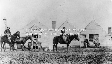
Photograph, William McLaughlin's Kangaroo Ground Hotel, General Store and Post Office, Eltham-Yarra Glen Road, Kangaroo Ground, c.1875
Initially known as the ‘Kangaroo Hotel,’ this photo shows the sign ‘Kangaroo Ground Hotel’ and William McLaughlin as the proprietor, which dates it between 1871 and 1882. The first hotel known as the Kangaroo Hotel was built at the top of the hill by Andrew Ross in 1864 commencing April; a license was obtained, and the bar opened by Edmund Pickett, the tenant, on 11th of July. The hotel was ready for public accommodation by September, 1864. On June 27, 1864, Edmund Pickett, residing at Kangaroo Ground, gave notice to the Bench of Magistrates at Eltham that it was his intention to apply on July 6th for a certificate authorising the issue of a Publican’s Licence for a house rented and occupied by himself, situated at Kangaroo Ground, containing two sitting rooms and five bedrooms exclusive of those required for the use of his family. On February 7, 1866, Edmund Pickett, publican, residing at Kangaroo Ground, applied at the Court of Petty Sessions held at Eltham for a Publican’s License for a house situated at the Kangaroo Ground, containing six bedrooms and two sitting rooms, rented and occupied by himself and licensed under the sign of the 'Kangaroo Hotel.' In 1866, with few boarders at the school and needing to reduce expenses, Ross had the bedroom house removed from the school and placed in contiguity to the hotel, the occupier to have the post office. The house was re-erected with a kitchen addition and was opened as the Post Office & General Store on April 1st. Throughout 1870 Andrew Ross found himself at odds with Pickett - he "felt much dissatisfaction at my having a hotel especially kept by a man of loose principals and low habits" and so served him notice to vacate by December 31st, occupying it himself on January 1, 1871, calling it Rossville House. William McLaughlin and his wife kept the store and post office. As a hotel was now wanted and McLaughlin was desirous to obtain a license, Ross set about making the Store building suitable which was achieved towards the end of 1871. Ross notes in his diary that the Store hotel was finished January 1, 1872. At the Court of Petty Sessions held at Eltham on 5 December 1871, William McLaughlin applied for a license for the Kangaroo Hotel, Kangaroo Ground. He had previously obtained a wine license, March 28. In June 1882, William McLaughlin of Madeline Street, Carlton, (late of Kangaroo Ground, hotelkeeper) was found insolvent due to losses in connection with the Kangaroo Ground Hotel. The license for the hotel was later transferred from Mr John Donaldson to Mrs Sophia Greenaway. It appears during McLaughlin’s tenure the hotel became known as the Kangaroo Ground Hotel. The hotel was replaced with a new wooden building in 1892, constructed by W.Holland and described as being "of a neat appearance, roomy, and fittled up with all modern requirements necessary in a business of this kind." This building was destroyed by fire in 1930. References: Ross, Andrew, 1814-1895 & Woiwod, Mick & Andrew Ross Museum. (2011). The diary of Andrew Ross 1828-1895 & the reminiscences of Andrew Ross 1851-1864 / edited, annotated and introduced by Mick Woiwod for the Andrew Ross Museum, Kangaroo Ground. Kangaroo Ground, [Vic.] : Tarcoola Press in association with the Andrew Ross Museum The Evelyn Observer, (1892, June 24). Evelyn Observer, and South and East Bourke Record (Vic. : 1882 - 1902), p. 2 (MORNING.). Retrieved May 13, 2025, from http://nla.gov.au/nla.news-article60667494 REMINISCENCES. (1893, April 21). Evelyn Observer, and South and East Bourke Record (Vic. : 1882 - 1902), p. 2 (MORNING.). Retrieved May 10, 2025, from http://nla.gov.au/nla.news-article60669116 REMINISCENCES COUNTY EVELYN. BY Andrew Ross. (No. 41) The summer of 1863-4 may be re membered by many colonists as one of the most enjoyable as regards wet weather, and it was one made remarkable by the enterprise and activity apparent throughout Evelyn County. This spirit was fostered and encouraged by the prospect presented from the opening up of the new route to the Jordan and Wood's Point, and the consequent occupation of lands and special localities along the main track. Accommodation for travellers were established at Yarra Flats, the future Healesville, Fernshaw, Marysville, while the beauties and difficulties of the Black Spur, together with the romantic region of the Stephenson Waterfalls mid the mountain forests attracted visitors other than the gold diggers. Before the end of this year 1863, the new route to Wood's Point by the Dividing Range had been so far improved that a track was laid off by the New Chum Creak, Paradise Plains, and the Springs to Emerald Hill, about half way between Jordan and Wood's Point, and the clearing of this track was looked forward to as enabling drays to be employed. The Government had so far yielded to the demands made upon it, that the work was proceeded with early in 1864. In March of that year the writer was favoured by a visit from Mr. Ligne, Surveyor-General, who was enroute to inspect the progress of the undertaking. He was accompanied by Mr. Collins Levey, his son-in-law, who had been a frequent visitor with his friend Mr. Franklin, of the Melbourne Herald newspaper, These parties, and not a few others, were glad to partake of the hospitality of residents on the Ground or, at Yarra Flats when as yet no public accommodation existed. Horsemen and pedestrians became numerous ere winter set in, and there was obviously the want of the hotel which was planned and commenced late in the autumn. The absence of any endeavour on that score by local proprietors induced the writer to undertake the erection of the Kangaroo Ground Hotel, which he did on his own responsibility. The spot best suited for the hotel being held by him on lease, he was permitted by the landlord to devote the required portion of land for the premises to be erected and occupied. Before this was accomplished the imported houses placed near the schoolhouse which had served for bedroom to boarded pupils were rebuilt near the hotel and served for a general store and post office also. Delay was experienced in procuring all the materials for the new building. After the break in the weather the roads on the Ground became very heavy and as timber had to come from town, it was under difficulties that the supply was procured. Bricks for chimneys were made in a small kiln, and hardwood for joists, &c., provided by sawyers employed for the purpose in the bush. The hotel, in consequence, was not ready for public accommodation until the spring, although a license was obtained, and the bar opened by Mr. Pickett, the tenant, on 11th of July. It may be remarked that the house was rather late in being established; a year earlier it would have secured the benefit of the rush to the new diggings, but in another sense it was rather premature for as yet no steps had been taken by the authorities to stop or even discourage the sale of liquor by unlicensed parties, and the holder of a license had to compete with the class in question. As the season (1864) advanced there were parties anxious to be the pioneers in traversing the whole of the route to Wood’s Point, but it was nigh to summer again before the track was available to vehicular traffic. I believe one of the first to effect the whole passage in this way was Mr. Gillies, some time settled at Mortlake. He drove a buggy and called at the Ground on 9th September, stating his intention to drive through to the Point, and we were subsequently informed that he had accomplished the task. (End of Reminiscences No 41)This photo forms part of a collection of photographs gathered by the Shire of Eltham for their centenary project book,"Pioneers and Painters: 100 years of the Shire of Eltham" by Alan Marshall (1971). The collection of over 500 images is held in partnership between Eltham District Historical Society and Yarra Plenty Regional Library (Eltham Library) and is now formally known as the 'The Shire of Eltham Pioneers Photograph Collection.' It is significant in being the first community sourced collection representing the places and people of the Shire's first one hundred years.Digital image (neg copy missing) Print 21 x 26.5 cmeltham-yarra glen road, kangaroo ground, kangaroo ground hotel, post office, shire of eltham pioneers photograph collection, gas lamp, hotels, kangaroo hotel, william mclaughlin, andrew ross, edmund pickett -
 Ballarat Tramway Museum
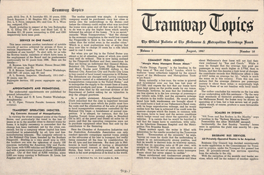
Magazine, Melbourne and Metropolitan Tramways Board (MMTB), "Tramway Topics" - M&MTB, 1947 and 1948
16 issues of the, "Tramway Topics" - "The Official Bulletin of The Melbourne & Metropolitan Tramways Board", issues 50, 51, 53 to 61, issued between August 1947 and October 1948. All printed on cream coloured paper. Headings of significance are listed below. Common items were; Retiring and Death Gratuities, Appointments and Promotions, long service records. 918.1 - 50 - August 1947 - 4 pages - Comment from London, Scalers in Sydney, Brisbane Services, PAYE to go, Newcastle wants to own the trams, Diesels in favour, Fares in London and Melbourne, Something like a deficit, a remarkable record (substations), Work of Testing Department, Accidents are Expensive, and Transport Operations Indicted (National City Lines - USA) 918.2 - 51 - Sept. 1947 - 4 pages - Our SW6 tram, Transport in the US, Conductresses again, How bus costs have risen, Footscray Extensions, Of Course you are good (drivers and driving), How Fares Go, 40-Hour week. 918.3 - 53 - November 1947 - 4 pages - No increase in fares, an unusually interesting tram (Glasgow), alcohol and driving do not mix, pedestrian crossing case, how wages have increased, Russia prefers trams, Sydney's "Honesty" joke, Higher Fares wanted, Tramcars as hearses, an editor on Trolley buses, buses lead - but at a cost (Leicester), the Non paying passenger (Sydney) 918.4 - 54 - December 1947 - 4 pages - Christmas 1947 (Chairman's notes on the future), New Stockholm tram, according to use and wont - Birmingham, Trams in the USA, Board re-appointed, Buses few, so coaches are hired (London), transport from Footscray, "Philadelphians must have the best" - so they are given trams!, The Merri Creek Bridge and appreciations. 918.5 - 55 - March 1948 - 4 pages - That 4/- doubts arising over the 5-day week, Buses carried pick-a-back, Sydney to lose L500,000 this year, Trolleybuses, Rapid transit with PCC trams, another compliment (rosters in Perth), the bill for it all (Melbourne tram strike), an Extraordinary award (Washington DC), Prison tram's last load (Sydney), Douglas horse trams, Lord Ashfield, Glasgow's all night buses. 918.6 -56 - April 1948 - 4 pages - The Board's ambassadors (MMTB Conductors), Brisbane's bus routes, Another deficit in sight (Liverpool UK), Poor Paris, The resilient wheel, the 5-day week rosters, a subway and its costs (Detroit), PCC's in Belgium, South London Trams. 918.7 -57 -May 1948 - 4 pages - Spread of Hours Payment - 5 day week, weak breaks, Buses multiply - losses expand (Manchester UK), Static Electricity, L750,000 deficit in Sydney, praise for conductresses, no purchase by Newcastle, a loss at Adelaide, Transport in Switzerland, Denmark's giant bus, new trams for Glasgow, Grants for sports, single deckers out of favour (UK buses), Transport by Water (London). 918.8 - 58 - June 1948 - 8 pages - Stirring up strife (Melb.) No profit - no sharing (Kansas City), Just why - prices and fares in the US, MMTB staff needs from 5 day week, Section fares in the US, trams at L5,500 each (Sheffield), The unfinished dance (Perth and Hay St.), Thanks from Bristol, Interest in Melbourne trams (letters to the Board), Adelaide's Deficit, Fares up in Sydney and Adelaide, Moscow transport, No trolleybuses thankyou in Belgium, thanks to the Traffic staff, the Late Inspector Boardman, 24,000 irregularities (passengers), Sth London trams, Melbourne's trams amazing, Winnipeg's transport Growth and Standing passengers - London. 918.9 - 59 - July 1948 - 4 pages - The Red Light - RACV and red lights on trams, A request from Argentina,, where our SW6's are, the last 5c fare (New York), Work in the Fog, Traffic headaches in the US, Brisbane's Streamlined tram, Safety glass, Now for La Trobe St. The Tramways Band (South St.), Transport Losses in Sydney. 918.10 - 60 - August 1948 - 4 pages - from Pretoria (Comments on Melbourne), Buses with sliding Doors (OPS1), PCC trams, trams of the future (Glasgow), new trams in Rome, Clearing up the Parking Problem (Sacramento), Fantastic figures - world tram car figures - anti tram, Trainer Drivers, the railway trams and disaster to Liverpool trams, Monte Video trams purchased. 918.11 - 61 - September 1948 - 4 pages - The Year's Work (Melbourne), How Absurd (transport management), items from Britain, Tramway Band News, Food from Melbourne (to Scotland floods), London's Extraordinary traffic, New trams for The Hague, who are the road hogs, the La Trobe St. extension, out clothing factory, Preston Workshops, Toil on the tracks, how the money comes in (fares distribution). 918.12 - 62 - October 1948 - 4 pages - Melbourne's tram fares, Bourke St., Sydney's Street Transport, Scientist or Baker (London), Trolleybuses out of favour, London's poor bus fleet, tram and bus fares, The band at Wattle Park, Madras tramway deal, 121 decide for 6000 (Sydney Sunday trams), Preston workshops, A Engineer's tribute, Was the Street Quiz on trams faked? (The Sun). 918.3 - No. 31 - September 1945 - Year in review - trams more reliable than buses, loss on buses to munitions and Fisherman's bend, ticket checking, Hawthorn clothing factory SW6 trams construction, news from cities in Europe, sub-stations. 918.14 - 64 - September 1949 - higher operating expenses and revenue, school children behaviour, headway recording system - communication issues, golf at Wattle Park, Mr Bell lives in Riversdale Rd. 918.15 - 67 - December 1949 - Record Payment to Consolidated Revenue, payment to MFB etc, flat fares, Latrobe St extension - delayed, fare concessions - who pays, 918.16 - 68 - January 1950 - Bourke St conversion - Risson looking for an early start, fitting of radios to MMTB vehicles, Resilient wheels 918.4 - on top edge in pencil is "Mr Russell", and 918.10 ditto.trams, tramways, mmtb, melbourne, tramways -
 Bendigo Historical Society Inc.
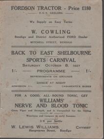
Document - BACK TO EAST SHELBOURNE SPORTS CARNIVAL, 8 October, 1927
Back To East Shelbourne Sports Carnival, Saturday, October 8, 1927. Programme. Refreshments on grounds, dance at night. 1/- Casamento's Buses. Executive Committee: President; W Harris. Vice-President; M De Araugo. Messrs. E Wright, A D Holden, W Hamilton, J Bartels, J Hinck, and H Hinck. Hon. Sec.; H M Burke. Asst. Hon. Sec.; G H Marshall. Ladies; Mesdames J Bartels, H Burke, G H Marshall, E Pocock, R Vines, and E Wright. General Committee; In addition to the above, Messrs. E Pocock, J De Araugo, F J Roberts, and W Marshall, Mesdames W Harris, A Holden, J De Araugo, F J Roberts, and Miss Pocock. Officials Judges: Messrs. T D Cairns, J Craven, and Geo. Hogben. Handicappers: Mr P Davidson (Northern District Walker's Assn.) Starter: Mr W Harris, M De Araugo, J Hinck, H Hovenden, E Pocock, W Hamilton, F J Roberts, A D Holden. Timekeeper: Mr H Hinck. Patrons: Cr, J Bartels, Nuttall & Clarke, Mrs D Punton, R S V Cocking, J Murray, and A Wells. Next 8 pages contain information on the history of East Shelbourne beginning with; This district is situated about ten miles west of south-west of Bendigo on Back Creek or Spring Creek, which received its names from the early diggers of Bendigo who, through shortage of water, were compelled to puddle at Bullock Creek or further 'back,' hence Back Creek; and because of the number of springs it contained - Spring Creek. Among the first to settle, in 1860, were Messrs. John Jenkinson, J Kilgour, T Connelly, G Nichols, R Fox, (who married Mrs James Jenkinson), Kenny, J Roberts, J Genders, J Curry, G Nevinson, Bartram, J Geary, A Nicholl, H Spencer, W Saunders, Mrs Prichard, and J Stansfield. History of East Shelbourne continues . . . Events held were Boy's (State School) Bicycle Race, Stepping the Distance (Gents), Stepping the Distance (Ladies), Bowling at the Stump, Kicking Football Through Hoop, Sheaf Toss, Bucket Ball, Sheffield, Children's Relay Race, Men's Potato Race, Tilting Rings, on Bikes, Walking Contest 1 mile, Car Race through pegs, Slow Bicycle Race 50 yards, Handicap Bicycle Race 2 miles, Tilting Rings in Cars, High Jump, Ladies' and Gent's Cigarette Race, Weight Guessing. Prizes were awarded for first and second placing of these events.In 1923, a Sports Carnival was held in the precincts of what was then a water reserve, situated south of the State School. The area was reserved for watering purposes on 1st May, 1894; and on July 15th, 1912, a small portion was excised. By 1923 its usefulness for water storage had disappeared, and being ideal for recreation purposes, it was decided, at the final meeting of the above sorts carnival, to apply for the area appointed, Mr W Harris (chairman), Messrs. G H Marshall, J Roberts, D Gill, M Connolly, R Vines, E Pocock, and H M Burke (secretary). The matter terminated in a Land Board, presided over by Mr McPherson, being held in Bendigo. The application was granted, but was not gazetted, until Messrs. W Harris and F J Roberts, with Messrs. A E Cook, MLA and Hon. H Keck, MLC interviewed the Minister for Lands. Soon afterwards, at a public meeting, the following members were elected to constitute the first Board of management, Messrs. W Harris (chairman), G H Marshall, A D Holden, F J Roberts (tres.), M D'Araugo, E Wright, and H M Burke (sec.). Since then the arena has been cleared and levelled by residents, and labor and material to the value of 150 pounds have been put into the reserve. At least 2/3rds of the program contain ads from business in Bendigo. Fordson Tractor - W Cowling, W Lewis William's Chymist, Collier footwear, William Wallace Land and Clearing Sales, Bain & Daws Groceries, Farmers & Citizens Trustees Company Bendigo Limited, Northern Seed Supply Co., Marong Bakery, Bennetts' Arcade Store, Marong Hotel, Warren's Drapery & Clothing, Jas. Friswell Butcher, Webster's Wireless, Baker & Woods Tennis Supplies, Hartleys Wireless, Cycle Hartleys, Bendigo Book & Stationery Centre Frank J Every's, T R Jones Chemist, Wool Skins & Hides F Ferguson, Furniture Carpets Linoleums Morley Johnsons, Jewellery & Silverware Prescott & Dawe, Drapers Honan & O'Toole, Stilwell's of Bendigo, Gents' & Ladies' Tailoring Hatters & Mercers Messrs. Denton Bros., Groceries Ales Wines & Spirits W Jeffrey, Ashman's Tailors Hatters Mercers, Myer's, Farmers' Grocery D Whyte & Co., Drapers & Furniture Stores The Beehive, Butcher les. Friswell, Tobacconist & Hairdresser W J Lenten, Timber Merchants & Ironmongers Hume & Iser, Stock E M Vains & Co., Ladies' & Gents' Tailors Clifford & Fulton, Printers & Stationers Bolton Bros. Pty Ltd, Bendigo Leather Shop, Everything Musical Suttons, Andrew's Auction Rooms Butter Eggs Poultry etc, Meats A C Petherick's, Albert Bush's Produce Stores & Chaff Mills, T D Cairns & Co., Jeweller C J Kirby, Casamento's Garage & Ballarat Motor Bus Service, Webster Bros. Sporting House Cycle Builders Motor Cycle & Car Agents, British Motors Bendigo, Webb's Bacon Depot. 20 pages plus coverBoltons Print, Bendigoevent, social, east shelbourne sports carnival -
 Flagstaff Hill Maritime Museum and Village
Photograph - Photograph and Negative, 1952
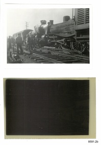
'Moriac, 1952 On 13 April 1952, a woman was killed and seven people were seriously injured when two passenger trains collided. A Melbourne-bound train collided with a Warrnambool-bound train, which was still shunting into siding at the station to allow the Melbourne-bound train to pass it on the single track. Both engines were derailed. The victim was in the first carriage of the Melbourne-bound train, which was telescoped after being forced into the tender of the locomotive. https://en.wikipedia.org/wiki/Railway_accidents_in_Victoria' 'April 12th 1952 7.52 p.m. Two passenger trains collided head on, on Warrnambool line near Moriac just out of Geelong. One killed four injured.' https://trove.nla.gov.au/newspaper/article/244373869?searchTerm=1952%20rail%20accident%20warrnambool ONE DEAD, MANY INJURED IN VIC. RAIL CRASH MELBOURNE, Saturday. — A woman was killed and seven persons were seriously injured when two passenger trains collided head-on at Moriac (59 miles south of Melbourne), near Geelong, at 8.15 tonight. Both engines were derailed, and the first carriage of the Geelong-bound train was telescoped by the coal tender. The dead woman was in this carriage. The trains involved were the 3.25 p.m. passenger train from Port Fairy to Geelong, and the 5.50 p.m. train from Melbourne to Warrnambool, which passed through Geelong at 7.05 p.m. ONE SHUNTING The Warrnambool-bound train had stopped at Moriac and was shunting into a siding to allow the other train to pass along the single track when the crash occurred. The impact hurled the Warrnambool-bound train backwards and the two engines, badly wrecked, came to rest 30ft apart. One engine hung at an acute angle on its side and the crew« were badly scalded by escaping steam. The crash was heard several miles away and hundreds of people rushed to the scene. Two ambulances were called from Geelong, and ambulance men joined railwaymen and volunteers in freeing the injured from badly damaged carriages. MANY SHOCKED Many other passengers were slightly hurt or badly affected by shock. They were treated on the spot. Mr. T. Mather, newsagent and postmaster at Moriac, said the noise of the crash startled him and he was on the scene in a matter of minutes. "There was great confusion," he said. "People on the trains were calling out for help. Many feared a fire would break out. However, we soon got relief gangs together and set to work to free those trapped in the wrecked carriage. One woman was dead, and a man seemed to be dead or dying." Special buses were chartered by the Railway Department to convey the passengers to their destinations. The line was blocked, but repair gangs were soon at work clearing the debris. https://trove.nla.gov.au/newspaper/article/18490332# This photograph and negative belonged to Dr. William Roy Angus. It was donated to Flagstaff Hill Maritime Village by his daughter, Bernice McDade. It is part of the “W.R. Angus Collection” includes historical medical equipment, surgical instruments and material once belonging to Dr Edward Ryan and Dr Thomas Francis Ryan, (both of Nhill, Victoria) as well as Dr Angus’ own belongings. The Collection’s history spans the medical practices of the two Doctors Ryan, from 1885-1926 plus that of Dr Angus, up until 1969. ABOUT THE “W.R.ANGUS COLLECTION” Doctor William Roy Angus M.B., B.S., Adel., 1923, F.R.C.S. Edin.,1928 (also known as Dr Roy Angus) was born in Murrumbeena, Victoria in 1901 and lived until 1970. He qualified as a doctor in 1923 at University of Adelaide, was Resident Medical Officer at the Royal Adelaide Hospital in 1924 and for a period was house surgeon to Sir (then Mr.) Henry Simpson Newland. Dr Angus was briefly an Assistant to Dr Riddell of Kapunda, then commenced private practice at Curramulka, Yorke Peninsula, SA, where he was physician, surgeon and chemist. In 1926, he was appointed as new Medical Assistant to Dr Thomas Francis Ryan (T.F. Ryan, or Tom), in Nhill, Victoria, where his experiences included radiology and pharmacy. In 1927 he was Acting House Surgeon in Dr Tom Ryan’s absence. Dr Angus had become engaged to Gladys Forsyth and they decided he further his studies overseas in the UK in 1927. He studied at London University College Hospital and at Edinburgh Royal Infirmary and in 1928, was awarded FRCS (Fellow from the Royal College of Surgeons), Edinburgh. He worked his passage back to Australia as a Ship’s Surgeon on the on the Australian Commonwealth Line’s T.S.S. Largs Bay. Dr Angus married Gladys in 1929, in Ballarat. (They went on to have one son (Graham 1932, born in SA) and two daughters (Helen (died 12/07/1996) and Berenice (Berry), both born at Mira, Nhill ) According to Berry, her mother Gladys made a lot of their clothes. She was very talented and did some lovely embroidery including lingerie for her trousseau and beautifully handmade baby clothes. Dr Angus was a ‘flying doctor’ for the A.I.M. (Australian Inland Ministry) Aerial Medical Service in 1928 . Its first station was in the remote town of Oodnadatta, where Dr Angus was stationed. He was locum tenens there on North-South Railway at 21 Mile Camp. He took up this ‘flying doctor’ position in response to a call from Dr John Flynn; the organisation was later known as the Flying Doctor Service, then the Royal Flying Doctor Service. A lot of his work during this time involved dental surgery also. Between 1928-1932 he was surgeon at the Curramulka Hospital, Yorke Peninsula, South Australia. In 1933 Dr Angus returned to Nhill and purchased a share of the Nelson Street practice and Mira hospital (a 2 bed ward at the Nelson Street Practice) from Dr Les Middleton one of the Middleton Brothers, the current owners of what previously once Dr Tom Ryan’s practice. Dr Tom and his brother had worked as surgeons included eye surgery. Dr Tom Ryan performed many of his operations in the Mira private hospital on his premises. He had been House Surgeon at the Nhill Hospital 1902-1926. Dr Tom Ryan had one of the only two pieces of radiology equipment in Victoria during his practicing years – The Royal Melbourne Hospital had the other one. Over the years Dr Tom Ryan had gradually set up what was effectively a training school for country general-practitioner-surgeons. Each patient was carefully examined, including using the X-ray machine, and any surgery was discussed and planned with Dr Ryan’s assistants several days in advance. Dr Angus gained experience in using the X-ray machine there during his time as assistant to Dr Ryan. When Dr Angus bought into the Nelson Street premises in Nhill he was also appointed as the Nhill Hospital’s Honorary House Surgeon 1933-1938. His practitioner’s plate from his Nhill surgery is now mounted on the doorway to the Port Medical Office at Flagstaff Hill Maritime Village, Warrnambool. When Dr Angus took up practice in the Dr Edward and Dr Tom Ryan’s old premises he obtained their extensive collection of historical medical equipment and materials spanning 1884-1926. A large part of this collection is now on display at the Port Medical Office at Flagstaff Hill Maritime Village in Warrnambool. In 1939 Dr Angus and his family moved to Warrnambool where he purchased “Birchwood,” the 1852 home and medical practice of Dr John Hunter Henderson, at 214 Koroit Street. (This property was sold in1965 to the State Government and is now the site of the Warrnambool Police Station. and an ALDI sore is on the land that was once their tennis court). The Angus family was able to afford gardeners, cooks and maids; their home was a popular place for visiting dignitaries to stay whilst visiting Warrnambool. Dr Angus had his own silk worm farm at home in a Mulberry tree. His young daughter used his centrifuge for spinning the silk. Dr Angus was appointed on a part-time basis as Port Medical Officer (Health Officer) in Warrnambool and held this position until the 1940’s when the government no longer required the service of a Port Medical Officer in Warrnambool; he was thus Warrnambool’s last serving Port Medical Officer. (Masters of immigrant ships arriving in port reported incidents of diseases, illness and death and the Port Medical Officer made a decision on whether the ship required Quarantine and for how long, in this way preventing contagious illness from spreading from new immigrants to the residents already in the colony.) Dr Angus was a member of the Australian Medical Association, for 35 years and surgeon at the Warrnambool Base Hospital 1939-1942, He served as a Surgeon Captain during WWII1942-45, in Ballarat, Victoria, and in Bonegilla, N.S.W., completing his service just before the end of the war due to suffering from a heart attack. During his convalescence he carved an intricate and ‘most artistic’ chess set from the material that dentures were made from. He then studied ophthalmology at the Royal Melbourne Eye and Ear Hospital and created cosmetically superior artificial eyes by pioneering using the intrascleral cartilage. Angus received accolades from the Ophthalmological Society of Australasia for this work. He returned to Warrnambool to commence practice as an ophthalmologist, pioneering in artificial eye improvements. He was Honorary Consultant Ophthalmologist to Warrnambool Base Hospital for 31 years. He made monthly visits to Portland as a visiting surgeon, to perform eye surgery. He represented the Victorian South-West subdivision of the Australian Medical Association as its secretary between 1949 and 1956 and as chairman from 1956 to 1958. In 1968 Dr Angus was elected member of Spain’s Barraquer Institute of Barcelona after his research work in Intrasclearal cartilage grafting, becoming one of the few Australian ophthalmologists to receive this honour, and in the following year presented his final paper on Living Intrasclearal Cartilage Implants at the Inaugural Meeting of the Australian College of Ophthalmologists in Melbourne In his personal life Dr Angus was a Presbyterian and treated Sunday as a Sabbath, a day of rest. He would visit 3 or 4 country patients on a Sunday, taking his children along ‘for the ride’ and to visit with him. Sunday evenings he would play the pianola and sing Scottish songs to his family. One of Dr Angus’ patients was Margaret MacKenzie, author of a book on local shipwrecks that she’d seen as an eye witness from the late 1880’s in Peterborough, Victoria. In the early 1950’s Dr Angus, painted a picture of a shipwreck for the cover jacket of Margaret’s book, Shipwrecks and More Shipwrecks. She was blind in later life and her daughter wrote the actual book for her. Dr Angus and his wife Gladys were very involved in Warrnambool’s society with a strong interest in civic affairs. He had an interest in people and the community They were both involved in the creation of Flagstaff Hill, including the layout of the gardens. After his death (28th March 1970) his family requested his practitioner’s plate, medical instruments and some personal belongings be displayed in the Port Medical Office surgery at Flagstaff Hill Maritime Village, and be called the “W. R. Angus Collection”. All rail accidents are serious, especially those involving fatalities.Photograph and negative showing two steam locomotives that appear to have collided head on. Also a newspaper article about the collision. From the W.R. Angus Collection.1139 on the back of the photograph together with multiple 'Ilford' brand marks.flagstaff hill maritime museum and village, great ocean road, shipwreck coast, rail accident, moriac, 1952, fatality, dr w r angus -
 4th/19th Prince of Wales's Light Horse Regiment Unit History Room
Photo Albums - set of two, c. 1919
Memorabilia of 908 Dvr Thomas Edward Whyte, 3rd Light Horse Field Ambulance, World War 1 READ THIS. During the last war I sent these pictures home through devious channels. When I lobbed back I found them all pasted in these albums by my young brother Billy. He was only a kid then! Nowadays he is serving up North. Went away with the original 9th Battn. Was in the Blitz on England and served in Libya, Tobruk, Greece, Crete and Palestine and was twice knocked. It's not long since the last upheaval 1914-18 and I wonder if these boys think as we did. This will be the last war? I sincerely hope so. TWSet of two photo albums. Photos pasted into albums with captions in white ink. Photo captions - Vol 1. (? = not legible) 1. Prisoners from ES SALT 2. Dust scene at AUJA FORD. 4th LH BDE 3. ? ? CHEOPS PYRAMID 4. Houses and domain WASSA battle 5 .Pontoon at SERAPELAI 6. SPINX (sic) & PYRAMID 7. The Nile floods occur once yearly and all irrigation centres are alternatively flooded 8. Pontoon bridge over SUEZ Canal at SERAPEUM . Constructed by Aust Engineers 9. The arrival of newspapers and mail 10. Lake IIMSAH-ISMALIA 11. Camp outside Jerusalem. Walls of old city easily discernible 12. Roman walls on beach at MONTAZEH 13. ? ? These boats are used for conveying between steamer & shore 14. Interest shown in the new issue. Through the scarcity of horses Batmen/Grooms and drivers ? allotted donkeys ? ? 15. DAMASCUS GATE JERUSALEM 16. Trumpeter ? 17 Indians making ? for railroad 18. 'SPELLO' Sinai Country 19. Police searching Egyptian labourer 20. Cavalry ?? SHA? 21. Entering ? WADI ? 22. Bedouins at ? 23 No caption 24 No caption 25 Bolar trees EZBEKIEH Gardens CAIRO 26 .Flamingos at NOUZEH Gardens ALEXANDRIA 27 BARAGE 28 KASR-ELNILL Bridge 29 NOUZEH GARDENS 30 AMGS on beach at ? 31 NOUZEH GARDENS - ALEX 32 Mascot of 7th M.V.G. 3RD ALHR 33 Printing on walls inside St Mary's Church. Depicting the Flight from Herod. (Corner torn off photo) 34 Inside Virgin Mary's Church at MATARA 35 ? painting in Church ?? 36 SUEZ Canal. Finish of Arab pony race. ZAL-A-ZIA 37 Admiralty offices at PORT SAID 38 A corner of CHEOP"s PYRAMID 39 The Spinx (sic). Nose was blown off by a shell from one of Napoleon's guns. 40 Monastry on the MT of TEMPTATION 41 Mess orderlies. Foodstuffs in locker given to troops by the AIF 42 Mid day meal on treck 43 Ambulance sand carts for conveying wounded and sick over desert sand 44 3rd ALHB 45 Kaisers Church JERUSALEM. Inside is a large painting figuring the Kaiser & Kaiserine holding a model church. 46 Bedouin women drawing water from well at EL-ARISH 47 2nd ALH BGDE doing route march on JERUSALEM-JERICHO ROAD 48 GEN HODSON GOC Anzac Mounted Divn presenting decorations & investitures on the sands at SHEIKS-ZOWAID 49 Armoured Car 50 Snow at the CEEDERS (sic) on Mt LEBANON 51 Compulsory phenyle bath for all troops in front line area 52 Austrian guns taken at point of bayonet by NZ & 2nd BGDE at GAZA 53 CACHOLETS for carrying wounded 54 The boys found some timber and made a spring board on SUEZ Canal 55 Bedouin wedding. The Bride travels in state amongst rubbish on top of camel. Her father leads conveyance. 56 Australian graves at SHALLAL 57 Camel Transport Company bring rations along beach 58 Billy the mascot holds an offensive & checks advancement 59 Exercising horses at HELMIEH Egypt 60 PONT-DE-QUOBBA Egypt. A suburb of well-to-do Egyptian merchants 61 Demolition stunt at ASLU. Bridge destroyed by Australian Engineers 62 Swimming horses in Great Bitter Lakes Egypt 63 On the move along Wadi 64 On the shores of the Bitter Lakes EL-EGYTE 65 A leave party waiting for the pontoon to swing into position 66 Carting grain 67 Egyptian Brass Band 68 French warboat (sic) in Canal 69 Russian Troops from Mesopotamia passing through SUEZ Canal 70 Prisoners coming in under escort. Turkish & German officers in lead mounted on ponies 71 Turkish prisoners 72 T.B.D in Canal 73 Old trenches on SUEZ CANAL near BITTER LAKES on W Bank 74 Monitor in Canal 75 Block house, trenches & entanglements near Post 62 76 A halt in an Egyptian village EL-MARO' 77 Mobile wireless plant 78 On the road from Canal to Railhead 79 Old Turkish guns in ancient fort at ALEXANDRIA 80 Francenia steaming through Canal 81 After MAGHDABA stunt. Convoy taking wounded form EL-ARISH to railway at 139 82 Indian Camelry 83 Virgin Mary's Church 84 Sluice gate at BARAGE Egypt 85 Hospital at lower W bank of Canal 86 Virgin Mary's tree 87 Sweetwater Canal at ISMAILIA Egypt 88 Halt and Feed. The A.M.C. attached to flying column. 89 Bringing stores ashore at JAFFA 90 H Videon & J Britton astride donks. Horses became scarce through casualties etc and units had donkeys issued to them 91 RAMLEH. The traditional burial place of St John the patron saint of England (sic). 92 Jewish Synagogue at RISHON-COUR-LE-LION (Richard the Lion Hearted) 93 Water tower at HELIOPOLIS 94 Portion of camp on HELIOPOLIS Racecourse 95 Arrival of papers 96 Sand sleigh 97 Boring plant & prisoners taken on the JIFF-JAFFA stunt. Two Austrian officers and party of Turks taken whilst building a concrete gun emplacement 98 The obelisk at MATARIA 99 In an avenue of Australian gums at ZEITOUA 100 Mountain battery gun 101 The 3rd ALH BGDE camped at HELIOPOLIS Racecourse 102 Captured Turkish guns 103 Turkish and Austrian prisoners. JORDAN VALLEY 104 The MT of Temptation Monastery built over spot where Christ spent his 40 days 105 Refugees from ES-SALT at JERICHO 106 3rd LHFA and 8th LH REGT at HELIOPOLIS 107 Fig trees at Roman Wells JIFF JAFFA 108 Inside the Blue Mosque CAIRO 109 Lagoon that was destroyed on JIFF JAFFA stunt 110 Section race at Brigade sports 111 Another tombstone at ALEX 112 Innoculating female date palm 113 Bronze tombstone in a cemetary at ALEXANDRIA 114 Luna Park at HELIOPOLIS 115 Egyptian water buffalo. Used by natives for ploughing etc 116 Russian church. Some call it the "Church of St Mary Magdelene" 117 At pyramids GIZA. Billingsley lost leg & McMullin KIA 118 Pontoon bridge over Suez Canal 119 DURBAN 120 Rescue work 121 Paddy Hanly 122 Motor train for conveying rations between Canal and Railhead. 123 At MUCKSHUBE ? 124 British ??? 125 Bedouins bringing in their harvest from the fields of ABBASSAN-EL-KEBIR Palestine 126 German HD QTRS BEERSHEBA 127 Date ? SINAI 128 Military railroad running through ? at EL-ARISH 129 Street scene at KHAN-YUNIS Palestine. Samson often called at this place to visit his girl. Napoleon narrowly escaped capture here during his ? in 1799 130 Date palms bearing fruit. These do not ? they are ?? 131 Motor ambulance convoy 132 Turkish hospital BEERSHEBA 133 MT CALVARY 134 Town Hall BEERSHEBA 135 Railway station BEERSHEBA 136 ASLUJ 137 Turkish depot MAGDABA 138 DURAN 139 3rd ALAB Hospital 140 Main Street PORT SAID 141 Stock Exchange ALEXANDRIA 142 The "Bull Ring" 14th AGH 143 (Double exposure) 144 Jewish School at DURAN Palestine 145 Damascus Gate JERUSALEM 146 Roller used for grinding clay for making bricks 147 The Harbour at ALEXANDRIA 148 Part of Napoleons Road along sea shore opposite BEELAH 149 Hotel at ALEX. Barred to the troops of course. 150 HELIOPOLIS 151 -153 ALEXANDRIA 154 Ambulance treck 155 Cacholets at the casually clearing station 156 Refugees from ES-SALT entering the Jordan Valley. Mts of MOAB in background 157 Cameliers bring in prisoners 158 The "Niagara". Casualties were from the front line by all descriptions of transport and passed through several field hospitals until they eventually reached the railway. They were sent to KANTARA by train. Despatched from there to PORT SAID by this boat 159 JERICHO 160 Turkish prisoners in JORDAN VALLEY 161 Bedouin nippers of SINAI 162 Bridge destroyed by ALH at ASLUJ 163 Railway sheds at BEERSHEBA. Portion was set afire by retreating Turks 164 ASLUJ Station 165 German Hospice 166 at ASLUJ 167 Suez Canal offices PORT SAID 168 MENA Village from top of Cheops. White lines at left are roads made by Australian troop. First Aust Contingent camped here. 169 A felukeh passing through gate at BARAGE 170 Military railway terminal EL ARISH 171 (No caption) 172 Egyptian family waiting for a train 173 Turkish prisoners and captured material coming in 174 Turkish wounded at BEERSHEBA awaiting removal 175 Two hospital ships at ALEXANDRIA 176 Some of the Bd boys 177 Race meeting 3rd ALHB at TRIPOLI- SYRIA 178 The blacksmith and Rodney Thomas swimming horse in SUEZ CANAL 179 Natives grinding grain 180 Thoroughbred 181 MUKATTAM HILLS 182 Trenches at JIFF JAFFA 183 MacBoyd as a Padre 184 Egyptian Syce having shave by travelling barber 185 The creek outside ALMINA 186 Cameliers 187 Clearing Station on beach at EL-ARISH 188 Wadi at TALLAT-EL-DUMM 189 Motor transport park 190 Some of the boys 191 Pompeys Pillar 192 at MAGHDABA 193 Hospital at JERUSALEM 194 Cheop's Pyramid 195 Golden Gate JERUSALEM 196 Hustling Turks through BEERSHEBA 197 Holy City 198 Mosque of Omar Jerusalem 199 Railway bridge destroyed by ALH at ASLUJ 200 Enemy material captured at SHERIA BEERSHEBA 201-3 These Mosques built with alabaster taken from pyramids at GIZA 204 Pontoon bridge built by our Engineers over RIVER JORDAN 205 3rd Bgde in Koil at MASAID 206 Billy McGhie throwing the weight 207 Nirazeh ? Gardens 208 Motor Ambulance Park 209 Bedouin women in Palestine village 210 ALEXANDRIA 211 Junction Stn 212 Indian Lancers 213 Motor convoy at ESSANI 214 A & B Sections 215 JERUSALEM. Once known as the 'City of Palms' and presented to Cleopatra by Anthony 216 Monastery on the Mount of Temptation. Situated on the Hills of Solomon on E side of Jordan Valley just behind JERICHO 217 DURAN A Jewish village in Palestine 218 One of our planes meets with a mishap on landing 219 Bedouin flocks around NABLUS 220 ES-SALT Road just above Jordan River 221 Halt! Action Front! Getting guns into action from pack 222 Village well 223 Gun inspection 224 WADI GHUZZEE Bridge 225-6 At GIZA Zoo Egypt 227 Syrians gathering olives 228 Smashed plane 229 MacBoyd 230 Bridge across Jordan at GORRONHOER 231 Competitors for Gretna Green. 3rd Bgde sports at TRIPOLIA 232 EL ARISH 233 Main street JAFFA 234 The beach at MARI-KHEB 235 Scene of old Cairo 236 Bedouin market 237 Bridge built over Wadi EL-ARISH. The biblical "River of Egypt". 238 Old water reservoir in native village 239 A "spello" on the track 240 Plane going out on reconnaissance 241 Bomb attached to carrier on a plane 242 Ancient Turkish gun at forts in TRIPOLI - SYRIA 243 Gun inspection 3rd AMGS 244 Old Turkish trenches outside GAZA 245 Wadi KHUZEL Bridge at SHALLA 246 BEERSHEBA 247 Street scene ZAG-A-ZIG 248 Spinx (sic) & Pyramid - GIZA 249 Egyptian Coastguards at ALEXANDRIA 250 A Palestine camp E Troop 3rd MG Sqn 251 B class horses killed in Syria 252 Scene from summit of Pyramid 253 Bert Richmond & an old Turkish Howitzer on MONTAZEH 254 LION'S WELL 255 Australian trenches outside Ferry's Post near Hill 70 256 A street scene in HELIO{PLIS 257 Electric trams at ALEXANDRIA 258 Cleaning harness 259 Swinging pontoon bridge into position at SERAPEUM 260 British Monitor in Suez Canal 261-2 Scenes of Turkish buildings at MAGHDABA. Taken by the ALH The first time in history mounted troops have attacked and taken entrenched positions 263 Aussies at Egypt's ancient monuments 264 Scenes of old CAIRO from MOKATTAM Hils 265 Bridge across canal at BARAGE, 16 miles outside CAIRO 266 Curly and Vic Norton 267 Stumpy McIntyre & Long Pikington 268 In Wadi GHUZZEL near TELL-EL-JEMM 269 Digging post holes for stables 270 Cameliers bring in prisoner. Austrian Officer in black 271 White washing mess shed 272 F Troop 3rd AMGS Sqn 273 Jews at Recruiting Depot at JERUSALEM, forming Jewish Battalion 274 In Jordan Valley, 3rd Machine Gunners have 8 horses killed by an aerial torpedo 275 Turkish prisoners 276 Cocos Island 277 Snow on the Lebanon Ranges 278 Egyptian Hotel 279 Gordon Wake. Note intruders 280 Electric trams at HELIOPOLIS Egypt. Heliopolis built by Belgian firm in 7 years 281 Sweetwater Canal at SERAPEUM 282 The ? wells at JIFF-JAFFA 283 Virgin Mary's well at MATARIA. Boyd, Simpkin & Crowley 284 Cricket for convalescents at MONTAREH 285 Indians working at cutting for military railway 286 Australian Hospital BEERSHEBA 287 Removing wrecked ambulance car from rail road 288 Engineers depot in ? at EL-ARISH 289 Water preservation scheme at SHALLAL 290 German Princes Palace at HELIOPOLOLIS 291 Some of the boys 292 Aussie aerodrome BEELAH 293 EL-JALLAH outside BETHLEHEM 294 Some of the gunners 295 Trying camels in gun carriages. Note sand caterpillar 296 Street outside old city JERUSALEM 297 D.H QRS In EL-ARISH. Hod 298 Cairo Museum 299 Wadi bridge built by Army Engineers 300 A two storied building at GALM used as German HQrs until reached by our guns 301-2 No caption 303 Ambulance with Flying Column 304 Jack Pegg 3 AMGS 305 KHAN YUNIS 306 In the Jewish village of "Rischon le Lion" 307 Wet Canteen BEELAH 308 Motor Transport LATRON 309 Gen Chauvel OC Desert Mounted Column 310 10th LH - Inverness Battery "Railhead" 311 3rd LHFA "SERAPIUM" 312 ESBEKIEN Gardens "LE CAIRE" 313 Camel training and wireless station Hill 60 314 ZAG-A-ZIG Rly Stn 315 One of the Irrigation Canal locks "HELOUAN" 316 Indian Camel Corps 317 Base at Hill 60 318 Aussie transport arriving "ALEXANDRIA" 319 3 ALHB at AL MINA 320 Main entry to city of JAFFA 321 Mosque at DAMASCUS 322 A Turk brought to earth by one of our patrols 323 Brigade boxing contrst 324 Ostrich farm ZEITOUN 325 MATERIA 326 No caption 327 Mail day 328 3rd LHFA entering HELIOPOLIS from MENA 329 M Boyd, L Simpkins, S Crowley 330 Stretcher bearers 331 French Hosp JERUSALEM 332 SERAPIUM 333 Gippo crushing wheel 334 On the move - bully and biscuits 335 V Morton, F Stokes, L Simpkins & Hanley 336 Turkish prisoners - SHERIA 337 Getting used to the mask J Antonio MM 338 Sand carts 339 Model house - MONTAZA Hospital 340 "Abdul" 341 Wood Depot "ESDUD" 342 On troop ship - from Syria 343 Turkish prisoners "JULIUS" 344 TRIPOLI 345 3rd AMGS cook house "BEELAH" 346 Breaking camp "ZEITOUN" 347 Turkish prisoners "GAZA" 348 One of our tanks. About nine were blown out of action at GAZA 349 Camp in HOD-EL-ARISH 350 German HQRS BEERSHEBA 351 Race Course TRIPOLI 352 A Locke & P Leeming 353 Sea planing in Suez Canal 354 MOASCR detail camp 355 KANTARE Suez Canal 356 Four boys of MG Sqn at cards while convalescing . Marked X was a prisoner of war for three days. Got him back with us when we countered. 357 Signal station at CANA 358 H Videon in german rig 359 ROD-EL-FARAC 360 Sweetwater Canal ZAG-A-ZOG 361 Hospital train on beach EL-ARISH 362 Jerusalem Road 363 Bedouin camel and young'un 364 Admiralty Offices, PORT SAID 365 Suez Canal PORT SAID 366 Taking wounded to clearing station 367 Hills of 10-60 MALHA 368 Junction Station 369 EL ARISH 370 Wine Distillery LATRON 371 White figures how entrance to Pyramid 372 RAPC Wireless Station 373 Sports in Canal. ANZAC Day 1916. Prince of Wales is aboard white launch. 374-5 Captured Austrian boat. 40,000 cases of benzine aboard. She was brought into Canal at Port Said. Spies set her afire. She burnt for some considerable time and eventually blew up. 376 Pumping water from Wadi on Muckshabee stunt 377 On trenches 378 Bringing in disabled battle plane 379 Giving a motor transport a lift 380 Old Turkish howitzer. MONTAZZA 381 Jerusalem country 382 Palm Hod in SINAI. Trees do not bear dates until 14 years old. No bees here. Palms innoculated by Bedouin. 383 Camel cacolets for conveying wounded 384 ESKBEKIEL Gardens Cairo 385 LAKE TIMBAH 386 Xmas dinner 1916 387 Gift billies from ACF 388 Section competition 389 In big marquees HELIOPOLIS 390 HM Landships 391 Capt Aberdeen inspecting horses 392 Football. Black vs White 393 The game 394 Old Napoleon fort. 10 mile along coast from ALEX 395 Jewish Cemetery AKRON 396 Ration fatigue 397 Blowing bottom out of Turkish Reservoir to allow soakage 398 Tilley & Farley - 14th AGH 399 At GIZA Zoo. Note height of giraffe 400 On this stunt we destroyed Turkish reservoir of 2 1/2 million gallons 401 Demolition party at wells MUCK-SHUBE 402 3rd ALH Bde HELIOPOLIS Race course 403 HMLS "Lady Wingate" 404 Turks blew out our tanks at GAZA 405 One of our aviators captured by German. Note German wearing Iron Cross. Snapped behind Turkish lines. Original of this snap was dropped at Aust aerodrome to let them know Aussie airman was alright and not killed in capture. Chivalry 406 Sausage observation balloon 407 READY 408 Bomb on carrier 409 Testing 410 B Richmond, Wireless Operator RAFC 411 Loading Bomb 412 Crash in desert 413 Bomb in YMCA at MAZRAR 414 No caption 415 LW Simpkin - Late 3LHFA 416 LEMNOS 417 Shelling the MARSDEN 418 Pontoon across Jordan River 419 Shells on Walkers Ridge 420 Sweetwater Canal 421 LAKE ISMAILIA 422 Indian Lancers on Canal 423 CAIRO Railway Station 424 Destroying Turkish water supplies. Explosives used for breaking clay at bottom of lagoon, help to absorb water 425 Exercising horses at ZEITOUN Egypt 426 In Wadi on MUG-SHUBEE stunt 427 Tractor drawing 60 lb gun towards front line 428 Sultan's mother's place at HELIOPOLIS = City of the Sun 429 Camped on the sands outside RAILHEAD, Jump off for SINAI campaign 430 G Turner & A Lockwood out for a camel ride. 431 GAZA and Nile floods from top of Pyramid 432 Baby refuses to carry his harness and his pal wears an astonished look 433 No caption 434 Turkish Officers 435 Regt HQRS at IBEETA 436 No caption 437 3rd Machine Gun Squadron 3rd ALH Bgde (my unit) 438 Camel Corps at dinner 439 KHEFREN Pyramid snapped from top of Cheops 440 CHEOPS 441 Pyramids 442 MENA from top of Pyramids 443 Snap from Pyramid showing MENA-CAIRO road running through Nile floods 444 MENA village from Pyramid 445 Band of British West Indies Regt 446 Gippo Band 447 Swimming on Med Sea 102 KmA 448 H Maddocks 449 Bedouin and Egyptians utilise any animals for their fields 450 Captured Turkish train - BEERSHEBA 451 Gardens ISMAILIA 452 Gippos used for horse lines etc 453 Canteens at HELIOPOLIS 454 3 ALHB watering in Wadi on ESSANI stunt 454 JAFFA 455 ALEX, Napoleon relics 456 Egyptian water wheel 457 SUEZ 458 WADI GHUZZEE 459 On Reconnaissance at 10-60 460 Goats and sheep captured from hostile Bedouins 461 Pontoon SERAPIUM 462 Aust trenches - Suez Canal. Turks attacked FEB 1916 463 Camel transport 464 3 ALHB Wireless Station. Col Scott 9 LH got DSO on this stunt (MUCK SHUBE) 465 ALEXANDRIA 466 Canal Hospital Ships 467 Ambulance - Sand cart 468 At old Cairo 469 No 1 Casualty Clearing Station 470 3rd Brigade on move 471 3rd LHFB- Making camp SERAPIUM 472 Watering horses 473 Moving up wadi 474 The wells at Wadi GHUZZEE 475 Camel transport SINAI 476 Turkish reservoir destroyed by ALH 477 Wall in a Luxor tomb 478 Entrance to "Temple of Bulls" 479 Bob White 480 Bedouin crops 481 Harem of Montazza, Turkish prince 482 Jack Holmes, Billy McGhee 483 MUDERIA, B Troop post 484 JIFF JAFFA 485 Natives on railroad construction 486 Aust graves SHALLAL 487 The Stumpy Mirror 488 R Nile at MANSUREH 489 Aust graves - BEELAH 490 NOUZEH Gardens - ALEXANDRIA 491 On issue from QMS. Take what comes. Fit does not matter 492 MATARA 493 German Yacht Club - ALEX 494 Old Turkish Howitzer and cannon ball 495 Field hospital 496 Gardens at BARAGE 497 A dispute's ending 498 Snow. MT LEBANON 499 Bedouin sheep 500 Combat in the air 501 no caption 502 Old Napoleon gun 503 Gordon Wake HQ car 504-5 Burying the dead at GAZA 506 Water Polo 507 Brigade boxing comp 508 Field cooker 509 Bridge on Jerusalem road, Blown up by Turks 510 Teaching horses to lay quiet. For protective purposes 511 "Major" and "Bitsy" 512 Bedouin Scarabs 513 Convalescent 514 1. W Billings. Returned to Aust 2. W McMahon KIA 515 Hospital 516 Coming good 517 1st day up - 14th AGH PORT SAID 518 Back again in Regt 519 Billy and Taffy 520 Stew 521 KHAN YUNIS 522 MENA 523 Casualties PORT SAID 524 Washing 525 Mail 526 Gun from the "Emden" mounted in Syney 527 MARSURES 528 Desert bivouac 529 HASSED 530 3RD ALH Bde. Good camp (Extra) All conv's 531 New issue 532 On to another camp (8 LH Regt) 533 Shore - JAFFA on MED SEA Photo Captions Volume 2 (Illegible = ?) 1 The Cedars on Mt Lebanon, according to tradition originated from the staves of the 12 Apostles 2000 years ago. 2 TIBERIUS taken 27th Sept '18 3 NAZARETH taken 20th Sept. German officer and Arab pony 4 TIBERIUS fell on 27th Sep. Von Saunders was the GOC of Turkish Forces in Palestine 5 Jordan Valley & Plains of Jericho run between Mts of Moab & Hills of Solomon. Distance across valley from foot of each range of hills abt 13 miles, looks ? 6 Storm on Sea of Galilee 7 DAMASCUS fell on 1st October. German vehicle park. 8 German funeral near Jerusalem 9 JENIN. German Headquarters. Fell 20th Sept. German field bakery 10 Three pages back will be seen a storm on GALILEE. Note now calm here. This photo taken near spot from which the previous one was taken. German motor launch on Galilee. 11 Captured intact on 20th Sept. German workshops JENIN 12 Turkish aerodrome captured here. Hostile aircraft landed whilst it was in our hands. Aviators greatly surprised and even indignant. Motor smash near EL FULE. 13 German Orderly Room (Ammunition box full of gold), DAMASCUS. All this gold Turkish coin secured by our troops. 14 German artillery on the way to the front near KENETRA. The ALH swooped down on the artillery around this vicinity & captured many field guns. 15 German Despatch Rider on the road to ES SALT. Unsuccessful raids carried out on ES SALT on 30th April & 4th May. This country was hard on men and horses. Goat tracks were used at times but horse were led most of the time. Stunt lasted 14 days in wet weather & horses were only unsaddled for about 2 hours during stunt. 16 Strand, ? , Tiberius, Gallilee 17 German workshop. Captured by ALH 18 One of the dead lying outside GAZA. Killed 19th April 17. We could not bury them before November 19 Some of the boys that fell in the charge at BEERSHEBA. Tibby Cotter 20 Collecting our dead for burial. They were K in A on the 19th April at GAZA. Buried seven months later, 23,000 casualties in one day 21 German U-Boat 22 Page of postage stamps and money - Struck to commemorate Gallipoli victory - Turkish war postage stamps - War duty - Turkish war bank notes 23 Pamphlet. With paper badges affixed These badges were worn by young Egyptian students. Arabic translation means "Egypt for Egyptians Long Live Egypt" This pamphlet was printed under German influence & distributed around ZAG-A-ZIG, the chief centre of hostilities during the recent Egyptian riots. The Young Egyptian Students influenced the Natives to oppose British Administration, what they called Tyranny. They professed to have sufficient competent educated men to govern their own affairs, but our Heads would not hear of it. Consequently the riots. Many ? and soldiers killed. All railways and communications disorganised. It took several months to bring things to their normal ? Pictures of medals 1. In honour of General Falkenhaugh GOC Turkish Forces 2. The Victorious Emperors of Germany, Austria and Turkey 3. Egypt Awakening 24 Those large photographs I sent you were procured for me by a pal who knew the chap that owned the negatives. The owner of these snaps belongs to the 5th Regiment of the 2nd Brigade, and he took the camera from a Turkish Officer. It had only 6 snaps of a spool of 10, and the BIll Jim finished off the spool by taking 4 of the special entry into Jerusalem. The cross indicates those taken by the Australian, the remainder were taken by the Jackos in the vicinity of BEERSHEBA and SHERIA Turkish field bakery 25 Cavalry going up to support their own line. However never had much action against the Turkish horsemen 26 Turkish Electricians in the field. I have an idea that this photo was taken to get the centre figure. He looks dinkum Australian. Note Australian leggings on Turk on the right 27 Turkish machine gunners ready for action. This is very much like the Beersheba country. Turkish officers on the right, and along side him is the range taker with his Barand Stroud. We use these instruments in the Sqn and they cost about 83 (Pound) 28 Turkish General Head Quarters just beyond SHERIA. Note hard rocky country 29 Turkish Cavalry watching a fight and getting ready to go into action. This is at SHERIA, and the heavy fighting lasted several days. Plenty of water and the Jacko's tried their hardest to hold on to this pozzie. Often our chaps met the gamer Turks in the dead of night, because both sides were on the same game, crawling down for water. This stunt is known as the Junction Fight. 30 Official entry Dec 11th. The official entry into Jerusalem. Sir G Allenby in the lead with his staff officers of the French and Italian troops accompanying him. Guard represents New Zealand, Australia, England Wales Scotland Ireland and India entering theJaffa Gate 31 Sir Ronald Storrs made Governor of JERU. Captured 9th Dec 17. Reading the Proclamation, General Allenby wearing white breeches. Troops of other nations were present, and the notables of Jerusalem. It was read from the foot of the Tower of David, a place that has been standing since the time of Christ 32 The first of the British troops entering Jerusalem. A few Turkish officers may b seen walking at the head of the column. Populace in a bad plight, very poor and no tucker, and all were greatly overjoyed at the ?? of the British Hundreds and kiddies ill treated ?? (Part of caption missing) 33 10th LH Regt first to enter JERUSALEM. Mounted officer on the right supposed to be the CO of the first troops to enter Jerusalem. Note mud on the horses. Had very wet and muddy weather 34 Dead Jacko 35 Turkish machine gun and crew 36 Hanging Armenian doctors who refused to join Turkish Army 37 Outside Damascus Gate Jerusalem 38 Turkish patrol lying outside trench at EL BUAJ 39 Burying Aussies at DAMASCUS 40 1. Djemel Pasha 2. General Limon Von Saunders GOC Turkish Forces in Palestine 41 One execution in Egypt. Executing an Egyptian offender 42 Turkish atrocities DAMASCUS 43 Turks occupying trenches outside JERICHO 44 On ASLUJ demolition stunt. Feeding and spelling. Arrived at Rendezvous too early 45 Turkish saw bayonet 46 Captured guns taken at BEERSHEBA & SHERIA 47 Our gunners obtained a direct hit on ammunition train 48 The large and small of the game. At GAZA. 74th CCS in background 49 Around JULIOUS. These Turkish shell dumps were very numerous around this vicinity 50 Captured Turkish Cavalry 51 Cavalry leaders 52 Turkish machine gun & crew 53 Enemy officers. One on left is wearing Iron Cross ribbon 54 Captured Austrian boat afire, Suez Canal Port Said. 40,000 cases of benzine aboard. Fire a mysterious outbreak 55 ? Hotchkiss gunners and enemy aircraft over ? TELL-EL-FARA 56 Types of enemy officers. One of our bikes in their possession. Recaptured later. The five pointed medals worn by these officers is called the Gallipoli Star. Issued to commemorate the Turkish victory at Gallipoli 57 Our batteries put in some good shooting amongst Turkish transport 58 Showing compactness of Turkish trenches 59 Desert homes. The only time we had cover in SINAI was when we camped near a Hod. Then we could use date palm leaves 60 JIFF JAFFA 61 ZAITZOUN 62 10th Regt MGS amongst hills outside JERUSALEM 63 Jews wailing place JERUSALEM 64-5 German post card characters 66 Post Card PHYLAE The Kiosk 67 Post Card Vue du Canal de Suez 68 Post Card No 93 Queen Street, Fort, Colombo 69 Snipers at NALIN Sth Syria. Lousy country for richochets. Nast wounds. (Aust War Memorial Melbourne) 70 Myself on Ginger. This little neddie is boshter jumper 71 Magazine cutting - Lt C H Vautin & German airman G Felmy 72 9th Regt 3rd LHB Judean Hills outside JERUSALEM. (Aust War memorial Melbourne) 73 Sand hills SINAI ? Desert (Aust War Memorial Melbourne) 74 3rd LHB spelling at GALILEE (AWM Melbourne) 75 Jordan Valley outside JERICHO (AWM Melbourne) - lovely Jordan Valley, dust and heat, 1280 ft below sea level 76 Copy of no 69 77 Watering at MATARIA 78 A desert grave - Tpr H R Olver MM 6th LH MGS Beneath this simple cross there lies a comrade true and tried He fought as fights a soldier And like a soldier died 79 B Section. When they first took our Stetsons and issued cumbersome helmets 80 Palestine types of Turkish and German officers 81 Some of the gunners amongst the snows in MT LEBANON 82 The country around JERUSALEM 83 JERUSALEM 84 Fishing ? ? at GALLILEE 85 Jerusalem taken Dec 9th. Official entry on the 11th. Jerusalem (showing) Holy City and Mosque of Omar 86 Turkish shell hits old tomb at ZERNUKAH. Capt Hurley official photographer - AWM Melbourne 87 14th AGH at PORT SAID 88 Human bones at Dead City ABBASSIA 89 3rd ALH Bde at HELIOPOLIS 90 Men wearing gloves 91 Wireless station in course of erection at MATARIA - 28 masts 92 Old slave market at ABBRASSIA. Many excavations performed on projecting wooden frame at corners 93 3rd guns on the move. The beautiful scenery between LATRON & JERUSALEM 94 Bedouin agents 95 Collecting captured enemy material 96 Captured double-engined plane 97 On the march. Country at Eastern SINAI 98 Anzac mosaic found at SHALLAL whilst trench digging now covered with gun etc ready for removal. Was sent to Canberra. 99 A Troop watering. A rotten job at a small well when horses are thirsty 100 The new Jericho road. Running through Hills of Solomon Valley in distance 101 Gun inspection 102 Draining pools at WADI AUJA. Keeping down Malaria carrying mosquitos 103 8th Regt and 3rd AMGS at BEELAH 104 A rendezvous in the Jordan Valley 105 2nd ALHB camped outside JERUSALEM 106 WADI AUJA in the Jordan Valley 107 Hospital train on the beach at EL -ARISH 108 Jacko's 109 Jerries 110 Stables of Turkish Headquarters SHALLAL 111 Early training. Every man to throw and quieten his horse for purpose of taking cover 112 A Troop 3rd Guns at TAALAT-EL-DUMM 113 Watering at WADI GHUZZEE 114 J Rushden KIA at ES-SALT 115 J Carling F Troop 3rd AMGS. Taken prisoner at EL-BURJ. Repatriated after Armistace 116 Captured enemy plane 117 Jacko gun 118 Brig-Gen Galloping Jack Royston. OC 3rd ALH Bde 119 Cleaning ammunition belts in the Hod at MASAID 120 Bringing up the fodder at ABBASSAN-EL-KEBIA 121 Some of the boys amongst the snow on MT LEBANON 122 Turkish barley crops at SHALLAL in Southern Palestine 123 The crops a few weeks after our horses had been in this vicinity 124 Clearing up after a stunt 125 On the move. 5 minute spells for the horses 126 In Jordan Valley. An airial torpedo lobbed amongst 3rd MG Transport horses & killed 28 127 Camel ration convoy coming along beach 128 Field Hospital at ET MALER 129 Desert graves at ROMANI 130 A day on the beach. Wash self, horse and clothing 131 Watering on the beach at BEELAH. Note how close fresh water is to the seashore 132 A patrol caught by a shell 133 Spello 134 Crossing the Wadi 135 Halt! Weights off and feed 136 Gas instruction 137 F Troop at TELL-EL-FARI 138 Xmas Dinner at MASAID 1916-17. Arrived back at this camp Xmas Eve after 5 nights & 4 days in saddle & the capture of MAGHDABA 139 Exercising along the beach at MARA-KHEB 140 Watering at a Bedouin well 141 At Sheikh's ZOWAID 142 3rd Gun Squadron at ABBASSAN-EL-KEBIR 143 Captured plane on its way to Australian Aerodrome 144 One of our planes about to pass over Hod 145 E & F Troop horse lines and horses 146 Sun set on Med Sea 147 Beach scene at EL-ARISH 148 Turkish transport. Small animals but they can pull big loads and they possess large hearts 149 The dressing station JIFF JAFFA ? 150-8 Types of Egyptian women - Nubian - Fellaheen - Sudanese - Low class Gippo - Egyptian - Middle Class -Egyptian Aristocracy - Turkish 159 French girls on beach at PORT SAID 160 Bedouin girls drawing water 161 Egyptian flappers at ALEXANDRIA 162 Post Card- Dame Turque 163 Post Card - Jeunne Fille Arabe 164 Graves of New Zealanders at RISCHON 165 Graves of Australians at DEIR-EL-BELAH 166 Race day. The saddling paddock 167 Bivouacs 168 3rd ALH Brigade at TRIPOLI 169 Advance party putting down horse lines at KHAN YURIS 170 Breaking the desert monotony 171 WADI QUELT. Taken from one of its precipitous banks 172 Turkish stores on N shore of DEAD SEA 173 Watering at Solomon's Pools 174 Waiting for action at - ES DUN (AWM Melbourne) 175 Camel Corps in action SINAI (AWM Melbourne) 176 ALH Time to Camp (part missing) (AWM Melbourne) 177 3rd Machine Gun Squadron IBU-HARITH, Lieut Breed, McLeod, Guppy, Whyte 178 Cartoon sketch - "A Digger" 179 Turkish Cavalry 180 Gun crew of No 2 Sub F Troop, 3rd Gun Sqdn 181 Operating base of JIFF JAFFA stunt 182 One of the British war boats that cooperated with the Land Force 183 Military railway line passing through a Hod in SINAI 184 AL-MINAH The sea port of Tripoli, Syria 185 NAZARETH Taken on 20 Sep 18 186 The Monastery on the Mt of Temptation, Taken from a cave on opposite hill. 187 JAFFA From the beach 188 In Monastery on the Mt of Temptation Rock on which Christ spent his 40 days 189 Cross indicates Garden of Gethsemane. Arrow at Russian Church of St Magdalene. MT of Olives on left 190 The Roman Bath at MONTAZAH. Hewn out of solid rock 191 Mine sweeper ashore near SHEIK'S ZOWAIL 192 Throwing "Chester" for an operation 193 The swimming pozzie at LAKE TIMSAH, ISMAILIA. Half a mile from MOASCAR, the Aust Training Depot 194 The remains of Napoleon's road. Portions can be seen running between BEELAH & GAZA 195 Camels utilised for ambulance work 196 TULKERAM taken on 19th Sep. This stunt started the previous night and this position fell to us the first day. About 60 miles from starting point 197 German officer at mess, JERUSALEM 198 German Headquarters SEMAK 199 TIBERIAS 200 Water preservation scheme at SHALLAL 201 A dip in the Jordan River. Crossed river on night 21-22 April 18 202 Watering and a wash up 203 JERICHO Taken on 21 Feb 18 204 Turkish graves 205 KHAN YUNIS. Southern Palestine, Note how sand ridges from the beach meet vegetation area. Fertile land 20 miles in width. the beginning of PHILISTIA 206 TAUBE-OVER 207 Drawing drinking water in Wadi GHUZZEE 208 The swimming pozzie in JORON 209 Landing stores at EL-ARISH 210 A camp near the wadi 211 Railway line and bridge crossing wadi above SHALLAL 212 The mid-day halt 213 Turks and Aussies at Dressing Station on beach 214 Washing day 215 Bringing supplies ashore 216 Trying mules in a 60 pounder 217 The desert winds have blown away and left this piece standing 218 Pontoons used by the Turks in their attempt to cross Suez Canal Feb 15 219 "HASSEIN" 220 "GIPPO" Mascot of 3rd AMG Sqdn 221 "Biddy" 222 Railhead camp 223 Typical Bedouin 224 Motor Submarine chaser dvr whyte, photos, ww1, light horse field ambulance -
 Eltham District Historical Society Inc
Photograph - Aerial Photograph, Landata, Eltham; Crown Allotment 15, Section 5, Parish of Nillumbik (Stokes Orchard Estate), Dec. 1945
Centred on present day Diosma Rd, Stokes Pl, Nyora Rd and Eucalyptus Rd Historic Aerial Imagery Source: Landata.vic.gov.au Aerial Photo Details: Project No :5 Project : MELBOURNE AND METROPOLITAN AREA PROJECT Run : 36 Frame : 60546 Date : 12/1945 Film Type : B/W Camera : EAG4 Flying Height : 10200 Scale : 6000 Film Number : 195 GDA2020 : 37°42'47"S, 145°09'56"E MGA2020 : 338306, 5824438 (55) Melways : 22 C4 (ed. 42) A History of the Development of Crown Allotment 15, Section 5, Parish of Nillumbik – Stokes Orchard Crown Allotment 15, Section 5, Parish of Nillumbik (CA15) is a square allotment of 158 acres or approximately a quarter of a square mile. It lies just beyond the eastern end of Pitt Street, south of Nyora Road to the northern end of Eucalyptus Road and extends east from Eucalyptus Road to Reynolds Road. The topography of CA15 is generally steep, sloping up to a hill near the centre of the land, the ridgeline passing through the properties along the southern side of Diosma Road. Eucalyptus Road is a straight north-south road with its northern end at the north west corner of CA15. Until the end of the 1970s this road was an un-named Government Road and was largely not open to traffic. With residential development in the 1970s the road was constructed, and the council allocated the name obviously in recognition of the predominant species of the local bushland. CA15 was purchased from the Crown by George D’Arley Boursiquot, a prominent Melbourne printer, on 28th October 1852. On November 23, 1922, former Member for Gippsland and Melbourne Real Estate Agent, Hubert Patrick Keogh purchased the allotment then sold it March 13, 1925, to local farmer, Robert David Taylor, a former Shire of Eltham Councillor (1911-1920) and Shire President (1919). Taylor had extensive land holdings stretching west towards Bible Street and Main Road. The Taylor home was situated at the top of the hill in Bible Street at present day 82 Bible Street. At the time of Taylor’s purchase in 1925, CA15 was subdivided into 48 lots that could be described as small rural properties or large residential lots. A typical lot size was one hectare or 2.5 acres. The subdivision created two roads, Nyora Road, and Diosma Road, each following an irregular alignment between Eucalyptus and Reynolds Roads. However, the lots were not sold off separately nor were the roads constructed. The land effectively remained as one parcel for many further years. Robert David Taylor died November 30, 1934, and probate was granted to his son of the same name, Robert David Taylor of Bible Street, Salesman and William McLelland Vance Taylor of 73 Emmeline Street, Northcote, Clerk, with the transfer of the land into their names on July 8, 1935. Frank Stokes worked as a qualified accountant at Kennons leather factory in Burnley, while living at 1 Thomas Street, Mitcham. He suffered from migraines and wanted to return to working the land (he had previously worked on farms and orchards since coming to Australia from England in 1926, both in WA and Vic.). He first travelled to the district by train in July 1942 to find land with the intention to establish an orchard. By chance he met Arthur Bird of Bird Orchard (bounded by Pitt Street, Eucalyptus Road, and Wattle Grove) and they got talking over their common interest. Arthur put Frank up for the night and pointed out the land, 158 acres- part of the Taylor Estate- £900, Crown Allotment 15, Section 5, Parish of Nillumbik (CA15) somewhat diagonally opposite Bird Orchard. Stokes applied through the Riverina Agency to purchase the land who in turn applied for permission from Canberra to sell as there was a new government regulation introduced during the Second World War banning land sales except for immediate production. Stokes obtained a loan on his Mitcham house of £600 @ 5% and paid £450 deposit with quarterly payments of £15 spread over 5 years. Stokes was assisted and advised by Arthur Bird who farmed the neighbouring orchard. In early 1943 Stokes took possession and would catch the train out to Eltham on Fridays after work and began building a hut on the corner of Nyora Road and the Government Road (Eucalyptus Road) for shelter and to lock up tools. He established an orchard on the central western part of the land through the centre of which ran a natural waterway (part of the present-day linear park) and was able to pay a neighbour (Hawkins) to help with clearing and fencing 25 acres, and with a horse and single furrowed plough, planted approximately 2,500 fruit trees - cherries, peaches, plums, almonds, pears, apricots and lemons as well as a few apples and oranges; a massive task. Aerial photographs from the 1940s through to the 1990s clearly show the orchard with most of the larger CA15 site remaining as natural bushland. A huge problem was hares and rabbits eating all the new buds off the tiny trees. As well as laying poison he painted the trees with a mixture of cow manure and lime, often working by moonlight. Procurement of wire and wire netting was difficult because of the war but after much effort he obtained a permit from the Agricultural Department for supplies in March 1944. In February 1945 Stokes applied for a permit to build a “packing shed” as no house building was allowed. It was to be 33 feet x 21 feet and cost £312. It was constructed mostly from second-hand materials, which were hard to obtain, especially iron for roofing. Stokes finished work at Kennons on October 31, 1945, and in March 1946 he sold the family home at Mitcham for £1,230 plus £170 for furniture. On May 15, 1946, title to the CA15 property was issued to Frank Howard Alfred Stokes, Orchardist and Gladys Ethel Stokes, Married Woman, both of Pitt Street, Eltham. The family of five then moved into the very unfinished “packing shed” at Eltham, which was a struggle to weatherproof. Eventually rooms were divided off and lined with hessian bags and whitewashed. Their income was firewood (cut and sold), selling rockery stones and cut Sweet Bursaria. (It was discovered during the 1940s that Sweet Bursaria contained the sunscreen compound Aesculin. The RAAF utilised this compound from Sweet Bursaria during WW2 for pilots and gunners.) The orchard’s first fruit sale was a half-case of Le Vanq peaches in December 1947 for the price of 8 shillings. In 1956 plans for house were drawn and Glen Iris bricks purchased (1956 Olympic Rings variant). The building of the house commenced in 1957 - 12 feet of original packing shed was removed – and was completed in 1959. Water was connected from newly built pressure storage on the property at the end of 1959 and the electricity connection for the first time at 3pm on April 29, 1960. The house remains to present day (somewhat modified) at 1 Nyora Road, home to Nyora Studio Gallery. On occasions, spare remnants of the 1956 bricks have been known to be unearthed in gardens on the estate as they were utilised by Frank Stokes to fill in rabbit holes. On May 26, 1950, a parcel of land was compulsorily acquired by the Melbourne and Metropolitan Board of Works on the hilltop to establish an easement for a high-level service reservoir to augment Eltham’s water supply. The project also included pipe tracks for the necessary water mains. The reservoir has now been superseded by higher level water tanks east of Reynolds Road and its former site is now a public reserve. On November 27, 1964, the State Electricity Commission served notice to compulsorily acquire a further parcel through the eastern part of the land for a major electricity transmission line that augmented supply from the La Trobe Valley to Melbourne. The easement was registered February 11, 1966. The easement was widened July 18, 1969 for a second transmission line to be constructed. In 1971 Melbourne Metropolitan Planning Scheme amendments adopted Nyora Road as the boundary between a residential zone to the north and a rural zone to the south. This determined the future development of the land. In the mid-1970s the Shire of Eltham divided the orchard into numerous rate-able parcel lots, the 48 lots having been established in 1925 and the subsequent rates assessment proved unsustainable for Stokes. He commenced selling lots outside the boundary of the orchard, north of Diosma and South of Nyora. However shortly later the land between Nyora and Diosma Roads and west of the electricity easement was sold and subdivided into residential lots, a housing development by Macquarie Builders and marketed as the Stokes Orchard Estate. New streets were created, and most were named after trees, although one, Stokes Place, commemorates the former owners. The development was undertaken in two stages; Stage 1 (1975) encompassing Scarlet Ash Court, Ironbark Close and Peppermint Grove bounded by Nyora and Eucalyptus roads and Stage 2 (1978) encompassing Stokes Place, Orchard Way, The Crest and The Lookout bound by Nyora and Diosma roads. The developer, Macquarie Builders went bankrupt shortly after the release of Stage 2 leaving many purchasers to fend for themselves and arrange for their own independent builders. There were also difficulties with sewerage for the land immediately south of Diosma Road and so the conventional residential lots were abandoned in favour of larger lots. The development of Orchard Way, The Crest and The Lookout did not proceed as planned and the proposed lots were incorporated into five-acre parcels instead. These included a low-density group housing development by the Graves family and the award winning Choong House (1983) with Gordon Ford developed garden immediately next door situated on the ridge of the hill nestled amongst the original bush, Eucalypt trees and Sweet Bursaria. In 1994, Nillumbik Shire Council applied Significant Environment and Significant Landscape overlays upon the properties on the south side of Diosma Road to ensure protection of this natural bush garden environment. With the arrival of the sewer along Diosma Road in the 1990s, most of these five-acre parcels have since been subdivided multiple times. The Choong house presently sits on a 2.7-acre property, which in 2022 Nillumbik Council nominated for Cultural Significance Heritage protection and is considered potentially significant at State level. The Stokes family were also associated with the Eltham Christian Church. In the 1970s this church had met in temporary premises in Eltham. Lots of the original 1925 subdivision remained south of Nyora Road and a number of these lots were utilized for the Eltham Christian School, which was established by the Eltham Christian Church in 1981. The school operated on this site until 2000. The premises are now used by The Vine Baptist Church. By the mid-1980s the whole of CA15 had been developed for residential and school purposes, except for the sections north of Diosma Road and between the transmission lines and Reynolds Road. Sewerage issues had been resolved for the section north of Diosma Road and in 1987 it was in the process of being subdivided into residential lots. The development coincided with the discovery of colonies of the rare and endangered Eltham Copper Butterfly on the site. This resulted in a community and political campaign to save the butterfly habitat. With the co-operation of the land developer the subdivision was altered to create two bushland reserves in the critical butterfly habitat areas. In the late 1980s the State Government was investigating options for establishing a metropolitan ring road link between Diamond Creek and Ringwood. The chosen route was adjacent to Reynolds Road and so this created a freeze on development of CA15 between Reynolds Road and the electricity easement. The ring road proposal was eventually abandoned, and this part of the land was subdivided into low density residential lots. Diosma Road has been discontinued at the electricity easement and the eastern part incorporated into View Mount Court with access from Reynolds Road. The whole of CA15 has now been developed for residential or associated purposes, ranging from conventional density to quite low density south of Nyora Road. Some remnants of the orchard remain, a few cherry trees on the Graves property and a lone apple tree in Stokes Place. The butterfly reserves comprise significant areas of remnant bushland. Linear reserves through the estate link with central Eltham via the Woodridge linear reserve and with Research along the electricity easement. CA15 as it exists today has a complicated history of rural use, Government acquisition, urban development, and community action. References: • “Stokes Orchard, an incomplete history”; Russell Yeoman with Doug Orford • Correspondence, Beryl Bradbury (nee Stokes) • Aerial Photographs, 1931-1991, Landata (landata.vic.gov.au) • Certificate of Title, Vol. 4930 Fol. 985900 • Plan Number LP 10859 aerial photo, diosma road, eltham copper butterfly, eucalyptus road, ironbark close, nyora road, peppermint grove, peter & elizabeth pidgeon collection, power transmission lines, reynolds road, scarlet ash court, stokes orchard estate, stokes place, woodridge estate, frank stokes -
 Eltham District Historical Society Inc
Photograph - Aerial Photograph, Landata, Eltham; Crown Allotment 15, Section 5, Parish of Nillumbik (Stokes Orchard Estate), Nov. 1931
Centred over present day Reynolds Road and Mount Pleasant Road, Eltham (including Diosma Rd, Stokes Pl, Nyora Rd and Eucalyptus Rd) Historic Aerial Imagery Source: Landata.vic.gov.au Aerial Photo Details: Project No :1931 Project : MALDON PRISON Run : 21 Frame : 3160 Date : 11/1931 Film Type : B/W Camera : F8 Flying Height : 11000 Scale : 18860 Film Number : 60 GDA2020 : 37°43'31"S, 145°10'20"E MGA2020 : 338912, 5823086 (55) Melways : 22 E8 (ed. 42) A History of the Development of Crown Allotment 15, Section 5, Parish of Nillumbik – Stokes Orchard Crown Allotment 15, Section 5, Parish of Nillumbik (CA15) is a square allotment of 158 acres or approximately a quarter of a square mile. It lies just beyond the eastern end of Pitt Street, south of Nyora Road to the northern end of Eucalyptus Road and extends east from Eucalyptus Road to Reynolds Road. The topography of CA15 is generally steep, sloping up to a hill near the centre of the land, the ridgeline passing through the properties along the southern side of Diosma Road. Eucalyptus Road is a straight north-south road with its northern end at the north west corner of CA15. Until the end of the 1970s this road was an un-named Government Road and was largely not open to traffic. With residential development in the 1970s the road was constructed, and the council allocated the name obviously in recognition of the predominant species of the local bushland. CA15 was purchased from the Crown by George D’Arley Boursiquot, a prominent Melbourne printer, on 28th October 1852. On November 23, 1922, former Member for Gippsland and Melbourne Real Estate Agent, Hubert Patrick Keogh purchased the allotment then sold it March 13, 1925, to local farmer, Robert David Taylor, a former Shire of Eltham Councillor (1911-1920) and Shire President (1919). Taylor had extensive land holdings stretching west towards Bible Street and Main Road. The Taylor home was situated at the top of the hill in Bible Street at present day 82 Bible Street. At the time of Taylor’s purchase in 1925, CA15 was subdivided into 48 lots that could be described as small rural properties or large residential lots. A typical lot size was one hectare or 2.5 acres. The subdivision created two roads, Nyora Road, and Diosma Road, each following an irregular alignment between Eucalyptus and Reynolds Roads. However, the lots were not sold off separately nor were the roads constructed. The land effectively remained as one parcel for many further years. Robert David Taylor died November 30, 1934, and probate was granted to his son of the same name, Robert David Taylor of Bible Street, Salesman and William McLelland Vance Taylor of 73 Emmeline Street, Northcote, Clerk, with the transfer of the land into their names on July 8, 1935. Frank Stokes worked as a qualified accountant at Kennons leather factory in Burnley, while living at 1 Thomas Street, Mitcham. He suffered from migraines and wanted to return to working the land (he had previously worked on farms and orchards since coming to Australia from England in 1926, both in WA and Vic.). He first travelled to the district by train in July 1942 to find land with the intention to establish an orchard. By chance he met Arthur Bird of Bird Orchard (bounded by Pitt Street, Eucalyptus Road, and Wattle Grove) and they got talking over their common interest. Arthur put Frank up for the night and pointed out the land, 158 acres- part of the Taylor Estate- £900, Crown Allotment 15, Section 5, Parish of Nillumbik (CA15) somewhat diagonally opposite Bird Orchard. Stokes applied through the Riverina Agency to purchase the land who in turn applied for permission from Canberra to sell as there was a new government regulation introduced during the Second World War banning land sales except for immediate production. Stokes obtained a loan on his Mitcham house of £600 @ 5% and paid £450 deposit with quarterly payments of £15 spread over 5 years. Stokes was assisted and advised by Arthur Bird who farmed the neighbouring orchard. In early 1943 Stokes took possession and would catch the train out to Eltham on Fridays after work and began building a hut on the corner of Nyora Road and the Government Road (Eucalyptus Road) for shelter and to lock up tools. He established an orchard on the central western part of the land through the centre of which ran a natural waterway (part of the present-day linear park) and was able to pay a neighbour (Hawkins) to help with clearing and fencing 25 acres, and with a horse and single furrowed plough, planted approximately 2,500 fruit trees - cherries, peaches, plums, almonds, pears, apricots and lemons as well as a few apples and oranges; a massive task. Aerial photographs from the 1940s through to the 1990s clearly show the orchard with most of the larger CA15 site remaining as natural bushland. A huge problem was hares and rabbits eating all the new buds off the tiny trees. As well as laying poison he painted the trees with a mixture of cow manure and lime, often working by moonlight. Procurement of wire and wire netting was difficult because of the war but after much effort he obtained a permit from the Agricultural Department for supplies in March 1944. In February 1945 Stokes applied for a permit to build a “packing shed” as no house building was allowed. It was to be 33 feet x 21 feet and cost £312. It was constructed mostly from second-hand materials, which were hard to obtain, especially iron for roofing. Stokes finished work at Kennons on October 31, 1945, and in March 1946 he sold the family home at Mitcham for £1,230 plus £170 for furniture. On May 15, 1946, title to the CA15 property was issued to Frank Howard Alfred Stokes, Orchardist and Gladys Ethel Stokes, Married Woman, both of Pitt Street, Eltham. The family of five then moved into the very unfinished “packing shed” at Eltham, which was a struggle to weatherproof. Eventually rooms were divided off and lined with hessian bags and whitewashed. Their income was firewood (cut and sold), selling rockery stones and cut Sweet Bursaria. (It was discovered during the 1940s that Sweet Bursaria contained the sunscreen compound Aesculin. The RAAF utilised this compound from Sweet Bursaria during WW2 for pilots and gunners.) The orchard’s first fruit sale was a half-case of Le Vanq peaches in December 1947 for the price of 8 shillings. In 1956 plans for house were drawn and Glen Iris bricks purchased (1956 Olympic Rings variant). The building of the house commenced in 1957 - 12 feet of original packing shed was removed – and was completed in 1959. Water was connected from newly built pressure storage on the property at the end of 1959 and the electricity connection for the first time at 3pm on April 29, 1960. The house remains to present day (somewhat modified) at 1 Nyora Road, home to Nyora Studio Gallery. On occasions, spare remnants of the 1956 bricks have been known to be unearthed in gardens on the estate as they were utilised by Frank Stokes to fill in rabbit holes. On May 26, 1950, a parcel of land was compulsorily acquired by the Melbourne and Metropolitan Board of Works on the hilltop to establish an easement for a high-level service reservoir to augment Eltham’s water supply. The project also included pipe tracks for the necessary water mains. The reservoir has now been superseded by higher level water tanks east of Reynolds Road and its former site is now a public reserve. On November 27, 1964, the State Electricity Commission served notice to compulsorily acquire a further parcel through the eastern part of the land for a major electricity transmission line that augmented supply from the La Trobe Valley to Melbourne. The easement was registered February 11, 1966. The easement was widened July 18, 1969 for a second transmission line to be constructed. In 1971 Melbourne Metropolitan Planning Scheme amendments adopted Nyora Road as the boundary between a residential zone to the north and a rural zone to the south. This determined the future development of the land. In the mid-1970s the Shire of Eltham divided the orchard into numerous rate-able parcel lots, the 48 lots having been established in 1925 and the subsequent rates assessment proved unsustainable for Stokes. He commenced selling lots outside the boundary of the orchard, north of Diosma and South of Nyora. However shortly later the land between Nyora and Diosma Roads and west of the electricity easement was sold and subdivided into residential lots, a housing development by Macquarie Builders and marketed as the Stokes Orchard Estate. New streets were created, and most were named after trees, although one, Stokes Place, commemorates the former owners. The development was undertaken in two stages; Stage 1 (1975) encompassing Scarlet Ash Court, Ironbark Close and Peppermint Grove bounded by Nyora and Eucalyptus roads and Stage 2 (1978) encompassing Stokes Place, Orchard Way, The Crest and The Lookout bound by Nyora and Diosma roads. The developer, Macquarie Builders went bankrupt shortly after the release of Stage 2 leaving many purchasers to fend for themselves and arrange for their own independent builders. There were also difficulties with sewerage for the land immediately south of Diosma Road and so the conventional residential lots were abandoned in favour of larger lots. The development of Orchard Way, The Crest and The Lookout did not proceed as planned and the proposed lots were incorporated into five-acre parcels instead. These included a low-density group housing development by the Graves family and the award winning Choong House (1983) with Gordon Ford developed garden immediately next door situated on the ridge of the hill nestled amongst the original bush, Eucalypt trees and Sweet Bursaria. In 1994, Nillumbik Shire Council applied Significant Environment and Significant Landscape overlays upon the properties on the south side of Diosma Road to ensure protection of this natural bush garden environment. With the arrival of the sewer along Diosma Road in the 1990s, most of these five-acre parcels have since been subdivided multiple times. The Choong house presently sits on a 2.7-acre property, which in 2022 Nillumbik Council nominated for Cultural Significance Heritage protection and is considered potentially significant at State level. The Stokes family were also associated with the Eltham Christian Church. In the 1970s this church had met in temporary premises in Eltham. Lots of the original 1925 subdivision remained south of Nyora Road and a number of these lots were utilized for the Eltham Christian School, which was established by the Eltham Christian Church in 1981. The school operated on this site until 2000. The premises are now used by The Vine Baptist Church. By the mid-1980s the whole of CA15 had been developed for residential and school purposes, except for the sections north of Diosma Road and between the transmission lines and Reynolds Road. Sewerage issues had been resolved for the section north of Diosma Road and in 1987 it was in the process of being subdivided into residential lots. The development coincided with the discovery of colonies of the rare and endangered Eltham Copper Butterfly on the site. This resulted in a community and political campaign to save the butterfly habitat. With the co-operation of the land developer the subdivision was altered to create two bushland reserves in the critical butterfly habitat areas. In the late 1980s the State Government was investigating options for establishing a metropolitan ring road link between Diamond Creek and Ringwood. The chosen route was adjacent to Reynolds Road and so this created a freeze on development of CA15 between Reynolds Road and the electricity easement. The ring road proposal was eventually abandoned, and this part of the land was subdivided into low density residential lots. Diosma Road has been discontinued at the electricity easement and the eastern part incorporated into View Mount Court with access from Reynolds Road. The whole of CA15 has now been developed for residential or associated purposes, ranging from conventional density to quite low density south of Nyora Road. Some remnants of the orchard remain, a few cherry trees on the Graves property and a lone apple tree in Stokes Place. The butterfly reserves comprise significant areas of remnant bushland. Linear reserves through the estate link with central Eltham via the Woodridge linear reserve and with Research along the electricity easement. CA15 as it exists today has a complicated history of rural use, Government acquisition, urban development, and community action. References: • “Stokes Orchard, an incomplete history”; Russell Yeoman with Doug Orford • Correspondence, Beryl Bradbury (nee Stokes) • Aerial Photographs, 1931-1991, Landata (landata.vic.gov.au) • Certificate of Title, Vol. 4930 Fol. 985900 • Plan Number LP 10859 aerial photo, diosma road, eltham copper butterfly, eucalyptus road, ironbark close, nyora road, peppermint grove, peter & elizabeth pidgeon collection, power transmission lines, reynolds road, scarlet ash court, stokes orchard estate, stokes place, woodridge estate, frank stokes -
 Eltham District Historical Society Inc
Photograph - Aerial Photograph, Landata, Eltham; Crown Allotment 15, Section 5, Parish of Nillumbik (Stokes Orchard Estate), Jan. 1951
Centred on present day Diosma Rd, Stokes Pl, Nyora Rd and Eucalyptus Rd Historic Aerial Imagery Source: Landata.vic.gov.au Aerial Photo Details: Project No :65 Project : MELBOURNE AND METROPOLITAN PROJECT NO. 2 Run : 8 Frame : 71 Date : 01/1951 Film Type : B/W Camera : EAG9 Flying Height : 12200 Scale : 12000 Film Number : 1419 GDA2020 : 37°43'14"S, 145°09'46"E MGA2020 : 338081, 5823608 (55) Melways : 22 C6 (ed. 42) A History of the Development of Crown Allotment 15, Section 5, Parish of Nillumbik – Stokes Orchard Crown Allotment 15, Section 5, Parish of Nillumbik (CA15) is a square allotment of 158 acres or approximately a quarter of a square mile. It lies just beyond the eastern end of Pitt Street, south of Nyora Road to the northern end of Eucalyptus Road and extends east from Eucalyptus Road to Reynolds Road. The topography of CA15 is generally steep, sloping up to a hill near the centre of the land, the ridgeline passing through the properties along the southern side of Diosma Road. Eucalyptus Road is a straight north-south road with its northern end at the north west corner of CA15. Until the end of the 1970s this road was an un-named Government Road and was largely not open to traffic. With residential development in the 1970s the road was constructed, and the council allocated the name obviously in recognition of the predominant species of the local bushland. CA15 was purchased from the Crown by George D’Arley Boursiquot, a prominent Melbourne printer, on 28th October 1852. On November 23, 1922, former Member for Gippsland and Melbourne Real Estate Agent, Hubert Patrick Keogh purchased the allotment then sold it March 13, 1925, to local farmer, Robert David Taylor, a former Shire of Eltham Councillor (1911-1920) and Shire President (1919). Taylor had extensive land holdings stretching west towards Bible Street and Main Road. The Taylor home was situated at the top of the hill in Bible Street at present day 82 Bible Street. At the time of Taylor’s purchase in 1925, CA15 was subdivided into 48 lots that could be described as small rural properties or large residential lots. A typical lot size was one hectare or 2.5 acres. The subdivision created two roads, Nyora Road, and Diosma Road, each following an irregular alignment between Eucalyptus and Reynolds Roads. However, the lots were not sold off separately nor were the roads constructed. The land effectively remained as one parcel for many further years. Robert David Taylor died November 30, 1934, and probate was granted to his son of the same name, Robert David Taylor of Bible Street, Salesman and William McLelland Vance Taylor of 73 Emmeline Street, Northcote, Clerk, with the transfer of the land into their names on July 8, 1935. Frank Stokes worked as a qualified accountant at Kennons leather factory in Burnley, while living at 1 Thomas Street, Mitcham. He suffered from migraines and wanted to return to working the land (he had previously worked on farms and orchards since coming to Australia from England in 1926, both in WA and Vic.). He first travelled to the district by train in July 1942 to find land with the intention to establish an orchard. By chance he met Arthur Bird of Bird Orchard (bounded by Pitt Street, Eucalyptus Road, and Wattle Grove) and they got talking over their common interest. Arthur put Frank up for the night and pointed out the land, 158 acres- part of the Taylor Estate- £900, Crown Allotment 15, Section 5, Parish of Nillumbik (CA15) somewhat diagonally opposite Bird Orchard. Stokes applied through the Riverina Agency to purchase the land who in turn applied for permission from Canberra to sell as there was a new government regulation introduced during the Second World War banning land sales except for immediate production. Stokes obtained a loan on his Mitcham house of £600 @ 5% and paid £450 deposit with quarterly payments of £15 spread over 5 years. Stokes was assisted and advised by Arthur Bird who farmed the neighbouring orchard. In early 1943 Stokes took possession and would catch the train out to Eltham on Fridays after work and began building a hut on the corner of Nyora Road and the Government Road (Eucalyptus Road) for shelter and to lock up tools. He established an orchard on the central western part of the land through the centre of which ran a natural waterway (part of the present-day linear park) and was able to pay a neighbour (Hawkins) to help with clearing and fencing 25 acres, and with a horse and single furrowed plough, planted approximately 2,500 fruit trees - cherries, peaches, plums, almonds, pears, apricots and lemons as well as a few apples and oranges; a massive task. Aerial photographs from the 1940s through to the 1990s clearly show the orchard with most of the larger CA15 site remaining as natural bushland. A huge problem was hares and rabbits eating all the new buds off the tiny trees. As well as laying poison he painted the trees with a mixture of cow manure and lime, often working by moonlight. Procurement of wire and wire netting was difficult because of the war but after much effort he obtained a permit from the Agricultural Department for supplies in March 1944. In February 1945 Stokes applied for a permit to build a “packing shed” as no house building was allowed. It was to be 33 feet x 21 feet and cost £312. It was constructed mostly from second-hand materials, which were hard to obtain, especially iron for roofing. Stokes finished work at Kennons on October 31, 1945, and in March 1946 he sold the family home at Mitcham for £1,230 plus £170 for furniture. On May 15, 1946, title to the CA15 property was issued to Frank Howard Alfred Stokes, Orchardist and Gladys Ethel Stokes, Married Woman, both of Pitt Street, Eltham. The family of five then moved into the very unfinished “packing shed” at Eltham, which was a struggle to weatherproof. Eventually rooms were divided off and lined with hessian bags and whitewashed. Their income was firewood (cut and sold), selling rockery stones and cut Sweet Bursaria. (It was discovered during the 1940s that Sweet Bursaria contained the sunscreen compound Aesculin. The RAAF utilised this compound from Sweet Bursaria during WW2 for pilots and gunners.) The orchard’s first fruit sale was a half-case of Le Vanq peaches in December 1947 for the price of 8 shillings. In 1956 plans for house were drawn and Glen Iris bricks purchased (1956 Olympic Rings variant). The building of the house commenced in 1957 - 12 feet of original packing shed was removed – and was completed in 1959. Water was connected from newly built pressure storage on the property at the end of 1959 and the electricity connection for the first time at 3pm on April 29, 1960. The house remains to present day (somewhat modified) at 1 Nyora Road, home to Nyora Studio Gallery. On occasions, spare remnants of the 1956 bricks have been known to be unearthed in gardens on the estate as they were utilised by Frank Stokes to fill in rabbit holes. On May 26, 1950, a parcel of land was compulsorily acquired by the Melbourne and Metropolitan Board of Works on the hilltop to establish an easement for a high-level service reservoir to augment Eltham’s water supply. The project also included pipe tracks for the necessary water mains. The reservoir has now been superseded by higher level water tanks east of Reynolds Road and its former site is now a public reserve. On November 27, 1964, the State Electricity Commission served notice to compulsorily acquire a further parcel through the eastern part of the land for a major electricity transmission line that augmented supply from the La Trobe Valley to Melbourne. The easement was registered February 11, 1966. The easement was widened July 18, 1969 for a second transmission line to be constructed. In 1971 Melbourne Metropolitan Planning Scheme amendments adopted Nyora Road as the boundary between a residential zone to the north and a rural zone to the south. This determined the future development of the land. In the mid-1970s the Shire of Eltham divided the orchard into numerous rate-able parcel lots, the 48 lots having been established in 1925 and the subsequent rates assessment proved unsustainable for Stokes. He commenced selling lots outside the boundary of the orchard, north of Diosma and South of Nyora. However shortly later the land between Nyora and Diosma Roads and west of the electricity easement was sold and subdivided into residential lots, a housing development by Macquarie Builders and marketed as the Stokes Orchard Estate. New streets were created, and most were named after trees, although one, Stokes Place, commemorates the former owners. The development was undertaken in two stages; Stage 1 (1975) encompassing Scarlet Ash Court, Ironbark Close and Peppermint Grove bounded by Nyora and Eucalyptus roads and Stage 2 (1978) encompassing Stokes Place, Orchard Way, The Crest and The Lookout bound by Nyora and Diosma roads. The developer, Macquarie Builders went bankrupt shortly after the release of Stage 2 leaving many purchasers to fend for themselves and arrange for their own independent builders. There were also difficulties with sewerage for the land immediately south of Diosma Road and so the conventional residential lots were abandoned in favour of larger lots. The development of Orchard Way, The Crest and The Lookout did not proceed as planned and the proposed lots were incorporated into five-acre parcels instead. These included a low-density group housing development by the Graves family and the award winning Choong House (1983) with Gordon Ford developed garden immediately next door situated on the ridge of the hill nestled amongst the original bush, Eucalypt trees and Sweet Bursaria. In 1994, Nillumbik Shire Council applied Significant Environment and Significant Landscape overlays upon the properties on the south side of Diosma Road to ensure protection of this natural bush garden environment. With the arrival of the sewer along Diosma Road in the 1990s, most of these five-acre parcels have since been subdivided multiple times. The Choong house presently sits on a 2.7-acre property, which in 2022 Nillumbik Council nominated for Cultural Significance Heritage protection and is considered potentially significant at State level. The Stokes family were also associated with the Eltham Christian Church. In the 1970s this church had met in temporary premises in Eltham. Lots of the original 1925 subdivision remained south of Nyora Road and a number of these lots were utilized for the Eltham Christian School, which was established by the Eltham Christian Church in 1981. The school operated on this site until 2000. The premises are now used by The Vine Baptist Church. By the mid-1980s the whole of CA15 had been developed for residential and school purposes, except for the sections north of Diosma Road and between the transmission lines and Reynolds Road. Sewerage issues had been resolved for the section north of Diosma Road and in 1987 it was in the process of being subdivided into residential lots. The development coincided with the discovery of colonies of the rare and endangered Eltham Copper Butterfly on the site. This resulted in a community and political campaign to save the butterfly habitat. With the co-operation of the land developer the subdivision was altered to create two bushland reserves in the critical butterfly habitat areas. In the late 1980s the State Government was investigating options for establishing a metropolitan ring road link between Diamond Creek and Ringwood. The chosen route was adjacent to Reynolds Road and so this created a freeze on development of CA15 between Reynolds Road and the electricity easement. The ring road proposal was eventually abandoned, and this part of the land was subdivided into low density residential lots. Diosma Road has been discontinued at the electricity easement and the eastern part incorporated into View Mount Court with access from Reynolds Road. The whole of CA15 has now been developed for residential or associated purposes, ranging from conventional density to quite low density south of Nyora Road. Some remnants of the orchard remain, a few cherry trees on the Graves property and a lone apple tree in Stokes Place. The butterfly reserves comprise significant areas of remnant bushland. Linear reserves through the estate link with central Eltham via the Woodridge linear reserve and with Research along the electricity easement. CA15 as it exists today has a complicated history of rural use, Government acquisition, urban development, and community action. References: • “Stokes Orchard, an incomplete history”; Russell Yeoman with Doug Orford • Correspondence, Beryl Bradbury (nee Stokes) • Aerial Photographs, 1931-1991, Landata (landata.vic.gov.au) • Certificate of Title, Vol. 4930 Fol. 985900 • Plan Number LP 10859 aerial photo, diosma road, eltham copper butterfly, eucalyptus road, ironbark close, nyora road, peppermint grove, peter & elizabeth pidgeon collection, power transmission lines, reynolds road, scarlet ash court, stokes orchard estate, stokes place, woodridge estate, frank stokes -
 Eltham District Historical Society Inc
Photograph - Aerial Photograph, Landata, Eltham; Crown Allotment 15, Section 5, Parish of Nillumbik (Stokes Orchard Estate), Feb. 1956
Centred on present day Diosma Rd, Stokes Pl, Nyora Rd and Eucalyptus Rd Historic Aerial Imagery Source: Landata.vic.gov.au Aerial Photo Details: Project No :250 Project : MELBOURNE OUTER SUBURBS PROJECT Run : 18 Frame : 94 Date : 02/1956 Film Type : B/W Camera : EAG9 Flying Height : 10000 Scale : 12000 Film Number : 1176 GDA2020 : 37°42'30"S, 145°09'44"E MGA2020 : 338008, 5824963 (55) Melways : 22 C3 (ed. 42) A History of the Development of Crown Allotment 15, Section 5, Parish of Nillumbik – Stokes Orchard Crown Allotment 15, Section 5, Parish of Nillumbik (CA15) is a square allotment of 158 acres or approximately a quarter of a square mile. It lies just beyond the eastern end of Pitt Street, south of Nyora Road to the northern end of Eucalyptus Road and extends east from Eucalyptus Road to Reynolds Road. The topography of CA15 is generally steep, sloping up to a hill near the centre of the land, the ridgeline passing through the properties along the southern side of Diosma Road. Eucalyptus Road is a straight north-south road with its northern end at the north west corner of CA15. Until the end of the 1970s this road was an un-named Government Road and was largely not open to traffic. With residential development in the 1970s the road was constructed, and the council allocated the name obviously in recognition of the predominant species of the local bushland. CA15 was purchased from the Crown by George D’Arley Boursiquot, a prominent Melbourne printer, on 28th October 1852. On November 23, 1922, former Member for Gippsland and Melbourne Real Estate Agent, Hubert Patrick Keogh purchased the allotment then sold it March 13, 1925, to local farmer, Robert David Taylor, a former Shire of Eltham Councillor (1911-1920) and Shire President (1919). Taylor had extensive land holdings stretching west towards Bible Street and Main Road. The Taylor home was situated at the top of the hill in Bible Street at present day 82 Bible Street. At the time of Taylor’s purchase in 1925, CA15 was subdivided into 48 lots that could be described as small rural properties or large residential lots. A typical lot size was one hectare or 2.5 acres. The subdivision created two roads, Nyora Road, and Diosma Road, each following an irregular alignment between Eucalyptus and Reynolds Roads. However, the lots were not sold off separately nor were the roads constructed. The land effectively remained as one parcel for many further years. Robert David Taylor died November 30, 1934, and probate was granted to his son of the same name, Robert David Taylor of Bible Street, Salesman and William McLelland Vance Taylor of 73 Emmeline Street, Northcote, Clerk, with the transfer of the land into their names on July 8, 1935. Frank Stokes worked as a qualified accountant at Kennons leather factory in Burnley, while living at 1 Thomas Street, Mitcham. He suffered from migraines and wanted to return to working the land (he had previously worked on farms and orchards since coming to Australia from England in 1926, both in WA and Vic.). He first travelled to the district by train in July 1942 to find land with the intention to establish an orchard. By chance he met Arthur Bird of Bird Orchard (bounded by Pitt Street, Eucalyptus Road, and Wattle Grove) and they got talking over their common interest. Arthur put Frank up for the night and pointed out the land, 158 acres- part of the Taylor Estate- £900, Crown Allotment 15, Section 5, Parish of Nillumbik (CA15) somewhat diagonally opposite Bird Orchard. Stokes applied through the Riverina Agency to purchase the land who in turn applied for permission from Canberra to sell as there was a new government regulation introduced during the Second World War banning land sales except for immediate production. Stokes obtained a loan on his Mitcham house of £600 @ 5% and paid £450 deposit with quarterly payments of £15 spread over 5 years. Stokes was assisted and advised by Arthur Bird who farmed the neighbouring orchard. In early 1943 Stokes took possession and would catch the train out to Eltham on Fridays after work and began building a hut on the corner of Nyora Road and the Government Road (Eucalyptus Road) for shelter and to lock up tools. He established an orchard on the central western part of the land through the centre of which ran a natural waterway (part of the present-day linear park) and was able to pay a neighbour (Hawkins) to help with clearing and fencing 25 acres, and with a horse and single furrowed plough, planted approximately 2,500 fruit trees - cherries, peaches, plums, almonds, pears, apricots and lemons as well as a few apples and oranges; a massive task. Aerial photographs from the 1940s through to the 1990s clearly show the orchard with most of the larger CA15 site remaining as natural bushland. A huge problem was hares and rabbits eating all the new buds off the tiny trees. As well as laying poison he painted the trees with a mixture of cow manure and lime, often working by moonlight. Procurement of wire and wire netting was difficult because of the war but after much effort he obtained a permit from the Agricultural Department for supplies in March 1944. In February 1945 Stokes applied for a permit to build a “packing shed” as no house building was allowed. It was to be 33 feet x 21 feet and cost £312. It was constructed mostly from second-hand materials, which were hard to obtain, especially iron for roofing. Stokes finished work at Kennons on October 31, 1945, and in March 1946 he sold the family home at Mitcham for £1,230 plus £170 for furniture. On May 15, 1946, title to the CA15 property was issued to Frank Howard Alfred Stokes, Orchardist and Gladys Ethel Stokes, Married Woman, both of Pitt Street, Eltham. The family of five then moved into the very unfinished “packing shed” at Eltham, which was a struggle to weatherproof. Eventually rooms were divided off and lined with hessian bags and whitewashed. Their income was firewood (cut and sold), selling rockery stones and cut Sweet Bursaria. (It was discovered during the 1940s that Sweet Bursaria contained the sunscreen compound Aesculin. The RAAF utilised this compound from Sweet Bursaria during WW2 for pilots and gunners.) The orchard’s first fruit sale was a half-case of Le Vanq peaches in December 1947 for the price of 8 shillings. In 1956 plans for house were drawn and Glen Iris bricks purchased (1956 Olympic Rings variant). The building of the house commenced in 1957 - 12 feet of original packing shed was removed – and was completed in 1959. Water was connected from newly built pressure storage on the property at the end of 1959 and the electricity connection for the first time at 3pm on April 29, 1960. The house remains to present day (somewhat modified) at 1 Nyora Road, home to Nyora Studio Gallery. On occasions, spare remnants of the 1956 bricks have been known to be unearthed in gardens on the estate as they were utilised by Frank Stokes to fill in rabbit holes. On May 26, 1950, a parcel of land was compulsorily acquired by the Melbourne and Metropolitan Board of Works on the hilltop to establish an easement for a high-level service reservoir to augment Eltham’s water supply. The project also included pipe tracks for the necessary water mains. The reservoir has now been superseded by higher level water tanks east of Reynolds Road and its former site is now a public reserve. On November 27, 1964, the State Electricity Commission served notice to compulsorily acquire a further parcel through the eastern part of the land for a major electricity transmission line that augmented supply from the La Trobe Valley to Melbourne. The easement was registered February 11, 1966. The easement was widened July 18, 1969 for a second transmission line to be constructed. In 1971 Melbourne Metropolitan Planning Scheme amendments adopted Nyora Road as the boundary between a residential zone to the north and a rural zone to the south. This determined the future development of the land. In the mid-1970s the Shire of Eltham divided the orchard into numerous rate-able parcel lots, the 48 lots having been established in 1925 and the subsequent rates assessment proved unsustainable for Stokes. He commenced selling lots outside the boundary of the orchard, north of Diosma and South of Nyora. However shortly later the land between Nyora and Diosma Roads and west of the electricity easement was sold and subdivided into residential lots, a housing development by Macquarie Builders and marketed as the Stokes Orchard Estate. New streets were created, and most were named after trees, although one, Stokes Place, commemorates the former owners. The development was undertaken in two stages; Stage 1 (1975) encompassing Scarlet Ash Court, Ironbark Close and Peppermint Grove bounded by Nyora and Eucalyptus roads and Stage 2 (1978) encompassing Stokes Place, Orchard Way, The Crest and The Lookout bound by Nyora and Diosma roads. The developer, Macquarie Builders went bankrupt shortly after the release of Stage 2 leaving many purchasers to fend for themselves and arrange for their own independent builders. There were also difficulties with sewerage for the land immediately south of Diosma Road and so the conventional residential lots were abandoned in favour of larger lots. The development of Orchard Way, The Crest and The Lookout did not proceed as planned and the proposed lots were incorporated into five-acre parcels instead. These included a low-density group housing development by the Graves family and the award winning Choong House (1983) with Gordon Ford developed garden immediately next door situated on the ridge of the hill nestled amongst the original bush, Eucalypt trees and Sweet Bursaria. In 1994, Nillumbik Shire Council applied Significant Environment and Significant Landscape overlays upon the properties on the south side of Diosma Road to ensure protection of this natural bush garden environment. With the arrival of the sewer along Diosma Road in the 1990s, most of these five-acre parcels have since been subdivided multiple times. The Choong house presently sits on a 2.7-acre property, which in 2022 Nillumbik Council nominated for Cultural Significance Heritage protection and is considered potentially significant at State level. The Stokes family were also associated with the Eltham Christian Church. In the 1970s this church had met in temporary premises in Eltham. Lots of the original 1925 subdivision remained south of Nyora Road and a number of these lots were utilized for the Eltham Christian School, which was established by the Eltham Christian Church in 1981. The school operated on this site until 2000. The premises are now used by The Vine Baptist Church. By the mid-1980s the whole of CA15 had been developed for residential and school purposes, except for the sections north of Diosma Road and between the transmission lines and Reynolds Road. Sewerage issues had been resolved for the section north of Diosma Road and in 1987 it was in the process of being subdivided into residential lots. The development coincided with the discovery of colonies of the rare and endangered Eltham Copper Butterfly on the site. This resulted in a community and political campaign to save the butterfly habitat. With the co-operation of the land developer the subdivision was altered to create two bushland reserves in the critical butterfly habitat areas. In the late 1980s the State Government was investigating options for establishing a metropolitan ring road link between Diamond Creek and Ringwood. The chosen route was adjacent to Reynolds Road and so this created a freeze on development of CA15 between Reynolds Road and the electricity easement. The ring road proposal was eventually abandoned, and this part of the land was subdivided into low density residential lots. Diosma Road has been discontinued at the electricity easement and the eastern part incorporated into View Mount Court with access from Reynolds Road. The whole of CA15 has now been developed for residential or associated purposes, ranging from conventional density to quite low density south of Nyora Road. Some remnants of the orchard remain, a few cherry trees on the Graves property and a lone apple tree in Stokes Place. The butterfly reserves comprise significant areas of remnant bushland. Linear reserves through the estate link with central Eltham via the Woodridge linear reserve and with Research along the electricity easement. CA15 as it exists today has a complicated history of rural use, Government acquisition, urban development, and community action. References: • “Stokes Orchard, an incomplete history”; Russell Yeoman with Doug Orford • Correspondence, Beryl Bradbury (nee Stokes) • Aerial Photographs, 1931-1991, Landata (landata.vic.gov.au) • Certificate of Title, Vol. 4930 Fol. 985900 • Plan Number LP 10859 aerial photo, diosma road, eltham copper butterfly, eucalyptus road, ironbark close, nyora road, peppermint grove, peter & elizabeth pidgeon collection, power transmission lines, reynolds road, scarlet ash court, stokes orchard estate, stokes place, woodridge estate, frank stokes -
 Eltham District Historical Society Inc
Photograph - Aerial Photograph, Landata, Eltham; Crown Allotment 15, Section 5, Parish of Nillumbik (Stokes Orchard Estate), Jan. 1962
Centred on present day Diosma Rd, Stokes Pl, Nyora Rd and Eucalyptus Rd Historic Aerial Imagery Source: Landata.vic.gov.au Aerial Photo Details: Project No :539 Project : MELBOURNE-GEELONG PROJECT Run : 5 Frame : 14 Date : 01/1962 Film Type : B/W Camera : RC5 Flying Height : 6000 Scale : 15840 Film Number : 1524 GDA2020 : 37°42'42"S, 145°09'51"E MGA2020 : 338177, 5824603 (55) Melways : 22 C4 (ed. 42) A History of the Development of Crown Allotment 15, Section 5, Parish of Nillumbik – Stokes Orchard Crown Allotment 15, Section 5, Parish of Nillumbik (CA15) is a square allotment of 158 acres or approximately a quarter of a square mile. It lies just beyond the eastern end of Pitt Street, south of Nyora Road to the northern end of Eucalyptus Road and extends east from Eucalyptus Road to Reynolds Road. The topography of CA15 is generally steep, sloping up to a hill near the centre of the land, the ridgeline passing through the properties along the southern side of Diosma Road. Eucalyptus Road is a straight north-south road with its northern end at the north west corner of CA15. Until the end of the 1970s this road was an un-named Government Road and was largely not open to traffic. With residential development in the 1970s the road was constructed, and the council allocated the name obviously in recognition of the predominant species of the local bushland. CA15 was purchased from the Crown by George D’Arley Boursiquot, a prominent Melbourne printer, on 28th October 1852. On November 23, 1922, former Member for Gippsland and Melbourne Real Estate Agent, Hubert Patrick Keogh purchased the allotment then sold it March 13, 1925, to local farmer, Robert David Taylor, a former Shire of Eltham Councillor (1911-1920) and Shire President (1919). Taylor had extensive land holdings stretching west towards Bible Street and Main Road. The Taylor home was situated at the top of the hill in Bible Street at present day 82 Bible Street. At the time of Taylor’s purchase in 1925, CA15 was subdivided into 48 lots that could be described as small rural properties or large residential lots. A typical lot size was one hectare or 2.5 acres. The subdivision created two roads, Nyora Road, and Diosma Road, each following an irregular alignment between Eucalyptus and Reynolds Roads. However, the lots were not sold off separately nor were the roads constructed. The land effectively remained as one parcel for many further years. Robert David Taylor died November 30, 1934, and probate was granted to his son of the same name, Robert David Taylor of Bible Street, Salesman and William McLelland Vance Taylor of 73 Emmeline Street, Northcote, Clerk, with the transfer of the land into their names on July 8, 1935. Frank Stokes worked as a qualified accountant at Kennons leather factory in Burnley, while living at 1 Thomas Street, Mitcham. He suffered from migraines and wanted to return to working the land (he had previously worked on farms and orchards since coming to Australia from England in 1926, both in WA and Vic.). He first travelled to the district by train in July 1942 to find land with the intention to establish an orchard. By chance he met Arthur Bird of Bird Orchard (bounded by Pitt Street, Eucalyptus Road, and Wattle Grove) and they got talking over their common interest. Arthur put Frank up for the night and pointed out the land, 158 acres- part of the Taylor Estate- £900, Crown Allotment 15, Section 5, Parish of Nillumbik (CA15) somewhat diagonally opposite Bird Orchard. Stokes applied through the Riverina Agency to purchase the land who in turn applied for permission from Canberra to sell as there was a new government regulation introduced during the Second World War banning land sales except for immediate production. Stokes obtained a loan on his Mitcham house of £600 @ 5% and paid £450 deposit with quarterly payments of £15 spread over 5 years. Stokes was assisted and advised by Arthur Bird who farmed the neighbouring orchard. In early 1943 Stokes took possession and would catch the train out to Eltham on Fridays after work and began building a hut on the corner of Nyora Road and the Government Road (Eucalyptus Road) for shelter and to lock up tools. He established an orchard on the central western part of the land through the centre of which ran a natural waterway (part of the present-day linear park) and was able to pay a neighbour (Hawkins) to help with clearing and fencing 25 acres, and with a horse and single furrowed plough, planted approximately 2,500 fruit trees - cherries, peaches, plums, almonds, pears, apricots and lemons as well as a few apples and oranges; a massive task. Aerial photographs from the 1940s through to the 1990s clearly show the orchard with most of the larger CA15 site remaining as natural bushland. A huge problem was hares and rabbits eating all the new buds off the tiny trees. As well as laying poison he painted the trees with a mixture of cow manure and lime, often working by moonlight. Procurement of wire and wire netting was difficult because of the war but after much effort he obtained a permit from the Agricultural Department for supplies in March 1944. In February 1945 Stokes applied for a permit to build a “packing shed” as no house building was allowed. It was to be 33 feet x 21 feet and cost £312. It was constructed mostly from second-hand materials, which were hard to obtain, especially iron for roofing. Stokes finished work at Kennons on October 31, 1945, and in March 1946 he sold the family home at Mitcham for £1,230 plus £170 for furniture. On May 15, 1946, title to the CA15 property was issued to Frank Howard Alfred Stokes, Orchardist and Gladys Ethel Stokes, Married Woman, both of Pitt Street, Eltham. The family of five then moved into the very unfinished “packing shed” at Eltham, which was a struggle to weatherproof. Eventually rooms were divided off and lined with hessian bags and whitewashed. Their income was firewood (cut and sold), selling rockery stones and cut Sweet Bursaria. (It was discovered during the 1940s that Sweet Bursaria contained the sunscreen compound Aesculin. The RAAF utilised this compound from Sweet Bursaria during WW2 for pilots and gunners.) The orchard’s first fruit sale was a half-case of Le Vanq peaches in December 1947 for the price of 8 shillings. In 1956 plans for house were drawn and Glen Iris bricks purchased (1956 Olympic Rings variant). The building of the house commenced in 1957 - 12 feet of original packing shed was removed – and was completed in 1959. Water was connected from newly built pressure storage on the property at the end of 1959 and the electricity connection for the first time at 3pm on April 29, 1960. The house remains to present day (somewhat modified) at 1 Nyora Road, home to Nyora Studio Gallery. On occasions, spare remnants of the 1956 bricks have been known to be unearthed in gardens on the estate as they were utilised by Frank Stokes to fill in rabbit holes. On May 26, 1950, a parcel of land was compulsorily acquired by the Melbourne and Metropolitan Board of Works on the hilltop to establish an easement for a high-level service reservoir to augment Eltham’s water supply. The project also included pipe tracks for the necessary water mains. The reservoir has now been superseded by higher level water tanks east of Reynolds Road and its former site is now a public reserve. On November 27, 1964, the State Electricity Commission served notice to compulsorily acquire a further parcel through the eastern part of the land for a major electricity transmission line that augmented supply from the La Trobe Valley to Melbourne. The easement was registered February 11, 1966. The easement was widened July 18, 1969 for a second transmission line to be constructed. In 1971 Melbourne Metropolitan Planning Scheme amendments adopted Nyora Road as the boundary between a residential zone to the north and a rural zone to the south. This determined the future development of the land. In the mid-1970s the Shire of Eltham divided the orchard into numerous rate-able parcel lots, the 48 lots having been established in 1925 and the subsequent rates assessment proved unsustainable for Stokes. He commenced selling lots outside the boundary of the orchard, north of Diosma and South of Nyora. However shortly later the land between Nyora and Diosma Roads and west of the electricity easement was sold and subdivided into residential lots, a housing development by Macquarie Builders and marketed as the Stokes Orchard Estate. New streets were created, and most were named after trees, although one, Stokes Place, commemorates the former owners. The development was undertaken in two stages; Stage 1 (1975) encompassing Scarlet Ash Court, Ironbark Close and Peppermint Grove bounded by Nyora and Eucalyptus roads and Stage 2 (1978) encompassing Stokes Place, Orchard Way, The Crest and The Lookout bound by Nyora and Diosma roads. The developer, Macquarie Builders went bankrupt shortly after the release of Stage 2 leaving many purchasers to fend for themselves and arrange for their own independent builders. There were also difficulties with sewerage for the land immediately south of Diosma Road and so the conventional residential lots were abandoned in favour of larger lots. The development of Orchard Way, The Crest and The Lookout did not proceed as planned and the proposed lots were incorporated into five-acre parcels instead. These included a low-density group housing development by the Graves family and the award winning Choong House (1983) with Gordon Ford developed garden immediately next door situated on the ridge of the hill nestled amongst the original bush, Eucalypt trees and Sweet Bursaria. In 1994, Nillumbik Shire Council applied Significant Environment and Significant Landscape overlays upon the properties on the south side of Diosma Road to ensure protection of this natural bush garden environment. With the arrival of the sewer along Diosma Road in the 1990s, most of these five-acre parcels have since been subdivided multiple times. The Choong house presently sits on a 2.7-acre property, which in 2022 Nillumbik Council nominated for Cultural Significance Heritage protection and is considered potentially significant at State level. The Stokes family were also associated with the Eltham Christian Church. In the 1970s this church had met in temporary premises in Eltham. Lots of the original 1925 subdivision remained south of Nyora Road and a number of these lots were utilized for the Eltham Christian School, which was established by the Eltham Christian Church in 1981. The school operated on this site until 2000. The premises are now used by The Vine Baptist Church. By the mid-1980s the whole of CA15 had been developed for residential and school purposes, except for the sections north of Diosma Road and between the transmission lines and Reynolds Road. Sewerage issues had been resolved for the section north of Diosma Road and in 1987 it was in the process of being subdivided into residential lots. The development coincided with the discovery of colonies of the rare and endangered Eltham Copper Butterfly on the site. This resulted in a community and political campaign to save the butterfly habitat. With the co-operation of the land developer the subdivision was altered to create two bushland reserves in the critical butterfly habitat areas. In the late 1980s the State Government was investigating options for establishing a metropolitan ring road link between Diamond Creek and Ringwood. The chosen route was adjacent to Reynolds Road and so this created a freeze on development of CA15 between Reynolds Road and the electricity easement. The ring road proposal was eventually abandoned, and this part of the land was subdivided into low density residential lots. Diosma Road has been discontinued at the electricity easement and the eastern part incorporated into View Mount Court with access from Reynolds Road. The whole of CA15 has now been developed for residential or associated purposes, ranging from conventional density to quite low density south of Nyora Road. Some remnants of the orchard remain, a few cherry trees on the Graves property and a lone apple tree in Stokes Place. The butterfly reserves comprise significant areas of remnant bushland. Linear reserves through the estate link with central Eltham via the Woodridge linear reserve and with Research along the electricity easement. CA15 as it exists today has a complicated history of rural use, Government acquisition, urban development, and community action. References: • “Stokes Orchard, an incomplete history”; Russell Yeoman with Doug Orford • Correspondence, Beryl Bradbury (nee Stokes) • Aerial Photographs, 1931-1991, Landata (landata.vic.gov.au) • Certificate of Title, Vol. 4930 Fol. 985900 • Plan Number LP 10859 aerial photo, diosma road, eltham copper butterfly, eucalyptus road, ironbark close, nyora road, peppermint grove, peter & elizabeth pidgeon collection, power transmission lines, reynolds road, scarlet ash court, stokes orchard estate, stokes place, woodridge estate, frank stokes -
 Eltham District Historical Society Inc
Photograph - Aerial Photograph, Landata, Eltham; Crown Allotment 15, Section 5, Parish of Nillumbik (Stokes Orchard Estate), Apr, 1963
Centred on present day Diosma Rd, Stokes Pl, Nyora Rd and Eucalyptus Rd Historic Aerial Imagery Source: Landata.vic.gov.au Aerial Photo Details: Project No :486 Project : MELBOURNE (1963) PROJECT Run : 6 Frame : 122 Date : 04/1963 Film Type : B/W Camera : RC8 Flying Height : 5100 Scale : 9600 Film Number : 1805 GDA2020 : 37°43'12"S, 145°09'32"E MGA2020 : 337723, 5823642 (55) Melways : 22 B6 (ed. 42) A History of the Development of Crown Allotment 15, Section 5, Parish of Nillumbik – Stokes Orchard Crown Allotment 15, Section 5, Parish of Nillumbik (CA15) is a square allotment of 158 acres or approximately a quarter of a square mile. It lies just beyond the eastern end of Pitt Street, south of Nyora Road to the northern end of Eucalyptus Road and extends east from Eucalyptus Road to Reynolds Road. The topography of CA15 is generally steep, sloping up to a hill near the centre of the land, the ridgeline passing through the properties along the southern side of Diosma Road. Eucalyptus Road is a straight north-south road with its northern end at the north west corner of CA15. Until the end of the 1970s this road was an un-named Government Road and was largely not open to traffic. With residential development in the 1970s the road was constructed, and the council allocated the name obviously in recognition of the predominant species of the local bushland. CA15 was purchased from the Crown by George D’Arley Boursiquot, a prominent Melbourne printer, on 28th October 1852. On November 23, 1922, former Member for Gippsland and Melbourne Real Estate Agent, Hubert Patrick Keogh purchased the allotment then sold it March 13, 1925, to local farmer, Robert David Taylor, a former Shire of Eltham Councillor (1911-1920) and Shire President (1919). Taylor had extensive land holdings stretching west towards Bible Street and Main Road. The Taylor home was situated at the top of the hill in Bible Street at present day 82 Bible Street. At the time of Taylor’s purchase in 1925, CA15 was subdivided into 48 lots that could be described as small rural properties or large residential lots. A typical lot size was one hectare or 2.5 acres. The subdivision created two roads, Nyora Road, and Diosma Road, each following an irregular alignment between Eucalyptus and Reynolds Roads. However, the lots were not sold off separately nor were the roads constructed. The land effectively remained as one parcel for many further years. Robert David Taylor died November 30, 1934, and probate was granted to his son of the same name, Robert David Taylor of Bible Street, Salesman and William McLelland Vance Taylor of 73 Emmeline Street, Northcote, Clerk, with the transfer of the land into their names on July 8, 1935. Frank Stokes worked as a qualified accountant at Kennons leather factory in Burnley, while living at 1 Thomas Street, Mitcham. He suffered from migraines and wanted to return to working the land (he had previously worked on farms and orchards since coming to Australia from England in 1926, both in WA and Vic.). He first travelled to the district by train in July 1942 to find land with the intention to establish an orchard. By chance he met Arthur Bird of Bird Orchard (bounded by Pitt Street, Eucalyptus Road, and Wattle Grove) and they got talking over their common interest. Arthur put Frank up for the night and pointed out the land, 158 acres- part of the Taylor Estate- £900, Crown Allotment 15, Section 5, Parish of Nillumbik (CA15) somewhat diagonally opposite Bird Orchard. Stokes applied through the Riverina Agency to purchase the land who in turn applied for permission from Canberra to sell as there was a new government regulation introduced during the Second World War banning land sales except for immediate production. Stokes obtained a loan on his Mitcham house of £600 @ 5% and paid £450 deposit with quarterly payments of £15 spread over 5 years. Stokes was assisted and advised by Arthur Bird who farmed the neighbouring orchard. In early 1943 Stokes took possession and would catch the train out to Eltham on Fridays after work and began building a hut on the corner of Nyora Road and the Government Road (Eucalyptus Road) for shelter and to lock up tools. He established an orchard on the central western part of the land through the centre of which ran a natural waterway (part of the present-day linear park) and was able to pay a neighbour (Hawkins) to help with clearing and fencing 25 acres, and with a horse and single furrowed plough, planted approximately 2,500 fruit trees - cherries, peaches, plums, almonds, pears, apricots and lemons as well as a few apples and oranges; a massive task. Aerial photographs from the 1940s through to the 1990s clearly show the orchard with most of the larger CA15 site remaining as natural bushland. A huge problem was hares and rabbits eating all the new buds off the tiny trees. As well as laying poison he painted the trees with a mixture of cow manure and lime, often working by moonlight. Procurement of wire and wire netting was difficult because of the war but after much effort he obtained a permit from the Agricultural Department for supplies in March 1944. In February 1945 Stokes applied for a permit to build a “packing shed” as no house building was allowed. It was to be 33 feet x 21 feet and cost £312. It was constructed mostly from second-hand materials, which were hard to obtain, especially iron for roofing. Stokes finished work at Kennons on October 31, 1945, and in March 1946 he sold the family home at Mitcham for £1,230 plus £170 for furniture. On May 15, 1946, title to the CA15 property was issued to Frank Howard Alfred Stokes, Orchardist and Gladys Ethel Stokes, Married Woman, both of Pitt Street, Eltham. The family of five then moved into the very unfinished “packing shed” at Eltham, which was a struggle to weatherproof. Eventually rooms were divided off and lined with hessian bags and whitewashed. Their income was firewood (cut and sold), selling rockery stones and cut Sweet Bursaria. (It was discovered during the 1940s that Sweet Bursaria contained the sunscreen compound Aesculin. The RAAF utilised this compound from Sweet Bursaria during WW2 for pilots and gunners.) The orchard’s first fruit sale was a half-case of Le Vanq peaches in December 1947 for the price of 8 shillings. In 1956 plans for house were drawn and Glen Iris bricks purchased (1956 Olympic Rings variant). The building of the house commenced in 1957 - 12 feet of original packing shed was removed – and was completed in 1959. Water was connected from newly built pressure storage on the property at the end of 1959 and the electricity connection for the first time at 3pm on April 29, 1960. The house remains to present day (somewhat modified) at 1 Nyora Road, home to Nyora Studio Gallery. On occasions, spare remnants of the 1956 bricks have been known to be unearthed in gardens on the estate as they were utilised by Frank Stokes to fill in rabbit holes. On May 26, 1950, a parcel of land was compulsorily acquired by the Melbourne and Metropolitan Board of Works on the hilltop to establish an easement for a high-level service reservoir to augment Eltham’s water supply. The project also included pipe tracks for the necessary water mains. The reservoir has now been superseded by higher level water tanks east of Reynolds Road and its former site is now a public reserve. On November 27, 1964, the State Electricity Commission served notice to compulsorily acquire a further parcel through the eastern part of the land for a major electricity transmission line that augmented supply from the La Trobe Valley to Melbourne. The easement was registered February 11, 1966. The easement was widened July 18, 1969 for a second transmission line to be constructed. In 1971 Melbourne Metropolitan Planning Scheme amendments adopted Nyora Road as the boundary between a residential zone to the north and a rural zone to the south. This determined the future development of the land. In the mid-1970s the Shire of Eltham divided the orchard into numerous rate-able parcel lots, the 48 lots having been established in 1925 and the subsequent rates assessment proved unsustainable for Stokes. He commenced selling lots outside the boundary of the orchard, north of Diosma and South of Nyora. However shortly later the land between Nyora and Diosma Roads and west of the electricity easement was sold and subdivided into residential lots, a housing development by Macquarie Builders and marketed as the Stokes Orchard Estate. New streets were created, and most were named after trees, although one, Stokes Place, commemorates the former owners. The development was undertaken in two stages; Stage 1 (1975) encompassing Scarlet Ash Court, Ironbark Close and Peppermint Grove bounded by Nyora and Eucalyptus roads and Stage 2 (1978) encompassing Stokes Place, Orchard Way, The Crest and The Lookout bound by Nyora and Diosma roads. The developer, Macquarie Builders went bankrupt shortly after the release of Stage 2 leaving many purchasers to fend for themselves and arrange for their own independent builders. There were also difficulties with sewerage for the land immediately south of Diosma Road and so the conventional residential lots were abandoned in favour of larger lots. The development of Orchard Way, The Crest and The Lookout did not proceed as planned and the proposed lots were incorporated into five-acre parcels instead. These included a low-density group housing development by the Graves family and the award winning Choong House (1983) with Gordon Ford developed garden immediately next door situated on the ridge of the hill nestled amongst the original bush, Eucalypt trees and Sweet Bursaria. In 1994, Nillumbik Shire Council applied Significant Environment and Significant Landscape overlays upon the properties on the south side of Diosma Road to ensure protection of this natural bush garden environment. With the arrival of the sewer along Diosma Road in the 1990s, most of these five-acre parcels have since been subdivided multiple times. The Choong house presently sits on a 2.7-acre property, which in 2022 Nillumbik Council nominated for Cultural Significance Heritage protection and is considered potentially significant at State level. The Stokes family were also associated with the Eltham Christian Church. In the 1970s this church had met in temporary premises in Eltham. Lots of the original 1925 subdivision remained south of Nyora Road and a number of these lots were utilized for the Eltham Christian School, which was established by the Eltham Christian Church in 1981. The school operated on this site until 2000. The premises are now used by The Vine Baptist Church. By the mid-1980s the whole of CA15 had been developed for residential and school purposes, except for the sections north of Diosma Road and between the transmission lines and Reynolds Road. Sewerage issues had been resolved for the section north of Diosma Road and in 1987 it was in the process of being subdivided into residential lots. The development coincided with the discovery of colonies of the rare and endangered Eltham Copper Butterfly on the site. This resulted in a community and political campaign to save the butterfly habitat. With the co-operation of the land developer the subdivision was altered to create two bushland reserves in the critical butterfly habitat areas. In the late 1980s the State Government was investigating options for establishing a metropolitan ring road link between Diamond Creek and Ringwood. The chosen route was adjacent to Reynolds Road and so this created a freeze on development of CA15 between Reynolds Road and the electricity easement. The ring road proposal was eventually abandoned, and this part of the land was subdivided into low density residential lots. Diosma Road has been discontinued at the electricity easement and the eastern part incorporated into View Mount Court with access from Reynolds Road. The whole of CA15 has now been developed for residential or associated purposes, ranging from conventional density to quite low density south of Nyora Road. Some remnants of the orchard remain, a few cherry trees on the Graves property and a lone apple tree in Stokes Place. The butterfly reserves comprise significant areas of remnant bushland. Linear reserves through the estate link with central Eltham via the Woodridge linear reserve and with Research along the electricity easement. CA15 as it exists today has a complicated history of rural use, Government acquisition, urban development, and community action. References: • “Stokes Orchard, an incomplete history”; Russell Yeoman with Doug Orford • Correspondence, Beryl Bradbury (nee Stokes) • Aerial Photographs, 1931-1991, Landata (landata.vic.gov.au) • Certificate of Title, Vol. 4930 Fol. 985900 • Plan Number LP 10859 aerial photo, diosma road, eltham copper butterfly, eucalyptus road, ironbark close, nyora road, peppermint grove, peter & elizabeth pidgeon collection, power transmission lines, reynolds road, scarlet ash court, stokes orchard estate, stokes place, woodridge estate, frank stokes -
 Eltham District Historical Society Inc
Photograph - Aerial Photograph, Landata, Eltham; Crown Allotment 15, Section 5, Parish of Nillumbik (Stokes Orchard Estate), Oct. 1968
Centred on present day Diosma Rd, Stokes Pl, Nyora Rd and Eucalyptus Rd Historic Aerial Imagery Source: Landata.vic.gov.au Aerial Photo Details: Project No :656 Project : MELBOURNE 1968 PROJECT Run : 13A Frame : 64 Date : 10/1968 Film Type : B/W Camera : RC8 Flying Height : 5100 Scale : 9600 Film Number : 2172 GDA2020 : 37°42'46"S, 145°10'01"E MGA2020 : 338430, 5824467 (55) Melways : 22 D4 (ed. 42) A History of the Development of Crown Allotment 15, Section 5, Parish of Nillumbik – Stokes Orchard Crown Allotment 15, Section 5, Parish of Nillumbik (CA15) is a square allotment of 158 acres or approximately a quarter of a square mile. It lies just beyond the eastern end of Pitt Street, south of Nyora Road to the northern end of Eucalyptus Road and extends east from Eucalyptus Road to Reynolds Road. The topography of CA15 is generally steep, sloping up to a hill near the centre of the land, the ridgeline passing through the properties along the southern side of Diosma Road. Eucalyptus Road is a straight north-south road with its northern end at the north west corner of CA15. Until the end of the 1970s this road was an un-named Government Road and was largely not open to traffic. With residential development in the 1970s the road was constructed, and the council allocated the name obviously in recognition of the predominant species of the local bushland. CA15 was purchased from the Crown by George D’Arley Boursiquot, a prominent Melbourne printer, on 28th October 1852. On November 23, 1922, former Member for Gippsland and Melbourne Real Estate Agent, Hubert Patrick Keogh purchased the allotment then sold it March 13, 1925, to local farmer, Robert David Taylor, a former Shire of Eltham Councillor (1911-1920) and Shire President (1919). Taylor had extensive land holdings stretching west towards Bible Street and Main Road. The Taylor home was situated at the top of the hill in Bible Street at present day 82 Bible Street. At the time of Taylor’s purchase in 1925, CA15 was subdivided into 48 lots that could be described as small rural properties or large residential lots. A typical lot size was one hectare or 2.5 acres. The subdivision created two roads, Nyora Road, and Diosma Road, each following an irregular alignment between Eucalyptus and Reynolds Roads. However, the lots were not sold off separately nor were the roads constructed. The land effectively remained as one parcel for many further years. Robert David Taylor died November 30, 1934, and probate was granted to his son of the same name, Robert David Taylor of Bible Street, Salesman and William McLelland Vance Taylor of 73 Emmeline Street, Northcote, Clerk, with the transfer of the land into their names on July 8, 1935. Frank Stokes worked as a qualified accountant at Kennons leather factory in Burnley, while living at 1 Thomas Street, Mitcham. He suffered from migraines and wanted to return to working the land (he had previously worked on farms and orchards since coming to Australia from England in 1926, both in WA and Vic.). He first travelled to the district by train in July 1942 to find land with the intention to establish an orchard. By chance he met Arthur Bird of Bird Orchard (bounded by Pitt Street, Eucalyptus Road, and Wattle Grove) and they got talking over their common interest. Arthur put Frank up for the night and pointed out the land, 158 acres- part of the Taylor Estate- £900, Crown Allotment 15, Section 5, Parish of Nillumbik (CA15) somewhat diagonally opposite Bird Orchard. Stokes applied through the Riverina Agency to purchase the land who in turn applied for permission from Canberra to sell as there was a new government regulation introduced during the Second World War banning land sales except for immediate production. Stokes obtained a loan on his Mitcham house of £600 @ 5% and paid £450 deposit with quarterly payments of £15 spread over 5 years. Stokes was assisted and advised by Arthur Bird who farmed the neighbouring orchard. In early 1943 Stokes took possession and would catch the train out to Eltham on Fridays after work and began building a hut on the corner of Nyora Road and the Government Road (Eucalyptus Road) for shelter and to lock up tools. He established an orchard on the central western part of the land through the centre of which ran a natural waterway (part of the present-day linear park) and was able to pay a neighbour (Hawkins) to help with clearing and fencing 25 acres, and with a horse and single furrowed plough, planted approximately 2,500 fruit trees - cherries, peaches, plums, almonds, pears, apricots and lemons as well as a few apples and oranges; a massive task. Aerial photographs from the 1940s through to the 1990s clearly show the orchard with most of the larger CA15 site remaining as natural bushland. A huge problem was hares and rabbits eating all the new buds off the tiny trees. As well as laying poison he painted the trees with a mixture of cow manure and lime, often working by moonlight. Procurement of wire and wire netting was difficult because of the war but after much effort he obtained a permit from the Agricultural Department for supplies in March 1944. In February 1945 Stokes applied for a permit to build a “packing shed” as no house building was allowed. It was to be 33 feet x 21 feet and cost £312. It was constructed mostly from second-hand materials, which were hard to obtain, especially iron for roofing. Stokes finished work at Kennons on October 31, 1945, and in March 1946 he sold the family home at Mitcham for £1,230 plus £170 for furniture. On May 15, 1946, title to the CA15 property was issued to Frank Howard Alfred Stokes, Orchardist and Gladys Ethel Stokes, Married Woman, both of Pitt Street, Eltham. The family of five then moved into the very unfinished “packing shed” at Eltham, which was a struggle to weatherproof. Eventually rooms were divided off and lined with hessian bags and whitewashed. Their income was firewood (cut and sold), selling rockery stones and cut Sweet Bursaria. (It was discovered during the 1940s that Sweet Bursaria contained the sunscreen compound Aesculin. The RAAF utilised this compound from Sweet Bursaria during WW2 for pilots and gunners.) The orchard’s first fruit sale was a half-case of Le Vanq peaches in December 1947 for the price of 8 shillings. In 1956 plans for house were drawn and Glen Iris bricks purchased (1956 Olympic Rings variant). The building of the house commenced in 1957 - 12 feet of original packing shed was removed – and was completed in 1959. Water was connected from newly built pressure storage on the property at the end of 1959 and the electricity connection for the first time at 3pm on April 29, 1960. The house remains to present day (somewhat modified) at 1 Nyora Road, home to Nyora Studio Gallery. On occasions, spare remnants of the 1956 bricks have been known to be unearthed in gardens on the estate as they were utilised by Frank Stokes to fill in rabbit holes. On May 26, 1950, a parcel of land was compulsorily acquired by the Melbourne and Metropolitan Board of Works on the hilltop to establish an easement for a high-level service reservoir to augment Eltham’s water supply. The project also included pipe tracks for the necessary water mains. The reservoir has now been superseded by higher level water tanks east of Reynolds Road and its former site is now a public reserve. On November 27, 1964, the State Electricity Commission served notice to compulsorily acquire a further parcel through the eastern part of the land for a major electricity transmission line that augmented supply from the La Trobe Valley to Melbourne. The easement was registered February 11, 1966. The easement was widened July 18, 1969 for a second transmission line to be constructed. In 1971 Melbourne Metropolitan Planning Scheme amendments adopted Nyora Road as the boundary between a residential zone to the north and a rural zone to the south. This determined the future development of the land. In the mid-1970s the Shire of Eltham divided the orchard into numerous rate-able parcel lots, the 48 lots having been established in 1925 and the subsequent rates assessment proved unsustainable for Stokes. He commenced selling lots outside the boundary of the orchard, north of Diosma and South of Nyora. However shortly later the land between Nyora and Diosma Roads and west of the electricity easement was sold and subdivided into residential lots, a housing development by Macquarie Builders and marketed as the Stokes Orchard Estate. New streets were created, and most were named after trees, although one, Stokes Place, commemorates the former owners. The development was undertaken in two stages; Stage 1 (1975) encompassing Scarlet Ash Court, Ironbark Close and Peppermint Grove bounded by Nyora and Eucalyptus roads and Stage 2 (1978) encompassing Stokes Place, Orchard Way, The Crest and The Lookout bound by Nyora and Diosma roads. The developer, Macquarie Builders went bankrupt shortly after the release of Stage 2 leaving many purchasers to fend for themselves and arrange for their own independent builders. There were also difficulties with sewerage for the land immediately south of Diosma Road and so the conventional residential lots were abandoned in favour of larger lots. The development of Orchard Way, The Crest and The Lookout did not proceed as planned and the proposed lots were incorporated into five-acre parcels instead. These included a low-density group housing development by the Graves family and the award winning Choong House (1983) with Gordon Ford developed garden immediately next door situated on the ridge of the hill nestled amongst the original bush, Eucalypt trees and Sweet Bursaria. In 1994, Nillumbik Shire Council applied Significant Environment and Significant Landscape overlays upon the properties on the south side of Diosma Road to ensure protection of this natural bush garden environment. With the arrival of the sewer along Diosma Road in the 1990s, most of these five-acre parcels have since been subdivided multiple times. The Choong house presently sits on a 2.7-acre property, which in 2022 Nillumbik Council nominated for Cultural Significance Heritage protection and is considered potentially significant at State level. The Stokes family were also associated with the Eltham Christian Church. In the 1970s this church had met in temporary premises in Eltham. Lots of the original 1925 subdivision remained south of Nyora Road and a number of these lots were utilized for the Eltham Christian School, which was established by the Eltham Christian Church in 1981. The school operated on this site until 2000. The premises are now used by The Vine Baptist Church. By the mid-1980s the whole of CA15 had been developed for residential and school purposes, except for the sections north of Diosma Road and between the transmission lines and Reynolds Road. Sewerage issues had been resolved for the section north of Diosma Road and in 1987 it was in the process of being subdivided into residential lots. The development coincided with the discovery of colonies of the rare and endangered Eltham Copper Butterfly on the site. This resulted in a community and political campaign to save the butterfly habitat. With the co-operation of the land developer the subdivision was altered to create two bushland reserves in the critical butterfly habitat areas. In the late 1980s the State Government was investigating options for establishing a metropolitan ring road link between Diamond Creek and Ringwood. The chosen route was adjacent to Reynolds Road and so this created a freeze on development of CA15 between Reynolds Road and the electricity easement. The ring road proposal was eventually abandoned, and this part of the land was subdivided into low density residential lots. Diosma Road has been discontinued at the electricity easement and the eastern part incorporated into View Mount Court with access from Reynolds Road. The whole of CA15 has now been developed for residential or associated purposes, ranging from conventional density to quite low density south of Nyora Road. Some remnants of the orchard remain, a few cherry trees on the Graves property and a lone apple tree in Stokes Place. The butterfly reserves comprise significant areas of remnant bushland. Linear reserves through the estate link with central Eltham via the Woodridge linear reserve and with Research along the electricity easement. CA15 as it exists today has a complicated history of rural use, Government acquisition, urban development, and community action. References: • “Stokes Orchard, an incomplete history”; Russell Yeoman with Doug Orford • Correspondence, Beryl Bradbury (nee Stokes) • Aerial Photographs, 1931-1991, Landata (landata.vic.gov.au) • Certificate of Title, Vol. 4930 Fol. 985900 • Plan Number LP 10859 aerial photo, diosma road, eltham copper butterfly, eucalyptus road, ironbark close, nyora road, peppermint grove, peter & elizabeth pidgeon collection, power transmission lines, reynolds road, scarlet ash court, stokes orchard estate, stokes place, woodridge estate, frank stokes -
 Eltham District Historical Society Inc
Photograph - Aerial Photograph, Landata, Eltham; Crown Allotment 15, Section 5, Parish of Nillumbik (Stokes Orchard Estate), Oct. 1970
Centred on present day Diosma Rd, Stokes Pl, Nyora Rd and Eucalyptus Rd Historic Aerial Imagery Source: Landata.vic.gov.au Aerial Photo Details: Project No :1148 Project : MELBOURNE 1970 PROJECT Run : 27 Frame : 192 Date : 10/1970 Film Type : B/W Camera : RC8 Flying Height : 5100 Scale : 9600 Film Number : 2366 GDA2020 : 37°42'45"S, 145°10'05"E MGA2020 : 338533, 5824496 (55) Melways : 22 D4 (ed. 42) A History of the Development of Crown Allotment 15, Section 5, Parish of Nillumbik – Stokes Orchard Crown Allotment 15, Section 5, Parish of Nillumbik (CA15) is a square allotment of 158 acres or approximately a quarter of a square mile. It lies just beyond the eastern end of Pitt Street, south of Nyora Road to the northern end of Eucalyptus Road and extends east from Eucalyptus Road to Reynolds Road. The topography of CA15 is generally steep, sloping up to a hill near the centre of the land, the ridgeline passing through the properties along the southern side of Diosma Road. Eucalyptus Road is a straight north-south road with its northern end at the north west corner of CA15. Until the end of the 1970s this road was an un-named Government Road and was largely not open to traffic. With residential development in the 1970s the road was constructed, and the council allocated the name obviously in recognition of the predominant species of the local bushland. CA15 was purchased from the Crown by George D’Arley Boursiquot, a prominent Melbourne printer, on 28th October 1852. On November 23, 1922, former Member for Gippsland and Melbourne Real Estate Agent, Hubert Patrick Keogh purchased the allotment then sold it March 13, 1925, to local farmer, Robert David Taylor, a former Shire of Eltham Councillor (1911-1920) and Shire President (1919). Taylor had extensive land holdings stretching west towards Bible Street and Main Road. The Taylor home was situated at the top of the hill in Bible Street at present day 82 Bible Street. At the time of Taylor’s purchase in 1925, CA15 was subdivided into 48 lots that could be described as small rural properties or large residential lots. A typical lot size was one hectare or 2.5 acres. The subdivision created two roads, Nyora Road, and Diosma Road, each following an irregular alignment between Eucalyptus and Reynolds Roads. However, the lots were not sold off separately nor were the roads constructed. The land effectively remained as one parcel for many further years. Robert David Taylor died November 30, 1934, and probate was granted to his son of the same name, Robert David Taylor of Bible Street, Salesman and William McLelland Vance Taylor of 73 Emmeline Street, Northcote, Clerk, with the transfer of the land into their names on July 8, 1935. Frank Stokes worked as a qualified accountant at Kennons leather factory in Burnley, while living at 1 Thomas Street, Mitcham. He suffered from migraines and wanted to return to working the land (he had previously worked on farms and orchards since coming to Australia from England in 1926, both in WA and Vic.). He first travelled to the district by train in July 1942 to find land with the intention to establish an orchard. By chance he met Arthur Bird of Bird Orchard (bounded by Pitt Street, Eucalyptus Road, and Wattle Grove) and they got talking over their common interest. Arthur put Frank up for the night and pointed out the land, 158 acres- part of the Taylor Estate- £900, Crown Allotment 15, Section 5, Parish of Nillumbik (CA15) somewhat diagonally opposite Bird Orchard. Stokes applied through the Riverina Agency to purchase the land who in turn applied for permission from Canberra to sell as there was a new government regulation introduced during the Second World War banning land sales except for immediate production. Stokes obtained a loan on his Mitcham house of £600 @ 5% and paid £450 deposit with quarterly payments of £15 spread over 5 years. Stokes was assisted and advised by Arthur Bird who farmed the neighbouring orchard. In early 1943 Stokes took possession and would catch the train out to Eltham on Fridays after work and began building a hut on the corner of Nyora Road and the Government Road (Eucalyptus Road) for shelter and to lock up tools. He established an orchard on the central western part of the land through the centre of which ran a natural waterway (part of the present-day linear park) and was able to pay a neighbour (Hawkins) to help with clearing and fencing 25 acres, and with a horse and single furrowed plough, planted approximately 2,500 fruit trees - cherries, peaches, plums, almonds, pears, apricots and lemons as well as a few apples and oranges; a massive task. Aerial photographs from the 1940s through to the 1990s clearly show the orchard with most of the larger CA15 site remaining as natural bushland. A huge problem was hares and rabbits eating all the new buds off the tiny trees. As well as laying poison he painted the trees with a mixture of cow manure and lime, often working by moonlight. Procurement of wire and wire netting was difficult because of the war but after much effort he obtained a permit from the Agricultural Department for supplies in March 1944. In February 1945 Stokes applied for a permit to build a “packing shed” as no house building was allowed. It was to be 33 feet x 21 feet and cost £312. It was constructed mostly from second-hand materials, which were hard to obtain, especially iron for roofing. Stokes finished work at Kennons on October 31, 1945, and in March 1946 he sold the family home at Mitcham for £1,230 plus £170 for furniture. On May 15, 1946, title to the CA15 property was issued to Frank Howard Alfred Stokes, Orchardist and Gladys Ethel Stokes, Married Woman, both of Pitt Street, Eltham. The family of five then moved into the very unfinished “packing shed” at Eltham, which was a struggle to weatherproof. Eventually rooms were divided off and lined with hessian bags and whitewashed. Their income was firewood (cut and sold), selling rockery stones and cut Sweet Bursaria. (It was discovered during the 1940s that Sweet Bursaria contained the sunscreen compound Aesculin. The RAAF utilised this compound from Sweet Bursaria during WW2 for pilots and gunners.) The orchard’s first fruit sale was a half-case of Le Vanq peaches in December 1947 for the price of 8 shillings. In 1956 plans for house were drawn and Glen Iris bricks purchased (1956 Olympic Rings variant). The building of the house commenced in 1957 - 12 feet of original packing shed was removed – and was completed in 1959. Water was connected from newly built pressure storage on the property at the end of 1959 and the electricity connection for the first time at 3pm on April 29, 1960. The house remains to present day (somewhat modified) at 1 Nyora Road, home to Nyora Studio Gallery. On occasions, spare remnants of the 1956 bricks have been known to be unearthed in gardens on the estate as they were utilised by Frank Stokes to fill in rabbit holes. On May 26, 1950, a parcel of land was compulsorily acquired by the Melbourne and Metropolitan Board of Works on the hilltop to establish an easement for a high-level service reservoir to augment Eltham’s water supply. The project also included pipe tracks for the necessary water mains. The reservoir has now been superseded by higher level water tanks east of Reynolds Road and its former site is now a public reserve. On November 27, 1964, the State Electricity Commission served notice to compulsorily acquire a further parcel through the eastern part of the land for a major electricity transmission line that augmented supply from the La Trobe Valley to Melbourne. The easement was registered February 11, 1966. The easement was widened July 18, 1969 for a second transmission line to be constructed. In 1971 Melbourne Metropolitan Planning Scheme amendments adopted Nyora Road as the boundary between a residential zone to the north and a rural zone to the south. This determined the future development of the land. In the mid-1970s the Shire of Eltham divided the orchard into numerous rate-able parcel lots, the 48 lots having been established in 1925 and the subsequent rates assessment proved unsustainable for Stokes. He commenced selling lots outside the boundary of the orchard, north of Diosma and South of Nyora. However shortly later the land between Nyora and Diosma Roads and west of the electricity easement was sold and subdivided into residential lots, a housing development by Macquarie Builders and marketed as the Stokes Orchard Estate. New streets were created, and most were named after trees, although one, Stokes Place, commemorates the former owners. The development was undertaken in two stages; Stage 1 (1975) encompassing Scarlet Ash Court, Ironbark Close and Peppermint Grove bounded by Nyora and Eucalyptus roads and Stage 2 (1978) encompassing Stokes Place, Orchard Way, The Crest and The Lookout bound by Nyora and Diosma roads. The developer, Macquarie Builders went bankrupt shortly after the release of Stage 2 leaving many purchasers to fend for themselves and arrange for their own independent builders. There were also difficulties with sewerage for the land immediately south of Diosma Road and so the conventional residential lots were abandoned in favour of larger lots. The development of Orchard Way, The Crest and The Lookout did not proceed as planned and the proposed lots were incorporated into five-acre parcels instead. These included a low-density group housing development by the Graves family and the award winning Choong House (1983) with Gordon Ford developed garden immediately next door situated on the ridge of the hill nestled amongst the original bush, Eucalypt trees and Sweet Bursaria. In 1994, Nillumbik Shire Council applied Significant Environment and Significant Landscape overlays upon the properties on the south side of Diosma Road to ensure protection of this natural bush garden environment. With the arrival of the sewer along Diosma Road in the 1990s, most of these five-acre parcels have since been subdivided multiple times. The Choong house presently sits on a 2.7-acre property, which in 2022 Nillumbik Council nominated for Cultural Significance Heritage protection and is considered potentially significant at State level. The Stokes family were also associated with the Eltham Christian Church. In the 1970s this church had met in temporary premises in Eltham. Lots of the original 1925 subdivision remained south of Nyora Road and a number of these lots were utilized for the Eltham Christian School, which was established by the Eltham Christian Church in 1981. The school operated on this site until 2000. The premises are now used by The Vine Baptist Church. By the mid-1980s the whole of CA15 had been developed for residential and school purposes, except for the sections north of Diosma Road and between the transmission lines and Reynolds Road. Sewerage issues had been resolved for the section north of Diosma Road and in 1987 it was in the process of being subdivided into residential lots. The development coincided with the discovery of colonies of the rare and endangered Eltham Copper Butterfly on the site. This resulted in a community and political campaign to save the butterfly habitat. With the co-operation of the land developer the subdivision was altered to create two bushland reserves in the critical butterfly habitat areas. In the late 1980s the State Government was investigating options for establishing a metropolitan ring road link between Diamond Creek and Ringwood. The chosen route was adjacent to Reynolds Road and so this created a freeze on development of CA15 between Reynolds Road and the electricity easement. The ring road proposal was eventually abandoned, and this part of the land was subdivided into low density residential lots. Diosma Road has been discontinued at the electricity easement and the eastern part incorporated into View Mount Court with access from Reynolds Road. The whole of CA15 has now been developed for residential or associated purposes, ranging from conventional density to quite low density south of Nyora Road. Some remnants of the orchard remain, a few cherry trees on the Graves property and a lone apple tree in Stokes Place. The butterfly reserves comprise significant areas of remnant bushland. Linear reserves through the estate link with central Eltham via the Woodridge linear reserve and with Research along the electricity easement. CA15 as it exists today has a complicated history of rural use, Government acquisition, urban development, and community action. References: • “Stokes Orchard, an incomplete history”; Russell Yeoman with Doug Orford • Correspondence, Beryl Bradbury (nee Stokes) • Aerial Photographs, 1931-1991, Landata (landata.vic.gov.au) • Certificate of Title, Vol. 4930 Fol. 985900 • Plan Number LP 10859 aerial photo, diosma road, eltham copper butterfly, eucalyptus road, ironbark close, nyora road, peppermint grove, peter & elizabeth pidgeon collection, power transmission lines, reynolds road, scarlet ash court, stokes orchard estate, stokes place, woodridge estate, frank stokes -
 Eltham District Historical Society Inc
Photograph - Aerial Photograph, Landata, Eltham; Crown Allotment 15, Section 5, Parish of Nillumbik (Stokes Orchard Estate), Apr. 1972
Centred on present day Diosma Rd, Stokes Pl, Nyora Rd and Eucalyptus Rd Historic Aerial Imagery Source: Landata.vic.gov.au Aerial Photo Details: Project No :985 Project : MELBOURNE 1972 Run : 27 Frame : 45 Date : 04/1972 Film Type : B/W Camera : RC10 Flying Height : 5700 Scale : 9600 Film Number : 2636 GDA2020 : 37°42'53"S, 145°10'19"E MGA2020 : 338884, 5824261 (55) Melways : 22 E5 (ed. 42) A History of the Development of Crown Allotment 15, Section 5, Parish of Nillumbik – Stokes Orchard Crown Allotment 15, Section 5, Parish of Nillumbik (CA15) is a square allotment of 158 acres or approximately a quarter of a square mile. It lies just beyond the eastern end of Pitt Street, south of Nyora Road to the northern end of Eucalyptus Road and extends east from Eucalyptus Road to Reynolds Road. The topography of CA15 is generally steep, sloping up to a hill near the centre of the land, the ridgeline passing through the properties along the southern side of Diosma Road. Eucalyptus Road is a straight north-south road with its northern end at the north west corner of CA15. Until the end of the 1970s this road was an un-named Government Road and was largely not open to traffic. With residential development in the 1970s the road was constructed, and the council allocated the name obviously in recognition of the predominant species of the local bushland. CA15 was purchased from the Crown by George D’Arley Boursiquot, a prominent Melbourne printer, on 28th October 1852. On November 23, 1922, former Member for Gippsland and Melbourne Real Estate Agent, Hubert Patrick Keogh purchased the allotment then sold it March 13, 1925, to local farmer, Robert David Taylor, a former Shire of Eltham Councillor (1911-1920) and Shire President (1919). Taylor had extensive land holdings stretching west towards Bible Street and Main Road. The Taylor home was situated at the top of the hill in Bible Street at present day 82 Bible Street. At the time of Taylor’s purchase in 1925, CA15 was subdivided into 48 lots that could be described as small rural properties or large residential lots. A typical lot size was one hectare or 2.5 acres. The subdivision created two roads, Nyora Road, and Diosma Road, each following an irregular alignment between Eucalyptus and Reynolds Roads. However, the lots were not sold off separately nor were the roads constructed. The land effectively remained as one parcel for many further years. Robert David Taylor died November 30, 1934, and probate was granted to his son of the same name, Robert David Taylor of Bible Street, Salesman and William McLelland Vance Taylor of 73 Emmeline Street, Northcote, Clerk, with the transfer of the land into their names on July 8, 1935. Frank Stokes worked as a qualified accountant at Kennons leather factory in Burnley, while living at 1 Thomas Street, Mitcham. He suffered from migraines and wanted to return to working the land (he had previously worked on farms and orchards since coming to Australia from England in 1926, both in WA and Vic.). He first travelled to the district by train in July 1942 to find land with the intention to establish an orchard. By chance he met Arthur Bird of Bird Orchard (bounded by Pitt Street, Eucalyptus Road, and Wattle Grove) and they got talking over their common interest. Arthur put Frank up for the night and pointed out the land, 158 acres- part of the Taylor Estate- £900, Crown Allotment 15, Section 5, Parish of Nillumbik (CA15) somewhat diagonally opposite Bird Orchard. Stokes applied through the Riverina Agency to purchase the land who in turn applied for permission from Canberra to sell as there was a new government regulation introduced during the Second World War banning land sales except for immediate production. Stokes obtained a loan on his Mitcham house of £600 @ 5% and paid £450 deposit with quarterly payments of £15 spread over 5 years. Stokes was assisted and advised by Arthur Bird who farmed the neighbouring orchard. In early 1943 Stokes took possession and would catch the train out to Eltham on Fridays after work and began building a hut on the corner of Nyora Road and the Government Road (Eucalyptus Road) for shelter and to lock up tools. He established an orchard on the central western part of the land through the centre of which ran a natural waterway (part of the present-day linear park) and was able to pay a neighbour (Hawkins) to help with clearing and fencing 25 acres, and with a horse and single furrowed plough, planted approximately 2,500 fruit trees - cherries, peaches, plums, almonds, pears, apricots and lemons as well as a few apples and oranges; a massive task. Aerial photographs from the 1940s through to the 1990s clearly show the orchard with most of the larger CA15 site remaining as natural bushland. A huge problem was hares and rabbits eating all the new buds off the tiny trees. As well as laying poison he painted the trees with a mixture of cow manure and lime, often working by moonlight. Procurement of wire and wire netting was difficult because of the war but after much effort he obtained a permit from the Agricultural Department for supplies in March 1944. In February 1945 Stokes applied for a permit to build a “packing shed” as no house building was allowed. It was to be 33 feet x 21 feet and cost £312. It was constructed mostly from second-hand materials, which were hard to obtain, especially iron for roofing. Stokes finished work at Kennons on October 31, 1945, and in March 1946 he sold the family home at Mitcham for £1,230 plus £170 for furniture. On May 15, 1946, title to the CA15 property was issued to Frank Howard Alfred Stokes, Orchardist and Gladys Ethel Stokes, Married Woman, both of Pitt Street, Eltham. The family of five then moved into the very unfinished “packing shed” at Eltham, which was a struggle to weatherproof. Eventually rooms were divided off and lined with hessian bags and whitewashed. Their income was firewood (cut and sold), selling rockery stones and cut Sweet Bursaria. (It was discovered during the 1940s that Sweet Bursaria contained the sunscreen compound Aesculin. The RAAF utilised this compound from Sweet Bursaria during WW2 for pilots and gunners.) The orchard’s first fruit sale was a half-case of Le Vanq peaches in December 1947 for the price of 8 shillings. In 1956 plans for house were drawn and Glen Iris bricks purchased (1956 Olympic Rings variant). The building of the house commenced in 1957 - 12 feet of original packing shed was removed – and was completed in 1959. Water was connected from newly built pressure storage on the property at the end of 1959 and the electricity connection for the first time at 3pm on April 29, 1960. The house remains to present day (somewhat modified) at 1 Nyora Road, home to Nyora Studio Gallery. On occasions, spare remnants of the 1956 bricks have been known to be unearthed in gardens on the estate as they were utilised by Frank Stokes to fill in rabbit holes. On May 26, 1950, a parcel of land was compulsorily acquired by the Melbourne and Metropolitan Board of Works on the hilltop to establish an easement for a high-level service reservoir to augment Eltham’s water supply. The project also included pipe tracks for the necessary water mains. The reservoir has now been superseded by higher level water tanks east of Reynolds Road and its former site is now a public reserve. On November 27, 1964, the State Electricity Commission served notice to compulsorily acquire a further parcel through the eastern part of the land for a major electricity transmission line that augmented supply from the La Trobe Valley to Melbourne. The easement was registered February 11, 1966. The easement was widened July 18, 1969 for a second transmission line to be constructed. In 1971 Melbourne Metropolitan Planning Scheme amendments adopted Nyora Road as the boundary between a residential zone to the north and a rural zone to the south. This determined the future development of the land. In the mid-1970s the Shire of Eltham divided the orchard into numerous rate-able parcel lots, the 48 lots having been established in 1925 and the subsequent rates assessment proved unsustainable for Stokes. He commenced selling lots outside the boundary of the orchard, north of Diosma and South of Nyora. However shortly later the land between Nyora and Diosma Roads and west of the electricity easement was sold and subdivided into residential lots, a housing development by Macquarie Builders and marketed as the Stokes Orchard Estate. New streets were created, and most were named after trees, although one, Stokes Place, commemorates the former owners. The development was undertaken in two stages; Stage 1 (1975) encompassing Scarlet Ash Court, Ironbark Close and Peppermint Grove bounded by Nyora and Eucalyptus roads and Stage 2 (1978) encompassing Stokes Place, Orchard Way, The Crest and The Lookout bound by Nyora and Diosma roads. The developer, Macquarie Builders went bankrupt shortly after the release of Stage 2 leaving many purchasers to fend for themselves and arrange for their own independent builders. There were also difficulties with sewerage for the land immediately south of Diosma Road and so the conventional residential lots were abandoned in favour of larger lots. The development of Orchard Way, The Crest and The Lookout did not proceed as planned and the proposed lots were incorporated into five-acre parcels instead. These included a low-density group housing development by the Graves family and the award winning Choong House (1983) with Gordon Ford developed garden immediately next door situated on the ridge of the hill nestled amongst the original bush, Eucalypt trees and Sweet Bursaria. In 1994, Nillumbik Shire Council applied Significant Environment and Significant Landscape overlays upon the properties on the south side of Diosma Road to ensure protection of this natural bush garden environment. With the arrival of the sewer along Diosma Road in the 1990s, most of these five-acre parcels have since been subdivided multiple times. The Choong house presently sits on a 2.7-acre property, which in 2022 Nillumbik Council nominated for Cultural Significance Heritage protection and is considered potentially significant at State level. The Stokes family were also associated with the Eltham Christian Church. In the 1970s this church had met in temporary premises in Eltham. Lots of the original 1925 subdivision remained south of Nyora Road and a number of these lots were utilized for the Eltham Christian School, which was established by the Eltham Christian Church in 1981. The school operated on this site until 2000. The premises are now used by The Vine Baptist Church. By the mid-1980s the whole of CA15 had been developed for residential and school purposes, except for the sections north of Diosma Road and between the transmission lines and Reynolds Road. Sewerage issues had been resolved for the section north of Diosma Road and in 1987 it was in the process of being subdivided into residential lots. The development coincided with the discovery of colonies of the rare and endangered Eltham Copper Butterfly on the site. This resulted in a community and political campaign to save the butterfly habitat. With the co-operation of the land developer the subdivision was altered to create two bushland reserves in the critical butterfly habitat areas. In the late 1980s the State Government was investigating options for establishing a metropolitan ring road link between Diamond Creek and Ringwood. The chosen route was adjacent to Reynolds Road and so this created a freeze on development of CA15 between Reynolds Road and the electricity easement. The ring road proposal was eventually abandoned, and this part of the land was subdivided into low density residential lots. Diosma Road has been discontinued at the electricity easement and the eastern part incorporated into View Mount Court with access from Reynolds Road. The whole of CA15 has now been developed for residential or associated purposes, ranging from conventional density to quite low density south of Nyora Road. Some remnants of the orchard remain, a few cherry trees on the Graves property and a lone apple tree in Stokes Place. The butterfly reserves comprise significant areas of remnant bushland. Linear reserves through the estate link with central Eltham via the Woodridge linear reserve and with Research along the electricity easement. CA15 as it exists today has a complicated history of rural use, Government acquisition, urban development, and community action. References: • “Stokes Orchard, an incomplete history”; Russell Yeoman with Doug Orford • Correspondence, Beryl Bradbury (nee Stokes) • Aerial Photographs, 1931-1991, Landata (landata.vic.gov.au) • Certificate of Title, Vol. 4930 Fol. 985900 • Plan Number LP 10859 aerial photo, diosma road, eltham copper butterfly, eucalyptus road, ironbark close, nyora road, peppermint grove, peter & elizabeth pidgeon collection, power transmission lines, reynolds road, scarlet ash court, stokes orchard estate, stokes place, woodridge estate, frank stokes -
 Eltham District Historical Society Inc
Photograph - Aerial Photograph, Landata, Eltham; Crown Allotment 15, Section 5, Parish of Nillumbik (Stokes Orchard Estate), Mar. 1975
Centred on present day Diosma Rd, Stokes Pl, Nyora Rd and Eucalyptus Rd Historic Aerial Imagery Source: Landata.vic.gov.au Aerial Photo Details: Project No :1148 Project : MELBOURNE 1974 Run : 27 Frame : 152 Date : 03/1975 Film Type : B/W Camera : RC8 Flying Height : 5200 Scale : 10000 Film Number : 2935 GDA2020 : 37°42'52"S, 145°10'06"E MGA2020 : 338553, 5824293 (55) Melways : 22 D5 (ed. 42) A History of the Development of Crown Allotment 15, Section 5, Parish of Nillumbik – Stokes Orchard Crown Allotment 15, Section 5, Parish of Nillumbik (CA15) is a square allotment of 158 acres or approximately a quarter of a square mile. It lies just beyond the eastern end of Pitt Street, south of Nyora Road to the northern end of Eucalyptus Road and extends east from Eucalyptus Road to Reynolds Road. The topography of CA15 is generally steep, sloping up to a hill near the centre of the land, the ridgeline passing through the properties along the southern side of Diosma Road. Eucalyptus Road is a straight north-south road with its northern end at the north west corner of CA15. Until the end of the 1970s this road was an un-named Government Road and was largely not open to traffic. With residential development in the 1970s the road was constructed, and the council allocated the name obviously in recognition of the predominant species of the local bushland. CA15 was purchased from the Crown by George D’Arley Boursiquot, a prominent Melbourne printer, on 28th October 1852. On November 23, 1922, former Member for Gippsland and Melbourne Real Estate Agent, Hubert Patrick Keogh purchased the allotment then sold it March 13, 1925, to local farmer, Robert David Taylor, a former Shire of Eltham Councillor (1911-1920) and Shire President (1919). Taylor had extensive land holdings stretching west towards Bible Street and Main Road. The Taylor home was situated at the top of the hill in Bible Street at present day 82 Bible Street. At the time of Taylor’s purchase in 1925, CA15 was subdivided into 48 lots that could be described as small rural properties or large residential lots. A typical lot size was one hectare or 2.5 acres. The subdivision created two roads, Nyora Road, and Diosma Road, each following an irregular alignment between Eucalyptus and Reynolds Roads. However, the lots were not sold off separately nor were the roads constructed. The land effectively remained as one parcel for many further years. Robert David Taylor died November 30, 1934, and probate was granted to his son of the same name, Robert David Taylor of Bible Street, Salesman and William McLelland Vance Taylor of 73 Emmeline Street, Northcote, Clerk, with the transfer of the land into their names on July 8, 1935. Frank Stokes worked as a qualified accountant at Kennons leather factory in Burnley, while living at 1 Thomas Street, Mitcham. He suffered from migraines and wanted to return to working the land (he had previously worked on farms and orchards since coming to Australia from England in 1926, both in WA and Vic.). He first travelled to the district by train in July 1942 to find land with the intention to establish an orchard. By chance he met Arthur Bird of Bird Orchard (bounded by Pitt Street, Eucalyptus Road, and Wattle Grove) and they got talking over their common interest. Arthur put Frank up for the night and pointed out the land, 158 acres- part of the Taylor Estate- £900, Crown Allotment 15, Section 5, Parish of Nillumbik (CA15) somewhat diagonally opposite Bird Orchard. Stokes applied through the Riverina Agency to purchase the land who in turn applied for permission from Canberra to sell as there was a new government regulation introduced during the Second World War banning land sales except for immediate production. Stokes obtained a loan on his Mitcham house of £600 @ 5% and paid £450 deposit with quarterly payments of £15 spread over 5 years. Stokes was assisted and advised by Arthur Bird who farmed the neighbouring orchard. In early 1943 Stokes took possession and would catch the train out to Eltham on Fridays after work and began building a hut on the corner of Nyora Road and the Government Road (Eucalyptus Road) for shelter and to lock up tools. He established an orchard on the central western part of the land through the centre of which ran a natural waterway (part of the present-day linear park) and was able to pay a neighbour (Hawkins) to help with clearing and fencing 25 acres, and with a horse and single furrowed plough, planted approximately 2,500 fruit trees - cherries, peaches, plums, almonds, pears, apricots and lemons as well as a few apples and oranges; a massive task. Aerial photographs from the 1940s through to the 1990s clearly show the orchard with most of the larger CA15 site remaining as natural bushland. A huge problem was hares and rabbits eating all the new buds off the tiny trees. As well as laying poison he painted the trees with a mixture of cow manure and lime, often working by moonlight. Procurement of wire and wire netting was difficult because of the war but after much effort he obtained a permit from the Agricultural Department for supplies in March 1944. In February 1945 Stokes applied for a permit to build a “packing shed” as no house building was allowed. It was to be 33 feet x 21 feet and cost £312. It was constructed mostly from second-hand materials, which were hard to obtain, especially iron for roofing. Stokes finished work at Kennons on October 31, 1945, and in March 1946 he sold the family home at Mitcham for £1,230 plus £170 for furniture. On May 15, 1946, title to the CA15 property was issued to Frank Howard Alfred Stokes, Orchardist and Gladys Ethel Stokes, Married Woman, both of Pitt Street, Eltham. The family of five then moved into the very unfinished “packing shed” at Eltham, which was a struggle to weatherproof. Eventually rooms were divided off and lined with hessian bags and whitewashed. Their income was firewood (cut and sold), selling rockery stones and cut Sweet Bursaria. (It was discovered during the 1940s that Sweet Bursaria contained the sunscreen compound Aesculin. The RAAF utilised this compound from Sweet Bursaria during WW2 for pilots and gunners.) The orchard’s first fruit sale was a half-case of Le Vanq peaches in December 1947 for the price of 8 shillings. In 1956 plans for house were drawn and Glen Iris bricks purchased (1956 Olympic Rings variant). The building of the house commenced in 1957 - 12 feet of original packing shed was removed – and was completed in 1959. Water was connected from newly built pressure storage on the property at the end of 1959 and the electricity connection for the first time at 3pm on April 29, 1960. The house remains to present day (somewhat modified) at 1 Nyora Road, home to Nyora Studio Gallery. On occasions, spare remnants of the 1956 bricks have been known to be unearthed in gardens on the estate as they were utilised by Frank Stokes to fill in rabbit holes. On May 26, 1950, a parcel of land was compulsorily acquired by the Melbourne and Metropolitan Board of Works on the hilltop to establish an easement for a high-level service reservoir to augment Eltham’s water supply. The project also included pipe tracks for the necessary water mains. The reservoir has now been superseded by higher level water tanks east of Reynolds Road and its former site is now a public reserve. On November 27, 1964, the State Electricity Commission served notice to compulsorily acquire a further parcel through the eastern part of the land for a major electricity transmission line that augmented supply from the La Trobe Valley to Melbourne. The easement was registered February 11, 1966. The easement was widened July 18, 1969 for a second transmission line to be constructed. In 1971 Melbourne Metropolitan Planning Scheme amendments adopted Nyora Road as the boundary between a residential zone to the north and a rural zone to the south. This determined the future development of the land. In the mid-1970s the Shire of Eltham divided the orchard into numerous rate-able parcel lots, the 48 lots having been established in 1925 and the subsequent rates assessment proved unsustainable for Stokes. He commenced selling lots outside the boundary of the orchard, north of Diosma and South of Nyora. However shortly later the land between Nyora and Diosma Roads and west of the electricity easement was sold and subdivided into residential lots, a housing development by Macquarie Builders and marketed as the Stokes Orchard Estate. New streets were created, and most were named after trees, although one, Stokes Place, commemorates the former owners. The development was undertaken in two stages; Stage 1 (1975) encompassing Scarlet Ash Court, Ironbark Close and Peppermint Grove bounded by Nyora and Eucalyptus roads and Stage 2 (1978) encompassing Stokes Place, Orchard Way, The Crest and The Lookout bound by Nyora and Diosma roads. The developer, Macquarie Builders went bankrupt shortly after the release of Stage 2 leaving many purchasers to fend for themselves and arrange for their own independent builders. There were also difficulties with sewerage for the land immediately south of Diosma Road and so the conventional residential lots were abandoned in favour of larger lots. The development of Orchard Way, The Crest and The Lookout did not proceed as planned and the proposed lots were incorporated into five-acre parcels instead. These included a low-density group housing development by the Graves family and the award winning Choong House (1983) with Gordon Ford developed garden immediately next door situated on the ridge of the hill nestled amongst the original bush, Eucalypt trees and Sweet Bursaria. In 1994, Nillumbik Shire Council applied Significant Environment and Significant Landscape overlays upon the properties on the south side of Diosma Road to ensure protection of this natural bush garden environment. With the arrival of the sewer along Diosma Road in the 1990s, most of these five-acre parcels have since been subdivided multiple times. The Choong house presently sits on a 2.7-acre property, which in 2022 Nillumbik Council nominated for Cultural Significance Heritage protection and is considered potentially significant at State level. The Stokes family were also associated with the Eltham Christian Church. In the 1970s this church had met in temporary premises in Eltham. Lots of the original 1925 subdivision remained south of Nyora Road and a number of these lots were utilized for the Eltham Christian School, which was established by the Eltham Christian Church in 1981. The school operated on this site until 2000. The premises are now used by The Vine Baptist Church. By the mid-1980s the whole of CA15 had been developed for residential and school purposes, except for the sections north of Diosma Road and between the transmission lines and Reynolds Road. Sewerage issues had been resolved for the section north of Diosma Road and in 1987 it was in the process of being subdivided into residential lots. The development coincided with the discovery of colonies of the rare and endangered Eltham Copper Butterfly on the site. This resulted in a community and political campaign to save the butterfly habitat. With the co-operation of the land developer the subdivision was altered to create two bushland reserves in the critical butterfly habitat areas. In the late 1980s the State Government was investigating options for establishing a metropolitan ring road link between Diamond Creek and Ringwood. The chosen route was adjacent to Reynolds Road and so this created a freeze on development of CA15 between Reynolds Road and the electricity easement. The ring road proposal was eventually abandoned, and this part of the land was subdivided into low density residential lots. Diosma Road has been discontinued at the electricity easement and the eastern part incorporated into View Mount Court with access from Reynolds Road. The whole of CA15 has now been developed for residential or associated purposes, ranging from conventional density to quite low density south of Nyora Road. Some remnants of the orchard remain, a few cherry trees on the Graves property and a lone apple tree in Stokes Place. The butterfly reserves comprise significant areas of remnant bushland. Linear reserves through the estate link with central Eltham via the Woodridge linear reserve and with Research along the electricity easement. CA15 as it exists today has a complicated history of rural use, Government acquisition, urban development, and community action. References: • “Stokes Orchard, an incomplete history”; Russell Yeoman with Doug Orford • Correspondence, Beryl Bradbury (nee Stokes) • Aerial Photographs, 1931-1991, Landata (landata.vic.gov.au) • Certificate of Title, Vol. 4930 Fol. 985900 • Plan Number LP 10859 aerial photo, diosma road, eltham copper butterfly, eucalyptus road, ironbark close, nyora road, peppermint grove, peter & elizabeth pidgeon collection, power transmission lines, reynolds road, scarlet ash court, stokes orchard estate, stokes place, woodridge estate, frank stokes -
 Eltham District Historical Society Inc
Photograph - Aerial Photograph, Landata, Eltham; Crown Allotment 15, Section 5, Parish of Nillumbik (Stokes Orchard Estate), Nov. 1975
Centred on present day Diosma Rd, Stokes Pl, Nyora Rd and Eucalyptus Rd Historic Aerial Imagery Source: Landata.vic.gov.au Aerial Photo Details: Project No :1243 Project : (ALSO A.P. 1227) Run : 23 Frame : 86 Date : 11/1975 Film Type : B/W Camera : RC8 Flying Height : 5000 Scale : 10000 Film Number : 3058 GDA2020 : 37°42'46"S, 145°10'06"E MGA2020 : 338546, 5824486 (55) Melways : 22 D4 (ed. 42) A History of the Development of Crown Allotment 15, Section 5, Parish of Nillumbik – Stokes Orchard Crown Allotment 15, Section 5, Parish of Nillumbik (CA15) is a square allotment of 158 acres or approximately a quarter of a square mile. It lies just beyond the eastern end of Pitt Street, south of Nyora Road to the northern end of Eucalyptus Road and extends east from Eucalyptus Road to Reynolds Road. The topography of CA15 is generally steep, sloping up to a hill near the centre of the land, the ridgeline passing through the properties along the southern side of Diosma Road. Eucalyptus Road is a straight north-south road with its northern end at the north west corner of CA15. Until the end of the 1970s this road was an un-named Government Road and was largely not open to traffic. With residential development in the 1970s the road was constructed, and the council allocated the name obviously in recognition of the predominant species of the local bushland. CA15 was purchased from the Crown by George D’Arley Boursiquot, a prominent Melbourne printer, on 28th October 1852. On November 23, 1922, former Member for Gippsland and Melbourne Real Estate Agent, Hubert Patrick Keogh purchased the allotment then sold it March 13, 1925, to local farmer, Robert David Taylor, a former Shire of Eltham Councillor (1911-1920) and Shire President (1919). Taylor had extensive land holdings stretching west towards Bible Street and Main Road. The Taylor home was situated at the top of the hill in Bible Street at present day 82 Bible Street. At the time of Taylor’s purchase in 1925, CA15 was subdivided into 48 lots that could be described as small rural properties or large residential lots. A typical lot size was one hectare or 2.5 acres. The subdivision created two roads, Nyora Road, and Diosma Road, each following an irregular alignment between Eucalyptus and Reynolds Roads. However, the lots were not sold off separately nor were the roads constructed. The land effectively remained as one parcel for many further years. Robert David Taylor died November 30, 1934, and probate was granted to his son of the same name, Robert David Taylor of Bible Street, Salesman and William McLelland Vance Taylor of 73 Emmeline Street, Northcote, Clerk, with the transfer of the land into their names on July 8, 1935. Frank Stokes worked as a qualified accountant at Kennons leather factory in Burnley, while living at 1 Thomas Street, Mitcham. He suffered from migraines and wanted to return to working the land (he had previously worked on farms and orchards since coming to Australia from England in 1926, both in WA and Vic.). He first travelled to the district by train in July 1942 to find land with the intention to establish an orchard. By chance he met Arthur Bird of Bird Orchard (bounded by Pitt Street, Eucalyptus Road, and Wattle Grove) and they got talking over their common interest. Arthur put Frank up for the night and pointed out the land, 158 acres- part of the Taylor Estate- £900, Crown Allotment 15, Section 5, Parish of Nillumbik (CA15) somewhat diagonally opposite Bird Orchard. Stokes applied through the Riverina Agency to purchase the land who in turn applied for permission from Canberra to sell as there was a new government regulation introduced during the Second World War banning land sales except for immediate production. Stokes obtained a loan on his Mitcham house of £600 @ 5% and paid £450 deposit with quarterly payments of £15 spread over 5 years. Stokes was assisted and advised by Arthur Bird who farmed the neighbouring orchard. In early 1943 Stokes took possession and would catch the train out to Eltham on Fridays after work and began building a hut on the corner of Nyora Road and the Government Road (Eucalyptus Road) for shelter and to lock up tools. He established an orchard on the central western part of the land through the centre of which ran a natural waterway (part of the present-day linear park) and was able to pay a neighbour (Hawkins) to help with clearing and fencing 25 acres, and with a horse and single furrowed plough, planted approximately 2,500 fruit trees - cherries, peaches, plums, almonds, pears, apricots and lemons as well as a few apples and oranges; a massive task. Aerial photographs from the 1940s through to the 1990s clearly show the orchard with most of the larger CA15 site remaining as natural bushland. A huge problem was hares and rabbits eating all the new buds off the tiny trees. As well as laying poison he painted the trees with a mixture of cow manure and lime, often working by moonlight. Procurement of wire and wire netting was difficult because of the war but after much effort he obtained a permit from the Agricultural Department for supplies in March 1944. In February 1945 Stokes applied for a permit to build a “packing shed” as no house building was allowed. It was to be 33 feet x 21 feet and cost £312. It was constructed mostly from second-hand materials, which were hard to obtain, especially iron for roofing. Stokes finished work at Kennons on October 31, 1945, and in March 1946 he sold the family home at Mitcham for £1,230 plus £170 for furniture. On May 15, 1946, title to the CA15 property was issued to Frank Howard Alfred Stokes, Orchardist and Gladys Ethel Stokes, Married Woman, both of Pitt Street, Eltham. The family of five then moved into the very unfinished “packing shed” at Eltham, which was a struggle to weatherproof. Eventually rooms were divided off and lined with hessian bags and whitewashed. Their income was firewood (cut and sold), selling rockery stones and cut Sweet Bursaria. (It was discovered during the 1940s that Sweet Bursaria contained the sunscreen compound Aesculin. The RAAF utilised this compound from Sweet Bursaria during WW2 for pilots and gunners.) The orchard’s first fruit sale was a half-case of Le Vanq peaches in December 1947 for the price of 8 shillings. In 1956 plans for house were drawn and Glen Iris bricks purchased (1956 Olympic Rings variant). The building of the house commenced in 1957 - 12 feet of original packing shed was removed – and was completed in 1959. Water was connected from newly built pressure storage on the property at the end of 1959 and the electricity connection for the first time at 3pm on April 29, 1960. The house remains to present day (somewhat modified) at 1 Nyora Road, home to Nyora Studio Gallery. On occasions, spare remnants of the 1956 bricks have been known to be unearthed in gardens on the estate as they were utilised by Frank Stokes to fill in rabbit holes. On May 26, 1950, a parcel of land was compulsorily acquired by the Melbourne and Metropolitan Board of Works on the hilltop to establish an easement for a high-level service reservoir to augment Eltham’s water supply. The project also included pipe tracks for the necessary water mains. The reservoir has now been superseded by higher level water tanks east of Reynolds Road and its former site is now a public reserve. On November 27, 1964, the State Electricity Commission served notice to compulsorily acquire a further parcel through the eastern part of the land for a major electricity transmission line that augmented supply from the La Trobe Valley to Melbourne. The easement was registered February 11, 1966. The easement was widened July 18, 1969 for a second transmission line to be constructed. In 1971 Melbourne Metropolitan Planning Scheme amendments adopted Nyora Road as the boundary between a residential zone to the north and a rural zone to the south. This determined the future development of the land. In the mid-1970s the Shire of Eltham divided the orchard into numerous rate-able parcel lots, the 48 lots having been established in 1925 and the subsequent rates assessment proved unsustainable for Stokes. He commenced selling lots outside the boundary of the orchard, north of Diosma and South of Nyora. However shortly later the land between Nyora and Diosma Roads and west of the electricity easement was sold and subdivided into residential lots, a housing development by Macquarie Builders and marketed as the Stokes Orchard Estate. New streets were created, and most were named after trees, although one, Stokes Place, commemorates the former owners. The development was undertaken in two stages; Stage 1 (1975) encompassing Scarlet Ash Court, Ironbark Close and Peppermint Grove bounded by Nyora and Eucalyptus roads and Stage 2 (1978) encompassing Stokes Place, Orchard Way, The Crest and The Lookout bound by Nyora and Diosma roads. The developer, Macquarie Builders went bankrupt shortly after the release of Stage 2 leaving many purchasers to fend for themselves and arrange for their own independent builders. There were also difficulties with sewerage for the land immediately south of Diosma Road and so the conventional residential lots were abandoned in favour of larger lots. The development of Orchard Way, The Crest and The Lookout did not proceed as planned and the proposed lots were incorporated into five-acre parcels instead. These included a low-density group housing development by the Graves family and the award winning Choong House (1983) with Gordon Ford developed garden immediately next door situated on the ridge of the hill nestled amongst the original bush, Eucalypt trees and Sweet Bursaria. In 1994, Nillumbik Shire Council applied Significant Environment and Significant Landscape overlays upon the properties on the south side of Diosma Road to ensure protection of this natural bush garden environment. With the arrival of the sewer along Diosma Road in the 1990s, most of these five-acre parcels have since been subdivided multiple times. The Choong house presently sits on a 2.7-acre property, which in 2022 Nillumbik Council nominated for Cultural Significance Heritage protection and is considered potentially significant at State level. The Stokes family were also associated with the Eltham Christian Church. In the 1970s this church had met in temporary premises in Eltham. Lots of the original 1925 subdivision remained south of Nyora Road and a number of these lots were utilized for the Eltham Christian School, which was established by the Eltham Christian Church in 1981. The school operated on this site until 2000. The premises are now used by The Vine Baptist Church. By the mid-1980s the whole of CA15 had been developed for residential and school purposes, except for the sections north of Diosma Road and between the transmission lines and Reynolds Road. Sewerage issues had been resolved for the section north of Diosma Road and in 1987 it was in the process of being subdivided into residential lots. The development coincided with the discovery of colonies of the rare and endangered Eltham Copper Butterfly on the site. This resulted in a community and political campaign to save the butterfly habitat. With the co-operation of the land developer the subdivision was altered to create two bushland reserves in the critical butterfly habitat areas. In the late 1980s the State Government was investigating options for establishing a metropolitan ring road link between Diamond Creek and Ringwood. The chosen route was adjacent to Reynolds Road and so this created a freeze on development of CA15 between Reynolds Road and the electricity easement. The ring road proposal was eventually abandoned, and this part of the land was subdivided into low density residential lots. Diosma Road has been discontinued at the electricity easement and the eastern part incorporated into View Mount Court with access from Reynolds Road. The whole of CA15 has now been developed for residential or associated purposes, ranging from conventional density to quite low density south of Nyora Road. Some remnants of the orchard remain, a few cherry trees on the Graves property and a lone apple tree in Stokes Place. The butterfly reserves comprise significant areas of remnant bushland. Linear reserves through the estate link with central Eltham via the Woodridge linear reserve and with Research along the electricity easement. CA15 as it exists today has a complicated history of rural use, Government acquisition, urban development, and community action. References: • “Stokes Orchard, an incomplete history”; Russell Yeoman with Doug Orford • Correspondence, Beryl Bradbury (nee Stokes) • Aerial Photographs, 1931-1991, Landata (landata.vic.gov.au) • Certificate of Title, Vol. 4930 Fol. 985900 • Plan Number LP 10859 aerial photo, diosma road, eltham copper butterfly, eucalyptus road, ironbark close, nyora road, peppermint grove, peter & elizabeth pidgeon collection, power transmission lines, reynolds road, scarlet ash court, stokes orchard estate, stokes place, woodridge estate, frank stokes -
 Eltham District Historical Society Inc
Photograph - Aerial Photograph, Landata, Eltham; Crown Allotment 15, Section 5, Parish of Nillumbik (Stokes Orchard Estate), Apr. 1978
Centred on present day Diosma Rd, Stokes Pl, Nyora Rd and Eucalyptus Rd Historic Aerial Imagery Source: Landata.vic.gov.au Aerial Photo Details: Project No :1368 Project : DIAMOND CREEK Run : 5 Frame : 71 Date : 03/1975 Film Type : B/W Camera : RC8 Flying Height : 2200 Scale : 4000 Film Number : 3279 GDA2020 : 37°42'50"S, 145°09'36"E MGA2020 : 337821, 5824325 (55) Melways : 22 B5 (ed. 42) A History of the Development of Crown Allotment 15, Section 5, Parish of Nillumbik – Stokes Orchard Crown Allotment 15, Section 5, Parish of Nillumbik (CA15) is a square allotment of 158 acres or approximately a quarter of a square mile. It lies just beyond the eastern end of Pitt Street, south of Nyora Road to the northern end of Eucalyptus Road and extends east from Eucalyptus Road to Reynolds Road. The topography of CA15 is generally steep, sloping up to a hill near the centre of the land, the ridgeline passing through the properties along the southern side of Diosma Road. Eucalyptus Road is a straight north-south road with its northern end at the north west corner of CA15. Until the end of the 1970s this road was an un-named Government Road and was largely not open to traffic. With residential development in the 1970s the road was constructed, and the council allocated the name obviously in recognition of the predominant species of the local bushland. CA15 was purchased from the Crown by George D’Arley Boursiquot, a prominent Melbourne printer, on 28th October 1852. On November 23, 1922, former Member for Gippsland and Melbourne Real Estate Agent, Hubert Patrick Keogh purchased the allotment then sold it March 13, 1925, to local farmer, Robert David Taylor, a former Shire of Eltham Councillor (1911-1920) and Shire President (1919). Taylor had extensive land holdings stretching west towards Bible Street and Main Road. The Taylor home was situated at the top of the hill in Bible Street at present day 82 Bible Street. At the time of Taylor’s purchase in 1925, CA15 was subdivided into 48 lots that could be described as small rural properties or large residential lots. A typical lot size was one hectare or 2.5 acres. The subdivision created two roads, Nyora Road, and Diosma Road, each following an irregular alignment between Eucalyptus and Reynolds Roads. However, the lots were not sold off separately nor were the roads constructed. The land effectively remained as one parcel for many further years. Robert David Taylor died November 30, 1934, and probate was granted to his son of the same name, Robert David Taylor of Bible Street, Salesman and William McLelland Vance Taylor of 73 Emmeline Street, Northcote, Clerk, with the transfer of the land into their names on July 8, 1935. Frank Stokes worked as a qualified accountant at Kennons leather factory in Burnley, while living at 1 Thomas Street, Mitcham. He suffered from migraines and wanted to return to working the land (he had previously worked on farms and orchards since coming to Australia from England in 1926, both in WA and Vic.). He first travelled to the district by train in July 1942 to find land with the intention to establish an orchard. By chance he met Arthur Bird of Bird Orchard (bounded by Pitt Street, Eucalyptus Road, and Wattle Grove) and they got talking over their common interest. Arthur put Frank up for the night and pointed out the land, 158 acres- part of the Taylor Estate- £900, Crown Allotment 15, Section 5, Parish of Nillumbik (CA15) somewhat diagonally opposite Bird Orchard. Stokes applied through the Riverina Agency to purchase the land who in turn applied for permission from Canberra to sell as there was a new government regulation introduced during the Second World War banning land sales except for immediate production. Stokes obtained a loan on his Mitcham house of £600 @ 5% and paid £450 deposit with quarterly payments of £15 spread over 5 years. Stokes was assisted and advised by Arthur Bird who farmed the neighbouring orchard. In early 1943 Stokes took possession and would catch the train out to Eltham on Fridays after work and began building a hut on the corner of Nyora Road and the Government Road (Eucalyptus Road) for shelter and to lock up tools. He established an orchard on the central western part of the land through the centre of which ran a natural waterway (part of the present-day linear park) and was able to pay a neighbour (Hawkins) to help with clearing and fencing 25 acres, and with a horse and single furrowed plough, planted approximately 2,500 fruit trees - cherries, peaches, plums, almonds, pears, apricots and lemons as well as a few apples and oranges; a massive task. Aerial photographs from the 1940s through to the 1990s clearly show the orchard with most of the larger CA15 site remaining as natural bushland. A huge problem was hares and rabbits eating all the new buds off the tiny trees. As well as laying poison he painted the trees with a mixture of cow manure and lime, often working by moonlight. Procurement of wire and wire netting was difficult because of the war but after much effort he obtained a permit from the Agricultural Department for supplies in March 1944. In February 1945 Stokes applied for a permit to build a “packing shed” as no house building was allowed. It was to be 33 feet x 21 feet and cost £312. It was constructed mostly from second-hand materials, which were hard to obtain, especially iron for roofing. Stokes finished work at Kennons on October 31, 1945, and in March 1946 he sold the family home at Mitcham for £1,230 plus £170 for furniture. On May 15, 1946, title to the CA15 property was issued to Frank Howard Alfred Stokes, Orchardist and Gladys Ethel Stokes, Married Woman, both of Pitt Street, Eltham. The family of five then moved into the very unfinished “packing shed” at Eltham, which was a struggle to weatherproof. Eventually rooms were divided off and lined with hessian bags and whitewashed. Their income was firewood (cut and sold), selling rockery stones and cut Sweet Bursaria. (It was discovered during the 1940s that Sweet Bursaria contained the sunscreen compound Aesculin. The RAAF utilised this compound from Sweet Bursaria during WW2 for pilots and gunners.) The orchard’s first fruit sale was a half-case of Le Vanq peaches in December 1947 for the price of 8 shillings. In 1956 plans for house were drawn and Glen Iris bricks purchased (1956 Olympic Rings variant). The building of the house commenced in 1957 - 12 feet of original packing shed was removed – and was completed in 1959. Water was connected from newly built pressure storage on the property at the end of 1959 and the electricity connection for the first time at 3pm on April 29, 1960. The house remains to present day (somewhat modified) at 1 Nyora Road, home to Nyora Studio Gallery. On occasions, spare remnants of the 1956 bricks have been known to be unearthed in gardens on the estate as they were utilised by Frank Stokes to fill in rabbit holes. On May 26, 1950, a parcel of land was compulsorily acquired by the Melbourne and Metropolitan Board of Works on the hilltop to establish an easement for a high-level service reservoir to augment Eltham’s water supply. The project also included pipe tracks for the necessary water mains. The reservoir has now been superseded by higher level water tanks east of Reynolds Road and its former site is now a public reserve. On November 27, 1964, the State Electricity Commission served notice to compulsorily acquire a further parcel through the eastern part of the land for a major electricity transmission line that augmented supply from the La Trobe Valley to Melbourne. The easement was registered February 11, 1966. The easement was widened July 18, 1969 for a second transmission line to be constructed. In 1971 Melbourne Metropolitan Planning Scheme amendments adopted Nyora Road as the boundary between a residential zone to the north and a rural zone to the south. This determined the future development of the land. In the mid-1970s the Shire of Eltham divided the orchard into numerous rate-able parcel lots, the 48 lots having been established in 1925 and the subsequent rates assessment proved unsustainable for Stokes. He commenced selling lots outside the boundary of the orchard, north of Diosma and South of Nyora. However shortly later the land between Nyora and Diosma Roads and west of the electricity easement was sold and subdivided into residential lots, a housing development by Macquarie Builders and marketed as the Stokes Orchard Estate. New streets were created, and most were named after trees, although one, Stokes Place, commemorates the former owners. The development was undertaken in two stages; Stage 1 (1975) encompassing Scarlet Ash Court, Ironbark Close and Peppermint Grove bounded by Nyora and Eucalyptus roads and Stage 2 (1978) encompassing Stokes Place, Orchard Way, The Crest and The Lookout bound by Nyora and Diosma roads. The developer, Macquarie Builders went bankrupt shortly after the release of Stage 2 leaving many purchasers to fend for themselves and arrange for their own independent builders. There were also difficulties with sewerage for the land immediately south of Diosma Road and so the conventional residential lots were abandoned in favour of larger lots. The development of Orchard Way, The Crest and The Lookout did not proceed as planned and the proposed lots were incorporated into five-acre parcels instead. These included a low-density group housing development by the Graves family and the award winning Choong House (1983) with Gordon Ford developed garden immediately next door situated on the ridge of the hill nestled amongst the original bush, Eucalypt trees and Sweet Bursaria. In 1994, Nillumbik Shire Council applied Significant Environment and Significant Landscape overlays upon the properties on the south side of Diosma Road to ensure protection of this natural bush garden environment. With the arrival of the sewer along Diosma Road in the 1990s, most of these five-acre parcels have since been subdivided multiple times. The Choong house presently sits on a 2.7-acre property, which in 2022 Nillumbik Council nominated for Cultural Significance Heritage protection and is considered potentially significant at State level. The Stokes family were also associated with the Eltham Christian Church. In the 1970s this church had met in temporary premises in Eltham. Lots of the original 1925 subdivision remained south of Nyora Road and a number of these lots were utilized for the Eltham Christian School, which was established by the Eltham Christian Church in 1981. The school operated on this site until 2000. The premises are now used by The Vine Baptist Church. By the mid-1980s the whole of CA15 had been developed for residential and school purposes, except for the sections north of Diosma Road and between the transmission lines and Reynolds Road. Sewerage issues had been resolved for the section north of Diosma Road and in 1987 it was in the process of being subdivided into residential lots. The development coincided with the discovery of colonies of the rare and endangered Eltham Copper Butterfly on the site. This resulted in a community and political campaign to save the butterfly habitat. With the co-operation of the land developer the subdivision was altered to create two bushland reserves in the critical butterfly habitat areas. In the late 1980s the State Government was investigating options for establishing a metropolitan ring road link between Diamond Creek and Ringwood. The chosen route was adjacent to Reynolds Road and so this created a freeze on development of CA15 between Reynolds Road and the electricity easement. The ring road proposal was eventually abandoned, and this part of the land was subdivided into low density residential lots. Diosma Road has been discontinued at the electricity easement and the eastern part incorporated into View Mount Court with access from Reynolds Road. The whole of CA15 has now been developed for residential or associated purposes, ranging from conventional density to quite low density south of Nyora Road. Some remnants of the orchard remain, a few cherry trees on the Graves property and a lone apple tree in Stokes Place. The butterfly reserves comprise significant areas of remnant bushland. Linear reserves through the estate link with central Eltham via the Woodridge linear reserve and with Research along the electricity easement. CA15 as it exists today has a complicated history of rural use, Government acquisition, urban development, and community action. References: • “Stokes Orchard, an incomplete history”; Russell Yeoman with Doug Orford • Correspondence, Beryl Bradbury (nee Stokes) • Aerial Photographs, 1931-1991, Landata (landata.vic.gov.au) • Certificate of Title, Vol. 4930 Fol. 985900 • Plan Number LP 10859 aerial photo, diosma road, eltham copper butterfly, eucalyptus road, ironbark close, nyora road, peppermint grove, peter & elizabeth pidgeon collection, power transmission lines, reynolds road, scarlet ash court, stokes orchard estate, stokes place, woodridge estate, frank stokes -
 Eltham District Historical Society Inc
Photograph - Aerial Photograph, Landata, Eltham; Crown Allotment 15, Section 5, Parish of Nillumbik (Stokes Orchard Estate), Feb. 1979
Centred on present day Diosma Rd, Stokes Pl, Nyora Rd and Eucalyptus Rd Historic Aerial Imagery Source: Landata.vic.gov.au Aerial Photo Details: Project No :1716 Project : WESTERN PORT FORESHORES Run : 15 Frame : 91 Date : 02/1979 Film Type : B/W Camera : RC8 Flying Height : 5500 Scale : 10000 Film Number : 3286 GDA2020 : 37°42'47"S, 145°09'57"E MGA2020 : 338339, 5824447 (55) Melways : 22 C4 (ed. 42) A History of the Development of Crown Allotment 15, Section 5, Parish of Nillumbik – Stokes Orchard Crown Allotment 15, Section 5, Parish of Nillumbik (CA15) is a square allotment of 158 acres or approximately a quarter of a square mile. It lies just beyond the eastern end of Pitt Street, south of Nyora Road to the northern end of Eucalyptus Road and extends east from Eucalyptus Road to Reynolds Road. The topography of CA15 is generally steep, sloping up to a hill near the centre of the land, the ridgeline passing through the properties along the southern side of Diosma Road. Eucalyptus Road is a straight north-south road with its northern end at the north west corner of CA15. Until the end of the 1970s this road was an un-named Government Road and was largely not open to traffic. With residential development in the 1970s the road was constructed, and the council allocated the name obviously in recognition of the predominant species of the local bushland. CA15 was purchased from the Crown by George D’Arley Boursiquot, a prominent Melbourne printer, on 28th October 1852. On November 23, 1922, former Member for Gippsland and Melbourne Real Estate Agent, Hubert Patrick Keogh purchased the allotment then sold it March 13, 1925, to local farmer, Robert David Taylor, a former Shire of Eltham Councillor (1911-1920) and Shire President (1919). Taylor had extensive land holdings stretching west towards Bible Street and Main Road. The Taylor home was situated at the top of the hill in Bible Street at present day 82 Bible Street. At the time of Taylor’s purchase in 1925, CA15 was subdivided into 48 lots that could be described as small rural properties or large residential lots. A typical lot size was one hectare or 2.5 acres. The subdivision created two roads, Nyora Road, and Diosma Road, each following an irregular alignment between Eucalyptus and Reynolds Roads. However, the lots were not sold off separately nor were the roads constructed. The land effectively remained as one parcel for many further years. Robert David Taylor died November 30, 1934, and probate was granted to his son of the same name, Robert David Taylor of Bible Street, Salesman and William McLelland Vance Taylor of 73 Emmeline Street, Northcote, Clerk, with the transfer of the land into their names on July 8, 1935. Frank Stokes worked as a qualified accountant at Kennons leather factory in Burnley, while living at 1 Thomas Street, Mitcham. He suffered from migraines and wanted to return to working the land (he had previously worked on farms and orchards since coming to Australia from England in 1926, both in WA and Vic.). He first travelled to the district by train in July 1942 to find land with the intention to establish an orchard. By chance he met Arthur Bird of Bird Orchard (bounded by Pitt Street, Eucalyptus Road, and Wattle Grove) and they got talking over their common interest. Arthur put Frank up for the night and pointed out the land, 158 acres- part of the Taylor Estate- £900, Crown Allotment 15, Section 5, Parish of Nillumbik (CA15) somewhat diagonally opposite Bird Orchard. Stokes applied through the Riverina Agency to purchase the land who in turn applied for permission from Canberra to sell as there was a new government regulation introduced during the Second World War banning land sales except for immediate production. Stokes obtained a loan on his Mitcham house of £600 @ 5% and paid £450 deposit with quarterly payments of £15 spread over 5 years. Stokes was assisted and advised by Arthur Bird who farmed the neighbouring orchard. In early 1943 Stokes took possession and would catch the train out to Eltham on Fridays after work and began building a hut on the corner of Nyora Road and the Government Road (Eucalyptus Road) for shelter and to lock up tools. He established an orchard on the central western part of the land through the centre of which ran a natural waterway (part of the present-day linear park) and was able to pay a neighbour (Hawkins) to help with clearing and fencing 25 acres, and with a horse and single furrowed plough, planted approximately 2,500 fruit trees - cherries, peaches, plums, almonds, pears, apricots and lemons as well as a few apples and oranges; a massive task. Aerial photographs from the 1940s through to the 1990s clearly show the orchard with most of the larger CA15 site remaining as natural bushland. A huge problem was hares and rabbits eating all the new buds off the tiny trees. As well as laying poison he painted the trees with a mixture of cow manure and lime, often working by moonlight. Procurement of wire and wire netting was difficult because of the war but after much effort he obtained a permit from the Agricultural Department for supplies in March 1944. In February 1945 Stokes applied for a permit to build a “packing shed” as no house building was allowed. It was to be 33 feet x 21 feet and cost £312. It was constructed mostly from second-hand materials, which were hard to obtain, especially iron for roofing. Stokes finished work at Kennons on October 31, 1945, and in March 1946 he sold the family home at Mitcham for £1,230 plus £170 for furniture. On May 15, 1946, title to the CA15 property was issued to Frank Howard Alfred Stokes, Orchardist and Gladys Ethel Stokes, Married Woman, both of Pitt Street, Eltham. The family of five then moved into the very unfinished “packing shed” at Eltham, which was a struggle to weatherproof. Eventually rooms were divided off and lined with hessian bags and whitewashed. Their income was firewood (cut and sold), selling rockery stones and cut Sweet Bursaria. (It was discovered during the 1940s that Sweet Bursaria contained the sunscreen compound Aesculin. The RAAF utilised this compound from Sweet Bursaria during WW2 for pilots and gunners.) The orchard’s first fruit sale was a half-case of Le Vanq peaches in December 1947 for the price of 8 shillings. In 1956 plans for house were drawn and Glen Iris bricks purchased (1956 Olympic Rings variant). The building of the house commenced in 1957 - 12 feet of original packing shed was removed – and was completed in 1959. Water was connected from newly built pressure storage on the property at the end of 1959 and the electricity connection for the first time at 3pm on April 29, 1960. The house remains to present day (somewhat modified) at 1 Nyora Road, home to Nyora Studio Gallery. On occasions, spare remnants of the 1956 bricks have been known to be unearthed in gardens on the estate as they were utilised by Frank Stokes to fill in rabbit holes. On May 26, 1950, a parcel of land was compulsorily acquired by the Melbourne and Metropolitan Board of Works on the hilltop to establish an easement for a high-level service reservoir to augment Eltham’s water supply. The project also included pipe tracks for the necessary water mains. The reservoir has now been superseded by higher level water tanks east of Reynolds Road and its former site is now a public reserve. On November 27, 1964, the State Electricity Commission served notice to compulsorily acquire a further parcel through the eastern part of the land for a major electricity transmission line that augmented supply from the La Trobe Valley to Melbourne. The easement was registered February 11, 1966. The easement was widened July 18, 1969 for a second transmission line to be constructed. In 1971 Melbourne Metropolitan Planning Scheme amendments adopted Nyora Road as the boundary between a residential zone to the north and a rural zone to the south. This determined the future development of the land. In the mid-1970s the Shire of Eltham divided the orchard into numerous rate-able parcel lots, the 48 lots having been established in 1925 and the subsequent rates assessment proved unsustainable for Stokes. He commenced selling lots outside the boundary of the orchard, north of Diosma and South of Nyora. However shortly later the land between Nyora and Diosma Roads and west of the electricity easement was sold and subdivided into residential lots, a housing development by Macquarie Builders and marketed as the Stokes Orchard Estate. New streets were created, and most were named after trees, although one, Stokes Place, commemorates the former owners. The development was undertaken in two stages; Stage 1 (1975) encompassing Scarlet Ash Court, Ironbark Close and Peppermint Grove bounded by Nyora and Eucalyptus roads and Stage 2 (1978) encompassing Stokes Place, Orchard Way, The Crest and The Lookout bound by Nyora and Diosma roads. The developer, Macquarie Builders went bankrupt shortly after the release of Stage 2 leaving many purchasers to fend for themselves and arrange for their own independent builders. There were also difficulties with sewerage for the land immediately south of Diosma Road and so the conventional residential lots were abandoned in favour of larger lots. The development of Orchard Way, The Crest and The Lookout did not proceed as planned and the proposed lots were incorporated into five-acre parcels instead. These included a low-density group housing development by the Graves family and the award winning Choong House (1983) with Gordon Ford developed garden immediately next door situated on the ridge of the hill nestled amongst the original bush, Eucalypt trees and Sweet Bursaria. In 1994, Nillumbik Shire Council applied Significant Environment and Significant Landscape overlays upon the properties on the south side of Diosma Road to ensure protection of this natural bush garden environment. With the arrival of the sewer along Diosma Road in the 1990s, most of these five-acre parcels have since been subdivided multiple times. The Choong house presently sits on a 2.7-acre property, which in 2022 Nillumbik Council nominated for Cultural Significance Heritage protection and is considered potentially significant at State level. The Stokes family were also associated with the Eltham Christian Church. In the 1970s this church had met in temporary premises in Eltham. Lots of the original 1925 subdivision remained south of Nyora Road and a number of these lots were utilized for the Eltham Christian School, which was established by the Eltham Christian Church in 1981. The school operated on this site until 2000. The premises are now used by The Vine Baptist Church. By the mid-1980s the whole of CA15 had been developed for residential and school purposes, except for the sections north of Diosma Road and between the transmission lines and Reynolds Road. Sewerage issues had been resolved for the section north of Diosma Road and in 1987 it was in the process of being subdivided into residential lots. The development coincided with the discovery of colonies of the rare and endangered Eltham Copper Butterfly on the site. This resulted in a community and political campaign to save the butterfly habitat. With the co-operation of the land developer the subdivision was altered to create two bushland reserves in the critical butterfly habitat areas. In the late 1980s the State Government was investigating options for establishing a metropolitan ring road link between Diamond Creek and Ringwood. The chosen route was adjacent to Reynolds Road and so this created a freeze on development of CA15 between Reynolds Road and the electricity easement. The ring road proposal was eventually abandoned, and this part of the land was subdivided into low density residential lots. Diosma Road has been discontinued at the electricity easement and the eastern part incorporated into View Mount Court with access from Reynolds Road. The whole of CA15 has now been developed for residential or associated purposes, ranging from conventional density to quite low density south of Nyora Road. Some remnants of the orchard remain, a few cherry trees on the Graves property and a lone apple tree in Stokes Place. The butterfly reserves comprise significant areas of remnant bushland. Linear reserves through the estate link with central Eltham via the Woodridge linear reserve and with Research along the electricity easement. CA15 as it exists today has a complicated history of rural use, Government acquisition, urban development, and community action. References: • “Stokes Orchard, an incomplete history”; Russell Yeoman with Doug Orford • Correspondence, Beryl Bradbury (nee Stokes) • Aerial Photographs, 1931-1991, Landata (landata.vic.gov.au) • Certificate of Title, Vol. 4930 Fol. 985900 • Plan Number LP 10859 aerial photo, diosma road, eltham copper butterfly, eucalyptus road, ironbark close, nyora road, peppermint grove, peter & elizabeth pidgeon collection, power transmission lines, reynolds road, scarlet ash court, stokes orchard estate, stokes place, woodridge estate, frank stokes -
 Eltham District Historical Society Inc
Photograph - Aerial Photograph, Landata, Eltham; Crown Allotment 15, Section 5, Parish of Nillumbik (Stokes Orchard Estate), Jan. 1984
Centred on present day Diosma Rd, Stokes Pl, Nyora Rd and Eucalyptus Rd Historic Aerial Imagery Source: Landata.vic.gov.au Aerial Photo Details: Project No :1716 Project : WESTERN PORT FORESHORES Run : 15 Frame : 70 Date : 01/1984 Film Type : B/W Camera : RC8 Flying Height : 5300 Scale : 10000 Film Number : 3833 GDA2020 : 37°42'38"S, 145°10'09"E MGA2020 : 338612, 5824719 (55) Melways : 22 D4 (ed. 42) A History of the Development of Crown Allotment 15, Section 5, Parish of Nillumbik – Stokes Orchard Crown Allotment 15, Section 5, Parish of Nillumbik (CA15) is a square allotment of 158 acres or approximately a quarter of a square mile. It lies just beyond the eastern end of Pitt Street, south of Nyora Road to the northern end of Eucalyptus Road and extends east from Eucalyptus Road to Reynolds Road. The topography of CA15 is generally steep, sloping up to a hill near the centre of the land, the ridgeline passing through the properties along the southern side of Diosma Road. Eucalyptus Road is a straight north-south road with its northern end at the north west corner of CA15. Until the end of the 1970s this road was an un-named Government Road and was largely not open to traffic. With residential development in the 1970s the road was constructed, and the council allocated the name obviously in recognition of the predominant species of the local bushland. CA15 was purchased from the Crown by George D’Arley Boursiquot, a prominent Melbourne printer, on 28th October 1852. On November 23, 1922, former Member for Gippsland and Melbourne Real Estate Agent, Hubert Patrick Keogh purchased the allotment then sold it March 13, 1925, to local farmer, Robert David Taylor, a former Shire of Eltham Councillor (1911-1920) and Shire President (1919). Taylor had extensive land holdings stretching west towards Bible Street and Main Road. The Taylor home was situated at the top of the hill in Bible Street at present day 82 Bible Street. At the time of Taylor’s purchase in 1925, CA15 was subdivided into 48 lots that could be described as small rural properties or large residential lots. A typical lot size was one hectare or 2.5 acres. The subdivision created two roads, Nyora Road, and Diosma Road, each following an irregular alignment between Eucalyptus and Reynolds Roads. However, the lots were not sold off separately nor were the roads constructed. The land effectively remained as one parcel for many further years. Robert David Taylor died November 30, 1934, and probate was granted to his son of the same name, Robert David Taylor of Bible Street, Salesman and William McLelland Vance Taylor of 73 Emmeline Street, Northcote, Clerk, with the transfer of the land into their names on July 8, 1935. Frank Stokes worked as a qualified accountant at Kennons leather factory in Burnley, while living at 1 Thomas Street, Mitcham. He suffered from migraines and wanted to return to working the land (he had previously worked on farms and orchards since coming to Australia from England in 1926, both in WA and Vic.). He first travelled to the district by train in July 1942 to find land with the intention to establish an orchard. By chance he met Arthur Bird of Bird Orchard (bounded by Pitt Street, Eucalyptus Road, and Wattle Grove) and they got talking over their common interest. Arthur put Frank up for the night and pointed out the land, 158 acres- part of the Taylor Estate- £900, Crown Allotment 15, Section 5, Parish of Nillumbik (CA15) somewhat diagonally opposite Bird Orchard. Stokes applied through the Riverina Agency to purchase the land who in turn applied for permission from Canberra to sell as there was a new government regulation introduced during the Second World War banning land sales except for immediate production. Stokes obtained a loan on his Mitcham house of £600 @ 5% and paid £450 deposit with quarterly payments of £15 spread over 5 years. Stokes was assisted and advised by Arthur Bird who farmed the neighbouring orchard. In early 1943 Stokes took possession and would catch the train out to Eltham on Fridays after work and began building a hut on the corner of Nyora Road and the Government Road (Eucalyptus Road) for shelter and to lock up tools. He established an orchard on the central western part of the land through the centre of which ran a natural waterway (part of the present-day linear park) and was able to pay a neighbour (Hawkins) to help with clearing and fencing 25 acres, and with a horse and single furrowed plough, planted approximately 2,500 fruit trees - cherries, peaches, plums, almonds, pears, apricots and lemons as well as a few apples and oranges; a massive task. Aerial photographs from the 1940s through to the 1990s clearly show the orchard with most of the larger CA15 site remaining as natural bushland. A huge problem was hares and rabbits eating all the new buds off the tiny trees. As well as laying poison he painted the trees with a mixture of cow manure and lime, often working by moonlight. Procurement of wire and wire netting was difficult because of the war but after much effort he obtained a permit from the Agricultural Department for supplies in March 1944. In February 1945 Stokes applied for a permit to build a “packing shed” as no house building was allowed. It was to be 33 feet x 21 feet and cost £312. It was constructed mostly from second-hand materials, which were hard to obtain, especially iron for roofing. Stokes finished work at Kennons on October 31, 1945, and in March 1946 he sold the family home at Mitcham for £1,230 plus £170 for furniture. On May 15, 1946, title to the CA15 property was issued to Frank Howard Alfred Stokes, Orchardist and Gladys Ethel Stokes, Married Woman, both of Pitt Street, Eltham. The family of five then moved into the very unfinished “packing shed” at Eltham, which was a struggle to weatherproof. Eventually rooms were divided off and lined with hessian bags and whitewashed. Their income was firewood (cut and sold), selling rockery stones and cut Sweet Bursaria. (It was discovered during the 1940s that Sweet Bursaria contained the sunscreen compound Aesculin. The RAAF utilised this compound from Sweet Bursaria during WW2 for pilots and gunners.) The orchard’s first fruit sale was a half-case of Le Vanq peaches in December 1947 for the price of 8 shillings. In 1956 plans for house were drawn and Glen Iris bricks purchased (1956 Olympic Rings variant). The building of the house commenced in 1957 - 12 feet of original packing shed was removed – and was completed in 1959. Water was connected from newly built pressure storage on the property at the end of 1959 and the electricity connection for the first time at 3pm on April 29, 1960. The house remains to present day (somewhat modified) at 1 Nyora Road, home to Nyora Studio Gallery. On occasions, spare remnants of the 1956 bricks have been known to be unearthed in gardens on the estate as they were utilised by Frank Stokes to fill in rabbit holes. On May 26, 1950, a parcel of land was compulsorily acquired by the Melbourne and Metropolitan Board of Works on the hilltop to establish an easement for a high-level service reservoir to augment Eltham’s water supply. The project also included pipe tracks for the necessary water mains. The reservoir has now been superseded by higher level water tanks east of Reynolds Road and its former site is now a public reserve. On November 27, 1964, the State Electricity Commission served notice to compulsorily acquire a further parcel through the eastern part of the land for a major electricity transmission line that augmented supply from the La Trobe Valley to Melbourne. The easement was registered February 11, 1966. The easement was widened July 18, 1969 for a second transmission line to be constructed. In 1971 Melbourne Metropolitan Planning Scheme amendments adopted Nyora Road as the boundary between a residential zone to the north and a rural zone to the south. This determined the future development of the land. In the mid-1970s the Shire of Eltham divided the orchard into numerous rate-able parcel lots, the 48 lots having been established in 1925 and the subsequent rates assessment proved unsustainable for Stokes. He commenced selling lots outside the boundary of the orchard, north of Diosma and South of Nyora. However shortly later the land between Nyora and Diosma Roads and west of the electricity easement was sold and subdivided into residential lots, a housing development by Macquarie Builders and marketed as the Stokes Orchard Estate. New streets were created, and most were named after trees, although one, Stokes Place, commemorates the former owners. The development was undertaken in two stages; Stage 1 (1975) encompassing Scarlet Ash Court, Ironbark Close and Peppermint Grove bounded by Nyora and Eucalyptus roads and Stage 2 (1978) encompassing Stokes Place, Orchard Way, The Crest and The Lookout bound by Nyora and Diosma roads. The developer, Macquarie Builders went bankrupt shortly after the release of Stage 2 leaving many purchasers to fend for themselves and arrange for their own independent builders. There were also difficulties with sewerage for the land immediately south of Diosma Road and so the conventional residential lots were abandoned in favour of larger lots. The development of Orchard Way, The Crest and The Lookout did not proceed as planned and the proposed lots were incorporated into five-acre parcels instead. These included a low-density group housing development by the Graves family and the award winning Choong House (1983) with Gordon Ford developed garden immediately next door situated on the ridge of the hill nestled amongst the original bush, Eucalypt trees and Sweet Bursaria. In 1994, Nillumbik Shire Council applied Significant Environment and Significant Landscape overlays upon the properties on the south side of Diosma Road to ensure protection of this natural bush garden environment. With the arrival of the sewer along Diosma Road in the 1990s, most of these five-acre parcels have since been subdivided multiple times. The Choong house presently sits on a 2.7-acre property, which in 2022 Nillumbik Council nominated for Cultural Significance Heritage protection and is considered potentially significant at State level. The Stokes family were also associated with the Eltham Christian Church. In the 1970s this church had met in temporary premises in Eltham. Lots of the original 1925 subdivision remained south of Nyora Road and a number of these lots were utilized for the Eltham Christian School, which was established by the Eltham Christian Church in 1981. The school operated on this site until 2000. The premises are now used by The Vine Baptist Church. By the mid-1980s the whole of CA15 had been developed for residential and school purposes, except for the sections north of Diosma Road and between the transmission lines and Reynolds Road. Sewerage issues had been resolved for the section north of Diosma Road and in 1987 it was in the process of being subdivided into residential lots. The development coincided with the discovery of colonies of the rare and endangered Eltham Copper Butterfly on the site. This resulted in a community and political campaign to save the butterfly habitat. With the co-operation of the land developer the subdivision was altered to create two bushland reserves in the critical butterfly habitat areas. In the late 1980s the State Government was investigating options for establishing a metropolitan ring road link between Diamond Creek and Ringwood. The chosen route was adjacent to Reynolds Road and so this created a freeze on development of CA15 between Reynolds Road and the electricity easement. The ring road proposal was eventually abandoned, and this part of the land was subdivided into low density residential lots. Diosma Road has been discontinued at the electricity easement and the eastern part incorporated into View Mount Court with access from Reynolds Road. The whole of CA15 has now been developed for residential or associated purposes, ranging from conventional density to quite low density south of Nyora Road. Some remnants of the orchard remain, a few cherry trees on the Graves property and a lone apple tree in Stokes Place. The butterfly reserves comprise significant areas of remnant bushland. Linear reserves through the estate link with central Eltham via the Woodridge linear reserve and with Research along the electricity easement. CA15 as it exists today has a complicated history of rural use, Government acquisition, urban development, and community action. References: • “Stokes Orchard, an incomplete history”; Russell Yeoman with Doug Orford • Correspondence, Beryl Bradbury (nee Stokes) • Aerial Photographs, 1931-1991, Landata (landata.vic.gov.au) • Certificate of Title, Vol. 4930 Fol. 985900 • Plan Number LP 10859 aerial photo, diosma road, eltham copper butterfly, eucalyptus road, ironbark close, nyora road, peppermint grove, peter & elizabeth pidgeon collection, power transmission lines, reynolds road, scarlet ash court, stokes orchard estate, stokes place, woodridge estate, frank stokes -
 Eltham District Historical Society Inc
Photograph - Aerial Photograph, Landata, Eltham; Crown Allotment 15, Section 5, Parish of Nillumbik (Stokes Orchard Estate), Mar. 1987
Centred on present day Diosma Rd, Stokes Pl, Nyora Rd and Eucalyptus Rd Historic Aerial Imagery Source: Landata.vic.gov.au Aerial Photo Details: Project No :1716 Project : WESTERN PORT FORESHORES Run : 15 Frame : 108 Date : 03/1987 Film Type : B/W Camera : RC10 Flying Height : 5600 Scale : 10000 Film Number : 4102 GDA2020 : 37°43'00"S, 145°10'13"E MGA2020 : 338725, 5824036 (55) Melways : 22 D5 (ed. 42)719 (55) Melways : 22 D4 (ed. 42) A History of the Development of Crown Allotment 15, Section 5, Parish of Nillumbik – Stokes Orchard Crown Allotment 15, Section 5, Parish of Nillumbik (CA15) is a square allotment of 158 acres or approximately a quarter of a square mile. It lies just beyond the eastern end of Pitt Street, south of Nyora Road to the northern end of Eucalyptus Road and extends east from Eucalyptus Road to Reynolds Road. The topography of CA15 is generally steep, sloping up to a hill near the centre of the land, the ridgeline passing through the properties along the southern side of Diosma Road. Eucalyptus Road is a straight north-south road with its northern end at the north west corner of CA15. Until the end of the 1970s this road was an un-named Government Road and was largely not open to traffic. With residential development in the 1970s the road was constructed, and the council allocated the name obviously in recognition of the predominant species of the local bushland. CA15 was purchased from the Crown by George D’Arley Boursiquot, a prominent Melbourne printer, on 28th October 1852. On November 23, 1922, former Member for Gippsland and Melbourne Real Estate Agent, Hubert Patrick Keogh purchased the allotment then sold it March 13, 1925, to local farmer, Robert David Taylor, a former Shire of Eltham Councillor (1911-1920) and Shire President (1919). Taylor had extensive land holdings stretching west towards Bible Street and Main Road. The Taylor home was situated at the top of the hill in Bible Street at present day 82 Bible Street. At the time of Taylor’s purchase in 1925, CA15 was subdivided into 48 lots that could be described as small rural properties or large residential lots. A typical lot size was one hectare or 2.5 acres. The subdivision created two roads, Nyora Road, and Diosma Road, each following an irregular alignment between Eucalyptus and Reynolds Roads. However, the lots were not sold off separately nor were the roads constructed. The land effectively remained as one parcel for many further years. Robert David Taylor died November 30, 1934, and probate was granted to his son of the same name, Robert David Taylor of Bible Street, Salesman and William McLelland Vance Taylor of 73 Emmeline Street, Northcote, Clerk, with the transfer of the land into their names on July 8, 1935. Frank Stokes worked as a qualified accountant at Kennons leather factory in Burnley, while living at 1 Thomas Street, Mitcham. He suffered from migraines and wanted to return to working the land (he had previously worked on farms and orchards since coming to Australia from England in 1926, both in WA and Vic.). He first travelled to the district by train in July 1942 to find land with the intention to establish an orchard. By chance he met Arthur Bird of Bird Orchard (bounded by Pitt Street, Eucalyptus Road, and Wattle Grove) and they got talking over their common interest. Arthur put Frank up for the night and pointed out the land, 158 acres- part of the Taylor Estate- £900, Crown Allotment 15, Section 5, Parish of Nillumbik (CA15) somewhat diagonally opposite Bird Orchard. Stokes applied through the Riverina Agency to purchase the land who in turn applied for permission from Canberra to sell as there was a new government regulation introduced during the Second World War banning land sales except for immediate production. Stokes obtained a loan on his Mitcham house of £600 @ 5% and paid £450 deposit with quarterly payments of £15 spread over 5 years. Stokes was assisted and advised by Arthur Bird who farmed the neighbouring orchard. In early 1943 Stokes took possession and would catch the train out to Eltham on Fridays after work and began building a hut on the corner of Nyora Road and the Government Road (Eucalyptus Road) for shelter and to lock up tools. He established an orchard on the central western part of the land through the centre of which ran a natural waterway (part of the present-day linear park) and was able to pay a neighbour (Hawkins) to help with clearing and fencing 25 acres, and with a horse and single furrowed plough, planted approximately 2,500 fruit trees - cherries, peaches, plums, almonds, pears, apricots and lemons as well as a few apples and oranges; a massive task. Aerial photographs from the 1940s through to the 1990s clearly show the orchard with most of the larger CA15 site remaining as natural bushland. A huge problem was hares and rabbits eating all the new buds off the tiny trees. As well as laying poison he painted the trees with a mixture of cow manure and lime, often working by moonlight. Procurement of wire and wire netting was difficult because of the war but after much effort he obtained a permit from the Agricultural Department for supplies in March 1944. In February 1945 Stokes applied for a permit to build a “packing shed” as no house building was allowed. It was to be 33 feet x 21 feet and cost £312. It was constructed mostly from second-hand materials, which were hard to obtain, especially iron for roofing. Stokes finished work at Kennons on October 31, 1945, and in March 1946 he sold the family home at Mitcham for £1,230 plus £170 for furniture. On May 15, 1946, title to the CA15 property was issued to Frank Howard Alfred Stokes, Orchardist and Gladys Ethel Stokes, Married Woman, both of Pitt Street, Eltham. The family of five then moved into the very unfinished “packing shed” at Eltham, which was a struggle to weatherproof. Eventually rooms were divided off and lined with hessian bags and whitewashed. Their income was firewood (cut and sold), selling rockery stones and cut Sweet Bursaria. (It was discovered during the 1940s that Sweet Bursaria contained the sunscreen compound Aesculin. The RAAF utilised this compound from Sweet Bursaria during WW2 for pilots and gunners.) The orchard’s first fruit sale was a half-case of Le Vanq peaches in December 1947 for the price of 8 shillings. In 1956 plans for house were drawn and Glen Iris bricks purchased (1956 Olympic Rings variant). The building of the house commenced in 1957 - 12 feet of original packing shed was removed – and was completed in 1959. Water was connected from newly built pressure storage on the property at the end of 1959 and the electricity connection for the first time at 3pm on April 29, 1960. The house remains to present day (somewhat modified) at 1 Nyora Road, home to Nyora Studio Gallery. On occasions, spare remnants of the 1956 bricks have been known to be unearthed in gardens on the estate as they were utilised by Frank Stokes to fill in rabbit holes. On May 26, 1950, a parcel of land was compulsorily acquired by the Melbourne and Metropolitan Board of Works on the hilltop to establish an easement for a high-level service reservoir to augment Eltham’s water supply. The project also included pipe tracks for the necessary water mains. The reservoir has now been superseded by higher level water tanks east of Reynolds Road and its former site is now a public reserve. On November 27, 1964, the State Electricity Commission served notice to compulsorily acquire a further parcel through the eastern part of the land for a major electricity transmission line that augmented supply from the La Trobe Valley to Melbourne. The easement was registered February 11, 1966. The easement was widened July 18, 1969 for a second transmission line to be constructed. In 1971 Melbourne Metropolitan Planning Scheme amendments adopted Nyora Road as the boundary between a residential zone to the north and a rural zone to the south. This determined the future development of the land. In the mid-1970s the Shire of Eltham divided the orchard into numerous rate-able parcel lots, the 48 lots having been established in 1925 and the subsequent rates assessment proved unsustainable for Stokes. He commenced selling lots outside the boundary of the orchard, north of Diosma and South of Nyora. However shortly later the land between Nyora and Diosma Roads and west of the electricity easement was sold and subdivided into residential lots, a housing development by Macquarie Builders and marketed as the Stokes Orchard Estate. New streets were created, and most were named after trees, although one, Stokes Place, commemorates the former owners. The development was undertaken in two stages; Stage 1 (1975) encompassing Scarlet Ash Court, Ironbark Close and Peppermint Grove bounded by Nyora and Eucalyptus roads and Stage 2 (1978) encompassing Stokes Place, Orchard Way, The Crest and The Lookout bound by Nyora and Diosma roads. The developer, Macquarie Builders went bankrupt shortly after the release of Stage 2 leaving many purchasers to fend for themselves and arrange for their own independent builders. There were also difficulties with sewerage for the land immediately south of Diosma Road and so the conventional residential lots were abandoned in favour of larger lots. The development of Orchard Way, The Crest and The Lookout did not proceed as planned and the proposed lots were incorporated into five-acre parcels instead. These included a low-density group housing development by the Graves family and the award winning Choong House (1983) with Gordon Ford developed garden immediately next door situated on the ridge of the hill nestled amongst the original bush, Eucalypt trees and Sweet Bursaria. In 1994, Nillumbik Shire Council applied Significant Environment and Significant Landscape overlays upon the properties on the south side of Diosma Road to ensure protection of this natural bush garden environment. With the arrival of the sewer along Diosma Road in the 1990s, most of these five-acre parcels have since been subdivided multiple times. The Choong house presently sits on a 2.7-acre property, which in 2022 Nillumbik Council nominated for Cultural Significance Heritage protection and is considered potentially significant at State level. The Stokes family were also associated with the Eltham Christian Church. In the 1970s this church had met in temporary premises in Eltham. Lots of the original 1925 subdivision remained south of Nyora Road and a number of these lots were utilized for the Eltham Christian School, which was established by the Eltham Christian Church in 1981. The school operated on this site until 2000. The premises are now used by The Vine Baptist Church. By the mid-1980s the whole of CA15 had been developed for residential and school purposes, except for the sections north of Diosma Road and between the transmission lines and Reynolds Road. Sewerage issues had been resolved for the section north of Diosma Road and in 1987 it was in the process of being subdivided into residential lots. The development coincided with the discovery of colonies of the rare and endangered Eltham Copper Butterfly on the site. This resulted in a community and political campaign to save the butterfly habitat. With the co-operation of the land developer the subdivision was altered to create two bushland reserves in the critical butterfly habitat areas. In the late 1980s the State Government was investigating options for establishing a metropolitan ring road link between Diamond Creek and Ringwood. The chosen route was adjacent to Reynolds Road and so this created a freeze on development of CA15 between Reynolds Road and the electricity easement. The ring road proposal was eventually abandoned, and this part of the land was subdivided into low density residential lots. Diosma Road has been discontinued at the electricity easement and the eastern part incorporated into View Mount Court with access from Reynolds Road. The whole of CA15 has now been developed for residential or associated purposes, ranging from conventional density to quite low density south of Nyora Road. Some remnants of the orchard remain, a few cherry trees on the Graves property and a lone apple tree in Stokes Place. The butterfly reserves comprise significant areas of remnant bushland. Linear reserves through the estate link with central Eltham via the Woodridge linear reserve and with Research along the electricity easement. CA15 as it exists today has a complicated history of rural use, Government acquisition, urban development, and community action. References: • “Stokes Orchard, an incomplete history”; Russell Yeoman with Doug Orford • Correspondence, Beryl Bradbury (nee Stokes) • Aerial Photographs, 1931-1991, Landata (landata.vic.gov.au) • Certificate of Title, Vol. 4930 Fol. 985900 • Plan Number LP 10859 aerial photo, diosma road, eltham copper butterfly, eucalyptus road, ironbark close, nyora road, peppermint grove, peter & elizabeth pidgeon collection, power transmission lines, reynolds road, scarlet ash court, stokes orchard estate, stokes place, woodridge estate, frank stokes -
 Eltham District Historical Society Inc
Photograph - Aerial Photograph, Landata, Eltham; Crown Allotment 15, Section 5, Parish of Nillumbik (Stokes Orchard Estate), Sep. 1991
Centred on present day Diosma Rd, Stokes Pl, Nyora Rd and Eucalyptus Rd Historic Aerial Imagery Source: Landata.vic.gov.au Aerial Photo Details: Project No :2072 Project : MELBOURNE PROJECT Run : 13 Frame : 119 Date : 09/1991 Film Type : COL Camera : RC10 Flying Height : 8300 Scale : 15000 Film Number : 4419 GDA2020 : 37°43'07"S, 145°09'35"E MGA2020 : 337812, 5823811 (55) Melways : 22 B6 (ed. 42) A History of the Development of Crown Allotment 15, Section 5, Parish of Nillumbik – Stokes Orchard Crown Allotment 15, Section 5, Parish of Nillumbik (CA15) is a square allotment of 158 acres or approximately a quarter of a square mile. It lies just beyond the eastern end of Pitt Street, south of Nyora Road to the northern end of Eucalyptus Road and extends east from Eucalyptus Road to Reynolds Road. The topography of CA15 is generally steep, sloping up to a hill near the centre of the land, the ridgeline passing through the properties along the southern side of Diosma Road. Eucalyptus Road is a straight north-south road with its northern end at the north west corner of CA15. Until the end of the 1970s this road was an un-named Government Road and was largely not open to traffic. With residential development in the 1970s the road was constructed, and the council allocated the name obviously in recognition of the predominant species of the local bushland. CA15 was purchased from the Crown by George D’Arley Boursiquot, a prominent Melbourne printer, on 28th October 1852. On November 23, 1922, former Member for Gippsland and Melbourne Real Estate Agent, Hubert Patrick Keogh purchased the allotment then sold it March 13, 1925, to local farmer, Robert David Taylor, a former Shire of Eltham Councillor (1911-1920) and Shire President (1919). Taylor had extensive land holdings stretching west towards Bible Street and Main Road. The Taylor home was situated at the top of the hill in Bible Street at present day 82 Bible Street. At the time of Taylor’s purchase in 1925, CA15 was subdivided into 48 lots that could be described as small rural properties or large residential lots. A typical lot size was one hectare or 2.5 acres. The subdivision created two roads, Nyora Road, and Diosma Road, each following an irregular alignment between Eucalyptus and Reynolds Roads. However, the lots were not sold off separately nor were the roads constructed. The land effectively remained as one parcel for many further years. Robert David Taylor died November 30, 1934, and probate was granted to his son of the same name, Robert David Taylor of Bible Street, Salesman and William McLelland Vance Taylor of 73 Emmeline Street, Northcote, Clerk, with the transfer of the land into their names on July 8, 1935. Frank Stokes worked as a qualified accountant at Kennons leather factory in Burnley, while living at 1 Thomas Street, Mitcham. He suffered from migraines and wanted to return to working the land (he had previously worked on farms and orchards since coming to Australia from England in 1926, both in WA and Vic.). He first travelled to the district by train in July 1942 to find land with the intention to establish an orchard. By chance he met Arthur Bird of Bird Orchard (bounded by Pitt Street, Eucalyptus Road, and Wattle Grove) and they got talking over their common interest. Arthur put Frank up for the night and pointed out the land, 158 acres- part of the Taylor Estate- £900, Crown Allotment 15, Section 5, Parish of Nillumbik (CA15) somewhat diagonally opposite Bird Orchard. Stokes applied through the Riverina Agency to purchase the land who in turn applied for permission from Canberra to sell as there was a new government regulation introduced during the Second World War banning land sales except for immediate production. Stokes obtained a loan on his Mitcham house of £600 @ 5% and paid £450 deposit with quarterly payments of £15 spread over 5 years. Stokes was assisted and advised by Arthur Bird who farmed the neighbouring orchard. In early 1943 Stokes took possession and would catch the train out to Eltham on Fridays after work and began building a hut on the corner of Nyora Road and the Government Road (Eucalyptus Road) for shelter and to lock up tools. He established an orchard on the central western part of the land through the centre of which ran a natural waterway (part of the present-day linear park) and was able to pay a neighbour (Hawkins) to help with clearing and fencing 25 acres, and with a horse and single furrowed plough, planted approximately 2,500 fruit trees - cherries, peaches, plums, almonds, pears, apricots and lemons as well as a few apples and oranges; a massive task. Aerial photographs from the 1940s through to the 1990s clearly show the orchard with most of the larger CA15 site remaining as natural bushland. A huge problem was hares and rabbits eating all the new buds off the tiny trees. As well as laying poison he painted the trees with a mixture of cow manure and lime, often working by moonlight. Procurement of wire and wire netting was difficult because of the war but after much effort he obtained a permit from the Agricultural Department for supplies in March 1944. In February 1945 Stokes applied for a permit to build a “packing shed” as no house building was allowed. It was to be 33 feet x 21 feet and cost £312. It was constructed mostly from second-hand materials, which were hard to obtain, especially iron for roofing. Stokes finished work at Kennons on October 31, 1945, and in March 1946 he sold the family home at Mitcham for £1,230 plus £170 for furniture. On May 15, 1946, title to the CA15 property was issued to Frank Howard Alfred Stokes, Orchardist and Gladys Ethel Stokes, Married Woman, both of Pitt Street, Eltham. The family of five then moved into the very unfinished “packing shed” at Eltham, which was a struggle to weatherproof. Eventually rooms were divided off and lined with hessian bags and whitewashed. Their income was firewood (cut and sold), selling rockery stones and cut Sweet Bursaria. (It was discovered during the 1940s that Sweet Bursaria contained the sunscreen compound Aesculin. The RAAF utilised this compound from Sweet Bursaria during WW2 for pilots and gunners.) The orchard’s first fruit sale was a half-case of Le Vanq peaches in December 1947 for the price of 8 shillings. In 1956 plans for house were drawn and Glen Iris bricks purchased (1956 Olympic Rings variant). The building of the house commenced in 1957 - 12 feet of original packing shed was removed – and was completed in 1959. Water was connected from newly built pressure storage on the property at the end of 1959 and the electricity connection for the first time at 3pm on April 29, 1960. The house remains to present day (somewhat modified) at 1 Nyora Road, home to Nyora Studio Gallery. On occasions, spare remnants of the 1956 bricks have been known to be unearthed in gardens on the estate as they were utilised by Frank Stokes to fill in rabbit holes. On May 26, 1950, a parcel of land was compulsorily acquired by the Melbourne and Metropolitan Board of Works on the hilltop to establish an easement for a high-level service reservoir to augment Eltham’s water supply. The project also included pipe tracks for the necessary water mains. The reservoir has now been superseded by higher level water tanks east of Reynolds Road and its former site is now a public reserve. On November 27, 1964, the State Electricity Commission served notice to compulsorily acquire a further parcel through the eastern part of the land for a major electricity transmission line that augmented supply from the La Trobe Valley to Melbourne. The easement was registered February 11, 1966. The easement was widened July 18, 1969 for a second transmission line to be constructed. In 1971 Melbourne Metropolitan Planning Scheme amendments adopted Nyora Road as the boundary between a residential zone to the north and a rural zone to the south. This determined the future development of the land. In the mid-1970s the Shire of Eltham divided the orchard into numerous rate-able parcel lots, the 48 lots having been established in 1925 and the subsequent rates assessment proved unsustainable for Stokes. He commenced selling lots outside the boundary of the orchard, north of Diosma and South of Nyora. However shortly later the land between Nyora and Diosma Roads and west of the electricity easement was sold and subdivided into residential lots, a housing development by Macquarie Builders and marketed as the Stokes Orchard Estate. New streets were created, and most were named after trees, although one, Stokes Place, commemorates the former owners. The development was undertaken in two stages; Stage 1 (1975) encompassing Scarlet Ash Court, Ironbark Close and Peppermint Grove bounded by Nyora and Eucalyptus roads and Stage 2 (1978) encompassing Stokes Place, Orchard Way, The Crest and The Lookout bound by Nyora and Diosma roads. The developer, Macquarie Builders went bankrupt shortly after the release of Stage 2 leaving many purchasers to fend for themselves and arrange for their own independent builders. There were also difficulties with sewerage for the land immediately south of Diosma Road and so the conventional residential lots were abandoned in favour of larger lots. The development of Orchard Way, The Crest and The Lookout did not proceed as planned and the proposed lots were incorporated into five-acre parcels instead. These included a low-density group housing development by the Graves family and the award winning Choong House (1983) with Gordon Ford developed garden immediately next door situated on the ridge of the hill nestled amongst the original bush, Eucalypt trees and Sweet Bursaria. In 1994, Nillumbik Shire Council applied Significant Environment and Significant Landscape overlays upon the properties on the south side of Diosma Road to ensure protection of this natural bush garden environment. With the arrival of the sewer along Diosma Road in the 1990s, most of these five-acre parcels have since been subdivided multiple times. The Choong house presently sits on a 2.7-acre property, which in 2022 Nillumbik Council nominated for Cultural Significance Heritage protection and is considered potentially significant at State level. The Stokes family were also associated with the Eltham Christian Church. In the 1970s this church had met in temporary premises in Eltham. Lots of the original 1925 subdivision remained south of Nyora Road and a number of these lots were utilized for the Eltham Christian School, which was established by the Eltham Christian Church in 1981. The school operated on this site until 2000. The premises are now used by The Vine Baptist Church. By the mid-1980s the whole of CA15 had been developed for residential and school purposes, except for the sections north of Diosma Road and between the transmission lines and Reynolds Road. Sewerage issues had been resolved for the section north of Diosma Road and in 1987 it was in the process of being subdivided into residential lots. The development coincided with the discovery of colonies of the rare and endangered Eltham Copper Butterfly on the site. This resulted in a community and political campaign to save the butterfly habitat. With the co-operation of the land developer the subdivision was altered to create two bushland reserves in the critical butterfly habitat areas. In the late 1980s the State Government was investigating options for establishing a metropolitan ring road link between Diamond Creek and Ringwood. The chosen route was adjacent to Reynolds Road and so this created a freeze on development of CA15 between Reynolds Road and the electricity easement. The ring road proposal was eventually abandoned, and this part of the land was subdivided into low density residential lots. Diosma Road has been discontinued at the electricity easement and the eastern part incorporated into View Mount Court with access from Reynolds Road. The whole of CA15 has now been developed for residential or associated purposes, ranging from conventional density to quite low density south of Nyora Road. Some remnants of the orchard remain, a few cherry trees on the Graves property and a lone apple tree in Stokes Place. The butterfly reserves comprise significant areas of remnant bushland. Linear reserves through the estate link with central Eltham via the Woodridge linear reserve and with Research along the electricity easement. CA15 as it exists today has a complicated history of rural use, Government acquisition, urban development, and community action. References: • “Stokes Orchard, an incomplete history”; Russell Yeoman with Doug Orford • Correspondence, Beryl Bradbury (nee Stokes) • Aerial Photographs, 1931-1991, Landata (landata.vic.gov.au) • Certificate of Title, Vol. 4930 Fol. 985900 • Plan Number LP 10859 aerial photo, diosma road, eltham copper butterfly, eucalyptus road, ironbark close, nyora road, peppermint grove, peter & elizabeth pidgeon collection, power transmission lines, reynolds road, scarlet ash court, stokes orchard estate, stokes place, woodridge estate, frank stokes -
 Eltham District Historical Society Inc
Document - Certificate of Title, Landata, Vol. 4930 Fol. 985900, Crown Portion 15 Section 5, Parish of Nillumbik, County of Evelyn, 1925
(Cancelled) Certificate of Title originally issued for Crown Portion 15, Section 5 to Robert David Taylor, of Eltham, County of Evelyn, Farmer, 13 March 1925. It is with this title that the land allotment was subdivided into 48 lots. The title shows the issuance to Robert David Taylor with encumbrance placed upon it by immediate former owner, Hugh Patrick Keogh, a former member for Gippsland and Melbourne Real Estate Agent. Following Taylor's death in 1934 the title passes to his Executors, sons Robert David Taylor of Bible Street, Eltham and William McLelland Vance Taylor of Northcote. The property is then sold to Frank Stokes who develops the Stokes Orchard. Compulsory acquisitions by the Melbourne Metropolitan Board of Works and State Electricity Commission show provisions of easemenst for town water supply and high voltage power transmission lines. Subsequent lots are then sold off with the development of the Stokes Orchard Estate residential development in the mid to late 1970s. A History of the Development of Crown Allotment 15, Section 5, Parish of Nillumbik – Stokes Orchard Crown Allotment 15, Section 5, Parish of Nillumbik (CA15) is a square allotment of 158 acres or approximately a quarter of a square mile. It lies just beyond the eastern end of Pitt Street, south of Nyora Road to the northern end of Eucalyptus Road and extends east from Eucalyptus Road to Reynolds Road. The topography of CA15 is generally steep, sloping up to a hill near the centre of the land, the ridgeline passing through the properties along the southern side of Diosma Road. Eucalyptus Road is a straight north-south road with its northern end at the north west corner of CA15. Until the end of the 1970s this road was an un-named Government Road and was largely not open to traffic. With residential development in the 1970s the road was constructed, and the council allocated the name obviously in recognition of the predominant species of the local bushland. CA15 was purchased from the Crown by George D’Arley Boursiquot, a prominent Melbourne printer, on 28th October 1852. On November 23, 1922, former Member for Gippsland and Melbourne Real Estate Agent, Hubert Patrick Keogh purchased the allotment then sold it March 13, 1925, to local farmer, Robert David Taylor, a former Shire of Eltham Councillor (1911-1920) and Shire President (1919). Taylor had extensive land holdings stretching west towards Bible Street and Main Road. The Taylor home was situated at the top of the hill in Bible Street at present day 82 Bible Street. At the time of Taylor’s purchase in 1925, CA15 was subdivided into 48 lots that could be described as small rural properties or large residential lots. A typical lot size was one hectare or 2.5 acres. The subdivision created two roads, Nyora Road, and Diosma Road, each following an irregular alignment between Eucalyptus and Reynolds Roads. However, the lots were not sold off separately nor were the roads constructed. The land effectively remained as one parcel for many further years. Robert David Taylor died November 30, 1934, and probate was granted to his son of the same name, Robert David Taylor of Bible Street, Salesman and William McLelland Vance Taylor of 73 Emmeline Street, Northcote, Clerk, with the transfer of the land into their names on July 8, 1935. Frank Stokes worked as a qualified accountant at Kennons leather factory in Burnley, while living at 1 Thomas Street, Mitcham. He suffered from migraines and wanted to return to working the land (he had previously worked on farms and orchards since coming to Australia from England in 1926, both in WA and Vic.). He first travelled to the district by train in July 1942 to find land with the intention to establish an orchard. By chance he met Arthur Bird of Bird Orchard (bounded by Pitt Street, Eucalyptus Road, and Wattle Grove) and they got talking over their common interest. Arthur put Frank up for the night and pointed out the land, 158 acres- part of the Taylor Estate- £900, Crown Allotment 15, Section 5, Parish of Nillumbik (CA15) somewhat diagonally opposite Bird Orchard. Stokes applied through the Riverina Agency to purchase the land who in turn applied for permission from Canberra to sell as there was a new government regulation introduced during the Second World War banning land sales except for immediate production. Stokes obtained a loan on his Mitcham house of £600 @ 5% and paid £450 deposit with quarterly payments of £15 spread over 5 years. Stokes was assisted and advised by Arthur Bird who farmed the neighbouring orchard. In early 1943 Stokes took possession and would catch the train out to Eltham on Fridays after work and began building a hut on the corner of Nyora Road and the Government Road (Eucalyptus Road) for shelter and to lock up tools. He established an orchard on the central western part of the land through the centre of which ran a natural waterway (part of the present-day linear park) and was able to pay a neighbour (Hawkins) to help with clearing and fencing 25 acres, and with a horse and single furrowed plough, planted approximately 2,500 fruit trees - cherries, peaches, plums, almonds, pears, apricots and lemons as well as a few apples and oranges; a massive task. Aerial photographs from the 1940s through to the 1990s clearly show the orchard with most of the larger CA15 site remaining as natural bushland. A huge problem was hares and rabbits eating all the new buds off the tiny trees. As well as laying poison he painted the trees with a mixture of cow manure and lime, often working by moonlight. Procurement of wire and wire netting was difficult because of the war but after much effort he obtained a permit from the Agricultural Department for supplies in March 1944. In February 1945 Stokes applied for a permit to build a “packing shed” as no house building was allowed. It was to be 33 feet x 21 feet and cost £312. It was constructed mostly from second-hand materials, which were hard to obtain, especially iron for roofing. Stokes finished work at Kennons on October 31, 1945, and in March 1946 he sold the family home at Mitcham for £1,230 plus £170 for furniture. On May 15, 1946, title to the CA15 property was issued to Frank Howard Alfred Stokes, Orchardist and Gladys Ethel Stokes, Married Woman, both of Pitt Street, Eltham. The family of five then moved into the very unfinished “packing shed” at Eltham, which was a struggle to weatherproof. Eventually rooms were divided off and lined with hessian bags and whitewashed. Their income was firewood (cut and sold), selling rockery stones and cut Sweet Bursaria. (It was discovered during the 1940s that Sweet Bursaria contained the sunscreen compound Aesculin. The RAAF utilised this compound from Sweet Bursaria during WW2 for pilots and gunners.) The orchard’s first fruit sale was a half-case of Le Vanq peaches in December 1947 for the price of 8 shillings. In 1956 plans for house were drawn and Glen Iris bricks purchased (1956 Olympic Rings variant). The building of the house commenced in 1957 - 12 feet of original packing shed was removed – and was completed in 1959. Water was connected from newly built pressure storage on the property at the end of 1959 and the electricity connection for the first time at 3pm on April 29, 1960. The house remains to present day (somewhat modified) at 1 Nyora Road, home to Nyora Studio Gallery. On occasions, spare remnants of the 1956 bricks have been known to be unearthed in gardens on the estate as they were utilised by Frank Stokes to fill in rabbit holes. On May 26, 1950, a parcel of land was compulsorily acquired by the Melbourne and Metropolitan Board of Works on the hilltop to establish an easement for a high-level service reservoir to augment Eltham’s water supply. The project also included pipe tracks for the necessary water mains. The reservoir has now been superseded by higher level water tanks east of Reynolds Road and its former site is now a public reserve. On November 27, 1964, the State Electricity Commission served notice to compulsorily acquire a further parcel through the eastern part of the land for a major electricity transmission line that augmented supply from the La Trobe Valley to Melbourne. The easement was registered February 11, 1966. The easement was widened July 18, 1969 for a second transmission line to be constructed. In 1971 Melbourne Metropolitan Planning Scheme amendments adopted Nyora Road as the boundary between a residential zone to the north and a rural zone to the south. This determined the future development of the land. In the mid-1970s the Shire of Eltham divided the orchard into numerous rate-able parcel lots, the 48 lots having been established in 1925 and the subsequent rates assessment proved unsustainable for Stokes. He commenced selling lots outside the boundary of the orchard, north of Diosma and South of Nyora. However shortly later the land between Nyora and Diosma Roads and west of the electricity easement was sold and subdivided into residential lots, a housing development by Macquarie Builders and marketed as the Stokes Orchard Estate. New streets were created, and most were named after trees, although one, Stokes Place, commemorates the former owners. The development was undertaken in two stages; Stage 1 (1975) encompassing Scarlet Ash Court, Ironbark Close and Peppermint Grove bounded by Nyora and Eucalyptus roads and Stage 2 (1978) encompassing Stokes Place, Orchard Way, The Crest and The Lookout bound by Nyora and Diosma roads. The developer, Macquarie Builders went bankrupt shortly after the release of Stage 2 leaving many purchasers to fend for themselves and arrange for their own independent builders. There were also difficulties with sewerage for the land immediately south of Diosma Road and so the conventional residential lots were abandoned in favour of larger lots. The development of Orchard Way, The Crest and The Lookout did not proceed as planned and the proposed lots were incorporated into five-acre parcels instead. These included a low-density group housing development by the Graves family and the award winning Choong House (1983) with Gordon Ford developed garden immediately next door situated on the ridge of the hill nestled amongst the original bush, Eucalypt trees and Sweet Bursaria. In 1994, Nillumbik Shire Council applied Significant Environment and Significant Landscape overlays upon the properties on the south side of Diosma Road to ensure protection of this natural bush garden environment. With the arrival of the sewer along Diosma Road in the 1990s, most of these five-acre parcels have since been subdivided multiple times. The Choong house presently sits on a 2.7-acre property, which in 2022 Nillumbik Council nominated for Cultural Significance Heritage protection and is considered potentially significant at State level. The Stokes family were also associated with the Eltham Christian Church. In the 1970s this church had met in temporary premises in Eltham. Lots of the original 1925 subdivision remained south of Nyora Road and a number of these lots were utilized for the Eltham Christian School, which was established by the Eltham Christian Church in 1981. The school operated on this site until 2000. The premises are now used by The Vine Baptist Church. By the mid-1980s the whole of CA15 had been developed for residential and school purposes, except for the sections north of Diosma Road and between the transmission lines and Reynolds Road. Sewerage issues had been resolved for the section north of Diosma Road and in 1987 it was in the process of being subdivided into residential lots. The development coincided with the discovery of colonies of the rare and endangered Eltham Copper Butterfly on the site. This resulted in a community and political campaign to save the butterfly habitat. With the co-operation of the land developer the subdivision was altered to create two bushland reserves in the critical butterfly habitat areas. In the late 1980s the State Government was investigating options for establishing a metropolitan ring road link between Diamond Creek and Ringwood. The chosen route was adjacent to Reynolds Road and so this created a freeze on development of CA15 between Reynolds Road and the electricity easement. The ring road proposal was eventually abandoned, and this part of the land was subdivided into low density residential lots. Diosma Road has been discontinued at the electricity easement and the eastern part incorporated into View Mount Court with access from Reynolds Road. The whole of CA15 has now been developed for residential or associated purposes, ranging from conventional density to quite low density south of Nyora Road. Some remnants of the orchard remain, a few cherry trees on the Graves property and a lone apple tree in Stokes Place. The butterfly reserves comprise significant areas of remnant bushland. Linear reserves through the estate link with central Eltham via the Woodridge linear reserve and with Research along the electricity easement. CA15 as it exists today has a complicated history of rural use, Government acquisition, urban development, and community action. References: • “Stokes Orchard, an incomplete history”; Russell Yeoman with Doug Orford • Correspondence, Beryl Bradbury (nee Stokes) • Aerial Photographs, 1931-1991, Landata (landata.vic.gov.au) • Certificate of Title, Vol. 4930 Fol. 985900 • Plan Number LP 10859 neil webster collection, diosma road, eltham copper butterfly, eucalyptus road, ironbark close, nyora road, peppermint grove, power transmission lines, reynolds road, scarlet ash court, stokes orchard estate, stokes place, woodridge estate, frank stokes, certificate of title -
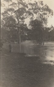 Stawell Historical Society Inc
Photograph, Whitehall Property Greens Creek
Hutchings family 1. Wimmera River in flood below Whitehall running a banker c. 1920. Ted & Col Hutchings in foreground. 2. Wimmera River in flood looking downstream. No date but possibly same time as no. 1. from same place. 3. Looking over the Wimmera River to Island paddock towards Greens Creek 4. Wimmera River half a banker at Whitehall 5. Wimmera River in flood upstream from carpenter's shop looking towards engine house at Whitehall 5a. Wimmera River in flood. Left to right - blacksmith shop and carpenters' shop. 5b. Taken from the same spot with Emily & Ada Hole, E G (Ted) & Col Hutchings. Blacksmith shop & carpenters' shop, Whitehall. 5c. Wimmera River upstream from the carpenters' shop. Foreground is possibly Belladonna lilies which were all over the river bank in 1992. Whitehall. 5d. Looking downstream towards the loose boxes, Whitehall. 5e. Blacksmiths' shop and carpenters' shop from the pumping station. Wimmera River, Whitehall. 6. Wimmera River in flood at Whitehall. 7. Wimmera River half a banker in front of old hut at Whitehall. 8. Wimmera River Emily Hayes, Edward G (Ted) Hutchings & Colin J Hutchings. 9. Morrl-Morrl - Greens Creek Road opposite back paddock. Whitehall. Black Ford in distance. c. 1919 10. Whitehall woolshed north east aspect, Drive to the right of photo 11. Whitehall woolshed - north east aspect showing the drive to the right 11a. Whitehall woolshed - north aspect 11b. Same tree near woolshed 11c. Same tree again in centre, other trees came up after the 23 flood. Woolshed to the right out of photo. 12. Whitehall woolshed - south aspect, sheep entrance end 13. Whitehall. left to right, Stackyard, stables in the centre and the Wimmera River behind following the trees. 14. Whitehall horse paddock c. 1920. left to right, Machinery shed, stable in the centre. Homestead to the right in distance. There is no windmill. 15. Load of wool from Whitehall woolshed to right. 16. Whitehall c. 1920 before the windmill. left to right, garage and mens' hut. Wimmera river runs along the tree line. 16a. Stables, garage and mens' hut after the construction of the windmill. River behind. 17. Whitehall c. 1922. Note windmill addition. Garage to left, Mens' Hut to right. Jack Donnelly & Edward G (Ted) Hutchings with pet lambs. River behind trees. 18. Whitehall gardens. Summer house to the right, pine tree lined drive in the centre background. Ted & Col Hutchings on the lawn. C. 1920 19. Edward G. (Ted) & Colin J. Hutchings in Whitehall garden. Wimmera River in the background. The building behind the fence is the carpenters' shop which the family lived in while house was rebuilt after fire 15 Jan 1877 20. Whitehall c. 1920. left to right, cattle yard, killing house, Wimmera river behind the fence, and the loose box on the right. Black Orpington chooks in foreground. 21. Bay window (original blinds) in the master bedroom. Whitehall 20 Sep 1992 22. Master bedroom (original wallpaper) Joyce & Col Hutchings, Moyu, Ben & Rebecca Roe 20 Sep 1992 23. Col & Ted's bedroom (original) Marble mantlepiece had been removed. Whitehall. 20 Sep 1992 24. Whitehall kitchen. Large yellow meat oven to left of stove, bread oven far left, extreme right is oven where milk heated to skim cream. Chimney was a central one shared with meat oven. Bread oven chimney separate. 20 Sep 1992 25. Whitehall dairy, made of natural stone with dried brick corners. Entrance behind creeper which is over trellis. 20 Sep 1992. This building still remains in 1 Jun 2023 26. Inside charcoal lined meat cellar. Bottom right is concrete vat for pickling meat in brine. Top of brickwork slightly above ground level. Whitehall 20 Sep 1992 27. Fire foreground was stable flooring which was to left of photo. Machinery shed (thatch roof). 4 posts far left remains of cowshed. Large post in centre foreground is the gate post of corral. River to right. 20 Sep 1992 28. Whitehall machinery shed. Posts on far right are cow shed. Over the river is the island paddock. Wimmera river runs behind machinery shed. 20 Sep 1992 29. Posts of 10 sided corral. Killing house by side of gum tree in centre of photo on far side of corral. To left is one of the bales of the cowshed. Whitehall. 20 Sep 1992 29a. Similar photo in the 1920's. To the right is horsebreaking corral, then cow shed, loose box, haystacks and stable on left. Whitehall. 30. Dining room fire place put in the open fire of the mens' hut, only the chimney remains. To the left is the drive & river. Rebecca Roe, Col Hutchings granddaughter. 20 Sep 1992 30a. Looking down the Whitehall Drive. Mens' Hut (Jack Donnelly in doorway) and garage far left. 1920's 30b. The Drive, Whitehall taken from in front of the mens' hut. Wimmera River on the left. Gum tree on left still there 20 Sep 1992. 30c. Reverse from 30a. Whitehall drive from the front gate looking towards the mens' hut and garage. c. 1926 30d. Curly Donohue leaving for Warracknabeal. Ex mail contractor Omeo to Bright Victoria. C. 1926 30e. Looking down the drive towards front gate. Mens' hut on the right, river on the left. 31. Whitehall from the side. Building in centre behind David is separater room. 2 roomed hut to left of separater room and remains of mens' hut chimney. Photo 16 taken from similar spot. 20 Sep 1992 32. Benjamin Roe (Col Hutchings grandson) in the Carpenters' shop. The family lived in this building after the fire in the 1870's. Whitehall 20 Sep 1992 33. Ford across the Wimmera River at Whitehall (River abt. 5 feet higher than normal) 20 Sep 1992 33a. Wimmera River, Whitehall 34. Site of old bridge before Col Hutchings time. Tree in foreground to right still has bolt from bridge work protuding. A large post was in the centre of photo to make equal distance. 20 Sep 1992 35. Entrance to the old ford. Colin J Hutchings & his daughter, Moyu Roe. Wimmera River, Whitehall 20 Sep 1992 36. Summer house at Whitehall 20 Sep 1992 looking down to the orchard, dark green trees in distance old fruit trees. 36a. Edward & Colin Hutchings in front of the Summer house, Whitehall c. 1921 36b. Summer house looking towards front gate. Whitehall. 36c. Grey thrush in nest box which can be seen in previous photo with summer house in the background. Whitehall. 36d. Summer house from the orchard side. Whitehall. 37a. South side of Whitehall. First window Edith Sutherland's room, 2nd window, Ted & Col's room, bay window master bedroom 38. Taken in middle of front path looking towards front gate. Edith Sutherland in garden. Date palm in centre, cotton palm to left. Whitehall c. 1920's 38a. Garden at Whitehall taken from near the cotton palm. 39. Whitehall 20 Sep 1992 Bay window-master bed, small window to r. of bay-Colin Hutchings born in, front door, window to right-dining room, round the corner- drawing room, window on right, spare bed, verandah on left is spare bed. 39a. Whitehall c. 1920's Date palm on the right. 39b. Win, Colin T & Colin J Hutchings. Date palm in background. Whitehall 1943 39c. Edward George, Colin Thomas, Elizabeth Ambler & Colin James Hutchings wearing RAAF uniform. Date Palm in background. Whitehall c. 1943 39c. Front garden of Whitehall looking from the front right side of the house towards the drive & Wimmera River. Date palm on right, cotton palm on left 20 Sep 1992 40. Taken from bottom left corner of front garden looking towards the summer house. Cotton palm on right. River to the left. 41. Elizabeth A Hutchings beside master bedroom window. Whitehall c. 1920 42. Whitehall (photo of a painting by Wallace) owned by Colin T Hutchings 1982. 42a. Whitehall painting by Wallace after restoration now owned by Nick Hutchings 2021 42b. Whitehall c. 1923 42c. Taken from the side garden looking towards the right side of house. Front door is to the left out of photo. The cotton palm is to the left. c. 1923 43. Signpost showing Whitehall 20 Sep 1992, All ground up to the tree line behind the signpost was Whitehall property. 44. Colin T. Hutchings age 9 mths. Mar 1943 Whitehall 45. Colin James, Elizabeth Ambler & Edward George Hutchings. Front garden by the date palm, Whitehall c. 1939-40 45a. Colin James, Edward George, Edward Thomas Hutchings & E. Winifred May & Barney (dog) Whitehall. c. 1939-40. 45b. Colin James & Colin Thomas Hutchings during drought & World War ll c. 1944-45 in front of cotton palm, date palm to right. 46. Garden at Whitehall. Jack Donnelly on the hand mower. Cotton palm on left, date palm behind Jack and roof of carpenters shop to right. 47. Colin J Hutchings on tractor, E. Tom Hutchings behind. Whitehall, c. 1933 48. Jack Donnelly (Tad) & Colin J. Hutchings. Cotton palm to right. Whitehall c. 1917-18 49. Edward G (Ted) & Colin J Hutchings with cockatoo outside the dairy in rear garden. Whitehall c. 1923 50. Taken from the windmill looking across the roof of the mens' hut to the garden, orchard and drive in Winter time. House is behind the trees to right, Wimmera River to the left out of picture. Whitehall. 50a. Not labelled by Col Hutchings. It is an aerial shot looking towards the house in the trees & seems to be taken from the top of a tree...on the river side. 51. E. Tom Hutchings & George Chambers dam sinking. Whitehall. 51a. Tom Hutchings & George Chambers dam sinking. Whitehall. 51b. E. Tom Hutchings dam sinking. 52. Emily Hayes & Ada Hole (sisters) with Tom, Col & Ted Hutchings at the woolshed. 53. E T (Tom) Hutchings on reaper & binder. Whitehall. 54. Orchard looking towards the house. Carpenters' shop and river on the right. Whitehall. 54a. Orchard looking from the house, dark trees in background form part of the drive. 55. Grasshopper plague, Christmas Day 1933. Whitehall 56. Frost on the front lawn, Whitehall. 57. Little red hen & chicks with the river in the background 58. Edward (Ted) G. Hutchings muscovy ducks, hay shed and trees along the river in the background. 58a. Edward (Ted) G Hutchings muscovy ducks. 59. Swimming in the Wimmera River, either Ted or Col Hutchings in the foreground. 60. Looking towards the fowl house and pigsty, Whitehall. 61. Snake on the path, Whitehall. c. 1923 61a. E. Tom Hutchings killing a snake, Whitehall. c. 1923 61b. E. Tom Hutchings killing a snake, Whitehall. c. 1923 62. Notice of clearing sale, Stawell News & Pleasant Creek Chronicle on 5 Apr 1916 where the stock & whole of the household furniture was to be sold by James Hutchings widow. 63. Back to Greens Creek 7 Jun 1987 Colin J Hutchings left and Belle Kindred centre looking at photo 64. Back to Greens Creek 7 Jun 1987 Colin J Hutchings centre, Graham Stewart holding photograph on the right. 65. Colin J Hutchings & Bill Walker. Back to Greens Creek 7 Jun 1987 66. Colin J Hutchings delivering a speech before the plaque unveiling. Back to Greens Creek 7 Jun 1987 67. Graeme Williamson & Colin J Hutchings (2 'old boys') Greens Creek School Site 7 Jun 1987 68. Graeme Williamson talking to Moyu Roe (Hutchings) in background is May Williamson. Back to Greens Creek 7 Jun 1987 69. Greens Creek SS, Edward (Ted) & Colin J Hutchings attended. 70. Original students of first Greens Creek School 7 Jun 1987 Back row left 1. Kindred 3. Colin J Hutchings 4,5,6 not known 7. Graeme Williamson Sitting left 1. Not an original 2,3,4, not known 5. Belle Kindred 71. Terrier at Greens Creek State School 72. The new school students Back to Greens Creek 7 Jun 1987. Perry twins standing in centre and the teacher kneeling front left. 73. Will Rees water colour 1925 signature 74. Will Rees water colour 1925 75. Shearing at Kirkellar. Allen Simpson's 76. Back to Greens Creek 7 Jun 1987 Colin J Hutchings left and Belle Kindred centre looking at photo 77. Back to Greens Creek 7 Jun 1987 Colin J Hutchings centre, Graham Stewart holding photograph on the right. 78. Colin J Hutchings & Bill Walker. Back to Greens Creek 7 Jun 1987 79. Colin J Hutchings delivering a speech before the plaque unveiling. Back to Greens Creek 7 Jun 1987 80. Graeme Williamson & Colin J Hutchings (2 'old boys') Greens Creek School Site 7 Jun 1987 81. Graeme Williamson talking to Moyu Roe (Hutchings) in background is May Williamson. Back to Greens Creek 7 Jun 1987 82. Greens Creek SS, Edward (Ted) & Colin J Hutchings attended. 83. Original students of first Greens Creek School 7 Jun 1987 Back row left 1. Kindred 3. Colin J Hutchings 4,5,6 not known 7. Graeme Williamson Sitting left 1. Not an original 2,3,4, not known 5. Belle Kindred 84. Shearing at Kirkellar. Allen Simpson's 85. Terrier at Greens Creek State School 86. The new school students Back to Greens Creek 7 Jun 1987. Perry twins standing in centre and the teacher kneeling front left. Digital Copy of Parish Maps Kara Karahomestead -
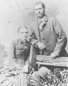 Ringwood and District Historical Society
Archive - Biographical material, Maggs Family of Ringwood and District (Parent Record)
Transcript of the Maggs Family History, given by Joan Walker, former member of RDHS:- Pioneer Family - Maggs • James Maggs and wife Harriet Banfield migrated to Melbourne on the “Ticondergoa” which sailed from Birkenhead on 4th August 1852 with 812 assisted immigrants. • In 1856 James purchased 7 acres of land, part of section 75, in the parish of Nunawading where he developed an orchard. • Three children died young – Emma (before 1862), Jemima at Ticonderoga Bay and Mary Jane aged 3 weeks at Koonung Creek. Three sons and a daughter survived them. Harriet died in 1875, James in 1888 both buried in Box Hill cemetery. • Their sons Joseph, Samuel and James all established orchards in the Ringwood/Croydon district. Samuel Maggs • Born 11 May 1851, Somerset, England and grew up on his fathers property in Springfield Road, Blackburn, one block east of Surrey Road. • On 4 October 1876 Sam married Eliza Ann Barnes. • 1881 purchased a block, Allot. 39 Parish of Warrandyte and developed an apple and cherry orchard. The orchard occupied the area between White Horse Road and Mullum Mullum Creek from Oban Rd east to where White Horse Road takes a slight turn to the right, near Burnt Bridge. • Son George b.28 December 1876 Warrandyte married Annie Smith d.9 May 1947. • Daughter Eliza Jane b.27 July 1878 Ringwood married William Dobbin, d.31 May 1946 Camberwell. • Son James b.15 May 1880, Lilydale married Catherine Atkins d.28 July 1940 Ringwood buried Box Hill. • Daughter Jemima b.16 December 1881 Warrandyte married Edward Lindsay in 1905, d.2 November 1955 and buried in Box Hill. • Daughter Jane b.22 May 1884 Warrandyte married Thomas S Knee in 1912 d.31 January 1971, buried at Box Hill. • Son Samuel William b.1 Jan 1889 Ringwood married Mina Lillian Schuhkraft in 1911 d.15 Jan 1955 Ringwood. Joseph Maggs • Born 5 June 1845, Somerset England. • Married Mary Ann Reid in April 1867 at Templestowe. • Bought Sec. 26a, in Ringwood on the corner of Eastfield Road an Mt Dandenong Road in February 1870. Planted 4 acres with fruit trees. Was also a wood carter. During the 1880s white clay was mined here, which he carted for the Victorian Porcelain Clay Coy. • Daughter Emma b.8 Jan 1868 Templestowe d. 3 August 1939, Richmond married May 1890 Fredrick W. McGinnis. • Daughter Agnes b.16 June 1869 Templestowe married John D Miller c.1894. d.3 February 1912 Heathmont, buried Box Hill. • Son Albert b.1 May 1871 Nunawading d.15 Nov 1893. • Son Hubert b.10 May 1873 Nunawading married Isabella Atkins in 1898 Ringwood d.11 August Wagga Wagga and buried there. • Daughter Harriet Annis b.13 August 1875 Box Hill d.21 Sept 1875. • Son Joseph b.25 September 1876 Box Hill d.3 Oct 1900 Mitcham. • Daughter Harriet Annis b.18 Aug 1879, Ringwood married James R Miller d.8 May 1945. • Son William b.3 Sep 1881 married Mary E Hardidge. D.6 April 1950 South Melbourne. • Daughter Dora Jane Dulcie b.13 December 1883 Ringwood d.1973. • Daughter Delia Rose b.20 February 1886, Ringwood married William J Sharkie d.30 October 1914 James Maggs • Youngest (born 28 April 1862, Blackburn) and only Australian born son was also an orchardist. • Married Marianne Hardidge in 1880 (divorced in 1906) purchased land in what is now Kalinda Road, adjoining Sam’s land. • James lived with Teresa Shanks in the Hawthorn and Prahran districts and became a taxi driver. Died in 1925, buried at Box Hill. Marianne became a midwife who delivered over 500 babies in the area – was known as Nurse Polly Maggs, died in 1941 aged 81. • Daughter Mary Ann Hase Polly b.5 July 1881 Ringwood married Thomas Lawford d.9 November 1961 buried at Box Hill. • Daughter Jane Emma b.9 May 1883 Ringwood married Frederick Bloom 1910 d.28 July 1954. • Daughter James John b.17 Jan 1885 Ringwood married Johanna Ida Edith Bloom in 1912 d.24 August 1962 buried at Box Hill. • Daughter David Joseph b.31 Jan 1887 Ringwood married Violet Lepp married 1916, d.11 July 1966. • Son Samuel Arthur b.11 March 1888 Ringwood married Bertha Anna Pump in 1913 d.7 August 1957. • Son John William b.16 April 1890 Ringwood married Lillian Mabel May Smith in 1909 d.18 February 1959 Cobram. • Daughter Eliza Anne b.6 March 1892 Ringwood d.April 18 1892. • Son Robert Thomas b.7 March 1893 Ringwood married Edith E Britnell in 1919 d.12 March 1981 buried Box Hill. • Son Albert Edward b.12 April 1895 Ringwood married Florence Sarah Pearce in 1918 d.30 January 1976 buried at Springvale. • Daughter Evaleen Victoria b.28 Aug 1897, Ringwood married Sydney Till married 1920 d.5 September 1989 buried at Box Hill. • Daughter Harriet Banfield Chrissy b.14 December 1899 Ringwood d.28 Dec 1979 buried Box Hill. Jane Maggs • Born 19 December 1858 in Blackburn. Died 5 July 1926 buried at Box Hill. Married William Cook and had one child, Harriet Amy Cook who never married and lived in Whitehorse Road, Mitcham until her death in 1962. Details, extract from Family Tree Maker family tree:- Descendants of James Maggs Generation No. 1 1. JAMES5 MAGGS (JOSEPH4, WILLIAM3, WILLIAM2, SAMUEL1)1 died 24 Sep 18881. He married (1) HARRIET MARTHA BANFIELD1 23 Dec 1841 in Bristol, Somerset, England1. She was born 19 Jun 1817 in Clutton, Somerset, England1, and died 12 May 1875 in Nunawading, Victoria, Australia1. He married (2) ROSENA MAHON1 09 Dec 1875 in Fitzroy, Victoria, Australia1. She was born in Deptford, London, England1. Notes for JAMES MAGGS: JAMES MAGGS, and his wife HARRIET BANFIELD, migrated to Melbourne on the "Ticonderoga", which sailed from Birkenhead 4th Aug 1852 with 812 assisted immigrants aboard. In the close confines of the ship fever broke out and by the time she arrived off Port Phillip Heads on or about 2nd Nov, 100 deaths had been recorded in the log and hundreds were too weak to help themselves. Captain Wylie of the coastal trader "Champion", informed Captain Ferguson, the harbourmaster at Williamstown, of the tragic plight of the passengers and crew, and he came with two doctors, in the "Empire", to their aid. They anchored just inside Port Phillip Heads on 5 Nov. at the "Sanatory Station", declared but not yet established by the local authorities. Those who were well enough were put ashore in tents made of spars and sails. The "Lysander" was despatched from Melbourne to act as a hospital ship, and 2 houses, built of the local limestone, were commandeered as a quarantine station. For six weeks the survivors were held near Point Nepean at a place still known as Ticonderoga Bay while the fever, propably typhus, a louse borne epidemic disease, ran its course and a further 68 passengers, 2 crew members and 4 newborn babes succumbed to the scourge. Among them was Jemima Maggs, 3 year old daughter of James and Harriet. The dead were buried at the waters edge, in a grove of titree, a site now marked by Heaton's monument. The remainder of the family, including Samuel, just one year old, lived through the ordeal to make a new life in Australia. James obtained work with Robert Wilson of Bulleen for a period of 3 months at a wage of 52 pounds per annum with rations. By 1856 he was able to purchase 7 acres of land, part of section 75, in the parish of Nunawading at 5 pounds per acre. Here he developed an orchard by means of various mortgages including one taken out 17 July 1872 for 50 pounds from the Victorian Permanent Property Investment & Building Society. Three of their seven children died young, Emma before 1862, Jemima at Ticonderoga Bay, and Mary Jane, the first of their three Australian born children, aged 3 weeks at Konung Creek.Three sons and a daughter survived them. Harriet died in 1875, James lived until 1888 and both are buried at the Box Hill Cemetery. Their sons, Joseph, Samuel, and James all established orchards in the Ringwood/Croydon district. Bur Reg 308 Box Hill Grave #64 Presbyterian More About JAMES MAGGS: Ancestral File Number: LN0V-G01 Burial: 26 Sep 1888, Box Hill, Victoria, Australia1 Christening: 20 Oct 1816, Clutton, Somerset, England1 Record Change: 03 Oct 20041 More About HARRIET MARTHA BANFIELD: Ancestral File Number: LN0V-N11 Burial: 14 May 1875, Box Hill, Victoria, Australia1 Christening: 31 Aug 18171 Record Change: 29 Nov 20041 More About ROSENA MAHON: Record Change: 01 Dec 20011 Children of JAMES MAGGS and HARRIET BANFIELD are: i. EMMA6 MAGGS1, b. 13 Nov 1843, Clutton, Somerset, England1. More About EMMA MAGGS: Record Change: 08 Jul 20031 2. ii. JOSEPH MAGGS, b. 05 Jun 1845, Clutton, Somerset, England; d. 24 Jun 1886, Ringwood, Victoria, Australia. iii. JEMIMA MAGGS1, b. 25 Oct 1848, Clutton, Somerset, England1; d. 1852, Ticonderoga Bay, Victoria, Australia1. More About JEMIMA MAGGS: Record Change: 24 Jan 20031 3. iv. SAMUEL MAGGS, b. 11 May 1851, Clutton, Somerset, England; d. 30 Aug 1942, Croydon, Victoria, Australia. v. MARY JANY MAGGS1, b. 03 Dec 1855, Konung Creek, Victoria, Australia1; d. 27 Dec 18551. More About MARY JANY MAGGS: Record Change: 23 Jan 20051 4. vi. JANE MAGGS, b. 19 Dec 1858, Blackburn, Victoria, Australia; d. 05 Jul 1926, , Victoria, Australia. 5. vii. JAMES MAGGS, b. 1862, Nunawading; d. 1925, Fitzroy. Generation No. 2 2. JOSEPH6 MAGGS (JAMES5, JOSEPH4, WILLIAM3, WILLIAM2, SAMUEL1)1 was born 05 Jun 1845 in Clutton, Somerset, England1, and died 24 Jun 1886 in Ringwood, Victoria, Australia1. He married MARY ANN READ1 01 Apr 1867 in Templestowe, Victoria, Australia1. She was born Abt. 1847 in of Templestowe, Victoria, Australia1, and died 1925 in Ringwood, Victoria, Australia1. Notes for JOSEPH MAGGS: Joseph Maggs born 5 Jun 1845 at Clutton, Somerset, England, arrived in Australia age 7 years. He married Mary Ann Read, in Apr 1867 at Templestowe, selected land, Lot 26a,in Ringwood on the corner of Eastfield Road and Mt.Dandenong Road, approx 114 acres, at 11 o'clock 2 Feb 1870. He planted 4 acres with fruit trees valued at 80 pounds and by Sep 1874 his occupation was farmer and wood carter. A 4 room house of lathe and plaster with a paling roof, a kitchen, a slab and bark stable and a pigsty had been errected to a value of 71 pounds. A well, 3 dams, clearing and fencing valued at 96 pounds are also listed. He notes "from the nature of the land, being very poor and heavily timbered, I have not been quite able to clear the complement required, not having means sufficient to do so, neither will the land pay when cultivated." Traces of antimony were found on the land but not in commercial quantities, however during the 1880s white clay was mined here, which he carted for the Victoria Porcelain Clay Coy. In Mar 1880 he was granted freehold title at a price of one pound per acre. More About JOSEPH MAGGS: Burial: Box Hill, Victoria, Australia1 Record Change: 18 Feb 20011 More About MARY ANN READ: Burial: Box Hill, Victoria, Australia1 Record Change: 21 Jul 20021 Children of JOSEPH MAGGS and MARY READ are: 6. i. EMMA7 MAGGS, b. 08 Jan 1868, Templestowe, Victoria, Australia; d. 03 Aug 1939, Richmond, Victoria, Australia. ii. ALBERT MAGGS1, b. 01 May 1871, Nunawading, Victoria, Australia1; d. 15 Nov 1893, Ringwood, Victoria, Australia1. More About ALBERT MAGGS: Record Change: 12 Oct 19971 7. iii. HUBERT MAGGS, b. 10 May 1873, Ringwood, Victoria, Australia; d. 11 Aug 1956, Wagga Wagga, N.S.W., Australia. iv. HARRIET ANNIS MAGGS1, b. 13 Aug 1875, Box Hill, Victoria, Australia1; d. Ringwood, Victoria, Australia1. More About HARRIET ANNIS MAGGS: Burial: 21 Sep 1875, Box Hill, Victoria, Australia1 Record Change: 18 Feb 20011 v. JOSEPH MAGGS1, b. 25 Sep 1876, Box Hill, Victoria, Australia1; d. 03 Oct 1900, Mitcham, Victoria, Australia1. More About JOSEPH MAGGS: Record Change: 18 Feb 20011 8. vi. HARRIET ANNIS MAGGS, b. 18 Aug 1879, Ringwood, Victoria, Australia; d. 08 May 1945. vii. WILLIAM MAGGS1, b. 03 Sep 18811; d. 06 Apr 1950, South Melbourne, Victoria, Australia1; m. MARY ELIZA HARDIDGE1, 24 Dec 1912, Goulburn, N.S.W., Australia1; b. Abt. 1884, , of Victoria, Australia1; d. 1956, Lilydale, Victoria, Australia1. More About WILLIAM MAGGS: Record Change: 18 Feb 20011 More About MARY ELIZA HARDIDGE: Record Change: 18 Feb 20011 viii. DORA JANE DULCIE MAGGS1, b. 13 Dec 1883, Ringwood, Victoria, Australia1; d. 1973, Mitcham, Victoria, Australia1. More About DORA JANE DULCIE MAGGS: Record Change: 21 Jan 20021 9. ix. DELIA ROSE MAGGS, b. 20 Feb 1886, Ringwood, Victoria, Australia; d. 30 Oct 1914. 10. x. AGNES MAGGS, b. 16 Jun 1869, Templestowe, Victoria, Australia; d. 03 Feb 1912, Heathmont, Victoria, Australia. 3. SAMUEL6 MAGGS (JAMES5, JOSEPH4, WILLIAM3, WILLIAM2, SAMUEL1)1 was born 11 May 1851 in Clutton, Somerset, England1, and died 30 Aug 1942 in Croydon, Victoria, Australia1. He married ELIZA ANN BARNES1 04 Oct 1876 in Nunawading, Victoria, Australia1. She was born 19 Sep 1848 in St Lukes, London, England1, and died 17 Feb 1923 in Croydon, Victoria, Australia1. Notes for SAMUEL MAGGS: SAMUEL MAGGS grew up on his father's property in Springfield Road, Blackburn, one block east of Surrey Road. West of Surrey Road and fronting to White Horse Road was James Barnes' property, so by walking through the Maggs land and crossing Surrey Road, one might enter the back of the Barnes land, an easy way to visit ELIZA ANN BARNES. On the 4 Oct 1876 Sam and Eliza were married at her father's house. Sam wrote to the Secretary for Lands on the 29 Sep 1880, requesting that Allot. 39 Parish of Warrandyte be made available for selection. This block had been refused for selection earlier on the objection of the Mines Department as it was believed that the area was auriferous. When told that the block was available, Sam marked it at 5 o'clock December 3rd and applied for a lease of 12 acres 3 rods and 34 perches on the 6th December. On the application it is noted that he already had leasehold of 104 acres. His license was approved 7 Mar 1881 at a rate of 6 shillings and 6 pence per halfyear. Previously paid fees and rental came to 3 pounds 18 shillings, and he paid another pound for a certificate fee, a pound lease fee, plus the first half years rental, then proceeded to develop the land into an apple and cherry orchard.In 7 Mar 1898 he had succeeded in securing the freehold grant of the area by paying 2 pounds 18 shillings 6 pence fees due,plus a 1 guinea grant fee and assurance fund contribution of 7 pence, a total of 4 pounds and 1 penny. The orchard occupied the area between White Horse Rd and Mullum Mullum Creek,from Oban Rd east to where White Horse Road, now the Maroondah Highway, takes a slight turn to the right, near the Burnt Bridge. Sam and Eliza built a house on Sec38 and planted Fivecrown apples grafted on a Maggs Seedling stock at 24 ft spacing. Trees put in about 1875 were yielding up to twenty bushells 30 years later. He didn't approve of regulations which required spraying for codlin moth and was reputed to have said when denied coolstorage space until he sprayed his trees, "No one is going to tell me how to grow apples and anyway a bit of codlin is good for you". More About SAMUEL MAGGS: Ancestral File Number: LN0V-8X1 Record Change: 20 Aug 19971 Notes for ELIZA ANN BARNES: ELIZA ANN BARNES married SAMUEL MAGGS, son of neighbouring land owner, James Maggs, 4 Oct 1876 and had 6 children. She had a stroke about 1921 but was able to attend her seventyfourth birthday party held at her daughter Jane Knee's home in Sep 1922 when over forty family members gathered for the celebration(see photo). She died 17 Feb 1923 at Croydon. More About ELIZA ANN BARNES: Ancestral File Number: LN0V-2W1 Record Change: 20 Aug 19971 Children of SAMUEL MAGGS and ELIZA BARNES are: 11. i. GEORGE7 MAGGS, b. 28 Dec 1876, Warrandyte, Victoria, Australia; d. 09 May 1947, Ringwood, Victoria, Australia. 12. ii. ELIZA JANE MAGGS, b. 27 Jul 1878, Ringwood, Victoria, Australia; d. 31 May 1946, Camberwell, Victoria, Australia. 13. iii. JAMES MAGGS, b. 15 May 1880, Lilydale, Victoria, Australia; d. 28 Jul 1940, Ringwood, Victoria, Australia. iv. JANE MAGGS1, b. 22 May 1884, Warrandyte, Victoria, Australia1; d. 31 Jan 19711; m. THOMAS SAMUEL KNEE1, 1907, , Victoria, Australia1; b. 07 Aug 1881, Lilydale, Victoria, Australia1; d. 19 Apr 19601. More About JANE MAGGS: Burial: Box Hill, Victoria, Australia1 Record Change: 18 Feb 20011 More About THOMAS SAMUEL KNEE: Burial: 21 Apr 1960, Box Hill, Victoria, Australia1 Record Change: 22 Aug 20031 14. v. SAMUEL WILLIAM MAGGS, b. 01 Jan 1889, Ringwood, Victoria, Australia; d. 15 Jan 1955, Ringwood, Victoria, Australia. 15. vi. JEMIMA MAGGS, b. 16 Dec 1881, Warrandyte, Victoria, Australia; d. 02 Nov 1955. 4. JANE6 MAGGS (JAMES5, JOSEPH4, WILLIAM3, WILLIAM2, SAMUEL1)1 was born 19 Dec 1858 in Blackburn, Victoria, Australia1, and died 05 Jul 1926 in , Victoria, Australia1. She married WILLIAM COOK1 1880 in , Victoria, Australia1. He was born Abt. 1859 in Wickliffe, Victoria, Australia1, and died 09 Aug 19391. Notes for JANE MAGGS: Jane Maggs, the only surviving daughter of James and Harriet, married William Cook and had one child, Harriet Amy Cook, known to her relatives as Cousin Amy. She never married and lived in the house inWhitehorse Road, Mitcham built by her parents, for many years until her death in 1962. She took a keen interest in family history and was a great source of information and memorabilia about the early days of the Ringwood area. More About JANE MAGGS: Burial: Box Hill1 Record Change: 18 Feb 20011 More About WILLIAM COOK: Burial: 10 Aug 1939, Box Hill, Victoria, Australia1 Record Change: 05 Nov 20011 Child of JANE MAGGS and WILLIAM COOK is: i. HARRIET AMEY7 COOK1, b. 1881, Box Hill, Victoria, Australia1; d. 13 Sep 1962, Surrey Hills, Victoria, Australia1. More About HARRIET AMEY COOK: Burial: 17 Sep 1962, Box Hill, Victoria, Australia1 Record Change: 18 Feb 20011 5. JAMES6 MAGGS (JAMES5, JOSEPH4, WILLIAM3, WILLIAM2, SAMUEL1)2,3 was born 1862 in Nunawading4, and died 1925 in Fitzroy4. He married (1) THERESA BROWN4 in Christchurch, New Zealand5. She was born 1869 in Clunes, Victoria, Australia5, and died 1930 in Prahran, Victoria, Australia5. He married (2) MARIANNE HARDIDGE6 1880 in Kew6. She was born 1860 in Doncaster6, and died 1941 in Mitcham6. He married (3) ADA JANE CROY7 19127. She was born 1883 in ,Victoria, Australia7. Notes for JAMES MAGGS: James Maggs, the youngest child and only Australian born son of James and Harriet, was an orchardist like his older brothers. He married Marianne Hardidge in 1880 and selected an area in what is now Kalinda Road, adjoining Sam's land. They constructed a four roomed house measuring 26 feet square valued at fifty pounds and stables valued at forty pounds. The buildings were made of palings with an iron roof. Here they raised ten children and lost a little girl, Eliza, aged three weeks. In 1900 James became seriously ill with a kidney disease and was visited during his illness by a wide section of his neighbours, including Mrs Theresa Shanks. He and Theresa became attracted to each other and broke up their marriages, with James and Marianne being divorced in 1906. James and Theresa lived in the Hawthorn and Prahran districts and he became a taxi driver. He contributed to the upkeep of his children although the divorce was a bitter affair. He died in 1925 in Fitzroy and Theresa only survived him by five years. They are buried in the same grave at Box Hill. Marianne became a midwife who delivered over 500 babies in the neighborhood. She was known as Nurse Polly Maggs and the people of Ringwood presented her with a wireless set in appreciation of her service to the community. She died at the age of 81 years in 1941. More About JAMES MAGGS: Burial: Box Hill Cemetery8 Record Change: 01 Sep 20018 Notes for THERESA BROWN: [Ringwood.ged] Theresa had a son Jim Shanks born1902 (father was James Maggs) Reg No 12243R More About THERESA BROWN: Burial: 05 Feb 1930, Box Hill, Victoria, Australia9 Record Change: 01 Sep 200110 More About MARIANNE HARDIDGE: Burial: Box Hill Cemetery10 Record Change: 01 Sep 200110 Marriage Notes for JAMES MAGGS and MARIANNE HARDIDGE: [Ringwood.ged] divorced in 1906 More About ADA JANE CROY: Burial: 15 Apr 1932, Geelong, Victoria, Australia11 Record Change: 10 Aug 200211 Child of JAMES MAGGS and THERESA BROWN is: i. JIM7 MAGGS12, b. 190212. More About JIM MAGGS: Record Change: 01 Sep 200112 Children of JAMES MAGGS and MARIANNE HARDIDGE are: ii. MARY ANN HASE7 MAGGS12, b. 188112. More About MARY ANN HASE MAGGS: Record Change: 01 Sep 200112 16. iii. JANE EMMA MAGGS, b. 1883; d. 28 Jul 1954. 17. iv. JAMES JOHN MAGGS, b. 1885; d. 24 Aug 1962, Parkville, Victoria, Australia. v. DAVID JOSEPH MAGGS12,13, b. 188714; d. 11 Jul 1966, Mt. Waverley, Victoria, Australia15; m. VIOLET ADELINE LEPP15, 1916, , Victoria, Australia15; b. 1888, Ballarat, Victoria, Australia15; d. 26 Mar 1966, ,Victoria, Australia15. More About DAVID JOSEPH MAGGS: Record Change: 01 Sep 200116 More About VIOLET ADELINE LEPP: Record Change: 21 Jan 200217 18. vi. SAMUEL ARTHUR MAGGS, b. 1888; d. 07 Aug 1957, Doncaster, Victoria, Australia. 19. vii. JOHN WILLIAM MAGGS, b. 1890; d. 18 Feb 1959, Cobram, Victoria, Australia. viii. ELIZA ANN MAGGS18, b. 189218; d. 189218. More About ELIZA ANN MAGGS: Burial: Box Hill Cemetery18 Record Change: 01 Sep 200118 20. ix. ROBERT THOMAS MAGGS, b. 1893; d. 12 Mar 1981. 21. x. ALBERT EDWARD MAGGS, b. 1895; d. 1976. 22. xi. EVALEEN VICTORIA MAGGS, b. 1897; d. 05 Sep 1989. xii. HARRIET BANFIELD MAGGS18, b. 189918. More About HARRIET BANFIELD MAGGS: Record Change: 01 Sep 200118 23. xiii. MARY ANN HASE POLLY MAGGS, b. 05 Jul 1881, Ringwood, Victoria, Australia; d. 09 Nov 1961. xiv. HARRIET BANFIELD CHRISSY MAGGS19, b. 14 Dec 1899, Ringwood, Victoria, Australia19; d. 28 Dec 1979, Blackburn, Victoria, Australia19. More About HARRIET BANFIELD CHRISSY MAGGS: Burial: Box Hill19 Record Change: 18 Feb 200119 Children of JAMES MAGGS and ADA CROY are: xv. CLENCIE JOAN7 MAGGS19, m. ARTHUR RODERICK PITTER19. xvi. CLYDE MAGGS19, b. 1917, Collingwood, Victoria, Australia19; d. 1917, Collingwood, Victoria, Australia19. More About CLYDE MAGGS: Record Change: 10 Aug 200219 Generation No. 3 6. EMMA7 MAGGS (JOSEPH6, JAMES5, JOSEPH4, WILLIAM3, WILLIAM2, SAMUEL1)19 was born 08 Jan 1868 in Templestowe, Victoria, Australia19, and died 03 Aug 1939 in Richmond, Victoria, Australia19. She married FREDRICK WILLIAM MCGINNIS19 May 1890 in , Victoria, Australia19. He was born in , of Victoria, Australia19. More About EMMA MAGGS: Record Change: 18 Feb 200119 More About FREDRICK WILLIAM MCGINNIS: Record Change: 18 Feb 200119 Children of EMMA MAGGS and FREDRICK MCGINNIS are: i. RENIRA EDDA8 MCGINNIS19. ii. FREDRICK HENRY MCGINNIS19, b. 1894, , of Victoria, Australia19; d. 195819. More About FREDRICK HENRY MCGINNIS: Record Change: 18 Feb 200119 7. HUBERT7 MAGGS (JOSEPH6, JAMES5, JOSEPH4, WILLIAM3, WILLIAM2, SAMUEL1)19 was born 10 May 1873 in Ringwood, Victoria, Australia19, and died 11 Aug 1956 in Wagga Wagga, N.S.W., Australia19. He married ISABELLA ATKINS19 09 Mar 1898 in Ringwood, Victoria, Australia19. She was born Abt. 1875 in St Arnaud, Victoria, Australia19. More About HUBERT MAGGS: Burial: Wagga Wagga, N.S.W., Australia19 Record Change: 23 Jan 200519 More About ISABELLA ATKINS: Record Change: 23 Jan 200519 Children of HUBERT MAGGS and ISABELLA ATKINS are: i. HUBERT CARLYLE8 MAGGS19. ii. ANNE THORA MAGGS19. iii. RAYMOND MAGGS19, b. 09 Jun 1905, Ringwood, Victoria, Australia19; d. 20 Jul 190519. More About RAYMOND MAGGS: Record Change: 18 Feb 200119 8. HARRIET ANNIS7 MAGGS (JOSEPH6, JAMES5, JOSEPH4, WILLIAM3, WILLIAM2, SAMUEL1)19 was born 18 Aug 1879 in Ringwood, Victoria, Australia19, and died 08 May 194519. She married JAMES RICHARD MILLER19 26 Sep 1910 in Ringwood East, Victoria, Australia19. He was born 1878 in Collingwood, Victoria, Australia19. More About HARRIET ANNIS MAGGS: Record Change: 18 Feb 200119 More About JAMES RICHARD MILLER: Record Change: 18 Feb 200119 Children of HARRIET MAGGS and JAMES MILLER are: i. DUDLEY8 MILLER19. ii. IRENE DOROTHY MILLER19, b. 10 Nov 1913, , of Victoria, Australia19; d. 29 Sep 199019. More About IRENE DOROTHY MILLER: Burial: Lilydale, Victoria, Australia19 Record Change: 18 Feb 200119 iii. CYRIL MILLER19, b. 26 Sep 1915, , of Victoria, Australia19; d. 05 Apr 197319. More About CYRIL MILLER: Burial: Springvale, Victoria, Australia19 Record Change: 18 Feb 200119 9. DELIA ROSE7 MAGGS (JOSEPH6, JAMES5, JOSEPH4, WILLIAM3, WILLIAM2, SAMUEL1)19 was born 20 Feb 1886 in Ringwood, Victoria, Australia19, and died 30 Oct 191419. She married WILLIAM JAMES SHARKIE19. More About DELIA ROSE MAGGS: Burial: Box Hill, Victoria, Australia19 Record Change: 18 Feb 200119 Child of DELIA MAGGS and WILLIAM SHARKIE is: i. RONALD8 SHARKIE19, b. Abt. 1914, , of Victoria, Australia19; d. Abt. 1964, , N.S.W., Australia19. More About RONALD SHARKIE: Record Change: 15 Oct 200119 10. AGNES7 MAGGS (JOSEPH6, JAMES5, JOSEPH4, WILLIAM3, WILLIAM2, SAMUEL1)20,21 was born 16 Jun 1869 in Templestowe, Victoria, Australia21, and died 03 Feb 1912 in Heathmont, Victoria, Australia21. She married (1) JOHN DOMONIC MILLER22 189423,24, son of FRANK MILLER and KATE MADDEN. He was born 187025,26, and died 194227,28. She married (2) JOHN DOMINIC MILLER29 1894 in , Victoria, Australia30,31. He was born 1870 in Box Hill, Victoria, Australia31. More About AGNES MAGGS: Burial: Box Hill, Victoria, Australia31 Record Change: 11 Sep 200132 More About JOHN DOMONIC MILLER: Record Change: 11 Sep 200132 More About JOHN DOMINIC MILLER: Record Change: 18 Feb 200133 Children of AGNES MAGGS and JOHN MILLER are: i. ALBERT JOHN8 MILLER33, b. 1894, , of Victoria, Australia33. More About ALBERT JOHN MILLER: Record Change: 18 Feb 200133 ii. LOUIS NICHOLAS MILLER33, b. 1901, , of Victoria, Australia33; d. 197433; m. LILA MERTON33. More About LOUIS NICHOLAS MILLER: Record Change: 18 Feb 200133 iii. LESLIE DOMINIC MILLER33, b. 1904, , of Victoria, Australia33; d. 198933. More About LESLIE DOMINIC MILLER: Record Change: 18 Feb 200133 11. GEORGE7 MAGGS (SAMUEL6, JAMES5, JOSEPH4, WILLIAM3, WILLIAM2, SAMUEL1)33 was born 28 Dec 1876 in Warrandyte, Victoria, Australia33, and died 09 May 1947 in Ringwood, Victoria, Australia33. He married ANNIE GRACE SMITH33 26 Mar 1902 in , Victoria, Australia33. She was born Abt. 1878 in of Ringwood, Victoria, Australia33, and died 1967 in Box Hill, Victoria, Australia33. More About GEORGE MAGGS: Record Change: 18 Feb 200133 More About ANNIE GRACE SMITH: Record Change: 21 Jan 200233 Children of GEORGE MAGGS and ANNIE SMITH are: i. CLYDE8 MAGGS33, m. VIOLET OXENBURY33. 24. ii. GEORGE ALBERT MAGGS, b. 17 Jul 1902, Ringwood, Victoria, Australia; d. 1974, Heidelberg, Victoria, Australia. iii. HILDA GLADYS BILLIE MAGGS33, b. 05 Sep 1903, Ringwood, Victoria, Australia33; d. 15 Oct 198733; m. LENARD DRYSDALE REID33. More About HILDA GLADYS BILLIE MAGGS: Burial: Springvale, Victoria, Australia33 Record Change: 18 Feb 200133 iv. MYRTLE OLIVE MAGGS33, b. 24 Dec 1905, Kew, Victoria, Australia33; d. 02 Jan 198333; m. ROBERT SAMUEL BOB HEAD33, 1924, , Victoria, Australia33; b. 1898, , of Victoria, Australia33; d. 15 Oct 1980, Mermaid Beach, Queensland, Australia33. More About MYRTLE OLIVE MAGGS: Record Change: 18 Feb 200133 More About ROBERT SAMUEL BOB HEAD: Burial: 17 Oct 1980, Nerang, Queensland, Australia33 Record Change: 18 Feb 200133 v. FREDERICK STANLEY MAGGS33, b. 10 Jul 1907, of, Victoria, Australia33; d. 26 Jan 1975, Box Hill, Victoria, Australia33; m. (1) RUBY EMILY BRIERLEY33; m. (2) SARAH MRS FREDERICK MAGGS33; m. (3) ISABEL WOOD33. More About FREDERICK STANLEY MAGGS: Record Change: 21 Jul 200233 vi. ALFRED FRANCIS MAGGS33, b. 19 Jun 1909, Ringwood, Victoria, Australia33; d. 06 Feb 198733; m. FRANCES ESTELLE WILLOUGHBY33. More About ALFRED FRANCIS MAGGS: Record Change: 18 Feb 200133 vii. ERIC RAYMOND MAGGS33, b. 29 Nov 1910, Ringwood, Victoria, Australia33; d. 29 Jan 198633; m. THELMA THOMPSON33. More About ERIC RAYMOND MAGGS: Record Change: 18 Feb 200133 viii. MARJORIE FLORENCE MAGGS33, b. 21 Jun 1912, Ringwood, Victoria, Australia33; d. 20 Aug 197433; m. COLIN ADDISON33. More About MARJORIE FLORENCE MAGGS: Record Change: 18 Feb 200133 ix. CLARICE MAGGS33, b. 20 Dec 1913, , Victoria, Australia33; m. RONALD STONE33. More About CLARICE MAGGS: Burial: , Queensland, Australia33 Record Change: 18 Feb 200133 12. ELIZA JANE7 MAGGS (SAMUEL6, JAMES5, JOSEPH4, WILLIAM3, WILLIAM2, SAMUEL1)33 was born 27 Jul 1878 in Ringwood, Victoria, Australia33, and died 31 May 1946 in Camberwell, Victoria, Australia33. She married WILLIAM NEWCOMB DOBBIN33 14 Mar 1900 in Ringwood, Victoria, Australia34,35. He was born 02 Aug 1878 in Bendigo, Victoria, Australia35, and died 12 May 1960 in Brighton, Victoria, Australia35. More About ELIZA JANE MAGGS: Ancestral File Number: LN0T-NV35 Record Change: 20 Aug 199735 Notes for WILLIAM NEWCOMB DOBBIN: WILLIAM NEWCOMB DOBBIN, the second child of William Edward Jones Dobbin and Amelia Matilda Shoman, was born at Bendigo in the state of Victoria, on the 2 August 1878. He spent his early childhood years in the goldfields towns of Bendigo and Ballarat but by the time he was of age to start school his family had moved to Melbourne and he commenced his education at the Richmond State school. His first job as a baker's boy in Ringwood included delivering bread by bicycle to homes in that area, and that was how he met ELIZA JANE MAGGS. By the time he turned 17 he had decided to go to Western Australia so in 1895 he embarked on a ship named the "Inaminka" which carried a deck cargo of draught horses. While crossing the Great Australian Bight a severe storm was encountered and three of the fifteen horses on deck were killed. He found work in a timber camp in the south west,near Albany, and lived in a hut made of palings for a time with five other men. While he was there an itinerant Indian photographer named S.Bhan took a picture of the hut with its inhabitants standing outside. Approaching the turn of the century his mind turned to thoughts of marriage. He returned to Victoria and proposed to Eliza Jane. They were married on the 14 March 1900 at Lilydale Road Ringwood according to the rites of the Church of Christ by Thomas Hagger in the presence of George Maggs,the brother of the bride and Elizabeth Frances Bell. He and his bride returned to Western Australia on a ship called the "Oruba" and when their first child was born at Denmark, on the 18 January 1901 he named her VERA ORUBA DOBBIN. Eliza Jane found the living conditions very rough and because of poor health she returned to Victoria when Vera was three months old. William followed on a ship called the "Suvic". Their second child, Cyril William Dobbin was born at Ringwood in October 1902 where William worked an orchard owned by his father-in-law, Sam Maggs. He purchased from Sam an area in Wonga Park Rd, (now Kalinda Rd) north of the creek which had been planted as a cherry orchard and part of the area on the corner of Oban Road He also worked in a pottery and in the 1905 Sands and McDougall directory he is listed as a brick and tile maker. In 1917 he rented premises in Main Street (Whitehorse Road), Ringwood, then newly built by J.B.McAlpin, the estate agent, on the corner of Melbourne Street. The shop between A.C.Beilby's store and McAlpin's office on the corner was opened as "The Railway Fruit and Confectionary Palace" and a shop in Melbourne Street, which adjoined the Main Street shop at the rear, became "The Fernery Refreshment Rooms". Three more children were born at Ringwood, Leonard Suvic in 1905, Clarence Newcomb in 1907, and the youngest child, a daughter named Elvie Olive in 1909. A fruit shop in Melrose Street, Sandringham, "The Covent Garden Fruit Palace" was purchased in 1921 and later taken over by his son Cyril. During the early 1930's his marriage failed and he went to Williamstown and opened a florist shop in the name of Walter Dobson which did very well. He married again and settled down to a life of retirement in Prahran, but his second wife, Elsie Fritzlaff (formerly Mrs Wilson) died unexpectedly and he was left alone once more. His eyesight deteriorated badly in his later years and he eventually entered the Mair Street Home for the Blind in Brighton where he died on the 12 May 1960. More About WILLIAM NEWCOMB DOBBIN: Ancestral File Number: LN0S-PW35 Record Change: 31 Mar 200135 Children of ELIZA MAGGS and WILLIAM DOBBIN are: i. ELVIE OLIVE8 DOBBIN35, m. ROY STEWART35; b. 1904, Landsborough, Victoria, Australia35; d. 30 Jun 1992, , Victoria, Australia35. More About ROY STEWART: Record Change: 18 Feb 200135 ii. VERA ORUBA DOBBIN35, b. 18 Jan 1901, Denmark, W.A., Australia35; d. 16 May 1995, Warwick, W.A., Australia35; m. ALEXANDER FRANCIS LAIRD35, 16 May 1923, Hampton, Victoria, Australia35; b. 24 Sep 1898, Collingwood, Victoria, Australia35; d. 21 Jul 1981, Kallaroo, W.A., Australia35. More About VERA ORUBA DOBBIN: Record Change: 02 Sep 200435 More About ALEXANDER FRANCIS LAIRD: Ancestral File Number: LN0Q-QS35 Record Change: 02 Sep 200435 iii. CYRIL WILLIAM DOBBIN35, b. 22 Oct 1902, Ringwood, Victoria, Australia35; d. 10 Aug 1989, Frankston, Victoria, Australia35; m. FLORENCE CONSTANCE DAVIDSON35, 22 Mar 1925, Brighton, Victoria, Australia35; b. 08 Mar 1903, South Melbourne, Victoria, Australia35; d. Jun 1987, Australia35. More About CYRIL WILLIAM DOBBIN: Record Change: 18 Feb 200135 Notes for FLORENCE CONSTANCE DAVIDSON: Notes: written by Carol Humphrey (daughter) 2001 Florence Constance Davidson, born in South Melbourne, was the second eldest child in her family. Her father worked for the Victorian railways and while stationed in Hamilton, Victoria, had met and married her mother. The family moved to the city from Hamilton, in 1903. They spent a brief period in South Melbourne before taking up residence in Ringwood. Throughout her life Florence answered to many different versions of her name. When she was small could never manage to say her full name, the best she could come up with was “Wonnie Connie Davie”. All of her life her immediate family called her “Won” (a shortened version of “Wonnie”). Her husband, Cyril, called her Florrie and her close friends called her Flo. She attended State School 2997, at the corner of Whitehorse Road and Ringwood Street, Ringwood. In the later stages of her schooling, each Wednesday, she travelled to Glenferrie Technical College (now Swinburne College) in Burwood Road, to attended cooking and laundry classes. She travelled by train to attend these classes and was given 1/- (one shilling) to cover the expenses for the day. A three course meal, which she helped to prepare, cost 3d. (three pence), her train fare cost 8d. (eight pence), leaving her one penny. Depending on the family finances for that week, sometimes she was allowed to spend the change. After leaving school she signed up as an apprentice tailoress. She began her apprenticeship on 9th May 1919, with Charles Lane & Co., whose workroom was in Flinders Lane Melbourne, between Elizabeth and Market Streets; the shop was on the corner of Flinders Lane and Elizabeth Street. Her wages for the first six months were 7 shillings and 6 pence and they increased gradually over the four year period of the apprenticeship to 35 shillings. After completing her apprenticeship she worked at Jimmy Oliver’s workroom at the back of Melbourne Town Hall, in Little Collins Street. She left this position when she married Cyril Dobbin in 1925. During her married life Florence worked in the family business in Melrose Street, as well as raising a family of 6 children. She sewed and knitted for her children, was a great cook and she was very meticulous with her laundry, which was probably a reflection of her lessons in cooking and laundry taken years earlier. In later life, when she had more time to herself, she loved to read and was a wizard at crossword puzzles, cryptic crossword puzzles and Scrabble (a word game). More About FLORENCE CONSTANCE DAVIDSON: Record Change: 18 Feb 200135 iv. LEONARD SUVIC DOBBIN35, b. 04 Jan 1905, Ringwood, Victoria, Australia35; d. Jan 194435; m. ALMA WEBSTER35. More About LEONARD SUVIC DOBBIN: Record Change: 18 Feb 200135 v. CLARENCE NEWCOMB DOBBIN35, b. 17 Mar 1907, Ringwood, Victoria, Australia35; d. 22 Jun 1977, Prahan, Victoria, Australia35; m. ELLEN PEARL ISELIN35, 04 Jul 1936, Camberwell, Victoria, Australia35; b. 17 Nov 1910, Richmond, Victoria, Australia35; d. 24 Aug 1979, Burwood, Victoria, Australia35. More About CLARENCE NEWCOMB DOBBIN: Record Change: 18 Feb 200135 More About ELLEN PEARL ISELIN: Record Change: 18 Feb 200135 13. JAMES7 MAGGS (SAMUEL6, JAMES5, JOSEPH4, WILLIAM3, WILLIAM2, SAMUEL1)35 was born 15 May 1880 in Lilydale, Victoria, Australia35, and died 28 Jul 1940 in Ringwood, Victoria, Australia35. He married CATHERINE ATKINS35 24 Apr 1901 in , Victoria, Australia36,37. She was born 04 Nov 1882 in St Arnaud, Victoria, Australia37, and died 11 Oct 1960 in Ringwood, Victoria, Australia37. More About JAMES MAGGS: Burial: 30 Jul 1940, Box Hill, Victoria, Australia37 Record Change: 23 Jan 200537 More About CATHERINE ATKINS: Burial: 18 Oct 1960, Box Hill, Victoria, Australia37 Record Change: 18 Feb 200137 Children of JAMES MAGGS and CATHERINE ATKINS are: i. RUBY ISABEL GENIVEVE8 MAGGS37, m. (1) RODERICK CASSIDY37; m. (2) CHARLES BRUCE37. ii. BEULAH LEAH DRUCILLA DAPHNE MAGGS37, m. HERBERT BOPPEL37. iii. OLIVER SAMUEL JAMES MAGGS37, b. 10 Jan 1903, Ringwood, Victoria, Australia37; d. 1974, Box Hill, Victoria, Australia37; m. RITA MARGUERITE PICKETT37; b. Abt. 1903, of, Victoria, Australia37; d. 1971, Ringwood, Victoria, Australia37. More About OLIVER SAMUEL JAMES MAGGS: Record Change: 22 Jul 200237 More About RITA MARGUERITE PICKETT: Record Change: 21 Jan 200237 iv. DOUGLAS LINDSAY GORDON MAGGS37, b. 30 Dec 1904, Ringwood, Victoria, Australia37; d. 1977, ,Victoria, Australia37; m. EDITH EMMA ANNE MEYLAND37, Abt. 1930, , Victoria, Australia37; b. 01 Oct 1905, of, Australia37; d. 1980, ,Victoria, Australia37. More About DOUGLAS LINDSAY GORDON MAGGS: Record Change: 21 Jul 200237 More About EDITH EMMA ANNE MEYLAND: Record Change: 21 Jul 200237 v. LAURENCE REGINALD VIVIAN MAGGS37, b. 26 Jun 1906, Ringwood, Victoria, Australia37; d. 04 Jul 1955, Ashburton, Victoria, Australia37; m. DOROTHY CLAIRE SKURRIE37. More About LAURENCE REGINALD VIVIAN MAGGS: Record Change: 18 Feb 200137 vi. BASIL RODERICK SYLVESTER MAGGS37, b. 06 Sep 191037; d. 04 Oct 1969, Aspendale, Victoria, Australia37; m. DOROTHY BURLOCK37. More About BASIL RODERICK SYLVESTER MAGGS: Record Change: 21 Jan 200237 vii. LEWIS KEVIN MAXWELL MAGGS37, b. 30 May 1912, , of Victoria, Australia37; d. 11 Nov 1948, Ringwood, Victoria, Australia37. More About LEWIS KEVIN MAXWELL MAGGS: Record Change: 13 Jul 200037 viii. RONALD ALBURY RUSSEL MAGGS37, b. 25 Sep 1914, , Victoria, Australia37; d. 20 Mar 1960, St Kilda, Victoria, Australia37; m. ELVIE MARY IRENE MAGGS37, Abt. 1946, , Australia37; b. 02 Jun 1920, , of Victoria, Australia37; d. 04 Feb 196837. More About RONALD ALBURY RUSSEL MAGGS: Burial: 23 Mar 1960, Springvale, Victoria, Australia37 Record Change: 18 Feb 200137 More About ELVIE MARY IRENE MAGGS: Record Change: 18 Feb 200137 ix. JAMES RALPH MCKENNA MAGGS37, b. 17 Nov 1921, , Victoria, Australia37; d. 18 Aug 1973, Ashwood, Victoria, Australia37; m. SYLVIA GRACE MAGGS37, Abt. 194237; b. 1925, of, Victoria, Australia37; d. 22 May 200237. More About JAMES RALPH MCKENNA MAGGS: Burial: 22 Aug 1973, Templestowe, Victoria, Australia37 Record Change: 18 Feb 200137 More About SYLVIA GRACE MAGGS: Record Change: 24 Mar 200337 14. SAMUEL WILLIAM7 MAGGS (SAMUEL6, JAMES5, JOSEPH4, WILLIAM3, WILLIAM2, SAMUEL1)37 was born 01 Jan 1889 in Ringwood, Victoria, Australia37, and died 15 Jan 1955 in Ringwood, Victoria, Australia37. He married MINA LILLIAN SCHUHKRAFT37 21 Jun 1911 in , Victoria, Australia37. She was born 21 Jun 189037, and died 1974 in Leongatha, Victoria, Australia37. More About SAMUEL WILLIAM MAGGS: Record Change: 18 Feb 200137 More About MINA LILLIAN SCHUHKRAFT: Record Change: 21 Jan 200237 Children of SAMUEL MAGGS and MINA SCHUHKRAFT are: i. BRIAN LESLIE8 MAGGS37, m. JEAN AIRD37. ii. CLIVE LIONEL MAGGS37, m. ALBERTA HARRIS37. iii. DONALD FREDERICK MAGGS37, m. PAULEEN HIGGS37. iv. RUSSELL IAN MAGGS37, m. VINA ANDERSON MILLAR37; b. 21 Jan 1928, Kew, Victoria, Australia37; d. 04 Nov 199437. More About VINA ANDERSON MILLAR: Record Change: 10 Jul 200237 v. MINA LYLA MAGGS37, m. WILLIAM ERNEST MATTHEWS37. vi. NANCY ELIN MAGGS37, m. ROBERT JOHN BRUCE37. vii. KEITH ALAN MAGGS37. 15. JEMIMA7 MAGGS (SAMUEL6, JAMES5, JOSEPH4, WILLIAM3, WILLIAM2, SAMUEL1)38,39 was born 16 Dec 1881 in Warrandyte, Victoria, Australia39, and died 02 Nov 195539. She married EDWARD LINDSAY40,41 190542, son of JAMES LINDSAY and HELEN CORMLEY. He was born 188242, and died 194243,44. More About JEMIMA MAGGS: Burial: 04 Nov 1955, Box Hill, Victoria, Australia45 Record Change: 16 Jul 200146 Notes for EDWARD LINDSAY: [Ringwood.ged] See Borough Visitors Book 14 Borough Voters Roll 1924 Borough of Ringwood Voters List 12,13 More About EDWARD LINDSAY: Burial: Box Hill Cemetery46 Record Change: 15 Aug 200146 Children of JEMIMA MAGGS and EDWARD LINDSAY are: i. MYRTLE IVY8 LINDSAY46,47, b. 190648; d. 197948; m. BERT QUICK49. More About MYRTLE IVY LINDSAY: Record Change: 15 Aug 200150 ii. EUNICE EVELYN LINDSAY50,51, b. 190952; d. 197552; m. ROY LONG53. More About EUNICE EVELYN LINDSAY: Record Change: 15 Aug 200154 iii. CLUTHA BRUCE LINDSAY54,55, b. 191156; d. 198156. More About CLUTHA BRUCE LINDSAY: Record Change: 15 Aug 200156 16. JANE EMMA7 MAGGS (JAMES6, JAMES5, JOSEPH4, WILLIAM3, WILLIAM2, SAMUEL1)56,57 was born 188358, and died 28 Jul 195459. She married FREDERICK ALFRED BLOOM59 14 Oct 1910 in , Victoria, Australia59. He was born 1882 in Doncaster, Victoria, Australia59. More About JANE EMMA MAGGS: Record Change: 01 Sep 200160 More About FREDERICK ALFRED BLOOM: Record Change: 18 Feb 200161 Child of JANE MAGGS and FREDERICK BLOOM is: i. HAROLD GRIFFITHS8 BLOOM61, b. 25 Nov 191161; d. 18 Jun 200061; m. MARJORIE HORSBURGH61. More About HAROLD GRIFFITHS BLOOM: Burial: 23 Jun 2000, Anderson's Creek, Victoria, Australia61 Record Change: 13 Jul 200061 17. JAMES JOHN7 MAGGS (JAMES6, JAMES5, JOSEPH4, WILLIAM3, WILLIAM2, SAMUEL1)62,63 was born 188564, and died 24 Aug 1962 in Parkville, Victoria, Australia65. He married JOHANNA IDA EDITH BLOOM65 23 Oct 1912 in , Victoria, Australia65. She was born 1880 in Doncaster, Victoria, Australia65, and died 22 Sep 1964 in Box Hill, Victoria, Australia65. More About JAMES JOHN MAGGS: Burial: Springvale, Victoria, Australia65 Record Change: 01 Sep 200166 More About JOHANNA IDA EDITH BLOOM: Record Change: 18 Feb 200167 Children of JAMES MAGGS and JOHANNA BLOOM are: i. MERLE ADRIENNE8 MAGGS67, m. EDWARD BARNFATHER67. ii. LINTON DAVID MAGGS67, b. 31 Jan 1915, , Victoria, Australia67; d. 28 Nov 198667; m. DOROTHY JEEVES67. More About LINTON DAVID MAGGS: Burial: , Queensland, Australia67 Record Change: 26 Feb 199967 iii. RALPH LINDSAY MAGGS67, b. 05 May 1921, , Victoria, Australia67; d. 1960, , N.S.W., Australia67; m. MAVIS HYLAND67. More About RALPH LINDSAY MAGGS: Record Change: 15 Oct 200167 iv. BETTINA MIRIAM MAGGS67, b. 30 Apr 1923, , Victoria, Australia67; d. 12 Feb 194967. More About BETTINA MIRIAM MAGGS: Burial: Box Hill, Victoria, Australia67 Record Change: 05 Mar 199967 18. SAMUEL ARTHUR7 MAGGS (JAMES6, JAMES5, JOSEPH4, WILLIAM3, WILLIAM2, SAMUEL1)68,69 was born 188870, and died 07 Aug 1957 in Doncaster, Victoria, Australia71. He married BERTHA ANNA PUMP71 01 Oct 1913 in , Victoria, Australia71. She was born 1887 in Doncaster, Victoria, Australia71, and died 13 Nov 1963 in Box Hill, Victoria, Australia72,73. More About SAMUEL ARTHUR MAGGS: Record Change: 01 Sep 200174 More About BERTHA ANNA PUMP: Record Change: 18 Feb 200175 Children of SAMUEL MAGGS and BERTHA PUMP are: i. NELLIE8 MAGGS75, m. THOMAS WHITMORE75. ii. MARY MAGGS75, m. (1) HECTOR WHITMORE75; m. (2) THOMAS BAKER75. iii. LESLIE JOHN MAGGS75, m. PATRICIA BONNEY75. 19. JOHN WILLIAM7 MAGGS (JAMES6, JAMES5, JOSEPH4, WILLIAM3, WILLIAM2, SAMUEL1)76,77 was born 189078, and died 18 Feb 1959 in Cobram, Victoria, Australia79. He married LILLIAN MABEL MAY SMITH79 20 Nov 1909 in Fitzroy, Victoria, Australia79. She was born 1888 in Walhalla, Victoria, Australia79, and died 18 Jul 1969 in Fitzroy, Victoria, Australia79. More About JOHN WILLIAM MAGGS: Record Change: 01 Sep 200180 More About LILLIAN MABEL MAY SMITH: Record Change: 21 Jan 200281 Children of JOHN MAGGS and LILLIAN SMITH are: i. BASIL ROBERT BOB8 MAGGS81, m. (1) FRANCES MAY CUNNINGHAM81; b. 05 May 1907, North Melbourne, Victoria, Australia81; d. 21 Jan 1947, Lilydale, Victoria, Australia81; m. (2) MARGARET JESSIE PEG LINCOLN81. More About FRANCES MAY CUNNINGHAM: Record Change: 21 Jul 200281 ii. RONALD JNO. MAGGS81. iii. GLADYS ELLA MAGGS81, m. CHARLES KEATING81. iv. EDNA LILLIAN MAGGS81, m. ALBERT ROWE81. v. CLIFFORD HENRY MAGGS81, m. SHIRLEY SMITH81. vi. EVELYN CHRISTINA MAGGS81, m. (1) FREDERICK HENRY CROSS81; b. 18 Aug 1928, of, Australia81; d. 25 Aug 196881; m. (2) LEONARD LLEWELYN HUGHES81; m. (3) RONALD FRANK BOLLARD81. More About FREDERICK HENRY CROSS: Record Change: 18 Feb 200181 vii. IVOR CYRIL EDWARD MAGGS81, b. 03 Mar 1910, Ringwood, Victoria, Australia81; d. 09 Mar 1992, Lilydale, Victoria, Australia81; m. ISABELLA CUNNINGHAM81. More About IVOR CYRIL EDWARD MAGGS: Record Change: 18 Feb 200181 viii. LORNA AGNES MAGGS81, b. 31 Jul 1915, , Victoria, Australia81; d. 1981, Ararat, Victoria, Australia81; m. ALBERT HUNTER81. More About LORNA AGNES MAGGS: Record Change: 18 Feb 200181 ix. EDWARD WILLIAM TINY MAGGS81, b. 08 Feb 1918, , Victoria, Australia81; d. 24 Aug 198281; m. MURIEL EMILY MORELAND81, 23 Jan 194381; b. 07 Dec 1917, of, Australia81; d. 27 Dec 2001, Bega, N.S.W., Australia81. More About EDWARD WILLIAM TINY MAGGS: Record Change: 07 Jan 200281 More About MURIEL EMILY MORELAND: Record Change: 07 Jan 200281 x. JOHN DAVID JACK MAGGS81, b. 05 Jun 192281; d. 04 Feb 1942, Rabaul, New Guinea, Ww281. More About JOHN DAVID JACK MAGGS: Record Change: 18 Feb 200181 xi. MAUREEN LESLEY MAGGS81, b. 12 Jul 1929, , Victoria, Australia81; d. 05 Jul 1989, Melbourne, Victoria, Australia81; m. STEPHEN BELL81. More About MAUREEN LESLEY MAGGS: Record Change: 18 Feb 200181 20. ROBERT THOMAS7 MAGGS (JAMES6, JAMES5, JOSEPH4, WILLIAM3, WILLIAM2, SAMUEL1)82,83 was born 189384, and died 12 Mar 198185. He married EDITH ELLEN BRITNELL85 30 Mar 1919 in , Victoria, Australia85. She was born 1893 in , of Victoria, Australia85, and died 07 Sep 1973 in Box Hill, Victoria, Australia85. More About ROBERT THOMAS MAGGS: Burial: Box Hill, Victoria, Australia85 Record Change: 01 Sep 200186 More About EDITH ELLEN BRITNELL: Record Change: 18 Feb 200187 Children of ROBERT MAGGS and EDITH BRITNELL are: i. GRACE ANNIE8 MAGGS87, m. JACOB BENNETT87. ii. BERYL ELLEN MAGGS87. iii. DOROTHY OLIVE PAT MAGGS87, m. ARTHUR BRYAN87; b. 08 May 1928, of, Australia87; d. 06 Jun 2004, ,Victoria, Australia87. More About ARTHUR BRYAN: Record Change: 08 Jun 200487 iv. GORDON ROBERT MAGGS87, m. MARY ELIZABETH BETTY GRAHAM87; b. , , of Victoria, Australia87; d. 28 Oct 1995, Swan Hill, Victoria, Australia87. More About MARY ELIZABETH BETTY GRAHAM: Record Change: 18 Feb 200187 v. WINIFRED FLORENCE MAGGS87, m. FRANK MCMILLAN87. vi. ELVIE MARY IRENE MAGGS87, b. 02 Jun 1920, , of Victoria, Australia87; d. 04 Feb 196887; m. (1) JAMES ANDERSON87; m. (2) RONALD ALBURY RUSSEL MAGGS87, Abt. 1946, , Australia87; b. 25 Sep 1914, , Victoria, Australia87; d. 20 Mar 1960, St Kilda, Victoria, Australia87. More About ELVIE MARY IRENE MAGGS: Record Change: 18 Feb 200187 More About RONALD ALBURY RUSSEL MAGGS: Burial: 23 Mar 1960, Springvale, Victoria, Australia87 Record Change: 18 Feb 200187 vii. ALEXANDER NORMAN MAGGS87, b. 19 Jan 192787; d. 199387. More About ALEXANDER NORMAN MAGGS: Record Change: 18 Feb 200187 viii. ARTHUR THOMAS MAGGS87, b. 22 Jun 1936, , Victoria, Australia87; d. 15 Apr 1945, Ringwood, Victoria, Australia87. More About ARTHUR THOMAS MAGGS: Record Change: 21 Jan 200287 21. ALBERT EDWARD7 MAGGS (JAMES6, JAMES5, JOSEPH4, WILLIAM3, WILLIAM2, SAMUEL1)88,89 was born 189590, and died 197690. He married FLORENCE SARAH PEARCE91 06 Jul 1918 in Box Hill, Victoria, Australia91. She was born Abt. 1898 in , of Victoria, Australia91, and died 1973 in Ringwood, Victoria, Australia91. More About ALBERT EDWARD MAGGS: Burial: Springvale, Victoria, Australia91 Record Change: 01 Sep 200192 More About FLORENCE SARAH PEARCE: Record Change: 21 Jul 200293 Children of ALBERT MAGGS and FLORENCE PEARCE are: i. JEAN EVELYN8 MAGGS93, b. 31 Oct 1918, Mitcham, Victoria, Australia93; d. 31 Mar 199093; m. ALBERT ERNEST BENNETT93. More About JEAN EVELYN MAGGS: Record Change: 18 Feb 200193 ii. STANLEY EDWARD MAGGS93, b. 17 Mar 1920, Ringwood, Victoria, Australia93; d. 26 Mar 1980, Ringwood, Victoria, Australia93. More About STANLEY EDWARD MAGGS: Record Change: 22 Jul 200293 iii. RUTH FLORENCE MAGGS93, b. 20 Dec 1923, , Victoria, Australia93; d. 15 Aug 197193; m. THOMAS BOYCE93. More About RUTH FLORENCE MAGGS: Record Change: 18 Feb 200193 22. EVALEEN VICTORIA7 MAGGS (JAMES6, JAMES5, JOSEPH4, WILLIAM3, WILLIAM2, SAMUEL1)94,95 was born 189796, and died 05 Sep 198997. She married SYDNEY NORMAN TILL97 12 Jun 1920 in , Australia97. He died 10 Mar 193197. More About EVALEEN VICTORIA MAGGS: Burial: Box Hill, Victoria, Australia97 Record Change: 01 Sep 200198 More About SYDNEY NORMAN TILL: Record Change: 18 Feb 200199 Children of EVALEEN MAGGS and SYDNEY TILL are: i. ALISON8 TILL99. ii. ALWYN TILL99, b. 09 May 192199; d. 28 Aug 1944, , Ww299. More About ALWYN TILL: Record Change: 18 Feb 200199 23. MARY ANN HASE POLLY7 MAGGS (JAMES6, JAMES5, JOSEPH4, WILLIAM3, WILLIAM2, SAMUEL1)99 was born 05 Jul 1881 in Ringwood, Victoria, Australia99, and died 09 Nov 196199. She married THOMAS CAREY LAWFORD99 1906 in , Victoria, Australia99. He was born 1883 in Box Hill, Victoria, Australia99. More About MARY ANN HASE POLLY MAGGS: Burial: Box Hill, Victoria, Australia99 Record Change: 18 Feb 200199 More About THOMAS CAREY LAWFORD: Record Change: 18 Feb 200199 Children of MARY MAGGS and THOMAS LAWFORD are: i. LINDA ISOBEL8 LAWFORD99, b. 14 May 190799; d. 08 Mar 199699. More About LINDA ISOBEL LAWFORD: Record Change: 26 Feb 199999 ii. MELBA LAWFORD99, b. 08 May 190899; d. 199599. More About MELBA LAWFORD: Record Change: 26 Feb 199999 iii. OLIVE LAWFORD99, b. 30 Apr 190999; d. 24 Mar 198799; m. ERIC BLANCHFLOWER99. More About OLIVE LAWFORD: Record Change: 26 Feb 199999 Generation No. 4 24. GEORGE ALBERT8 MAGGS (GEORGE7, SAMUEL6, JAMES5, JOSEPH4, WILLIAM3, WILLIAM2, SAMUEL1)99 was born 17 Jul 1902 in Ringwood, Victoria, Australia99, and died 1974 in Heidelberg, Victoria, Australia99. He married THELMA LILIAN SMITH99 17 Oct 1923 in , Australia99. She was born Abt. 1906 in of, Victoria, Australia99, and died 1974 in Melbourne, Victoria, Australia99. More About GEORGE ALBERT MAGGS: Record Change: 21 Jan 200299 More About THELMA LILIAN SMITH: Record Change: 22 Jul 200299 Child of GEORGE MAGGS and THELMA SMITH is: i. SYLVIA GRACE9 MAGGS99, b. 1925, of, Victoria, Australia99; d. 22 May 200299; m. JAMES RALPH MCKENNA MAGGS99, Abt. 194299; b. 17 Nov 1921, , Victoria, Australia99; d. 18 Aug 1973, Ashwood, Victoria, Australia99. More About SYLVIA GRACE MAGGS: Record Change: 24 Mar 200399 More About JAMES RALPH MCKENNA MAGGS: Burial: 22 Aug 1973, Templestowe, Victoria, Australia99 Record Change: 18 Feb 200199 This is the parent record for the archives collection of the Maggs family in the Ringwood area. -
 The Beechworth Burke Museum
Animal specimen - Regent Honeyeater, Trustees of the Australian Museum, 1860-1880
Regent Honeyeaters get their name from their striking yellow-and-black plumage . Previously found across the south east of Australia far as Adelaide and Rockhampton in central Queensland, over the last thirty years their population has dwindled. Regent Honeyeaters are now only found between north-eastern Victoria and south-eastern Queensland, with only three known breeding grounds. Regent Honeyeaters typically live in eucalypt forests and woodlands. The yellow edging on the specimen's wings is duller than the bright yellow typical of most Regent Honeyeaters. The specimen is also stretched taller than most Regent Honeyeaters, resulting in a thinner neck and chest compared to the plumpness typically expected. This specimen is part of a collection of almost 200 animal specimens that were originally acquired as skins from various institutions across Australia, including the Australian Museum in Sydney and the National Museum of Victoria (known as Museums Victoria since 1983), as well as individuals such as amateur anthropologist Reynell Eveleigh Johns between 1860-1880. These skins were then mounted by members of the Burke Museum Committee and put-on display in the formal space of the Museum’s original exhibition hall where they continue to be on display. This display of taxidermy mounts initially served to instruct visitors to the Burke Museum of the natural world around them, today it serves as an insight into the collecting habits of the 19th century.The Regent Honeyeater is a critically endangered Australian bird due to the clearing of their natural habitat, particularly around the Yellow Box-White Box-Blakely's Red Gum Woodlands in New South Wales. This specimen is part of a significant and rare taxidermy mount collection in the Burke Museum. This collection is scientifically and culturally important for reminding us of how science continues to shape our understanding of the modern world. They demonstrate a capacity to hold evidence of how Australia’s fauna history existed in the past and are potentially important for future environmental research. This collection continues to be on display in the Museum and has become a key part to interpreting the collecting habits of the 19th century.This Regent Honeyeater has a dark brown/black crown with a distinct orange patch under each red-coloured eye. Its back and upper chest are also a dark brown but with a white scalloped pattern. At the lower are of its belly, the white colour dominates the brown. Its wings and tail are brown edged with yellow. Its beak is a short, dark brown curl and its legs are brown. The bird stands on a brown, wooden perch with a circular bar, curved stand, and circular base. It has an identification tag tied around its right leg.57a. / Warty-faced Honey-eater ./ See Catalogue, Page 18 ./taxidermy mount, taxidermy, animalia, burke museum, beechworth, australian museum, skin, reynell eveleigh johns, bird, regent honeyeater, honeyeater, warty-faced honeyeater, australian birds, endangered birds, endangered animals -
 Orbost & District Historical Society
poison pot, Smith, R. & E, 1940's
This item was used on P.C. Toby Nixon and Grace Nixon's farm, "Rolling Downs" at Bete Bolong. During WW11 the farm grew carrots, red beet, cabbages, beans and maize. Because of labour shortages the government built a Prisoner of War Camp on Russell's Hill. The manager, Dick Northrope, used three Italian prisoners to frill ring small trees and shrubs between crop harvesting. The introduction of ‘frill ringing’ and poisoning with arsenical tree killers in the 1940's and 1950's helped reduce the amount of labour required and trees on more country were treated. This enabled the hill country at Bete Bolong to become more productive. The dead trees and shrubs were later cleared by Erle Broome's D7 caterpillar bulldozer. This was the first big area of 230 acres to be cleared in the Orbost district. Soon after entering World War 11 Australia was asked by Britain to accept and guard large numbers of 'enemy aliens' and prisoners of war. The British government felt that it could not afford to feed large numbers of prisoners and it was believed that once in Australia the internees would have no chance of escape. Eager to show solidarity with Britain's cause, Australia readily agreed and decided to place the prisoners in a number of different camps scattered around the country and guard them with reservists and soldiers too unfit to serve overseas. There was an internment camp at Bete Bolong, Orbost. This item is an example of an item used by the Italian P.O.W.'s residing there. It is also an example of an agricultural tool not commonly used today.A galvanized iron watering can which has been used to hold poison for ring barking trees (possibly arsenic). It has a narrow spout. There is a handle at the back and a folding handle on the top. The top is conical with an opening for a cork. agriculture prisoner-of-war-camp tree-removal land-clearing -
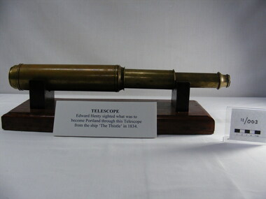 Dunkeld Museum Inc.
Telescope, Unknown, 18th century
Believed to be Edward Henty's telescope which was used at the early settlement at Portland and used to observe movements of ships at sea. Believed to have come off the boat "The Thistle"Found, stored in a thermos which was purchased in a box of sundries at a clearing sale at the Henty property.Brass telescope, made in 4 sections plus the eye piece. Eye piece has a slideable cover to protect the lens. Removeable lens.None from manufacture however there are scratched markings inside the eyepiece but are no longer readablehentys, expolration of victoria, telescope, major mitchell -
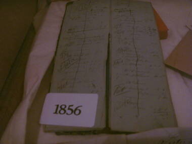 Heathcote McIvor Historical Society
Day Book, Book, 1856
Believed to be long to Routledge Brothers who ran a general store business in heathcote. They also owned a sawmill and quartz crushing battery.one of three books donated to the Museum, were found by the donors father back in the late 1960's while he was working on renovations to a building in heathcote these books had been thrown onto a pile of builders rubble, he retrieved them. when he passed away some years later his son found them while clearing out his effects, have travel through several house changes till 2010 when the son was doing a cleanup and the books were found again he contacted the Historic Society, date back to first settlement of Heathcote, inside writing is in excellient condition, as if it were written yeaterday. give a daily account of purchases by locals.gives us an insight into persons living and working in Heathcote McIvor district. Not many early items of this era left .Day book, oblong, leather cover, Day book gold blocked on front coverday book routledge, brothers -
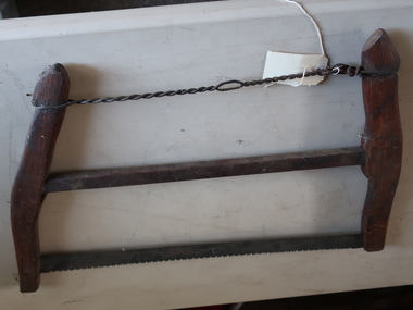 Kiewa Valley Historical Society
Buck Saw
A bucksaw is a hand powered frame saw similar to bow saw and generally used with a sawbuck to cut logs or firewood to length (bucking).Used by residents of the Kiewa Valley for clearing land, chopping firewood, cutting lumber. Also used while camping because it is portableFormerly UKV 239. Buck Saw with Lightning Tooth Blade. Operated by two men.Ref. Page 10 Tools for all Trade Catalogue. It consists of 3 horizontal bars, the top one being twisted wire and the bottom one being the metal blade with a wood bar in between. They are attached at each end to curved wooden bars. tool for wood, saw, buck saw -
 Orbost & District Historical Society
book, Key to the System of Victorian Plants, 1887 - 1888
Ferdinand von Mueller was born at Rostock, Germany, on 30 June 1825 , died at Melbourne, Australia, on 10 October 1896. He studied pharmacy and took his Doctor of Philosophy at the University of Kiel in 1847. He came to Australia in 1848 for health reasons and became a great botanical collector and writer. He was Victorian Government Botanist from 1853, and for a time Director of the Botanic Gardens. He travelled widely in Victoria and was on the A.C.Gregory expedition to northern Australia in 1855-57. He supported botanical exploration and collecting throughout the colonies. Charles Henry [Carl] Grove died on 17/4/1938 at Box Hill at the age of 88 and was buried in Orbost. Prior to coming to the Snowy River district, Carl worked as overseer on Buchan Station. In 1880, he selected land at Newmerella after first coming here in 1874 with early selector James A Robertson. He married Annie Robertson in 1876. Carl was a farmer, hop and seed grower and nurseryman. He was an elected Councillor of the newly formed Tambo Shire in 1882, and then in 1892 to the Orbost Shire where he served for many years filling varioius public roles. In 1911, he shifted to Queensland, but later returned to Victoria and died at Box Hill. (Ref. Nov 2014 Newsletter) Mueller was one of the first people to take a scientific interest in Victorian forests, and argued against indiscriminate clearing of land. This item is a useful research tool. It is associated with Carl Grove, a prominent early resident of Orbost.A black book with the title "Key To The System of Victorian Plants 1" in gold print.inside cover - "To Carl Grove from Baron Von Mueller March 1896"von-mueller-ferdinand botany-victoria plants-victoria grove-carl