Showing 821 items
matching diamond creek road
-
 Greensborough Historical Society
Map, Melbourne and Metropolitan Board of Works. Survey Division, MMBW, Yarra 2500 / 12.22. Watsonia North, 1978_03
Melbourne and Metropolitan Board of Works. Yarra 2500 [base map]. 12-22, Parishes of Keelbundora 2856, Municipalities of Whittlesea 239 and Diamond Valley 257. Shows street names, easement sizes, lot numbers, lodged plan numbers, names of prominent features, contour values, creek or river names. Watsonia Railway Station and environs. Prominent streets: Edmund Rice Parade and Macorna Street. Includes Christian Brothers Edmund Rice College and Janefield Special School sites and "proposed future freeway" (now Metropolitan Ring Road).MMBW Map in 1:2500 [scale] series. Cream parchment with green tape reinforcing on edges and punched holes on left edge.mmbw, melbourne and metropolitan board of works, shire of diamond valley, watsonia - maps, bundoora - maps -
 Greensborough Historical Society
Map, Melbourne and Metropolitan Board of Works. Survey Division, MMBW, Yarra 2500 / 12.21. Watsonia North, 1979_02
Melbourne and Metropolitan Board of Works. Yarra 2500 [base map]. 12-22, Parish of Keelbundora 2856, Municipality of Diamond Valley 257. Shows street names, easement sizes, lot numbers, lodged plan numbers, names of prominent features, contour values, creek or river names. Watsonia Railway Station and environs. Prominent streets: Grimshaw Street, William Street and Macorna Street. Includes former Institute of Social Welfare (now Loyola College) Lines Reserve and Binnak Park.MMBW Map in 1:2500 [scale] series. Cream parchment with green tape reinforcing on edges and punched holes on left edge.mmbw, melbourne and metropolitan board of works, shire of diamond valley, watsonia - maps, bundoora - maps -
 Greensborough Historical Society
Map, Melbourne and Metropolitan Board of Works. Survey Division, MMBW, Yarra 2500 / 12.24. Plenty and Blue Lake, 1977_10
Melbourne and Metropolitan Board of Works. Yarra 2500 [base map]. 12-24, Municipalities of Whittlesea 239 and Diamond Valley 257. Shows street names, easement sizes, lot numbers, lodged plan numbers, names of prominent features, contour values, creek or river names. Watsonia Railway Station and environs. Prominent streets: Memorial Drive. Includes Plenty River and Blue Lake in the Plenty Gorge.MMBW Map in 1:2500 [scale] series. Cream parchment with green tape reinforcing on edges and punched holes on left edge.mmbw, melbourne and metropolitan board of works, shire of diamond valley, plenty - maps, blue lake -
 Greensborough Historical Society
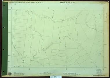
Map, Melbourne and Metropolitan Board of Works. Survey Division, MMBW, Yarra 2500 / 17.27. Central Hurstbridge, 1978_02
Melbourne and Metropolitan Board of Works. Yarra 2500 [base map] 17-27. Central Hurstbridge. Parish of Greensborough 2724, Municipalities of Diamond Valley 257, Eltham 238 and Whittlesea 239. Prominent streets include: Anzac Avenue and Hurstbridge-Arthurs Creek Road. MMBW Map in 1:2500 [scale] series. Cream parchment with green tape reinforcing on edges and punched holes on left edge.mmbw, melbourne and metropolitan board of works, shire of diamond valley, hurstbridge - maps -
 Greensborough Historical Society
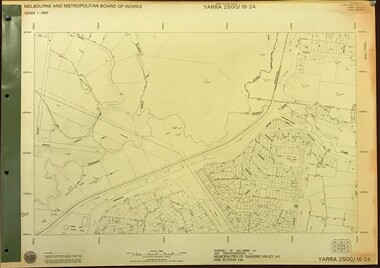
Map, Melbourne and Metropolitan Board of Works. Survey Division, MMBW, Yarra 2500 / 16.24. Northern Diamond Creek and Wattle Glen, 1978_02
Melbourne and Metropolitan Board of Works. Yarra 2500 [base map] 16-24. Northern Diamond Creek and Wattle Glen. Parishes of Nillumbik 3310 and Greensborough 2724. Municipalities of Diamond Valley 257 and Eltham 238. Prominent streets include: Hurstbridge Road, and Reynolds Road. Includes Wattle Glen Station.MMBW Map in 1:2500 [scale] series. Cream parchment with green tape reinforcing on edges and punched holes on left edge.mmbw, melbourne and metropolitan board of works, shire of diamond valley, wattle glen - maps, diamond creek - maps -
 Greensborough Historical Society
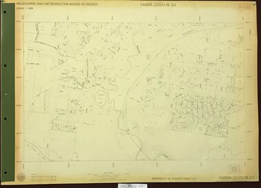
Map, Melbourne and Metropolitan Board of Works. Survey Division, MMBW, Yarra 2500 / 16.23. Diamond Creek, 1978_02
... map] 16-23. Diamond Creek. Parish of Nillumbik 3310..., and Reynolds Road. Includes the former Diamond Creek Technical School ...Melbourne and Metropolitan Board of Works. Yarra 2500 [base map] 16-23. Diamond Creek. Parish of Nillumbik 3310. Municipalities of Diamond Valley 257 and Eltham 238. Prominent streets include: Phipps Crescent, Bishop Avenue, and Reynolds Road. Includes the former Diamond Creek Technical School.MMBW Map in 1:2500 [scale] series. Cream parchment with green tape reinforcing on edges and punched holes on left edge.mmbw, melbourne and metropolitan board of works, shire of diamond valley, diamond creek - maps -
 Greensborough Historical Society
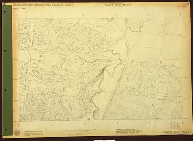
Map, Melbourne and Metropolitan Board of Works. Survey Division, MMBW, Yarra 2500 / 16.22. Research, 1979_05
Melbourne and Metropolitan Board of Works. Yarra 2500 [base map] 16-22. Research. Parish of Nillumbik 3310. Municipalities of Diamond Valley 257 and Eltham 238. Prominent streets include: Orme Road and Allendale Road. MMBW Map in 1:2500 [scale] series. Cream parchment with green tape reinforcing on edges and punched holes on left edge.mmbw, melbourne and metropolitan board of works, shire of diamond valley, diamond creek - maps -
 Greensborough Historical Society
Map, Heidelberg: Historic River Landscape Assessment, Historical Maps. Map A To 1838. Country of the Wawarang, 1985c
Geographical area of around 35 sq. kilometres marked with physical features such as major roads, rivers, vegetation and properties, with contemporary notes on landowners, descriptions and comments on the land and its development. Bounded by Shire of Diamond Valley to the North, Darebin Creek to the West and Plenty River to the East.Black an white sketch map on white paperheidelberg, heidelberg - maps -
 Greensborough Historical Society
Map, Heidelberg: Historic River Landscape Assessment. Historical Maps. Map B 1838-1851, "The Distinctly aristocratic locality", 1985c
Geographical area of around 35 sq. kilometres marked with physical features such as major roads, rivers, vegetation and properties, with contemporary notes on landowners, descriptions and comments on the land and its development. Bounded by Shire of Diamond Valley to the North, Darebin Creek to the West and Plenty River to the EastBlack and white sketch map on white paperheidelberg, heidelberg - maps -
 Greensborough Historical Society
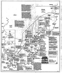
Map, Heidelberg. Historic River Landscape Assessment. Historical maps: Map C 1851-1863. "The Garden of the colony", 1985c
Geographical area of around 35 sq. kilometres marked with physical features such as major roads, vegetation and properties, with locations and notes of the increasing number of farms, gardens orchards and vineyards which had become established in addition to pastoral runs. Bounded by Shire of Diamond Valley to the North, Darebin Creek to the West and Plenty River to the East.Black and white sketch map on white paperheidelberg, heidelberg - maps -
 Greensborough Historical Society
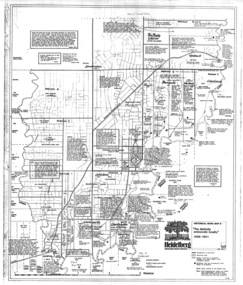
Map, Heidelberg: Historic River Landscape Assessment. Historical maps. Map D 1864 -1901 "Sleepy Hollow" and "Sleeping beauty", 1985c
Geographical area of c. 35 sq. kilometres marked with physical features such as major roads, rivers, vegetation and properties, with locations and notes on the increasing number of farms, orchards and vineyards that had been developed in addition to pastoral runs. Bounded by Shire of Diamond Valley to the North, Darebin Creek to the West, and Plenty River to the East.Black and white sketch on white paper. Second copy 600 x 430 cm printed in black on semi-opaque paperheidelberg, heidelberg - maps -
 Greensborough Historical Society
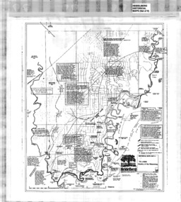
Map, Heidelberg: Historic River Landscape Assessment. Historical maps. Map E 1901-1934 "A Time of projects and improvements", 1985c
Geographical area of around 35 sq. kilometres marked with physical features such as major roads, railways (new extension to Eltham), rivers and properties, also housing sub-divisions and community facilities such as hospitals, parks and sporting reserves and indications of new small scale industries such as dairying. Bounded by Shire of Diamond Valley to the North, Darebin Creek to the West and Plenty River to the East. Black and white sketch map on white paperheidelberg, heidelberg - maps -
 Greensborough Historical Society
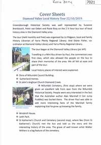
Booklet and article, Diamond Valley Local History Tour 2019, by Yarra Plenty Regional Library, 22/10/2019
Cover article written by Rosie Bray. In addition to YPRL booklets which have a brief history of each site visited, there are leaflets on Anglican parish of Diamond Creek; Nillumbik Cemetery; Ellis Cottage; Greensborough Cemetery and Sutherland Homes for ChildrenBooklet (2 copies) containing a brief history of sites visited on the Library's Diamond Valley Tour 2019, with 21 p. of supplementary information by various writers and 6 photographs taken on the tour.diamond valley, yarra plenty regional library, sutherland homes, st katherines church st helena, andrew yandell reserve, greensborough rsl, greensborough war memorial park, greensborough cemetery -
 Greensborough Historical Society
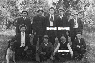
Photograph - Digital Image, Diamond Creek boys, 1910c
A group of young men from Diamond Creek, including Hugh Norman Coventry, John Thomas Coventry and W.S. Laurie. Names supplied by Bruce McDowell.Digital copy of black and white photographSome names have been added to photo.hugh norman coventry, john thomas coventry -
 Greensborough Historical Society
Map, Melbourne and Metropolitan Board of Works. Survey Division, MMBW, Yarra 2500 / 15.23. Diamond Creek Reserve, 1978_02
Melbourne and Metropolitan Board of Works. Yarra 2500 [base map] 15.23. Hurstbridge. Municipality of Diamond Valley 257. Prominent streets include: Challenger Street, James Cook Drive and Ryans Road / Main Street. Features include the Diamond Creek and Diamond Creek Reserve.MMBW Map in 1:2500 [scale] series. Cream parchment with green tape reinforcing on edges and punched holes on left edge.mmbw, melbourne and metropolitan board of works, shire of diamond valley, diamond creek - maps -
 Greensborough Historical Society
Map, Melbourne and Metropolitan Board of Works. Survey Division, MMBW, Yarra 2500 / 15.22. Eltham North. Allendale Road, 1979_08
... include the Diamond Creek.... Road and Ryans Road. Features include the Diamond Creek. mmbw ...Melbourne and Metropolitan Board of Works. Yarra 2500 [base map] 15.22. Eltham North, Allendale Road. Parish of Nillumbik. Municipalities of Eltham 238 and Diamond Valley 257. Prominent streets include: Allendale Road, Godber Road and Ryans Road. Features include the Diamond Creek.MMBW Map in 1:2500 [scale] series. Cream parchment with green tape reinforcing on edges and punched holes on left edge.mmbw, melbourne and metropolitan board of works, shire of diamond valley, nillumbik, eltham - maps -
 Greensborough Historical Society
Map, Melbourne and Metropolitan Board of Works. Survey Division, MMBW, Yarra 2500 / 15.21. Eltham North, 1979_08
... include the Diamond Creek, Eltham Council Pound and Eltham North... Road. Features include the Diamond Creek, Eltham Council Pound ...Melbourne and Metropolitan Board of Works. Yarra 2500 [base map] 15.21. Eltham North. Parish of Nillumbik 3310. Municipalities of Diamond Valley 257 and Eltham 238. Prominent streets include: Progress Road, Glen Park Road and Zig Zag Road. Features include the Diamond Creek, Eltham Council Pound and Eltham North Reserve.MMBW Map in 1:2500 [scale] series. Cream parchment with green tape reinforcing on edges and punched holes on left edge.mmbw, melbourne and metropolitan board of works, shire of diamond valley, nillumbik, eltham - maps -
 Greensborough Historical Society
Map, Melbourne and Metropolitan Board of Works. Survey Division, MMBW, Yarra 2500 / 15.27. Yarrambat, De Fredricks Lane, 1977_10
Melbourne and Metropolitan Board of Works. Yarra 2500 [base map] 15.27. Yarrambat, De Fredricks Lane. Parish of Greensborough 2724. Municipality of Diamond Valley 257 and Whittlesea 239. Prominent streets include: De Fredricks Lane, Astons Road and Bannons Lane. Features include Scrubby Creek.MMBW Map in 1:2500 [scale] series. Cream parchment with green tape reinforcing on edges and punched holes on left edge.mmbw, melbourne and metropolitan board of works, shire of diamond valley, yarrambat - maps -
 Greensborough Historical Society
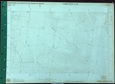
Map, Melbourne and Metropolitan Board of Works. Survey Division, MMBW, Yarra 2500 / 15.26. Yarrambat, Hacketts Road, 1978_07
Melbourne and Metropolitan Board of Works. Yarra 2500 [base map] 15.26. Yarrambat, Hacketts Road. Municipality of Diamond Valley 257. Prominent streets include: Black Gully Road, Hacketts Road and Collins Lane. Features include Scrubby Creek.MMBW Map in 1:2500 [scale] series. Cream parchment with green tape reinforcing on edges and punched holes on left edge.mmbw, melbourne and metropolitan board of works, shire of diamond valley, yarrambat - maps -
 Greensborough Historical Society
Newspaper Clipping, Diamond Valley Leader, Hell On Wheels: Cyclists safety concerns, 06/03/2019
... diamond creek greensborough cyclists bike lanes News article 1 ...Diamond Valley cyclists are calling for better safety as they negotiate one of the area's busiest roads. A bike lane needs to be continuous along Main Road Eltham. News article 1 page, black text.eltham, diamond creek, greensborough, cyclists, bike lanes -
 Greensborough Historical Society
Newspaper Clipping, Diamond Valley Leader, Last drinks for Pat's pub, 13/03/2019
The Windy Mile pub in Diamond Creek has 'never been the same" since teenager Patrick Cronin died from a senseless coward punch at the bar almost three years ago.The Windy Mile will serve its last drink on Sunday, March 31 2019.News article 1 page, black text.windy mile, diamond creek, patrick cronin, cronin family -
 Greensborough Historical Society
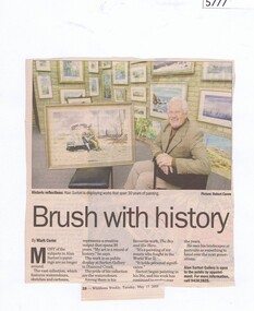
Newspaper Clipping, Diamond Valley News, Brush with history, 17/06/1995
Greensborough artist Alan Sartori show some of his work at the Alan Sartori Gallery in Diamond Creek.Newspaper clipping, black and white text and colour image.alan sartori, sartori gallery diamond creek -
 Greensborough Historical Society
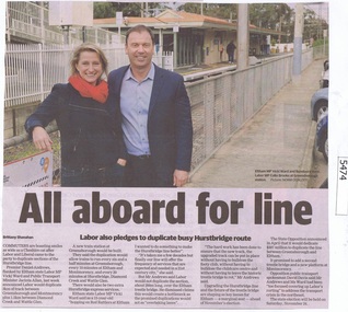
Newspaper Clipping, Diamond Valley Leader, All aboard for line, 08/08/2018
Premier Daniel Andrews flanked by Eltham state Labor MP Vicki Ward and Public Transport Minister Jacinta Allan, last week announced Labor would duplicate 3km of track between Greensborough and Montmorency plus 1.5km between Diamond Creek and Wattle Glen. In this article local MPs Colin Brooks and Vicki Ward are shown standing on Greensborough Station.News article 1 page, black text and colour image .hurstbridge rail line, greensborough, montmorency, daniel andrews, vicki ward, colin brooks -
 Greensborough Historical Society
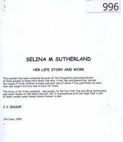
Article, J.C.Jessop, Selina M Sutherland: her life story and work by J.C. Jessop (1958), 26/12/1839o
Selina Sutherland was a 19th century nurse and social welfare reformer. She was particularly concerned with the welfare of destitute children. She founded the Sutherland Homes for Children which moved to Diamond Creek in around 1909. This biography was written by J. C. Jessop in 1958. Mr Jessop was a member of the Committee of Management of Sutherland Homes and a well known identity in Greensborough.24 page article in black folder.selina sutherland, sutherland homes for children -
 Greensborough Historical Society
Photograph - Digital Image, Gilding wedding, 1896_
Informal photograph of wedding party from the Gilding family. The Gilding family lived in Greensborough and operated a Bootmaker’s shop located on the west side of Main Street, north of the rail line. John married Harriet Flower Edmonds in 1896. Standing next to the bride is Bruce Heddle and his mother Mrs W Heddle. John relocated to Diamond Creek after this wedding.Digital copy of black and white photograph. -
 Greensborough Historical Society
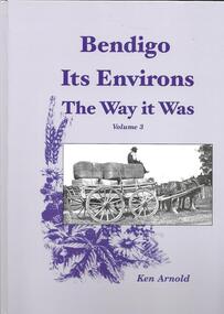
Book, Crown Castleton Publishers, Bendigo Its Environs - the Way it Was. Vol 3 / by Ken Arnold, 2013_
A brief history of the areas of Strathfieldsaye, Junortoun, Longlea, Axedale, Kimbolton, Redesdale, Lyal, Myrtle Creek, Axe Creek, Eppalock, Emu Creek, Sedgwick, Mandurang, Mandurang South and Diamond Hill.399 pages, illus. Hard cover.bendigo -
 Greensborough Historical Society
Article, Bushranging, murder and capture of the murderer, 02/11/1866
Article from 'Colonist' newspaper (2/11/1866) reporting on the capture of bushranger Robert Bourke in Diamond Creek.Has references to Greensborough.5 page article downloaded from National Library of New Zealand website 'paperspast'. bushrangers, greensborough, murder, robert bourke, diamond creek, hurstbridge -
 Greensborough Historical Society
Newspaper clipping, Sensational accident. Picnic van upset. 1896, 28/12/1896
... on country roads. road accidents picnics greensborough diamond creek ...Greensborough and district has always been a popular spot for picnickers but his Boxing Day picnic ended in disaster. [The injured were treated at The Farmers Arms Hotel]An account of the dangers of fast travel on country roads.2 pages. Page one has a facsimile of the article downloaded from Trove (National Library of Australia); page two is a transcription of the article.road accidents, picnics, greensborough, diamond creek -
![Article, Greensborough RSL, Memorabilia: Did You Know [Article on water powered flour mills], 1842o](/media/collectors/4f729f5697f83e03086015b8/items/5091b7fc2162ef017426bfd2/item-media/509a25b52162ef0d908e9725/item-fit-380x285.jpg) Greensborough Historical Society
Greensborough Historical SocietyArticle, Greensborough RSL, Memorabilia: Did You Know [Article on water powered flour mills], 1842o
Contains a brief history of the various flour mills that existed on the Plenty River upstream from Greensborough and some others in the district.Contains some hard to find information on district flour mills and their fate.A one page article on Plenty River flour mills written by Jim Allen.Niljanefield mill, george coulstock, john brock, peter hurlestone, carome mill, thomas mill, plenty river, yan yean reservoir, boadles mill, marsh farm, diamond creek -
 Greensborough Historical Society
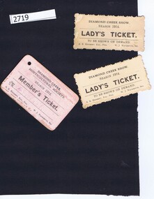
Tickets, Diamond Creek Horticultural Society, Diamond Creek Show 1924, 1924_
Two Lady's Tickets for Diamond Creek Show, Season 1924, Diamond Creek Horticultural Society stamp on verso; one Member's Ticket for Diamond Creek Horticultural Society, Season 1924. Two Lady's Tickets for Diamond Creek Show, Season 1924: black print on buff card, Diamond Creek Horticultural Society stamp on verso; one Member's Ticket for Diamond Creek Horticultural Society, Season 1924: black print on pink card Signed H. J. Blackdiamond creek