Showing 8701 items
matching ely
-
 Surrey Hills Historical Society Collection
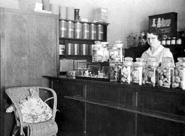
Photograph, Anne's Pantry, 165 Union Road, Surrey Hills in 1947
In 1930 Miss Anne Cook opened Anne’s Pantry, a home-made cakeshop at 165 Union Road, but later moved to 135 Union Road. The business of the same name is currently (2018) located at 139 Union Road. Miss Cook used to catch the first train up from Auburn and usually worked into the evening. Eventually the long hours took their toll and she had to sell. Miss E Porteous, her assistant, pictured in this photo, remained for many years with later owners. She recalled: “On the first day we opened at 10 a.m., the people surged in and within half an hour there wasn’t a cake left.” A black and white photograph of a shop interior. There are a number of large jars full of biscuits sitting on the counter. Large tins and boxes are on the shelf to the left hand side. A wicker chair is beside the counter, and part of a table and chair is on the far left hand side. A lady with glasses is standing behind the counter.Original: Top LH corner: Just in case / you forget / Anne's Pantry / 1947 Top Middle: PS/ How could we forget / love Mumunion road, businesses, surrey hills, cake shop, pastry shop, shopkeepers, 1930, 1947, anne's pantry, e. porteous (miss), anne cook (miss) -
 Ambulance Victoria Museum
Photograph, Ambulance Officers Training Centre Course 200, Recruit Course, 1977
Front Row L to R: J. Brereton, d. Catteral, M. Chilton, L. Cooke, P. Crew, K Crowle, J. Engledow, K. Filcock, K. Ford, R. Green, K. Holt, M. Hunting, C. Linke, S. Lamb, J. Lee. Back Row L to R: J. Lennon, D. Lumby. J. McDonald, P. Malone, T. Nunn, R. Paravinic, J. Poole, R. Reid, W. Sampey, P. Sanger, E. Schanssema, K Struthers, P. Turner, N. White, R. Williams, P. Williams. P. Worboys.Black and White photograph of ambulance officer recruitsambulance officers training centre, recruits -
 Federation University Historical Collection
Correspondence, Correspondence from the Royal Institute of Architects regarding the Architectural Technicians' Course, 1949, 23/09/1949
11994.1 Page 01. Letter, dated 26/09/1949, from the Secretary of The Royal Victorian Institute Of Architects to F. E. Ferguson Esq., Registrar, The School of Mines and Industry. Letter requests a new architectural syllabus that caters to the separation of architectural professions into Qualified Architect and Architectural Technician 11994.2 Page 02. Recommending the Ballarat School of Mines establish an Architectural Technician course 11994.3 Page 03. Recommended Architectural Technicians course; 1st, 2nd & 3rd year subjects 11994.4 Letter from F.E. Ferguson to The Royal Victorian Institute of Architects confirming the establishment of the Architectural Technician course11994.1 Typed letter on quarto paper with letterhead 11994.2 Typed letter on quarto paper 11994.3 Typed letter on airplane paper, with an airoplane watermark 11994.4 Typed letter on quarto paperf.e. ferguson, royal victorian institute of architects, ballarat school of mines, registrar, architectural technician, 1949 -
 Wodonga & District Historical Society Inc
Functional object - 'Sessions' Cottage Clock c. early 20th century
This clock was produced by the American Sessions Clock Company. The company was formed in 1903, after William E. Sessions and his nephew Albert L. Sessions bought out the failing clock company of E.N.Welch Manufacturing. The clock belonged to local Wodonga bootmaker Franz Gördes (b.1843) who immigrated to Australia from Germany in 1871. After docking in Melbourne Franz headed for the goldfields in Beechworth, but didn't strike gold. He returned to his trade and opened a boot shop in Wodonga, which burnt to the ground the day before the opening. Undeterred, he rebuilt and operated the business until his death in 1928.This item has a well documented provenance and connection to the local history of Wodonga.An ornate wooden clock with Roman numeral clock face and glass door with a decorative gold transfer. clock, clocks, session clock company, wodonga, gold rush, gold fields, beechworth -
 Rutherglen Historical Society
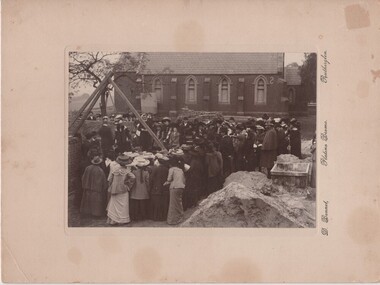
Photograph, D. Bennett, 1905 (Exact)
On note in photograph file: Laying the Foundation Stone of St Stephen's Rectory, High St, Rutherglen. "The foundation stone was laid on Wednesday, 21st June, 1905, before a large number of parishioners and visitors by Mrs T H Armstrong, wife of the Bishop of Wangaratta; Royston Ready presenting Mrs Armstrong with a silver trowel as a momento of the occasion." From - The Parish of St Stephen, Rutherglen 1863-1963. The Rector at this time was Rev A J E Harris-Rivett. St Stephens Rectory, High Street, Rutherglen. Mrs Armstrong, wife of the first Bishop laid the stone. Information from Father Angus Cooper - 1987Photograph of the laying of the foundation stone at St Stephens Rectory, Rutherglen, black & white, cardboard, unframed"D. Bennett, Platino Bromo, Rutherglen" On back of photo: "Laying of foundation stone of rectory of St Stephens Rutherglen"anglican church, st stephens church, royston ready, t h armstrong -
 Eltham District Historical Society Inc
Photograph - Aerial Photograph, Landata, Eltham / Research, Vic, Jan. 1951
Centred on Brinkkotter Road opposite Yarramie Reserve, Eltham bounded by Maroondah Aqueduct to north, Nyora Road to south, Eltham College to east and Leane Drive to west. Historic Aerial Imagery Source: Landata.vic.gov.au Aerial Photo Details: Project No :65 Project : MELBOURNE AND METROPOLITAN PROJECT NO. 2 Run : 7 Frame : 8 Date : 01/1951 Film Type : B/W Camera : EAG9 Flying Height : 12200 Scale : 12000 Film Number : 1419 GDA2020 : 37°42'32"S, 145°10'41"E MGA2020 : 339408, 5824924 (55) Melways : 22 F3 (ed. 42)Historical aerial photos and photo maps provide viusal evidence of the chronology of changes to the built landscape of the district and assist in dating other imagesaerial photo, 1951-01, eltham, neil webster collection, brinkkotter road, eltham college, leane drive, maroondah aqueduct, melways 22f3, nyora road, yarramie reserve -
 Eltham District Historical Society Inc
Photograph - Aerial Photograph, Landata, Eltham, Vic, Jan. 1951
Centred on Beard Street between Main Road and Frank Street, Eltham bounded by Maroondah Aqueduct to north, Arthur Street to south, Maroong Drive to east and Catholic Ladies College to west. Historic Aerial Imagery Source: Landata.vic.gov.au Aerial Photo Details: Project No :65 Project : MELBOURNE AND METROPOLITAN PROJECT NO. 2 Run : 7 Frame : 9 Date : 01/1951 Film Type : B/W Camera : EAG9 Flying Height : 12200 Scale : 12000 Film Number : 1419 GDA2020 : 37°42'23"S, 145°09'39"E MGA2020 : 337874, 5825170 (55) Melways : 22 B3 (ed. 42)Historical aerial photos and photo maps provide viusal evidence of the chronology of changes to the built landscape of the district and assist in dating other imagesaerial photo, 1951-01, eltham, neil webster collection, arthur street, beard street, catholic ladies college, frank street, main road, maroondah aqueduct, maroong drive, melway 22b3, research (vic.) -
 Eltham District Historical Society Inc
Photograph - Aerial Photograph, Landata, Eltham North, Feb. 1956
Centred on present day 54 Kelway Crescent, Eltham North bounded by Glen Gully Road to north, Meruka Drive to south, Eltham College to east and Leach Street to west. Historic Aerial Imagery Source: Landata.vic.gov.au Aerial Photo Details: Project No :250 Project : MELBOURNE OUTER SUBURBS PROJECT Run : 17 Frame : 113 Date : 02/1956 Film Type : B/W Camera : EAG9 Flying Height : 10000 Scale : 12000 Film Number : 1176 GDA2020 : 37°42'16"S, 145°08'08"E MGA2020 : 335650, 5825336 (55) Melways : 21 G2 (ed. 42)aerial photo, 1956-02, eltham, eltham north, glen gully road, leach street, main road, melway 21g2, meruka drive, montmorency, neil webster collection -
 Eltham District Historical Society Inc
Photograph - Aerial Photograph, Landata, Montmorency, Feb. 1956
Centred on present day Tahlee Place Reserve and Sherbourne Preschool, Montmorency bounded by Progress Road to north, Withers Way to south, Main Road to east and Leach Street to west. Historic Aerial Imagery Source: Landata.vic.gov.au Aerial Photo Details: Project No :250 Project : MELBOURNE OUTER SUBURBS PROJECT Run : 17 Frame : 114 Date : 02/1956 Film Type : B/W Camera : EAG9 Flying Height : 10000 Scale : 12000 Film Number : 1176 GDA2020 : 37°42'50"S, 145°08'02"E MGA2020 : 335512, 5824286 (55) Melways : 21 F5 (ed. 42)aerial photo, 1956-02, neil webster collection, central park, eltham, leach street, main road, melway 21f5, montmorency, progress road, withers way, sherbourne preschool, tahlee place reserve -
 Eltham District Historical Society Inc
Photograph - Aerial Photograph, Landata, Lower Plenty, Feb. 1956
Centred on present day 217 Old Eltham Road, Lower Plenty bounded by Pitt Street to north, Yarra River to south, Main Road to east and Bonds Road to west. Historic Aerial Imagery Source: Landata.vic.gov.au Aerial Photo Details: Project No :250 Project : MELBOURNE OUTER SUBURBS PROJECT Run : 17 Frame : 116 Date : 02/1956 Film Type : B/W Camera : EAG9 Flying Height : 10000 Scale : 12000 Film Number : 1176 GDA2020 : 37°43'58"S, 145°07'49"E MGA2020 : 335237, 5822186 (55) Melways : 21 E10 (ed. 42)aerial photo, 1956-02, neil webster collection, eltham, main road, bonds road, elham, lower plenty, melway 21e10, pitt street, yarra river -
 Eltham District Historical Society Inc
Photograph - Aerial Photograph, Landata, Eltham, Feb. 1956
Centred on present day Shalbury Avenue, Eltham bounded by Leane Drive and Parsons Road to north, Nyora Road to south, Reynolds Road to east and the Diamond Creek to west Historic Aerial Imagery Source: Landata.vic.gov.au Aerial Photo Details: Project No :250 Project : MELBOURNE OUTER SUBURBS PROJECT Run : 18 Frame : 95 Date : 02/1956 Film Type : B/W Camera : EAG9 Flying Height : 10000 Scale : 12000 Film Number : 1176 GDA2020 : 37°41'57"S, 145°09'51"E MGA2020 : 338145, 5825965 (55) Melways : 22 C1 (ed. 42)aerial photo, 1956-02, neil webster collection, eltham, diamond creek (creek), melway 22c1, nyora road, parsons road, reynolds road, shalbury avenue -
 Eltham District Historical Society Inc
Photograph - Aerial Photograph, Landata, Research, Vic, Feb. 1956
Centred on present day Thompson Crescent, Research bounded by Maroondah Aqueduct to north, Thompson Crescent and Nyora Road to south, Bells Hill Road to east and Eucalyptus Road to west Historic Aerial Imagery Source: Landata.vic.gov.au Aerial Photo Details: Project No :250 Project : MELBOURNE OUTER SUBURBS PROJECT Run : 19 Frame : 6 Date : 02/1956 Film Type : B/W Camera : EAG9 Flying Height : 10000 Scale : 12000 Film Number : 1176 GDA2020 : 37°42'38"S, 145°11'02"E MGA2020 : 339927, 5824736 (55) Melways : 22 H4 (ed. 42)aerial photo, 1956-02, neil webster collection, bells hill road, eltham, eucalyptus road, maroondah aqueduct, melway 22h4, nyora road, research (vic.), thompson crescent -
 Eltham District Historical Society Inc
Photograph - Aerial Photograph, Landata, Research, Vic, Apr. 1963
Centred on present day Thompson Crescent and Nicholson Close, Research bounded by Maroondah Aqueduct to north, Nyora Road to south, Eltham College to east and Eltham Gateway Hotel to west. Historic Aerial Imagery Source: Landata.vic.gov.au Aerial Photo Details: Project No :486 Project : MELBOURNE (1963) PROJECT Run : 5 Frame : 61 Date : 04/1963 Film Type : B/W Camera : RC8 Flying Height : 5100 Scale : 9600 Film Number : 1805 GDA2020 : 37°42'24"S, 145°10'06"E MGA2020 : 338528, 5825143 (55) Melways : 22 D3 (ed. 42)aerial photo, neil webster collection, eltham, 1963-04, eltham college, eltham gateway hotel and conference centre, maroondah aqueduct, melway 22d3, nicholson close, nyora road, research (vic.), thompson crescent -
 Eltham District Historical Society Inc
Photograph - Aerial Photograph, Landata, Eltham, Vic, Apr. 1963
Centred on present day John Street, Eltham between Main and Bible streets bounded by Elsa Court to north, Main Road Bridge to south, Wattle Grove to east and Bolton Street to west. Historic Aerial Imagery Source: Landata.vic.gov.au Aerial Photo Details: Project No :486 Project : MELBOURNE (1963) PROJECT Run : 6 Frame : 123 Date : 04/1963 Film Type : B/W Camera : RC8 Flying Height : 5100 Scale : 9600 Film Number : 1805 GDA2020 : 37°43'12"S, 145°08'54"E MGA2020 : 336800, 5823623 (55) Melways : 21 J6 (ed. 42)aerial photo, neil webster collection, 1963-04, bolton steet, elsa court, eltham, john street, main road, main road bridge, melway 21j6, wattle grove -
 Eltham District Historical Society Inc
Photograph - Aerial Photograph, Landata, Eltham, Vic, Apr. 1963
Centred on present day Eltham Ridge, Bolton Street, Eltham bounded by Elsa Court to north, Main Road to south, Bible Street to east and Reichelt Avenue and Rattray Road to west. Historic Aerial Imagery Source: Landata.vic.gov.au Aerial Photo Details: Project No :486 Project : MELBOURNE (1963) PROJECT Run : 6 Frame : 124 Date : 04/1963 Film Type : B/W Camera : RC8 Flying Height : 5100 Scale : 9600 Film Number : 1805 GDA2020 : 37°43'12"S, 145°08'16"E MGA2020 : 335876, 5823604 (55) Melways : 21 G6 (ed. 42)aerial photo, neil webster collection, 1963-04, bible street, bolton street, eltham, eltham ridge, main road, montmorency, rattray road, reichelt avenue -
 Eltham District Historical Society Inc
Photograph - Aerial Photograph, Landata, Eltham, Vic, Apr. 1963
Centred on present day Griffith Park Road, Eltham bounded by Mount Pleasant Road to north, Yarra River and Templestowe to south, Main Road at Reynolds Road to east and Falkiner Street to west. Historic Aerial Imagery Source: Landata.vic.gov.au Aerial Photo Details: Project No :486 Project : MELBOURNE (1963) PROJECT Run : 7 Frame : 233 Date : 04/1963 Film Type : B/W Camera : RC8 Flying Height : 5100 Scale : 9600 Film Number : 1805 GDA2020 : 37°44'04"S, 145°09'10"E MGA2020 : 337237, 5822053 (55) Melways : 22 A10 (ed. 42)aerial photo, neil webster collection, 1963-04, eltham, falkiner street, griffith park road, melway 22a10, mount pleasant road, reynolds road, templestowe, yarra river -
 Eltham District Historical Society Inc
Photograph - Aerial Photograph, Landata, Eltham, Vic, Apr. 1972
Centred on present day Parsons Road, Eltham bounded by Allendale Road to north, Frank Street to south, Research Shops and Raglan Road to east and Zig Zag Road to west. Historic Aerial Imagery Source: Landata.vic.gov.au Aerial Photo Details: Project No :985 Project : MELBOURNE 1972 Run : 26 Frame : 192 Date : 04/1972 Film Type : B/W Camera : RC10 Flying Height : 5700 Scale : 9600 Film Number : 2636 GDA2020 : 37°42'00"S, 145°09'59"E MGA2020 : 338360, 5825897 (55) Melways : 22 D1 (ed. 42)aerial photo, neil webster collection, 1972-04, allendale road, eltham, zig zag road, frank street, melway 22d1, parsons road, raglan road, research (vic.), research shops, eltham barrel -
 Eltham District Historical Society Inc
Photograph - Aerial Photograph, Landata, Eltham, Vic, Apr. 1972
Centred on present day Zig Zag Road near Coolabah Drive, Eltham bounded by Allendale Road to north, Park West Road to south, Parsons Road to east and Banks Road to west. Historic Aerial Imagery Source: Landata.vic.gov.au Aerial Photo Details: Project No :985 Project : MELBOURNE 1972 Run : 26 Frame : 191 Date : 04/1972 Film Type : B/W Camera : RC10 Flying Height : 5700 Scale : 9600 Film Number : 2636 GDA2020 : 37°41'56"S, 145°09'26"E MGA2020 : 337533, 5826000 (55) Melways : 22 A1 (ed. 42)aerial photo, neil webster collection, 1972-04, allendale road, eltham, eltham north, zig zag road, banks road, coolabah drive, melway 22a1, park west road, parsons road -
 Eltham District Historical Society Inc
Photograph - Aerial Photograph, Landata, Eltham, Vic, Apr. 1972
Centred on present day Woodridge Estate, Eltham bounded by Park Road to north, Mount Pleasant Road to south, Stokes Orchard Estate to east and Eltham Railway Station to west. Historic Aerial Imagery Source: Landata.vic.gov.au Aerial Photo Details: Project No :985 Project : MELBOURNE 1972 Run : 27 Frame : 46 Date : 04/1972 Film Type : B/W Camera : RC10 Flying Height : 5700 Scale : 9600 Film Number : 2636 GDA2020 : 37°42'49"S, 145°09'46"E MGA2020 : 338053, 5824365 (55) Melways : 22 C5 (ed. 42)aerial photo, neil webster collection, 1972-04, eltham, eltham railway station, melway 22c5, mount pleasant road, park road, stokes orchard estate, woodridge estate -
 Eltham District Historical Society Inc
Photograph - Aerial Photograph, Landata, Eltham, Vic, Apr. 1972
Centred on present day Main Road at Pryor Street, Eltham bounded by Park West Road to north, Napoleon Street to south, Woodridge Estate to east and Ryans Road to west. Historic Aerial Imagery Source: Landata.vic.gov.au Aerial Photo Details: Project No :985 Project : MELBOURNE 1972 Run : 27 Frame : 47 Date : 04/1972 Film Type : B/W Camera : RC10 Flying Height : 5700 Scale : 9600 Film Number : 2636 GDA2020 : 37°42'45"S, 145°09'12"E MGA2020 : 337223, 5824470 (55) Melways : 22 A4 (ed. 42)aerial photo, neil webster collection, 1972-04, eltham, eltham railway station, woodridge estate, eltham shops, main road, melway 22a4, napoleon street, park west road, pryor street, ryans road -
 Eltham District Historical Society Inc
Photograph - Aerial Photograph, Landata, Eltham, Vic, Apr. 1972
Centred on present day Dalton Street at Mount Pleasant Road, Eltham bounded by Arthur Street to north, Yarra River and Kent Hughes Road to south, Eucalyptus Road to east and Susan Street to west. Historic Aerial Imagery Source: Landata.vic.gov.au Aerial Photo Details: Project No :985 Project : MELBOURNE 1972 Run : 28 Frame : 208 Date : 04/1972 Film Type : B/W Camera : RC10 Flying Height : 5700 Scale : 9600 Film Number : 2635 GDA2020 : 37°43'29"S, 145°08'54"E MGA2020 : 336816, 5823118 (55) Melways : 21 J8 (ed. 42)aerial photo, neil webster collection, 1972-04, eltham, arthur street, dalton street, eucalyptus road, kent hughes road, melway 21j8, mount pleasant road, susan street, yarra river -
 Mission to Seafarers Victoria
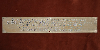
Plaque - Memorial Plaque, Ethel Augusta Godfrey
This plaque was erected in the Williamstown Sailors' Rest, the former skating ring in Thompson Street. It's one the three memorials to Ethel Godfrey with the stained glass window in the St Peter chapel in the Central Institute (See 0064.2) ) and the optus sectile plaque in the 1888 Port Melbourne Institute (See 2053) . This plaque was moved to the Nelson Place building when the Mission purchased the E,S&A Bank in 1943. In 1982, the plaque ws removed from the Williamstown mission along with 4 other plaques, objects and furniture to furnish the chapel of the new Flagstaff Maritime Museum. The transfer of the 5 plaques was requested in 2020 and they returned to the Mission's collection in 2022.The plaque along with the two other memoriels erected in the memory of Ethel Godfrey demonstrates the gratitude for the her 30 years of work.Rectangular plaque for Ethel Augusta Godfrey ethel augusta godfrey 1861-1935, williamstown, thompson street, seamen's mission, sailors' rest, flasgstaff maritime museum, lhlg -
 Trafalgar Holden Museum
Vehicle - VS model commodore, April 1995
The extent of exterior changes veered not much further than a redesigned Holden logo and wheel trims. An updated Ecotec (Emissions and Consumption Optimisation through TEChnology) version of the Buick V6 engine coincided with the changes to the engine in the United States. The Ecotec engine packed 13 percent more power, an increase of 17 kilowatts (23 hp) over the VR, cut fuel consumption by 5 percent, and increased the compression ratio from 9.0:1 to 9.4:1. Holden mated the new engine with a modified version of the GM 4L60-E automatic transmission, bringing improved throttle response and smoother changes between gearsThe VS Commodore was the last of which to be sold as Toyota Lexcens, as Holden and Toyota ended their model-sharing scheme The last Lexcens were built during 1997This model was also sold between 1995 and 1997 in small numbers to Malaysia and Singapore as the Opel Calais.4 door sedan VS Commodore sedanLion and stone badge on Bonnet and on Boot centre, Commore on both mudguards Holden badge on Rear under tail lightsvehicle, vs commodore, car -
 Wodonga & District Historical Society Inc
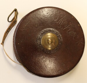
Functional object - Retractable wired measuring tape, John Rabone & Sons, 1939
Rabone & Sons had its origins in Birmingham, as rule and tool makers. The business was continued by John Rabone and his (John's) grandson, Eric Rabone. It worked under the name of John Rabone & Sons c1784-1953, becoming a public company in 1948. Control of the business remained with the Rabone family until 1962. In 1963 the company merged with a toolmaker from Sheffield to become Rabone Chesterman. The name E. M. Lock has been carved into the leather on one side. Edith May Lock was the mother of Arthur Lock who served in the 2/23 RD Australian Infantry Battalion, known as "Albury's Own".This item is part of a collection of items owned by Arthur Lock, a member of the 2/23rd Battalion, an all-volunteer Second Australian Imperial Force which served as part of the garrison during the Siege of Tobruk, then at El Alamein, New Guinea and Borneo. It has particular local significance as the battalion was know as "Albury's Own" because a large majority of the battalion's initial intake of volunteers came from the Albury–Wodonga region.A retractable wire measuring tape with leather casing and brass centre and winding handle. The tape is 66 feet in length. The manufacture's name, John Rabone & Sons, is inscribed around the centre circle as well as the Number 401 and 66FTAround centre circle "JOHN RABONE & SONS/BIRMINGHAM ENGLAND". In the centre "NO401 66FT" On opposite side around centre circle "RABONE'S METALLIC WIRED TAPE". Engraved into the surface "E.M.Lock"world war 11, john rabone and sons, wired measuring tape -
 Melton City Libraries
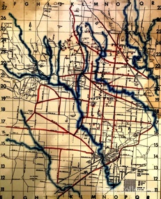
Map, Mount Cottrell Fire group, Unknown
"In 1966, the Mount Cottrell Fire Brigades Group was formed as a way of consolidating the smaller groups around Melton, Rockbank, Toolern Vale, Sydenham, Truganina and Werribee. Its headquarters were established at the home of Ernest ‘Bon’ and Edna Barrie in Ferris Road, Melton. Captain Bon Barrie was a member of the Melton Fire Brigade and elected group and communications officer of the new Mount Cottrell Brigades Group". Fire Brigade Meeting 14th September held at Rockbank Formation a new Group in Region 14 Present: R/O H Rothsay, Assistant R/O R Orchard Tru? G Summerton Purpose of Group The pooling of the equipment in the area should be co-ordinated under one leader. The Brigade and private equipment should be co-ordinated under one leader. Formation was carried unanimously. To be called Mt Cotterill Group. Rockbank nominated Captain E W Barrie elected, Secretary K Watt Toolern Vale. Names listed C/O K L McNaughton Anakie Group COO/O R B Chirnside Lieut J Richmond Capt E Gillespie Toolern Vale Eddie L/ T S Atkin Stan L/T B Storey Bert Sec K Watt Keith Capt E W Barrie Melton Bon L/T K Gillespie Keith A Gillespie Arthur L/T G Lunson George L/T J Robinson Jeff Capt A Marquand Truganina Alan L/T I Cowie Ian Sec T Gard Tom Capt G Harrison Rockbank a/ps G Harrison N Harrison N Fisher a/ps S Hirt Melton Steve Pres M Chomley Sydenham Capt S Hughes Stan Capt L Waterson Werribee Lex Res/o J Hanson G/O S Cooper Bacchus Marsh Syd P/GO W Lidgett Wal Pro/O D Dunton G/O T Healy R C [Mt Macedon] Tom Reg Sec G Douglas Hand written notes of Edna Barrie Typed by Wendy Barrie Maps of the Mt Cottrell Fire groupemergency services, maps -
 Phillip Island and District Historical Society Inc.
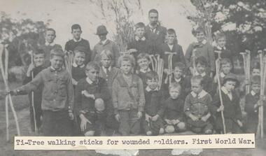
Photograph
One of a collection of over 400 photographs in an album commenced in 1960 and presented to the Phillip Island & Westernport Historical Society by the Shire of Phillip IslandPhotograph of the juvenile Red Cross workers holding Tea Tree walking sticks made for soldiers wounded in World War I Back row: E Bennell, R Forrest, H West, W Smith, W Wilson Teacher, R Smith, T Burton, C Cleeland. Middle row: C Leeson, J Cleeland, A Jackson, A West, N Leeson, F Forrest, S Smith, K West. Front row: A Jenner, J Jenner, C Jackson, D McLardy, A Jackson, R Jenner, V Leeson, S Jenner.local history, photography, juvenile red cross workers, black & white photograph, red cross, world war i, john jenner, bryant west -
 Federation University Historical Collection
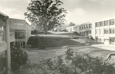
Photograph - Black and White, Mount Helen Campus, 1979
Five black and white images of the courtyard at the Mount Helen Campus of Federation University Australia. .1) View of the courtyard North of 'S' building, towards east .2) View westward, across the courtyard pool (since demolished). The walkway joins the library building (right) and 'S' building. .3) View towards the north-west. Coates Centre ('U' building, formerly Union Building) with Stage Two is on the right. The library is centre. To the left is 'S' building .4) View from the East end of Coates Centre ('U' building) towards 'E' building. -
 Federation University Historical Collection
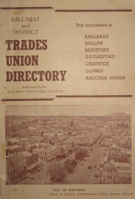
Booklet, Challenge Press Print Geelong, Ballarat and District Trades Union Directory, c1948
The Trades Union Directory was for circulation in Ballarat, Ballan, Beaufort, Daylesford, Creswick, Clunes and Bacchus MarshBrown soft covered book of 96 pages. Numerous advertisements and illustrations. It includes a listing of unions affiliated with the Trades and Labour Council, Ballarat and extracts and amendments to the Workers' Compensation Act.The book also includes many advertisements including E. Lucas and Co.; Myer Woollen Mills; Day-tex Fabrics (Daylesford); Ballarat Star Dairies; Rowlands Aerated Waters; Menzies Knitwear; Haymes Paints; Paddle Shoes; and Ronaldson - Tippett. Includes information on Social Services including old-age pensions and invalid pensions; Extracts and Amendments to the Workers' Compensation Act.union, pension, labor council, trade unions, trades and labor council, trades union -
 Federation University Historical Collection
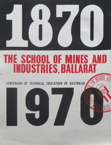
Poster - Posters, BCAE and BIAE Open Days: 1970-1987, 1970-1987
Includes the Centenary of Technical Education Poster10 posters advertising open days at BCAE and BIAE .1) SMB Centenary of Technical Education in Australia 1870-1970 .2) BCAE Open Day 1982 .3) BCAE The Country Alternative current courses 1987 .4) BIAE Degrees and Diplomas .5) BIAE Professional Careers .6) BCAE Open day 1986 .7) BCAE The Country Alternative 1986 .8) BCAE Choose Your Ballarat C. A. E. Careers Tree 1986 .9) BCAE Open day 1981 .10) BCAE Guess Whos Where at the BCAEbcae, biae, open day, henry moritz, graham hawley, anniversary, centenary, ballarat school of mines centenary, technical education centenary, poster, ballarat college of advanced education, ballarat institute of advanced education -
 Tennis Australia
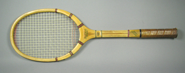
Racquet, Circa 1930
A 13 1/2 inch head, wooden racquet. Inscription across neck and stem of obverse: DREADNOUGHT/DRIVER/.../LEE/CUSTOM BUILT. Inscription across neck and stem of reverse: HARRY C. LEE & CO/NEW YORK/DREADNOUGHT/DRIVER/.../POWER/MODEL. A sticker with orange text adhered onto neck of obverse reads:STRUNG WITH/DU PONT/NYLON. The butt cap is missing - instead, the bare butt is painted white, upon which is handwritten: SIMON E./BRUCE. Materials: Wood, Leather, Nylon, Glue, Lacquer, Ink, String, Painttennis