Showing 1181 items matching "municipality"
-
 Greensborough Historical Society
Map, Melbourne and Metropolitan Board of Works. Survey Division, MMBW, Yarra 2500 / 12.24. Plenty and Blue Lake, 1977_10
Melbourne and Metropolitan Board of Works. Yarra 2500 [base map]. 12-24, Municipalities of Whittlesea 239 and Diamond Valley 257. Shows street names, easement sizes, lot numbers, lodged plan numbers, names of prominent features, contour values, creek or river names. Watsonia Railway Station and environs. Prominent streets: Memorial Drive. Includes Plenty River and Blue Lake in the Plenty Gorge.MMBW Map in 1:2500 [scale] series. Cream parchment with green tape reinforcing on edges and punched holes on left edge.mmbw, melbourne and metropolitan board of works, shire of diamond valley, plenty - maps, blue lake -
 Richmond & Burnley Historical Society
Petition, Richmond Churches Petition regarding Sunday Icecream Vendors 1908
The scroll describes the concerns of the Churches of Richmond against the Street Icecream Vendors who are threatening the sanctity of the Holy Sunday. Each denomination organsied for each of their Sunday School Teachers to sign the petition and these where pasted together to form a Sroll. The Scroll provides an indication of the sizes of the Sunday Schools and the number of Churches in the area in 1908. The petition to the City of Richmond was intended to introduce a By-law to prevent Sunday Trading in the municipality of Richmond. A combined record demonstating the collaboration between Richmond Churches to form a residents action group to combat the threat of Sunday Vendor Trading. The scroll has a record of the names and addresses of the hundreds of School Teachers from each demonination in 1908. A petition to the Richmond City Council From local churches protesting about the Sunday Trading by Icecream Vendors and the impact on the Holy Day. The petition contains signatures of Sunday School Teachers from each particpating denomination. The petition is presented as a paper scroll fixed to a wooden rod. (July 1908)Signatures of Sunday School Teachers and Leaderschurches, scroll, petition, richmond council, sunday school, icecream vendors, congregational church, central methodist church, baptist church, north richmond church of christ, balmain church of christ, burnley methodist church, richmond congregational church, burnley congregational church, st stephens church of england richmond, richmond presbyterian church, burnley presbyterian church, local action groups -
 Kew Historical Society Inc
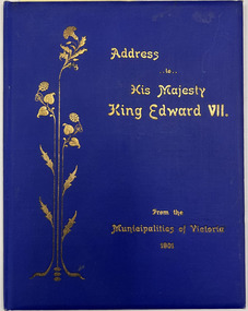
Book, Joint Address to His Majesty King King Edward VII from the Municipalities of Victoria 1901
Six page facsimile, the original produced by the Municipal Association of Victoria on the accession to the throne of King Edward VII. A facsimile edition was printed and presented to each municipality, shire etc in Victoria.Melbourne : Municipal Association of Victoria, 1901 [16] p. : all facsims. ; 21 cm.non-fictionSix page facsimile, the original produced by the Municipal Association of Victoria on the accession to the throne of King Edward VII. A facsimile edition was printed and presented to each municipality, shire etc in Victoria.edward vii, municipal association of victoria, 1901, testimonials, facsimiles -
 Kew Historical Society Inc
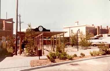
Photograph - Street Beautification: Port Melbourne
The City Engineer's Department within the former City of Kew, was responsible for public works, including street beautification. This photograph was held in the archives of the Department and was subsequently gifted to the Kew Historical Society. Like other examples originally held by the Department, photographs of road works, street beautification, engineering works were often sourced from other municipalities, or countries, to use as references for engineering works and design in Kew.Colour photographic positive (faded) of street beautification in Port Melbourne, used as a model by the Engineer's Department of the City of Kew for how civic spaces, including shopping centre precincts, could be improved. street beautification, city of kew -- engineers department, public works -- kew (vic.), port melbourne -
 Kew Historical Society Inc
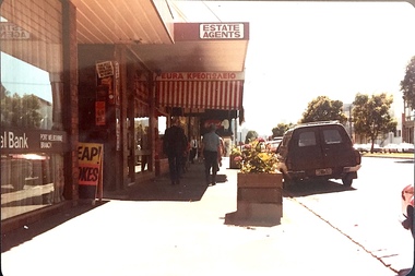
Photograph - Street Beautification: Port Melbourne
The City Engineer's Department within the former City of Kew, was responsible for public works, including street beautification. This photograph was held in the archives of the Department and was subsequently gifted to the Kew Historical Society. Like other examples originally held by the Department, photographs of road works, street beautification, engineering works were often sourced from other municipalities, or countries, to use as references for engineering works and design in Kew.Colour photographic positive (faded) of street beautification in Port Melbourne, used as a model by the Engineer's Department of the City of Kew for how civic spaces, including shopping centre precincts, could be improved. street beautification, city of kew -- engineers department, public works -- kew (vic.), port melbourne -
 Kew Historical Society Inc
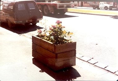
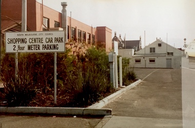
Photograph - Carpark: South Melbourne
The City Engineer's Department within the former City of Kew, was responsible for public works, including street beautification. This photograph was held in the archives of the Department and was subsequently gifted to the Kew Historical Society. Like other examples originally held by the Department, photographs of road works, street beautification, engineering works were often sourced from other municipalities, or countries, to use as references for engineering works and design in Kew.Colour photographic positive (faded) of public parking in South Melbourne, perhaps used as a model by the Engineer's Department of the City of Kew for how civic spaces, including shopping centre precincts, could be improved. city of kew -- engineers department, public works -- kew (vic.), south melbourne, carparks, signs -
 Melbourne Tram Museum
Administrative record - Research and Statistics - Melbourne, Melbourne & Metropolitan Tramways Board (MMTB), c1922
Digital image or scan of a document most likely prepared for the 1923 General Scheme for Melbourne Tramways as the statistical background information. See item 2088 for the General Scheme itself. Gives statistical detail for each Melbourne municipality at the time, areas, dwellings, passengers carried, population, route miles of railways and tramways, passenger capacity of the railways, and traffic counts - some of which have been extended to 1925. Demonstrates a statistical document prepared for research purposes and possibly part of the 1923 General Scheme for Tramways in Melbourne.Document - Journal bound in leather with red leather corners, sewn, alphabetical index pages, pages ruled in light blue ink.general scheme, statistics, tramways, railways, population -
 Bayside Gallery - Bayside City Council Art & Heritage Collection
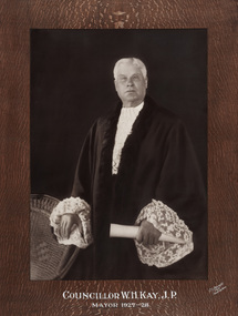
Photograph - sepia photograph, C.S. Bennett, Councillor W.H. Kay, J.P., Mayor of Sandringham 1927-28, c. 1928
William Hargreaves Kay (1866-1936) was Mayor of Sandringham in 1927-28.councillor, sandringham, local government, municipality, mayor, justice of the peace, portrait, city of sandringham, cr w.h. kay, william hargreaves kay, mayoral robes, jabot, mayor of sandringham -
 Bayside Gallery - Bayside City Council Art & Heritage Collection
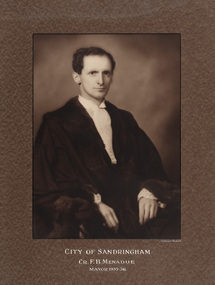
Photograph - sepia photograph, Dickinson-Monteath Studio, Councillor F.B. Menadue, Mayor of Sandringham 1935-36, c.1936
Frederick Bice Menadue (1895-1981) was Mayor of Sandringham in 1935-36.councillor, sandringham, local government, municipality, mayor, mayoral robes, portrait, city of sandringham, jabot, frederick bice menadue, cr. f.b. menadue, dickinson-monteath studio, mayor of sandringham -
 Warrnambool and District Historical Society Inc.
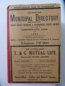
Stamp, W'bool Co.op Commons Seal, 1945
This is a Victorian Municipal Directory for 1945, containing general information on all municipalities in Victoria, a Gazeteer, a Commonwealth Guide and a Water Supply Record. Municipal Directories were published annually in Victoria from 1867 on. This directory came from the Shire of Mortlake which was established in 1864 when it had an area of 2137 square kilometres. The Shire of Mortlake was abolished in 1994 and merged with other neighbouring shires to form the present day Shire of Moyne. This book is very useful to researchers as it contains much information on the City, Borough and Shire structures, the Council employees and Government employees of all the municipalities. It has, therefore, important local information on Warrnambool and the surrounding areas in 1945. This is a soft cover book of 1114 pages. It has a buff- coloured cover with red binding on the spine. The printed material on the covers is printed in black. It has a blue stamp of the Shire of Mortlake on several pages. The book contains several advertisements for Melbourne businesses. ‘Shire of Mortlake’ shire of mortlake, local government in victoria, warrnambool history -
 Greensborough Historical Society
Map, Melbourne and Metropolitan Board of Works. Survey Division, MMBW, Yarra 2500 / 13.21. Central Greensborough, 1979_05
Melbourne and Metropolitan Board of Works. Yarra 2500 [base map]. 13-21, Parishes of Keelbundora 2856 and Nillumbik 3310, Municipality of Diamond Valley 257. Shows street names, easement sizes, lot numbers, lodged plan numbers, names of prominent features, contour values, creek or river names. Central Greensborough. Prominent streets: Main Street, Para Road, St Helena Road and Diamond Creek Road.MMBW Map in 1:2500 [scale] series. Cream parchment with green tape reinforcing on edges and punched holes on left edge.mmbw, melbourne and metropolitan board of works, shire of diamond valley, greensborough - maps -
 Greensborough Historical Society
Map, Melbourne and Metropolitan Board of Works. Survey Division, MMBW, Yarra 2500 / 12.19. Watsonia, Simpson Army Barracks, 1983_03
Melbourne and Metropolitan Board of Works. Yarra 2500 [base map]. 12-19, Parish of Keelbundora 2856, Municipalities of Diamond Valley 257 and 228. Shows street names, easement sizes, lot numbers, lodged plan numbers, names of prominent features, contour values, creek or river names. Watsonia Barracks (Simpson Army Barracks) and environs. Prominent streets: Yallambie Road, Greensborough Road, and Strathallan Road. MMBW Map in 1:2500 [scale] series. Cream parchment with green tape reinforcing on edges and punched holes on left edge.mmbw, melbourne and metropolitan board of works, shire of diamond valley, watsonia - maps -
 Greensborough Historical Society
Map, Melbourne and Metropolitan Board of Works. Survey Division, MMBW, Yarra 2500 / 13.22. Greensborough, Apollo Parkways, 1979_06
Melbourne and Metropolitan Board of Works. Yarra 2500 [base map] 13-22. Greensborough, Apollo Parkways. Parishes of Nillumbik 3310 and Keelbundora 2856. Municipalities of Diamond Valley 257 and Whittlesea 239. Prominent streets include: Plenty River Drive, Diamond Creek Road and Civic Drive. Includes Diamond Valley Civi Centre, Churinga, Janefield Colony Reserve and "proposed freeway" now Greensborough Highway (Bypass)MMBW Map in 1:2500 [scale] series. Cream parchment with green tape reinforcing on edges and punched holes on left edge.mmbw, melbourne and metropolitan board of works, shire of diamond valley, greensborough - maps, apollo parkways - maps -
![Borough of Kew - Gazetted Streets [1865-1937]](/media/collectors/550653872162f11fb04854aa/items/59614050d0cdd511a09c84a0/item-media/59614577d0cdd511a09e80c0/item-fit-380x285.jpg) Kew Historical Society Inc
Kew Historical Society IncDocument, Borough of Kew / Gazetted Streets, 1865-1937
The Melbourne suburb of Kew gained independence from the Boroondara Roads Board in 1860, being declared a Municipality in that year. Kew became a Borough in 1863, a Town in 1910, and a City in 1921. The former City of Kew became part of a newly declared City of Boroondara in 1994. This very fragile document records the following information about streets in Kew - Name, Total Width, Width of Carriageway, Description, Government Gazetted - Year & Page.While the name of a street was formally acknowledged and published in the Victorian Government Gazettes, this document, compiled by a public officer, probably in the Town Clerk's Department, is the earliest known local record listing street names in the Borough, later Town, then City of Kew. The front page indicates that in 1865, the responsibility for an initial 36 streets in Kew was taken over by Council. The final annotation in the document was made in 1937. The document is an important record for researchers seeking to understand the dating of streets in the district.27-page document compiled by officers of the Borough, Town and City of Kew, listing the names of streets taken over by Council, and providing details of their proportions and gazettiing. The document covers the period of 1865 to 1937. Handwritten documentborough of kew, streets -- kew (vic.) -
 Kew Historical Society Inc
Map, MMBW, MMBW Plan No.117 Heidelberg & Kew, 1900-1910
The Melbourne and Metropolitan Board of Works (MMBW) was established by an act of the Victorian Parliament in 1890 to prepare for and to implement a sewerage and water reticulation system across what was then inner Melbourne, its surrounding and middle distance suburbs, including Kew. The MMBW was disbanded in 1991.The map collection of the Kew Historical Society has at its core the historic maps assembled and originally stored in the City Engineer's Department of the City of Kew. These include maps in a number of scales. The vast majority of maps were produced by the MMBW in the first two decades of the twentieth century, and are solid working maps, backed by linen for durability. These maps are historically significant to Kew, the City of Boroondara and to the history of the development of state utilities in Victoria. A number of the Kew maps have additional details added by former municipal officers, including the levels reached by various floods. As these were working documents, information was added to them long after the period of their initial production and distribution.Early map of part of the Borough of Kew, created in the early twentieth century, at a scale 160 ft to 1 inch. The map covers what was then the north eastern part of Kew showing the natural landscape and limited development on the south side of the Yarra River. In the Kew section, south of the river, the land is occupied currently by the Greenacres and Kew Golf Clubs. The map shows the extent of urban development by that time and the outlines of the few built structures in the municipality. The height above sea level of all parts of the landscape are indicated numerically in feet. Contour lines and the levels of historic floods were added in ink to the map at a later stage. MELBOURNE AND METROPOLITAN BOARD OF WORKS / PLAN NO. 117 / HEIDELBERG & KEW melbourne & metropolitan board of works, mmbw maps, borough of kew, cartography, mmbw plan no. 117, kew (vic.) -- maps, heidelberg (vic.) -- maps -
 Sunshine and District Historical Society Incorporated
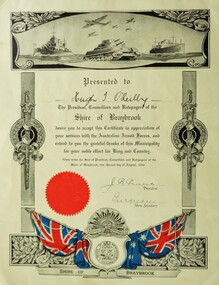
Certificate (Photocopy), Certificate in Appreciation of services with the Australian Armed Forces, Photocopy made 29/09/2015, Original made in 1946
Corporal Hugh Terence O'Reilly VX108560 was born in Temora, NSW on 25 September 1916. He later lived in Hampshire Road, Sunshine, Victoria, and enlisted at Sunshine with the Australian Army on 29 July 1942. He served in New Guinea, and at the time of discharge on 8 November 1945 was posted with the 22 Australian Infantry Battalion. Additional service number recorded is V37790. In civilian life Hugh Terence O'Reilly was employed in the manufacture of fibrous plaster boards.The significance is that the Shire of Braybrook, and perhaps other councils, recognised their citizens who served in the Australian Armed Forces during World War 2, by presenting them with Certificates in appreciation of their military service.Yellowish background. Grey scale diagrammatic image of warships, tank, and aeroplanes at the top. Vertical posts with swords and wreaths along the sides. At the bottom a diagrammatic image containing in colour the Union Jack and the Australian flag, the Shire of Braybrook Coat of Arms, the Australian Commonwealth Military Forces insignia, and a red coloured circular seal.Presented to Hugh T. O'Reilly. The President, Councillors and Ratepayers of the Shire of Braybrook desire you to accept this Certificate in appreciation of your services with the Australian Armed Forces, and extend to you the grateful thanks of this Municipality for your noble effort for King and Country. Given under the Seal of President, Councillors and Ratepayers of the Shire of Braybrook, this second day of August, 1946. J. R. Parsons - President, 'illegible' - Shire Secretary -
 Phillip Island and District Historical Society Inc.
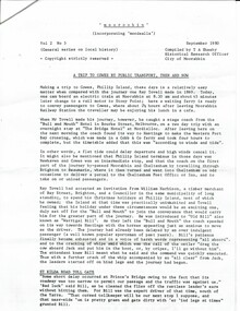
Document, Documents relating to the re-enactment of the 1869 coach run from Melbourne to Cowes via Hastings in 1985, 1985
1985 was the 150 anniversary of Victoria. Moorabin, Mordialloc, Sandringham and Phillip Island Councils organised a Cavalcade of Transport which included a re-enactment of a mail coach ride from Melbourne to Phillip Island in 1869. This trip was by Mr Ray Tovell at the invitation of William Harbison to stay with him at Phillip Island. Citizens were to dress in period costume and each municipality was to hand a letter containing local information to the coach driver along the route..Historical8 pages of typed letters and documents explaining the reasons for and details of the occasion. Also a history of the original trip.150 anniversary of victoria, transport, horse drawn coaches, stan gates, william harbison, local government -
 Bayside Gallery - Bayside City Council Art & Heritage Collection
Map - print, Melbourne and Metropolitan Board of Works, Interim development order: Brighton, Moorabbin and Sandringham, 1959
The Melbourne and Metropolitan Board of Works (now Melbourne Water) was established in 1891. From that time, as part of their work laying water and sewerage connections, they created detailed plans of houses and other buildings in the Melbourne metropolitan area. In 1956 it acquired powers to construct and maintain highways and bridges, protect and improve the foreshores and create and maintain parks within the metropolitan region. This Interim development order comprises part of the municipalities of Brighton, Moorabbin and Sandringham and was made on 20 October 1959.brighton, moorabbin, sandringham, melbourne and metropolitan board of works, map, town planning, cartographic material, interim development order, bayside -
 Bayside Gallery - Bayside City Council Art & Heritage Collection
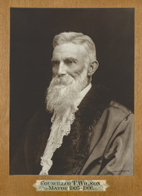
Photograph - sepia photograph, Johnstone O'Shannessy & Co. Falk, Councillor T. Wilson, Mayor of Brighton 1905-06, c. 1906
Thomas Wilson (1838-1923) was a local councillor in Brighton (in its three phases as Borough, Town and City) representing the central ward over a 57-year period, firstly in 1866-79 and again in 1894-1923. He was elected as mayor seven times, as Borough of Brighton in 1869, Town of Brighton in 1895-96, 1905 and 1912-13, and was the second Mayor of the City of Brighton in 1919. He was also a land speculator and both Wilson and his father William Wilson owned considerable land in the area. William Wilson sold land on the corner of Wilson and Carpenter Streets to the Council for its Town Hall. Wilson also represented the council on the Melbourne and Metropolitan Board of Works, of which he had been a member for 22 years.portrait, councillor, mayor, brighton, metropolitan board of works, borough of brighton, town of brighton, city of brighton, central ward, municipality, land speculator, william wilson, thomas wilson, cr. t wilson -
 Bayside Gallery - Bayside City Council Art & Heritage Collection
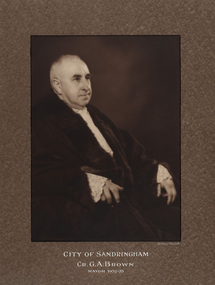
Photograph - sepia photograph, Dickinson-Monteath Studio, Councillor G.A. Brown, Mayor of Sandringham 1932-33, c. 1933
George Albert Brown (1877-1949) was a councillor at Coburg and Sandringham, and was Mayor of both cities. He was Mayor of Sandringham in 1932-33 and 1944-45.councillor, sandringham, local government, municipality, mayor, mayoral robes, portrait, city of sandringham, jabot, dickinson-monteath studio, cr. g.a. brown, george albert brown, coburg, mayor of sandringham -
 Ringwood and District Historical Society
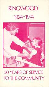
Pamphlet, Ringwood 1924-1974 50 Years of Service to the Community, 1974
Community information brochure issued in 1974 by Ringwood Council outlining local services, sporting, and cultural facilities. Includes names of Ward Councillors, Council's revenue and expenditure charts, and two City of Ringwood Free Tipping Vouchers valid until the end of 1975."Frontpiece: Council's Immunisation Programme." "Message from your Mayor, Councillor Stan Morris, J.P. (photo). In this, Ringwood's 50th Year as an independent Municipality another milestone is recorded. It is our hope that the City will continue to develop soundly so as to improve our quality of life. The past achievements have been accomplished by Council/Citizen co-operation and we have no doubt that this co-operation will continue during the next 50 years".rinx -
 Ringwood and District Historical Society
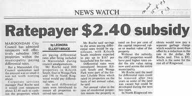
Newspaper, Scrapbook Clipping, Library Collection, Ringwood, Victoria
Newspaper clipping from "The Mail", 15-8-95, P 13 Ratepayer $2.40 subsidy - by Leonora Elliot-BruceMaroondah City Council has admitted ratepayers will effectively subsidise 1002 properties within the municipality paying differential rates. But a Maroondah City Council spokesman said the amount was so small it was not worth worrying about . Corporate Services Manager, Paul Roche, said it would cost ratepayers $2.40 each to cushion the properties which are paying differential rates after being included in Maroondah during council amalgamations. -
 Ringwood and District Historical Society
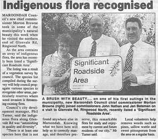
Newspaper, Scrapbook Clipping, Library Collection, Ringwood, Victoria, `
``Newspaper clipping from "The Post", 23-8-95, P 2. Indigenous flora recognised Maroondah Council's new chief Commissioner Moreton Brown took in some of the municipality's natural beauty this week when he visited the northern end of Glenvale Rd., Ringwood North. As the area contains an array of indigenous flora, the area has recently been listed a "Significent Roadside Area". The listing was the result of a vegetation suvey by council. Pictured are: Jan Bateman, John Nathan and new Maroondah Chief Commissioner, Moreton Browne.` -
 Lilydale RSL Sub Branch
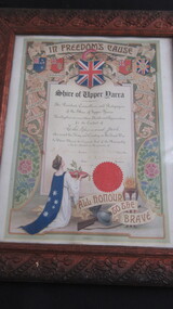
Certificate, "In Freedoms Cause"
Framed Certificate for Leslie Raymond JackShire of Upper Yarra/ The President, Councilors and Ratepayers of the Shire of Upper Yarra hereby place on record their thanks and appreciation for the conduct of Leslie Raymond Jack who served his King and Country in The Great War/ In Witness whereof the Corporate Seal of the Municipality is hereto attached in the presence of / A J Speers President, Henry E Glynn, Councillor. H B Wornerslie, Secretary. Dated 24/5/1918. / All Honour to the Brave. -
 Clunes Museum
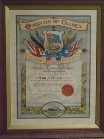
Certificate, D W PATERSON CO. PTY.LTD
FRAMED IN BROWN WOODEN FRAME - MOUNTED ON GOLD COLOURED MATBorough of Clunes/For Liberty/Anzacs for Justice "The Mayor, Councillors and Burgesses of the Borough of Clunes hereby place on record their thanks and appreciation for the conduct of Gnr A. Sexton who served his King and Country in the Great War of 1914, 1915,1916,1917." In witness whereof the Corporate Seal of the Municipality is hereby attached in the presence of John F Phillips Mayor Allan K Buckley Town Clerk Philip Rowe Scty 25/3/19 ww1, the great war, sexton, borough of clunes -
 Flagstaff Hill Maritime Museum and Village
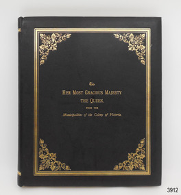
Book - Album, Sands & McDougall Limited, To Her Most Gracious Majesty the Queen from the Municipalities of the Colony of Victoiia, 1897
This book is a black and white facsimile of the coloured, commemorate album presented to Queen Victoria on her Diamond Jubilee in June, 1897, celebrating the 60th Anniversary of her reign on the British throne. The Municipalities also received original copies, each numbered as limited editions. The first two pages of the album are an address to Queen Victoria from the Municipalities of the Colony of Victoria, Australia, written in fancy Old English calligraphy. The remaining twenty-three pages display images representing each of the 208 municipalities as in 1897 and include a medallion of their Coat of Arms and statistics such as population, size and valuation, signatures of the Shire Presidents and Secretaries. The album’s publisher, Sands & Mc Dougall Limited, was first established in Sydney. This book was published by the Melbourne Branch. Local areas mentioned in the album include – Town of Warrnambool, page 5, Borough of Portland, page 7 Borough of Port Fairy, page 9 Borough of Koroit, page 9 Shire of Belfast, page 10 Shire of Portland, page 10 Shire of Warrnambool, page 10 Shire of Mortlake, page 12 TRANSCRIPTION OF THE ADDRESS TO QUEEN VICTORIA – “May it please Your Majesty, We Your Majesty’s most dutiful and loyal subjects, the representatives of the Municipal Government of the entire Colony of Victoria, humbly approach Your Majesty with earnest assurances of our attachment and devotion to Your Majesty’s Throne and person. We beg to offer to Your Majesty respectful and heartfelt congratulations on completion of the 60th Year of Your Majesty’s reign and to express our grateful recognition of the beneficent influence exercised by You as our Queen during that long period. We are proud of the honour that united, we form the Colony which bears Your Majesty’s name and the unity of this, our expression of congratulation and thankfulness, is truly typical of the united love of the people of this Colony for You as our Queen and for our Nation. With devout thankfulness to our Almighty God for wisdom, guidance and strength vouchsafed in You as our Sovereign, and for unexampled blessings bestowed upon us Your people, we offer earnest prayer that the continuance of Your Majesty’s reign may be a season of peace amongst the Nations of the World and of closer and still happier kinship between the many and wide unretruding sections of our Empire. As witness, the Corporate Seals of the 208 Municipalities of the Colony of Victoria. This 21st day of June 1897.”This facsimile album is significant for its association with early Australian history, the influence of the British Monarch over its Colony, and the establishment, growth and extent of the Colony of Victoria. The album gives a summary of a set year and the statistics of each Municipality. This gives added significance to the history of South-West Victoria, including Warrnambool, allowing a comparison of then and now. The album's inclusion of the Address to Your Majesty shows the respect of the people of Victoria towards the British Monarchy.Book, hard cover, bound in black leather with gold embossed title and border on the front cover, gold lines top and bottom of spine and gilt edged pages. Inside covers are lined in white embossed fabric. Twenty-five pages are all thick, cream coloured card with a rectangular border in the centre of each page. Attached inside the boarders are black and white copies of illustrations and text. A green printed label is attached inside the back cover.“SANDS & Mc DOUGALL LIMITEDN/Manufacturers/MELBOURNE”flagstaff hil, warrnambool, flagstaff hill maritime museum, maritime museum, shipwreck coast, flagstaff hill maritime village, great ocean road, queen victoria, diamond jubilee, 60th anniversary, album, municipalities of victoria, colony of victoria, 1897 statistics of victoria, sands & mcdougal, facsimile album, australian history, victorian history, historical document, address to your majesty, address to queen victoria, victoria queen of britain, queen of the united kingdom, 60th anniversary of reign, 1819-1901, jubilee 1897, 208 municipalities, seals of victoria, statistics in victoria 1897, presentation album, british monarchy -
 Bendigo Military Museum
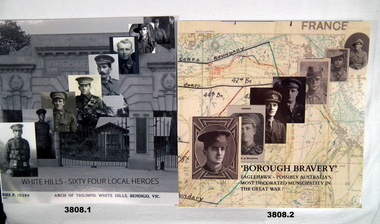
Book - BOOKS WW1
1.) & .2) Soft cardboard cover, glossy finish. Black print on front, spine, & back. Cut, plain, white, glossy pages. Illustrated black / white / colour photos of portraits, medals & scenes. No page numbers. .1) Title - White Hills - Sixty Four Local Heroes. Illustrated black / white / sepia photo of Arch of Triumph, White Hills. 8 portraits of uniformed soldiers superimposed on front, back. Small colour photo of Arch of Triumph. .2) Title - Borough Bravery. Eaglehawk - Possibly Australia's Most Decorated Municipality in the Great War. Illustrated colour / sepia photo of map superimposed with numerous portraits of soldiers on front & back.books, white hills, eaglehawk -
 Bendigo Historical Society Inc.
Letter - KANGAROO FLAT GOLD MINE COLLECTION: LETTER WESTERN MINING TO D. CAHILL
Letter from Western Mining Corporation to D.W. Cahill, Barrister, Bendigo dated 1st October, 1980, from J.H. Lalor, Exploration Manager, Minerals, WMC, regarding the objective of the Western Mining Corporation exploration program on the Bendigo goldfield. The major objective is to develop a long term mining operation 'which would be environmentally acceptable' It was considered that the value 'of such an operation to the local community and the Bendigo region would be substantial'. Bendigo Mining NL was planning 'to undertake a commercial mining operation using some existing facilities at the Central Deborah Gold Mine' Exploration activity was prohibited within the boundaries of the municipality of Bendigo prior to September 10th. 1980.bendigo, western mining corporation, exploration, central deborah gold mine. -
 Greensborough Historical Society
Map, Melbourne and Metropolitan Board of Works. Survey Division, MMBW, Yarra 2500 / 12.20. Watsonia Railway Station and environs, 1983_03
Melbourne and Metropolitan Board of Works. Yarra 2500 [base map]. 12-20, Parishes of Keelbundora 2856, Municipalities of Diamond Valley 257 and 228. Shows street names, easement sizes, lot numbers, lodged plan numbers, names of prominent features, contour values, creek or river names. Watsonia Railway Station and environs. Prominent streets: Watsonia Road, Elder Street, Morwell Avenue and Nepean Street. Includes former Watsonia Technical School and Gresswell Rehabilitation Centre sites.MMBW Map in 1:2500 [scale] series. Cream parchment with green tape reinforcing on edges and punched holes on left edge.mmbw, melbourne and metropolitan board of works, shire of diamond valley, watsonia - maps