Showing 569 items matching "project planning"
-
 Glen Eira Historical Society
Document - Historic Conservation Areas Project
Contains 4 items relating to historic conservation: 1/Five newsletters (one page each newsletter, dated 07/1975, 08/1975, 09/1975, 10/1975 and the final one 12/1975) describing how the project evolved, project funds, progress, study method, project 1 report, project 2 report and summary as no further funds available. Project was to include all of Melbourne but funding did not allow this. Note: newsletters stamped with Caulfield Historical Society. 2/Letter (one page on official city of Caulfield letterhead) from Andrew Rodda (manager planning) to Hazal Ford (dated 13/11/1989) describing ‘council resolved on 18/07/1989 to proceed with preliminary conservation survey’ and mentions that a copy is included. 3/Preliminary conservation survey for the City of Caulfield (nine pages) describing background, study area, budget, purpose, study outline, timeframe, report format, ownership, tasks and background information (mentions number and types of houses and properties as at 1986 and 1988) and a map of City of Caulfield. 4/Booklet (28 pages) titled ‘Heritage Area – Caulfield North Draft Heritage Guidelines July 1999 – City of Glen Eira’, containing Caulfield North Heritage Area, cultural heritage, Heritage Overlay Area, architectural description, common architectural forms and features, development guidelines, key design checklist. It includes a map of the Caulfield North Heritage Overlay Area, two illustrations about the development envelope and many black-and-white photographs of houses and architectural features.historic conservation areas project niven barbara, newsletters, town planning, historic buildings, heritage studies, housing, royal historical society of victoria (rhsv), read michael, plans, local government, historical societies, committee for urban action (cua), national trust, hopkins sherry ms., ford hazel, preliminary conservation survey, town planning, heritage studies, rodda andrew, city of caulfield, housing estates, victoria national estate grants program, australia icomos, burra charter, buildings structures and establishments, land surveys, suburbs, historic buildings, architectural significance, ‘caulfield’s heritage study’, soloman geulah dr., caulfield library, dandenong road, nepean highway, hotham street, iknerman road, orrong road, north road, poath road, ‘plan of the city of caulfield’, north ward, east ward, south ward, west ward, kooyong road, neerim road, bambra road, balaclava road, shire of caulfield, railways, world war 1914-1918, depression 1929-1939, rippon lea, labassa, parks, mansions, community services, ‘caulfield north draft heritage guidelines july 1999’, city of glen eira, caulfield north heritage area, glen eira heritage management plan, mayfield grove, normanby avenue, carnarvon street, glenferrie street, arthur street, malakoff street, normanby road, heritage advisory service, construction materials, victorian style, mediterranean style, spanish mission style, californian bungalow style, federation style, architectural style, architectural features, heritage conservation design, building construction, building regulations, aboriginal peoples, carnarvon road -
 Lakes Entrance Historical Society
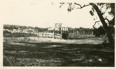
Photograph - Lakes Camping Park, Jemmeson Edie, 1928
This fully self contained camp park containing accommodation, general store, entertainment, Rotunda, petrol bowsers and community kitchen was the vision of Richard Bromby Whiter, who commenced the project in 1927. Water for gardening and sewerage supplied by an underground bore.Small format black and white photograph of the entrance to the planned Lakes Camping Park, fronting Roadknight Street. Shows sign at the rear of block on timber fence, other buildings in background. Lakes Entrance Victoriatourism, recreation, caravan parks -
 Hymettus Cottage & Garden Ballarat
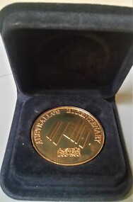
Medal - Medallion, Western Victorian Games Australian Bicentenary medal
Australian Bi-Centennial medal issued for the Western Victorian Games 1988, the only time these games were undertaken despite initial plans to be a regular event.Held in 1988 the Western Victorian Games were a Bi-Centennial project of the Victorian Government proposed to be held every four years but never repeated after 1988.circular medallionAustralian Bi-Centenniarymedal, sport, westerrn victorian games -
 Eltham District Historical Society Inc
Photograph - Digital Photograph, Alan King, Eltham Court House, 730 Main Road, Eltham, 28 December 2007
The Eltham Court House is Eltham's oldest public building. It was classified by the National Trust in 1977. In 1857 five Eltham residents petitioned the licensing magistrates of the Heidelberg district asking for better police protection, including from itinerant gold prospectors who turned to crime when their quest was unsuccessful. In response the Eltham Courthouse was constructed in 1860. Over the years it has also been used for other activities, including for electoral polling purposes, inquests, early meetings of the Eltham Roads Board and even as an overflow classroom. This type of localised solution is characteristic of the self-reliance preserved in Eltham today. The court house is an important symbol of the spirit which makes Eltham distinctive as a community. The Eltham Courthouse is historically significant because its construction was intended to emphasise the centralised control over law and order in the Colony of Victoria in the wake of the 1852 Snodgrass committee report on the Victorian police force and the resulting Police Regulation Act (1853). The nature of the Court House planning and use of architectural devices make the building's function easily interpreted. The arrangement of rooms, with public entry and clerical rooms to the rear, and the use of raised floor levels throughout these spaces to signify relative rank is easily perceived. The distinction in entries, public, magistrate and person-in-custody, and the existing court furniture enhances appreciation of this building. The Eltham Court House is one of only two intact examples in the state of this simple design with projecting entry. The building is of architectural significance because it retains intact early features. These include use of handmade bricks, simple decoration, roof trusses, timber ceiling boards, original windows, doors and associated hardware and a collection of court furniture. Additions to the court house have been done in a manner which did not interfere with the fabric of the original building. Typical cases heard before the Court of Petty Sessions included financial debt, straying livestock, theft, assault, drunkenness, public disorder, truancy, motor vehicle offences, unregistered animals and failing to have children attend school, or be vaccinated. The courthouse operated for over 120 years before it closed in 1985. In April 2021, Nillumbik Shire Council authorised restoration of the building and furnishings. The extensive works required for the total restoration of this highly valued heritage building was undertaken by Ducon Building Solutions and other specialist contractors. Covered under Heritage Overlay, Nillumbik Planning Scheme. Victorian Heritage National Trust of Australia (Victoria) State significance Published: Nillumbik Now and Then / Marguerite Marshall 2008; photographs Alan King with Marguerite Marshall.; p65 A demand for better police protection resulted in the building of the Eltham Courthouse and the police residence beside it. In 1857 five Eltham residents petitioned the Heidelberg district licensing magistrates. They pointed out that Eltham had two hotels, a population of about 1000, and many strangers employed on the public roads. Yet the nearest police were at Heidelberg eight miles (12.8km) away, or at the Caledonia Diggings 21 miles (33.7km) away.1 Subsequently the courthouse and then the police residence, near the corner of Main Road and Brougham Street, were built in 1859/60. The courthouse is Eltham’s oldest public building and the National Trust classified it in 1977. It ceased operation in 1984 and has since been used by local groups. There are only six other known examples of similar small brick country courthouses in Victoria . For £536, a Mr Duncan built the courthouse – a neat, narrow, oblong building with handmade orange bricks. Its gabled roof and porch are covered with brown slate tiles and it has 12-paned windows. Inside, the roof is peaked and the courthouse is still ventilated by oblong slits near the ceiling. Most of the fine carved timber and upholstered furniture is original. The original prisoners’ door, now permanently closed, led from the police station to the dock. Builders, Langridge Wright and Witney built a timber police station (since demolished) and a brick residence to its north,2 for £1150/7/-. Built around the same time were the lock-up behind the residence, also later demolished, and the two-storey orange brick stables. The former police residence also has a brown slate roof and handmade bricks. The front veranda roof is made of corrugated iron, as is the roof of the back weatherboard extension. The application for police protection was approved within a few months and police operated from a cottage rented at ten shillings a week and owned by William Jarrold. This was probably the one at the corner of Main Road and Dalton Street called Jarrold or White Cloud Cottage. In 1858 a second constable was appointed to Eltham following a fight at the hotel. The timber police office a replica of which was built in the early 1990s is at the building’s side. The lock-up was demolished following the relocation of the police to a new station in about 1952. The residence has been used as the Eltham District Historical Society centre since 1997. Records show court cases were held at Eltham before the courthouse was built, but the location is unknown. Some court cases were not very different from those today. In 1891 a man was charged with being drunk while in charge of a horse and was fined ten shillings. The courthouse was used for other purposes during its long history. It was probably used as a polling place as indicated by old photographs of election-day crowds outside. The Eltham Road Board met there from the early 1860s until 1868 when the Board transferred to Kangaroo Ground. During the same period the Road Board Secretary used the courthouse as an office until 1867 when it was transferred to his home at Wingrove Cottage. The courthouse was also used as an overflow classroom for the Dalton Street school in 1875. The two buildings can further link us with Eltham’s early days through Police Department correspondence. The first constable-in-charge was George Reid. In 1860 a letter to The Argus newspaper signed ‘A Sufferer’ declared the Eltham police were not active enough in their duties. The writer suggested that the ‘very snug’ police quarters were too comfortable, and he detailed various incidents including one of an alleged break-in to the Road Board Secretary’s home. But the Board Secretary, C S Wingrove, wrote to the Police Department refuting The Argus letter saying he had received full co-operation from Sen. Constable Peter Lawler.This collection of almost 130 photos about places and people within the Shire of Nillumbik, an urban and rural municipality in Melbourne's north, contributes to an understanding of the history of the Shire. Published in 2008 immediately prior to the Black Saturday bushfires of February 7, 2009, it documents sites that were impacted, and in some cases destroyed by the fires. It includes photographs taken especially for the publication, creating a unique time capsule representing the Shire in the early 21st century. It remains the most recent comprehenesive publication devoted to the Shire's history connecting local residents to the past. nillumbik now and then (marshall-king) collection, eltham, eltham court house, main road -
Clunes Museum
Plan - CONCEPT DRAWINGS/PLANS, JOHN ALKEMADE & ASSOC, CLUNES COMMUNITY AND INTERPRETIVE CENTRE, 2012
CONCEPT DRAWINGS BY 3 ARCHITECTS AND EXPLANATORY INFORMATION. ALL LAMINATED ARCHITECT JOHN ALKEMADE & ASSOC. .1 PROPOSED FLOOR PLAN .2 SITE PLAN - PHOTOCOPY OF 1 AND 3 .3 SOUTH EAST VIEW ARCHITECT R. BRAMELL 2006 .4 LONGITUDINAL SECTION .5 FLOOR PLAN .6 FACADE ARCHITECT MORTON DUNN 2012 .7 GROUND FLOOR PLAN .8 SITE PLAN .9 FIRST FLOOR PLAN 10 CONCEPT DRAWING OF OUTCOME .11 WHAT IS THE CCIC .12 COMMUNITY REFERENCE GROUP .13 THE BUDGET .14 PROJECTED TIMELINE clunes community and interpretive centre concept, william barkell -
 Melbourne Tram Museum
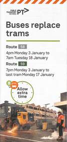
Pamphlet, Yarra Trams, Buses Replace Trams - Routes 58, 59, 86 and 96, 2022
.1 - pamphlet provided at tram stops giving details of the works and bus services for routes 58 and 59 .2 - Project document describing the work and dates - downloaded from the Yarra Trams website after buses were used to replace route 58 from the Royal Children's Hospital rather than from Royal Park Station as originally planned. .3 - as for .1 - for the upgrading of the Merri Creek Bridge - route 86 - see also Reg Item 6066 .4 - as for .1 - for the installation of superstops in Nicholson St between Elgin St and Holden St - route 96Shows the methods that Yarra Trams customers are advised of changes due to track replacement works..1 - Pamphlet - DL, four fold printed on off white paper titled - Buses Replace Trams - Route 58 and Route 59 - Jan 2022 .2 - Project sheet - 3 A4 sheets, titled "Renewal works: Essendon Depot and Mt Alexander Road - 3.1 to 18.1.2022. .3 - Pamphlet - DL 3 fold, Buses Replace Trams, route 86, November 2021 - Merrit Creek Bridge works .4 - Pamphlet - DL - 4 fold, Buses Replace Trams, route 96, January 2020 - Nicholson St works for tram super stops.mt alexander road, tram works, track work, route 58, route 59, yarra trams, ptv, essendon tram depot, route 86, route 96, nicholson st, merri creek, bridges, carlton, super stops, trams, tramways, northcote -
 Ringwood and District Historical Society
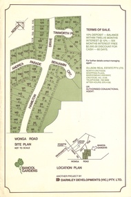
Flyer, Land Sale Advertisement - Banool Gardens Subdivision, Ringwood, Vic. c.1985
Double-sided advertisement for Banool Gardens subdivision with site plan, location plan, terms of sale, and summary of homesite features and local services & facilities. Subdivision includes Wonga Road, Hamilton Drive, Tinworth Place, Andrea Parade and Benjamin Court, Ringwood North. Managing agent - Ollson Real Estate Pty. Ltd., North Croydon Shopping Plaza, Maroondah Highway. Croydon, Vic. 3136. Telephone 726 9988 After Hours 876 4190. Project by Darnley Developments (Vic.) Pty. Ltd. Accompanying handwritten notation by Richard Carter R.E.S.I. - "Part of original Banool property (Mahon, sold to Stallman, sold to McMahon, sold to Len Macley etc etc). Hamilton Drive named after Lynn Hamilton McMahon, Tinworth Place after his son-in-law, David Tinworth". -
 Melbourne Tram Museum
Pamphlet - Metro Tunnel - Anzac Station tram corridor works, Rail Projects Victoria, 11/2022
Provides information about the works planned to realign tram tracks at the Metro Tunnel Anzac station, following the completion of the surface works. Gives timing, tram routes affected, plans of the proposals, contact details. All St Kilda Road routes would be affected from 27/11/2022 to 17/12/2022, tram stops would be closed, bus replacement services. includes works to remove the Glenhuntly Road level crossing at Glenhuntly Station. Yields information about the trackworks for the future Anzac Station interchange and St Kilda Road services.Set of two documents issued by Rail Projects Victoria (Metro Tunnel) and Yarra Trams with regard to the reallignment of tram tracks at Anzac Station Nov. 2022 1 - Metro Tunnel - Works proposed, maps - 6 A4 pages 2 - Yarra Trams - Service Changes St Kilda Road works - 4 A4 pages.anzac station, metro tunnel, tramways, st kilda road, domain road, domain interchange, park street, track work, tram tracks, glenhuntly road, glenhuntly station, level crossings -
 Melbourne Tram Museum
Badge - G class thankyou, Department of Transport, 2024
... the Department of Transport and Planning – Next Generation Trams project... the Department of Transport and Planning – Next Generation Trams project ...The Department of Transport produced the Melbourne " Next Generation" G class tram badge to thank the team members involved in its design and production. As many of the team members came from Germany, the German translation was included on both sides of the card. Note from one of the production team was: "Staff from the Department of Transport and Planning – Next Generation Trams project team led a self-funded initiative to produce a commemorative badge of the Melbourne " Next Generation" G class tram. These were issued as gifts to persons involved in its design and production to mark the start of series manufacturing. The card it is mounted to is typeset in the proprietary “Network Sans” font, in both Australian English and Austrian German; including a special translated version of the Next Generation Trams Project logo. This was a gesture to recognise several key Alstom staff involved in the project being loaned from Vienna.”Demonstrates a badge featuring the Melbourne G class.Metal enamel badge with pin retaining clip attached to a printed card sheet.tramways, tramcars, g class, badge, new tramcars, alstom -
University of Melbourne, Burnley Campus Archives
Plan, City Square, 1977- 1991
(1) Photocopy of plan by City of Melbourne, City Architects Office No VA47. Date not clear (January 1981?). (2) Melbourne Civic Square Stage 1, Level 2: Plan SW Sector/ Lower Square Level. Project and drawing no 7620 WT00, 20.11.1977, Revision date 10.07.1979 by Denton Corker Marshall Pty. Ltd. for Melbourne City Council. (3) Level 2: N.W. Sector. (4) Level 2: S.E. Sector. (5) Level 2: N.E. Sector. (6) Level 3 Plan: N.E. Sector Upper Square Level. (7) Level 3 Plan: S.E. Sector. (8) Melbourne City Square Diagramatic Plan: View from top of Wales Corner Building Refer 2A. (9) Melbourne Cityscope, November 5, 1990, Map 39 pp 1-2 and Map 39 June 1991. (10) Portfolio: City Square by Simon Howe, Site Inventory and Analysis, Concept Plans 1, 2, Preliminary Plan, (all Scale 1:200), Section Elevation A-A, Scale 1:100.city square, melbourne, city of melbourne, denton corker marshall pty. ltd., landscape architecture -
University of Melbourne, Burnley Campus Archives
Plan, Ratio Consultants Pty. Ltd, Conceptual Subdivision & Garden Layout Plan Project 'Rosecraddock' Rosecraddock Place Caulfield, 1991
... Conceptual Subdivision & Garden Layout Plan Project... & Garden Layout Plan Project 'Rosecraddock' Rosecraddock Place ...Tracing paper plan by Ratio Consultants Pty. Ltd., for Mr P. Shellard, Project No 1887, drawing No LS3, October 1991. Scale 1:250.p. shellard, caulfield, ratio consultants, "rosecraddock", subdivision plans, landscape design -
University of Melbourne, Burnley Campus Archives
Plan, 68-70 Dorcas St South Melbourne, 1989
Site/Roof plan by David Earle & Associates, Project No 1189 Drawing No A1. Designed by D.F.david earle, south melbourne, roof plans -
University of Melbourne, Burnley Campus Archives
Newspaper - Newspaper Cutting, The Herald, £100,000 garden plan …Olympic Village, 1954
A rough sketch and text in the "Herald," 10.07.1954 of the proposed plan for the Olympic Village in Heidelberg. Drawn by Erica Ball (1948).the herald, sketch, olympic games 1956, olympic village, erica ball, heidelberg, landscape project olympic village -
University of Melbourne, Burnley Campus Archives
Map, Map of Showgrounds, c. 1970
Tracing paper plan with grid lines. Student project? -
 Bendigo Historical Society Inc.
Booklet - Kangaroo Flat Gold Mine Collection: Western Mining Corporation Bendigo Gold Project Environmental Effects Statement December 1987, Western Mining Corporation, Bendigo Office, Western Mining Corporation Limited Bendigo Gold Project Environment Effect Statement December 1987, December 1987
Spiral bound booklet, plastic cover, black plastic binding, On front cover: Western Mining Corporation Bendigo Gold Project, Environment Effects Statement, December 1987. On front page, colour aerial photograph of Bendigo mining areas mentioned in report. Key on front page related to photograph: 1. Woodvale Evaporation Ponds. 2. New Moon area. 3. North New Chum Williams United shaft. 4. Carshalton, Carshalton shaft. 5. South Nell Gwynne, North Bendigo shaft. Contents: historical perspective; Western Mining Corporation Ltd Bendigo activities; project outline, project approvals - controlling factors, elements of the mining project, surface based exploration, underground operations and surface support, mining areas and operations ore and mullock haulage, New Moon area, water management, environmental management. Planning and land use, socio-economic environment, physical environment and biological environment are examined and discussed. bendigo, goldmining, bendigo mining nl, bendigo goldfield, environmental effects statement, bendigo gold project, woodvale evaporation ponds, new moon, north new chum, carshalton, south nell gwynne, western mining corporation -
 Flagstaff Hill Maritime Museum and Village
Document - Ship Model Plans, Loch Ard, October 1977
These two framed model ship plans are from more than 650 produced for the LOCH ARD Centenary (1878-1978) Commemoration Committee. These plans were originally researched, designed and distributed in 1977 to assist entrants in the Committee’s Ship Model Competition. The competition was arranged as a means of creating public interest and awareness for the 100th anniversary of the tragic LOCH ARD shipwreck on Victoria’s south west coast in 1878. The main subject specified for modelling was “The Loch Ard ― Iron Wool Clipper 1873”. “The plans were drawn by Mr P Webb to the order of the Committee through Mr P Williams, organizer of the competition. The details were based on all available information which resulted in considerable historical research…and received favourable comment from model makers because of their attention to detail…In excess of 650 sets of plans were sold before entries closed…Many plans were probably purchased by collectors and interested persons for historical reference. An illustrated historical story sheet…was prepared and enclosed with the plans…” (‘Loch Ard Shipwreck Centenary 1878-1978 Report’, November 1978). An example of the attention to historical detail delivered on the plans is the inclusion of the following useful information about the original vessel: “Tonnage….1,693 G.R.T., 1,624 N.R.T. Builders….Charles Connell & Co., Ltd., Scotstoun, 1873. Owners….General Shipping Co., Glasgow, (Aitken Lilburn & Co., Ltd.)”. The quality of research and drafting makes these framed copies of considerable interpretive value to related items from the LOCH ARD shipwreck on display at Flagstaff Hill. They were originally mass produced but are now out of print. Flagstaff Hill retains other (unframed) copies in storage. The plans, in conjunction with the scale Ship Model of the LOCH ARD also on display, are of interpretive significance to Flagstaff Hill Maritime Village. The plans provide historical and technological context to artefacts from the shipwreck, increasing understanding and appreciation of those objects. Flagstaff Hill’s collection of artefacts from LOCH ARD is significant for being one of the largest collections of artefacts from this shipwreck in Victoria. It is significant for its association with the shipwreck, which is on the Victorian Heritage Register (VHR S417). The collection is significant because of the relationship between the objects, as together they have a high potential to interpret the story of the LOCH ARD. The LOCH ARD collection is archaeologically significant as the remains of a large international passenger and cargo ship. The LOCH ARD collection is historically significant for representing aspects of Victoria’s shipping history and its potential to interpret sub-theme 1.5 of Victoria’s Framework of Historical Themes (living with natural processes). The collection is also historically significant for its association with the LOCH ARD, which was one of the worst and best known shipwrecks in Victoria’s history. Two framed model ship plans of the LOCH ARD. These are detailed and researched plans from the original vessel, drawn to scale and printed on good quality paper, and framed behind glass to be hung on display. One slightly smaller plan “Lines, Decks and Details” portrays the hull lines as a body plan (straight on at the bow), a sheer plan (full side view), and a half breadth plan (a top-down view of deck to keel), as well as two top-down views of the upper decks and main deck with fittings and details of specific fixtures. One slightly larger “Sail and Rigging Plan” presents a side on, above deck view of masts and shrouds and a front on, above deck view showing “Elevation of Mainmast Looking Aft”. Each plan bears the draftsman’s initials and date of completion (“P.A.W. 10/77”). The larger plan also includes a boxed label attributing the project to the “LOCH ARD CENTENARY Commemoration Committee Ship Model Competition.”Smaller plan: heading “LOCH ARD: LINES, DECKS and DETAILS”; initials “P.A.W. 10/77”. Larger plan: heading “LOCH ARD: SAIL and RIGGING PLAN”; initials “P.A.W. 10/77”; label “LOCH ARD CENTENARY Commemorative Committee Ship Model Competition”. flagstaff hill, warrnambool, shipwrecked coast, flagstaff hill maritime museum, maritime museum, shipwreck coast, flagstaff hill maritime village, great ocean road, loch line, loch ard, captain gibbs, eva carmichael, tom pearce, glenample station, mutton bird island, loch ard gorge, ship model plans, loch ard model plans, sailing ship, loch ard centenary -
 Flagstaff Hill Maritime Museum and Village
Document - Plan, Victorian Harbours Warrnambool, Victorian Harbours, Warrnambool, Plan to Accompany Sir John Coode's Report, 28-02-1879
This plan is of great significance to the local history of Warrnambool, in particular the Breakwater and its impact on Warrnambool's maritime and trade history. The plan shows the existing jetties at the Port of Warrnambool, plus the partially erected Breakwater and proposed works to the Breakwater by both the Borough of Warrnambool Surveyor and Sir John Coode. The plan was signed 28th February 1879 by Sir John Coode. The legend at the bottom left describes the existing works and the proposed works. The Warrnambool Breakwater Sir John Coode was a British harbour engineer. He was brought to Melbourne by the Melbourne Harbour Trust to advise on works to improve the Port of Melbourne. The Victorian Government commissioned him to present a plan to complete the Warrnambool Breakwater. His original plan was too expensive so he prepared a revised plan for a shorter structure. The work was completed in 1890. The construction proved to be too short to protect adequately from the weather and didn't allow enough depth for larger vessels to come into port. The decreasing trade was further affected by siltation in the bay due to the breakwater, and the completion of the railway line. The situation of the harbour became a real problem that, by 1910, required continuous dredging. In 1914 the Breakwater was extended but proved to be a failure because the work began to subside and by 1920 about two thirds of the harbour was silted up. Alterations made in the 1920's increased the silting problem and by the 1940's the harbour was no longer used. More alterations were made in the 1950's and 1960's. The Warrnambool Breakwater is registered as a place of significance on the Victorian Heritage Database. This plan of the proposed works for the existing Warrnambool Breakwater is of great significance to the local history of Warrnambool, in particular the Breakwater and its impact on Warrnambool's maritime and trade history. The Warrnambool Breakwater is registered as a place of significance on the Victorian Heritage Database (VHR H2024). It is historically significant to Victoria as one of the most important maritime engineering projects in Victoria in the late 19th century. The Warrnambool Breakwater is of historical significance as one of the most important maritime engineering projects in Victoria in the late nineteenth century. It is evidence of Victoria's nineteenth century investment in regional port infrastructure and the development of Victorian coastal shipping. It is of significance for its association with the English civil engineer Sir John Coode, the most distinguished harbour engineer of the nineteenth century, who was brought to Victoria to advise on works to improve the Port of Melbourne, but was retained by the Government to advise on improvements to the harbours at Portland, Geelong, Port Fairy, and Lakes Entrance, as well as Warrnambool. His projects for Melbourne, Lakes Entrance and Warrnambool were major engineering projects of the nineteenth century. The breakwater is historically significant as a reminder of Warrnambool's early maritime history as a Western District port, and as one of Victoria's major 'outer ports'. While the Warrnambool Breakwater is a demonstration of the engineering skills of the nineteenth century, it also demonstrates the limitations of knowledge relating to sedimentology at the time and the confidence apparent in a number of nineteenth century plans which assumed that natural forces could be overcome or contained by engineering.Plan of Warrnambool Harbour, Port of Warrnambool, dated 28 Feb 1879. Plan shows existing Breakwater and work proposed by both Warrnambool Borough Surveyor and Sir John Coode. Plan has gold coloured quarter-dowel rods top and bottom and a metal ring at the top. Stamped with title. Signed by Sir John Coode.Stamped "VICTORIAN HARBOURS / WARRNAMBOOL / PLAN / to accompany / SIR JOHN GOODE'S REPORT / DATED 28 FEB 1879" Signature "John Coode"flagstaff hill, warrnambool, maritime museum, shipwreck coast, great ocean road, sir john coode, borough of warrnambool surveyor, plan of warrnambool, victorian harbours, warrnambool harbour, warrnambool breakwater, port of warrnambool, vhd vhr h2024, flagstaff hill maritime museum & village, maritime village, map, chart, plan, lady bay, breakwater, jetty, pier, vhr h2024, proposed works, 1879 -
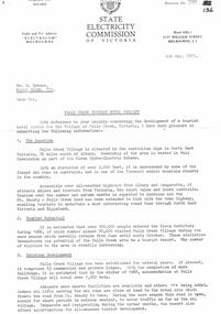 Falls Creek Historical Society
Document - SEC Information related to Tourist Hotel Project
Bob (Herman) Hymans (a former member of the Royal Netherlands Navy) was born in Bloemendaal, Holland on 30th September 1922. During World War II he fought against the Japanese in the Dutch East Indies (now Indonesia) and was imprisoned in Changi and on the Burma Railway. After gaining qualifications as a Ski Instructor, Bob arrived in Falls Creek in July 1950. Working as an Instructor and Supervisor at Bogong Lodge, Bob decided his future was in accommodation. He was successful in negotiating an indenture for land from the State Electricity Commission (SEC). It took Bob two years to build his Grand Coeur Chalet but, tragically, it was burned down in August 1961. Bob also built the first Chairlift in Australia. This was a single chairlift and the structure was built from wooden electricity poles. He was constantly full of new ideas and proposals for the village. Bob Hymans died on 7th July 2007. This Collection of documents and letters tells the story of Bob's endeavours to develop Falls Creek into the ski village it is today.This item is significant because it documents proposals put forward by Bob Hymans to develop facilities in the Falls Creek Tourist Area.A letter from the SEC to Mr Hymans outlining information related to the Falls Creek Tourist Hotel Project. Topics covered include: Tourist Potential; Existing Development in the area; information regarding the Site For Development; Liquor Licence; Lease; Process for submission of applications & Designs; References Required; Inspection Recommended prior to application. A general Plan & Aerial Photo of the proposed site was enclosed.falls creek tourist area management committee, falls creek administration, sewerage system falls creek -
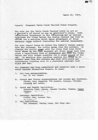
 Falls Creek Historical Society
Document - Application For Lease Of Site Selected By S.E.C
Bob (Herman) Hymans (a former member of the Royal Netherlands Navy) was born in Bloemendaal, Holland on 30th September 1922. During World War II he fought against the Japanese in the Dutch East Indies (now Indonesia) and was imprisoned in Changi and on the Burma Railway. After gaining qualifications as a Ski Instructor, Bob arrived in Falls Creek in July 1950. Working as an Instructor and Supervisor at Bogong Lodge, Bob decided his future was in accommodation. He was successful in negotiating an indenture for land from the State Electricity Commission (SEC). It took Bob two years to build his Grand Coeur Chalet but, tragically, it was burned down in August 1961. Bob also built the first Chairlift in Australia. This was a single chairlift and the structure was built from wooden electricity poles. He was constantly full of new ideas and proposals for the village. Bob Hymans died on 7th July 2007. This Collection of documents and letters tells the story of Bob's endeavours to develop Falls Creek into the ski village it is today.This item is significant because it documents proposals put forward by Bob Hymans to develop facilities in the Falls Creek Tourist Area.A letter of application from Mr Hymans for the lease of land offered by the State Electricity Commission to develop a tourist hotel. His hotel would provide accommodation for 100 guests. It would contain a dining-room seating 140 and cater for guests and day-visitors. Other facilities included a lounge, public-bar and lounge-bar facilities. A private lounge for reception would also provide guest and convention facilities. His project was designed as a year-round resort hotel. As well as serving as a winter sports hotel, the plan featured indoor facilities including a heated swimming pool, squash courts, bowling alley and sauna bath. Stables, a tennis court and boats would also attract year-round tourism. The budgeted cost was £130,000 plus bowling alley equipment. He planned that construction would commence in October, 1963 and be completed in June, 1965.falls creek tourist area management committee, hymans' hotel plans, falls creek development -
 Falls Creek Historical Society
Document - S.E.C. - Falls Creek Tourist Hotel Project (Adjacent To Ski Village)
Bob (Herman) Hymans (a former member of the Royal Netherlands Navy) was born in Bloemendaal, Holland on 30th September 1922. During World War II he fought against the Japanese in the Dutch East Indies (now Indonesia) and was imprisoned in Changi and on the Burma Railway. After gaining qualifications as a Ski Instructor, Bob arrived in Falls Creek in July 1950. Working as an Instructor and Supervisor at Bogong Lodge, Bob decided his future was in accommodation. He was successful in negotiating an indenture for land from the State Electricity Commission (SEC). It took Bob two years to build his Grand Coeur Chalet but, tragically, it was burned down in August 1961. Bob also built the first Chairlift in Australia. This was a single chairlift and the structure was built from wooden electricity poles. He was constantly full of new ideas and proposals for the village. Bob Hymans died on 7th July 2007. This Collection of documents and letters tells the story of Bob's endeavours to develop Falls Creek into the ski village it is today.This item is significant because it documents plans made by the State Electricity Commission to develop the Falls Creek Tourist Area.A letter from the State Electricity Commission (SEC) outlining details of a site available for the development of a Tourist Hotel Project in Falls Creek in late 1962/3. The SEC estimated that by the winter of 1963 Falls Creek Village would be able to accommodate 500 persons. The site for development was up to 2 1/2 acres adjacent to the Upper Kiewa Valley Road. It envisaged a building able to accommodate about 100 guests. The successful developer would be granted a lease for 45 years at a rent of £300 per annum. Written applications for the lease were to be submitted by 31st March 1963.falls creek tourist area management committee, falls creek administration, state electricity commission -
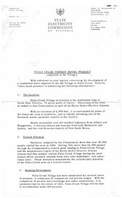
 Falls Creek Historical Society
Document - Report - Proposed Falls Creek Tourist Hotel Project
Bob (Herman) Hymans (a former member of the Royal Netherlands Navy) was born in Bloemendaal, Holland on 30th September 1922. During World War II he fought against the Japanese in the Dutch East Indies (now Indonesia) and was imprisoned in Changi and on the Burma Railway. After gaining qualifications as a Ski Instructor, Bob arrived in Falls Creek in July 1950. Working as an Instructor and Supervisor at Bogong Lodge, Bob decided his future was in accommodation. He was successful in negotiating an indenture for land from the State Electricity Commission (SEC). It took Bob two years to build his Grand Coeur Chalet but, tragically, it was burned down in August 1961. Bob also built the first Chairlift in Australia. This was a single chairlift and the structure was built from wooden electricity poles. He was constantly full of new ideas and proposals for the village. Bob Hymans died on 7th July 2007. This Collection of documents and letters tells the story of Bob's endeavours to develop Falls Creek into the ski village it is today.This item is significant because it documents proposals put forward by Bob Hymans to develop facilities in the Falls Creek Tourist Area.A typed report of aspects of Bob Hymans' application for a lease of land to establish a new hotel at Falls Creek. The document has some works underlined and handwritten notes added.falls creek tourist area management committee, hymans' hotel plans, falls creek development -
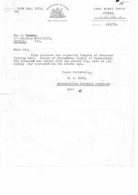 Falls Creek Historical Society
Letter - Letter Re Diagram Of Governor Phillip Park, Parish Of Narrabeen
Bob Hymans Collection Bob (Herman) Hymans (a former member of the Royal Netherlands Navy) was born in Bloemendaal, Holland on 30th September 1922. During World War II he fought against the Japanese in the Dutch East Indies (now Indonesia) and was imprisoned in Changi and on the Burma Railway. After gaining qualifications as a Ski Instructor, Bob arrived in Falls Creek in July 1950. Working as an Instructor and Supervisor at Bogong Lodge, Bob decided his future was in accommodation. He was successful in negotiating an indenture for land from the State Electricity Commission (SEC). It took Bob two years to build his Grand Coeur Chalet but, tragically, it was burned down in August 1961. Bob also built the first Chairlift in Australia. This was a single chairlift and the structure was built from wooden electricity poles. He was constantly full of new ideas and proposals for the village. Bob Hymans died on 7th July 2007. This Collection of documents and letters tells the story of Bob's endeavours to develop Falls Creek into the ski village it is today.This letter is significant because it reflects the desire for Bob Hymans to consider projects outside of Falls Creek.A letter from Department of Lands, New South Wales accompanying a diagram of Governor Phillip Park. Plans are no longer available.falls creek administration, governor phillip park -
Clunes Museum
Booklet, Clunes Street Beautification Project
Loosely bound A4 with clear cover contains proposal for Clunes beautification with street drawings, undated, unnumberedbeautification, cheshire, street plan -
University of Melbourne, Burnley Campus Archives
Document, Planting design guidelines for a Heritage Garden in Australia, 2009-2010
202311 Industry Project 2009 by Elizabeth Alcorn - research on Emily Gibson's plans at Burnleyelizabeth alcorn, heritage gardens, australia, landscaping, emily gibson -
University of Melbourne, Burnley Campus Archives
Plan, 30 Lorne Pde Surrey Hills Preliminary Site Plan 1:100, c. 1980
Tracing paper copy, "Preliminary Site Plan," by "?N." and a rough sketch on paper. Scale 1:100. Possibly Landscape Design Project 1978.surrey hills, landscape design -
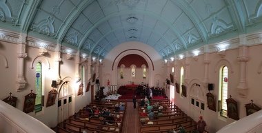 Ballarat Heritage Services
Photograph - Digital photographs, L.J. Gervasoni, Interior of St Brigid's Crossley, 2018
"LARGE GATHERINGNG AT - CROSSLEY DEDICATION AND OPENING SERVICES. SERMON BY DR. MANNIX. Yesterday was an important and historic day for the Roman Catholic community of Crossley and Koroit, in as much as it will be always associated in the memories of all con cerned with the opening of the new St. Brigid's Church, Crossley. This building is far above the average standard of sacred edifices in country towns, and is certainly superior to any ercted in this district outside the churches in the two larger centres - Warrnambool and Koroit. The style of architecture chosen is a free treatment of the Romanesque, which is something quite original in the Western District. This noble style, from which, with its near re lative the Byzantine, spring the great Gothic school of architecture, is characterised by a special charm of its own, one of its chief features being graceful and sweeping circular curves in roof, window heads and in the ar rangenent of the ground plan. The building is of brick finished off with true Romanesqiue pillared pinnacles in concrete and plaster, the brick and concrete producing a pleasing contrast. The main characteristic of the front is a large rose window filled with Romlanesque circular tracery, and below a bold porch and entrance. The two sides are pierced with long circular-headed windows between graceful buttresses and the wall line is pleasingly broken by the projecting bays of the confessionals and also by the vestries. The main building is 80 feet by 30 feet' and the Sanctuary is spacious and semi-circular in shape, and lighted by three windows. The interior of the church is most artistic. The ceiling is semi-circular and of fibrous plaster in ornate designs. All the windows are lead lighted, throwing a rich and mellow harmony of' color throughout the interior and the white wails, mouldings, architraves and other fibrous plaster decorations: are further relieved by the rich coloring: in the stations of.the Cross arrranged around the nave. The central window of the Sanctuary contains a splendidly executed stained glass representation of St. Brigid. At.the western end is a room gallery. The altar is a choice piece of Gothic woodwork, in light, soft coloring, and there are two altars on either side of the Sanctuary in oak, and above whlch are very fine colored figures of Christ; and the Madonna. On either side of the altar are life-size figures of angels holding high brass candalabra. The whole of the furnishings of the church are on a sumptuous scale, and the edifice reflects credit on all concerned. The church can seat nearly 500 people. The architect was Mr. A. A. Fritsch. of Melbourne, and the contractors Messrs F. and E. Deagne, of North Fitzroy. The contract price for the building was £5,500. THE OPENING SERVICE. After the cereimony of solemnly blesssing the church was performed by His Lordship the Bishop of the Diocese, Dr. Higgins, assisted by His Grace the Coadjutor Archbishop of Melbourne. Dr. Mannix, the great gatheiring from all parts of the district entered the church, which was soon completely filled. The members of the H.A.C.B.S. attended wearing their green and gold regalia, and acted as a 'guard of honor' to the Co-adjlutor Arclhbishop and Bishop. Mass was celebrated by the Rev. Father Phelan, of Koroit, and a feature of the solemn service was the singing of a choir which consisted of picked voices from St. Carthage's choir, with friends from Warrnam bool and assisted by some of the mem bers of the Koroit choir, with Miss Logan as organist and Mr. Arthur H. Renwick as conductor. They rendered the music in splendid style throghonut. The "Kyrie," "Gloria." "Agnus Dei' and Dona Nobis" were from Farmer's Mass in B flat, and the "Credo" and "Sanctus" from Webbe's Mass in G. The soloists in the Mass were Mrs. Ryan, the Misses McEntee. Miss Katie O'Brien. and Messrs. J. M. Crowley, W. J. Callaghan; B. McEntee and W. Mahony. The chorus sang with great precision, special attention being paid to at tack. At the offertory Mrs. Dan Ryan gave a beautiful rendering of Gounod's "Ava Maria." After the Elevation that fine duet "Tantum Ergo." by Rossi, was sung by Messrs. Crowley and Renwick in an artistic manner, their fine voices blending splendidly. During the collection, Mr. Renwick sang with much feeling that devotional solo, "Lead Thou Me On,", after which Mr Crowley gave .an ex cellent rendering of Weissi's "0 Salu taris Hostia;" and the choir sang several hymns." It might here be mentioned that at the request of Fa ther Kerin, the same choir will repeat the music.at the Koroit Church on Sunday next, on the occasion of the ceremnly of laying the foundation stone of the cormpletion of the church. Dr. Mannix preachled the sermon for the occasion, taking his text from St. Luke first 11 verses. He re viewed the Gospel story of Christ preaching to the multitude from a boat on Lake Gennesaret and the miraculous draught of fish. The obedi ence of the poor fishermen in casting their nets at Christ's bidding was richly rewarded, and the miraculous occurrence was a striking example of what was to happen when Christ established His Church and built it up on those twelve apostles. When they came to think of it, nothing so re markable and marvellous had happened before or since in the history of mankind. The world at that time was for the most part a Pagan world steeped in iniquity and sin. The chosen people of God had God's re velation, but they worshipped with their lips and not with their hearts. When Christ was to establish His Church upon earth and leave an or gantisation that would continue His work, did He select learned men, powerful men, rich men, or a time that would seem propituous? No. He selected twelve poor, igorant simple fishermen, without money, power, learning or anything calculated to enable them to do anything striking in the world's history. The success of the first morning after pentecost was not confined to those first days when the plentitude of the Holy Ghost sat upon the .Apostles, but it continued age after age until the whole world was brought within the sphere of ac tion of the Church. Greece, Rome Europe Asia and America, and now Australia had been brought into the net. This must be a consolation to them all as well as it was to him (the preacher), when they remembered that they came from a land which of all others had been faithful to the Gospel of Jesus Christ. It was a consolation to them that in that great work that had been accomplished in bringing men into the meshes of the Church, and bringing them to God the nation to which they belontged had taken so great a part. Their religion flourished in England, Scotland, America and Australia. Surely it was due to the sons of St. Patrick, the sons and daughters of Ireland to find consolation in these great facts might It might seem hard that so many had to leave their native-land for England, Scotland, America and Australia. But if hard it was the means of keeping the Catholic faith living in England and Scotland. If to-day the Irish Catholics and Catholics of Irish de scent were taken out of the English and Scotch population there would be little left of the true Church of God. It seemed hard to emigrate to distant lands, but the result had been the new magnificent church in the United States, the flourishing churches in Canada and South Africa. Those Irish emigrants were a cornparatively small band. Perhaps they had not the learning of other nations. Certainly they had not the wealth and it did not fall to their lot to have the power of the sword, but God was with them, and the faith they took from Ireland flourished in those distant lands. In this fair land of Australia they had a glorious herit age handed down from the pioneer Irish Catholics, who came to this fair Austral land. There was a time when those who were opposed to God and God's Church,thought that Australia should be a wholly Protestant land. They had lived to see whether God or His enemies were the stronger. They had lived to see that those who in distant days would have stamped out the Catholic religion in Australia, had not prevailed. Their names had been forgotten because of their persecution of the Catholic Church, and they had lived - to see the glorious success that now, in every part of the Common wealth, rested upon the Catholic Church in Australia. Might God bless that Church and those Irish people, and the people of Irish descent, who had built it up. In that locality, and there was no place in.the Common wealth where the Catholic Church was held in higher esteem, the people would always be faithful to God and His Church. That beautiful building, and all it signified in loyalty and faithfulness, was a credit and a consolation to the Bishop and people of the diocese, to the architect who had done his work so artistically and skil fully. to the priests and the zealous administration of the parish. There was surely hope and inspiration in that day's celebration, that as time went on the Catholic faith would sink deeper and deeper into ther coming generation, and that the Catholic progress of the past 50 years would be small in comparison to the great progress of the future. He congratulated the Bishop priests and people who had raised that temple. He congratulated the people of Crossley; upon their generosity and self-sacrifice, and he prayed that God's blessing and the blessing of St. Brigid would rest upon them; their children and children's children. And when those who had received the sacraments and had been instructed in that Church were called before the Judgment Seat he pray ed that not one would be missing, and St. Peter aind St. Brigid would be able to count them all into the en joyment .of Eternal bliss. THE CELEBRATION The Rev. Father Kerin, Adninistra tor of the Parish, after the collection, read a lengthy list of the principal donations, headed by the Bishop, Dr. Higgins, with £250. All the furnish ings of the Church were also donations, and the Coadjutor-Archbishop added £5 to the list. The Rev. Father Kerin stated that the total to hand was £1245/10/7, which was an other proof of the generosity of the Crossley and district people. The amount previously received in donations was £1077/3. They started buildiing with a credit balance of £262 10/5 and ther now had a debit balance of £2,728/18/5. The total cost of the Church was £6,250, so that they would see the greater part of the indebtedness had already been wiped out. The Bishop (Dr. Higgins) delivered a brief address, in the course of which he congratulated the priests and people upon the completion of their magnificent Church. He congratulated the people on their magnificent generosity. He expressed his of deep indebtedness to the Coadjutor Archbishop of Melbourne for the services he had rendered to them. He had attended at considerable sacrifice to himself, and they were extremely grateful for the presence of so distinguished a champion who had shown such zeal and interest in their Church in this new land. He (the Bishop) trusted that his splendid talents would long be devoted to the defence of the Church." (Warrnambul Standard, 02 July 1914)Digital panoramic image of the interior of St Brigid's Crossley.st brigid's crossley, st brigid's, catholic church, catholic, church, community, ceiling, stations of the cross, confessional, statues, windows -
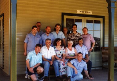 Ballarat Tramway Museum
Photograph - Colour Photograph/s, Carolyn Dean, 25/02/1995 12:00:00 AM
Colour print of BTM Planning group meeting - Sovereign Hill, "Court House", 25/2/1995. Reported in March 1995 Fares Please and photograph used in the 1994 - 1995 Annual Report. Stephen Butler, Warren Doubleday, Greg Rodgers, Garry Wood, Frank Puls, Alan Bradley, Richard Gilbert, Clayton Giles, Peter Winspur, Elizabeth Downes (CHHA Project Officer), Carolyn Dean, Len Millar and John Phillips. Photo by Carolyn's Camera. On Kodak Paper. March 1995 Fares Please! and BTM Annual Report 1994 1995btm, planning, sovereign hill -
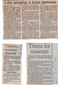 Melbourne Tram Museum
Newspaper, The Age, Progress Press, "Libs promise a tram Museum", 1991 - 1995
Set of five Newspaper cuttings and one hand written note regarding the planning for a museum at the Hawthorn Tram Museum Depot. .1 - The Age 25/11/1991 - "Libs promise a tram Museum" by Mark Brolly, quotes the Minister, Mr. Alan Brown. .2 - Progress Press, 27/11/1991 - "Trams for Museum" .3 - Progress Press, 24/3/1993 - "Tramway Museum planned" .4 - Progress Press, 27/9/1994 - "Tram museum call" .5 - Progress Press, 21/3/1995 - "Tram depot on track", features a photo of Alan Brown inside a W. Story by Emma Duncan, photo Simon .6 - Handwritten note regarding the re-development of the Hawthorn Tram depot and VicTrack details - Brendon Mack and Office of Major Projects.trams, tramways, hawthorn tram depot, tram museum, museums, minister for transport -
 Melbourne Tram Museum
Pamphlet, Yarra Trams, "Power supply upgrade project - J. S. Grey Reserve West Preston", Jul. 2016
Digital image of a folded A4 pamphlet titled "Power supply upgrade project - J. S. Grey Reserve West Preston", about the construction of a new sub-station on the reserve, gives construction dates, impact, site plan, elevation plan, reason or need for the sub-station for tram power upgrades. Dated July 2016. A4 print made for files.trams, tramways, substation, power supply, yarra trams, west preston -
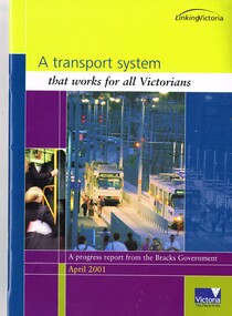 Melbourne Tram Museum
Book, Department of Infrastructure (DOI), "A transport system that works for all Victorians", Apr. 2001
Report or Book - 28 A4 pages, full colour centre stapled printed on gloss paper titled "A transport system that works for all Victorians", published as a progress from the Bracks Government, April 2001. Includes a message from Peter Batchelor. Looks at the forward planning for transport in Victoria, including various public transport projects.trams, tramways, planning, doi, m>tram, spencer st, public transport, railways