Showing 11715 items
matching railways
-
 Tarnagulla History Archive
Newspaper clipping: Plenty Of Puff But Where's The Bell?, Plenty Of Puff But Where's The Bell?, November 22, 1988
... railways ...Donald Clark Collection. Clipping from The Bendigo Advertiser, of November 22, 1988, with article titled 'Plenty Of Puff But Where's The Bell?'. Discusses train services in the region and the celebration at Tarnagulla of the centenary of the town's passenger rail link. Reports on calls to restore the passenger rail services. Also describes the centenary celebrations which involved a race between teams carrying homemade replicas of steam trains. Images of the races and one of Donald Clark. Mentions the Tarnagulla Fire Brigade Senior and Junior teams and the Tarnagulla Golf Club Juniors team all as winners. tarnagulla, railways, rail, transport, trains, steam, centenary, centenaries, commemorations, community events, fire brigade, golf club, recreation reserve, races -
 Melbourne Tram Museum
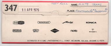
Negative, Bruce Herbert, "MMTB Trams - Hawthorn and Dandenong Road", 11/04/1976 12:00:00 AM
... Railways ...Negative folder - made by SAGA Japan, containing 8 no. 120 film negatives 60mm x 90mm of MMTB Trams at the intersection of Hawthorn and Dandenong Road 11 April 1976, marked "Test Film" and stamped "347". .1 - Harris Train at ? .2 - 901 - route 64, City .3 - 959 - route 69 - Kew Cotham Road - with a CP Air advert .4 - Tramway Emergency Vehicle .5 - 947 - route 64 Three negs not scanned.trams, tramways, sw6 class, dandenong rd, hawthorn rd, route 64, route 69, r10 vehicle, railways, tram 901, tram 959, tram 947, aec, mmtb -
 Melbourne Tram Museum
Document - Notice, The Met, Public Transport Corporation, "Staff Bulletin No. 2 - 17/2/93", 17/02/1993 12:00:00 AM
... Railways ...Notice - 3 A4 sheets stapled in the top left hand corner, titled "Staff Bulletin No. 2 - 17/2/93" - follows an agreement with the ATMOEA union, about fare collection, workshops, line closure (just Northcote to Thornbury), Infrastructure, service levels, retention of tram services, tendering of bus services, and various other reforms, consultation, arbitration hearings and revised interim management structure. Signed by John McMillan. See also 3049 and 3052trams, tramways, services, buses, bus replacement, tram replacement, railways, contracts, preston depot, met ticket, maintenance, unions, atmoea, agreements -
 Melbourne Tram Museum
Document - Notice, The Met, Public Transport Corporation, "Staff Bulletin - Public Transport Reform Package", "Staff Bulletin No. 2 - 17/2/93", 6/01/1993 12:00:00 AM
... Railways ...Notice - Folded A3 sheet titled "Staff Bulletin - Public Transport Reform Package", dated 6-1-1993 with an announcement by the Minister Alan Brown about the contracting out metropolitan bus services, country rail passenger service, substituting trams with buses, all night bus services, Automated Fare Collection, Driver Only suburban trains, Rolling stock maintenance, closure of Preston tram depot, infrastructure maintenance, cleaning, catering contracting out freight and other services. Signed by John McMillan. See also Reg items 3048 and 3052.trams, tramways, services, buses, bus replacement, tram replacement, railways, contracts, preston depot, met ticket, maintenance, unions, atmoea, agreements -
 Bendigo Historical Society Inc.
Slide - Images by Arthur Pulfer, 1957-1970
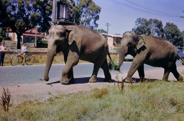
ROSEVIEW 407 High Street, Golden Square Bendigo "Roseview" was designed by Godfrey Eathorne and constructed in 1939. It is one of the few Streamline Moderne houses in the Central Goldfields region, and was one of the earliest constructed in the Bendigo region. It is an outstanding example of this style of housing. It resembles an ocean liner, and reflects the emphasis on the streamlining of methods of transportation. It utilizes both flat and curved surfaces and has little external ornamentation. The use of materials such as rounded glass windows and metal window and door frames reflects an innovative approach to construction consistent with the style. "Roseview" was constructed on a large scale, with large and spacious rooms. It reflects the prominent social status and wealth of the original owner, together with the desire for a building in 'the latest' style which was sure to attract attention and prominence in the region. It has been maintained largely in original condition. CARALULUP HOTEL 'The Sun' dated January 17, 1941 on the back. It states that 'The licence of Caralulup Hotel, near Talbot, has been surrendered, thus severing an 80 year association with the district' State Library of Victoria TOLMER GOLD ESCORT ROUTE The gold rush in New South Wales and Victoria left few able miners in South Australia. Bad economic conditions saw more than 15,000 men leave the Kapunda and Burra mines by the end of 1851. Alexander Tolmer, Commissioner of Police in 1852 proposed that the gold won by South Australians should be brought back to South Australia under an escort consisting of only a few men. In March a Gold Escort was on its way back to Adelaide with almost 6,000 ounces of gold for the vaults of the Treasury Building. After this successful trip Tolmer led two other escorts before handing over his duties. A total of eighteen gold escorts were made, the last one during November and December 1853 when Inspector Wyndham was in charge. You’ll find Gold Escort Route Monuments between Meningie, Coonalpyn and Tintinara.Many images from by Arthur Pulfer copied to slides. Twenty Slides of Bendigo: Bullen's Circus Bendigo February 1966 "Roseview", Pethard's Home at 407 High Street, Golden Square, Bendigo. 25th March 1957. House is possibly on the Midland Highway Epsom, Bendigo - 8 April 1955 Kangaroo Flat Bus Lines mini bus The Big Tree Sedgwick Road March 1972 The old Golden Gully Hotel Diamond Hill Road, Bendigo The old Lockup Eaglehawk Bendigo September 1967 Market Gardens - possibly North Bendigo North Deborah Mine photo taken from Breen Street 1958 Laying the track to get the engine into the park, looking down Mitchell Street Bendigo Engine R766 in the Victorian Railways Institute Park Railway Place Bendigo On the Methodist Church Steps Arnold street Bendigo Miner's Hut at Moliagul Basket Lunch - White Hills Botanical Gardens - St johns 100 year celebrations White Hills Swimming Pool February 1970 White Hills Botanical Gardens Bendigo Bendigo Show Parade 1958 The Arrival of the Cobb and Co Coach in Bendigo September 1963 history, bendigo, james lerk collection, golden square high school, dragon loong, white hill botanical gardens, 407 high street bendigo, r766 engine, bullens circus, caralulup, moligual, bendigo show, tolmer's gold route, kangaroo flat bus lines, eaglehawk lockup, arnold street methodist church, elephants -
 Kew Historical Society Inc
Plan, Melbourne & Metropolitan Board of Works. Borough of Kew Detail Plan No.1579, 1904
The Melbourne and Metropolitan Board of Works (MMBW) plans were produced from the 1890s to the 1950s. They were crucial to the design and development of Melbourne's sewerage and drainage system. The plans, at a scale of 40 feet to 1 inch (1:480), provide a detailed historical record of Melbourne streetscapes and environmental features. Each plan covers one or two street blocks (roughly six streets), showing details of buildings, including garden layouts and ownership boundaries, and features such as laneways, drains, bridges, parks, municipal boundaries and other prominent landmarks as they existed at the time each plan was produced. (Source: State Library of Victoria). This plan forms part of a large group of MMBW plans and maps that was donated to the Society by the Mr Poulter, City Engineer of the City of Kew in 1989. Within this collection, thirty-five hand-coloured plans, backed with linen, are of statewide significance as they include annotations that provide details of construction materials used in buildings in the first decade of the 20th century as well as additional information about land ownership and usage. The copies in the Public Record Office Victoria and the State Library of Victoria are monochrome versions which do not denote building materials so that the maps in this collection are invaluable and unique tools for researchers and heritage consultants. A number of the plans are not held in the collection of the State Library of Victoria so they have the additional attribute of rarity.Original survey plan, issued by the MMBW to a contractor with responsibility for constructing sewers in the area identified on the plan within the Borough of Kew. The plan was at some stage hand-coloured, possibly by the contractor, but more likely by officers working in the Engineering Department of the Borough and later Town, then City of Kew. The hand-coloured sections of buildings on the plan were used to denote masonry or brick constructions (pink), weatherboard constructions (yellow), and public buildings (grey). While MMBW Plan No.1579 does not include many buildings, those that it does show are significant to Kew’s history. These include the ‘Kew [Railway] Station’ in Denmark Street and the ‘Recreation Hall’ and rear courts off Wellington Street. The plan shows the outline of the Recreation Hall, constructed in 1880, at the rear of which is listed a bowling green, two tennis courts, a ‘skittle alley’ and a pavilion. When the Hall was first built, the Kew Cricket Club occupied an adjacent ground, however in 1885 this was acquired by the State Government as the future location of the Kew Railway Station. The Plan also shows a single oval at Xavier College. This oval was completed in 1883. One of the current ovals conforms to this oval’s original shape and position in the school grounds.melbourne and metropolitan board of works, detail plans, maps - borough of kew, mmbw 1579, cartography -
Glen Eira Historical Society
Newsletter - ROTARY CLUB OF GLEN EIRA
... Railways ...This file contains six items pertaining to the Rotary Club of Glen Eira: 1/The 1996-7 bulletin of the Club. Contains the address and phone number of the Club, a brief history of Glen Eira, a list of the times and locations of the meetings of both the Glen Eira branch and others in Melbourne, and a list of present and past faculty. 2/A typewritten letter, dated 21/03/1997, from Geoff Oscar, former president of the Club, to Mrs. Felicitie Campbell of the Caulfield Historical Society, thanking the latter for an address delivered to the Club on 18/03. 3/Bulletin #38 of the Club, which principally describes a meeting held at 29/04/1997. Features a duty roster, an advance program, a description of a presentation about ANZAC Day to be delivered at the meeting by Ross Bastiaan, a description of a presentation about great cities of the world delivered at the previous meeting by Peter Shellie, a poem about ANZAC Day, notifications of various upcoming events, and an attendance report. Also attached is a an extract from Victorian Railways to ’62 by Leo J. Harrigan describing the history of the Rosstown Railway. 4/Two copies of a booklet announcing the 21st birthday celebration dinner of the Club, to be held on 11/11/2008. Included is the menu, program of events, and a list of past presidents of the Club. 5/A booklet, dated 2009, providing basic information about the Club, including its address, meeting time, contact details, mission statement, faculty, past presidents, calendar and a brief history. 6/A card announcing the 21st Annual Business Person’s Breakfast, to be held at Glen Eira Town Hall on 12/03/2010, featuring David Smorgon as guest speaker.glen eira, rotary club of glen eira, clubs and associations, st. georges road, elsternwick, local history, ricketson henry, watts thomas, architects, ‘glen eira’, mansions, house names, australian general military hospital no. 11, alfred hospital, southern memorial hospital, graham jeremy, james barry, langfelder kurt, fookes marc, asher geoff, süssmann jacques, flores denis, strong john, sylvester bill, oscar geoff, cohen peter, leske john, sharp merv, ray alf, nettelbeck david, sherlock max, rattray john, pollock david, smith barry, harris paul, britten elizabeth, jacobs frank, campbell felicitie mrs., caulfield historical society, scout groups, dover street, north road, trams, ripponlea, market gardens, chinese community, nepean highway, glen eira road, caulfield grammar, horses, edinburgh avenue, bastiaan ross dr., zazryn ben, schwartz roy, nathan vic, stewart ron, sharp hiam, bendel david, steven john, turner brian, shellie peter, warren r., dalidakis g., silvester b., brain judy, stuckey hugh, solomon john, sloman felicity, anzac day, ‘anzac day poem’, stockdale alan, pfau leon, caulfield races, fundraising events, rotary club of caulfield-rosstown, rosstown sugar mill, banners, ‘victorian railways to ‘62’, harrigan leo j., rosstown railway, railways, business and finance, ross william murray, ‘the grange’, caulfield, rosstown junction railway and property co., rosstown railway abandonment act 1916, rosstown, carnegie, rosstown road, festivals and celebrations, kooyong lawn tennis club, food, heuberger david, harambee choir, mcinnes ray archdeacon, muir colin, aarons joseph, nagaoka ryo, miwa takashi, sheezel robert, matheson judy, marks ian, nelson adrian, blode larry, the london tavern, hawthorn road, binstock sam, hill jan, faiman keith, nirens jeff, preston mark, fabian garry, dimand jack, silvester bill, city of glen eira town hall, annual business person’s breakfast, smorgon david -
 Eltham District Historical Society Inc
Photograph, Tess Justine (Nillumbik Shire Council), Construction work on replacement of Murray's Bridge over the Diamond Creek, Eltham North, 31 Mar 2022
Construction work on replacement of Murray's Bridge over the Diamond Creek on the Diamond Creek Trail Mary (Sweeney) Murray and John Wright Murray selected 80 acres, Lot C Section 16 and Lot 5 Section 17 Parish of Nillumbik, under an occupation license in 1866. John died in 1867 and freehold was granted to his son John in 1873. The farm was known as ‘Laurel Hill’. John Junior was an Eltham Shire councillor and sometime president from 1887 up until 1897. He added Lot A Section 16 to the farm in ca1888. John and his younger brother James arranged to rent/purchase Lot B Section 17, across Diamond Creek to the west, in ca1900. It appears that John and James farmed separately for a few years, with a new homestead built for James ad family on the high point of Lot B Section 17 in ca1910. John sold off Lot 5 Section 17 in 1912. When John died in 1912 James took over the land on both sides of the Diamond Creek. The old homestead on the west side of the Creek disappeared. A farm bridge over Diamond Creek from this period may have been located close to the northern boundary of the farm. John Langlands, owner of the farm known as ‘Ihurst’ on the west side of Diamond Creek to the south of the Murray’s land, died in 1907. In 1909 his land was then subdivided into 100 lots to become the ‘Glen Park Estate’. Other similar subdivisions of nineteenth century farms around Eltham in this period included the ‘Franktonia (or Beard’s) Estate’ to the northeast and ‘Bonsack’s Estate’ between Eltham and Greensborough. Soon after the opening of the railway extension line from Eltham to Hurstbridge in 1912, Glen Park and nearby residents including James Murray agitated for a railway station or siding to be located half-way between Eltham and Hurstbridge, so that the Glen Park residents who used the railway daily did not have to walk into the Eltham or Hurstbridge stations. Some believed Coleman’s Corner (opposite Edendale Farm) was an appropriate spot for the platform. James Murray was among those who thought the railway should be located on his land, closer to half-way between Eltham and Hurstbridge stations. The Railways Commissioners warned that the locals would have to fund these works themselves. The Glen Park Estate residents initially had difficulty accessing Eltham by road, with only an old low-level bridge over Diamond Creek at the south end of their estate. A new timber trestle bridge across the creek, now on Wattletree Road, was opened in 1915. Road access to the north was gained in 1927 when the new Murray’s Road, which crossed the Murray’s land, was built. Residents continued to agitate for a Glen Park station. By 1926 the Railways Commissioners’ preferred site was on the Murray’s land. They arranged an estimate of cost of a full-length platform. The estimate was too much for the locals, who in 1928 argued unsuccessfully for a shorter and hence cheaper platform. By 1929 Murray had agreed to donate the land, but the locals would still have to fund the works. Murray decided, unilaterally it would appear, to commence work on a timber trestle road bridge over Diamond Creek to link the new Murray Road to the proposed station. Late in 1929 he stopped work on the bridge, for reasons unknown, but started work again and completed the bridge in 1931. There is no further newspaper evidence of the campaign for the Glen Park station until 1939, when Murray and another local, Mr Maxwell, met the Railways Commissioner. The Glen Park locale now included 45 homes on the west side of the creek and 20 on the Eltham side. Most of the residents used the train every day. The Commissioner remained adamant that only a full-length platform could be built for safety reasons. It appears the campaign dissolved at this point. The increasing move to cars may have had an impact. There is no evidence of Murray’s bridge ever being connected to Murray’s Road, or of it having wide use for any purpose by locals. James Murray died in 1947 and the farm was taken over by his son James (Jim). Jim started to sell off parts of the farm in the 1980s, retaining a few acres around the ca1910 homestead and building a new house there. Recreation reserves were established along the creek. In ca1990 Murray’s bridge was renovated with steel girders as part of a bike/pedestrian path in the reserve. The old farmhouse was demolished in ca2014. Born digital image (5)diamond creek (creek), diamond creek trail, murrays bridge, ‘laurel hill’, john wright murray, mary (sweeney) murra, john murray jnr, james murray, john langlands, ‘ihurst’, ‘glen park estate’, beard's estate, franktonia, bonsack's estate, glen park estate, glen park railway station -
 Eltham District Historical Society Inc
Photograph, Tess Justine (Nillumbik Shire Council), Murray's Bridge over the Diamond Creek, Eltham North, 19 Feb 2022
Murray's Bridge over the Diamond Creek on the Diamond Creek Trail just prior to demolition and replacement with a new steel bridge. Heritage advice obtained by Nillumbik Shire Council, following a suggestion by the Eltham District Historical Society (EDHS), is that the original bridge appears to have been a simplified version of the Country Roads Board’s (CRB) standard timber bridge design of the early-to-mid 1920s. In c1990 Murray’s bridge was renovated with three recycled steel girders as part of a bike/pedestrian path in the reserve. During these alterations many parts of the bridge were removed, and some were replaced. Heritage advice indicates the condition of Murray’s bridge is poor. The remaining original parts are all in poor condition, with severe weathering, splitting and rot, especially to the stringers retained on the bridge. Heritage advice is that Murray’s Bridge does not have sufficient significance in the cultural history of the Nillumbik area to warrant inclusion in the Nillumbik Shire Heritage Overlay and also does not have sufficient significance as a rare survivor to warrant inclusion in the Nillumbik Shire Heritage Overlay. There are no indications in the historical record that this site was individually important to the cultural history of this area. EDHS is comfortable with the heritage advice provided to Council and has worked closely on this project with Council. EDHS has suggested some of the removed timbers be used in the vicinity of the bridge for landscaping and possibly seating, so as to retain these remnants close to the site of the original bridge, which is the last old timber bridge along the lower reaches of the Diamond Creek. Mary (Sweeney) Murray and John Wright Murray selected 80 acres, Lot C Section 16 and Lot 5 Section 17 Parish of Nillumbik, under an occupation license in 1866. John died in 1867 and freehold was granted to his son John in 1873. The farm was known as ‘Laurel Hill’. John Junior was an Eltham Shire councillor and sometime president from 1887 up until 1897. He added Lot A Section 16 to the farm in ca1888. John and his younger brother James arranged to rent/purchase Lot B Section 17, across Diamond Creek to the west, in ca1900. It appears that John and James farmed separately for a few years, with a new homestead built for James ad family on the high point of Lot B Section 17 in ca1910. John sold off Lot 5 Section 17 in 1912. When John died in 1912 James took over the land on both sides of the Diamond Creek. The old homestead on the west side of the Creek disappeared. A farm bridge over Diamond Creek from this period may have been located close to the northern boundary of the farm. John Langlands, owner of the farm known as ‘Ihurst’ on the west side of Diamond Creek to the south of the Murray’s land, died in 1907. In 1909 his land was then subdivided into 100 lots to become the ‘Glen Park Estate’. Other similar subdivisions of nineteenth century farms around Eltham in this period included the ‘Franktonia (or Beard’s) Estate’ to the northeast and ‘Bonsack’s Estate’ between Eltham and Greensborough. Soon after the opening of the railway extension line from Eltham to Hurstbridge in 1912, Glen Park and nearby residents including James Murray agitated for a railway station or siding to be located half-way between Eltham and Hurstbridge, so that the Glen Park residents who used the railway daily did not have to walk into the Eltham or Hurstbridge stations. Some believed Coleman’s Corner (opposite Edendale Farm) was an appropriate spot for the platform. James Murray was among those who thought the railway should be located on his land, closer to half-way between Eltham and Hurstbridge stations. The Railways Commissioners warned that the locals would have to fund these works themselves. The Glen Park Estate residents initially had difficulty accessing Eltham by road, with only an old low-level bridge over Diamond Creek at the south end of their estate. A new timber trestle bridge across the creek, now on Wattletree Road, was opened in 1915. Road access to the north was gained in 1927 when the new Murray’s Road, which crossed the Murray’s land, was built. Residents continued to agitate for a Glen Park station. By 1926 the Railways Commissioners’ preferred site was on the Murray’s land. They arranged an estimate of cost of a full-length platform. The estimate was too much for the locals, who in 1928 argued unsuccessfully for a shorter and hence cheaper platform. By 1929 Murray had agreed to donate the land, but the locals would still have to fund the works. Murray decided, unilaterally it would appear, to commence work on a timber trestle road bridge over Diamond Creek to link the new Murray Road to the proposed station. Late in 1929 he stopped work on the bridge, for reasons unknown, but started work again and completed the bridge in 1931. There is no further newspaper evidence of the campaign for the Glen Park station until 1939, when Murray and another local, Mr Maxwell, met the Railways Commissioner. The Glen Park locale now included 45 homes on the west side of the creek and 20 on the Eltham side. Most of the residents used the train every day. The Commissioner remained adamant that only a full-length platform could be built for safety reasons. It appears the campaign dissolved at this point. The increasing move to cars may have had an impact. There is no evidence of Murray’s bridge ever being connected to Murray’s Road, or of it having wide use for any purpose by locals. James Murray died in 1947 and the farm was taken over by his son James (Jim). Jim started to sell off parts of the farm in the 1980s, retaining a few acres around the ca1910 homestead and building a new house there. Recreation reserves were established along the creek. In ca1990 Murray’s bridge was renovated with steel girders as part of a bike/pedestrian path in the reserve. The old farmhouse was demolished in ca2014. * * * A theory posted on local community Facebook groups was that the bridge was built in the 1860s and was built to be more robust than was necessary for the movement of cows from one side of the creek to the other. It was suggested the robustness was necessary to support the weight of gold ore being transferred from a mine on Murray’s land to a railway siding near Murrays Bridge (presumably for transfer and processing at Diamond Creek). Perhaps this may have been one of the motivators for Murray, who really knows? Knowing when mining operations ceased on his land and how that fits the overall timeline would be useful but at the time the bridge was built, local gold production was minimal at best. The known facts are: • The railway line came to Eltham in 1902. • The extension of the railway from Eltham to Hurstbridge was constructed in 1912 so no railway line even existed through Murray's property until 1912 and the Victorian Railways maps at the time show no such siding on Murray’s property. • In 1923 a new company was formed in anticipation of the old Diamond Creek Gold Mine being re-opened. The mine had been previously closed and flooded. It was noted in the press at the time that the mine was within a mile of the railway. Nothing really came of this. • Construction of Murrays Bridge was commenced by James Murray in early 1929 in anticipation of a proposed flag station being nominated on his land, but work ceased shortly afterwards. The proposed flag station was commonly referred to as Glen Park as the residents of the Glen Park Estate wanted Option 1, located near them with the platform adjacent to Colemans corner. This was probably never going to fly as it was virtually in eyesight of Eltham station. Allandale Road was the third option, but the Commissioners' preferred option was No. 2 - on Murray's property. • The Railway Commissioners were not going to finance any such station and the works had to be funded by private landowners and residents, hence Murray investing in this himself. • Murray recommenced work two years later and finished his bridge in 1931 but unfortunately for him, the proposed flag station never eventuated. The bluestone siding you reference may well have been built by Murray as part of the proposed station platform. • Up until then, apart from the Main Road bridge, which was washed away in 1924, virtually all local crossings over the Diamond Creek were low lying bridges – Kaylocks Bridge at Brougham Street, Diamond Street bridge, Glen Park Road bridge. It is expected that Murray also had a low-lying bridge to connect his land either side of the creek. These were all washed away or severely damaged multiple times in the 1920s. Lessons were learnt, and Murrays Bridge appears to have been built in accordance with Country Road Board standards of the time. Flood damage was ongoing, and even more recently constructed raised bridges kept getting washed away, e.g., the new Wattle Tree Road bridge in 1958 just months after completion. Murray’s bridge was reinforced with steel some 30 years ago presumably to provide additional floodwater resistance, given the history of bridges disappearing in floodwaters. • In March 1932 it was reported in the Advertiser that there were still some prospectors operating around Eltham North who apart from further scarring the face of the earth over the previous two years had gained significant experience but little gold - hardly a driving factor for constructing a dedicated railway siding and bridge to transfer gold ore. It is far more probable that James Murray was hoping to have the railway station located on his property and invested his money by building the bridge to lead to it as well as a station platform. Had the station eventuated, it may well have driven up the value of his land for subdivision and new housing estates like the Glen Park Estate. That did not eventuate. Whilst the bridge was indeed old (90 years), the core structure being completed in 1931, it had been modified substantially from original and hence had no significant historic value – i.e., it was not a representative example of its type, construction, and age. Given that the bridge was not worthy of saving, the Eltham District Historical Society with Council’s support, and the Eltham Woodworkers group endeavoured to see what suitable sized timbers were salvageable to fabricate a commemorative seat. Unfortunately, the experts at the Woodworkers group were unable to salvage any suitable length/width timbers to fabricate the seat due to the presence of rot. Last remaining wooden trestle bridge on the Diamond Creek Trail just prior to demolition and replacementBorn digital image (27)diamond creek (creek), diamond creek trail, murrays bridge, ‘laurel hill’, john wright murray, mary (sweeney) murra, john murray jnr, james murray, john langlands, ‘ihurst’, ‘glen park estate’, beard's estate, franktonia, bonsack's estate, glen park estate, glen park railway station -
 Bendigo Military Museum
Certificate - CERTIFICATE, LIFE MEMBER 1960, RSL Inter Units Social Club, 28.3.1960
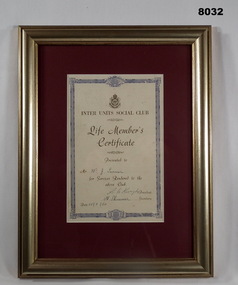
The Life Membership relates to William John Turner Bendigo RSL Sub Branch. Refer Cat No 8029 for details of his work and fund raising for the Sub Branch. Refer Cat No 8030 for details re his Committee involvement with Bendigo Sub Branch and his WW1 service history. The Unit Social Clubs listed in an RSL Bendigo Annual report 1946 appear to be 6th, 38th, 57th Bn Associations, Railways Sub Section, Catholic War Veterans Association, POW Association (new member 1947).Framed certificate, frame is timber gold colour, backing for the certificate is maroon colour, certificate has ornate blue edging, RSL logo at the top followed by the details of the certificate, all print in black, signed and dated.Main points; “Inter Units Social Club - Life Members Certificate - Presented to Mr W.J. Turner for services rendered to the above club” “R C. Kuryke President” “H Skinner Secretary” Dated 28.3.1960”brsl, smirsl, certificate. -
 Eltham District Historical Society Inc
Newsclipping, Vince Chadwick, Violent storms shatter the peace of Christmas, The Age, Monday, December 26, p3, 2011
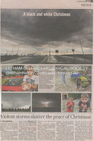
A late afternoon storm on Christmas Day 2011. A flash flood occurred from significant rain fall and hail, which accumulated along an old waterway with floodwater submerging cars along Valonia Drive then down Grove Street flooding houses, through the Bible Street Reserve where it then submerged Main Road washing away the small railway trestle bridge opposite the reserve then flooding the Judge Book Village before finally entering the Diamond Creek. Widespread damage occured from hail and flash flooding.fay bridge collection, 2011-12-26, eltham, flood damage, floods, grove street, main road, valonia drive -
 Eltham District Historical Society Inc
Newsclipping, Reid Sexton, Wild day's trail of destruction, The Age, Tuesday, December 27, pp4-5, 2011
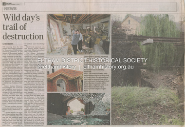
A late afternoon storm on Christmas Day 2011. A flash flood occurred from significant rain fall and hail, which accumulated along an old waterway with floodwater submerging cars along Valonia Drive then down Grove Street flooding houses, through the Bible Street Reserve where it then submerged Main Road washing away the small railway trestle bridge opposite the reserve then flooding the Judge Book Village before finally entering the Diamond Creek. Widespread damage occured from hail and flash flooding.fay bridge collection, eltham, 2011-12-27, flood damage, floods, floodwater -
 Eltham District Historical Society Inc
Newsclipping, Angus Thompson et al, Another insurance storm brews, Herald Sun, Tuesday, December 27, pp4-5, 2011
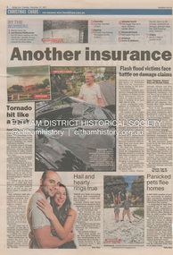
A late afternoon storm on Christmas Day 2011. A flash flood occurred from significant rain fall and hail, which accumulated along an old waterway with floodwater submerging cars along Valonia Drive then down Grove Street flooding houses, through the Bible Street Reserve where it then submerged Main Road washing away the small railway trestle bridge opposite the reserve then flooding the Judge Book Village before finally entering the Diamond Creek. Widespread damage occured from hail and flash flooding.fay bridge collection, eltham, 2011-12-27, flood damage, floods, floodwater -
 Eltham District Historical Society Inc
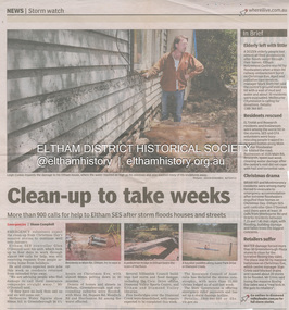
Newsclipping, Shaun Campbell, Clean-up to take weeks, Diamond Valley Leader, December 2011
A late afternoon storm on Christmas Day 2011. A flash flood occurred from significant rain fall and hail, which accumulated along an old waterway with floodwater submerging cars along Valonia Drive then down Grove Street flooding houses, through the Bible Street Reserve where it then submerged Main Road washing away the small railway trestle bridge opposite the reserve then flooding the Judge Book Village before finally entering the Diamond Creek. Widespread damage occured from hail and flash flooding.fay bridge collection, eltham, flood damage, floods, floodwater -
 Eltham District Historical Society Inc
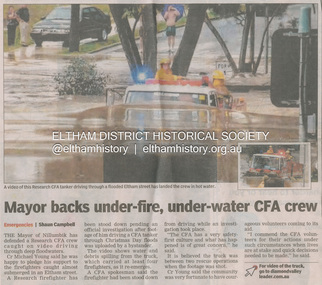
Newsclipping, Shaun Campbell, Mayor backs under-fire, under-water CFA crew, Diamond Valley Leader, December 2011
A late afternoon storm on Christmas Day 2011. A flash flood occurred from significant rain fall and hail, which accumulated along an old waterway with floodwater submerging cars along Valonia Drive then down Grove Street flooding houses, through the Bible Street Reserve where it then submerged Main Road washing away the small railway trestle bridge opposite the reserve then flooding the Judge Book Village before finally entering the Diamond Creek. Widespread damage occured from hail and flash flooding.fay bridge collection, eltham, flood damage, floods, floodwater, main road, research fire brigade -
 Eltham District Historical Society Inc
Film - Video (Digital), Geoff Paine, Eltham District Historical Society: Stories of the Nillumbik Shire with Geoff Paine, May 2020
One of a series of videos "Stories from the Nillumbik Shire with Geoff Paine" Features the Justice Precinct located at 728-730 Main Road Eltham made up of the former Police Residence (1859), replica Police Station (c.1989) and the former Eltham Courthouse (1860); home of the Eltham District Historical Society. President Jim Connor gives an overview of the history behind the establishment of the Courthouse and Police Residence, the beginnings of Little Eltham and the impact of the railway arriving in 1902. Also a potted history on the establishment of the historical society.MP4 Digital file 00:04:35; 260MBeltham courthouse, eltham district historical society, eltham justice precinct, geoff paine, jim connor, lock-up, police residence, police station, shillinglaw cottage, shillinglaw cottage preservation committee, shire of eltham historical society, video recording -
 Eltham District Historical Society Inc
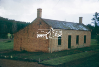
Slide, Shillinglaw Cottage, c.1973
Shillinglaw Cottage was relocated in 1963 from its former site a few hundred metres up Main Road to make may for new shire offices built in 1964. It was situated near the Eltham Railway Trestle Bridge on a site that was developed into the Eltham Common. The new Eltham Town Park was constucted opposite on the other side of what was to become Panther Place. In 1993/94 the new Eltham Library was constructed on the Eltham Common. This picture, though out of focus still gives a reasonable impression of the cottage at the time.35 mm colour positive transparency Mount - Kodak Kodachrome Cardeltham common, shillinglaw cottage -
 Eltham District Historical Society Inc
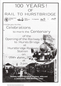
Folder, The Age et al, Centenary of the Eltham to Hurstbridge Railway extension, 2012
In 2012 local community groups acknowledged the centenary of the extension of the Railway line from Eltham to Hurstbridge which took place in 1912. Newspaper article: Automatic system signals the end of the station's tradition, The Age 20 June 2012. Material produced by Nillumbik Historical Society advertising centenary celebrations and providing history with photographs of the Eltham to Hurstbridge extension. The Heidelberg Historian newsletter of the Heidelberg Historical Society No 279, December 2013 (14 pages) including an article by David Watson "Prince's Bridge to Hurst's Bridge".29 pages, newspaper articleharry gilham collection, hurstbridge railway line, centenary celebrations, eltham railway station -
 Eltham District Historical Society Inc
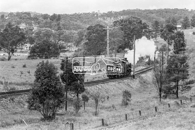
Photograph, Steam locomotive D-639 Vintage train excursion, Hurstbridge to Eltham, near Wattletree Road, Eltham North, c.1970, 1970
View appears to be from near Coolabah Drive looking northwest across parts of Edendale Farm and to the oval near the present day Adventure Playground and Wattletree Road. Possibly run in conjunction with the Eltham Community Festival or the Hurstbridge Wattle Festival; the steam train would conduct trips between Eltham and Hurstbridge Railway stations. As there is no turning table at Hurstbridge, the locomotive would simply shunt from one end of the carriages to the other to reverse direction, hence the locomotive is running in reverse as it approaches Eltham Station.Digital TIFF file Scan of 35mm Ilford HP4 black and white transparencyd-639, edendale farm, eltham festival, eltham north, eltham north adventure playground, george coop collection, hurstbridge wattle festival, steam engine, vintage train excursion, wattletree road -
Greensborough Historical Society
Folder, Chapman family (James Chapman), 1849o
History of the origins of this Greensborough family and the family tree of James Chapman (1805-1875) and Susan Palmer (1808-1895). James Chapman, his wife Susan and all his family including his son-in-law William Poulter left the Port of London in November 1848 on board the 'Francis Ridley' of 536 tons on her maiden voyage to Australia and Bombay India. The Master of the ship was Henry Hudson. James Poulter owned the land between Greensborough Railway Station and Plenty River before selling it to William Poulter.20-page plastic binder, spiral bound, clear cover. Contains documents relating to the James Chapman family.chapman family, james chapman, susan palmer -
 Eltham District Historical Society Inc
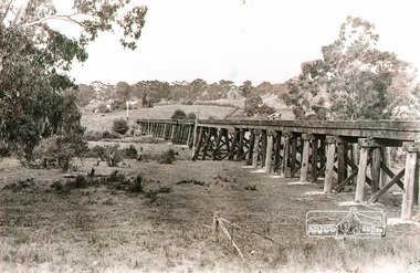
Photograph, Trestle Bridge, Eltham, c.1912
Note the new Catholic Church in Henry Street and Shillinglaw Cottage visible in background past where Eltham Library now stands. This is the new St Mary’s Catholic Church on Henry Street near Main Road (or Maria Street). The church site had been relocated from further south along Main Road (near Wingrove Cottage) in order to be more central to the congregation following the shifting of the township away from Little Eltham and closer to the railway station. It was subsequently destroyed by fire in 1961.Black and white photograph of the trestle bridge at Eltham; Catholic Church in Henry Street visible in backgroundeltham, trestle bridge, bridges, catholic church, henry street, bridge, shillinglaw cottage, shillinglaw trees -
 Orbost & District Historical Society
black and white photograph, February 1971
This photograph was taken near the Snowy River Bridge on the the old Princes Highway in Orbost, near the caravan park. The 1971 flood was the the worst flood on record. At Jarrahmond it was at least 11 metres and up to one and a half kilometres wide on the flats causing enormous damage to the flood plain. Records say that "The brown floodwater stain in Bass Strait could be seen from passing airliners." Considerable damage was done to railway infrastructure, roads and farms. More information from the APRIL, 2008 newsletter by John Phillips. (see orbosthistory.com.au)This is pictorial evidence of a significant local event. Floods have been an integral part of Orbost's history for hundreds of years.A black / white photograph of debris, fallen power lines, a tree across the highway and floodwaters across the road.on front at bottom - handwritten in upper case print - " 1971 FLOOD PRINCES HIGHWAY NEAR SNOWY BRIDGE"floods-orbost-1971 -
 Orbost & District Historical Society
black and white photograph, February 1971
This photograph is an aerial view of the township of Orbost taken by the Bairnsdale Advertiser newspaper. It was taken from the northern end of the town. The 1971 flood was the the worst flood on record. At Jarrahmond it was at least 11 metres and up to one and a half kilometres wide on the flats causing enormous damage to the flood plain. Records say that "The brown floodwater stain in Bass Strait could be seen from passing airliners." Considerable damage was done to railway infrastructure, roads and farms. More information from the APRIL, 2008 newsletter by John Phillips. (see orbosthistory.com.au)This is a pictorial record of a significant event in the history of Orbost,A black / white aerial photograph of a township with floodwaters in the background.on back - "Note main current through the lagoon 1971."orbost-floods-1971 bairnsdale-advertiser orbost-township -
Bendigo Historical Society Inc.
Document - Bendigo Tramways Brochure, abt 1950s
In 1890 Bendigo's first tramway battery-electric carriages operated between Sanhurst and Eaglehawk. In 1892 Battery-electrics were replaced by steam tram cars on the Bendigo Railway Station track to Eaglehawk. In 1903 Electric traction overhead was inaugurated extending to Quarry Hill, Golden Square and Lake Weeroona. In 1913 Open cross-seat cars added for the service Quarry Hill to Eaglehawk. In 1945 Traction bogie cars replaced older cars. In 1947 Birney safety cars (dead man controllers) replaced older carsBrochure, a "Welcome to Bendigo, and "Evolution of Bendigo Tramways." 8668.1 Brochure is titled "Welcome to Bendigo," on the front a photo of Charing Cross and Trams, also the Bendigo City Coat of Arms. Inside two pages and descriptions of six tram showing the "Evolution of Bendigo tramways." On the rear is a map of the tramways and places of interest to visit. The brochure was "Printed for the preservation committee in co-operation with the Royal Historical Society of Victoria (Bendigo and District Branch) All donations for a preservation fund."history, bendigo tramways, evolution of bendigo tramways -
Bendigo Historical Society Inc.
Programme - Program and Toast list, 1951
In 1890 Bendigo's first tramway battery-electric carriages operated between Sanhurst and Eaglehawk. In 1892 Battery-electrics were replaced by steam tram cars on the Bendigo Railway Station track to Eaglehawk. In 1903 Electric traction overhead was inaugurated extending to Quarry Hill, Golden Square and Lake Weeroona. In 1913 Open cross-seat cars added for the service Quarry Hill to Eaglehawk. In 1945 Traction bogie cars replaced older cars. In 1947 Birney safety cars (dead man controllers) replaced older carsToast list for a Bendigo Tramways Division Retirement Dinner - A complimentary Dinner tendered to Mr Arthur Douglas on his retirement after 31 years as Secretary of The Australian Tramway and Motor Omnibus Employees' Association. Held at the Shamrock Hotel, Bendigo Saturday 29th September 1951. Inside are two tramways photos, one of the Bendigo Steam trams 1902, and the other of trams passing through Charing Cross in 1951. On the last page is a program and menu for the event.history, bendigo tramways, evolution of bendigo tramways, arthur douglas, australian tramway and motor omnibus employees association -
 City of Ballarat
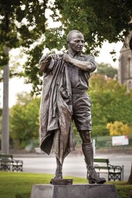
Artwork, other - Public Artwork, Albert Coates Memorial by Louis Laumen, 2012
Leading surgeon and academic Sir Albert Coates (1895-1977) is one of Ballarat's most celebrated sons. A medical orderly during WWI, he returned home to become a pioneering neurosurgeon. A medical man in the worst of circumstances, Coates is often mentioned for his compassion and care in his role as a doctor in the Burma-Siam Railway POW camps. The bronze statue by Louis Laumen captures his down-to-earth nature. Laumen is a Melbourne sculptor who has completed many commissioned bronze public artworks around Australia.The statue is of aesthetic and historic significance to the people of BallaratBronze figure mounted on granite, amid garden plantings and plaques.Inscription details the life of Albert Coates.albert coates, medicine, pow camps -
 Ballarat Tramway Museum
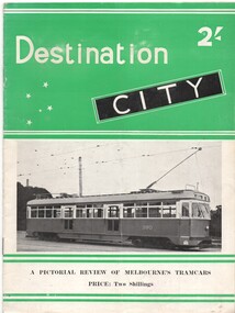
Book, Jack Richardson, "Destination City", 1954
Reproduced from the Australian Tramway Album 2nd Edition, (revised). 2nd Edition, (revised). Two colour cover - green with black. Describes Melbourne's tram car fleet, including Victorian Railways tramcars, cable cars and the Doncaster and Box Hill tramway. Includes brief description of each type, photographs and a summary history. Has many photographs of the various tramcars associated with relevant text. On front cover, has PCC 980 with green banding and price. On back cover is a map of Melbourne tramways drawn in 1948. Book - "Destination City" - paper covers - 20 pages - with sub title "A Pictorial Review of Melbourne's Tramcars", priced at 2/-, published by Traction Publications of Brighton Beach in 1954. Copy 2 - on front cover has number "500/18" crossed out with "501/2" in blue ink underneath. Copy 3 - on inside of front cover, stamped in black ink "R.J.Meyer / 6 Moorefield Rd., / Johnsonville".trams, tramways, melbourne, tramcars, mmtb, vr -
 Ballarat Tramway Museum
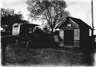
Photograph - Geelong MESCo Bus East Geelong, c1920
The photo shows the Melbourne Electric Supply Co. (MESCo), bus at the East Geelong terminus. MESCo operated the Geelong tram system from 1912 and opened the tram line to this location "East Geelong" in 1923. The terminus was at the Geelong Cemetery, with a wooden waiting room shelter with signage about the building being used for passengers only and prohibiting the posting of bills. The buses ran from the railway station and Moorabool St wharf from 1912 until they were replaced by trams in 1923. The bus is also seen in item 4315. Yields information about the operation of a bus by MESCo in Geelong.Black and white photograph - plain back.geelong, tramways, mesco, buses, east geelong, shelters -
 Kew Historical Society Inc
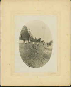
Photograph - Construction of the electric tram line in Riversdale Road, Camberwell
One of a series of photographs, taken by Edgar James Dower in the second decade of the twentieth century. Born and raised in Olinda, his family later moved to Surrey Hills. He worked as an adult as a clerk in the city office of the Metropolitan Gas Company, and in his role as a 'collector', he was able to photograph scenes including the construction of tramlines, railways and associated buildings in Kew, Hawthorn, Camberwell and Surrey Hills. Later he established a real estate agency with his brother - the E.J. Dower Real Estate Agency, Dandenong Office.The image is an historically significant record of the development of transport infrastructure which was used to connect Victorians in the first two decades of the twentieth century. This development resulted from increases in population and the consequent extension of Melbourne's suburbs. The photographs, both individually and collectively, richly detail the labour of workers and the tools and machinery used to create and extend Melbourne's public transport network in the years preceding and during World War 1.Digital copy of an original mounted photograph showing workers excavating Riversdale Road, Camberwell, in preparation for the laying of the new electric tramline.Verso: "Riversdale Road between Wattle Valley and Highfield Roads"theme -- connecting victorians by transport and communications, riversdale road - camberwell (vic.), theme -- travelling by tram -
Surrey Hills Historical Society Collection
Archive - Vertical file, Armitstead family
The Armitstead family's first woodyard in Surrey Hills was located in Croydon Road but later they moved to 153-157 Union Road, Surrey Hills. The business delivered timber and briquettes for heating to homes in the local area but also blocks of ice in the days before refrigerators were a usual household appliance. The timber was unloaded from railway trucks at a siding at Surrey Hills station; some came from the Armitstead's property of 130 acres of timbered land near Killara. They also sold mallee roots and briquettes.A vertical file containing the following documents: 1. Land Victoria map of Surrey Hills including Union Road from Bedford Street to Montrose Street, showing location of woodyard (undated) (1 A3 page). 2. Possibly ‘Sun’ article ‘When Surrey Hills ran short of wood’, Michael Sefton (undated) (1 page). 3. Plaque for the red mechanism of the weighbridge at Centre, by convenor, Surrey Hills Heritage Group, 12.11.2002 (1 page). 4. Pooley and Sons weighbridge, notes by Dennis Armstrong, in email to Sue Barnett, 4.4.2013 (2 pages). 5. Laminated diagram and notes by Ken Hall re weighbridge from Armitstead’s woodyard, and photocopy, undated (3 pages). 6. ‘Armitstead’s woodyard’ 153-7 Union Road (now Neighbourhood Centre), typed Progress Leader article, 13.1.1982 (2 pages). pooley and sons weighbridge, armitstead family, woodyard, armitstead's woodyard, union road