Showing 192 items
matching pleasant hill
-
 Eltham District Historical Society Inc
Photograph, Murchison Gap viewed from Strath Creek, Autumn Excursion, Hume and Hovell's 1824 expedition, 26 May 1996, 26/05/1996
[article by Bettina Woodburn in EDHS Newsletter No. 109, July 1996:] ON THE TRAIL OF HUME AND HOVELL - REPORT ON THE AUTUMN EXCURSION - On a green and fresh morning (Sunday 26th May 1996) the Cobb and Co coach (driven by the most obliging Peter Tampion) set off in a north easterly direction from Eltham to connect with Hume and Hovell's route on their 1824 explorations of central Victoria. The Society would follow a series of monuments erected for the 1924 centenary of the expedition from King Parrot Creek (Tuesday 7th December 1824), through Strath Creek, over Sunday Creek (Sunday 12th December 1824) at Broadford, Tullamarine, St Albans, Deer Park, through Werribee, skirting east of the You Yangs to Lara and Avalon Beach. Because their distance-measuring wheel had broken and a one degree mistake was made in calculations, the two leaders of the original group of six convict-companions arrived at Corio Bay, instead of the expected Western Port, discovered earlier by Flinders. From below Mt. Disappointment (Hume and Hovell's difficulties in "scrambling over brush and rock", "leeches in forest, as well as no water", "cutting grass 4-5 ft. high", dreadful scrub", "devil flies") we took an easier route, saw the Strath Creek memorial in ground fog and a wonderful "field of dreams", the Hume-Hovell privately owned cricket ground with its white picket boundary fence. Now, after a steep climb, in sunshine under gums we stretched and viewed magnificent rolling hills and fog-filled valleys - not "smoke from Aborigines' bush fires". After morning tea at Broadford we followed the Sunday Creek valley beside the Hume Freeway, passed the Wallan Wallan Rest Area (more appropriately Hume and Hovell Rest Area) to tum right at Beveridge. In Gellibrand Hill Park, near the headwaters of the Moonee Ponds Creek, we experienced the landscape the first European settlers saw - huge river red gums and rolling pastures. The gardens and sheltered courtyard of the 1840s, timber, brought from .....[?] prefabricated Woodlands Homestead, provided a pleasant lunch stop. We enjoyed a private tour, panoramic views over Melbourne and surroundings and the excitement of arriving and departing aircraft. Our next river crossing was at Werribee, "in a vast treeless plain", then we drove on by-ways no coach had previously travelled, to find "an immense sheet of water" salty Corio Bay, off-course to the west. In late afternoon of a super, calm, late autumn day we headed homewards. Back at Eltham we were rather surprised to find that we had travelled a total of 347 km. Thanks again to Russell Yeoman for his research and organization. What a wonderful day! Colour photographactivities, hume and hovell, murchison valley, murchison gap, strath creek -
 Eltham District Historical Society Inc
Photograph, Autumn Excursion, Hume and Hovell's 1824 expedition, 26 May 1996, 26/05/1996
[article by Bettina Woodburn in EDHS Newsletter No. 109, July 1996:] ON THE TRAIL OF HUME AND HOVELL - REPORT ON THE AUTUMN EXCURSION - On a green and fresh morning (Sunday 26th May 1996) the Cobb and Co coach (driven by the most obliging Peter Tampion) set off in a north easterly direction from Eltham to connect with Hume and Hovell's route on their 1824 explorations of central Victoria. The Society would follow a series of monuments erected for the 1924 centenary of the expedition from King Parrot Creek (Tuesday 7th December 1824), through Strath Creek, over Sunday Creek (Sunday 12th December 1824) at Broadford, Tullamarine, St Albans, Deer Park, through Werribee, skirting east of the You Yangs to Lara and Avalon Beach. Because their distance-measuring wheel had broken and a one degree mistake was made in calculations, the two leaders of the original group of six convict-companions arrived at Corio Bay, instead of the expected Western Port, discovered earlier by Flinders. From below Mt. Disappointment (Hume and Hovell's difficulties in "scrambling over brush and rock", "leeches in forest, as well as no water", "cutting grass 4-5 ft. high", dreadful scrub", "devil flies") we took an easier route, saw the Strath Creek memorial in ground fog and a wonderful "field of dreams", the Hume-Hovell privately owned cricket ground with its white picket boundary fence. Now, after a steep climb, in sunshine under gums we stretched and viewed magnificent rolling hills and fog-filled valleys - not "smoke from Aborigines' bush fires". After morning tea at Broadford we followed the Sunday Creek valley beside the Hume Freeway, passed the Wallan Wallan Rest Area (more appropriately Hume and Hovell Rest Area) to tum right at Beveridge. In Gellibrand Hill Park, near the headwaters of the Moonee Ponds Creek, we experienced the landscape the first European settlers saw - huge river red gums and rolling pastures. The gardens and sheltered courtyard of the 1840s, timber, brought from .....[?] prefabricated Woodlands Homestead, provided a pleasant lunch stop. We enjoyed a private tour, panoramic views over Melbourne and surroundings and the excitement of arriving and departing aircraft. Our next river crossing was at Werribee, "in a vast treeless plain", then we drove on by-ways no coach had previously travelled, to find "an immense sheet of water" salty Corio Bay, off-course to the west. In late afternoon of a super, calm, late autumn day we headed homewards. Back at Eltham we were rather surprised to find that we had travelled a total of 347 km. Thanks again to Russell Yeoman for his research and organization. What a wonderful day! Colour photographactivities, hume and hovell -
 Eltham District Historical Society Inc
Photograph, Sign to Hume and Hovell Cricket Ground, at Allandale Road, Strath Creek, Autumn Excursion, Hume and Hovell's 1824 expedition, 26 May 1996, 26/05/1996
[article by Bettina Woodburn in EDHS Newsletter No. 109, July 1996:] ON THE TRAIL OF HUME AND HOVELL - REPORT ON THE AUTUMN EXCURSION - On a green and fresh morning (Sunday 26th May 1996) the Cobb and Co coach (driven by the most obliging Peter Tampion) set off in a north easterly direction from Eltham to connect with Hume and Hovell's route on their 1824 explorations of central Victoria. The Society would follow a series of monuments erected for the 1924 centenary of the expedition from King Parrot Creek (Tuesday 7th December 1824), through Strath Creek, over Sunday Creek (Sunday 12th December 1824) at Broadford, Tullamarine, St Albans, Deer Park, through Werribee, skirting east of the You Yangs to Lara and Avalon Beach. Because their distance-measuring wheel had broken and a one degree mistake was made in calculations, the two leaders of the original group of six convict-companions arrived at Corio Bay, instead of the expected Western Port, discovered earlier by Flinders. From below Mt. Disappointment (Hume and Hovell's difficulties in "scrambling over brush and rock", "leeches in forest, as well as no water", "cutting grass 4-5 ft. high", dreadful scrub", "devil flies") we took an easier route, saw the Strath Creek memorial in ground fog and a wonderful "field of dreams", the Hume-Hovell privately owned cricket ground with its white picket boundary fence. Now, after a steep climb, in sunshine under gums we stretched and viewed magnificent rolling hills and fog-filled valleys - not "smoke from Aborigines' bush fires". After morning tea at Broadford we followed the Sunday Creek valley beside the Hume Freeway, passed the Wallan Wallan Rest Area (more appropriately Hume and Hovell Rest Area) to tum right at Beveridge. In Gellibrand Hill Park, near the headwaters of the Moonee Ponds Creek, we experienced the landscape the first European settlers saw - huge river red gums and rolling pastures. The gardens and sheltered courtyard of the 1840s, timber, brought from .....[?] prefabricated Woodlands Homestead, provided a pleasant lunch stop. We enjoyed a private tour, panoramic views over Melbourne and surroundings and the excitement of arriving and departing aircraft. Our next river crossing was at Werribee, "in a vast treeless plain", then we drove on by-ways no coach had previously travelled, to find "an immense sheet of water" salty Corio Bay, off-course to the west. In late afternoon of a super, calm, late autumn day we headed homewards. Back at Eltham we were rather surprised to find that we had travelled a total of 347 km. Thanks again to Russell Yeoman for his research and organization. What a wonderful day! Colour photographactivities, hume and hovell, allandale road, strath creek -
 Eltham District Historical Society Inc
Photograph, Autumn Excursion, Hume and Hovell's 1824 expedition, 26 May 1996, 26/05/1996
[article by Bettina Woodburn in EDHS Newsletter No. 109, July 1996:] ON THE TRAIL OF HUME AND HOVELL - REPORT ON THE AUTUMN EXCURSION - On a green and fresh morning (Sunday 26th May 1996) the Cobb and Co coach (driven by the most obliging Peter Tampion) set off in a north easterly direction from Eltham to connect with Hume and Hovell's route on their 1824 explorations of central Victoria. The Society would follow a series of monuments erected for the 1924 centenary of the expedition from King Parrot Creek (Tuesday 7th December 1824), through Strath Creek, over Sunday Creek (Sunday 12th December 1824) at Broadford, Tullamarine, St Albans, Deer Park, through Werribee, skirting east of the You Yangs to Lara and Avalon Beach. Because their distance-measuring wheel had broken and a one degree mistake was made in calculations, the two leaders of the original group of six convict-companions arrived at Corio Bay, instead of the expected Western Port, discovered earlier by Flinders. From below Mt. Disappointment (Hume and Hovell's difficulties in "scrambling over brush and rock", "leeches in forest, as well as no water", "cutting grass 4-5 ft. high", dreadful scrub", "devil flies") we took an easier route, saw the Strath Creek memorial in ground fog and a wonderful "field of dreams", the Hume-Hovell privately owned cricket ground with its white picket boundary fence. Now, after a steep climb, in sunshine under gums we stretched and viewed magnificent rolling hills and fog-filled valleys - not "smoke from Aborigines' bush fires". After morning tea at Broadford we followed the Sunday Creek valley beside the Hume Freeway, passed the Wallan Wallan Rest Area (more appropriately Hume and Hovell Rest Area) to tum right at Beveridge. In Gellibrand Hill Park, near the headwaters of the Moonee Ponds Creek, we experienced the landscape the first European settlers saw - huge river red gums and rolling pastures. The gardens and sheltered courtyard of the 1840s, timber, brought from .....[?] prefabricated Woodlands Homestead, provided a pleasant lunch stop. We enjoyed a private tour, panoramic views over Melbourne and surroundings and the excitement of arriving and departing aircraft. Our next river crossing was at Werribee, "in a vast treeless plain", then we drove on by-ways no coach had previously travelled, to find "an immense sheet of water" salty Corio Bay, off-course to the west. In late afternoon of a super, calm, late autumn day we headed homewards. Back at Eltham we were rather surprised to find that we had travelled a total of 347 km. Thanks again to Russell Yeoman for his research and organization. What a wonderful day! Colour photographactivities, hume and hovell -
 Eltham District Historical Society Inc
Photograph, Autumn Excursion, Hume and Hovell's 1824 expedition, 26 May 1996, 26/05/1996
[article by Bettina Woodburn in EDHS Newsletter No. 109, July 1996:] ON THE TRAIL OF HUME AND HOVELL - REPORT ON THE AUTUMN EXCURSION - On a green and fresh morning (Sunday 26th May 1996) the Cobb and Co coach (driven by the most obliging Peter Tampion) set off in a north easterly direction from Eltham to connect with Hume and Hovell's route on their 1824 explorations of central Victoria. The Society would follow a series of monuments erected for the 1924 centenary of the expedition from King Parrot Creek (Tuesday 7th December 1824), through Strath Creek, over Sunday Creek (Sunday 12th December 1824) at Broadford, Tullamarine, St Albans, Deer Park, through Werribee, skirting east of the You Yangs to Lara and Avalon Beach. Because their distance-measuring wheel had broken and a one degree mistake was made in calculations, the two leaders of the original group of six convict-companions arrived at Corio Bay, instead of the expected Western Port, discovered earlier by Flinders. From below Mt. Disappointment (Hume and Hovell's difficulties in "scrambling over brush and rock", "leeches in forest, as well as no water", "cutting grass 4-5 ft. high", dreadful scrub", "devil flies") we took an easier route, saw the Strath Creek memorial in ground fog and a wonderful "field of dreams", the Hume-Hovell privately owned cricket ground with its white picket boundary fence. Now, after a steep climb, in sunshine under gums we stretched and viewed magnificent rolling hills and fog-filled valleys - not "smoke from Aborigines' bush fires". After morning tea at Broadford we followed the Sunday Creek valley beside the Hume Freeway, passed the Wallan Wallan Rest Area (more appropriately Hume and Hovell Rest Area) to tum right at Beveridge. In Gellibrand Hill Park, near the headwaters of the Moonee Ponds Creek, we experienced the landscape the first European settlers saw - huge river red gums and rolling pastures. The gardens and sheltered courtyard of the 1840s, timber, brought from .....[?] prefabricated Woodlands Homestead, provided a pleasant lunch stop. We enjoyed a private tour, panoramic views over Melbourne and surroundings and the excitement of arriving and departing aircraft. Our next river crossing was at Werribee, "in a vast treeless plain", then we drove on by-ways no coach had previously travelled, to find "an immense sheet of water" salty Corio Bay, off-course to the west. In late afternoon of a super, calm, late autumn day we headed homewards. Back at Eltham we were rather surprised to find that we had travelled a total of 347 km. Thanks again to Russell Yeoman for his research and organization. What a wonderful day! Colour photographactivities, hume and hovell -
 Federation University Historical Collection
Document - Documents, Golden Point - Mount Pleasant Progress Association Establishment
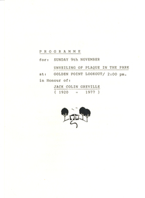
The Golden Point - Mt Pleasant Progress Association was established on Wednesday 6 April 1983. Membership was open to any person or organisation in the area generally bounded by Bridge mall and Skipton Street, Elsworth Street and main Road. annual family or organisation membership was $2.00. Mara Gluyas served as secretary of the Golden Point - Mt Pleasant Progress Association from 1983 to 1994. Ian McKinnon was the President from 1983 to 1992. Kerry Daniels was the President in 1994.A small white cardboard box with purple lid of A4 documents relating to the establishment of the Golden Point - Mt Pleasant Progress Association. The documents include the original constitution and minutes. Topics include: Pearce's Park; removal of elms, names and addresses of members, Sovereign Hill realignment; Sovereign Hill Lookout; membership form; Golden Point Historic Mines Direction Indicator; Ballarat Observatory; Nerrina Tip; Yarrowee Creek; Mine Capping (Sovereign Mine); tree planting (Sovereign Hill Lookout); Magpie Street Park; Hill Street; Yarrowee Flora Park; Barkly Street; South Street Bluestone Gutter; Ballarat Goldfields; Eastern baths site; Grant Street; Flooding; Aboriginal Advancement League; Sunnyside Woollen Mill; Chinese Garden; Golden Point Primary School closure; Ballarat West Goldfields; Sovereign Hill Land Title and Management Revision; Wainwright; Street; Llanberris; Yuille's Station Parkgolden point, mount pleasant, mt pleasant, ian mckinnno, mara gluyas, peter hiscock, frank williams, geoff howard, leigh gillett, sovereign hill, kerry daniels, norm strange; graeme kent; george netherway; keith rash; ian mckinnon, albert graham, bryan crebbin, jim humphreys. wid radbourn, heath martin, janet dore, alex mills park -
 Federation University Historical Collection
Booklets, Ballarat Historical Society, Spievogel Papers, volumes 1,2, & 3
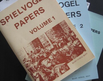
Nathan Spielvogel was a local historian. The Spielvogel Papers consist of the articles he prepared for a series of weekly talks on Radio 3BA in 1936 and 1937. According to Alex Barnett there is a reference in the Spielvogel Papers to the moving of the bodies of diggers killed at the Eureka Stockade to the old cemetery on 26 November 1857.3 soft covered books with text relating to the history of Ballarat. .1) yellow cover .2) blue cover .3) green cover .1) includes topics such as Gold discovery, Eureka, Main Road, Ballarat Fire Brigade, Ballarat Benevolent Home, Buninyong, Burke and Wills Monument, Chinese in Ballarat, Dana Street School, Ballarat Hospital, Lost Trades of Ballarat, Ballarat Military, Mount Pleasant, Old Colonists' Club, Phoenix Foundry, Ballarat Post Office, Railways, Ballarat School of Mines, South Street Society, Martin Hosking, Charles Curnow Phillips, James Sainsbury, and William Cross Yuille. .2) includes topics such as Ballarat streets, bowls, cricket, football, hotels, Little Bendigo, Lake Wendouree, Ballarat Quartz Mines, Sebastopol, Ballarat Turf Club, Ballarat Zoo, water supply. .3) includes topics such as the Kohinoor Nugget, Eureka, Black Hill, Sebastopol, oddietown, Joe the bellman, Trades Hall, Lal Lal Iron, Ballarat Library, Yuille Creek, Martin Hosking, Stonewall Jackson, steeplechase, Lemonade Paddock, Ivey's Flour Mill, Salvation Army, Stick Jaw Davey, Unicorn Hotel, doctors, Alfred Bells, Ballarat School of Mines Museum (War Museum), Joseph Orange, Ballarat East Post Office.ballarat, speilvogel, nathan spielvogel -
 Federation University Historical Collection
Map, Municipality of Ballarat East, 1857
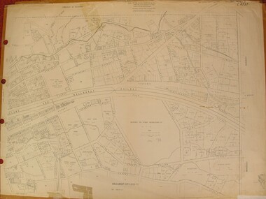
Gold was discovered in Ballarat in 1851. This plan was created six years later and names some of the great gold locations of Ballarat East. It also shows the locality of the Eureka Stockade (1854) and the walking tracks and roads on the Ballarat East Goldfield.In 2007 this map was listed on the inaugural Ballarat Treasure's Register.Large map backed onto linen. The map has read and blue highlights, and identifies areas such as Mount Pleasant, Golden Point, White Flat, Nightingale, Malekoff, Old Post Office Hill, Red streak, Gumtree Flat, Old Gravelpits, Bakery Hill, Ballaarat Flat, The Camp, Specimen Gully, Pennyweight Hill, Warrenheip Gully, Gays Gully, Pennyweight Flat, Eureka, Black Hill, Pinchgut, Crocodile, Hit or Miss, Little Bendigo, Brown Hill, Mopoke, Cricket Reserve, Canadian Hotel, Ballarat Eastmount pleasant, golden point, white flat, nightingale, malekoff, old post office hill, red streak, gumtree flat, old gravelpits, bakery hill, ballaarat flat, the camp, specimen gully, pennyweight hill, warrenheip gully, gays gully, pennyweight flat, eureka, black hill, pinchgut, crocodile, hit or miss, little bendigo, brown hill, mopoke, cricket reserve, canadian hotel, ballarat eastm phillips, john phillips, field draughtsman, ballarat east, ballarat east map -
 Federation University Historical Collection
Letter - Document, Correspondence to the Ballarat School of Mines, 1899-1901
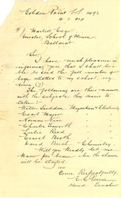
The Ballarat School of Mines held specialist classes for State School Students, including Chemistry and Electricity & Magnetism. Thirty three letters to the Ballarat School of Mines between 1899 and 1904. Some of the correspondence relates to Electricity, Chemistry, Physics and Mineralogy classes for State School students run by the Ballarat School of Mines. The Schools involved were Urquhart Street, Brown Hill, Queen Street, Dana Street, Eureka Street, Mount Pleasant, Sebastopol, Little Bendigo, Mount Clear, Golden Point, Humffray Street, Macarthur Street, Pleasant Street, and Wendouree. .2) Handwritten on lined foolscap paper: 'Golden Point S.S. 1493 10.8.04 F.J. Martell Esq Director, School of Mines, Ballarat Sir, I have much pleasure in informing you that I shall be able to send the full number of boys allotted to my school, viz., seven (7). The following are their names with the subject they desire to take: Walter Sneddon Magnetism & Electricity Cecil Major Magnetism & Electricity Norman Nice Magnetism & Electricity Charles Tinsworth Magnetism & Electricity Leslie Reed Magnetism & Electricity Ernest Booth Magnetism & Electricity David Both Magnetism & Electricity David Birch Chemistry Will you kindly let me know per bearer when the classes will be started. I am Yours respectfully, E.C. Perrin, Head Teacher.' ********* .8) Handwritten on lined paper 'State School 1071 Eureka St, Ballarat East 13/8/04 Sir, In reply to your letter of 8th Inst. I wish to infrom tou that seven boys from teh above school will attend the science classes at teh School of Mines and all of them desire to rak Chemsitry and mineralogy. Yours respectfully R.J. Burke Fred. J Martell Esq.' ********* .22) Eureka St S.S. Ballarat East 23 Aug 1904 Dear Sir, In reply to your last letter I wish to state that Friday afternoon will suit my school the better (for boys attending science lectures) Yours faithfully R.J. Burke F.J. Martell.' ********* .26) Handwritten on lined foolscap paper 'State School 1493 Golden Point 1.9.04 F.J. Martell Esqr. Director School of Mines Sir, The following are the names and classes of the boys from the above school: Charles Tinworth Electricity Ernest Book Electricity Neil Petch Electricity Cecil Major Mineralogy Norman Nice Physics Walter Sneddon Physics David Baird Chemistry Yours faithfully E.C. Perrin, Head Teacher education, school, state school, golden point state school, golden point primary school, eureka street state school, eureka street primary school, perrin, frederick martell, dana street primary school, sebastopol primary school, pleasant street state school, sebastopol state school, mount pleasant state school, mt pleasant state school, mount pleasant, sebsatopol, golden point, charles tinworth, chemistry, electricity, physics, mineralogy, cecil major, norman nice, david baird, walter sneddon, e.c. perrin, leslie reed, ernest booth, david birch, david booth, dana street state school -
 Federation University Historical Collection
Plan, Ballarat East, 1957, 1957
Dr George Clendinning and others were trustees of the Church of England (St Paul's) A number of enlargements of the Ballarat East maps. .4) Bakery Hill, Humffray Street, Victoria Street, Ballarat Youth Council .5) Specimen Vale, Victoria Street, Eureka Street, Housing Commission .10) - Tomber Reserve, York Street, Spencer Street, Bennett Street, Wilson Street, Rodier Street, Richard Street, Fussell Street, Turpie Street, Stockade Street, Ballarat Rifle Range Lal La Street, Clayton Street, Eureka Street Sheet 2 - Yarrowee Creek, High Street, Dinney's Dam, Binney Street, Oliver Street, Humffray Street, Morres Street, Finch Street, Scotts Parade, Rice Street, HOrnby Street, Queen Street, Newman street, King Street, Napier Street, Sim Street. Sheet 3 - Russell Square, Victoria Street, Orphan Asylum, Ballarat Orphanage, Lofven Street, Haines Street, Yarrowee Creek, Ching Who Coey, Chinese, Stawell Street, Rice Street, Lane Street, Humffray Street, Nelson Street, Coffield Street, Morres Street, Western Highway, Rodier Street, Scott Parade, Canterbury Street Sheet 4 - Orphan Asylum, Ballarat Orphanage School, Fortune Street, Scotts Parade, Water Street, Ritchie Street, Humffray Street, Brophy Street, Thompson Street, Victoria Street,Humffray Street Church of England Reserve, Strickland Parade. Mount Xavier Recreation Reserve, Charlesworth Street Catholic Church Reserve. Sheet 5 - Western Highway, Mount Street, Fortune Street, Finlay Street, Jones Street, Ryan Street, Water Street, Brandbury Street, Humffray Street. Sheet 6 - Barkly Street, Ebden Street, Grenville Street, Cameron Street, Peel Street, Young Street, Victoria Street, Steinfeld Street, Haymes Street, Bond Street, Anderson Street, Eastwood Street, Mair Street, East Street, Haymes Crescent Sheet 7 - Murphy Street, Queen Street, Dyte Parade, Princes Street, Midland Highway, York Street, Dodds St, Wilson St Otway Street, Specimen vale, King Street, Gray Street, Little Dodds Street, Eureka Street. Sheet 9 - Richards Street, Fussell Street, Stockade Street, Orphan Asylum, Ballarat Orphanage, Elford Street, Russell Street, Ross Street, Charlesworth Street, Lalor Street, Stockade Street, Wilson Street, York Street, Eureka Street Sheet 10 - Eureka Street, York Street, Elford Street, Wilson Street, Mount Street, Turpie Street, Timber Reserve, Mount Xavier Sheet 11 - Yarrowee Creek, Humffray Street, Barkly Street, Morton Street, Cobden Street, Morton Street Wesleyan Church, Pryor Street, Albion Street, Bradshaw Street, Ballarat Woollen Mills, Tannery, Mount Pleasant. Sheet 12 - Magpie Street, Grant Street, Gladstone Street, Cobden Street, Fraser Street, Grenfell Street, Robertson Street, Bond Street, Barkly Street, Vine Street, Sovereign Hill, Ballarat Observatory, Pearce Street, Bond Street. Sheet 13 - Murphy Street, Larter Street, midland Highway, Geelong Road, gales Street, Lal Lal Street, Clayton Street, Dodds Street, Elsworth Street Sheet 14 - Eureka Street, Eureka Stockade Memorial Park, Eureka Stockade Reserve. York Street, Joseph Street, Kline Street, Charlesworth Street, Chamberlain Street, Trevor Street, Belford Street, Queen Street, Murray Street, Eureka Tiles, Orphan Asylum, Ballarat Orphanage. Sheet 18 - Scotts Parade, Stawell Street, Fortune Street, Victoria STreet, Railway Line, Haines Street, Eureka Street, Elford STreet, Brophy Street, York Street, Clayton Street, Elsworth Street, Barkly Street, Humffray Street, Midland Highway, Princes Street ballarat youth council, ballarat east, bakery hill, humffray street, victoria street, st paul's anglican church, humffray street state school -
 Federation University Historical Collection
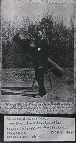
Photograph, William H. Wooster at the Ballarat Observatory, Mount Pleasant
An image of W.H. Wooster with telescope, and a page copy of his handwritten notes outlining his achievements.7707.2 "Notes Grandpa has lectured scores of times in the Sch. of Mines, sometimes for one of the Professors who was ill. Also Lectured in the City Fire Brigade, Ballarat E Fire Brigade, Barkley St Wesn chap., Lydiard St. Wes. Chapl, St Peter's Church of England, Mt Pleasant Wes. Chapl., Baptist Church; & many other places. Preached i the Neil St. Wes. Chapels at Brown Hill, the Gong, Ltl Bendigo, Golden Point, Macarthur St., Mnt Pleasant, the Bible Christian Chppl., and many others. Too photos of most of the places shown in these "Ballarat Views", and many others. And laid the Foundation of the fine Municipal Observatory, in a long series of "Astronomical" and other "Scientific Notes", published in the Ballarat Courier and Ballarat Star, & occasionally in another Newspaper, which roused much public interest in Astronomy. The present official astronomer, Mr John Brittain, is my pupil in Astronomy and Microscopy, and calls me his Father in Science. W.H. Wooster."w.h. wooster, ballarat observatory, microscope, microscopy, churched, preaching, lay preacher, ballarat school of mines, ballarat field naturalists club, observatory, telescope -
 Federation University Historical Collection
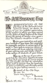
Photograph - Black and white printed card, Ballarat Old Boys' Association presentation to Albert W.Steane, 1942, 1942
Albert Steane was born at Sandhurst (now known as Bendigo) in 1877. He attended the Gravel Hill State School until the fourth class, then transferred to the Central School 1876 where he gained the Merit Certificate. The monitor system of teacher training had been introduced and he passed fourth, third, second and first class pupil teacher. At about 16 years of age he was appointed a teacher monitor at 12 pounds per annum. Albert Steane was awarded the Teachers' Certificate of Competency in 1897. The teaching of woodwork in Victoria began in 1901 and Steane was chosen, among 18 others for the inaugural training course at Queensberry State School in Melbourne. Steane was known for the teaching of Sloyd or woodwork, which was an important point in his career. He opened the Sloyd (woodwork) Centre in 1902 at the Ballarat East Art School (later known as the Ballarat East Free Library) at the School of Mines and Industries Ballarat (SMB). In 1913 Albert Steane, the young head of the East Ballarat Sloyd Centre, was appointed to establish a junior technical school in Ballarat becoming the first headmaster of the Ballarat Junior Technical School. Steane's lifelong interest in gymnastics brought him as much fame as his reputation as a headmaster. He organised the Education Department's gymnastics display at Bendigo's Golden Jubilee Exhibition in 1902. He played a major role in the establishment of the Ballarat Y.M.C.A. and from 1906 responsible for evening classes in physical culture. In 1968, aged 91, he was made a Life Member of the Association. Steane was in complete command of his school, his staff and students. It must be remembered that schooling was not as permissive, tolerant and informal as today. A.W. Steane retired in 1942 after 29 years as Headmaster of Ballarat Junior Technical School. Many visible memorials are evident of his time and influence on the growth of the Junior Tech. A good school also lives on in the memories and affections of its old boys. Many remained in touch to talk about "the old days". A simple lesson he taught was "Win Through". No matter what path was chosen by the students, many were true to his teaching. On his retirement, Mr Jeffery was appointed the new Headmaster. On 19 March 1942, a farewell meeting was held presided over by Mr Jeffery. Those present included A.F. Heseltine, G. Netherway (representing the Old Boys' Association), N. McHuthchinson (District Schools' Inspector), G.A. Simcock (High School), E. Youlden (Pleasant Street State School), and J.A. Ewins (Citizens' Representative). The following presentations were made: G Netherway - nickel-plated smokers' stand with the Old Boys' badge A. Robinson - an illuminated scroll (B&W photograph above) C. Jeffery - lounge room clock with inscribed silver plate Steane died, aged 93 years, on 13 July 1970, at Sydney, leaving his widow Grace Elliott Steane and children Eric and Violet. Black and white image of an illumination for the retirement of Albert W. Steane. Written in calligraphy and signed by the President and Secretary of the Old Boys' Association. Dated March 19th 1942 .1) Framed colour illumination with ribbons in School coloursSignatures of H. Daykin, President and Alan Robinson, Secretary of the Ballarat Junior Technical School Old Boys' Association. Dated March 19th 1942.albert steane, sandhurst, bendigo, gravel hill state school, teacher monitor system, teaching certificate, sloyd, ballarat sloyd centre, gymnastics, y.m.c.a., ballarat junior technical school, n. mchutchison, a heseltine, george netherway, c jeffery, old boys' association, illuminated scroll, h. daykin -
 Flagstaff Hill Maritime Museum and Village
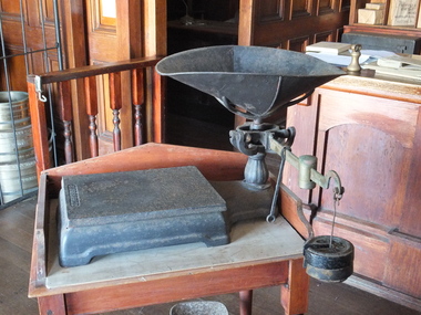
Functional object - Platform Scales, Thaddeus Fairbanks, 1880-1910
Thaddeus Fairbanks (1796 –1886) was an American inventor. of heating and cook stoves, cast iron ploughs, and other items. His greatest success was the invention and manufacture of the platform scale, which allowed the weighing of large objects accurately. Fairbanks was born in Brimfield, Massachusetts, on January 17, 1796, the son of Joseph Fairbanks (1763–1846) and Phebe (Paddock) Fairbanks (1760–1853). His uncle was Ephraim Paddock, the brother of Phebe Paddock. In 1815 he moved to St. Johnsbury, Vermont, and set up a wheelwright's shop above his father's gristmill. In 1820 he married Lucy Peck Barker and In 1824 he built an iron foundry. his brother Erastus joined him to establish E. and T. Fairbanks, a partnership to manufacture heating stoves, cast iron ploughs a design for which he patented in 1826. In 1830 Fairbanks and Erastus became interested in the raising and processing of hemp. Fairbanks went on to patent a hemp and flax dressing machine and became the manager of the St. Johnsbury Hemp Company. He also built a set of scales that would measure large loads of hemp accurately, as there were no reliable scales at the time. Upon the success of building these scales, his brothers recommended that he make and sell these for general use. Fairbanks' most famous invention then became the platform scale for weighing heavy objects. These are commonly known as the Fairbanks Scales, for which he patented his original design in 1830. Before this time, accurate weighing of objects required hanging them from a balancing beam as a result, particularly heavy or ungainly objects could not be weighed accurately. A platform scale, if large enough, could weigh an entire wagon. By placing a full wagon on the scale, unloading it, and then placing it on the scale when empty, it became possible to easily and accurately calculate the weight and value of farm produce and other loads. In 1834 Fairbanks and his brother formed "E. and T. Fairbanks and Company" to manufacture and sell these platform scales. These scales were well known in the United States and around the world resulting in the company doubling in volume every three years from 1842 to 1857. There was a temporary slow down during the American Civil War, however, the business took off again after the war. Their partnership was incorporated in 1874 into a firm known as "Fairbanks Scale Company". These platform scales revolutionized weighing methods of large loads and have been in use ever since. Portable platform scales are found in almost every hardware store, physician's office, and manufacturing factory throughout the United States and the world. The first railway track platform scale patent was granted to Fairbanks on January 13, 1857, as Patent No. 16,381. In 1916 the company was purchased by ”Fairbanks, Morse and Company”. Ownership of the company has since changed several times, but Fairbanks Scales continue to be made in St. Johnsbury Vermont to this day. Fairbanks had received 43 patents in his lifetime with the last one at the age of 91. He died on April 12, 1886, and is buried at St. Johnsbury, Vermont, at the Mount Pleasant Cemetery. An early example circa 1900 of the first type of platform scales used in a grocery store. This design for accurately measuring goods that were sold over the counter revolutionised the weighing of goods throughout the world. Platform scale metal black with removable tray & pan. Has horizontal brass arm with a brass slide weight black removable weight hook and 2 x 2 lb. weights. Fairbanksflagstaff hill, warrnambool, shipwrecked-coast, flagstaff-hill, flagstaff-hill-maritime-museum, maritime-museum, shipwreck-coast, flagstaff-hill-maritime-village -
 Yarra Glen & District Historical Society
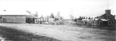
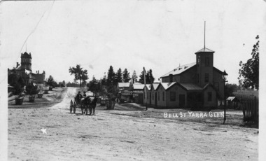
Black and white photographs, Bell Street Yarra Glen looking north c.1900
View of Bell Street Yarra Glen looking north from junction with King Street. On left hand side is Scott & Allen's General Store, next to that is a bootmaker, then the house of Charles Bath, the Grand Hotel and the Colonial Bank building. On the eastern side of Bell Street (right hand side of photograph) is the Victoria Hall. Beyond that is W.J.Dawborn's General Store, then Smith's bakery, and on top of the hill the trees surrounding 'Point Pleasant' owned by the Herbert family.yarra glen, point pleasant, grand hotel, victoria hall, bell street, charles bath, general store, colonial bank, bank building, w j dawborn, scott and allen, bootmaker, smith, bakery, baker s shop, herbert -
 Yarra Glen & District Historical Society
Black and white postcards, Bell St Yarra Glen c.1900
... that is the bakery. The pine trees at the top of the hill are at 'Point...-ranges yarra glen point pleasant victoria hall horse drawn ...Photograph taken from the junction of Bell and King Streets looking north up Bell Street early 20th century. On the eastern side of Bell Street (left hand side of photograph) is the Victoria Hall. Behind the hall is a newsagency and behind that is the bakery. The pine trees at the top of the hill are at 'Point Pleasant', home of the Herbert family. On the western side of Bell Street can be seen the Grand Hotel and the Colonial Bank. The street trees are in wooden tree guards. In the middle foreground are two men in a buggy drawn by two horses.On back of the postcard at the top "POST CARD". Under those words are "CORRESPONDENCE" on the left and "ADDRESS ONLY" on the right.yarra glen, point pleasant, victoria hall, horse drawn vehicle, bell street, bakery, herbert, newsagency, newsagent, bakers shop, horse buggy, buggy -
 Federation University Historical Collection
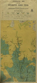
Map, Geological Map of The Stieglitz Gold Field, 1940
... hill mount pleasant gully township of steiglitz W.H. Ferguson ...At the bottom of the 2nd page, there is text that reads "Geologically and topographically surveyed in 1909 by W.H. Ferguson, Assistant Field Geologist. Published 1940."Rectangular geological map edged in masking tape showing Steiglitz, Victoria. Scale 48 chains to 4 inches.steiglitz, geology, geological map, north albion, moreep, mining, mine, caribald reef, durdidwarrah, gilbraltar hill, mount pleasant gully, township of steiglitz, w.h. ferguson, garibaldi reef, yankee gully, kinglock mine engine shaft, herbert werner frederick de nully, albion gully, virago reef, mulrooney's reef -
 Bendigo Historical Society Inc.
Document - BARNEDOWN RUN: SHORT PAPER JOHN HARNEY
The original Barnedown Run consisted of 51,280 acres and was first taken up in 1839 by Henry Grey Bennett and was held under "Pre-emptive right" until it was subdivided in 1856 into Muskerry and Mt. Pleasant. In 1853 John Harney arrived in Australia and took up storekeeping at White Hills. In 1855 he took up land which was originally part of Barnedown Run and erected part of the present homestead. In 1860 Harney entertained Bourke and Wills exploration party at Adelaide Vale on the Campaspe River. Mr Harney owned a Hotel which was burnt down in 1861. Henry Grey Bennett a generous man died in1871 and the citizens of Bendigo erected a 20ft monument over his grave.John Harneyperson, individual, john harney, barnedown run, john harney, henry grey bennett, pre-emptive rights, white hills, adelaide vale, bourke and wills, edward o'keefe, cecil hyatt, mr frank k. hill. -
 Bendigo Historical Society Inc.
Document - ARTICLES FOR RHSV BENDIGO BRANCH NEWSLETTER NOV. 1973
Articles for RHSV Bendigo Branch Newsletter Nov. 1973: 1. Bendigo Memories, 1860-80 (cont.) by G D Meudell , author of ''The Pleasant career of a spendthrift and his later reflections'. (Source 'Bendigo Advertiser' 1930); article by Mr R Buck - mention of wine growing in area; Henry Montague Marks (and father - auctioneer); Bank of Victoria; David Williamson; Dr Hugh Smith; E N Emmett; Malcolm Tolmie; Andrew Williamson; Jimmy Menzies; Lort Smith; A McD Cooper; William Davis; George Valentine; W B Reid; Bob Lewers,; Jack Tone; Dan Luxton. 2. ‘The burning of the Beehive'' (1871) - details of the fire, problems of loss of script and mention of Messrs Moore Bros; Messrs Buick & Co (drapers) using manuscript of the late Mrs Lucy Hill. 3. Article entitled '' Stiff Sentence'' re story of William Stanford (background to the Stanford Fountain, Melbourne) submitted by I Hendry; 4. Handwritten notes on ''The Diamond Hill Company (later Melbourne Hope) - two pages with the final page being located within Mosaic #6543 - mention, with mining details, of London Shaft; London Christmas Company; Melbourne Hope + typewritten article (full) published.document, names of bendigo pioneers, bendigo -
 Victorian Interpretive Projects Inc.
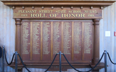
Photograph - Colour, Mount Pleasant State School Honour Board
Photograph of a timber honour boardworld war one, world war, mt pleasant state school, honour board, barnett, mcgregor, gribble, pollock, ross, jolly, sargeant, eggington, jerram, frank, hind, lingham, king, may, renfree, chandler, wight, zilles, matthews, slater, rowsell, hallett, peice, simpson, webb, coffet, tobert, buchanan, burrows, brazenor, cochrane, macdonald, ottaway, smith, o'bern, ware, treloar, saxton, wilson, stark, greenwood, orr, nankervis, burge, rooney, hoskin, bell, dunstan, craig, pattie, carroll, moon, bieske, page, richards, lockett, collett, frampton, williams, symonds, mcdonald, hicks, selmon, britton, martell, bolton, westcott, simper, cowdell, doepel, commons, hooley, gates, campbell, martin, neville, aikins, price, jeffree, rogers, murrie, fraser, cunningham, gedling, zazzard, malcolm, thomas, spears, hyland, pascoe, davis, peters, martnell, hill, reynolds, parkin, dobson, pope, stratford, scott, preston, adamson, lucas, bailey, jones, wrigley, morrell, gullan, provis, semmens, whittle, falla, gluyas, barrett, berryman, carincross, twaits, porter, heard, edwards, hand, robb, grant, bishop, dean, graham, mcallester -
 Bendigo Historical Society Inc.
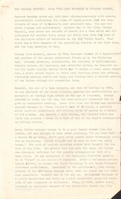
Document - THE MEUDELL MYSTERY
George Meudell was born in Bendigo in 1860, the son of a bank manager. He became a public accountant. He worked for B J Fink. He took up a seat on the Stock Exchange. He later wrote a book, 'The Pleasant Career of a Spendthrift'. The book caused a stir and was withdrawn from sale. There was a later edition where a lot of names were withdrawn from the book.document, names of bendigo pioneers, the meudell mystery, the land boomers, michael cannon, maurice brodzky, george meudell, table talk, bendigo high school, money miller's bank of victoria, grant meudell, hnry miller, isaac pitman, john alsop, melbourne savings bank, andrew lyell, mercantile finance co ltd, b j fink, g w taylor, thomas bent, w l baillieu, stock exchange melbourne, william knox, broken hill proprietary, f m dickenson, historical society of victoria, the pleasant career of a spendthrift, george routledge & sons ltd, routledge & kegan paul ltd, frank campbell, robertson & mullens ltd, j m gillespie, sir matthew davies's mercantile bank, unofficial history of victoria, booksellers' association, the pleasant career, theodore fink, the herald, wilke & co pty ltd, the pleasant career of a spendthrift and his later reflections, lionel robinson, william clark, s m bruce, premier building society, j kitchen & sons ltd -
 Stawell Historical Society Inc
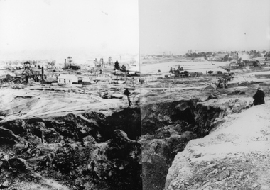
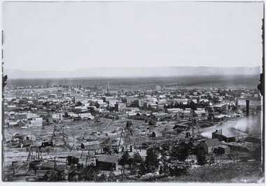
Photograph, View from Big Hill Looking North to Newington Road
Mining Scene. In foreground is Scotts Open Cut, on the left is the Great Northern mine, behind that is the Oriental Mine and the two shafts of the North Cross mines. On the upper right is the Magdala Mine. The mines on the horizon could be the Prince Alfred, Prince Patrick, Newington and Pleasant Creek or Little Newington Mine.B/W Scene Man sitting above open cut, looking at buildings and poppet headsstawell, gold mining -
 Stawell Historical Society Inc
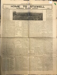
Archive - Newspaper Supplement, The Stawell Times News and Pleasant Creek Chronicle Home to Stawell Glourious Holiday ending 1935
Home to CelebrationsThe Stawell News Wednesday October 9 1935View of Stawell from Big Hilltourism -
 Stawell Historical Society Inc
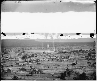
Photograph, View of Stawell from Big Hill April 1874 showing mines centered on St Georges Crushing Mill -- 5 Photos
From left Reefs Restaurant, T. Hogan & Co Tea Wine Spirits Merchant, R. Hepburn Carolina Hotel, Pleasant Creek Hotel, St George Stamping Battery, Free Methodist Chapel Church, Ballarat Hotel, Woodcock Produce Grocer, Stawell Brewery in far distance, L. Thomas Wheelwright Farrier & General Blacksmith, Australian Hotel, G. Laing Bootmaker, Brierly & Wilson Greengrocer, P. Corkeron Bootmaker, P. Corkeron Wholesale Retail General Grocer, Globe Hotel in distance, Christ Church.Part of Holtermann Collection. Black and White photograph of Stawell from Big Hill with mining in foreground. April 1874. View covers from St Patrick's Church to current location of Police Station along Patrick Street. St George Crushing Mill near Centre of Photograph. Includes Carolina Hotelmining, panorama -
 Stawell Historical Society Inc
Photograph, View of Stawell from Big Hill April 1874 showing mines centered on north end of Main Street -- 2 Photos
From left Shire Hall Pleasant Creek in distance, Mathers & Franklin, Stawell Coach Factory, Coffee Palace, Christ Church of England Church Hill, Mechanics Institute, Temperance Hotel, Matherson Cross Reef Hotel.Black and White Holtermann photograph of Stawell from Big Hill with mining in foreground. 1874 Site of fire in Main and Street Patrick Street 22 April 1874 visible in centre of photograph.mining, panorama, streetscape -
 Stawell Historical Society Inc
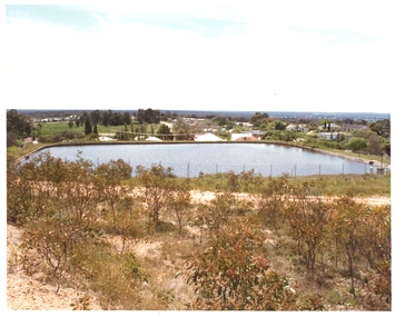
Photograph, Pleasant Creek Special School, Big Hill No1 Reservoir Stawell Water Supply, Nov 1975
Photographs taken by teacher at Pleasant Creek Training Centre to help train students in living skills. Part of socializing students for leaving the training centre.November 1975 Big Hilleducation, water supply -
 Stawell Historical Society Inc
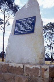
Slide, Ian McCann, Monuments Doctor's Hill
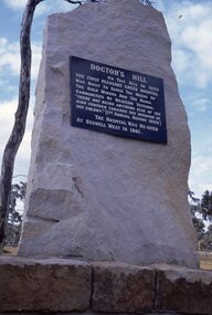
Monument to mark where the First hospital was built at Pleasent CreekDoctor's Hill On the hill in 1859 the First Pleasant Creek Hospital was built to serve the needs of the Gold Miners and the Rural Communitites of Western Victoria. There not being anything else of the kind further towards the interior oof the Colony. [1st Annual Report 1959] The Hospital was resited at Stawell West 1861.doctor's hill -
 Stawell Historical Society Inc
Slide, Ian McCann, Monuments Doctors Hill
Monument to mark where the first hospital was built at Pleasent CreekDoctor's Hill On this Hill in 1859 the First Pleasant Creek Hospitalwas built to serve the needs of the Gold Miners and the Rural Communities of Western Victoria. "There not being Anything Else of the kind further towars the interior of the Colony.' [1st Annual Report 1859]. The Hospital Was Re-sited to Stawell West in 1861doctors hill, monument -
 Whitehorse Historical Society Inc.
Document, Notes on Box Hill and Nunawading, c1972
Covers various interviews and extracts from sourcesCovers various interviews and extracts from sourcesCovers various interviews and extracts from sourceslocal history, leach, nancy, walker, g. e., box hill, east burwood methodist church, lowan, walter, edward street, mitcham, no 9, middleborough road, blackburn, no 372, mount pleasant road, nunawading, no 129, lucknow street, mitcham, no 58, wolseley crescent, blackburn, no 7