Showing 820 items
matching mays park
-
 Kew Historical Society Inc
Photograph - Civic event in Stradbroke Park, 1976
Stradbroke Park. Extent: Kilby Road to Harp Road at Burke Road. Historical Documentation: 1851 - Portion 91 purchased by Edward Glynn; 1888 - The Harp of Erin Estate (which included Section 91) offered for sale; 1896 - The area now known as Stradbroke Park was bisected by a creek that flowed from the Yarra via Hay's Paddock (q.v.) and extended through to Burke Road; 1943 - W.D. Birrell, Town Clerk of Kew, proposed that the creek be filled and a reserve created; 1954 - Entire area designated as 'open space' and named 'Stradbroke Park'. The line of the creek that ran through the Park created a further reserve on the north side of High Street, now known as 'Harrison Reserve'. Existing Condition: The park is largely of mown grass that has mature trees set into it It is possible that a number of these are remnant of the original vegetation, while there are also a number of exotic trees introduced, particularly at the northern end of the park. The southern end is dominated by playing fields. (Source: Sanderson, P 1988. Kew Conservation Study)Colour photographic positive (with colour degradation) of sporting teams at a civic event in Stradbroke Park in Kew East in May 1976. The event was officiated by the Mayor of Kew, Cr Alan Hutchinson. Stradbroke Park is situated on the western boundary of Kew and bordered by Burke and Harp Roads.stradbroke park, cr alan hutchinson, team sports -- kew (vic.) -
 Kew Historical Society Inc
Photograph - Studley Park, 1937
Those sections of Studley Park closest to the River Yarra were set aside as parkland in the 1850s. After initial discussions about whether it was a suitable site for a Government House, much of the land was instead gazetted in the 1860s as the location for a new lunatic asylum, to expand overcrowded mental health facilities at the Yarra Bend Asylum on the other side of the river at Fairfield. Those sections of Studley Park bounded by the Yarra River, Studley Park Road, Princess Street and Fellows Street were subdivided and sold at the Crown Land Sales in 1851. Much of this urban area remained open farmland until the twentieth century, apart from mansions, largely located along the main roads.Original, black and white positive print of what is said to represent Studley Park in 1937. If the attribution and date is literally to be understood, then it would appear that the photograph may have been taken from the Kew side of the river looking across to open farmland in the Yarra Bend Park. If the designation of Studley Park is to be understood more loosely, then it might be a view of what is now East Kew, taken from a section of Kilby Road. Inscribed verso: "Studley Park 1937" studley park -- kew (vic.) -
 Kew Historical Society Inc
Photograph - Flooding of the Yarra Valley at Kew East, 1974
Flooding of the Yarra Valley, including that section of the Yarra bordering Kew and Kew East in the north and west of the municipality, was a regular occurrence. Extreme flood events of the Yarra River are recorded to have occurred in 1891, 1901, 1916, 1923 and 1934. The Municipality of Kew's response to these floods was to enact planning decisions restricting residential development in flood prone areas following the floods of 1916, 1921 and 1934. While floods continued after the development of the Upper Yarra Reservoir (construction 1948-57), the regularity and extent of these inundations diminished. During the nineteenth century, the land abutting the south side of the Yarra in Kew was devoted to dairy farming. In the twentieth century, before and after the construction of the Eastern Freeway, much of this low-lying area was used as golf courses and public parks.Late example of the capacity of the Yarra Valley at Kew to flood, even though drainage works and the Upper Yarra Reservoir had reduced their regularity.Original black and white print photograph of the low-lying land at East Kew under floodwater on 16 May 1974. The vantage point of the photographer is Lister Street. In the photo, the fences of the Kilby Farm can be seen. Flooding was caused by overflowing water in Glass' Creek and the River Yarra. Annotation verso: "Hay's Paddock op No.30 Lister Street / 16 May 1974 11.50am / R.L. 46.04"hays paddock, floods, yarra river, glass' creek, lister street -
 Kew Historical Society Inc
Photograph - Flooding of the Yarra Valley at Kew East, 1974
Flooding of the Yarra Valley, including that section of the Yarra bordering Kew and Kew East in the north and west of the municipality, was a regular occurrence. Extreme flood events of the Yarra River are recorded to have occurred in 1891, 1901, 1916, 1923 and 1934. The Municipality of Kew's response to these floods was to enact planning decisions restricting residential development in flood prone areas following the floods of 1916, 1921 and 1934. While floods continued after the development of the Upper Yarra Reservoir (construction 1948-57), the regularity and extent of these inundations diminished. During the nineteenth century, the land abutting the south side of the Yarra in Kew was devoted to dairy farming. In the twentieth century, before and after the construction of the Eastern Freeway, much of this low-lying area was used as golf courses and public parks.Late example of the capacity of the Yarra Valley at Kew to flood, even though drainage works and the Upper Yarra Reservoir had reduced their regularity.Original black and white print photograph of the low-lying land at East Kew under floodwater on 16 May 1974. The vantage point of the photographer is Lister Street. Flooding was caused by overflowing water in Glass' Creek and the River Yarra. Annotation verso: "Lister Street looking north / Flood level / 16 May 1974 11.30am / R.L. 46.04"hays paddock, floods, yarra river, glass' creek, lister street -
 Kew Historical Society Inc
Photograph - Flooding of the Yarra Valley at Kew East, 1974
Flooding of the Yarra Valley, including that section of the Yarra bordering Kew and Kew East in the north and west of the municipality, was a regular occurrence. Extreme flood events of the Yarra River are recorded to have occurred in 1891, 1901, 1916, 1923 and 1934. The Municipality of Kew's response to these floods was to enact planning decisions restricting residential development in flood prone areas following the floods of 1916, 1921 and 1934. While floods continued after the development of the Upper Yarra Reservoir (construction 1948-57), the regularity and extent of these inundations diminished. During the nineteenth century, the land abutting the south side of the Yarra in Kew was devoted to dairy farming. In the twentieth century, before and after the construction of the Eastern Freeway, much of this low-lying area was used as golf courses and public parks.Late example of the capacity of the Yarra Valley at Kew to flood, even though drainage works and the Upper Yarra Reservoir had reduced their regularity.Original black and white print photograph of Hay's Paddock under floodwater on 16 May 1974. The vantage point of the photographer is Keystone Crescent looking east. Flooding was caused by overflowing water in Glass' Creek and the River Yarra. Annotation verso: "Keystone Cr looking east / 16 May 1974 11.50am"hays paddock, floods, yarra river, glass' creek -
 Kew Historical Society Inc
Photograph - Flooding of the Yarra Valley at Kew East, 1974
Flooding of the Yarra Valley, including that section of the Yarra bordering Kew and Kew East in the north and west of the municipality, was a regular occurrence. Extreme flood events of the Yarra River are recorded to have occurred in 1891, 1901, 1916, 1923 and 1934. The Municipality of Kew's response to these floods was to enact planning decisions restricting residential development in flood prone areas following the floods of 1916, 1921 and 1934. While floods continued after the development of the Upper Yarra Reservoir (construction 1948-57), the regularity and extent of these inundations diminished. During the nineteenth century, the land abutting the south side of the Yarra in Kew was devoted to dairy farming. In the twentieth century, before and after the construction of the Eastern Freeway, much of this low-lying area was used as golf courses and public parks.Late example of the capacity of the Yarra Valley at Kew to flood, even though drainage works and the Upper Yarra Reservoir had reduced their regularity.Original black and white print photograph of the low-lying land at East Kew under floodwater on 16 May 1974. The vantage point of the photographer is Lister Street. Flooding was caused by overflowing water in Glass' Creek and the River Yarra. Annotation verso: "Lister St looking same as No.3 / 16 May 1974 11.30"floods, yarra river, glass' creek, lister street -
 Kew Historical Society Inc
Photograph - Flooding of the Yarra Valley at Kew East, 1974
Flooding of the Yarra Valley, including that section of the Yarra bordering Kew and Kew East in the north and west of the municipality, was a regular occurrence. Extreme flood events of the Yarra River are recorded to have occurred in 1891, 1901, 1916, 1923 and 1934. The Municipality of Kew's response to these floods was to enact planning decisions restricting residential development in flood prone areas following the floods of 1916, 1921 and 1934. While floods continued after the development of the Upper Yarra Reservoir (construction 1948-57), the regularity and extent of these inundations diminished. During the nineteenth century, the land abutting the south side of the Yarra in Kew was devoted to dairy farming. In the twentieth century, before and after the construction of the Eastern Freeway, much of this low-lying area was used as golf courses and public parks.Late example of the capacity of the Yarra Valley at Kew to flood, even though drainage works and the Upper Yarra Reservoir had reduced their regularity.Original black and white print photograph of the low-lying land at East Kew under floodwater on 16 May 1974. The vantage point of the photographer is at Willsmere Road. The road itself is underwater.Annotation verso: "Willsmere Rd / Same as No.7 / 16 May 1974 11.15am"floods, yarra river, willsmere road -
 Kew Historical Society Inc
Photograph - Flooding of the Yarra Valley at Kew East, 1974
Flooding of the Yarra Valley, including that section of the Yarra bordering Kew and Kew East in the north and west of the municipality, was a regular occurrence. Extreme flood events of the Yarra River are recorded to have occurred in 1891, 1901, 1916, 1923 and 1934. The Municipality of Kew's response to these floods was to enact planning decisions restricting residential development in flood prone areas following the floods of 1916, 1921 and 1934. While floods continued after the development of the Upper Yarra Reservoir (construction 1948-57), the regularity and extent of these inundations diminished. During the nineteenth century, the land abutting the south side of the Yarra in Kew was devoted to dairy farming. In the twentieth century, before and after the construction of the Eastern Freeway, much of this low-lying area was used as golf courses and public parks.Late example of the capacity of the Yarra Valley at Kew to flood, even though drainage works and the Upper Yarra Reservoir had reduced their regularity.Original black and white print photograph of the low-lying land at East Kew under floodwater on 16 May 1974. The photograph is of Hyde Park looking north-east.Annotation verso: "Hyde Park looking nth-east / Flood Level / 16 May 1974 11.15am / R.L. 46.61"floods, yarra river, hyde park -
 Kew Historical Society Inc
Photograph - Flooding of the Yarra Valley at Kew, 1974
Flooding of the Yarra Valley, including that section of the Yarra bordering Kew and Kew East in the north and west of the municipality, was a regular occurrence. Extreme flood events of the Yarra River are recorded to have occurred in 1891, 1901, 1916, 1923 and 1934. The Municipality of Kew's response to these floods was to enact planning decisions restricting residential development in flood prone areas following the floods of 1916, 1921 and 1934. While floods continued after the development of the Upper Yarra Reservoir (construction 1948-57), the regularity and extent of these inundations diminished. During the nineteenth century, the land abutting the south side of the Yarra in Kew was devoted to dairy farming. In the twentieth century, before and after the construction of the Eastern Freeway, much of this low-lying area was used as golf courses and public parks.Late example of the capacity of the Yarra Valley at Kew to flood, even though drainage works and the Upper Yarra Reservoir had reduced their regularity.Original black and white print photograph of the low-lying land at East Kew under floodwater on 16 May 1974. The photograph is taken from 43 Kellett Grove.Annotation verso: "Kellett Gve No.43 / Flood Level / 16 May 1974 11.40am"floods, yarra river, kellett grove -
 Tennis Australia
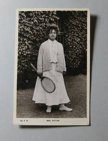
Photographic print, Circa 1908
Photo postcard of May Sutton Materials: Paper, Photographic emulsiontennis -
 Tennis Australia
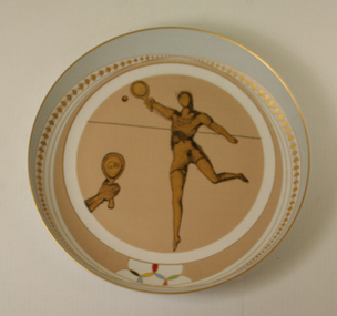
Commemorative plate, 1991
Ceramic decorated plate, number 305 of a total 5,000 made worldwide. Text on back in Spanish, with reference to Salvador Dali, who may have illustrated the front. Materials: Ceramic, Gold/Metal, Pigmenttennis -
 Tennis Australia
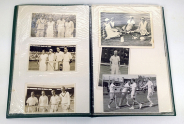
Photograph Album, Circa 1930-1970
Album that once contained 17 black and white photographs of tennis players from the 1940s to 1970s. Sticker on front says 'Photos by D P Turnbull...Sundries'. Donald Paterson "Don" Turnbull (28 May 1909 - 30 January 1994) was a tennis player from Australia. He won the men's doubles title at the Australian Championships twice, in 1936 and 1937. Turnbull represented Australia in three Davis Cup ties, including the 1933 Europe Zone final against Great Britain. Photos include 1935 Davis Cup team. Album is now empty. Photographs have been catalgoued separately. Materials: Ink, Paper, Plastictennis -
 Surrey Hills Historical Society Collection
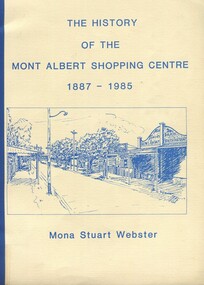
Book, Box Hill Historical Society et al, The history of the Mont Albert Shopping Centre, 1986
Born in 1900, Mona was the daughter of Florence Jane McDowall Stuart (1867-1936) and George Hudson Grant (1864-1910) who married in 1899. He was a surveyor and they lived in Albany Crescent, Surrey Hills. Her full name was Jessie Mona Stuart Grant and she had a sister Mollie. In 1924 she married Clarence William Willoughby Webster (1895-1980) - SERN 33286. Clarence was born in Thorpedale where his father was a teacher. He was living in View Street Mont Albert and was a law student when he enlisted on 3 October 1916. After discharge on 10 May 1919, Clarence returned to his studies. He joined a legal firm in the city which became Pearce & Webster (later Pearce Webster Dugdale). Mona and Clarence lived in Surrey Hills and Mont Albert in a number of homes for the remainder of their lives.A history of the Mont Albert Shopping Centre in Hamilton Street, Mont Albert, including the early land use, and a chronology of shop owners. Index, photos., 39p. Compiled by local resident, Mona Webster.On front cover: top RH corner "Kay Kirkwood/98995158"phoenix park estate, mont albert, hamilton street, (mr) - mckerdy, (mr) - andrew, (mr) - dunn, (lady) emma hamilton, railways, churchill street, surrey hills golf club, (mrs) mona webster -
 Surrey Hills Historical Society Collection
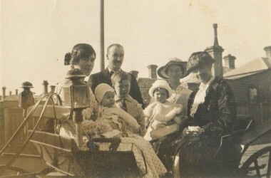
Photograph, David Miller and Lily Vipond Mair and family, c1921
David Miller (Dave) Mair (1879-1938) married Lily Vipond Deakin (1890-1945) in 1910. They had 5 children: Geoffrey David (1913-1970), Beryl (1916-1976), Gwynneth (1917-1997), Isabel Lillian (1921-1997) and Shirley Inez (1928-1968). Personal communication from Laurie Newton, Beryl's daughter: Dave and Lily initially lived in East Melbourne after they married. Dave walked across the gardens to work at the MCG. He never drove or owned a car. Geoffrey, Beryl and Gwynneth were born in East Melbourne. They subsequently moved to Louise Avenue, Mont Albert and Isabel may have been born while they were there. Later they purchased 20 Barton Street, Mont Albert. Electoral roll details: 1919 68 Park Street, Hawthorn 1922 24 Louise Avenue, Mont Albert 1924 20 Barton Street, Mont Albert So, Shirley would have been born while they were at Barton Street. On the basis of these dates, this may have been taken in Hawthorn. Identification of 'Grannie': If this is Lily's mother her name is Janet Deakin (nee Longmore - 1851-1939). If it is Dave's mother her name is Isabel Brown (1855-1944). The other woman is identified as May Little, who helped in the house. Dave Mair was a very keen sportsman. A sepia photo of a well-dressed family in and beside a buggy. The group is comprised of a man, 3 women and 3 children. The chimneys of Victorian or perhaps Edwardian houses are in the background.On rear: "Grannie Dad Mum / Beryl Geoff Isabel" (in hand 1 and blue biro) "on left Isabel on knee" (in a different hand in black biro) "May Little (Helped in / House" (in hand 1 in blue biro). On the basis of inscriptions in family autograph books, the first and third inscriptions look to have been written by Beryl Mair.david miller mair, dave mair, lily vipond mair, lily vipond deakin, geoffrey david mair, beryl mair, gwynneth mair, isabel lillian mair, janet deakin, janet longmore, isabel brown, isabel mair, horse-drawn vehicles, children, may little -
 Surrey Hills Historical Society Collection
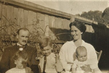
Photograph - Photograph, Sepia, c1921
David Miller (Dave) Mair (1879-1938) married Lily Vipond Deakin (1890-1945) in 1910. They had 5 children: Geoffrey David (1913-1970), Beryl (1916-1976), Gwynneth (1917-1997), Isabel Lillian (1921-1997) and Shirley Inez (1928-1968). Personal communication from Laurie Newton, Beryl's daughter: Dave and Lily initially lived in East Melbourne after they married. Dave walked across the gardens to work at the MCG. He never drove or owned a car. Geoffrey, Beryl and Gwynneth were born in East Melbourne. They subsequently moved to Louise Avenue, Mont Albert and Isabel may have been born while they were there. Later they purchased 20 Barton Street, Mont Albert. Shirley was born after they moved to Barton Street. Electoral roll details: 1919 68 Park Street, Hawthorn 1922 24 Louise Avenue, Mont Albert 1924 20 Barton Street, Mont Albert Dave Mair was a very keen sportsman. This is part of a large donation of material from the Deakin, Mair and Young families. The Mair family were long term residents in the area with strong social and business connections to the Surrey Hills community.A sepia photo of a man, a women, 2 children and a baby seated in front of a paling fence. The man is balding with a moustache. Children's faces are lowered as if avoiding looking at the sun.On rear: "Dad Beryl Geoff / Mum Isabel" in blue biro. Thought to be Beryl Mair's handwriting.david miller mair, dave mair, lily vipond deakin, lily vipond mair, geoffrey mair, beryl mair, isabel mair gwynneth mair, toddlers, family portraits, 1920s -
 Surrey Hills Historical Society Collection
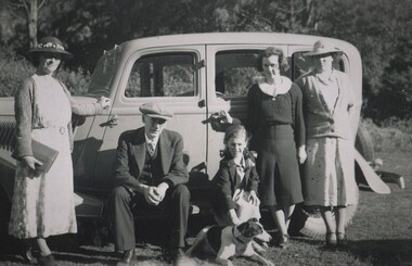
Photograph, David Miller and Lily Vipond Mair and family and friends on outing, c1932
David Miller (Dave) Mair (1879-1938) married Lily Vipond Deakin (1890-1945) in 1910. They had 5 children: Geoffrey David (1913-1970), Beryl (1916-1976), Gwynneth (1917-1997), Isabel Lillian (1921-1997) and Shirley Inez (1928-1968). Personal communication from Laurie Newton, Beryl's daughter: Dave and Lily initially lived in East Melbourne after they married. Dave walked across the gardens to work at the MCG. He never drove or owned a car. Geoffrey, Beryl and Gwynneth were born in East Melbourne. They subsequently moved to Louise Avenue, Mont Albert and Isabel may have been born while they were there. Later they purchased 20 Barton Street, Mont Albert. Shirley was born after they moved to Barton Street. Electoral roll details: 1919 68 Park Street, Hawthorn 1922 24 Louise Avenue, Mont Albert 1924 20 Barton Street, Mont Albert Dave Mair was a very keen sportsman. The woman named as Mattie was Martha Dunham Brooks b1892, Camberwell. She was the daughter of Arthur 'Empire' Brooks and his wife Mary Jane Wilson who lived at 21 York Street. They also had twin boys: Thomas Moffat Brooks – b. 1899, Surrey Hills; d. 1906 and Edwin Dunham Wilson Brooks – b. 1899, Surrey Hills; d. 1971 Heidelberg. The donor remembered the later as a builder of 11 York Street. Martha m. Clifford Ernest Cairns in 1935. Mattie Cairns was the donor's godmother. This is part of a large donation of material from the Deakin, Mair and Young families. This is part of a large donation of material from the Deakin, Mair and Young families all of which had connections with Surrey Hills / Mont Albert.A black & white photo of a man, a women, 2 women, a girl and a young lady beside a car in a country setting. The girl is bending to pat a dog.On rear: "Mum Dad Mair / Shirl Isabel Mattie / Digger - Cliff Cairns / Dog" in blue biro. Thought to be Beryl Mair's handwriting. "LILY" and "DAVE" in lead pencil above Mum and Dad. Photographer's stamp "653" in blue ink.dave mair, david miller mair, lilly vipond deakin, lily vipond mair, shirley inez mair, isabel lillian mair, mattie brooks, martha dunham brooks, cars -
 Surrey Hills Historical Society Collection
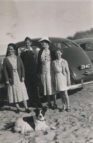
Photograph, Lily Vipond Mair with family and friends at the beach, c1936
David Miller (Dave) Mair (1879-1938) married Lily Vipond Deakin (1890-1945) in 1910. They had 5 children: Geoffrey David (1913-1970), Beryl (1916-1976), Gwynneth (1917-1997), Isabel Lillian (1921-1997) and Shirley Inez (1928-1968). Personal communication from Laurie Newton, Beryl's daughter: Dave and Beryl initially lived in East Melbourne after they married. Dave walked across the gardens to work at the MCG. He never drove or owned a car. Geoffrey, Beryl and Gwynneth were born in East Melbourne. They subsequently moved to Louise Avenue, Mont Albert and Isabel may have been born while they were there. Later they purchased 20 Barton Street, Mont Albert. Shirley was born after they moved to Barton Street. Electoral roll details: 1919 68 Park Street, Hawthorn 1922 24 Louise Avenue, Mont Albert 1924 20 Barton Street, Mont Albert Dave Mair was a very keen sportsman. The woman named as Mattie was Martha Dunham Brooks b1892, Camberwell. She was the daughter of Arthur 'Empire' Brooks and his wife Mary Jane Wilson who lived at 21 York Street. They also had twin boys: Thomas Moffat Brooks – b. 1899, Surrey Hills; d. 1906 and Edwin Dunham Wilson Brooks – b. 1899, Surrey Hills; d. 1971 Heidelberg. The donor remembered the later as a builder of 11 York Street. Martha m. Clifford Ernest Cairns in 1935. Mattie Cairns was the donor's godmother. This is part of a large donation of material from the Deakin, Mair and Young families. This is part of a large donation of material from the Deakin, Mair and Young families all of which had connections with Surrey Hills / Mont Albert. Mattie Brooks' father was a significant figure in early Surrey Hills.A black & white photo of 2 women, a girl and a lad beside a car on the sand at the beach.On rear: "Mum Mattie / Shirl / Digger (Cliff Cairns / Dog" in blue biro. "MATTIE BROOKS / LAD UNKNOWN" Thought to be Beryl Mair's handwriting. Photographer's stamp "653" in blue ink.beach, lily vipond mair, lilly vipond deakin, mattie brooks, martha dunham brooks, mattie cairns, martha dunham carins -
 Surrey Hills Historical Society Collection
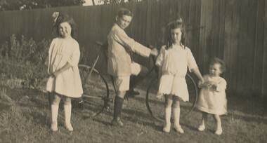
Photograph, Four Mair children in the backyard, c1922
David Miller (Dave) Mair (1879-1938) married Lily Vipond Deakin (1890-1945) in 1910. They had 5 children: Geoffrey David (1913-1970), Beryl (1916-1976), Gwynneth (1917-1997), Isabel Lillian (1921-1997) and Shirley Inez (1928-1968). Personal communication from Laurie Newton, Beryl's daughter: Dave and Lily initially lived in East Melbourne after they married. Dave walked across the gardens to work at the MCG. He never drove or owned a car. Geoffrey, Beryl and Gwynneth were born in East Melbourne. They subsequently moved to Louise Avenue, Mont Albert and Isabel may have been born while they were there. Later they purchased 20 Barton Street, Mont Albert. Shirley was born after they moved to Barton Street. Electoral roll details: 1919 68 Park Street, Hawthorn 1922 24 Louise Avenue, Mont Albert 1924 20 Barton Street, Mont Albert Dave Mair was a very keen sportsman. This is part of a large donation of material from the Deakin, Mair and Young families. The Deakin, Mair and Young families had many connections with Mont Albert and Surrey Hills.A sepia photo of 4 well-dressed children, a boy and 3 girls, one a toddler, in a back yard. The boy is astride a bicycle and the girls stand either side. Behind them is a high paling fence.On rear: "Gwen Geoff Beryl Isabel" in blue biro. Thought to be Beryl Mair's handwriting. Photographic processing stamp in blue "54".david miller mair, dave mair, lily vipond deakin, lily vipond mair, geoffrey mair, beryl mair, isabel mair gwynneth mair, children, back yards, bicycles -
 Surrey Hills Historical Society Collection
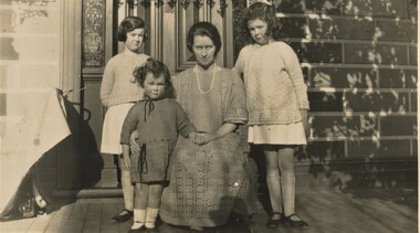
Photograph, Lily Mair and 3 daughters, c1924
David Miller (Dave) Mair (1879-1938) married Lily Vipond Deakin (1890-1945) in 1910. They had 5 children: Geoffrey David (1913-1970), Beryl (1916-1976), Gwynneth (1917-1997), Isabel Lillian (1921-1997) and Shirley Inez (1928-1968). Personal communication from Laurie Newton, Beryl's daughter: Dave and Lily initially lived in East Melbourne after they married. Dave walked across the gardens to work at the MCG. He never drove or owned a car. Geoffrey, Beryl and Gwynneth were born in East Melbourne. They subsequently moved to Louise Avenue, Mont Albert and Isabel may have been born while they were there. Later they purchased 20 Barton Street, Mont Albert. Shirley was born after they moved to Barton Street. Electoral roll details: 1919 68 Park Street, Hawthorn 1922 24 Louise Avenue, Mont Albert 1924 20 Barton Street, Mont Albert Dave Mair was a very keen sportsman. This is part of a large donation of material from the Deakin, Mair and Young families. The Deakin, Mair and Young families had many connections with Mont Albert and Surrey Hills.A sepia photo of a woman seated on a veranda with 3 girls. Part of the facade of the house can be seen behind them. The veranda is timber. The door has acid-etched feature windows either side of it. The front is block-fronted and looks to be picked out in 2 paint colours. There are shadows of foliage and from lacework detail on the veranda cast over one side and the top pf the photo. The shadow of the photographer's hat can be seen on the bottom edge.On rear: "L-R" (in lead pencil) Beryl Isabel Mum / Gwen at Barton St" in blue biro. Thought to be Beryl Mair's handwriting. Number 39 in lead pencil.barton street, children, lily vipond deakin, lily vipond mair, beryl mair, isabel mair,, gwynneth mair -
 Surrey Hills Historical Society Collection
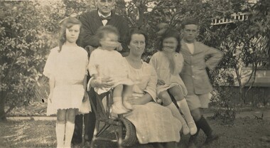
Photograph, Dave and Lily Mair and children, c1923, c1923
David Miller (Dave) Mair (1879-1938) married Lily Vipond Deakin (1890-1945) in 1910. They had 5 children: Geoffrey David (1913-1970), Beryl (1916-1976), Gwynneth (1917-1997), Isabel Lillian (1921-1997) and Shirley Inez (1928-1968). Personal communication from Laurie Newton, Beryl's daughter: Dave and Lily initially lived in East Melbourne after they married. Dave walked across the gardens to work at the MCG. He never drove or owned a car. Geoffrey, Beryl and Gwynneth were born in East Melbourne. They subsequently moved to Louise Avenue, Mont Albert and Isabel may have been born while they were there. Later they purchased 20 Barton Street, Mont Albert. Shirley was born after they moved to Barton Street. Electoral roll details: 1919 68 Park Street, Hawthorn 1922 24 Louise Avenue, Mont Albert 1924 20 Barton Street, Mont Albert Dave Mair was a very keen sportsman. This is part of a large donation of material from the Deakin, Mair and Young families. The Deakin, Mair and Young families had many connections with Mont Albert and Surrey Hills.A sepia photo of a family posed informally in a garden. The woman is seated on a cane chair holding the youngest child with one girl standing to her left and a girl and boy standing to her right. The man is standing behind her with only his face captured in the photo. The infant and the girl to the right have moved and their faces are blurred. The house in the background is of block-front construction with simple fretwork to the veranda.On rear: "Beryl Dad Isabel Mum / Gwen Geoff / at Louise Avenue / Mont Abert" in blue biro. Thought to be Beryl Mair's handwriting. Photographic processing stamp in blue ink "54 P"barton street, children, lily vipond deakin, lily vipond mair, beryl mair, isabel mair,, gwynneth mair -
 Surrey Hills Historical Society Collection
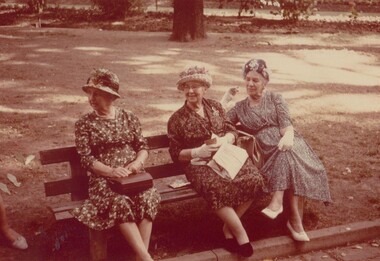
Photograph, Three Deakin sisters, 1964
These are the 4 surviving daughters of Thomas Henry Deakin (1845-1915), born in Monmouthshire, Wales and his wife Janet (Jessie) Longmore (1851-1939), born in Morayshire, Scotland. The couple also had 2 sons: John Henry (1879-1962) and William Andrew (1883-1939). A fifth daughter Daisy Jessie was born in 1880 and died the same year at the age of 7 months. Elsie Longmore Deakin (1881-1969) was a nurse ans remained single; Minnie Winifred (1886-1966) married Charles Williamson in 1923; Lily Vipond (1890-1943) married David Mair in 1910 and Jessie Alice, known as Alice, married Hector Williamson in 1921. Hector and Charles were brothers. Elsie Longmore Deakin enlisted AANS aged 35 years in 10 May 1915; embarked on the Mooltan on 22 August 1916. Address : 114 Station Street, Fairfield, Next of kin : mother, Mrs Janet Deakin (nee Longmore), 114 Station Street, Fairfield, father, Thomas Henry Deakin Elsie Deakin enlisted at 35 years of age on 10 May, 1915 and served locally before volunteering for overseas duty on 9 August, 1916. Her three years of training were completed at the Melbourne General Hospital. She embarked with the rank of Sister for India and was appointed to the Victoria Hospital, Bombay. In January, 1917, when she was transferred to England and a Military Hospital at Bagthorpe later to the 1 Australian Auxiliary Hospital, and in January of the following years to 25 (British) GH in France but returned a few weeks later to England and the 1 AAH after suffering a seriously strained left ankle. She returned to France post-war and served another four months before being returned to Australia in May, 1919. Her appointment was terminated as medically unfit on 9 June, 1919. Born South Melbourne, she died in Elsternwick on 14 October, 1969, aged 87. (REF: http://www.ozsportshistory.com/wardeaths/women_a_e.html) There is a photo of her in uniform on this site and also on http://ww1nurses.gravesecrets.net/de.html LtoR: Alice, Minnie, Lily, Elsie. This is part of a large donation relating to the Deakin, Mair and Young families. The donor thought this was taken during the 1950s but the Kodak stamp identifies it as later.This is part of a large collection of material related to the Deakin, Mair and Young families with multiple connections to Surrey Hills and Mont Albert.A colour photo with a cream edge of 3 well-dressed women sitting on a public bench in what looks to be a park. All are wearing hats and carrying handbags. Two are wearing gloves. On rear in blue biro - "Aunties / Elsie Minnie & Alice / Mum's RIGHT TO LEFT In black biro) / Beryl / YOUNG / My Mothers Sisters / (Lily Vipond Deakin / MAIR." Some of the handwriting is thought to be that of the donor's mother, Beryl Mair. There may be another hand. It appears that not all the inscriptions were added at the same time. There is also a photographic processing stamp in red: " THIS IS A / KODACHROME PRINT / Made by / KODAK / FEBRUARY 1964 M" elsie longmore deakin, minnie winifred deakin, minnie winifred williamson, lily vipond deakin, lily vipond mair, jessie alice deakin, alice deakin, jessie alice williamson, alice williamson -
 Surrey Hills Historical Society Collection
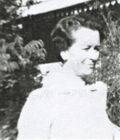
Photograph, Lily Vipond Mair, c1940, c1940
David Miller (Dave) Mair (1879-1938) married Lily Vipond Deakin (1890-1945) in 1910. They had 5 children: Geoffrey David (1913-1970), Beryl (1916-1976), Gwynneth (1917-1997), Isabel Lillian (1921-1997) and Shirley Inez (1928-1968). Personal communication from Laurie Newton, Beryl's daughter: Dave and Lily initially lived in East Melbourne after they married. Dave walked across the gardens to work at the MCG. He never drove or owned a car. Geoffrey, Beryl and Gwynneth were born in East Melbourne. They subsequently moved to Louise Avenue, Mont Albert and Isabel may have been born while they were there. Later they purchased 20 Barton Street, Mont Albert. Shirley was born after they moved to Barton Street. Electoral roll details: 1919 68 Park Street, Hawthorn 1922 24 Louise Avenue, Mont Albert 1924 20 Barton Street, Mont Albert Dave Mair was a very keen sportsman. This is part of a large donation of material from the Deakin, Mair and Young families. A black & white photocopy image of Lily Vipond Mair (nee Deakin) taken from a photo.On rear in grey lead pencil: "Lily Vipond Mair / (nee Deakin) / aged about 50 / (5.7.1890-1943)" lily vipond deakin, lily vipond mair -
 Surrey Hills Historical Society Collection
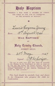
Baptism certificate, 25 May 1947
Rev. C. P. Schwieger, known as Percy, was vicar at Holy Trinity from October 1934 to 1953. Many Children in Surrey Hills were baptised by him as there was a population explosion following WW2. There is a stained glass window of Mary and Martha with Jesus that he donated to the church in memory of his wife Mary, obit. 6.4.1949. He oversaw many improvements to the church properties over the time when the parish was extending to St Augustine in Balwyn and land was obtained for the church at Wattle Park, now closed. REF: Holy Trinity Archives.A cream baptism card printed in brown with ink inscriptions."Laurie Gwynne Young / 18th August 1946 / 25th May / 47 / C P Schwiger"laurie young, laurie newton, churches, rev c p schwiger, rev c p schwieger -
 Surrey Hills Historical Society Collection
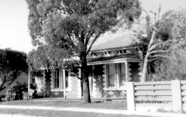
Photograph, 1 Russell Street, Surrey Hills in 1988
1 Russell Street was built in 1888 and from 1888–1905 (maybe 1911, as his death notice says he died at Russell Street) it was the home of James Burrell, a blacksmith. His smithy was on the corner of Canterbury Road. In 1893 a block of land (No.3 ) was bought to establish the fire station and James Burrell acted as fire officer and stored the reel and hose until the station was built. From 1911–1928 it was the fire station residence, as the brigade gained status. James Burrell (1860-1911) married Elizabeth Wilson (1862-1925). She was daughter of Edward Wilson. They had 4 children: James Herbert, known as Bert (1888-1953); Aleck (1890-1951); William Spencer, known as Bill, (1893-1976) and Elsie May (1898-1990). Both James and Elizabeth Burrell are buried in Burwood Cemetery. From 1930–1943 Michael Ginnane, retired station master, and members of his family lived in the house. Michael Ginnane (1864-1935) married Annie Mary Brock (1868-1945). Both were born in the Ballarat area. They had 10 children. From 1913-1917 he was station master at Woodend. In the 1925 electoral rolls the family is listed as living at Surrey Hills station. There was a station master's house adjacent to the station (demolished and the site now part of the car park accessed off Blackburn Street). They are again listed here in the 1925 electoral roll. By 1931 they are at 1 Russell Street and he is listed as a retired station master. The following children lived in Surrey Hills: John James (Clerk) - 1922 Mary Ellen (HD) - 1922, 1925, 1931 Michael Thomas (labourer) - 1922 Annie Florence (dressmaker) - 1925, 1931 William Patrick (railwayman) - 1925 Elizabeth Catherine (sales) - 1931 Patrick Leo (postman) - 1931. A black and white photograph taken on an angle from across the street of a mid-late Victorian style cottage with multi-coloured brickwork. There is a large tree in the front garden, no fence and a letterbox on a lean.(mr) james burrell, blacksmiths, canterbury road, surrey hills, fire officers, (mr) michael ginnane, station masters, fire stations, mid-victorian style, (miss) elizabeth wilson, (mrs) elizabeth burrell, james herbert burrell, aleck burrell, william (bill) spencer burrell, elsie may burrell, (miss) annie mary brock, (mrs) annie mary ginnane, john james ginnane, (miss) mary ellen ginnane, michael thomas ginnane; (miss) annie florence ginnane; william patrick ginnane; elizabeth catherine ginnane; patrick leo ginnanean), late-victorian style, russell street -
 Surrey Hills Historical Society Collection
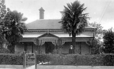
Photograph, Richard Bate at his home 'Camelford', 7 Norris Street, Surrey Hills (demolished)
Richard Bate built ‘Avondale’ at 176 Union Road in 1883 as a display home for subdividers of the Windsor Park Estate auction in that year. Richard built many homes in the locality – probably including No.101 Guildford Road, almost identical to his home. Richard also built the Box Hill Shire Hall in the 1880s (replaced in 1934 by the Box Hill Town Hall). Richard junior and family retained this house until the 1950s. Occupied in 2000 by Julie Ellis. In May 2000 Richard's grandson Jack Bate and great-grandsons Alan and Geoff (all of whom are builders) visited 7 Norris Street and lent this photo for copying. Demolished after subsequent sale. A black and white photograph of a Federation/Edwardian style timber house with detailed lacework around the veranda. There is a man standing on the right side of the photo. He is wearing a hat and is sporting a long white beard.norris street, surrey hills, house names, avondale, camelford, windsor park estate, box hill shire hall, builders, federation style, edwardian style, richard bate -
 Surrey Hills Historical Society Collection
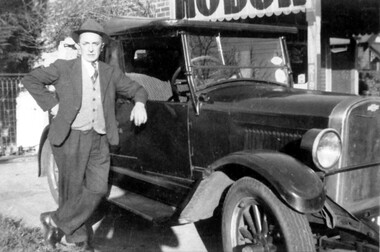
Photograph, Frank Etheridge, outside the small general store at 224 Mont Albert Road, Surrey Hills
In earlier years (c1923-1943), the shop was known as Mrs Sim's shop. Note that prior to c1928 the property was numbered 292 Mont Albert Road. Electoral rolls describe Victoria May Sims (nee Munday) as a confectioner but she also sold school requisites and other general household items. Her husband Harry Pascoe Sims died in 1926. The shop was taken over by Leonard William James Etheridge, whom electoral rolls and probate records variously describe as a grocer, stationer or builder. His sons Austin, Douglas and Leonard attended nearby Chatham Primary School. Leonard senior and his wife Marie Wanda (nee Chambers) lived in various locations around Surrey Hills after leaving the shop. Austin went on to establish Etheridge Ford in Ringwood.A black and white photograph of a man dressed in a suit wearing a hat. He is standing beside a car parked beside a shop.mrs sims shop, mont albert road, surrey hills, chatham school, austin etheridge, frank etheridge, victoria may sims, leonard william etheridge, douglas etheridge, leonard etheridege, marie wanda etheridge, marie wanda chambers -
 Surrey Hills Historical Society Collection
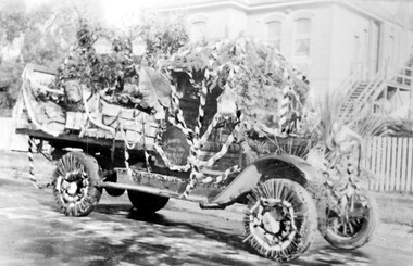
Photograph, Armitstead Woodyard truck decorated for Empire Day, mid-1930s, 1930
Date is approximate. Donor's connection with Armitstead's Woodyard was that Frank Foley was a long term employee. The Empire Day movement was instituted in England in 1904 and on 24 May 1906 a group of Surrey Hills residents pledged to make Empire Day a success. From 1932-1938 large Empire Day celebrations were held in Surrey Hills and business and commercial vehicles were decorated to take part in large processions held in May each year. These attracted large crowds from all over Melbourne. The truck is parked outside Nethercourt Hospital at 15 Barton Street. The Armitstead family had a business in Union Road which supplied wood in winter and ice in summer. Photos such as this one are evidence of the importance once attached to celebrating Empire Day, which was held on 24 May (Queen Victoria’s birthday). From 1905, a range of patriotic activities across Australia were performed on this day. There was a focus on schoolchildren, who were given a half-holiday, and the occasion was often highlighted with bonfires and fireworks in the evening - in this area at Beckett Park. The parade down Union Road was famous throughout Melbourne and attracted large crowds. Floats in the parade were often decked with British flags. The pro-Empire sentiment in the Surrey Hills area in part reflected the background and strong ties of many families.Black and white photo of a delivery truck with bunting and ferns over the cabin and back. The wheels have straws around the rims and more foliage is on the cabin roof and bonnet. The back of the tray is up and boxes, foliage and possibly a lion's head decorate the tray. Behind is a 2 storey (?) rendered building with an external timber staircase broken in 2 by a landing. The house sits behind a simple picket fence.On the cabin door of the truck: "S ARMITS ....[remainder in shadow] / Surrey Hills / phone 10X1816 / [undecipherable]" On back of the original in pencil in top centre left "446a" in Jocelyn Hall's handwriting; centre on a piece of paper stuck on with tape "Mrs D Foley / 39 Sunbury Cres., / Surrey Hills / Phone 8301163".empire day, festival and celebrations, woodyard, parades, processions, hospitals, nethercourt hospital, stephen godfrey armitstead, frank foley, mrs d foley, barton street -
 Surrey Hills Historical Society Collection
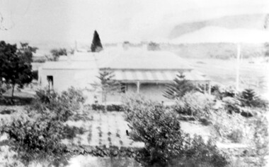
Photograph, 'Glenisla', 18 Chestnut Street, Surrey Hills, c 1920, 1920
Date is approximate. In 1920 this became the home of Mr and Mrs Robert Moore, whose daughter Mabel Annie married Norman Brodley Carter of Mont Albert. The house was named after 'Glenisla', a western District grazing property located between Hamilton and Horsham on the Henty Highway and on the edge of the Grampians National Park. This was established as a super-fine wool stud in 1860 and was passed down the family until it was sold in 1922. The family transferred from this property to Melbourne. Robert is listed as a grazier in the 1924 electoral roll at Chestnut Street. With him are Victor Cecil listed as a carpenter; Isabella, Mabel Annie and Edgar Gilbert listed as an orchardist. In 2003 the house was extant minus the verandas. This photo may have been taken from the rear of the property. Ref: History of original property - Age newspaper article: 'The Best - Glenisla: historic Grampians property', 7 January 1994. Moore family details: Robert Moore born 1857 on Isle of Man; died Surrey Hills 1940 Isabella Bateson born 1869; died Surrey Hills 1938 Married in 1894 in Miram, 10 km north-east of Kaniva in the northern Wimmera. All the children were born in Kaniva. Children: Lena Florence (1895-1980) Victor Cecil (1896-1984) - a builder Edgar Gilbert (1897-1976); died Surrey Hills; married Myrtle Emary, daughter of Henry John Emary of Surrey Hills Ernest Alan (1900-1900) Mabel Annie (1901-1957); died Surrey Hills married Norman Brodley Carter (1899-1984) Clarence Arthur (1904-2004). Norman Carter took many photos in the Surrey Hills and Mont Albert are from the 1920s; many is connection with Church of England events and activities. Robert and Isabella Moore are buried in Box Hill Cemetery. Black and white photo of a Victorian home with a veranda with a corrugated iron roof and lacework on 2 sides. It appears to have a later extension at the rear. It is surrounded by mature gardens with ornamental trees (cypresses) and an area with plants in rows, which may be a vegetable garden. There appears to be significant areas of open space around the house.glenisla, homes, victorian style, gardens, norman carter, robert moore, miss isabella bateson, mrs isabella moore, victor cecil moore, edgar gilbert moore, miss mabel annie moore, box hill cemetery -
 Surrey Hills Historical Society Collection
Folder of real estate advertisements, Folders of real estate advertisements (Streets beginning with P), Various
A4 folders with individual pockets for each property in streets beginning with P located in Surrey Hills and Mont Albert. Folders are ordered by street name and then chronologically by property number. Each property has its own pocket. This may include multiple real estate advertisements collected from sales over time. It may also include copies of any research undertaken by Alan Holt and / or members of the SHNCHC team. These are augmented by cards in the Alan Holt index file and by his property registers of Surrey Hills and Mont Albert.park road, payne street, pembroke street, pine street, prospect hill road, proudfroot street -
 Albert Park-South Melbourne Rowing Club
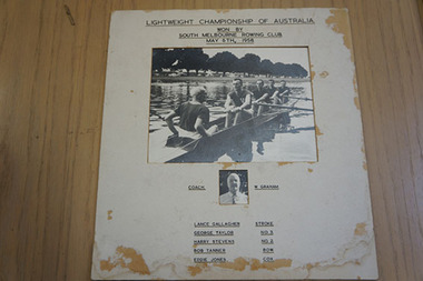
Photograph of South Melbourne Rowing Club Crew that Won the First Championship for Lightweight Fours (Penrith Cup), 1958, 1958
"As with most items in the AP-SMRC collection, the ‘chain of ownership’ is not formally recorded for this item. The image is not unique, but is one of a set that was produced for each of the men represented in the photographs, with perhaps additional copies for the SMRC. Lance Gallagher, speaking with Ms (Grace) Blake and the consultant (Mrs Margaret Birtley) on 8 June 2014, recalled the photograph well and confirmed on 17 July 2014 that he has a personal copy." 2014 Significance Assessment, p28."This item comprises two photographs mounted together with a caption that identifies the men depicted as being a South Melbourne Rowing Club (SMRC) crew and coach. Representing Victoria, this crew won the first Championship for Lightweight Fours at an Interstate Regatta. The race was contested on the Nepean River, NSW, on 3 May 1958. The photograph of the crew was taken on the Yarra River, Victoria, prior to the Regatta and was used for publicity in the Regatta program.16 The victory was significant to SMRC because the oarsmen and coaches (although not the coxswain) were members of that club. The item is a memento of the club’s success, through its crew, at an elite and national level. The Lightweight Four Championship event’s first hosting at Penrith on the Nepean River resulted in a perpetual trophy being donated by that local municipal council. The race for the Lightweight Championship Four continues to this day as a featured event at the annual Interstate Regatta. The Penrith Cup lends its name to this prestigious event. It is unusual for Interstate race crews to be drawn entirely from a single club; more typically, the state representative crews are selected as composites. The selection of an all-SMRC crew for this inaugural race between representative Lightweight Four crews testifies to the exceptional standards at SMRC during this period. The item is of historic significance because it provides pictorial evidence of the crew and the club’s success in a national competition and in a category of event that was being contested at the Interstate Regatta for the very first time. It also carries social significance through the captioning that credits the victory as being the club’s rather than the state’s, and thus reflects the pride of the SMRC in the achievements of its oarsmen and coaches." 2014 Statement of Significance, p30Unframed photograph of the crew which won the inaugural interstate men’s lightweight coxed four in Penrith, 1958. Lightweight Championship of Australia / Won by / South Melbourne Rowing Club / May 6th, 1958 Coach W. Graham / Lance Gallagher Stroke / George Taylor No. 3 / Harry Stevens No. 2 / Bob Tanner Bow / Eddie Jones Cox / South Melbourne state crew ??? This event became the Penrith Cup.rowing, albert park lake, apsm rowing club, penrith cup, lightweight, four, championship, south melbourne rowing club, gallagher, lance, taylor, george, stevens, harry, tanner, bob, jones, eddie, webster, jack, graham, wal