Showing 981 items
matching fortuna ?
-
 Bendigo Military Museum
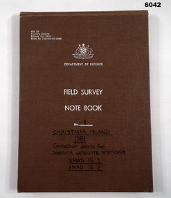
Journal - Field Survey Notebook No1 Christmas Island 1981, SSGT JD Mobbs and CPL NF Kelly, Department of Defence, Field survey Notebook No1 Christmas Island 1981, 09.02.1981
Notebook compiled by J.D. Mobbs, SSGT and N.F. Kelly, CPLCloth covered Cardboard, 100 Pages, Field Survey Notebook"Connection Details for Doppler Satellite Stations." "Xmas Is 1", "Xmas Is 2"royal australian survey corps, rasvy, fortuna, army survey regiment, army svy regt, asr -
 Bendigo Military Museum
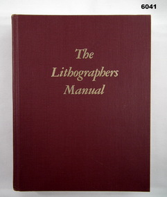
Manual - The Lithographers Manual Fifth Edition, Graphic arts Technical Foundation, Produced by the Graphic Arts Technical Foundation, 1977
The Graphic Arts Technical Foundation Lithographers ManualHard Cover, Red, 20 Chapters, Text, Diagrams, Photographs, ISBN 0-88362-005-7Inside Front Cover - "B. McLachlan"royal australian survey corps, rasvy, fortuna, army survey regiment, army svy regt, asr -
 Bendigo Military Museum
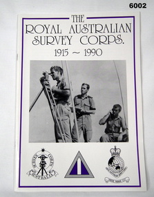
Booklet - Booklet Royal Australian Survey Corps History, " The Royal Australian Survey Corps " 1915-1990, c, 1995
This article was presented as a paper to the 1990 Australian War Memorial History Conference to mark the 75th anniversary of the formation of the "Australian Survey Corps" on 1 July 1915. The Corps has since been renamed. Booklet, A4, 13 Pages, Cardboard Cover, Colour, Maps, Photographs, Black and White. Held together by metal staplesroyal australian survey corps, rasvy, fortuna, army survey regiment, army svy regt, asr -
 Bendigo Military Museum
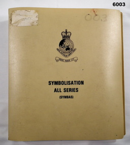
Manual - Symbolisation All Series (Symbas), Specification for maps produced by the Royal Australian Survey Corps, C 1988
Symbas provides the specification (rules) for the collection and compilation of topographic data; the basic instructions for colour preparation and reproduction of topographical detail on maps produced by RASvyPlastic cover, book, beige, 7 chapters, metal clip bindingroyal australian survey corps, rasvy, fortuna, army survey regiment, army svy regt, asr, symbas, specification -
 Bendigo Military Museum
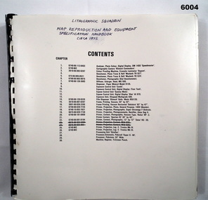
Manual - Map Reproduction and Equipment Specification Handbook, Circa 1975
Manual used by Lithographic Technicians as a register of Map reproduction equipment. Possible uses include to identify and quantify available equipment as part of the stocktaking process.90 page technical manual/ handbook. Does not have a front cover. Contents page and pages within the document have black and white stock descriptions followed by photos of equipment. The manual is printed on photographic paper and is bounded by a black plastic spiral spline.royal australian survey corps, rasvy, fortuna, army survey regiment, army svy regt, asr -
 Bendigo Military Museum
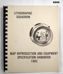
Manual - Map Reproduction and Equipment Specification Handbook, 1982
This handbook provided comprehensive technical information principally to the lithographic technician and to other Royal Australian Survey Corps technical trades. Part 1 comprised technical descriptions and photos of lithographic equipment used in military map production. Part 2 provided various tables such as printing sizes conversion tables. Part 3 provided technical guidance on the stipples and screens utilised in the map reproduction process. Part 4 detailed the Pantone Matching System printing colours for map and chart products. Part 5 was a Glossary of Lithographic Technical Terms.Army Survey Regiment Manual/handbook with a manilla cover comprising approximately 100 pages. The pages in the document are in black and white paper providing technical information and photograph identifying lithographic equipment and other information to lithographic technicians. Printed on standard paper bound by a by a black plastic spiral spline.royal australian survey corps, rasvy, fortuna, army svy regt, asr, army survey regiment -
 Bendigo Military Museum
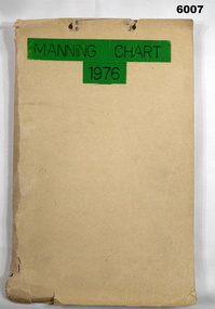
Document - Army Survey Regiment Manning Chart 1976, 1976
This document contains detailed photocopies of reports of Army Survey Regiment’s staff manning from December 1975 to August 1976. Each monthly report provided to Directorate of Survey covered the allocation of staff to Regimental Headquarters and its four sub units comprising Headquarters, Air Survey (Topographic), Cartographic and Lithographic Squadrons. Each Squadron’s troop or section structure was represented by a wire diagram with soldiers and/or civilians names assigned to rank based established positions. A detailed table at the end of each report sumarised Army Survey Regiment’s posted strength by employment category and rank.Manilla cardboard folder containing 83 photocopied pages of staff posted to the Army Survey Regiment. Pages are fixed to the folder by a metal fastener. The title of the folder is written in black ink on a green tape background.royal australian survey corps, rasvy, army survey regiment, army svy regt, asr, fortuna -
 Bendigo Military Museum
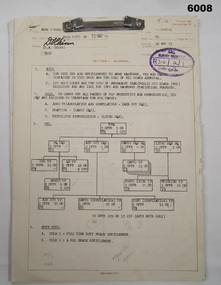
Document - Army Survey Regiment Army and Civilian Establishment Authorisation, 23 05 1975
This document was a directive from Army Headquarters authorising the allocation of Army and Civilian positions to the Army Survey Regiment. It provided an organisational wire diagram summarising the overall numbers of Officer, Civilian and Other Ranks to RHQ, and Headquarters, Air Survey, Cartographic and Lithographic Squadrons. Staff allocations to RHQ and each of the four squadron's troop and/or sections were identified in a table format, by hierarchy of rank and employment categories.This document comprises 7 pages of information in black and white with diagrams and tables detailing the allocation of staff to the unit. Pages are fixed by a metal fastener. There is no cover.royal australian survey corps, rasvy, fortuna, army survey regiment, army svy regt, asr -
 Bendigo Military Museum
Pamphlet - An Introduction to Topographic Mapping, C 1991
This pamphlet was published by the Army Survey Regiment as an overview of the Royal Australian Survey Corps (RASvy), its role and unit structure circa 1991, prior to RASvy’s disbandment in 1996. The pamphlet comprehensively detailed the eight steps of topographic map production: Establish Survey Control, Aerial Photography, Aerotriangulation, Stereoplotting, Field Verification, Cartography, Printing and Storage/Map Distribution. Leading technologies used by RA Svy in 1991 included GPS control surveys, 5 colour printing on the Speedmaster offset press and bulk map packaging using the Map Handling Station (with guillotine). Digital map production was operating on the AUTOMAP 2 system, before the “Newheart” system upgrade two years later. Printed on the pamphlet cover was a portion of the plane tabled “four inches to a mile” map of Newcastle. This was compiled and surveyed in 1910 by LCPL A. Barrett, a member of the RAE Detachment, as part of the first major topographic mapping effort of Australia.This is a Royal Australian Survey Corp pamphlet with a historical map printed in colour on cardboard on both sides of the cover. There are 16 pages printed in colour on gloss paper, with photos, diagrams and descriptions. The pamphlet is bounded by two staples on its spine. Each of the 17 images were scanned at 300 dpi in JPEG (.jpg) format and stored on the attached 16 Gb USB memory stick. The images have been converted into MPEG-4 (.mp4) video format, 4Mb in size and runs for 2:16 minutes and is also stored on the memory stick.royal australian survey corps, rasvy, fortuna, army survey regiment, army svy regt, asr -
 Bendigo Military Museum
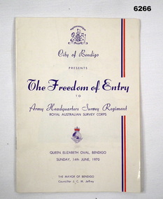
Booklet - City of Greater Bendigo Presents "The Freedom of Entry to Army Headquarters Survey Regiment", Army Headquarters Survey Regiment, 14.06.1970
This booklet is the program for the AHQ Survey Regiment Freedom of Entry to Bendigo on Sunday 14 Jun 1970 held at the Queen Elizabeth Oval, Bendigo. The ceremony was officiated by the Mayor of Bendigo Councillor CM JeffreyBooklet, B4 size, 11 pages, semi gloss paper, cover, red and blue text, contents, photos and text.army survey regiment, army svy regt, fortuna, royal australian survey corps, rasvy, asr -
 Bendigo Military Museum
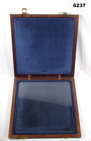
Article - Aerial photography Diapositive Filter Plate, circa 1960
Aerial photography glass plate filter used in the production of aerial photography for mappingWooden box, lacquered, hinges and clasps, blue felt lined, glass plateroyal australian survey corps, rasvy, fortuna, army survey regiment, army svy regt, asr -
 Ballarat Heritage Services
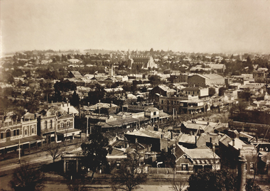
Photograph - Image - Black and White, City of Bendigo, c1918
Bendigo is a goldfields town in Central Victoria.Black and white image of the township of Bendigo.george lansell, bendigo, fortuna, townscape -
 Bendigo Military Museum
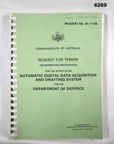
Administrative record - RFT for an Automated Digital Acquisition and Drafting System for DOD (Automap 2), Purchasing Division, Department of Administrative Services, Canberra ACT, Australia, Circa 1981
This Request for Tender (RFT) covers the supply, installation, acceptance testing and maintenance of the Automap 2 System and also included the Automap 3 System that did not eventuate.A4 Booklet, Green card cover, Plastic ring bindingroyal australian survey corps, rasvy, fortuna, army survey regiment, army svy regt, asr -
 Bendigo Military Museum
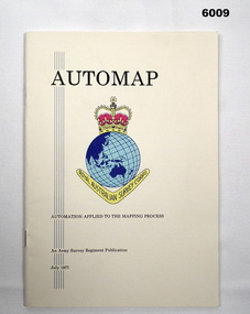
Pamphlet - AUTOMAP - Automation Applied to the Mapping Process, Major Sam Thompson US Army Corps of Engineers, 01.07.1977
This pamphlet produced by Major Sam Thompson US Army Engineer Corps on exchange to Australia was published as a guide to AUTOMAP 1, the Army Survey Regiment’s first computer-based map production system. It examined how automation had changed the compilation and drafting phases of the map production process. It attempted to present in a light-hearty story telling style, short and clear description of each AUTOMAP 1 sub-system with photos of staff and equipment, diagrams and humorous cartoons. The cartoonist is unknown. The pamphlet was printed at the Army Survey Regiment, Bendigo Army Survey Regiment pamphlet comprises a manilla card cover printed in colour with 24 pages with photographs in black and white; and descriptions, diagrams, and cartoons printed in colour. It is bounded by two staples on its spine. The coloured pages have been scanned at 300 dpi and are stored on a USB Digital Storage Device. The page images have been converted into a video (.mp4) format and also stored on the USB. The video is 1.3Mb in size and runs for 1.3 minutes.royal australian survey corps, rasvy, fortuna, army survey regiment, army svy regt, asr -
 Bendigo Military Museum
Photograph - Flag Day - Army Survey Regiment Versus School of Military Survey, 10.10.1986
These photographs were taken at Flag Day, an annual sports competition between the Army Survey Regiment and the School of Military Survey, at Bendigo on the 10th of October 1986. The two RASvy units took turns each year to host the event. The day competition usually comprised basketball, cross country, golf, sailing, squash softball, tennis, touch football, tug-of-war and volleyball. The evening competition often included darts, carpet bowls, hookey, quoits and snooker. The scoreboard in the background in photo .11P indicated an emphatic victory for the Army Survey Regiment.This is a set of 13 photographs of Flag Day, Army Survey Regiment versus the School of Military Survey, at Bendigo on the 10th of October 1986. There are more photographs available on 35mm negatives and 35mm positive proofs. The photographs were printed on photographic paper and are part of the Army Survey Regiment’s Collection. The photographs were scanned at 300 dpi. .1) - Photo, black & white, 1986, Ian ‘Rock’ Thistleton. .2) - Photo, black & white, 1986, L to R: CPL Dave Cook, unidentified (x4), CPL Peter Johnson, unidentified. .3) - Photo, black & white, 1986, L to R: CPL John Smith, Peter Tuddenham, John ‘Stormy Tempest, unidentified, Pat Drury, Mick ‘Buddha’ Ellis, Trevor Roddam, Paul Richards, Warren ‘Waldo’ Shirley. .4) - Photo, black & white, 1986, L to R: unidentified (x2). .5) - Photo, black & white, 1986, Eddy Jacobs - No. 13, Paul Baker – with ball, Brian Fauth – 2nd from right, Daryl South - No. 7. .6) - Photo, black & white, 1986, Rick van Der Bom. .7) - Photo, black & white, 1986, L to R: Leah (Hoffman) Peppler, unidentified, Stu Thaxter. .8) - Photo, black & white, 1986, L to R: SGT Mick Gillham, unidentified (x3), Phil Meagher, Barry Hogan, Jim Walker, Daryl South, WO1 Trevor Osborne, CPL Michelle Griffiths, CPL Sherri (Dally) Burke, SPR Avril (Bray) Lloyd. .9) - Photo, black & white, 1986, L to R foreground: SPR Jan (Crighton) Minchin, CPL Eddy Jacobs .10) - Photo, black & white, 1986, L to R: John ‘Stormy’ Tempest, Mark Donnelly, Paul ‘Hutch’ Hunter, Andy Lucas, foreground unidentified, Lyall Camp, CPL John Martin, SSGT Bob Scaddan. .11) - Photo, black & white, 1986, L to R: CO SMS LTCOL Jim Corless, CO ASR LTCOL Don Swiney MBE, RSM WO1 Jeff Lynch, SGT Wayne Rothwell. .12) - Photo, black & white, 1986, L to R: LTCOL Clem Sargent, RSM WO1 Jeff Lynch, CO ASR LTCOL Don Swiney MBE, SGT Wayne Rothwell. .13) - Photo, black & white, 1986, L to R: LTCOL Clem Sargent, RSM WO1 Jeff Lynch, SGT Wayne Rothwell, CO ASR LTCOL Don Swiney MBE.1P – annotated with ‘10 Oct 86 I. Thistleton’ .2P to .13P –No personnel are identifiedroyal australian survey corps, rasvy, army survey regiment, army svy regt, fortuna, asr -
 Bendigo Military Museum
Photograph - RASvy Surveyors in the field, c1950s – 1960s
This is a set of 16 photographs of surveyors in the field measuring distances using chains, taking observations using theodolites and operating electric distance measurement equipment. They were probably employed in establishing mapping and geodetic control operations or the surveyors may have been in training. The photos were most likely taken in the 1950s and 1960s. Photos .1P to .6P feature personnel setting up geodetic survey chaining equipment to measure distances. The surveyor in Photo .5P is LTCOL Howard Angus Johnson MBE who served from 1936 to 1954. The RA Svy surveyor in photos .7P to .12P were using a theodolite to take angular measurements. They were usually supported by an observer who recording their readings on a booking form. The surveyor in Photo .10P and .11P is LTCOL Jorge Gruszka, who served from 1955 to 1985. He was CO of the Army Survey Regiment from 1982 to 1985. The surveyor in photo .13P is cutting an identification blaze on a tree using a hammer and chisel. The tellurometer in Photos .14P to .16P was a MRA1 microwave Electronic Distance Measuring instrument (EDM) introduced in 1958. It and later models were man-portable systems that improved geodetic survey efficiencies for rapid network extension and densification replacing triangulation with EDM and theodolite traverse sometimes using Bilby Towers to extend line lengths. The surveyor with the slouch hat is Colonel James ‘Jim’ Leslie Stedman, who served from 1941 to 1978. He was Director of Military Survey from 1975 to 1978 and was appointed as Colonel Commandant (honorary appointment, Retd) of the Royal Australian Survey Corps from 1978 to 1983. Jim Stedman is demonstrating EDM equipment.This is a set of 16 photographs of surveyors in the field measuring distances using chains, taking observations using theodolites and operating electric distance measurement (EDM) equipment. c1950s – 1960s. The photographs were printed on photographic paper and are part of the Army Survey Regiment’s Collection. The photographs were scanned at 300 dpi. .1) - Photo, black & white, c1950s, unidentified personnel using geodetic survey chaining equipment. .2) to .4) - Photo, black & white, c1950s, geodetic survey chaining equipment. .5) – Photo, black & white, Jim Stedman using geodetic survey chaining equipment to measure distances. .6) - Photo, black & white, c1950s, geodetic survey chaining equipment. .7) – Photo, black & white, mounted on card, c1950s. Unidentified personnel undertaking observations on a coral reef using a theodolite. .8) – Photo, black & white, c1950, unidentified personnel undertaking observations with a Tavistock theodolite. .9) – Photo, black & white, mounted on green card, c1950s. Unidentified personnel undertaking observations with a theodolite. .10) – Photo, black & white, c1955, Jorge Gruszka undertaking observations with a theodolite. 7/55 Basic Survey Course Balcombe. .11) – Photo, black & white, c1950s, Jorge Gruszka undertaking observations with a theodolite. .12) – Photo, black & white, c1950s, unidentified personnel undertaking observations with a theodolite. .13) – Photo, black & white, c1950s, unidentified personnel cutting a blaze in a tree. .14) and .15P – Photo, black & white, c1960s, Jim Stedman demonstrating EDM equipment. .16P – Photo, black & white, c1960s, L to R: probably Jim Stedman and unidentified personnel demonstrating EDM equipment..1P on back - First Order Chaining Equipment .2P on back - First Order Chaining Equipment .3P on back - Full catenary 1800 – 1960 replaced by EDM .4P on back - First Order Chaining Equipment .5P on back - H.A. Johnson, Benambra baseline? 1st Order Chaining .6P on back - Chaining .7P on front - Difficult observing conditions especially when the tide is in. The station is sighted (sic) on a coral reef. .8P on back - Tavistock. .10P on back of duplicate in Photo Folder 14 – George (sic) Gruszka 7/55 Basic Survey Course Balcomme (sic) 1955/56 .14P and .15P on back - Jim Stedman demonstrating early EDM equipment.royal australian survey corps, rasvy, army survey regiment, army svy regt, fortuna, asr, surveying -
 Bendigo Military Museum
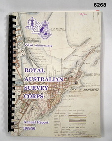
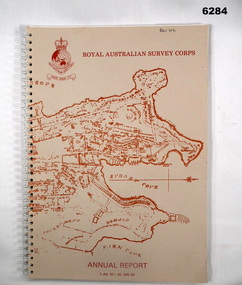
Administrative record - 75th Anniversary of the Royal Australian Survey Corps - Annual Report 1989/90, Royal Australian Survey Corps, 1990
Royal Australian Survey Corps Annual Report 1989/90 of all mapping and charting carried out during that periodAn A4 booklet, glossy pages, map index of all mapping scales, 17 pages and Annexes, plastic ring bindingroyal australian survey corps, rasvy, fortuna, army survey regiment, army svy regt, asr -
 Bendigo Military Museum
Photograph - Army Survey Regiment - Regimental Training Field Phase, c1988
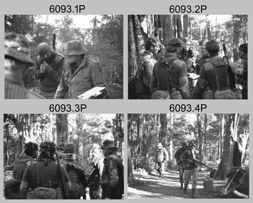
This is a set of 31 photographs of Army Survey Regiment personnel undertaking regimental training in the Wellsford Forest, Bendigo, c1988. The aim of the training was to provide personnel a practical knowledge of infantry and minor tactics at the section level, navigation and map reading, RATEL and Survival in the Field. This is a set of 31 photographs of the Army Survey Regiment undertaking regimental training in the Wellsford Forest, Bendigo. c1988. The photographs were printed on photographic paper and negatives are on 35mm film. They are part of the Army Survey Regiment’s Collection. The photographs were scanned at 300 dpi and negatives at 96 dpi .1) - Photo, black & white, c1988, unidentified personnel. .2) - Photo, black & white, c1988, CPL Terry ‘TJ’ Wicker 3rd from right. .3) - Photo, black & white, c1988, unidentified personnel. .4) - Photo, black & white, c1988, unidentified personnel. .5) - Photo, black & white, c1988, L to R: CPL Steve Coulson, unidentified. .6) - Photo, black & white, c1988, L to R: SPR Kerron South, unidentified – radio, unidentified personnel, SPR Wally Twidale. .7) - Photo, black & white, c1988, unidentified – radio, .8) - Photo, black & white, c1988, L to R: CPL John Bettridge, SPR Wally Twidale, SPR Shane ‘Soupy’ Campbell. .9) - Photo, black & white, c1988, SPR Kerron South .10) - Photo, black & white, c1988, L to R: unidentified, CPL Terry ‘TJ’ Wicker, unidentified. .11) - Photo, black & white, c1988, unidentified personnel. .12) - Photo, black & white, c1988. .13) - Photo, black & white, c1988. .14) - Photo, black & white, c1988, L to R: unidentified personnel, SPR Kerron South .15) - Photo, black & white, c1988, unidentified, CPL Terry ‘TJ’ Wicker, unidentified. .16) - Photo, black & white, c1988, L to R: unidentified personnel, SPR Jim Ash. .17) - Photo, black & white, c1988, MAJ Rene van den Tol .18) - Photo, black & white, c1988, L to R: WO2 Pat Lumsden, SPR Sue (Foote) Bourne. .20) - Photo, black & white, c1988, vehicles. .21) - Photo, black & white, c1988, tentage. .21) - Photo, black & white, c1988, L to R: MAJ Roger Rix, CAPT Dave Sankey, MAJ Bob Roche, unidentified. .23) - Photo, black & white, c1988, L to R: WO2 Alan Bunn, unidentified. .24) - Photo, black & white, c1988, unidentified personnel. .25) - Photo, black & white, c1988, unidentified personnel. .26) - Photo, black & white, c1988, unidentified personnel. .27) - Photo, black & white, c1988, L to R: unidentified personnel, WO2 Rob Bogumil. .28) - Photo, black & white, c1988, unidentified personnel. .29) - Photo, black & white, c1988, unidentified personnel. .30) - Photo, black & white, c1988, L to R: SPR Sue (Foote) Bourne, SPR Tracy (Parker) Ash. .31) - Photo, black & white, c1988, L to R: SPR Tracy (Parker) Ash, SPR Sue (Foote) Bourne..1P to .31P – No personnel are identifiedroyal australian survey corps, rasvy, army survey regiment, army svy regt, fortuna, asr -
 Bendigo Military Museum
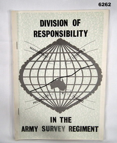
Booklet - Division of Responsibility within the Army Survey Regiment, Army Survey Regiment, 30.10.1979
Division of Responsibility within the Army Survey Regiment detailing the Management, Logistics, Production and Training in some detail. Sections detail the functions of key personnel and sub sections within the Regt. Other Sections describe production responsibilities, coordination of production aspects, management, manning and supply. Annex A has 13 x appendices. The "P" category has Personnel Employment - Officers, Other Ranks and Misc. Individual Support, Collective Support, Discipline, Financial, Conditions of Service, Ceremonial, Personnel Branch Services, Individual Training and other functions not allocated to the "P" category.A4 booklet detailing the division of responsibility within the Army Survey Regiment, paper pages with two staples on the booklet spine.royal australian survey corps, rasvy, fortuna, army survey regiment, army svy regt, asr -
 Bendigo Military Museum
Administrative record - Intergraph Maintenance Programme for Project "Newhart", Intergraph, Suite 6, 1401 Burke Rd, Kew East 3102, 28 August 1992
Intergraph Maintenance by Replacement Proposal (MBR) is the Terms and conditions for the implementation of "Project Newhart" ad the ongoing maintenance of the Automap 2 System. The Document was prepared by Intergraph's Account Manager, Norman John McMurtrie and addressed to LtCol R McHenry, CO Army Survey Regiment.A4 Booklet, Plastic cover, Blue front cover and white rear, Plastic ring binder, RASvy Badge and Text "Intergraph". Pages inserted loose and not secured, includes diagrams and text.royal australian survey corps, rasvy, fortuna, army survey regiment, army svy regt, asr -
 Bendigo Military Museum
Administrative record - RFT - Supply and Maintenance of an Optical Disk Data and Retrieval Storage System, PSG Operations Branch, Purchasing and Sales Group, Department of Administrative Services, Canberra ACT, September 1989
This Request for Tender (RFT) 59/10713J is for the archival storage of digital mapping data produced by the Automap 1 and Automap2 computerised mapping systems. The RFT Closed on 28 September 1989.A4 Booklet, Light Blue Cover, Dark Blue plastic Bindingroyal australian survey corps, rasvy, fortuna, army survey regiment, army svy regt, asr -
 Bendigo Military Museum
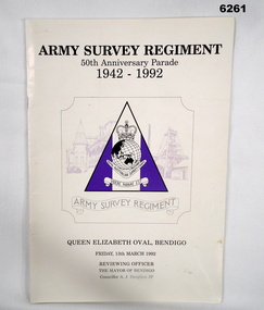
Booklet - Army Survey Regiment - 50th Anniversary Parade 1942-1992, Army Survey Regiment, March 1992
The booklet contains the programme for the Army Survey Regiment's 50th Anniversary Parade. Contains pen portraits of the Director of the Royal Australian Survey Corps, a history of the Corps, the City of Bendigo current and former Mayors, details of the Parade, various prayers, Directors of the Corps, Corps Colonel Commandants, Army Svy Regt Commanding Officers and a Nominal Role of Regt personnel.A4 soft covered booklet, glossy light card cover, paper pages, stapled. Unit Plaque design on cover.royal australian survey corps, rasvy, fortuna, army survey regiment, army svy regt, asr -
 Bendigo Military Museum
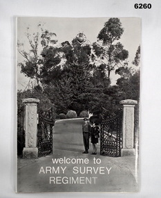
Booklet - Welcome to the Army Survey Regiment, Army Survey Regiment, Circa late 1970's
An information booklet provided to new arrivals at the Army Svy Regt. It contains information on daily routine, unit facilities and services, accommodation options, sports policy, Regimental Appointments, recreational facilities and places of interest around Bendigo. Cover photo of the gate entrance to the Army Survey Regiment on the cover. WO1 Ken and Cpl Heather Slater stand at the gate. A4 soft covered booklet, paper pages held together with "ARNOS" an Fastenerroyal australian survey corps, rasvy, fortuna, army survey regiment, army svy regt, asr -
 Bendigo Military Museum
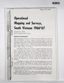
Booklet - Operational Mapping and Surveys - South Vietnam 1966/67, Royal Australian Survey Corps
Report written for the "Australian?" Army Journal. This report describes in some detail the Australian 1st Topographical Survey Troop from its initial formation in Oct 1965 through its deployment to South Vietnam in May 1966 and its Operational activities during 1966/67 in support of the 1st Australian Task Force.A4 booklet, stapled in top left corner. "SSgt Learmonth" written on front cover.royal australian survey corps, rasvy, fortuna, army survey regiment, army svy regt, asr, 1st topographical survey troop, south vietnam -
 Bendigo Military Museum
Booklet - A survey of the North Australian Coast on AK121 Aroetta, NT Force, NT Coastal Recce Unit RAE, 6 Aust Army Topo Survey Corps, AKA121 Aroetta, 28 Mar 1945
The work of the Australian Survey Corps is to make maps for the Army. At the outbreak of war very little of the mainland had been mapped, especially the northern parts. The best maps in existence of the N.T. coast in Dec "41 were those made by Matt Flinders in 1801 -1802. The Army soon got out new maps of all important areas including much of the inland. Later it was decided to bring the complete coastline up to date. Several parties put in between them six months on the coast during the dry season of "45 but a couple more months would be needed to complete the program when the "wet" interrupted the work. A small section from Buckingham Bay - Groote Eylandt was still untouched and this diary covers that section of the N.T. Coast. A survey party of four men was chosen who were to be transported from place to place by the AK121 Aroetta - a ketch of 25 tons belonging to an army unit called N.T. Coastal Recce whose work it was to patrol the coast and as well do air - sea rescue. The survey party: Lieut Jack Worsley (the Loot) Sgt jack Love, Spr Jack Cook, Spr Pat Hede. Crew of Aroetta: Liet Ralph Warne (Skipper), Sgt Buckley (Buck) (First Mate and Ordly Rm), Sgt Jim Terjesen (Jumbo) Bosun, WO2 Tom Davis (Engineer), Cpl Kevin Monk (Artificer), L/Cpl Jack Cox (Deck Hand), Spr Jack Andrews (Signals), Spr Laurie Rament (Ass. Engineer), Spr McKenzie (Mac) (Cook). The complete history is not available after July 31 1945. The remainder of the notes are very badly water-damaged and in some places unreadable.A4 Booklet, plain paper with text and diagrams and half tone photograph of Lt Jack Worsley with plastic binderSigned by George Barton Maj. for LtCol GS. NT Forceroyal australian survey corps, rasvy, fortuna, army survey regiment, army svy regt, asr -
 Bendigo Military Museum
Manual - DRAFT SPECIFICATIONS FOR TOPOGRAPHIC MAP SERIES, Specifications for 1:50000 and 1:25000 maps produced in Australia, Circa 1973
These draft Specifications set out the Standards for the production of topographic maps within the Commonwealth of Australia at scales of 1:50000 and 1:25000 and are designed to satisfy the basic requirements of both civil and military map users.Hard cover, cloth, Red, 11 Annexes, Supplementary documents.royal australian survey corps, rasvy, fortuna, army survey regiment, asr -
 Bendigo Military Museum
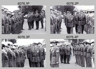
Photograph - Army Survey Regiment – CO’s Parade and Defence Force Service Medal Presentations, c1985
These photographs were taken at a CO’s parade at the Army Survey Regiment, Bendigo in c1985. The Colonel Commandant (honorary appointment) of the Survey Corps - COL Clem Sargent (retired) presented the Defence Force Service Medal to retired WO1 Dave Malligan and SGT Bill Friswell, in recognition of 15 years of efficient remunerated service.This is a set of 36 photographs of a CO’s parade and the presentation of the Defence Force Service Medal, at the Army Survey Regiment, Bendigo in c1985. The photographs were printed on photographic paper and are part of the Army Survey Regiment’s Collection. The photographs were scanned at 300 dpi. .1) to .36) - Photos, black & white, c1985.1P to .36P – There are no personnel identifiedroyal australian survey corps, rasvy, army survey regiment, army svy regt, fortuna, asr -
 Bendigo Military Museum
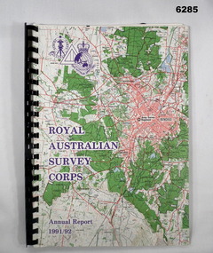
Administrative record - Royal Australian Survey Corps - Annual Report 1991 - 1992, Army Survey Regiment, 30 June 1992
This is a report on the status of Royal Australian Survey Corps mapping and charting and geodesy for the period 1 July 1991 to 30 June 1992A4 Report, Part of Bendigo 1:100,000 map on the cover, Plastic ring binder., gloss paper pages, plastic folders inside back cover containing Indexes of Mapping production and a momento of 50th Anniversary Army Survey Regiment ParadeSigned by Simon Lemon, Director of the Royal Australian Survey Corps - Armyroyal australian survey corps, rasvy, fortuna, army survey regiment, army svy regt, asr -
 Bendigo Military Museum
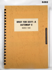
Administrative record - Brief for DSVY-A Automap 2 - March 1986, RJ McHenry Major for CO, 14 September 1987
Automap 2 is the second phase of a 3 phase project to introduce a computer assisted cartographic drafting system into service capable of capturing, storing and manipulating and outputting topographic data in digital form.A4 Folder, Orange Cardboard Cover, plastic ring bounding, "Arnos" fastener, text and diagramsroyal australian survey corps, rasvy, fortuna, army survey regiment, army svy regt, asr -
 Bendigo Military Museum
Booklet - Royal Australian Survey Corps - Annual Report 1 Jul 87 - 30 Jun 88, Director of Military Survey -Army, 01.09.1988
Royal Australian Survey Corps Annual Report detailing Surveying and mapping activities 1 July 87 - 30 Jun 88. The first part of the report details the highlights during the period followed by Annexes A to J detailing Australian Map and Chart production. Annex A: 45 pages, Annex B: 1 page Aust Doppler Satelite Stations, Annex C: 1 page, Aust airborne Profile Recording, Annex D: 1 page Aust Aerial photography, Annex E: 1 page Aust Analytical Aerotriangulation, Annex F: 1 page Inertial Positioning System Network Traverses Fils Svy, Annex G: 1 page Global Positioning System Station/networks TI4100 Svy, Annex H: 1 page, Defence Cooperation Programme, Annex I 3 Pages RASvy Officer Manning, Annex J: 1 page RASvy ARES Manning Levels.Buff coloured light cardboard covers. Old map of Sydney Cove area printed in red/brown on front cover and Survey Corps Badge in red top left corner. "Map of the town of Sydney 1836" printed on back cover. A4 sized paper pages, 17 numbered pages plus, Annex A: 45 x pages, Annex B: 1 x page Aust Doppler Satellite Stations, Annex C: 1 x page, Aust Airborne Profile Recording, Annex D: 1 x page Aust Aerial photography, Annex E: 1 x page Aust Analytical Aerotriangulation, Annex F: 1 x page Inertial Positioning System Network Traverses Fils Svy, Annex G: 1 x page Global Positioning System Station/Networks TI4100 Svy, Annex H: 1 x page, Defence Cooperation Programme, Annex I 3 x pages RASvy Officer Manning, Annex J: 1 x page RASvy ARES Manning Levels.royal australian survey corps, rasvy, fortuna, army survey regiment, army svy regt, asr