


Historical information
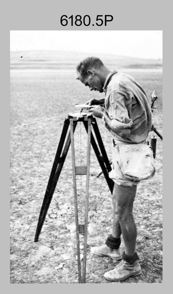
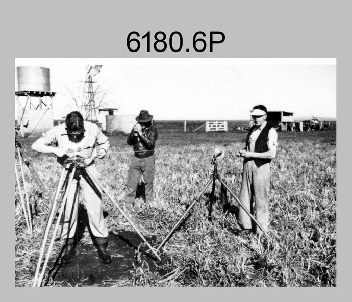
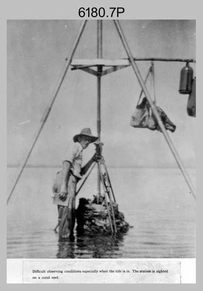
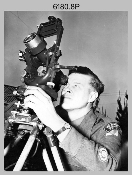
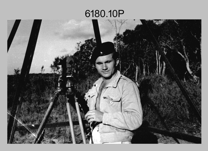
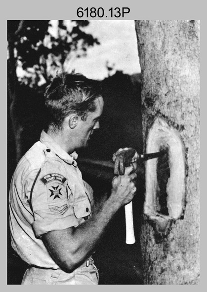
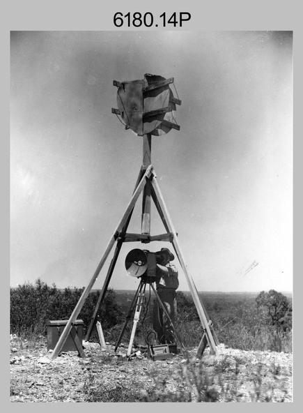
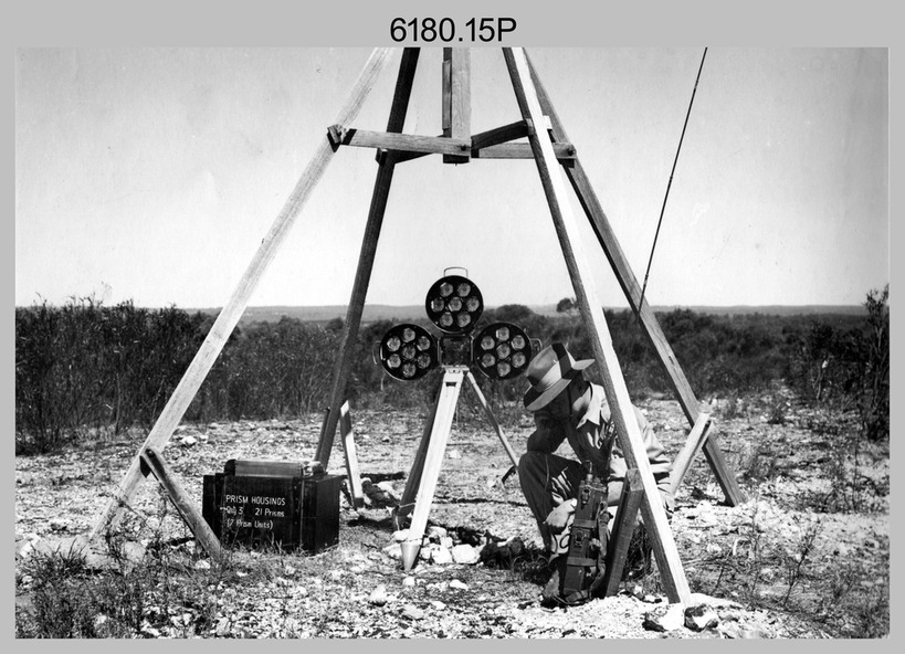
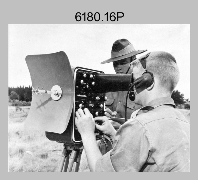
This is a set of 1photographs of surveyors in the field measuring distances using chains, taking observations using theodolites and operating electric distance measurement equipment. They were probably employed in establishing mapping and geodetic control operations or the surveyors may have been in training. The photos were most likely taken in the 1950s and 1960s. Photos .1P to .6P feature personnel setting up geodetic survey chaining equipment to measure distances. The surveyor in Photo .5P is LTCOL Howard Angus Johnson MBE who served from 1936 to 1954. The RA Svy surveyor in photos .7P to .12P were using a theodolite to take angular measurements. They were usually supported by an observer who recording their readings on a booking form. The surveyor in Photo .10P and .11P is LTCOL Jorge Gruszka, who served from 1955 to 1985. He was CO of the Army Survey Regiment from 1982 to 1985. The surveyor in photo .13P is cutting an identification blaze on a tree using a hammer and chisel. The tellurometer in Photos .14P to .16P was a MRA1 microwave Electronic Distance Measuring instrument (EDM) introduced in 1958. It and later models were man-portable systems that improved geodetic survey efficiencies for rapid network extension and densification replacing triangulation with EDM and theodolite traverse sometimes using Bilby Towers to extend line lengths. The surveyor with the slouch hat is Colonel James ‘Jim’ Leslie Stedman, who served from 1941 to 1978. He was Director of Military Survey from 1975 to 1978 and was appointed as Colonel Commandant (honorary appointment, Retd) of the Royal Australian Survey Corps from 1978 to 1983. Jim Stedman is demonstrating EDM equipment.
Physical description
This is a set of 17 photographs of surveyors in the field measuring distances using chains, taking observations using theodolites and operating electric distance measurement (EDM) equipment. c1950s – 1960s. The photographs were printed on photographic paper and are part of the Army Survey Regiment’s Collection. The photographs were scanned at 300 dpi.
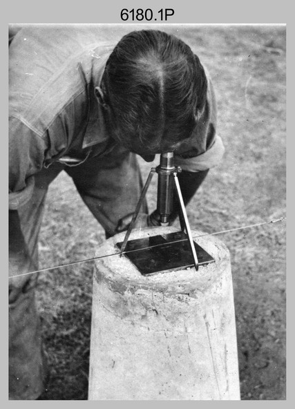
.1) - Photo, black & white, c1950s, unidentified personnel using geodetic survey chaining equipment.
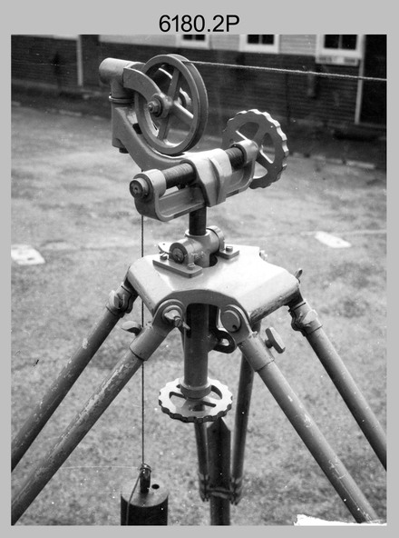
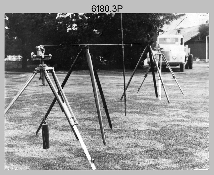
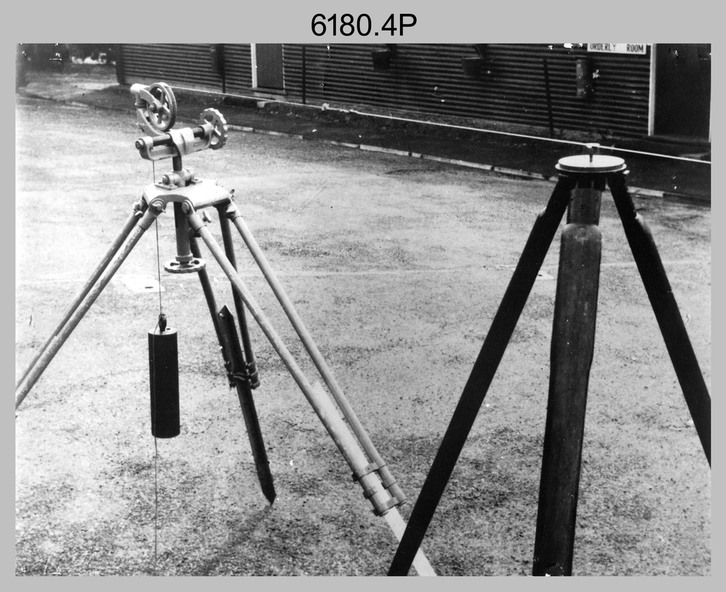
.2) to .4) - Photo, black & white, c1950s, geodetic survey chaining equipment.
.5) – Photo, black & white, c1950s, Jim Stedman using geodetic survey chaining equipment to measure distances.
.6) - Photo, black & white, c1950s, Unidentified personnel geodetic survey chaining equipment.
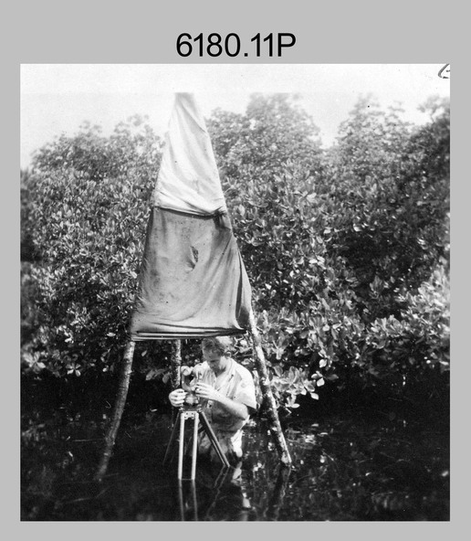
.7) – Photo, black & white, mounted on card, c1950s. Unidentified surveyor undertaking observations on a coral reef using a theodolite.
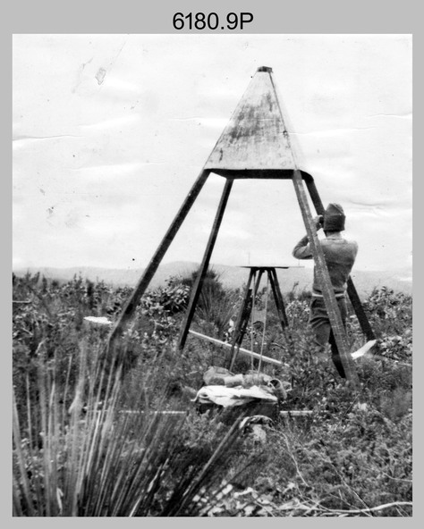
.8) – Photo, black & white, c1950, unidentified surveyor undertaking observations with a Tavistock theodolite.
.9) – Photo, black & white, mounted on green card, c1950s. Unidentified surveyor undertaking observations using a plane table.
.10) – Photo, black & white, c1955, Jorge Gruszka undertaking observations with a theodolite. 7/55 Basic Survey Course Balcombe.
.11) – Photo, black & white, c1950s, Jorge Gruszka undertaking observations with a theodolite.
.12) – Photo, black & white, c1946-1948, unidentified surveyor undertaking observations with a theodolite to gain control for the mapping of the Snowy Mountain Diversion Scheme.
.13) – Photo, black & white, c1950s, unidentified surveyor cutting a blaze in a tree.
.14) and .15) – Photo, black & white, c1960s, Jim Stedman demonstrating EDM equipment.
.16) – Photo, black & white, c1960s, L to R: Jim Stedman (probably) and unidentified surveyor demonstrating EDM equipment.
.17) – Photo, black & white, 1956, Operation Cutlass - Surveyors SPR W. Crane and J.A. Campbell undertaking observations with a theodolite in extreme conditions.
Inscriptions & markings
.1P on back - First Order Chaining Equipment
.2P on back - First Order Chaining Equipment
.3P on back - Full catenary 1800 – 1960 replaced by EDM
.4P on back - First Order Chaining Equipment
.5P on back - H.A. Johnson, Benambra baseline? 1st Order Chaining
.6P on back - Chaining
.7P on front - Difficult observing conditions especially when the tide is in. The station is sighted (sic) on a coral reef.
.8P on back - Tavistock.
.10P on back of duplicate in Photo Folder 14 – George (sic) Gruszka 7/55 Basic Survey Course Balcomme (sic) 1955/56
.14P and .15P on back - Jim Stedman demonstrating early EDM equipment.