Showing 1763 items
matching settlements
-
 National Wool Museum
Tool - Stencil, 1938
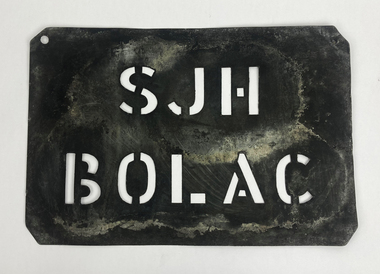
The story of 90 years of wool classing between father & son begins in 1936, when a young boy by the name of Stanley James Hucker walked through the doors of the Gordon Technical School in Geelong. Born in 1921, Stanley was 15 years of age when he began his 3-year course in Wool Classing. 30 years later, Stanley’s second son Denis completed the same 3-year wool classing course. Beginning in 1966, Denis attended the same Gordon Technical School and walked the same halls as his father before him. Stanley finished his course in 1938. He went back to the family farm in Lake Bolac for a brief period before enrolling in the Second World War. At the completion of the war, Stanley returned home and married before gaining a soldier settler allotment, north of Willaura. This enabled Stan to use his wool classing knowledge. He ran between 1,500 and 2,000 sheep for many years, while his wool classer stencil also allowed him to go out and class at various sheds around the area. He held his stencil from 1938 until he retired at the age of 60 in 1981. On retirement, his second son Denis was working in the district, managing a local property while also leasing land himself. Upon his father’s retirement, Denis had the opportunity to lease his father’s farm, an opportunity he could not refuse. Denis had finished his wool classing course at the Gordon Technical School in 1968, graduating dux of his class. He began working with a local contractor and started classing wool in his team. Denis gained a great deal of experience working as part of this team in big sheds of up to 8 stands servicing between 10 & 20,000 sheep. It was not all smooth sailing for Denis however, and he soon learnt an important lesson. Class wool the way you’re taught, don’t listen to the owner standing over your shoulder. At a clip of Corriedales near Casterton, Denis was pushing too many fleeces into the line of fine wool. This resulted in a notice from the Australian Wool Exchange (AWEX) “mixing counts too much, submit three clips for inspection”. Denis was able to submit 3 clips with no further complaints, however, this proved a valuable lesson he would never forget over his long career classing wool. In the early 1980s, when Denis was leasing two properties including his father’s, things were going well until drought struck. February 1983 was the date of the Ash Wednesday bushfires, and saw Melbourne have three days over 40 °C for only the second time on record. This period saw Denis give away farming, turning towards contracting work instead. After the difficult times of the early 1980s, the next two decades were a good time for the sheep industry. 15 micron wool was selling for prices between 4 to 5,000 cents per kilo, double what you’d expect for the same wool in 2022. In 1995 a single bale of wool sold for a million dollars. This was a good time for Denis too. His contracting work saw him employing local shearers and shed staff. His team was involved with the shearing and classing of more than 130,000 sheep. After 20 years of contracting, it was time for Denis to transition into the next phase of his life. He gave up independent contracting, preferring instead to return to being a member of someone else’s team. In 2018, having completed 50 years of wool classing, it was time to call it a day and retire completely. At the annual Gordon Wool School Old Students Association dinner held in 2018, Denis was presented with his 50 years as a registered wool classer stencil awarded by the Australian Wool Exchange (AWEX). This is a rare honour achieved by few. As of February 2020, a total of 430 wool classers had achieved this 50-year milestone. For Denis however, his proudest achievement is achieving 90 years of wool classing with his father. The National Wool Museum is proud to share the collection of objects gained from 90 years in the wool classing industry by Stanley and Denis. This ranges from Stanley’s first stencil and Wool Sample book, started when he first attended the Gordon in 1936. The collection concludes 90 years later with Denis’ 50 years of wool classing Stencil. The collection contains many more objects, all telling the story of these 90 years, and the hard work invested by this dedicated father and son duo. Thin sheet of metal with letters cut to produce a consistent pattern for the surface below through the application of ink. This wool classing stencil belonged to Stanley Hucker. It was his first Wool Classing Stencil. It was used on Stanley’s property named “Yohhatnbu” in Willaura. Stanley gained the property as part of the Returned Soldiers Settlement Scheme for his service in World War 2. The role of a Wool Classer is to sort, classify, and grade wool into various ‘lines’ so that it can be sold for best market price. Wool Classers are typically also tasked with the managing and supervising of wool-handling teams. The stencil is used in the final step of preparing a bale of wool for sale. It is branded across the front of a wool bale to indicate the quality of the wool, with the classers number used as a seal of guarantee.Cut letters. “SJH / BOLAC ”wool classing, stencil, 90 years wool classing between father & son -
 Eltham District Historical Society Inc
Slide - Photograph, Unidentified significant tree, Eltham district, c.Feb. 1993
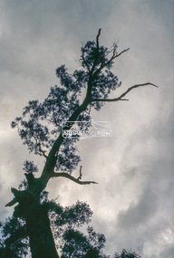
Possibly the Yellow Box, Eucalyptus melliodora, Laughing Waters Road, Eltham 80 m from Reynolds Road http://vhd.heritagecouncil.vic.gov.au/places/71057 Outstanding size Outstanding specimen Located 80m from Reynolds Road, this tree is one of the few remaining forest trees that covered the area before settlement. Measurements: 11/1981 Spread (m): 23 Girth (m): 4.3 Height (m): 42 Estimated Age (yrs): 250+ Condition: Good Measurements: 20/09/2010 Spread (m): EW 20 NS 23 Girth (m): 4..5 Height (m): 40 Estimated Age (yrs): 250+ Condition: Access: Unrestricted Classified: 17/02/198335mm colour positive transparency (1 of 3) Mount - Kodak Ektachromeunidentified, significant tree -
 Glen Eira Historical Society
Letter - HUNT, WILLIAM HOGARTH
Two sets of this man's handwritten memories: 1/Five pages of handwritten personal memories, written by William Hogarth Hunt 13/07/1977. He outlines his family, their travels and settlement in 1908 at Glenhuntly: a detailed account of residents, shop owners, land sales and identities, Murray Ross, Mr Burr of Burr’s Gun Oil and Mr Zarman. Also details Glenhuntly Methodist Church, football, athletics, Glenhuntly Aerodrome and an extensive list of local residents and their stories. 2/Two pages of handwritten personal memories, written by William Hogarth Hunt 02/09/1977. A detailed account of residents, shop owners, identities, athletes, local policemen and their stories in the Glen Huntly area.personal memories, hunt william hogarth, glenhuntly, grange road, trams, plumber, stone mary ann, neerim road, wanalta road, schurme mrs, private hospital, hospitals, watson grove, hunt jessie, hunt alfred, hunt charles, smith mr, fisher mr, smith mrs, jockeys, dore george, ‘willis’, builders, house names, mernda, roseberry grove, el nido, neerim road, glenhuntly post office, mrs fielder’s sweetshop, mrs beer’s sweet shop, paddocks, confectionery, fielder fred, maroona road, murrumbeena, grocers, callister dave, carnegie state school, hay and corn store, james street, woodyard, hillards chemist, hughes body works, chemists, davidson’s, glenhuntly printing, hay and corn stores, railway gates, anz bank, fox mr, martin jack, fox mrs, clothing stores, steam rollers, radio and tv shop, beasley j, delicatessen/ham and beef shop, butchers, schurme’s private hospital, gellatley george, tailors, commonwealth banks, watson grove, banks, preston peter, e.j. & h. amos, hardware stores, estate agents, glenhuntly picture theatre, whittle mr, theatres, newsagency, cooper and cooke, station street, f.j. long and co, jennings a.v, timber yards, builders, ‘the estate’, hillcrest estate, grange road, marara road, rosedale avenue, hobart jack, mackie road, confectionery stores, ross murray, glenhuntly athletic club, godfrey evelyn, athletics clubs, railways, glenhuntly junior football club, elsternwick, princess park, carnegie oval, booran road, koornang park, ormond oval – ee. gunn reserve, glenhuntly oval, oakleigh road, victorian amateur turf club, koornang road, glenhuntly aerodrome, neville street, glenhuntly state school, rosslyn street, geary mr, lauriston tennis courts, bakers, carnegie r.s.l., east bentleigh, bowling clubs, tucker road, tennis clubs, centre road, murrumbeena road, larman mr, hollway street, nurseries, parker street, lyle marshall, burr mr, solicitors, builders, bones nursery, ‘burr’s gunoil’, glenhuntly methodist church, carnegie, smith alf, ezard family, clemens family, noy family, noy clarrie, dickie family, storey family, storey george, davis family, joss house, chinese community, wattle avenue, grange road, glenhuntly amateur football club, football clubs, glenhuntly athletic club, athletic clubs, glen huntly junior football club, carnegie oval, koornang park, glenhuntly oval, victorian amateur turf club, glenhuntly aerodome, glenhuntly state school, geary mr., bakers, east bentleigh, tucker road, centre road, larman mr, nurseries, lyle marshall, solicitors, bones nursery, carnegie, "the estate", royal avenue, mckay avenue, dumsday bertha miss, love family, gilmour family, waratah ave, sinclair mr, tuckpointers, bricks, donegan mr, plumbers, frazer mr, frazer and jenkinson printers, frazer arthur, ezard manufacturing, jewellers, private hospital, maroona road, o'carroll mr, beattie mr, horse trainer, morton tom, lord harry, estate agents, ormond, councillors, taylor mr, builders, gibson family, westley alf, o'carroll j (jack) d, glenhuntly athletics club, athletes, jack page's bakery and cake shop, nay clarrie, hunt william h., hunt alf, page jack, armstrong jack, manchester grove, morgan advertising, cusdin sid, farrier, glenhuntly cricket club, caulfield racecourse, neerim road, hoffman's plumbing, emma street, st. agnes school, st. agnes church hall, jenkin 'boss' mr, teachers, hawthorn miss, quinn miss, chitty charlie, chitty's timber, crystal palace picture theatre, theatres, marsh bill, hardware shops, watson arthur w, j.s. kidd and company, marshes hardware, kidd's hardware, bruce ivy, 'belgrave', house names, belgrave road, dandenong road, hunter 'pud', police officers, hunt jess, kangaroo road, murrumbeena, glen huntly -
 Mt Dandenong & District Historical Society Inc.
Photograph, Walker's LOT 2
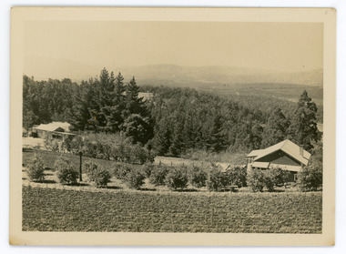
Harry Walker's property would have been run by his son William in 1922. When the CRB Road cut through the property William planted plum trees on the opposite side. These are visible in this photo. An extensive raspberry crop is in the foreground. The building over the road on the left hand side is the corn and produce store built by Edward John Price (son of Edward Joseph Price) to capitalise on the CRB Road cutting through the Price farm. John Lundy-Clarke grew up in the Kalorama/Mt Dandenong area and later in life (1972-74) began to write a comprehensive history of the area working from an original settlement map in an effort to cover all areas.Small black and white postcard showing a crop in foreground with a house to the right. A road passes through the centre with a house on the left on the opposite side of the road. A view to the ranges in the distance. A handwritten description on reverse by John Lundy-Clarke.View at Kalorama. View over LOT 2 (Walkers) 1922.harry walker, william walker, crb road, raspberry, edward john price, edward joseph price, produce store, store -
 Glen Eira City Council History and Heritage Collection
Oral History - Deirdre Farrell, Cameron Auty, 11/05/2016
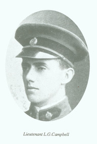
This interview was recorded in May 2016 as part of the Wounded Soldier exhibition. The Wounded Soldier ran in November 2016, exploring No. 11 Australian General Military Hospital (later Caulfield Hospital) and its impact on Glen Eira's community during and after the First World War. The audio file catalogued here is an edited excerpt from the larger interview, designed for use in the exhibition. Deirdre Farrell trained as a nurse at Caulfield Hospital in the 1960's. Her father Les Campbell was a First World War veteran, and Deirdre grew up on a soldier settlement farm. This interview explores her childhood, her relationship with her father, her experience of repatriation medicine and her memories of Caulfield Hospital. This oral history is significant as the firsthand testimony of the child of a First World War veteran and for its recollections of Caulfield Hospital in the 1960's. Digital recording of an oral history interview taken by Cameron Auty with Deirdre Farrell. Supplementary files include photographs of Deirdre's father Les Campbell, a WWI veteran, Les' service record and a research file created by Deirdre.glen eira, caulfield, deirdre farrell, wwi, oral history, first world war, soldier settlement -
 City of Greater Bendigo - Civic Collection
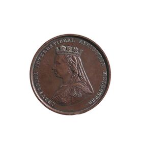
Medal - Centennial International Exhibition Melbourne 1888, Stokes and Martin, 1888
The 1888 Centennial International Exhibition, celebrating a century of Australian settlement, surpassed even the grand scale of the1880 Melbourne International Exhibition. It attracted over two million people, but the Victorian government had to spend £250 000 on it, ten times the amount estimated. The exhibition had a distinctively imperial focus, and a greater emphasis on culture than in 1880, particularly on music and painting (1). (1. https://collections.museumsvictoria.com.au/items/273830) S.D. Gadd was appointed Curator of Parks and Gardens in 1874 an lived in residence in Rosalind Park. He resigned in 1905 and moved to Melbourne where he died in 1917. Mr Gadd was a prominent member of the Masonic Lodge. It is not clear why he was awarded this medal.The bronze medal of the Centennial International Exhibition awarded to S.G. Gadd. Obverse - Portrait: bust of Queen Victoria in left profile wearing a crown, veil and 3 medals. Reverse - Field: Victor's wreath consisting of leaves and acorns of British oak and the leaves and acorns of the wattle. The oak and wattle were tied together 'by a true-lover's knot, 'symbolizing the unity and affection between the mother country and the colony'. Southern Cross inside surrounded by a legend. (https://collections.museumsvictoria.com.au/items/273822) Obverse - Motto: Centennial International Exhibition Melbourne Reverse - Legend: (Latin) Artibus Dignis Honor Insignis (To the deserving arts, distinguished honor) (Mint) left: Melbourne Mint. (Date) Lower Centre: MDCCCLXXXVIII. (Engraver) Right: Stokes & Martin S.C. Edge - Plain, impressed with S.G. Gadd ESQ.centennial international exhibition melbourne 1888, s.g. gadd, rosalind park, city of greater bendigo medals -
 Melbourne Legacy
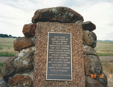
Photograph, Widow Daytrip, 1988
An outing by the widows club to visit a memorial to servicemen and women from the Woodhouse-Nareeb area. The photos show a group of ladies who attended and the plaques and memorial board. The plaque says 'These trees were planted by district people in memory of servicemen and women who died serving their country in the 1939-45 war, including nursing sisters who lost their lives in the java seas and on Banka Island. Dedicated 1978, Sister Jeffery 'Lest We Forget'. The memorial board says 'World War 2 Soldier Settlement Woodhouse-Nareeb area. The settlers served with Navies, Armies, and Air Forces of the British Commonwealth, many of their wives served with the Womens' Auxillaries and nursing services.'A record of the types of activities Legacy provided as a physical and social outlet for widows.Colour photo x 5 of an outing to a memorial in 1988.Photos are marked as 4 December 1988.widows, widows outing, memorial, daytrip -
 Warrnambool and District Historical Society Inc.
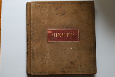
Administrative record (Collection) - Grasmere cheese and Butter Factory Company Records, Grasmere Cheese and Butter Factory administrative employees, Records: Grasmere Cheese and Butter Factory, 1890-1959
Administrative Records of Grasmere Cheese and Butter Factory - source of collection unknown This collection of administrative records has been created for historical reasons and archival purposes.Items kept in two A2 size archival boxes in the Archives Room and stored in this way some years after the acquisition of these items at an unknown date.Four ledgers containing Minutes, two unbound packets of Minutes and one photographic supplement from a magazinegrasmere cheese and butter factory pty ltd, dairying in the warrnambool districtgrasmere cheese and butter factory pty ltd, dairying in the warrnambool district -
 National Wool Museum
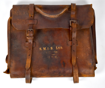
Functional object - Brown Leather Satchel Bag, Strachan, Murray and Shannon Ltd, c. 1920s
The company developed from the merchant activities of John Ford Strachan who commenced business in the Port Phillip settlement during 1836. A series of amalgamations from 1876 to 1896 extended the interests of the firm which registered on 23 Dec 1897 as Strachan, Murray & Shannon Pty Ltd. The company floated as a public company on 12 Sep 1919 and changed its name to Strachan & Co Ltd on 1 Jul 1931. The business was taken over by Dennys Lascelles Ltd and deregistered on 2 Aug 1978. The Stachan Woolstore complex on the corner of Moorabool Street and Brougham Street, Geelong was first built in 1840 and has been systematically redesigned over the years. Currently only the facade remains.Brown leather satchel bag with a handle and straps which fasten with metal belt clips. Gold printed lettering is featured on the front. Front [printed]: S. M. & S. LTD. / GEELONG / H. H. H.bag, working life, geelong, leather satchel -
 Sunbury Family History and Heritage Society Inc.
Photograph, Emu Bottom
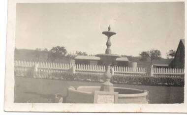
The fountain in the image is at the entrance to the 'Emu Bottom' homestead. George Evans squatted on land to graze sheep, along the Jacksons Creek Valley, originally known as Buttlejork Valley, in 1836 and built the homestead from local Silurian sandstone and timber. Over the years it has had a number of owners. In the 1920s the property was renamed 'Holly Green' by H.L Webb after a property in Narre Warren.In the 1950s it was renamed 'Emu Bottom'. Over the years a number of fires have destroyed parts of the building and as a result, little of the original building remains. The fountain was erected in 1936 to mark the centenary of the property as well as 100 years of European settlement in theSunbury area. The property is now a private residence and function centre.'Emu Bottom' is one of the oldest homesteads in Victoria.A small non-digital sepia photograph with a cream border of a fountain, with a horse trough around the base, at the entrance of a rural property.'emu bottom', holly green, sunbury, jacksons creek, buttlejork valley, george evans -
 Orbost & District Historical Society
black and white photograph, January 1, 1897
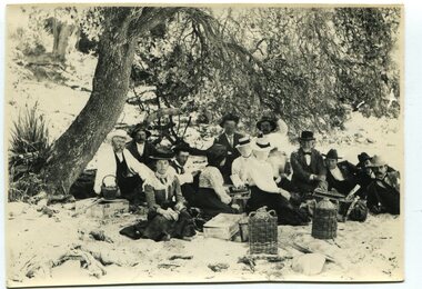
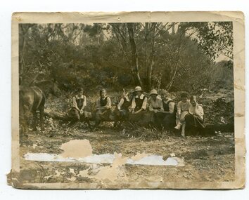
This photograph shows Mr John Bird ( 3rd from left) ; Mr John Gilbert and Mr Lance Herbert among others having a picnic at the popular beach paddock at Old Station, Corringle, on January 1, 1897. Late in 1857 Mr Thomas T. Stirling took over Corringle Run ("Corringle" means "shallow water"). Mr Stirling and his family came from the wester district - Winchelsea. He settled at the Old Station. A few people were employed at the Orbost Stationb and there was settlement on the Orbost flats, Mr T. T. Stirling held the land from Lake Tyrers to Bemm River as a cattle run. About 1888 he became Secretary of the new Tambo Shire.This photograph is a portrait of rural life in the late 19th century. It is an insight into the dress, manners and activities of the first settlers of Orbost.Two copies of a black / white photograph of a group of men and women picnicking on the sand under tall trees.on back - "Beach Paddock - Old Station -1897" with a list of namesold-station-orbost rural-family-life -
 Kiewa Valley Historical Society
Newspaper clipping 11/7/72 Canoe tree in Kiewa & Photo-Tawonga Homestead
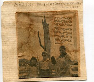
1. Kiewa Valley Consolidated School was established in 1953 combining Dederang North, Kergunyah, Gundowring, Kiewa, Gundowring Upper, Red Bluff, Charleroi and Gundowing North schools on a 10 acre site with 11 rooms at Kiewa. The bark was cut from the canoe tree, by aboriginal craftsmen, to produce a canoe for fishing in the rivers running through the Kiewa Valley either before or just after the 1800's. The tree trunk, located at Kiewa, would have been used at the beginning of European settlement in the Kiewa Valley or just before contact was made. 2. Pictorial record of the graves of early pioneers C Ibbotson, Mrs Elizabeth Eyre and John Eyre who died between 1858 – 1904, all located at Tawonga Homestead 1. The above schools are in the Kiewa Valley. The date and number of combined schools give insight into the change in population and families in the Kiewa Valley before and after 1953. The tree was found along the Kiewa River and indicates that Aborigines lived by the river and used tree bark to craft canoes to cross rivers and to fish in the deeper sections of the river. 2. Pictorial record of the early history of Kiewa Valley pioneers whose descendants have lived and worked in the Kiewa Valley for many years 1. Newspaper article of local school children visiting a canoe tree in Kiewa July 11, 1972. mounted on buff card 2. Black and white photo of pioneer graves at old Tawonga Homestead. Mounted on buff card 1. Handwritten in black ink above newspaper clipping ‘Canoe Tree Kiewa Valley Consolidated School. 11 July, 1972’ Handwritten in pencil at bottom of article ’10 Nov. ‘72’ 2. Handwritten in black ink above photo ‘Tawonga Homestead graves’ Handwritten below photo ‘T Ibbotson D. 1858, Elizabeth Eyre D. 1879, John Eyre D 1879, John Eyre D. 1904 tawonga homestead, canoe tree at kiewa, tawonga graves -
 Warrnambool and District Historical Society Inc.
Hat, School W'bool High School, Early 1930s
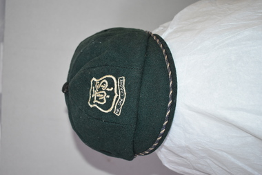
This is a Warrnambool High School cap from the 1930s. Warrnambool High School was established in 1907 with a farm site in Merrivale and it was also in several sites in the main town area, with the longest occupancy in Hyland Street. In 1961 the school moved to its present location in Albert Park (Grafton Road). The High School amalgamated with Warrnambool North Technical School in 1995 to form Warrnambool College. Malcolm Goodall, the owner of the cap, was born in 1917 and died in 2010. He lived in Coulstock Street and he worked in the tinning department of Nestles. The Goodall family has been in the Warrnambool area since the mid 1850s including being at the farm, ‘Wanstead’ in East Warrnambool and at Framlingham in the 19th century where William Goodall was the manager of the aboriginal settlement. This cap is of interest as an example of the boys’ uniform at Warrnambool High School in the 1930s and as a memento of Malcolm Goodall. His ancestors were pioneers in the Warrnambool district.This is a boy’s cap made of dark green cloth with octagonal sections and a cloth button on top. The peak is edged with navy and cream cord. The centre front of the cap has a school badge with the school initials and motto. The inside of the cap is lined with black cloth with a cream centre and has the cap seller’s business details and the name of the owner of the cap. Some of the printed material here is indecipherable. The stitching is worn in some places. W.H.S. Sine Labore V. Becker Boys Shop & Hosiery Parlour Warrnambool Name: M. Goodall warrnambool high school, goodall family, history of warrnambool -
 Eltham District Historical Society Inc
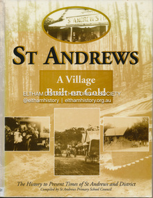
Book, St Andrews Primary School Council, St Andrews: A Village Built on Gold : the history to present day of St Andrews and District compiled by St Andrews Primary School Council, 2008
This history of the Victorian town of St. Andrews (formerly Queenstown) and its surroundings was written to celebrate the 140th anniversary of St Andrews Primary School. Describes the displacement of the Aboriginal inhabitants of the area, European settlement and the Gold Rushes and the Caledonia diggings. Discusses establishment of the school, church and cemetery and various other notable events. The school in 1998 and speculations on the future by primary school pupils. Contents: Introduction The First People Mining- What a rush! The School The Church Queenstown Cemetery The Hotels The Police Paddocks The Families Queenstown in the early twentieth century The Queenstown Bush Fire Brigade The 1st Queenstown Scout troop Queenstown, the 1940s and 1950s The Characters Odds and Sods St Andrews - The Present Times The Future St Andres Primary School in 1998This book is significant in that it documents the history of the St Andrews community from the indigenous presence through its foundation during the Victorian Gold Rush through to local bushfires and predictions of the future by local primary schools students in 1998. It remains the only significant secondary source publication written specifically on this rural community.Reprint edition with index 158 p. : ill., ports ; indexEx Eltham College copy Bendigo bank donation label inside cover Title page with stampings for D.D. Davey Senior Library Rear page date due slip st andrews, queenstown -
 Kiewa Valley Historical Society
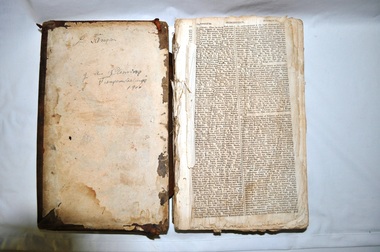
Bible - Family, Brown's Superb Bible, circa early 1800's to 1900
This item represents one of the most important spiritual references available to a settler in countryside Australia in the period 1800s to 1900s. This is the family bible and relates to the major religious beliefs of the early settlers who pioneered British/European colonial settlements. Although the first pages are missing the family name is written on the inside cover (J.A. Fleming). Most of these bibles (of this era) showed the family genealogical record of births, baptism and deaths, however this bible has the relevant pages missing. This bible would have provided the spiritual strength needed in bad times. Throughout this bible there are copies of specially commissioned lithographic engravings, each published between March 1812 to December 1813. These photographs were provided to visualise the theme of the each chapter.This item is significant because it shows that spiritualism of a small group (family in this case) is a vital part of the cohesive forces which holds a family(the basic subgroup of society) together, against all odds, and external pressures. It demonstrates that even in isolated or sparsely populated areas, the mores of a christian community is as strong as that of the cities. Mountains (Victorian Alps) have throughout the enlightened Ages been of extreme spiritual significance and this beholds those who live in this area.The families in the Kiewa Valley fall into the "isolated rural area" when this bible was first in use. This bible contains as its introduction,scripture history starting from 4004 BC "God created all things" to 2900 AD end of the World. There is a high degree of probability that this bible belonged to a member or members of the John Ambrose Flemming extended family who resided in the Kiewa Valley. J.A. Flemming (a famous English electrical engineer and physicist) invented the first diode in 1904). He and his family were devout Christians and he helped establish the Evolution Protest Movement.Leather bound bible. Leather in some areas is in tatters revealing the thick multi-layered cardboard backing. Front and back covers are held together by the thin leather binding. The lettering of the bible is large.Hand written inscriptions are in ink on the inside front cover, " J Tangam" at the top, "J A Fleming" underneath "Tangambalanga" and below that "1900". There are penciled dates "1937 1900" which have at one point in time been scribbled over in pencil. Although not marked on cover, the bible was known as "Brown's Bible" after the Author, the Rev. John Brown. Each of the major chapters is introduced by a copy of a lithographic print detailing the relevant religious picture and all are headed by "Brown's Superb Bible" and the date of the print. bible, rev. john brown, old and new testament, christianity -
 Eltham District Historical Society Inc
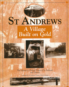
Book, St Andrews Primary School Council, St Andrews: A Village Built on Gold : the history to present day of St Andrews and District compiled by St Andrews Primary School Council, 1998
This history of the Victorian town of St. Andrews (formerly Queenstown) and its surroundings was written to celebrate the 140th anniversary of St Andrews Primary School. Describes the displacement of the Aboriginal inhabitants of the area, European settlement and the Gold Rushes and the Caledonia diggings. Discusses establishment of the school, church and cemetery and various other notable events. The school in 1998 and speculations on the future by primary school pupils. Contents: Introduction The First People Mining- What a rush! The School The Church Queenstown Cemetery The Hotels The Police Paddocks The Families Queenstown in the early twentieth century The Queenstown Bush Fire Brigade The 1st Queenstown Scout troop Queenstown, the 1940s and 1950s The Characters Odds and Sods St Andrews - The Present Times The Future St Andres Primary School in 1998This book is significant in that it documents the history of the St Andrews community from the indigenous presence through its foundation during the Victorian Gold Rush through to local bushfires and predictions of the future by local primary schools students in 1998. It remains the only significant secondary source publication written specifically on this rural community.158 p. : ill., ports ISBN 0646353756st andrews, queenstown -
 Warrnambool and District Historical Society Inc.
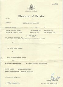
Document, Australian Army Statement of Service, C 1976
He served from December 1941 to July 1942 in the Citizen Military Forces and from July 1942 to September 1944 in the Australian Imperial Forces. His reason for discharge was reserved occupation. He held the rank of corporal in 26th Motor regiment. He was born in Colac 19/11/1919 to Ernest Swan and Daisy Johnson. He died 04/08/2009 and is buried at the Warrnambool cemetery. During his life he farmed a soldiers’ settlers block in the Grasmere area, north of Warrnambool. The soldiers' settlement program was instigated after both world wars whereby land was made available to returning soldiers. Some of the land was Crown land and some was acquired. This document is an official statement of his service.This document has social significance and interest as it is representative of thousands of local men who served in World War 2. It is a link also to the Soldiers' settlement programCream paper with black text. Personal details of Ernest Henry Swan have been typed into fields. text in the centre of the reverse.Signed E H Swan. date of issue is 11/08/1976.Army number VX88010.warrnambool, e h swan, e h swan statement of service -
 Orbost & District Historical Society
black and white photograph, 1923
This photograph was taken at the "old station" at Corringle near Orbost. It was a popular picnic spot. Late in 1857 Mr Thomas T. Stirling took over Corringle Run ("Corringle" means "shallow water"). Mr Stirling and his family came from the wester district - Winchelsea. He settled at the Old Station. A few people were employed at the Orbost Stationb and there was settlement on the Orbost flats, Mr T. T. Stirling held the land from Lake Tyrers to Bemm River as a cattle run. About 1888 he became Secretary of the new Tambo Shire. In the photograph L-R are; Hilda Kerr; Myra Malcolm; Marion Nixon; Bess Goudie (teacher); Mary Gilbert; Gwen Hobson (teacher); Pen GilbertOrbost High School / Orbost Secondary College has played a significant part in the education of senior students in the Orbost district . It is the sole senior educational institution. This item is representative of its history. It is a useful reference tool.A black / white photograph of a group of young women sitting on a log in a clearing in a bush setting. Five are in school uniform. On the left is a horseeducation-orbost orbost-higher-elementary-school recreation old-station-corringle -
 Mt Dandenong & District Historical Society Inc.
Photograph, Clint Rowse and Staff
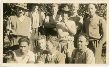
John Lundy-Clarke grew up in the Kalorama/Mt Dandenong area and later in life (1972-74) began to write a comprehensive history of the area working from an original settlement map in an effort to cover all areas. John Lundy-Clarke has identified the photograph as being of Clint Rowse and Staff at Olinda Creek Valley in 1939. The workmen are: Back row from right: Bob Daly, Dud Page, Harry Dyson, Bill Cavell, Len Child, Ken Williams. Front row from right: Clint Rowse, Jack Clarke, Bernie Page, Jack Johnson (with dog). The Rowse family had extensive raspberry crops but later changed to flowers. Daisy Rowse married Hubert Jeeves. Black and white photograph showing a group of 10 workmen, one holding a dog.The names Lenny Child, Dyson, Page, Bob Daly, Jackie Johnston, J Clarke, Clint Rowse are handwritten on the back by John Lundy-Clarkelen child, bob daly, clint rowse, jack johnston, bill cavell, ken williams, jack clarke, dud page, bernie page -
 Glenelg Shire Council Cultural Collection
Work on paper - Watercolour, Florence Tatham Mellblom, Portland Shire Hall, n.d
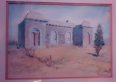
From Antiques Reporter: Florence Tatham Mellblom, (Australian, 1900 - 1983), Visit Portland The First Victorian Settlement, during the Centenary Celebrations from 15th to 23rd November 1934', 1934 colour lithograph, signed 'F. Mellblom' in image lower left, 63.5 x 101.5 cm. Linen-backed. Text continues in lower margin: 'Arbuckle, Waddell Pty Ltd Print, Melb.', Mellblom (nee Henry) was a painter, naturalist and photographer. She was born at Portland, Victoria, and studied art in Ballarat. She was a talented etcher from childhood, and joined the Portland Camera club. She also produced many watercolour paintings of the historic places of Portland. She was married (1932) to Karl Enoch Mellblom.A bluestone building on an arid landscape. Yellow grass in the foreground with one tree standing at the front. There is a blue sky behind. The left hand wing has a door which is slightly open. Above each wing is an engraved piece of stone. Left - Portland, right - Shire. An old rickety fence to the left of the building.Bottom Right - F. Mellblomfemale artist, women, female, landscape, portland landscape, portland shire -
 Warrnambool and District Historical Society Inc.
Dunmore Journals (4), Mid 20th century
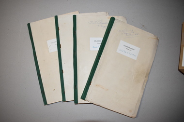
These four booklets contain typed copies of the diaries of Charles Hamilton MacKnight from 1841 to 1873. They mostly concern details of MacKnight’s life and work on Dunmore Station, a property at Broadwater, 20 kilometres from Macarthur and 54 kilometres from Warrnambool. Charles Hamilton MacKnight (1819-1873) came to Australia from Scotland in 1841 and established the property of Dunmore in 1842 with partners William Campbell and James Hamilton Irvine. MacKnight was a prominent breeder of sheep, cattle and horses and his diaries provide a valuable record of early settlement in the Western District of Victoria. The original diaries are in the Latrobe Library in Melbourne. These copies come from the Baulch family who owned part of the original Dunmore property for many years. As these booklets are copies of the original diaries they are of minor significance only but will be useful to local researchers..1 This is a foolscap-size booklet containing typed material. It has a buff-coloured paper cover with green binding containing three staples. It has a handwritten name and address, a handwritten set of dates and a typed label pasted on the front cover. The cover is somewhat creased and stained. .2 as .1 above .3 This is a foolscap-size booklet containing typed material. It has a buff-coloured paper cover with green binding containing three staples. It has a typed label pasted on to the front cover. .4 as .3 above .1 S.S. Baulch 7 Ferguson St Warrnambool The Dunmore Journal Volume 1 Oct 14th 1841 to Feb 28th 1851 .2 S.S. Baulch 7 Ferguson St Warrnambool The Dunmore Journal Volume 2 March 1st 1851 to Mar 19th 1860 .3 The Dunmore Journal Volume 3 .4 The Dunmore Journal Volume 4dunmore station, western victoria, charles hamilton macknight, baulch family, dunmore, history of warrnambool -
 Glenelg Shire Council Cultural Collection
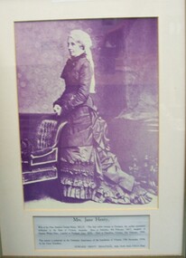
Photograph, Mrs. Jane Henty, 1984
Displayed at History House. Original presented by Edward Henty Smallpage to Stokesley in around 1934Black and white photograph of a standing woman in 19th century dress. Her dress is a dark colour and she is wearing a white cap with trailing lace/fabric back. She is posed in a room with floral wallpaper, standing behind a chair with her hands clasped in front of her. At bottom of frame are the details of the donation of this item. Framed under glass in wooden frame.Front: PRESENTED TO THE TOWN OF PORTLAND BY THE PARISH COUNCIL OF STOKESLEY, ENGLAND 1984 (typed, upper case). Mrs. Jane Henty, wife of the Hon. Stephen George henty, M.L.C. The first white woman in Portland, the earliest permanent settlement in the State of Cictoria, Australia. Born at Stokesley, 8th February 1817, daughter of Captain Walter Pace. Landed at Portland, June 1836. Died at Hamilton, Victoria, 3rd February 1906. This portrait is presented on the Centenary Anniversary of the foundation of Victoria, 19th November 1934, by her Great Grandson, EDWARD HENTY SMALLPAGE, M.B., Ch.M. (Syd), F.R.C.S. (Eng).henty, jane henty, portrait photography -
 Mt Dandenong & District Historical Society Inc.
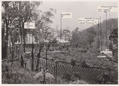
Photograph, 1908 View of the Kalorama Gap from Main Road With Labelling, 1908
Photograph with labels attached to front identifying buildings. View of the Kalorama Gap from main Road (now Ridge Road), looking across Walker's raspberry patch with Mountjoy coaching stables on the LHS and Mountjoy Guest House in centre. Price's house and shop on the RHS. This photograph has a detailed inscription on the back handwritten by John Lundy-Clarke in 1974.1908 View of the Kalorama Gap from main Road – now Ridge Road above Lot 2 of the Village Settlement. Looking across Walker’s raspberry patch with “Mountjoy” coaching stables on left. “Mountjoy” in centre. Prices house and shop on right with Hands “Beulah Tearooms” above Prices roof. On hillside beyond Hand’s is the slope now taken up by Kalorama Terrace. Walker’s well, then newly dug is in lower right hand corner below the tree fern head. Mt Kalorama is the hill top right. Track leaving Main Road left is Walker’s entrance drive.kalorama, kalorama gap, walker, beulah tea rooms, price, hand, mountjoy, mt kalorama -
 Orbost & District Historical Society
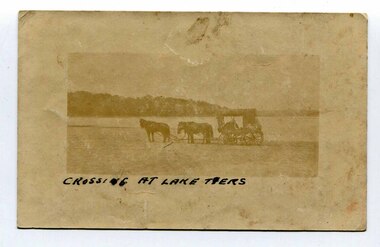
black and white photograph, late 19th - early 20th century
In the late 19th century in the Orbost area roads were just bush tracks which generally were unsuitable for any type of vehicular traffic so were traversed mainly by horseback. As the settlement grew, a weekly mail service from Cunninghame (Lakes Entrance) was estab-lished. The settlers had to carry the mail for three months and each took a turn as mailman during that time. The first coach was driven by Mr Alex Hall. Eventually a daily mail service was set up and many drivers included B. Sutherland, W. Middleton, Jonson Bros., J. Mitchell, F. Newport, J. Geddes, A. Coulson, Bert Cessor, H. Weekes and A. Barthile. (info. from Newletter August 2007) This photograph is one of A. Coulson’s Coach crossing the Sand Bar at Lake Tyers.This is a pictorial record of very early transport in East Gippsland.A very faded small postcard / photograph of a horse and cart crossing a beach.on front in black writing - " Crossing at Lake Tyers" on back - "A Coulson"lake-tyers transport coulson-coaches -
 Orbost & District Historical Society
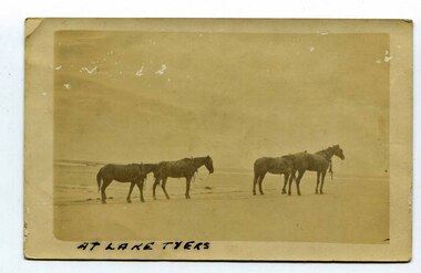
black and white photograph, late 19th century - early 20th century
In the late 19th century in the Orbost area roads were just bush tracks which generally were unsuitable for any type of vehicular traffic so were traversed mainly by horseback. As the settlement grew, a weekly mail service from Cunninghame (Lakes Entrance) was estab-lished. The settlers had to carry the mail for three months and each took a turn as mailman during that time. The first coach was driven by Mr Alex Hall. Eventually a daily mail service was set up and many drivers included B. Sutherland, W. Middleton, Jonson Bros., J. Mitchell, F. Newport, J. Geddes, A. Coulson, Bert Cessor, H. Weekes and A. Barthile. (info. from Newletter August 2007) This photograph is one of A. Coulson’s Coach crossing the Sand Bar at Lake Tyers.This is associated with early transport in East Gippsland.A black / white postcard photograph of four horses alone on a beach.on front - At Lake Tyers on back - "Mr A. Coulson, coach driver, Orbost"lake-tyers coulson-coach-driver transport-horse-drawn -
 Warrnambool and District Historical Society Inc.
Ledger, Warrnambool Municipal Common, Circa 1865
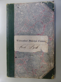
This cash book contains entries which relate to the everyday operation of the Borough Common which predates the establishment of Warrnambool as a town. All ratepayers had the right to graze their cows on the common, with the cows being collected every morning by the herdsman and walked to the common. Entries relate to items such as eradication of thistles, repairs and erection of stock yards, burying of dead stock, purchase of bulls and clearing of waterholes. Salaries were paid to E. Margetts, D Allan, T Raingill, and M T Read. Auditors were James Dickson. After WW1 parts of the common were allocated to soldiers’ settlement blocks ranging from 18 to 30 acres. Other parts remained with the Crown for Municipal uses and part became the Warrnambool Golf Course. In 1925 the common was abolished.The entries in this book record the operations and earliest residents who were involved in the Common in the early days of WarrnamboolGrey and red mottled card cover with dark green points and spine. Paper label on front cover. Dark blue and tan mottled paper inside front and back covers. Warrnambool Municipal Common Cash Book.warrnambool borough, warrnambool common, e margetts, raingill, d allan, m t read, warrnambool common cash book -
 Warrnambool and District Historical Society Inc.
Audio - Audio CD, Tapestry: our Pye family history through all generations, Early 21st century
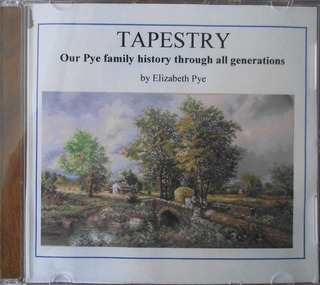
This DVD gives information about the Pye family. Thomas Pye came to Sydney as convict in 1837 and was assigned to work for Captain Sylvester Brown and came to the Port Philip district with his master. Sylvester's son, Thomas, travelled to the Western District in 1844 and took Thomas and his wife. Mary with him. Thomas Browne later wrote novels under the name of Rolf Boldrewood . In his book " Old Melbourne Memories " Thomas Pye is given the name Joe Burge. Thomas Browne established the property "Squattlesea Mere" and Thomas Pye and his family settled in Port Fairy and then in Bessiebelle. Today this little settlement has many Pye descendants. The other matter of interest is that Thomas Pye's son,Charles Pye, gained the Victoria Cross in India and is buried at Tower Hill. his DVD is of historical interest because it records the story of the Pye family in the Western District.This is a DVD with blue hand writing on the front and an accompanying sheet of paper showing an English country scene. It is enclosed in a plastic mesh envelope.TAPESTRY Our Pye Family history through all generations by Elizabeth Pye.pye family, warrnambool, captain sylvester brown, thomas browne, rolf boldrewood -
 Warrnambool and District Historical Society Inc.
Book, Poems - Australian poetry lovers society, 1952
This book was published in 1952 by the Australian Poetry Lovers’ Society. This group was based in Melbourne and was founded in 1934 by George and Ethel Fielding. In 1973 a member, Harry Hastings Pearce, wrote a history of the society. This 1952 volume contains two poems by Thomas Terrington (born 1897) - ‘Henry Lawson’ and ‘Stella’. Tom Terrington was a well-known local poet and writer from Framlingham. He has been described as a ‘rhymster of flair and skill’. He was a self-taught person with little formal education and he worked at various jobs until he took over the general store at Framlingham in his middle age. He also recorded some of the history of Framlingham, a small settlement about 24 kilometres north east of Warrnambool. The identity of ‘Fred’ in the inscription is not known. This book is of interest because it contains two poems written by Tom Terrington, a local 20th century writer and poet. This is a soft cover book of 50 pages. The cover is green with black printing and an image of two kookaburras on the front cover. The book has poems by 18 writers and a black and white photograph on page 10 of the late George Fielding. The cover is somewhat soiled. The book has been stapled but the staples have been removed. The inscription is handwritten in black ink. ‘To Fred with best wishes from Tom Terrington Framlingham 21.11.52’ tom terrington, history of framlingham -
 Warrnambool and District Historical Society Inc.
Document, Indenture A Bostock Esquire to Messrs Aitkin & Bostock( Ernest), 1865
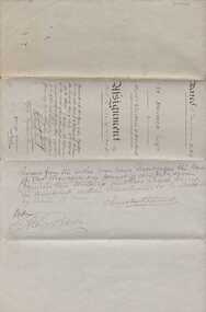
The Bostock, Manifold and Aitkin families were all pioneering families in the Western District of Victoria almost from the time of settlement. They leased and owned vast tracts of land and operated businesses around the district, often associated with the farming industry. This document is dated 5th July 1865 and is an assignment of stock by way of mortgage. Augustus Bostock is the mortgagor with James William Manifold Aitkin and Ernest Bostock as mortgagees. At various times they were involved in running businesses together, in particular the Aitkin and Bostock store and flour mill. Three of the Bostock men were married to three of the Aitkin sisters. The amount in question is £2157/3/2 and surety is 8000 sheep and their increase, presently running at Coomete. The penciled in details on the document refer to Robert Brand Paterson who was later in business with Aitkin This is one of a number of documents which relate to the Bostock family who were one of the most important pioneering families of the Western District. They owned and leased various properties around Warrnambool and were involved in many aspects of social and business life. The document itself is indicative of its time and provides an insight into the details and terms of such documents at the time.Large grey coloured, lined hand written document over four pages. Folded in four with date and details on one section. Red wax seal on page 3. There are extra entries written in black lead pencil in areas relating to the money and surety of the agreement.Signed by the following George Barber Warrnambool, Thomas Sunderland Deputy Registrar General, and Augustus Bostock. Hingston & Co, Chancery Lane Melbourne hand written in top left hand corner. warrnambool, bostock,augustus bostock james william manifold aitkin,robert brand paterson, coomete, -
 Warrnambool and District Historical Society Inc.
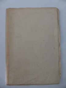
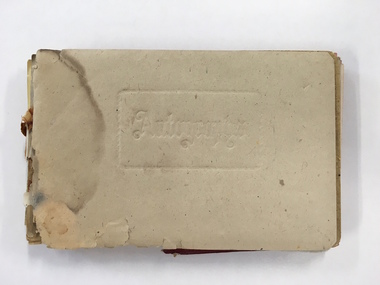
Booklet, Autograph Book, Late 1930s
According to the front page this autograph book belonged to Patricia Spencer of Spencer Street, Dartmoor. Dartmoor is a small settlement on the Princes Highway between Heywood and the South Australian border. It was first settled in the late 1850s and the main industry is the processing of timber from the surrounding pine plantations. Patricia Spencer attended Warrnambool High School in the late1930s and this album contains a number of entries from Warrnambool High School in 1938. It also has a page of eleven signatures of the Head Master, George Langley and other teachers from Warrnambool High School. There are also entries from people from Mortlake and Panmure and other entries with the person’s address not indicated. Autograph books such as this one were commonly owned by young people in the 19th and 20th centuries (up to about 1950) and were very popular with young girls.This album, although incomplete and tattered, is of interest because it is a good example of the social custom, more popular a couple of generations back than it is today, of young people owning and obtaining signatures and verses from their friends and acquaintances. It is also important because it contains signatures of Warrnambool High School teachers in 1938 and there are other entries of interest. This is a small autograph album that was originally bound with a cardboard cover with red leather backing but now has no front cover and only part of the back cover. The pages are all loose and the front section (buff-coloured) has a cardboard piece with felt padding. The pages are coloured in a variety of pastel tones and there are many handwritten entries of verses and signatures, with several from the ‘B’ Form, 1938, of ‘W.H.S. (Warrnambool High School). The album appears to have belonged to Patricia Spencer from Dartmoor. Some of the pages are torn and stained. At the back there are remnants of a sketch of an Asian scene and a letter to ‘Pat’ for her birthday. ‘Autographs’ ‘Patricia Spencer, Spencer Street, Dartmoor’ autograph albums, patricia spencer, warrnambool