Showing 1068 items matching "fortuna"
-
 Bendigo Military Museum
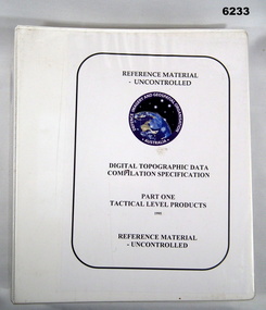
Manual - Digital Topographic Data Compilation Specification - Part 1 Tactical Level Products, February 1995
These specifications enable the compilation of digital topographic data for the Australian Defence Force (ADF) to support the production of topographic information across a multiple product range covering Australia and its Area of Direct Military Interest (ADMI)A plastic covered four ring folder containing A4 paper, white, ten chapters, metal clip ringsroyal australian survey corps, rasvy, fortuna, army survey regiment, army svy regt, asr, director of survey-army -
 Bendigo Military Museum
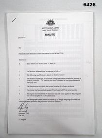
Administrative record - Army Survey Regiment Map Production System Configuration GESS/RSSS, 11 May 1995
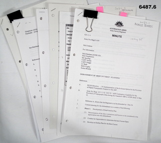
This minute encloses a copy of the Software Licence Agreement with Intergraph Corporation Pty Ltd that applies to the software packages within the Automap Raster Sub System (RSSS) and the Graphic Edit Sub System (GESS) at the Army Survey Regiment.A4 Army Survey Regiment Minute - Author AJ Spurling Manager Tech Spt Gp 11 May 95royal australian survey corps, rasvy, fortuna, army survey regiment, army svy regt, asr, intergraph corporation -
 Bendigo Military Museum
Administrative record - Advisory Committee on Commonwealth Mapping Meeting Notes - (National Mapping Council Meetings), Circa 1972
Advisory Committee on Commonwealth Mapping (ACOCM) Meeting Notes. 15 Items of typed pages and diagrams. .1 Letter to the Hon WS Kent Hughes MVO, OBE, Mc, ED, MP, Minister for the Interior, ACT Signed Jos Francis. Cabinet Decision taken on 22 July 1954, effects on current military mapping agreements between AUS, UK and USA. Australian responsibility "Noted was the fact that RASvy was in preparation for War." .2 Letter by H Wells Lieutenant General, Chief of the General Staff, 17 Feb 1955. Refers to the invitation of Major General RL Brown UK Defence to visit Australia to help align the mapping programme. .3 Draft Cabinet Submission on National Mapping Survey and Mapping Co-ordination of the 22 July 1955. Attachment 1 Cabinet Minute, Vice-President's letter Canberra22 July 1954. Decision No2 (VP). Submission 8 National Mapping Survey and Mapping Co-ordination. .4 Air photography and Mapping Programme 1956/57. Signed by LF Fitzgerald OBE Director of Military Survey 26 Jan 56. .5 Letter Hon WS Kent Hughes MVO, OBE, MC, ED, MP. Minister for the Interior ACT. Confirming the Cabinet Decision No2 (VP) Signed by Joe Francis .6 National Mapping Programme 1956/57. States a view to Army's contribution to this programme .7 Clarifies Army participation in Cabinet Decision No2 (VP) .8 History of National Mapping Asst Secretary (General) 24 Apr 1958 .9 Report on Army Committee on National Mapping. 2 July 1958 .10 RASvy Brief Review of Activities Jan - Dec 1964 .11 Advisory Committee on Commonwealth Mapping Meeting Notes 12 Feb 1965 - Agenda item 8. This endorsed the principle of grouping Commonwealth Mapping Agencies in a Survey Mapping Group in Canberra which included AHQ Survey Regiment. This did not come to fruition. .12 Advisory Committee on Commonwealth Mapping Meeting Notes 12 Feb 1965 - Agenda item 8 para 5.1.3 - 11.2 .13 ACOCM Meeting Agenda 1968 .14 ACOCM Meeting Minutes 1970 .15 Letter to Mr B White CBE Secretary from LF BottAdvisory Committee on Commonwealth Mapping (ACOCM) Meeting Notes. 15 Items of typed pages and diagrams. .1 Letter 22 July 1954 .2 Letter 17 Feb 1955 .3 Letter 22 July 1955 .4 letter 26 Jan 1956 .5 Letter Hon WS Kent Hughes Minister for the Interior ACT .6 National Mapping Programme 1956/57 .7 Clarifies Army participation in Cabinet Decision No2 (VP) .8 History of National Mapping 24 Apr 1958 .9 Report on Army Committee on National Mapping 2 July 1958 .10 RASvy Brief Review of Activities Jan - Dec 1964 .11 Advisory Committee Meeting Notes 12 Feb 1965 - Agenda item 8 .12 Advisory Committee Meeting Notes 12 Feb 1965 - Agenda item 8 para 5.1.3 - 11.2 .13 ACOCM Meeting Agenda 1968 .14 ACOCM Meeting Minutes 1970 .15 Letter to Mr B White CBE Secretary from LF Bottroyal australian survey corps, rasvy, fortuna, army survey regiment, army svy regt, asr, national mapping -
 Bendigo Military Museum
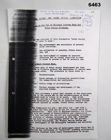
Administrative record - Use of Military maps for water supply planning, 1962
These are typed notes on the use of Military maps for water supply planning. This demonstrates the value of Military Mapping containing accurate relief information that can then be used for water supply planning.5 x A4 pages of typed notes, poorly photocopiedroyal australian survey corps, rasvy, fortuna, army survey regiment, army svy regt, asr, state rivers and water supply commission -
 Bendigo Military Museum
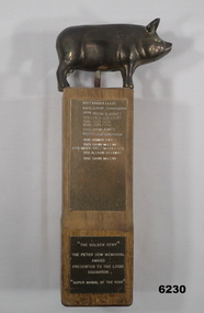
Award - The Peter Dew Memorial Award "The Golden Dewy", 1977
A humorous novelty award presented generally annually to a Litho Squadron member selected as the "Super Animal of the Year" Wooden pedestal with engraved brass plates on the front. The upper plate contains a list of award recipients 1977 - 1992 Lower plate engraved: " The Golden Dewy", The Peter Dew Memorial Award, Presented to the Litho Squadron "Super Animal of the Year"royal australian survey corps, rasvy, fortuna, army survey regiment, army svy regt, asr, litho sqn -
 Bendigo Military Museum
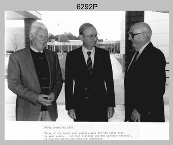
Photograph - Retired Officers of the Royal Australian Survey Corp on Corps Day, School of Military Survey, Latchford Barracks, Bonegilla, 1991
This is a photograph of three retired officers from the Royal Australian Survey Corps taken on Corps Day, at the School of Military Survey, Latchford Barracks, Bonegilla in July 1991. BRIG Don Macdonald AM served in the Australian Regular Army from 1st of January 1936 to 22nd of March 1967. He was the Director of the Survey Corps from January 1960 to March 1967. COL Macdonald was promoted to Brigadier before assuming the honorary position of Colonel Commandant of RA Svy from August 1967 to January 1973. LTCOL Bob Skitch served in the Australian Regular Army from 14th of February 1955 to 27th of February 1981. He was the CO of the Army Survey Regiment from 1976 to 1980. LT Leo Noel Fletcher MID served in the Australian Regular Army from 1st January 1938 to 14th November 1945. He was the NSW Surveyor General from 1965 to 1978.This is a photograph of three retired officers from the Royal Australian Survey Corps taken on Corps Day, at the School of Military Survey, Latchford Barracks, Bonegilla in July 1991. The black and white photograph was printed on photographic paper and is part of the Army Survey Regiment’s Collection. The photograph was scanned at 300 dpi. .1) - Photo, black & white, 1991, retired RA Svy officers – L to R: LT Leo Noel Fletcher MID, LTCOL Bob Skitch, BRIG Don Macdonald AM.Annotated on front of photo ‘RASvy Corps Day1991. Three of the Corps past members meet for the first time in many years. Lt Noel Fletcher (ex NSW Surveyor General), Lt Col Bob Skitch and Brig Don MacDonald.’royal australian survey corps, rasvy, army survey regiment, army svy regt, fortuna, asr, school of military survey -
 Bendigo Military Museum
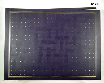
Album - Photographic Identification Guide (PIG) of the Gove Penisula (Sic) Peninsula, Army Topographic Support Establishment, May 1997
These photographs and a video were captured in May 1997 by Jeff Ruiz and Wayne Walsh from the Army Topographic Support Establishment (ATSE). The video taken onboard an aircraft has not been located at this time. A flight line diagram showing the path of the aircraft taking the video is enclosed in the album. The Army Topographic Support Establishment was created to perform some of the functions of the Army Survey Regiment.A Large Purple covered Album with gold dots containing maps, plans and coloured photographs of Gove Peninsula.royal australian survey corps, rasvy, fortuna, army survey regiment, army svy regt, asr, atse -
 Bendigo Military Museum
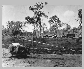
Photograph - Bell 47G-2 helicopter used in Royal Australian Survey Corps Field Operations, c1965
This is a set of four photographs of Bell 47G-2 helicopters used in Royal Australian Survey Corps Field Operations. c1965. From 1957, helicopter transport of survey parties revolutionised transport in remote areas. The most common helicopter used by the Royal Australian Survey Corps at this time was the civilian Bell 47G-2 and the Sioux, the Australian Army’s’s equivalent. equivalent. From 1964 an Aerodist MRC2 airborne Electronic Distance Measuring (EDM) system was extensively used for topographic surveys over long distances by trilateration to replace traverse requiring survey station intervisibility. In 1965 the command field survey unit personnel attached to the Army Survey Regiment’s Topographic Squadron were used mainly in support roles such as station clearing, tower operations, station monumenting, Aerodist computations, forward base operations, geodetic observations on the north-south traverse and logistic support for Remote teams. .1P is a photo of a civilian Bell 47G-2 helicopter Registration / Serial VH-UTB owned by Helicopter Utilities from Mascot, NSW c1965. In the background of this photograph is three personnel and vehicles at a field survey camp. The left-hand vehicle is a Willys Jeep with trailer and on the right is probably a Truck, 2 1/2 ton, 6x6, General Service GMC. The Bell 47G-2: VH-UTB was destroyed, and its pilot killed in tragic circumstances during a civilian survey operation on Cape York Peninsula in June 1966. .2P is a photo of a a civilian Bell 47G-2 helicopter Registration / Serial VH-IHB taken in Wyndham, WA. As the letters ‘TAA’ appear on the fuselage, the helicopter was charted from Trans Australian Airways. .3P is a photo of a Bell 47G-2: VH-UTC with survey camp in background. .4P is a photo of a Bell 47G-2 equipped with floats and unidentified personnel loading stores, possibly in Darwin. Acknowledgement: Royal Australian Survey Corps – Aerodist Years 1964-1975 Version 2021.0 Authored by Peter Jensen.This is a set of four photographs of civilian Bell 47G-2 helicopters used in Royal Australian Survey Corps Field Operations. c1965. The photographs were printed on photographic paper and are part of the Army Survey Regiment’s Collection. The photographs were scanned at 300 dpi. .1) - Photo, black & white, c1965, Bell 47G-2 helicopter: VH-UTB with survey camp in background. .2) - Photo, black & white, c1965, Bell 47G-2 helicopter: VH-IHB with survey station in foreground. .3) - Photo, black & white, c1965, Bell 47G-2 helicopter: VH-UTC with survey camp in background. .4) - Photo, black & white, c1965, Bell 47G-2 helicopter: Unidentified personnel loading stores possibly in Darwin..2P – annotated on bottom of photo ‘Wyndham Area – Helicopter drops observing party’ The other photographs are not annotated.royal australian survey corps, rasvy, army survey regiment, army svy regt, fortuna, asr, surveying -
 Bendigo Military Museum
Manual - TM5 - 245: (US) Department of the Army Technical Manual - Map Reproduction, US Department of the Army, United States of America, War Office, 10 Sep 1956
Nine Chapters describing all aspects of Map Reproduction. 224 pages, including 8 appendices, glossary and indexA soft covered military manual, 224 pages of text, diagrams and annotated photographs"AHQ Survey Regiment" stamped inside front and back covers. Number "149" handwritten inside front cover.royal australian survey corps, rasvy, fortuna, army survey regiment, army svy regt, asr, mapping -
 Bendigo Military Museum
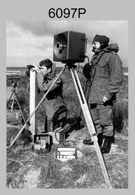
Photograph - Royal Australian Survey Corps Electronic Distance Measuring Equipment Demonstration, c1960s
This is a set of five photographs of CAPT James ‘Jim’ Leslie Stedman in the field demonstrating the setup of prisms used as electric distance measurement (EDM) receiver reflectors for tellurometer equipment and the sighting of a large surveyor’s light. This equipment was deployed in establishing mapping and geodetic control operations. The photos were most likely taken in the late 1950s or early 1960s. The tellurometers of this era were man-portable systems that improved geodetic survey efficiencies for rapid network extension and densification replacing triangulation with EDM and theodolite traverse sometimes using Bilby Towers to extend line lengths. Jim Stedman later reached the rank of Colonel, was Director of Military Survey from 1975 to 1978 and was appointed as Colonel Commandant (honorary appointment, Retd) of the Royal Australian Survey Corps from 1978 to 1983. Jim Stedman is demonstrating EDM equipment. See item 6180.16P, photos .14) to .16) for more information and photos of Jim Stedman’s EDM demonstration. This is a set of five photographs of a surveyor in the field demonstrating electric distance measurement (EDM) equipment. c1950s – 1960s. The photographs were printed on photographic paper and are part of the Army Survey Regiment’s Collection. The photographs were scanned at 300 dpi. .1) to .2) - Photo, black & white, c1960s, CAPT Jim Stedman demonstrating the sighting of a large surveyor’s light. .3) to .5) – Photo, black & white, c1960s, CAPT Jim Stedman demonstrating EDM prism equipment. .1P to .5P on back – CAPT Stedman EDM Eqpt.royal australian survey corps, rasvy, army survey regiment, army svy regt, fortuna, asr, surveying -
 Bendigo Military Museum
Manual - Manual of Photogrammetry, (Preliminary Edition), 1934 American Society of Photogrammetry, Circa 1934
This book belonged to Brigadier FD Buckland OBE Director of Survey Land HeadquarterHardcover, light blue, 819 pages, text, diagrams, photographsroyal australian survey corps, rasvy, fortuna, army survey regiment, army svy regt, asr, photogrammetry -
 Bendigo Historical Society Inc.
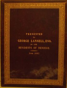
Document - LANSELL COLLECTION: ILLUMINATED ADDRESS TO GEORGE LANSELL
Leather bound, gold embossing on borders of cover and inside folder. Front text in gold print: 'presented to George Lansell Esq by the residents of Bendigo June 1887' Inside: illuminated address to George Lansell, London, imploring him to return to Bendigo ' Your long absence form Bendigo is keenly felt ..' Address written in black calligraphy surrounded by water colour flowers.person, individual, george lansell esq., lansell, george, fortuna, illuminated address -
 Bendigo Military Museum
Photograph - 4 Fd Svy Sqn Closure Ceremony 25 Nov 1995, 4 Fd Svy Sqn, Keswick Barracks, Adelaide, 25.11.1995
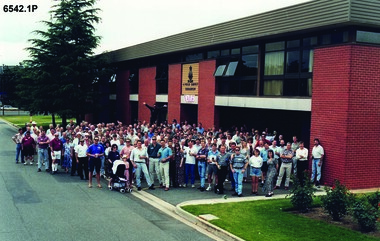
Between 1915 and 1951, military topographical mapping in SA was conducted by Royal Australian Survey Corps (RASvy) units based outside the state. In February 1952, Army HQ Field Survey Section (Central Command Detachment) was established in Adelaide in a drill hall at Largs Bay. It was tasked with providing map coverage in the Woomera and Southern areas of the state. The section was subsequently reorganised as Central Command Field Survey Section moving firstly to Hampstead Barracks, Hampstead in 1953 and then into accommodation at Keswick Barracks in 1954. In 1957 the Section commenced mapping operations in the NT. The Unit was relocated to the old cavalry stables in 1961 and was redesignated Central Command Survey Unit and remained there till 1973. In 1970 the Unit was redesignated 4 Fd Svy Sqn and engaged in operations conducted in PNG from 1972 to 1974 inclusive. In 1973 the Squadron moved into a brand new two-storey specially designed and purpose built building adjacent to the old building. The old building then became the Squadron Q and Map store with an interconnecting lobby to the new building. Since 1975 the Unit was involved in the 1:50,000 Mapping Programme in WA, NT, QLD, SA and conducted many other operations within Australia and overseas. Post disbandment of the Corps the old Squadron building (cavalry stables) now houses the Army Museum of South Australia (AMOSA). The Royal Australian Survey Corps was amalgimated into the Royal Australian Engineer Corps in July 1996. In the lead up to this amalgamation, 4 Field Survey Squadron Keswick Barracks, Adelaide, South Australia was disbanded in 1995. A closing Ceremony was held on 25 November 1995 at 4 Fd Svy Sqn Keswick Barracks attended by about 208 former members of the Unit. A photo was taken of attendees at that event on the day and a list was prepared of attendees. All attendees were sent a copy of the photograph and the list of names as a momento of the Unit and the ceremony..1P A4 Print of an original photo of attendees at the 4 Fd Survey Sqn Closure Ceremony at Keswick Barracks 25 Nov 1995. .2P A4 Print of the names of the attendees at the 4 Fd Survey Sqn Closure Ceremony at Keswick Barracks 25 Nov 1995. Approx 208 attendees.royal australian survey corps, rasvy, fortuna, army survey regiment, army svy regt, asr, 4 fd svy sqn -
 Bendigo Military Museum
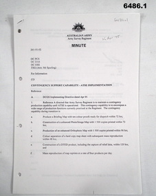
Document - Contingency Support Capability - Army Topographic Support Establishment (ATSE) Implementation, Army Survey Regiment, Bendigo, Apr - Jun 1995
.1 The Minute details that the Army Survey Regiment is maintain a contingency production capability until ATSE is operational. .2 The Minute details the Data Aquisition Squadron requirements during the Implementation to ATSE. .3 The Minute details the Hardware, Software, Personnel and skills required during Implementation to ATSE. .4 The Instruction details that the non-core mapping, charting and geodetic (MC&G) activities of the Army Survey Regiment and 4 Fd Svy Sqn were tested under the Commercial Support Program (CSP) process resulting in the decision to award the contract for the provision of non-core mapping services to the ADF to the Preferred In-House Option (PIHO). .1 Contingency Support Capability - Army Topographic Support Establishment (ATSE) Implementation 26 Apr 95 (11 x A4 pages) .2 Data Acquisition Squadron (DAS) Contingency Support Capability - Army Topographic Support Establishment (ATSE) Implementation Apr 95 (4 x A4 Pages) .3 Contingency Support Capability - Army Topographic Support Establishment (ATSE) Implementation 28 Apr 95 (9 x A4 pages) .4 Directorate of Military Survey - Army Instruction for Implementation of the Army Topographic Support Establishment (ATSE) Jun 95 (10 x A4 pages)royal australian survey corps, rasvy, fortuna, army survey regiment, army svy regt, asr, atse -
 Bendigo Military Museum
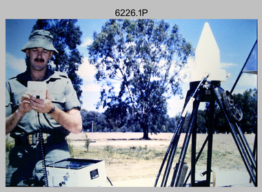
Photograph - Demonstration of TI4100 GPS Receiver, Royal Australian Survey Corps, c1988
This is a set of four photographs of WO2 Graham Ragless from the Royal Australian Survey Corps demonstrating the operation of Global Positioning System equipment in c1988. The photos were probably taken at the School of Military Survey (SMS), Bonegilla, VIC. Texas Instruments TI4100 portable Global Positioning System (GPS) geodetic receivers were introduced from 1986–1988. The GPS receivers and Ferranti FILS3 helicopter and vehicle mounted Inertial Positioning System (IPS) replaced the TRANSIT satellite receivers. The equipment was deployed to establish the baseline for a GPS controlled air camera and photogrammetric system to significantly reduce the requirement for ground survey to accurately control air photography for topographic mapping. Personnel from the four field survey squadrons at this time were trained at the SMS to operate the TI4100 receivers. Field survey operations using GPS and IPS equipment followed in the late 1980s. This technology is described in more detail in the RA Svy booklet titled An Introduction to Topographic Mapping. See record ID - 6010. WO2 Graham Ragless progressed to the rank of WO1 and was appointed as RSM of the Army Survey Regiment from 1990 to 1992. Refer to item 6186.2P for more photographs of WO2 Graham Ragless demonstrating the TI4100.This is a set of four photographs of a technician from the Royal Australian Survey Corps demonstrating the operation of Global Positioning System equipment in c1988. Colour photos are on 35mm slide film and were scanned at 96 dpi. .1) to .4) - Photo, colour, c1988, WO2 Graham Ragless demonstrating the operation of a TI4100 GPS receiverThere are no annotations.royal australian survey corps, rasvy, army survey regiment, army svy regt, fortuna, asr, surveying -
 Bendigo Military Museum
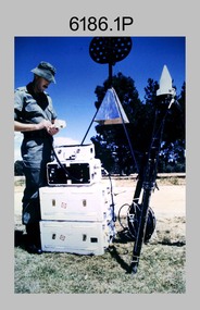
Photograph - Demonstration of TI4100 GPS Receiver, Royal Australian Survey Corps, c1988
This is a set of two photographs of WO2 Graham Ragless from the Royal Australian Survey Corps demonstrating the operation of Global Positioning System equipment in c1988. The photos were probably taken at the School of Military Survey (SMS), Bonegilla, VIC. Texas Instruments TI4100 portable Global Positioning System (GPS) geodetic receivers were introduced from 1986–1988. The GPS receivers and Ferranti FILS3 helicopter and vehicle mounted Inertial Positioning System (IPS) replaced the TRANSIT satellite receivers. The equipment was deployed to establish the baseline for a GPS controlled air camera and photogrammetric system to significantly reduce the requirement for ground survey to accurately control air photography for topographic mapping. Personnel from the four field survey squadrons at this time were trained at the SMS to operate the TI4100 receivers. Field survey operations using GPS and IPS equipment followed in the late 1980s. This technology is described in more detail in the RA Svy booklet titled An Introduction to Topographic Mapping. See record ID - 6010. WO2 Graham Ragless progressed to the rank of WO1 and was appointed as RSM of the Army Survey Regiment from 1990 to 1992. Refer to item 6226.4P for more photographs of WO2 Graham Ragless demonstrating the TI4100.This is a set of two photographs of a technician from the Royal Australian Survey Corps demonstrating the operation of Global Positioning System equipment in c1988. Colour photos are on 35mm slide film and were scanned at 96 dpi. .1) and .2) - Photo, colour, c1988, WO2 Graham Ragless demonstrating the operation of a TI4100 GPS receiverThere are no annotations.royal australian survey corps, rasvy, army survey regiment, army svy regt, fortuna, asr, surveying -
 Bendigo Military Museum
Photograph - Army Survey Regiment Personnel – Mahogany Ship Survey, Warrnambool, VIC, 1985
This is a photograph of Army Survey Regiment personnel undertaking surveying measurements during a search for the ‘Mahogany Ship’ Warrnambool, VIC on 3rd September1985. CPL Mark Lander and SGT Don Williams were taking electronic distance measurements using an MRA-301 tellurometer. To measure the distance, personnel at another site operating another MRA-301 tellurometer would have exchanged the signal emission. A ‘Hilga Watts’ light appears in the background and a barometer in the foreground.This is a photograph of Army Survey Regiment personnel undertaking surveying measurements during a search for the ‘Mahogany Ship’ Warrnambool, VIC on 3rd September1985. The photograph was printed on photographic paper and is part of the Army Survey Regiment’s Collection. The photograph was scanned at 300 dpi. L to R: CPL Mark Lander, SGT Don Williams‘R.S. 3/9/1985 CPL Mark Lander, SGT Don Williams PIC BY COURTESY OF THE WARRNAMBOOL STANDARD’ annotated on back of photoroyal australian survey corps, rasvy, army survey regiment, army svy regt, fortuna, asr, surveying -
 Bendigo Military Museum
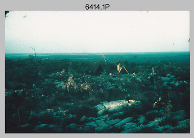
Photograph - Royal Australian Survey Corps Surveyors in the Field – Northern Territory and Queensland, 1959 – 1960
This is a set of 10 photographs of surveyors and support staff in the field undertaking duties in the Northern Territory and North Queensland in 1959 – 1960. The surveyors were employed in the establishment of mapping and geodetic control. In this era surveyors used theodolites to observe horizontal and vertical angles and tellurometers to measure base line distances between survey stations. Laplace survey observations seen in Photo .1P was a series of precise observations carried out at geodetic survey stations to determine astronomic latitudes, longitudes and azimuths to achieve maximum precision in the survey network. Laplace observations were necessary in a geodetic network at every 6th survey station, however the National Mapping Council specified at this time the spacing would be ideally between 4-6 survey stations. The cairn shown in photo .4P was built by RASvy as a landmark over a trigonometric survey station. It was dismantled in 1960 to enable re-occupation and survey observations. It was not restored to the condition shown in the photo.This is a set of 10 photographs of surveyors and support staff in the field undertaking duties in the Northern Territory (NT) and Queensland (QLD) in 1959 – 1960. The photographs were printed on photographic paper and are part of the Army Survey Regiment’s Collection. The photographs were scanned at 300 dpi. .1) - Photo, colour, 1959. Tony Slattery occupying a Laplace survey station on a hill in the Mount Young area of the NT. .2) - Photo, colour, 1959. Surveyors’ camp in the Mount Young area of the NT, L to R: Spencer Snow and Tony Slattery. .3) - Photo, colour, 1959. Surveyors’ camp in the Peckman Hill area, near Katherine in the NT. .4) - Photo, colour, 1959. Cairn on Trig Hill, Borroloola, NT. Built by Spencer Snow, Tom Royle and Jack McCabe. .5) - Photo, colour, 1959. Survey party taking a break next to their Austin Champ vehicle, in transit between Katherine, NT and Wyndam WA. L to R: Tony Slattery, Dave Owens, John Van De Graff. .6) - Photo, colour, 1960. Surveyors’ camp between Mount Isa, QLD and Borroloola, NT. L to R: Pat Cox and John Van De Graff prepare their meal on an open fire. .7) - Photo, colour, 1960. Surveyor - Dennis Woods undertaking survey observations, using MRA1 tellurometer to measure base-line distances NW of Mount Isa, QLD. .8) - Photo, colour, 1960. Unidentified surveyors assessing recovery of their stalled Studebaker truck vehicle after attempting a water crossing in the NT. .9) - Photo, colour, 1960. Unidentified surveyor making batches of bread at a camp in the NT. Seen in the photo placing a lid with hot coals onto the camp oven. .10) - Photo, colour, 1960. Unidentified survey party occupying a survey station on a hill in the Mount near the Lawn Hill area, NW of Mount Isa, QLD. A MRA1 tellurometer to measure base-line distances appear on the right side of the photo. .9) - Photo, colour, 1960. Unidentified surveyors assessing recovery of their stalled Studebaker truck vehicle after attempting a water crossing in the NT. .10) - Photo, colour, 1960. Unidentified surveyor making batches of bread at a camp in the NT. Seen in the photo placing a lid with hot coals onto the camp oven. .1P to .10P annotated on back – personnel names, the year and the location. royal australian survey corps, rasvy, army survey regiment, asr, army svy regt, fortuna, surveying -
 Bendigo Military Museum
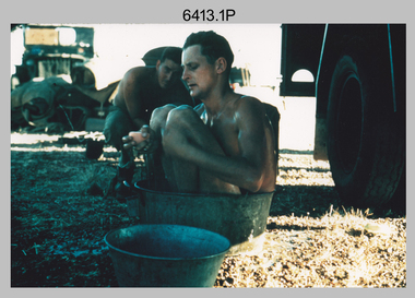
Photograph - Royal Australian Survey Corps Surveyors in the Field – North Queensland, 1958
This is a set of seven photographs of surveyors and support staff in the field undertaking duties in North Queensland in 1958. The surveyors were employed in the establishment of mapping and geodetic control. In this era surveyors used theodolites to observe horizontal and vertical angles and chains to measure base line distances between survey stations. Bob Skitch shown in photos .4P to .6P was in the 2nd year of his career in the Australian Army. He achieved the rank of Lieutenant Colonel and his last appointment was the CO of the Army Survey Regiment from 1976 to 1980. The annotation on the back of photo .5P ‘Black foreground is where Bob Skitch boiled billy and started a grass fire’.This is a set of seven photographs of surveyors and support staff in the field undertaking duties in North Queensland in 1958. The photographs were printed on photographic paper and are part of the Army Survey Regiment’s Collection. The photographs were scanned at 300 dpi. .1) - Photo, colour, 1958. Surveyor in Nth QLD enjoying a bath. L to R: Don Cocker, Bob Thompson. .2) - Photo, colour, 1958. Don Cocker surveyor in Nth QLD, enjoying a bath. .3) - Photo, colour, 1958. Surveyors Nth QLD undertaking survey observations, using MRA1 tellurometer to measure base-line distances. L to R: Len Davies, Lou Sommer, John Van De Graff. MRA1 was covered to stop overheating. .4) - Photo, colour, 1958. Surveyors south of Richmond, QLD digging holes for the erection of a Bilby observation tower. L to R: John Van De Graff, Bob Skitch, Kev Moody, Mal Hayes, Don Gray .5) - Photo, colour, 1958. Surveyors south of Richmond, QLD erecting a Bilby observation tower. L to R: Tom Royle, Bob Skitch (on ground level), Mal Hayes. .6) - Photo, colour, 1958. Surveyors south of Richmond, QLD erecting a Bilby observation tower. L to R: Tom Royle, Bob Skitch, Mal Hayes, Jim McGill (on ground level). .7) - Photo, colour, 1958. Surveyors south of Richmond, QLD undertaking survey measurements from a Bilby observation tower..1P to .7P annotated on back – personnel names, the year and the location. Annotated on back of .5P ‘Black foreground is where Bob Skitch boiled billy and started a grass fire’.royal australian survey corps, rasvy, army survey regiment, asr, army svy regt, fortuna, surveying -
 Bendigo Military Museum
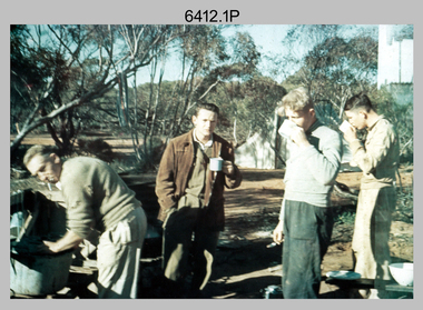
Photograph - Royal Australian Survey Corps Surveyors in the Field – Victoria, 1956 - 1958
This is a set of two photographs of surveyors and support staff in the field undertaking tasks in Victoria 1956 – 1958. The surveyors were employed in the establishment of mapping and geodetic control. In this era surveyors used theodolites to observe horizontal and vertical angles and chains to measure base line distances between survey stations. This is a set of 23 photographs of surveyors and support staff in the field undertaking duties in Victoria 1956 – 1958. The photographs were printed on photographic paper and are part of the Army Survey Regiment’s Collection. The photographs were scanned at 300 dpi. .1) - Photo, colour, 1956. Surveyors enjoying a tea break. L to R: Tom Gilbert (cook), Barry Broad, Tony Slattery, John Van De Graff. Taken at Boonoonar, a locality south of Mildura. .2) - Photo, colour, 1958. Surveyors taking a break from driving. L to R: Leo Bub, Bob Thompson. Taken at Puckapunyal..1P to .2P annotated on back – personnel names, the year and the location. royal australian survey corps, rasvy, army survey regiment, asr, army svy regt, fortuna, surveying -
 Bendigo Military Museum
Photograph - Royal Australian Survey Corps Surveyors in the Field – North Queensland and Torres Strait, 1961
This is a set of five photographs of surveyors and support staff in the field undertaking duties in North Queensland and Torres Strait in 1961. The surveyors were employed in the establishment of mapping and geodetic control. In this era surveyors used theodolites to observe horizontal and vertical angles and tellurometers to measure base line distances between survey stations. In photo .2P Joe Farrington is seen taking survey observations using a Tavistock V500 Series Tavistock theodolite at a survey station between the Edward River and Aurukun in the Cape York Peninsula. The Gulf of Carpentaria appears in the background. From 1957 helicopter transport of survey parties revolutionised transport in remote areas. The civilian helicopter was hired from TAA. This is a set of five photographs of surveyors and support staff in the field undertaking duties in North Queensland and Torres Strait in 1961. The photographs were printed on photographic paper and are part of the Army Survey Regiment’s Collection. The photographs were scanned at 300 dpi. .1) - Photo, colour, 1961. Andy Millar occupying a survey station on a hill in the Cape York Peninsula, QLD. .2) - Photo, colour, 1961. Joe Farrington taking observations with a V500 Series Tavistock geodetic theodolite at a survey station in the Cape York Peninsula, QLD. .3) - Photo, colour, 1961. Daryl Parker taking a break from survey observations on a hill located on Duaun Island QLD, in the Torres Strait, a few miles south of the PNG coastline. Hill height was 975 ft. .4) - Photo, colour, 1961. Three Torres Strait divers L to R: unidentified, Darku and Ray Mau Daryl standing behind a Tavistock geodetic theodolite on a hill located on Duaun Island QLD, in the Torres Strait, a few miles south of the PNG coastline. .5) - Photo, colour, 1961. Andy Millar holding meat from a small turtle on Duaun Island QLD, in the Torres Strait, a few miles south of the PNG coastline. An unidentified Duaun Island local appears in the background..1P to .5P annotated on back – personnel names, the year and the location. royal australian survey corps, rasvy, army survey regiment, asr, army svy regt, fortuna, surveying -
 Bendigo Military Museum
Photograph - Royal Australian Survey Corps Surveyors in the Field – PNG, 1962
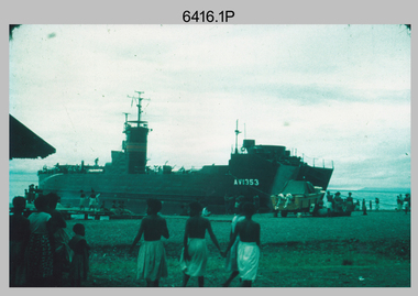
This is a set of four photographs of surveyors and support staff in the field undertaking duties in Dogera, Milne Bay Province and Kerema, Gulf Province of PNG in 1962. The surveyors were employed in the establishment of mapping and geodetic control. In this era surveyors used theodolites to observe horizontal and vertical angles and tellurometers to measure base line distances between survey stations. From 1957 helicopter transport of survey parties revolutionised transport in remote areas.This is a set of four photographs of surveyors and support staff in the field undertaking duties in PNG in 1962. The photographs were printed on photographic paper and are part of the Army Survey Regiment’s Collection. The photographs were scanned at 300 dpi. .1) - Photo, colour, 1962. Unloading survey operation stores from a Landing Ship Medium (LSM) at Dogera, Milne Bay Province, PNG. .2) & .3) - Photo, colour, 1962. Hired civilian helicopter Bell 47G-2 helicopters operating at at Dogera, Milne Bay Province, PNG. .4) - Photo, colour, 1962. Survey party at survey station located near Kerema, Gulf Province southern PNG. L to R: Dave Owens, Keith Broadbent, with local villagers in background..1P to .4P annotated on back – personnel names, the year and the location. royal australian survey corps, rasvy, army survey regiment, asr, army svy regt, fortuna, surveying -
 Bendigo Military Museum
Photograph - Defence Co-operation Project Students, School of Military Survey, Bonegilla, VIC, 1990
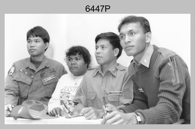
This is a photograph of Defence Co-operation Project (DCP) students from the Pacific region who attended the 1/90 Specialist Carto course held at the School of Military Survey, Bonegilla, Victoria from the 9th of May to the 5th of June 1990.This is a photograph of Defence Co-operation Project (DCP) students attending the 1/90 Specialist Carto course held at the School of Military Survey, Bonegilla, Victoria in 1990. The photograph was printed on photographic paper and is part of the Army Survey Regiment’s Collection. The photograph was scanned at 300 dpi. .1) - Photo, black & white, 1990, DCP Students L to R: SGT Ramos – Philippines, Miss Chukeni – Solomon Islands, SGT Laguador – Philippines, CPL Jais – Malaysia. .1P – Students, course title and date annotated on back of photo.royal australian survey corps, rasvy, army survey regiment, army svy regt, school of military survey, fortuna, asr -
 Bendigo Military Museum
Photograph - Royal Australian Survey Corps Surveyors in the Field, Army Survey Regiment, 1950s to 1970s
These three photographs were most likely taken from the 1950s to the 1970s. The RASvy surveyor in each photograph was taking angular measurements with the observer recording their readings on a booking form. They were probably employed in establishing mapping and geodetic control operations or the surveyors may have been in training. Photo .1P was possibly taken at Mount Alexander in Central Victoria, a location close to Bendigo, as the stone cairn in the background of the photo appears to be identical to the cairn presently located on top of the mountain. Personnel and location have been confirmed on another photo in the collection with annotation. These three photographs are of surveyors in the field undertaking observations using theodolites. The photographs were printed on photographic paper and are part of the Army Survey Regiment’s Collection. The photographs were scanned at 300 dpi. .1) - Photo, black & white, c1950s. Unidentified personnel undertaking observations with a Tavistock geodetic theodolite. .2) – Photo, colour, mounted on card, c1960s. Unidentified personnel undertaking observations with a Kern DKM2 theodolite. .3) - Photo, colour, c1970s. Unidentified personnel undertaking observations with a theodolite..1 – not annotated .2 –annotated on front “Kern DKM2, TOPO 10” royal australian survey corps, rasvy, army survey regiment, army svy regt, fortuna, asr, surveying -
 Bendigo Military Museum
Administrative record - Army Survey Regiment - PNG JOG After Action Report Cartographic Sqn March 1982, DR Bowen, US Major, OC Carto Sqn, 22 Mar 1982
The Royal Australian Survey Corps produced complete coverage of Papua New Guinea of Joint Operations Graphics (JOG) at 1:250,000 scale. JOG were produced in two versions JOG Ground in metres and JOG Air in feet. This report estimates the amount of manpower required to complete the last 30 x JOG and JOGA as at 22 March 1982 by Cartographic Squadron.A4 typed 4 x page report stapled top LHSroyal australian survey corps, rasvy, fortuna, army survey regiment, army svy regt, asr, png -
 Bendigo Military Museum
Document - Disbandment of Army Survey Regiment Planning 1995, Army Survey Regiment, Bendigo, December 1995
.1 Disbandment of Army Survey Regiment (ASR) Planning19 May 1995. Reference A - DCGS Directive /95 Implementation of the In-house option for the provision of Digital Topographic Support to the ADF. Reference B - Army Svy Regt 623-11-02 262/95 ADF Contingency Capability for the Provision of Topographic Data during the transition ASR to ATSE dated 12 May 1995. Reference A directs the ASR to be disbanded by 1 Dec 1996. Planning for the Disbandment is to consist of the following: Phase 1 - Development of Draft Outline Plan (1) Determine the Aim, Limitations and factors to be considered in the appreciation into the disbandment, (2) Conduct an appreciation to determine the best course of action, (3) Develop an Outline Plan for the Best Course of Action. (4) Brief DSVY-A and staff on the proposed Outline Plan. Phase 2 - Review of the Outline Plan by DSVY-A and issue further guidance. Phase 3 - Develop the Detailed plan including project management strategy. The disbandment is to achieve the smooth transition of operational responsibility to ATSE. The responsibility and resources to maintain the Minimum Operational Capability outlined in Reference B is to be formally passed to ATSE prior to disbandment. Proposed timings: Phase 1 completed by 1 Jun 95, Phase 2 completed by 15 Jun 95, Phase 3 complete d by 30 Jun 95, Disbandment completed by no later than 1 Dec 96 (Executive Order). All postings, administration and stores and equipment returns are to be completed by this date. .2 Disbandment of Army Survey Regiment Planning Report 26 May 1995 - Develop possible courses of action for the disbandment of ASR with reference to Technical, Historical and Union Issues by 6 Jun 95. .3 Disbandment of Army Survey Regiment Disbandment Team 26 May 1995 - Allocation of Team Members and responsibilities. .4 Disbandment of Army Survey Regiment May 1995 - Minimum Contingency Technical Equipment List for transition to ATSE. .5 Disbandment of Army Survey Regiment Plan 23 Aug 1995 - During the transition period (1 Jul 95 - 1 Dec 1996) leading to the full implementation of the Preferred In House Option (PIHO) Army Svy Regt and ATSE will at all times operate concurrently whilst Army Svy Regt scales down production and progressively transfers all technical functions to ATSE. Army Svy Regt will continue programmed production activities at best endeavor until declared operationally ineffective. During the transition to ATSE a contingency mapping capability is to be maintained. .6 Directorate of Survey - Army Commercial Support Program Digital Topographic Support to the ADF In-House Option Directive Dec 95. This directive defines the CSP contract management arrangements between the contract Administrator (DSVY-A) and the Contractor (ATSE) for the implementation and operation of the IHO for digital Topographic support to the ADF. .1 Disbandment of Army Survey Regiment Planning19 May 1995 - A4 paper clipped document, 4 x hole punched, 21 pages, diagrams and typed and hand written. .2 Disbandment of Army Survey Regiment Planning Report 26 May 1995 - A4 paper stapled document, 4 x hole punched, 9 pages, diagrams and typed and hand written. .3 Disbandment of Army Survey Regiment Disbandment Team 26 May 1995 - A4 paper stapled document, 4 x hole punched, 2 pages, typed. .4 Disbandment of Army Survey Regiment May 1995 - Minimum Contingency Technical Equipment for transition. A4 paper stapled document, 4 x hole punched, 2 pages, typed. .5 Disbandment of Army Survey Regiment Plan 23 Aug 1995 - A4 paper stapled document, 4 x hole punched, 10 pages, diagrams and typed. .6 Directorate of Survey - Army Commercial Support Program Digital Topographic Support to the ADF In-House Option Directive Dec 95. A4 paper clipped document, 4 x hole punched, 16 pages, diagrams and typed, hand written notes. royal australian survey corps, rasvy, fortuna, army survey regiment, army svy regt, atse, asr -
 Bendigo Military Museum
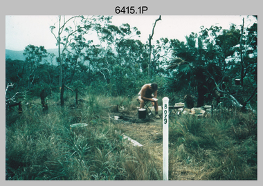
Photograph - RASvy Surveyors in the field, c1950s – 1960s
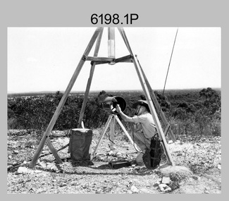
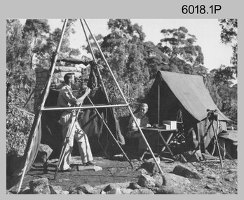
This is a set of 1photographs of surveyors in the field measuring distances using chains, taking observations using theodolites and operating electric distance measurement equipment. They were probably employed in establishing mapping and geodetic control operations or the surveyors may have been in training. The photos were most likely taken in the 1950s and 1960s. Photos .1P to .6P feature personnel setting up geodetic survey chaining equipment to measure distances. The surveyor in Photo .5P is LTCOL Howard Angus Johnson MBE who served from 1936 to 1954. The RA Svy surveyor in photos .7P to .12P were using a theodolite to take angular measurements. They were usually supported by an observer who recording their readings on a booking form. The surveyor in Photo .10P and .11P is LTCOL Jorge Gruszka, who served from 1955 to 1985. He was CO of the Army Survey Regiment from 1982 to 1985. The surveyor in photo .13P is cutting an identification blaze on a tree using a hammer and chisel. The tellurometer in Photos .14P to .16P was a MRA1 microwave Electronic Distance Measuring instrument (EDM) introduced in 1958. It and later models were man-portable systems that improved geodetic survey efficiencies for rapid network extension and densification replacing triangulation with EDM and theodolite traverse sometimes using Bilby Towers to extend line lengths. The surveyor with the slouch hat is Colonel James ‘Jim’ Leslie Stedman, who served from 1941 to 1978. He was Director of Military Survey from 1975 to 1978 and was appointed as Colonel Commandant (honorary appointment, Retd) of the Royal Australian Survey Corps from 1978 to 1983. Jim Stedman is demonstrating EDM equipment.This is a set of 17 photographs of surveyors in the field measuring distances using chains, taking observations using theodolites and operating electric distance measurement (EDM) equipment. c1950s – 1960s. The photographs were printed on photographic paper and are part of the Army Survey Regiment’s Collection. The photographs were scanned at 300 dpi. .1) - Photo, black & white, c1950s, unidentified personnel using geodetic survey chaining equipment. .2) to .4) - Photo, black & white, c1950s, geodetic survey chaining equipment. .5) – Photo, black & white, c1950s, Jim Stedman using geodetic survey chaining equipment to measure distances. .6) - Photo, black & white, c1950s, Unidentified personnel geodetic survey chaining equipment. .7) – Photo, black & white, mounted on card, c1950s. Unidentified surveyor undertaking observations on a coral reef using a theodolite. .8) – Photo, black & white, c1950, unidentified surveyor undertaking observations with a Tavistock theodolite. .9) – Photo, black & white, mounted on green card, c1950s. Unidentified surveyor undertaking observations using a plane table. .10) – Photo, black & white, c1955, Jorge Gruszka undertaking observations with a theodolite. 7/55 Basic Survey Course Balcombe. .11) – Photo, black & white, c1950s, Jorge Gruszka undertaking observations with a theodolite. .12) – Photo, black & white, c1946-1948, unidentified surveyor undertaking observations with a theodolite to gain control for the mapping of the Snowy Mountain Diversion Scheme. .13) – Photo, black & white, c1950s, unidentified surveyor cutting a blaze in a tree. .14) and .15) – Photo, black & white, c1960s, Jim Stedman demonstrating EDM equipment. .16) – Photo, black & white, c1960s, L to R: Jim Stedman (probably) and unidentified surveyor demonstrating EDM equipment. .17) – Photo, black & white, 1956, Operation Cutlass - Surveyors SPR W. Crane and J.A. Campbell undertaking observations with a theodolite in extreme conditions..1P on back - First Order Chaining Equipment .2P on back - First Order Chaining Equipment .3P on back - Full catenary 1800 – 1960 replaced by EDM .4P on back - First Order Chaining Equipment .5P on back - H.A. Johnson, Benambra baseline? 1st Order Chaining .6P on back - Chaining .7P on front - Difficult observing conditions especially when the tide is in. The station is sighted (sic) on a coral reef. .8P on back - Tavistock. .10P on back of duplicate in Photo Folder 14 – George (sic) Gruszka 7/55 Basic Survey Course Balcomme (sic) 1955/56 .14P and .15P on back - Jim Stedman demonstrating early EDM equipment.royal australian survey corps, rasvy, army survey regiment, army svy regt, fortuna, asr, surveying -
 Bendigo Military Museum
Administrative record - International Map of the World (IMW) 1:1 Million Scale - H Ureta, Circa 1964, MR H Ereta, Post 1964
This document records the history of the International Map of the World (IMW) at 1:1Million Scale. Mr H. Ereta, Chief of the Cartographic Section of the United Nations Department of Economic Development and Social Affairs gave a lecture on the IMW and described the history and development of the map series in post 1964. This document is a copy of that lecture. 7 x Foolscap pages of typed text, stapled and two hole punched, Paper is dis-coloured.royal australian survey corps, rasvy, fortuna, army survey regiment, army svy regt, asr, imw -
 Bendigo Military Museum
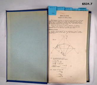
Booklet - Royal Australian Survey Corps - School of Military Survey Precis - Formula for Survey Calculations, School of Military Survey, Balcombe, Circa 1960s
This selection of Precis was produced by the Royal Australian Survey Corps, School of Military Survey, Balcombe, circa 1960s. The Precis are intended to instruct RASvy Surveyors employed on Engineer/ Field Survey Tasks on the calculations necessary for Surveying formula. The blue hard covered foolscap sized booklet held together with two Chicago screws contains 7 x precis listed below. .1 Setting out simple Curves .2 Earthworks .3 Calculation of area by double Latitude .4 Notes on Station Adjustment by Least Squares .5 Notes on Figure Adjustment by Least Squares .6 Technical Memo No1, Computation of Tellurometer Traverses using Plain Angles and Plain Distances by WO2 R Wilson RASvy (later Major) .7 Computing Traverses in Plane CoordinatesBlue Hard covered foolscap sized booklet held together with two Chicago screws. Booklet contains 7 x precis. .1 Setting out simple Curves .2 Earthworks .3 Calculation of area by double Latitude .4 Notes on Station Adjustment by Least Squares .5 Notes on Figure Adjustment by Least Squares .6 Technical Memo No1, Computation of Tellurometer Traverses using Plain Angles and Plain Distances by WO2 R Wilson (later Major) .7 Computing Traverses in Plane Coordinatesroyal australian survey corps, rasvy, fortuna, army survey regiment, army svy regt, asr, school of military survey -
 Bendigo Military Museum
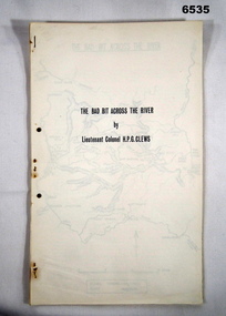
Journal - Royal Australian Survey Corps - The Bad Bit Across the River - LtCol HPG Clews 1934, LTCol HPG Clews RASvy, 1934
This Journal "The bad bit across the River" was written by - LtCol HPG Clews in 1934 and is about his experiences around the Colo River approximately 60 miles NW of Sydney, NSW. LtCol Clews was a remarkable man and his achievements were just as remarkable. He is affectionately known as "The Major." He served in the British Army 1909 - 1911 with the Sherwood Foresters. He then served in the Royal Australian Survey Corps from 1912 - 1949 and then served as the Senior Surveyor with the Snowy Mountains Authority from 1950-1958. A Survey Cairn is errected in Khancoban to record his life 1890 - 1980. This Journal records the field trip to establish Survey Control in very rugged country by a handful of party members on foot. The map shows the routes taken.14 x foolscap pages stapled and two hole punched. The Journal includes a map, 7 x pages of typed text and 4 x Annexesroyal australian survey corps, rasvy, fortuna, army survey regiment, army svy regt, asr, 2nd field survey company