Showing 4634 items
matching historical maps
-
 Kiewa Valley Historical Society
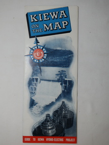
Map - Kiewa on the Map, Guide to Kiewa Hydro-Electric Project
Published by the SECV in 1950. They controlled the roads from Mt Beauty to the Bogong High Plains and all other roads within the Kiewa works area. The roads are not open to general tourist traffic. Conducted tours of the Kiewa area are operated by Eastern Road Lines Pty. Ltd., AlburyThe SECV constructed the KHES and controlled all roads within the Kiewa works area.Large colored map folded in half and then in 3. Front third is mostly blue and white with titles.. When opened the cover has black and white photos beside it with print and 'Please Note'. Also in the other half, a 'Road Map to Kiewa' showing the south eastern side of Australia, mostly yellow (the land) and blue (the sea). Inside the map is a close up map of "Ground Plan of Kiewa Hydro Electric Project' with a 'Key Map Showing Distances'.map of kiewa 1950, khes map -
 Kiewa Valley Historical Society
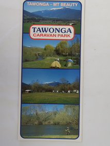
Brochure - Tawonga Caravan Park, Tawonga - Mt Beauty
Tawonga Caravan park is on the Kiewa River situated north of Mt Beauty and 30 km from Falls Creek. Tawonga Caravan park has always been popular for families and fishermen with plenty to do.Colored cardboard brochure with 3 small photos on the front and information printed on the back with a small map.tawonga caravan park, trout fishing -
 Kiewa Valley Historical Society
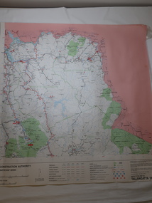
Map - Road Construction Authority 1986, Ref. Tallangatta 282008
... authorities updated maps regularly. Historically of interest eg. 1 ...Government authorities updated maps regularly.Historically of interest eg. 1. Pre dates the Alpine National Park. 2. 'Mt Beauty Estates' now known as Tawonga South. 3. Mt Niggerhead is named - It is now known as Mt Jaithmathang having been renamed in 2009.Colored map dated 1986 titled Road Construction Authority with an update of roads in the local Shires. It names places in the area and has a legion describing the rating of the roads and tracks. It also shows the main towns in the area and their roads.road construction authority, map of tallangatta area -
 4th/19th Prince of Wales's Light Horse Regiment Unit History Room
Book, Government Press and Survey of Egypt, A Brief Record of the Advance of the Egyptian Expeditionary Force Under the Command of General Sir Edmund H H Allenby GCB, GCMB. July 1917 to October 1918, 1919
Provides historical information about operations of Australian Light Horse units in the Middle EastSoft covered A4 book, 112 pages plus mapsIn front cover: Joan Rice (Flawley) 41 Arnold Drive Chelsea vic 3196world war 1, middle east, egyptian expeditionary force -
 Kiewa Valley Historical Society
Maps - Educational x 10 and Kiewa Scheme x1
Maps were used to teach children geography, the explorers, the minerals, the world etc. The school bought and stored the maps so that they were available for use. This predated electronic devices. The KHE Works map was hand drawn showing lots of detail.These maps were used by the Bogong Primary School. The Kiewa Hydro Electric Works was built by the SECV and produced hydro power. This map may have been used by pupils as well as workers on the Works. Large coloured maps on canvas, with a wooden beam along the top and bottom. Each one has a cord attached to the top so that the map may be hung up on a wall. Some are made by Chas. H. Scally & Co., Baronia Ave., Wollstonecraft, N.S.W. The Kiewa Hydro Electric Works map is pinkish and shows Rocky Valley Dam, Lake Guy and Mt Beauty pondage in dark blue.maps, educational maps, geography, primary school, kiewa hydro electric works -
 Kiewa Valley Historical Society
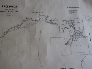
Map - Freeburgh - Counties of Bogong and Delatite
Drawn and reproduced at the Dept. of Lands and Survey, Melbourne, Victoria November 1948Black and white map of Freeburgh, County of Bogong and Delatitefreeburgh, map county of bogong and delatite -
 Kiewa Valley Historical Society
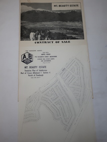
Folder - Mt Beauty Estate
After the State Electricity of Victoria completed the construction of the Kiewa Hydro Electric Scheme in 1961 the township of Mt Beauty was sold. The Shire of Bright (currently Alpine Shire) purchased the town and individual houses were put up for sale to the public.The sale of Mt Beauty changed the town - its occupants, its industry, its governance etc. Papers held in a manila folder. They include the Contract of Sale and Maps of Mt Beauty 1961mt beauty township, shire of bright -
 Kiewa Valley Historical Society
Papers - Geological Survey, Reports of Fossil Specimens, Maps
Research undertaken in the local areaStudy done by resident of the Kiewa ValleyPapers photocopied from books pertaining to the local areageology, fossils -
 Kiewa Valley Historical Society
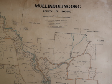
Parish Map - Mullindolingong, County of Bogong
The Department of Lands regularly updated the occupiers with leases or licences of the land.The names of the early settlers of the Kiewa Valley occupying land by lease or licence are shown. Many of these familie's descendants still live in the Kiewa Valley.Government (Lands Department?) cloth map showing the leases or licenses of occupiers of the land in the valley. The Kiewa River is shown in blue and roads in yellow. There is no date on the map.parish of mullindolingong map, settlers of the kiewa valley -
 Kiewa Valley Historical Society
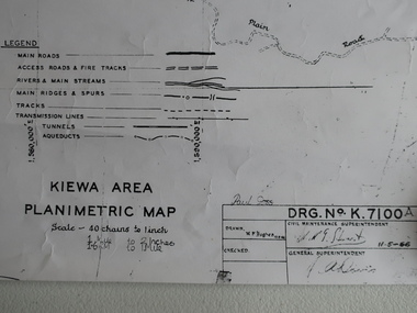
Map - Kiewa Area Planimetric Map
Planimetric maps are two-dimensional representations of the Earth's surface, showing the location and spatial arrangement of features such as roads, buildings, and bodies of water.A very clear map showing the Kiewa Hydro Electric Scheme in two dimensions to include the construction done by the SECV.Black and white Map of the Kiewa Area from Mt Beauty to the High Plains covering the Kiewa Hydro Electric Scheme and surrounds. Drawn on 11th May 1966kiewa hydro electric scheme 1966 -
 Kiewa Valley Historical Society
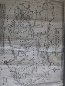
Map of the Ovens and Murray District of Victoria
The map features Beechworth and its history.This map features the north-east and in particular, Beechworth where residents of the Kiewa Valley may have shopped or visited for appointments.Black and white map with references to roads and gold. The centre of the map is Beechworth and in the bottom left side of the map is the heading Beechworth with 12 lines of print of information regarding Beechworth. The Kiewa Valley is not identified.beechworth -
 Kiewa Valley Historical Society
Maps - Kiewa Valley Parish Maps x3 and Kiewa Area Planimetric Map x1
Planimetric maps are 2 dimensional representations of the Earth's surface, showing the location and spatial arrangement of features such as roads, buildings, and bodies of water. The parish maps show the occupiers with leases or licences of the land. These are updated by the Department of Lands regularly. The names of early settlers of the Kiewa Valley occupying land by lease or licence are shown. Many of these familie's descendants still live in the Kiewa Valley.1. Kiewa Area Planimetric Map (photo) 2. Wermatong, County of Bogong Parish Map 3. Mulllindolingong, County of Bogong Parish Map 4. Mullagong, County of Bogong Parish Map All black and white kiewa valley. parish maps. land owners -
 Kiewa Valley Historical Society
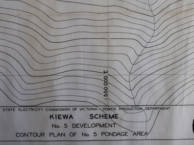
Plans - Kiewa Works Area and Environs
State Electricity Commission of Victoria constructed the Kiewa Hydro Electric Scheme from the late 1940s to 1961. These plans were used during the construction.Plans and Maps were used during the construction of the Kiewa Hydro Electric SchemeTransparent with blue tinge plans/maps created by the SECV during the construction of the Kiewa Hydro Electric Scheme. 1. Kiewa Scheme No 5 Development Contour Plan of No 5 Pondage Area 2. Mt Beauty Township 3. Kiewa Scheme No 1 Development - McKay Creek Area, Construction Layout 4. Kiewa Works and Environs 5. North Eastern Victoria and Adjoining Snowy Mountains Regionsecv, kiewa hydro electric scheme plans -
 Kiewa Valley Historical Society
Maps 3D - National Parks
Used by the employees of National Parks. The maps show the topography and contours in 3D when used with the stereoscope KVHS 0743. This enables the photographed area to be compared to previous photos and enables the planning of construction of eg. new roads etc. Digital information is now available.These photographs give the topography and contours of vast local areas eg. Mt Feathertop and Tawonga township.when used with a stereoscope. Black and white large aerial photos of the Bogong High Plains area. 14 to 20 of them all on thick paper and the same size as the brown wooden box which holds them. The box hasn't got a lid at the top.Identified and catalogued by National Parksmaps showing topography, national parks, stereoscope -
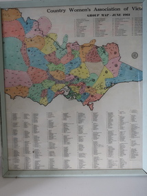 Kiewa Valley Historical Society
Framed Map - CWA- Tawonga
CWA of Victoria was a popular widely known organisation throughout Australia. The CWA aimed to improve health welfare, and education for women and children living in the country.Each town / area in the Kiewa Valley had an active CWA. The Tawonga branch commenced in Feb. 1946 and often combined activities with other branches of the Kiewa Valley.Country Women's Association of Victoria Group Map, June 1961. each area is colored ad each wit a letter of the alphabet. each group has a number and is listed. eg. blue, 'N' and "Tawonga 14' country women's association, map of cwa groups, tawonga cwa -
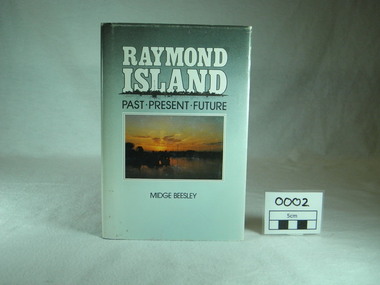 Raymond Island Historical Society
Book, Midge Beesley, Raymond Island:past present future, 1986
Local history of Raymond Island. Includes stories of Island identities, maps, photographsLocal significance Out of print publicationMonograph publication 291 pages Hardback Loose cover Maps Sunset picture of lake from Raymond Island on front cover Photographs of people, buildings, Raymond Island ferries, boats. Contents: Raymond Island early settlers, indigenous history, Island identities, Raymond Island State School, a'Beckett Park, Raymond Island Ferry, The Presbyterian Church, raymond Island Advancement League park, gippsland lakes, raymond island, raymond island state school, a beckett, raymond island ferry, early, settlers, raymond island advancement league -
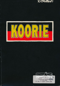 Eltham District Historical Society Inc
Book, Koorie Heritage Trust, Koorie, 1991c
Oldest culture - Yarra River and Port Phillip - Religion - Serpents - Fire - In 1830 - First contacts - Massacre map - Survival - Identity - Resistance and rights (Pastor Sir Douglas Nicholls) - Land rights - From hand-out to hand-back - Aborigines in war - Sportspeople - Cultural heritage.Paperback; 57, [3] pages : illustrations, maps, ports ; 30 cm.ISBN 0724198105aborigines, social customs, koorie, victoria -
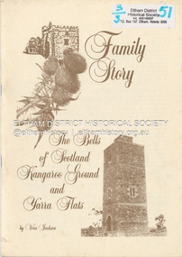 Eltham District Historical Society Inc
Book, Family story, concerning a Scottish border family which migrated to the Port Phillip District of Australia in 1839 and the countryside which became their home / by Vera Jackson, 1986
Family story, concerning a Scottish border family which migrated to the Port Phillip District of Australia in 1839 and the countryside which became their homePaperback; 48 p. : ill., geneal. tables, maps, ports. ; 31 cm.ISBN 1862522804bell family, kangaroo ground, yarra flats -
 Eltham District Historical Society Inc
Book, Bushfires Royal Commission, 2009 Victorian Bushfires Royal Commission, Interim Report, Executive Summary, 2009
Interim report of Bushfires Royal Commission on the 2009 Victorian bushfires26 p. : col. ill., maps ; 30 cm.ISBN 978192337765 -
 Eltham District Historical Society Inc
Book, Bruce Bence, Kangaroo Ground Bush Fire Brigade, centenary 1892-1992 : the story of the Kangaroo Ground Fire Brigade / Bruce Bence, 1992
Contents (described as Index): The early days, Ewen Hugh Cameron, 1914-1939, Supporting organisations, Eltham Emergency Operations Centre, Kangaroo Ground Fire Brigade Ladies Auxiliary, The fire tower, the Salvation Army and Red Cross, 1930-1992, The Kangaroo Ground Fire Brigade Today, Kangaroo Ground Fire Brigade Chronology. Includes a list of names of office bearers. Also includes references to neighbouring brigades and copies of historical newspaper articles. This publication was supported by the resources, information and facilities of The Shire of Eltham Historical Society.This book is significant in that not only does it traces the development of Kangaroo Ground Bush fire brigade since 1892 and of emergency services in the area but it also gives an insight into the people and their community.Softcover; 61 p., [7] p. of plates : b&w ill., 7 maps, ports.ISBN 064606651Xkangaroo ground, fire brigades, emeregency services, kangaroo ground fire brigade, fires, bush fires, shire of eltham war memorial, kangaroo ground tower -
 Eltham District Historical Society Inc
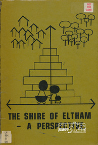
Book, Shire of Eltham, The Shire of Eltham - A Perspective, July 1981
This report was produced by the Shire of Eltham (Planning Department) following a population study of the Shire. It also includes other areas of general interest. The Document contents includes Present and Future - Population - Housing - Residential Lands - Social Characteristics - Development and History. Includes maps, tables and diagrams. Part 1: The Existing situation - introduction, the Shire of Eltham, physical characteristics, historical development, population growth. Characteristics of the population - size and distribution, age / sex, natural increase, migration. Socio-Economic Factors: socio-economic status, employment/workforce, education, other social factors. Housing/ building statistics: characteristics of Housing stock, current residential trends, other types of building activity. Residential Land: existing vacant lots, estimated additional lots. Part 2: The Future. Land availability, the future population.The Shire of Eltham Council resolved on publication of this report "to commend it to the ratepayers as a most valuable resource document". It provides a comprehensive statistical review of the Shire of Eltham, Victoria in 1981 with some population and development predictions for the future.Spiral bound, soft cover, includes indexBarcode and identification markings including stamped "WITHDRAWN" from Heidelberg Regional Library Serviceshire of eltham, planning, population -
 Eltham District Historical Society Inc
Book, Country Fire Authority Mapping Association Inc, ESMAP - Outer Melbourne Directory, 1991
Outer Melbourne directory of information for emergencies with maps of the state and major towns217 p. : maps ; 30 cm.ISBN 0646065661emergency services victoria -
 Eltham District Historical Society Inc
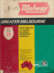
Book, Melway Publishing, Melway Greater Melbourne Street Directory, edition 20, 1990, 1990
Coloured detailed maps accessed by a street or location index.500 p. : col. maps ; Flexible cover edition with fitted clear plastic jacket.ISSN 03113957streets, roads, maps, melway -
 Eltham District Historical Society Inc
Book, Melway Great Melbourne street directory including Geelong, Phillip Island Healesville, Bellarine & Mornington Peninsulas, 1998
25th edition. Coloured detailed maps accessed by a street or location index. Cover: (Includes) New Southbank map including Crown Complex, enlargements of Footscray and Kensington, bike paths, walking tracks & horse trails, latest public transport information, South east Australia tours maps, Vic Roads new route numbers, map of Australia1 atlas (22, 772 p.) : col. maps ; ISSN 03113957streets, maps, roads, melbourne -
 Eltham District Historical Society Inc
Book, Melway Publishing, Melway Greater Melbourne street directory : including Geelong, Phillip Island, Healesville, Bellarine & Mornington Peninsulas, 2002
Edition 29. Coloured detailed maps accessed by a street or location index. Cover: 20 additional pages of new maps, extended coverage of Bellarine Peninsula, further coverage of Werribee South, Public Transport Information, latest official suburb boundaries, CBD "hook turn" intersections map, over 1200 new streets, 1 atlas (24, 886 p.) : col. maps ; ISSN 03113957streets, roads, melbourne, maps, melway -
 Eltham District Historical Society Inc
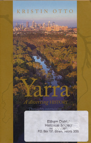
Book, Text Publishing, Yarra: a diverting history by Kristin Otto, 2009
Exploration of the history and meaning of Melbourne's Yarra river and those who have lived and worked on it. Softcover, 245 p. : ill. maps, ports. ISBN 9781921520006yarra river -
 Eltham District Historical Society Inc
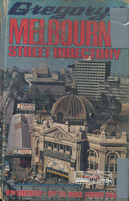
Book, Gregory's Melbourne Street Directory of Melbourne and suburbs and metropolitan road guide (8th edition) extends to Laverton, Deer Park, Epping, Diamond Creek, Lilydale, Olinda, Belgrave, Doveton and Mornington, 1973
This is the 8th edition of Gregory's Melbourne Street Directory, fully revised and up-to-date for this edition published December 1973. It is a comprehensive guide to the streets and localities of Melbourne and suburbs at that time. The colour maps are arranged in double-page spreads. Names of streets and suburbs are arranged alphabetically in the index to streets.Hard copy with plastic cover. 382 p. streets, melbourne - maps, roads -
 Eltham District Historical Society Inc
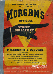
Book, Val Morgan and Sons Pty Ltd, Morgan's Street Directory of Melbourne & Suburbs, 42nd edition (large scale) (published 1965), 1965c
1 atlas (228 p.) : 147 col. maps ; 25 cm. (Two copies - second copy front and back covers separated/loose)melbourne maps, street directory -
 Eltham District Historical Society Inc
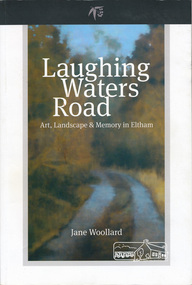
Book, Shire of Nillumbik, Laughing Waters Road: art, landscape & memory by Jane Woollard, 2016
"Laughing Waters has been a source of inspiration for many artists and designers, and was a natural extension of the dynamic art and lifestyle movement that began in the 1930s at Montsalvat. It was also an important site in the development of the Melbourne art scene in the 1960s and '70s, especially the earth building movement known as the Eltham Style. Since 2001 more than eighty artists have been in residence at Laughing Waters in Birrarung House and Riverbend. Their experiences and art making are woven together with Wurundjeri, European and family histories to create an evocative account of a special place in a bushy outer suburb of Melbourne." -- back cover. Eltham District Historical Society is acknowledged in the Acknowledgments section of this book.264 pages : illustrations, maps, portraits ISBN 9780994486707laughing waters, eltham, yarra river, artists, killeavey, mud bricks -
 Eltham District Historical Society Inc
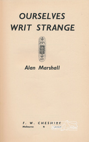
Book, Alan Marshall (1902-1984), Ourselves Writ Strange by Alan Marshall published by F.W. Cheshire Pty. Ltd, 1949
321 p. : plates, map (on lining papers) ; 23 cm[written on flyleaf] Hullo, John. Greetings from Australia - Alan Marshall Dec 61australian aboriginal