Showing 128 items matching "aerial survey map"
-
 St Kilda Historical Society
Photograph - Photo map, 22/01/1970
One of a series of photo-maps produced for the Department of Crown Lands and Survey (1857-1983). For correlation with a current map, and access to other historical photo maps of Victoria, see the Historic Photo-Maps Index published by the Department of Environment, Land, Water and Planning at https://services.land.vic.gov.au/DELWPmaps/historical-photomaps/Black and white aerial photographVic 2358 Department of Crown Lands and Survey Victoria,.© Melbourne 1970 Project Run 43E 22.1.70 5,100 ASL 206elwood, elsternwick, elsternwick park, 1970 -
 Creswick Campus Historical Collection - University of Melbourne
Still Image, 1952
... of a topographical map marked State Aerial Survey. Stored in a brown... section of a topographical map marked State Aerial Survey. Stored ...Subject: King Lake . 6 brown envelopes marked Run 3, 4, 7, 7a, 8, 9 containing c. 80 prints. 1 section of a topographical map marked State Aerial Survey. Stored in a brown cardboard file box marked King Lake Run No.3 - 9. (x9). Photos commissioned by Forests Commission Victoria.Aerial Photographs -
Creswick Campus Historical Collection - University of Melbourne
Maps, 1967 - 1972
... Forest 1967. Survey maps from aerial photography 1971... Island 1972. Barmah Forest 1967. Survey maps from aerial ...Maps of various subjects: Gunbower Island 1972. Barmah Forest 1967. Survey maps from aerial photography 1971 _Narnargoon.Tonimbuk. Gilwell & Beenak.Maps -
Whitehorse Historical Society Inc.
Map, Dandenong Ranges Area, 1956
Sheet 1. Parts of Parishes: Nunawading, Warrandyte and Ringwood. Scale: 10 chains : 1 inch. Contour intervals marked and locations of buildings.Sheet 1. Parts of Parishes: Nunawading, Warrandyte and Ringwood. Scale: 10 chains : 1 inch. Contour intervals marked and locations of buildings. Compiled from aerial photographs and cadastral survey information.Sheet 1. Parts of Parishes: Nunawading, Warrandyte and Ringwood. Scale: 10 chains : 1 inch. Contour intervals marked and locations of buildings. maps, ringwood, mitcham, warrandyte -
Whitehorse Historical Society Inc.
Map, Aerial Photographs Nunawading, 1970
State Aerial Survey, Melbourne 1970.State Aerial Survey, Melbourne 1970. Project runs 34 - 39 - City of Nunawading. Frames numbered from South to North boundaries, each strip numbered from East to West. See table of index and photo numbers attached.non-fictionState Aerial Survey, Melbourne 1970.state aerial survey, aerial photographs, nunawading, mitcham, blackburn, blackburn north, blackburn south, forest hill, vermont, burwood east, vermont south -
Whitehorse Historical Society Inc.
Map, Aerial photographs Nunawading, 1972
Department of Crown Lands and Survey, Melbourne, 1972.Department of Crown Lands and Survey, Melbourne, 1972. Project runs 34 - 39 - City of Nunawading. frames numbered from South to North boundaries, each strip numbered from West to east. The series extends further West to Box Hill and East to Ringwood than the 1970 project. No index map. Sheets 39/2 and 34/28 missing.non-fictionDepartment of Crown Lands and Survey, Melbourne, 1972.victoria. department of crown lands and survey, aerial photographs, nunawading, mitcham, blackburn, blackburn north, blackburn south, forest hill, vermont, burwood east, box hill, ringwood, vermont south -
Whitehorse Historical Society Inc.
Map, Aerial photographs Nunawading, 1976
Department of Crown Lands and Survey, Melbourne, 1976 Project.Department of Crown Lands and Survey, Melbourne, 1976 Project. Runs 29 - 33 City of Nunawading. Frames numbered from South to North boundaries, each strip numbered from West to East. No index map. Sheets 30/8 and 30/9 missing.non-fictionDepartment of Crown Lands and Survey, Melbourne, 1976 Project. victoria. department of crown lands and survey, aerial photographs, nunawading, mitcham, blackburn, blackburn north, blackburn south, forest hill, vermont, vermont south, burwood east, box hill, ringwood -
Whitehorse Historical Society Inc.
Map, M.M.B.W, c1962
Melbourne Metropolitan Area Base Map series sheet 235, covering part, Mitcham, Nunawading and Ringwood areas.Melbourne Metropolitan Area Base Map series sheet 235, covering part, Mitcham, Nunawading and Ringwood areas. Prepared by Department of Lands and Survey and Melbourne and Metropolitan Board of Works from State aerial Survey, June 1957 and Cadastral Survey information, August 1960. Scale 1:4,800.Melbourne Metropolitan Area Base Map series sheet 235, covering part, Mitcham, Nunawading and Ringwood areas. maps, mitcham, nunawading, ringwood, melbourne and metropolitan board of works, victoria. department of lands and survey -
Whitehorse Historical Society Inc.
Map, Boronia Road, Vermont, 1970
Enlargement of aerial photograph of Boronia Road, Vermont. State Aerial Survey 1970 Run 37Enlargement of aerial photograph of Boronia Road, Vermont. State Aerial Survey 1970 Run 37Enlargement of aerial photograph of Boronia Road, Vermont. State Aerial Survey 1970 Run 37boronia road, vermont, lusk drive, vermont, morack road, vermont south, allison court, vermont, trinian street, vermont, cosgrove street, vermont, mawson court, vermont, aerial photographs -
Whitehorse Historical Society Inc.
Map, Boronia Road, Vermont, 1970
Enlargement of Aerial photograph of Boronia Road Vermont, State Aerial Survey, 1970. Run 37Enlargement of Aerial photograph of Boronia Road Vermont, State Aerial Survey, 1970. Run 37Enlargement of Aerial photograph of Boronia Road Vermont, State Aerial Survey, 1970. Run 37boronia road, vermont, gallus close, vermont, moore road, vermont, carlinga drive, vermont, beleura avenue, vermont, olinda crescent, vermont, penllyne avenue, vermont, holyrood drive, vermont, aerial photographs -
Whitehorse Historical Society Inc.
Map, Campbell's Croft, c1970
Enlarged aerial photograph of the area around Campbell's Croft Reserve. State aerial Survey, Melbourne, 1970 project. Run 37Enlarged aerial photograph of the area around Campbell's Croft Reserve. State aerial Survey, Melbourne, 1970 project. Run 37Enlarged aerial photograph of the area around Campbell's Croft Reserve. State aerial Survey, Melbourne, 1970 project. Run 37campbells croft, boronia road, vermont, madonna court, vermont, aerial photographs -
Whitehorse Historical Society Inc.
Map, Boronia Road, Canterbury Road intersection, c1970
Enlarged aerial photograph of the intersection of Canterbury and Boronia Roads. State Aerial Survey, Melbourne 1970 project.Enlarged aerial photograph of the intersection of Canterbury and Boronia Roads. State Aerial Survey, Melbourne 1970 project.Enlarged aerial photograph of the intersection of Canterbury and Boronia Roads. State Aerial Survey, Melbourne 1970 project.boronia road, vermont, canterbury road, vermont, mitcham road, vermont, frances avenue, vermont, nurlendi road, vermont, beaumont street, vermont, kingsclere street, vermont, webb court, vermont, aerial photographs -
Whitehorse Historical Society Inc.
Map, Canterbury Road, Vermont, c1970
Enlarged aerial photo of intersection of Canterbury and Boronia Roads. State Aerial Survey, Melbourne 1970 project.Enlarged aerial photo of intersection of Canterbury and Boronia Roads. State Aerial Survey, Melbourne 1970 project.Enlarged aerial photo of intersection of Canterbury and Boronia Roads. State Aerial Survey, Melbourne 1970 project.canterbury road, vermont, boronia road, vermont, mitcham road, vermont, frances avenue, vermont, nurlendi road, vermont, webb court, vermont, vermont primary school, no. 1022, aerial photographs -
Whitehorse Historical Society Inc.
Map, Dandenong Ranges area. Sheet 7, c1957
Detailed map covering area from Mitcham and Vermont to Ringwood and Heathmont.Detailed map covering area from Mitcham and Vermont to Ringwood and Heathmont. Shows streets, block boundaries, buildings, railway and creeks. Note says prepared from State Aerial Survey, April 1954 and Cadastrial Survey information July 1956.Detailed map covering area from Mitcham and Vermont to Ringwood and Heathmont. maps, mitcham, vermont, ringwood, heathmont -
Whitehorse Historical Society Inc.
Map, Melbourne Metropolitan Area Base Map series. Sheet 214, c1960
... increments. Note on map: 'prepared ... from State Aerial Survey... on map: 'prepared ... from State Aerial Survey, January 1957 ...Map showing northern section of the City of Nunawading together with parts of Shire of Doncaster and Templestowe.Map showing northern section of the City of Nunawading together with parts of Shire of Doncaster and Templestowe. Shows roads, creeks, block numbers and contours at 5 feet vertical increments. Note on map: 'prepared ... from State Aerial Survey, January 1957 and Cadastral Survey information February 1959'.Map showing northern section of the City of Nunawading together with parts of Shire of Doncaster and Templestowe. maps, city of nunawading, shire of doncaster and templestowe -
Whitehorse Historical Society Inc.
Map, Melbourne Metropolitan Area Base Map, 1957?
Sheet 254 of part of the Municipality of Nunawading and part of the Parish of Nunawading, showing roads, block numbers, creeks and contours mostly south of Canterbury Road.Sheet 254 of part of the Municipality of Nunawading and part of the Parish of Nunawading, showing roads, block numbers, creeks and contours mostly south of Canterbury Road. Prep. from State Aerial and Cadastral survey information, August 1957. Scale: 400 ft = 1 inchSheet 254 of part of the Municipality of Nunawading and part of the Parish of Nunawading, showing roads, block numbers, creeks and contours mostly south of Canterbury Road. city of nunawading, cadastral -
 Bayside Gallery - Bayside City Council Art & Heritage Collection
Photograph, Department of Crown Lands and Survey, Victoria, Melbourne Project: Brighton and Elwood, 1976
The Department of Crown Lands and Survey (1857-1983) was responsible for the administration of survey and mapping and the sale, occupation and management of crown land throughout its existence. This aerial photograph shows parts of Brighton and Elwood and was taken on 1 December 1976brighton, elwood, department of crown lands and survey, aerial photograph, elsternwick park, point ormond, north road, ormond esplanade, st kilda street, glen huntly road, bayside, port phillip bay, map, cartographic material, melbourne project 1976 -
 Bayside Gallery - Bayside City Council Art & Heritage Collection
Photograph, Department of Crown Lands and Survey, Victoria, Melbourne Project: Brighton, Hampton, Sandringham, 1976
The Department of Crown Lands and Survey (1857-1983) was responsible for the administration of survey and mapping and the sale, occupation and management of crown land throughout its existence. This aerial photograph shows parts of Brighton, Hampton and Sandringham and was taken on 1 December 1976brighton, department of crown lands and survey, aerial photograph, bayside, port phillip bay, map, cartographic material, hampton, sandringham, green point, sandringham yacht club, south road, beach road, hampton street, melbourne project 1976 -
 Bayside Gallery - Bayside City Council Art & Heritage Collection
Photograph, Department of Crown Lands and Survey, Victoria, Melbourne Project: Brighton, 1976
The Department of Crown Lands and Survey (1857-1983) was responsible for the administration of survey and mapping and the sale, occupation and management of crown land throughout its existence. This aerial photograph shows parts of Brighton and was taken on 1 December 1976brighton, department of crown lands and survey, aerial photograph, bayside, port phillip bay, map, cartographic material, melbourne project 1976, brighton yacht club, middle brighton baths, north road, st kilda street, new street -
 Bayside Gallery - Bayside City Council Art & Heritage Collection
Photograph, Department of Crown Lands and Survey, Victoria, Melbourne Project: Brighton and Hampton, 1976
The Department of Crown Lands and Survey (1857-1983) was responsible for the administration of survey and mapping and the sale, occupation and management of crown land throughout its existence. This aerial photograph shows parts of Brighton and Hampton and was taken on 1 December 1976. brighton, department of crown lands and survey, aerial photograph, bayside, port phillip bay, map, cartographic material, melbourne project 1976, brighton yacht club, middle brighton baths, hampton, green point, brighton beach, south road, the esplanade, hampton street -
 Bayside Gallery - Bayside City Council Art & Heritage Collection
Photograph, Department of Crown Lands and Survey, Victoria, Brighton, Elwood and Elsternwick, c. 1965-71
The Department of Crown Lands and Survey (1857-1983) was responsible for the administration of survey and mapping and the sale, occupation and management of crown land throughout its existence. This aerial photograph shows parts of Brighton, Elwood and Elsternwick and was taken circa 1965-71.brighton, department of crown lands and survey, aerial photograph, bayside, port phillip bay, map, cartographic material, elwood, elsternwick, elsternwick park, elwood tram depot, elwood pier, new street, glen huntly road, st kilda street, nepean highway -
 Bayside Gallery - Bayside City Council Art & Heritage Collection
Photograph, Department of Crown Lands and Survey, Victoria, Brighton, Brighton East and Bentleigh, c. 1965-71
The Department of Crown Lands and Survey (1857-1983) was responsible for the administration of survey and mapping and the sale, occupation and management of crown land throughout its existence. This aerial photograph shows parts of Brighton, Brighton East and Bentleigh and was taken circa 1965-71.brighton, department of crown lands and survey, aerial photograph, bayside, port phillip bay, map, cartographic material, bentleigh, brighton east, dendy park, dendy street, centre road, nepean highway, south road, football -
 Bayside Gallery - Bayside City Council Art & Heritage Collection
Photograph, Department of Crown Lands and Survey, Victoria, Brighton, Brighton East and Bentleigh, c. 1965-71
The Department of Crown Lands and Survey (1857-1983) was responsible for the administration of survey and mapping and the sale, occupation and management of crown land throughout its existence. This aerial photograph shows parts of Brighton and Brighton East and was taken circa 1965-71.brighton, department of crown lands and survey, aerial photograph, bayside, port phillip bay, map, cartographic material, brighton east, dendy park, dendy street, centre road, nepean highway, south road, brighton golf course, golf -
 Forests Commission Retired Personnel Association (FCRPA)
Pocket Stereoscope
This pocket stereoscope was used to view a pair of separate and overlapping aerial photos as a single three-dimensional image. It was small and could be easily used in the field. Larger, mirror stereoscope were also available in some offices. The aerial images were used to map forest types, timber stands, new roads and tracks, firebreaks, boundaries of timber harvesting, plantations, bushfires, insect and disease attack and so on In 1928, the Forests Commission undertook its first major aerial photography project over 15,000 acres of forest which is said to be the first of its kind in Australia. During the Second World War, large areas of Victoria were photographed by RAAF and used to produce orthophoto maps. By 1945 aerial photography of 13,000 square miles (3.4 M ha) was completed, including much of the inaccessible eastern forests. The Forests Commission started developing its own small format photography in the early 1970s. Simple, cheap and rapid methods of obtaining photographs using 70mm and 35mm cameras were developed Small pocket stereoscope to interprete aerial photographs in the field Adjustable lenses on foldaway wire legsSokkisha Tokyoforest measurement, surveying, forests commission victoria (fcv) -
 Department of Energy, Environment and Climate Action
Hasselblad aerial camera
Aerial photos were used to make maps of forest types, timber resources, to survey logging areas and regeneration, to mark boundaries of public land and new plantations, to identify new roads and tracks, as well as for fire suppression. Infrared film was sometimes used to monitor insect and disease attack. The images needed to sharp, with high contrast, and in a large format (most were printed in B&W on 9-inch by 9-inch glossy photographic paper) with at least a 60% overlap to enable stereoscopic viewing and with a 20-30% side lap to allow for aircraft drift. Preferably, the photo scale was close to the final map scale avoid to problems when enlarging and to reduce distortion. Something was needed to supplement the very expensive and infrequent large-area photography programs. From the mid-1960s Victorian foresters began experimenting with small format 70mm and 35mm cameras which proved simple, practical, cheap and flexible. It was found that any SLR camera could be used provided it had a good quality lens and fast shutter speed (preferably down to 1/1000 second). Motorised cameras with a large film capacity had obvious advantages and were essential when access to the camera was not possible during flight. It is also essential for the shutter to operate at low temperatures and those lubricated with silicones were recommended. Components of a typical FCV Divisional Office system included – A Hasselblad or Vinten 70 mm format aerial camera with a focal plane shutter which could be electrically operated. Interchangeable lenses to allow for different photo scales and flying heights. Several large film magazines, which were loaded in a darkroom, each with a capacity of 100 feet or approximately 500 frames. A remote control for the camera in single-shot mode or automatic firing at selected intervals of 2 to 50 seconds. It also needed a frame counter. A light aircraft was modified with an internal mounting for the camera to keep it level and steady. Often a hole was cut through the floor for the lens. The aircraft also needed an inbuilt 12 Volt DC battery to operate the motorised camera shutter. The front passenger seat was generally removed to improve access to the camera. An Aldis drift sight was also fitted. This might be likened to an inverted periscope and is used to determine drift, to facilitate accurate navigation along flight lines and to determine the exposure interval for stereoscopic overlap. This item is kept at Traralgon.Hasselblad 500 ELM camera with 70mm lens, film pack, motor drive and battery In 1964 Hasselblad started production of a motorized camera, the 500 EL The EL/M is a modified version of the EL, "M" means modified, "EL" electric. Perhaps the most famous use of the Hasselblad camera was during the Apollo program missions when man first landed on the Moon. Almost all of the still photographs taken during these missions used modified Hasselblad cameras. forests commission victoria (fcv), forest measurement, surveying, mapping -
 Department of Energy, Environment and Climate Action
Foldable Stereoscope
This stereoscope was used to view a pair of separate and overlapping aerial photos as a single three-dimensional image. This smaller foldable unit could be easily used in the field but larger, mirror stereoscope was used in offices. The aerial images were used to map forest types, timber stands, new roads and tracks, firebreaks, boundaries of timber harvesting, plantations, bushfires, insect and disease attack and so on In 1928, the Forests Commission undertook its first major aerial photography project over 15,000 acres of forest which is said to be the first of its kind in Australia. During the Second World War, large areas of Victoria were photographed by RAAF and used to produce orthophoto maps. By 1945 aerial photography of 13,000 square miles (3.4 M ha) was completed, including much of the inaccessible eastern forests. The Forests Commission started developing its own small format photography in the early 1970s. Simple, cheap and rapid methods of obtaining photographs using 70mm and 35mm cameras were developedFoldable plastic stereoscope in box Benallaforests commission victoria (fcv), surveying, forest measurement -
 Department of Energy, Environment and Climate Action
Stereoscope
This stereoscope was used to view a pair of separate and overlapping aerial photos as a single three-dimensional image. Smaller units and could be easily used in the field but this larger, mirror stereoscope was used in offices. The aerial images were used to map forest types, timber stands, new roads and tracks, firebreaks, boundaries of timber harvesting, plantations, bushfires, insect and disease attack and so on In 1928, the Forests Commission undertook its first major aerial photography project over 15,000 acres of forest which is said to be the first of its kind in Australia. During the Second World War, large areas of Victoria were photographed by RAAF and used to produce orthophoto maps. By 1945 aerial photography of 13,000 square miles (3.4 M ha) was completed, including much of the inaccessible eastern forests. The Forests Commission started developing its own small format photography in the early 1970s. Simple, cheap and rapid methods of obtaining photographs using 70mm and 35mm cameras were developedFoldable metal stereoscope in wooden box with mirror covers Ex Dept of Defenceforests commission victoria (fcv), surveying, forest measurement -
Port Melbourne Historical & Preservation Society
Photograph, Aerial Survey of Port Melbourne; December 1945, 2105
Seventeen (17) individual photos were joined together by John KIRBY to make a compsite image.Aerial Survey of Port Melbourne; December 1945 Large photograph mounted on foam board. Shows aerial view of Port Melbourne showing its extent from the Bay. Panel on right hand side has key to numbered areas on map . PMHPS logo on top left cornereclipse picture theatre, brookes lemos ltd, built environment, local government, natural environment, built environment - industrial, religion - roman catholic church (st josephs), gmh, general motors-holden, rotten row, sport - trotting, j kitchen & sons pty ltd, australian wool board, government aircraft factory, gaf, commonwealth aircraft corporation, cac, north port oval, fire and fire services, market reserve, religion - presbyterian church, leading lights, foresters arms hotel, commonwealth government engine works, st josephs catholic primary school, mission to seamen, centenary bridge, naval drill hall, mail exchange, gasworks, piers and wharves - town pier, robert harper & co ltd, ran - royal australian navy, hmas lonsdale, port melbourne yacht club, pmyc -
 Bendigo Military Museum
Photograph - 4th Field Survey Squadron – Operation ARIGHT 93, Queensland, 1993
This is a set of 42 photographs taken during 4th Field Survey Squadron’s deployment on Operation ARIGHT 93 in North Queensland from the 30th of August to the 8th of October 1993. The Survey Field Completion area of operations was Weipa near the top end of the Cape York Peninsula. Survey parties conducted field checking of topographic maps covering Bamaga, Heathlands, Weipa, Lockhart River and Strathgordon in Perentie 110 Series Survey variant FFR Land Rovers. Hand-held Trimble and Magellan GPS receivers were used to assist with navigation and to position remote isolated features. Three Bell Kiowa LOH helicopters provided by 162 Recce Sqn supported field checking operations. Supplementary and Vital Asset Protection photography was taken by air camera operators in AAAvn Nomad aircraft from 173 Survl Sqn fitted with an RC10 aerial camera.This is a set of 42 photographs taken in 1993 durin8g 4th Field Survey Squadron’s deployment on Operation ARIGHT in North Queensland. The colour photographs are on 35mm negative film and are part of the Army Survey Regiment’s Collection. The photographs were scanned at 96 dpi. .1) - Photo, colour, 1993. Survey party in Perentie 110 Series Land Rover navigates through Cape York Peninsula sand hills. .2) - Photo, colour, 1993. Cape York Peninsula sand hills. .3) - Photo, colour, 1993. Cape York Peninsula Island. .4) - Photo, colour, 1993. Survey party in Perentie 110 Series Land Rover enters a Cape York Peninsula beach. .5) - Photo, colour, 1993. SPR Kim Baker takes a break on a Cape York Peninsula beach. .6) - Photo, colour, 1993. L to R: MAJ Andy Cordova (USA Exchange) from the Army Survey Regiment and unidentified civilians. .7) to .14) - Photo, colour, 1993. Cape York Peninsula topography. .15) - Photo, colour, 1993. Unidentified surveyor in Bell Kiowa LOH helicopter. .16) - Photo, colour, 1993. Bell Kiowa LOH helicopter circles base camp. .17) to .18) - Photo, colour, 1993. Cape York Peninsula topography. .19) - Photo, colour, 1993. Vehicle convoy taking a break. L to R: LT John Bath (Detachment OC), unidentified (x2), SPR Chris Pearse. .20) - Photo, colour, 1993. Vehicle convoy taking a break. .21) - Photo, colour, 1993. Vehicle convoy ready to go. SPR Chris Pearse. .22) - Photo, colour, 1993. Vehicle convoy on the move. .23) - Photo, colour, 1993. Cape York Peninsula topography. .24) - Photo, colour, 1993. Unidentified personnel. .25) - Photo, colour, 1993. SGT Neale ‘Tex’ Houston. .26) - Photo, colour, 1993. Ground below a Bell Kiowa LOH helicopter .27) - Photo, colour, 1993. L to R: SPR Mark Sinderberry and CPL Stuart Adrain in a Bell Kiowa LOH helicopter. .28) & .29) - Photo, colour, 1993. Ground below a Bell Kiowa LOH helicopter. .30) - Photo, colour, 1993. Base camp viewed from a Bell Kiowa LOH helicopter. .31) - Photo, colour, 1993. Cape York Peninsula topography in recovery after burn-off. .32) & .33) - Photo, colour, 1993. SPR Kim Baker contemplates crossing this bridge in his Land Rover. .34) - Photo, colour, 1993. SPR Kim Baker takes a break next to a billabong. .35) - Photo, colour, 1993. Survey party in Perentie 110 Series Land Rover crosses a creek. .36) - Photo, colour, 1993. Cape York Peninsula bush fire in distance. .37) - Photo, colour, 1993. Survey party in Perentie 110 Series Land Rover traverses a sand hill. .38) - Photo, colour, 1993. SPR Kim Baker. .39) - Photo, colour, 1993. Cape York Peninsula bush fire. .40) - Photo, colour, 1993. Cape York Peninsula topography. .41) & .42) - Photo, colour, 1993. Cape York Peninsula sand hills..1P to .42P – There are no personnel identified. ‘1993 OP ARIGHT’ annotated on negative sleeve.royal australian survey corps, rasvy, 4 fd svy sqn, op aright 93 -
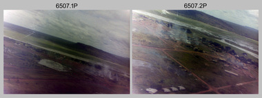 Bendigo Military Museum
Photograph - 4th Field Survey Squadron – Operation NERVOSE 85 Field Phase Oblique Photos, NT, 1985
This is a set of 20 oblique aerial photographs taken during the field phase of 4th Field Survey Squadron’s Operation NERVOSE 85 project in the Northern Territory in 1985. Operation NERVOSE 85 was mounted by 4 Fd Svy Sqn in the EAST ARNHEM, VICTORIA RIVER DOWNS AND DALY WATERS areas of the Northern Territory from 26 May to 18 Sep 85. The aim of Operation NERVOSE 85 was to finalise the horizontal and vertical control for mapping at a scale of 1:50,000, to field check 40x 1:50,000 preliminary maps and to obtain mapping photography in support of the RAAF TINDAL redevelopment project. *Note –These photos were most likely taken in 1985, contrary to the ‘1987’ date annotated on the negative sleeves. The Op NERVOSE 85 Project Report available on RASVY’s web site lists a nominal roll of personnel. Photos of 4 Fd Svy Sqn taken in 1985 and 1987 provide names of posted personnel. Several personnel identified in these photos were posted to 4 Fd Svy Sqn in 1985, not in 1987. See items 6504.13P, 6505.28P and 6506.16P for more photos taken prior to and during Operation NERVOSE 1985. This is a set of 20 oblique aerial photographs taken during the field phase of 4th Field Survey Squadron’s Operation NERVOSE 85 project in the Northern Territory in 1985. The colour photographs on 35mm negative film and are part of the Army Survey Regiment’s Collection. The photographs were scanned at 96 dpi. .1) to .20) - Photo, colour, 1985. Unknown locations..1P to .20P – There are no personnel identified. ‘1987 OP NERVOSE VICTORIA RIVER DOWNS AND DALY WATERS.’ annotated on negative sleeve.royal australian survey corps, rasvy, 4 fd svy sqn, op nervose 85