Showing 154 items matching "local area development"
-
 Kew Historical Society Inc
Photograph - Flooding of the Yarra River in North Kew, 1934
North Kew, now divided between Kew and Kew East, bordered the Yarra River. As such, it was a region subject to flooding in the Yarra Valley. Development beyond this point (ie Kellett Grove) was limited by the City of Kew's planning regulations. Prior to urban development, the area since European settlement and the first land sales in the district in the 1840s, had been used for dairy farming. .Small sepia snapshot of a local family's house in what was then River Avenue, North Kew being surrounded by floodwaters.Verso: THE SIDE OF RYANSyarra river -- north kew, floods -- yarra valley, floods -- north kew, floods -- 1934, natural disasters -- kew -
 Kew Historical Society Inc
Photograph - Flooding of the Yarra River in North Kew, 1934
North Kew, now divided between Kew and Kew East, bordered the Yarra River. As such, it was a region subject to flooding in the Yarra Valley. Development beyond this point (ie Kellett Grove) was limited by the City of Kew's planning regulations. Prior to urban development, the area since European settlement and the first land sales in the district in the 1840s, had been used for dairy farming. .Small sepia snapshot of the devastation caused by the 1934 flood.The photo was taken in the vicinity of Kellett Grove, North Kew and includes the roof of Chipperfield's Boathouse as well as other local houses.Verso: THIS IS CHIPPERFIELD'S BOAT SHEDS & COES & WILLIAMS TAKEN FROM OUR STREET / 1934yarra river -- north kew, floods -- yarra valley, floods -- north kew, floods -- 1934, natural disasters -- kew, chipperfields boathouse -
 Kew Historical Society Inc
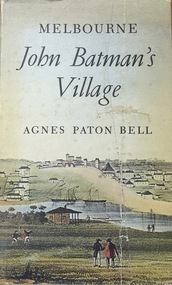
Book, Agnes P Bell, Melbourne: John Batman’s Village, 1965
A history of Melbourne, tracing its development from the riverside village founded by John Batman to the metropolis of the 1960s; includes description of Aboriginal corroborees and other early encounters with the Aboriginal inhabitants of the area.Melbourne, Vic. : Cassell Australia, 1965 xiv, 178p. : ill. (some col.), facsims., map, porto. ; 25cm. non-fictionA history of Melbourne, tracing its development from the riverside village founded by John Batman to the metropolis of the 1960s; includes description of Aboriginal corroborees and other early encounters with the Aboriginal inhabitants of the area.batman, john, 1801-1839, melbourne (vic.) -- history., settlement and contacts - colonisation - 1851- -
 Sunbury Family History and Heritage Society Inc.
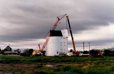
Photograph, Wheat silo
The wheat silo was erected on railway land on the west side of the railway line at Sunbury from approx 1970s - 1980s. It served as a grain storage provision for the local cereal farmers.The former CFA depot which was in Evans Street. With the expansion of the shopping centre the silo was dismantled to provide commercial development on the west side of the railway line.The wheat silo is a reminder of past agricultural industries that were carried out in Sunbury.A non-digital photograph of two trucks and a crane dismantling a metal wheat silo, which has been standing in an open area. A CFA pavilion is visible in the distance.wheat storage, silos, sunbury railway station, evans street -
 Sunbury Family History and Heritage Society Inc.
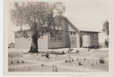
Photograph, Greenvale State School, 27 June 1934
The building is the former Greenvale State School No. 890. Although a school had been functioning at Greenvale since 1870. This is a photo of the school building that was renovated in 1926. At weekends the building was often used for family gatherings and social functions in the district. As the area became developed and changed from a country settlement to a suburb, the school was relocated to a new building closer to the new housing development. The existing building became a community centre. Many country settlements throughout Australia had similar school buildings which as well as being used for education also doubled up as venues for local social functioons.A non-digital sepia photograph with a surrounding white border of a two roomed country school with a water tank against a wall. A gum tree is growing in front of the building.schools -
 Surrey Hills Historical Society Collection
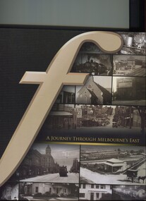
Book, A journey through Melbourne's east, 2008
Pictorial representation of the development of Melbourne's eastern suburbs. A collection of photographs of the local eastern area of Melbourne showing a lot of 'then' and 'now' photographs.A collection of photographs of the local eastern area of Melbourne showing a lot of 'then' and 'now' photographs.fletcher and parker, fletchers, real estate agents, melbourne, hawthorn, balwyn, camberwell, kew, land use, ashburton, montagnana-wallace, (mr) neil wallace, (mr) neil montagnana -
 Surrey Hills Historical Society Collection
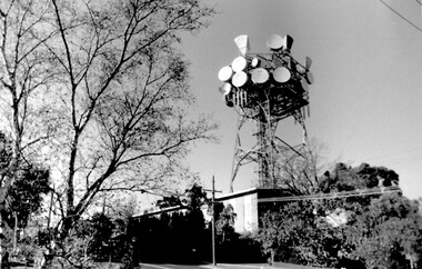
Photo, Telecom tower, Canterbury Road
This photo of the Telecom Tower was one of a series of photos taken of landmarks and houses of the area by Ken Hall in c1980. The PMG / Telecom / Telstra tower was built in 1961-1963 as a relay station to support television and radio links between city and regional broadcasting stations. The tower itself was 45 m in height with a 2 storey building for equipment and staff surrounded by garden. From the beginning it was opposed by local residents. In response to a Telstra application to replace it with a 40m slimline monopole, the City of Whitehorse controversially sought to have the structure heritage-listed, a move which caused much debate. In May 2015 Council ultimately rescinded its decision and gave permission for demolition, however Telstra deemed the permit conditions to be too restrictive and decided to continue to use the tower. The permit (to replace the tower) expired in September 2017. A black and white photo of local landmark visible from many vantage points in Surrey Hills and surrounding area, as it was built on the high point of the area.telecommunications tower, city of whitehorse, heritage overlay, heritage study, development, pmg tower, telstra, telecom, harding street, canterbury road -
 Surrey Hills Historical Society Collection
Photograph, Chatham State School Grade 1 1927, 1927
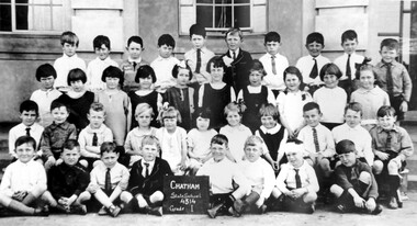
Chatham School, located in Weybridge Street Surrey Hills, was opened on 1 August 1927 following pressure from local residents as nearby schools (Balwyn, Mont Albert & Surrey Hills) were all over-crowded. This followed a surge in development following WW1. Land in surrounding streets was sub-divided. This included part of John Butler Maling (Jnr)'s small farm bounded by Banool Road, Wharton Road, Weybridge Street and Whitehorse Road. An area surrounding his home, 'The Willows' was retained and not sold until after he died in 1931. leased by Mr John Butler Maling in 1861. Three acres of his land were purchased by the Education Department. Some of the early students have referred to Chatham’s land as Mr Maling’s bull paddock. Some of the original yellow box trees remain on the property. The most significant of these is now called the Friendship Tree. On 1 August 1927 212 students were enrolled; Ralph Rae was one of these. The school was official opened on 15th February 1928. The school number is 4314. A black and white photograph of a group of 39 Grade 1 students from Chatham State School.1927, schools, chatham state school, clothing and dress, primary schools, john butler maling (jnr), ralph rae (mr) -
 Surrey Hills Historical Society Collection
Photograph, Chatham State School Grade 5 1931, 1931
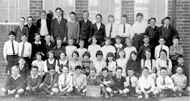
Chatham School, located in Weybridge Street Surrey Hills, was opened on 1 August 1927 following pressure from local residents as nearby schools (Balwyn, Mont Albert & Surrey Hills) were all over-crowded. This followed a surge in development following WW1. Land in surrounding streets was sub-divided. This included part of John Butler Maling (Jnr)'s small farm bounded by Banool Road, Wharton Road, Weybridge Street and Whitehorse Road. An area surrounding his home, 'The Willows' was retained and not sold until after he died in 1931. leased by Mr John Butler Maling in 1861. Three acres of his land were purchased by the Education Department. Some of the early students have referred to Chatham’s land as Mr Maling’s bull paddock. Some of the original yellow box trees remain on the property. The most significant of these is now called the Friendship Tree. On 1 August 1927 212 students were enrolled; Ralph Rae was one of these. The school was official opened on 15th February 1928. The school number is 4314. A black and white photograph of a group of 51 Grade 5 students from Chatham State School.schools, chatham state school, clothing and dress, primary schools, john butler maling (jnr), ralph rae (mr) -
 Surrey Hills Historical Society Collection
Photograph, Chatham State School Grade 2 1928, 1931
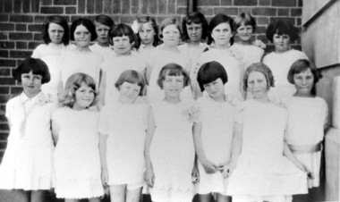
Chatham School, located in Weybridge Street Surrey Hills, was opened on 1 August 1927 following pressure from local residents as nearby schools (Balwyn, Mont Albert & Surrey Hills) were all over-crowded. This followed a surge in development following WW1. Land in surrounding streets was sub-divided. This included part of John Butler Maling (Jnr)'s small farm bounded by Banool Road, Wharton Road, Weybridge Street and Whitehorse Road. An area surrounding his home, 'The Willows' was retained and not sold until after he died in 1931. leased by Mr John Butler Maling in 1861. Three acres of his land were purchased by the Education Department. Some of the early students have referred to Chatham’s land as Mr Maling’s bull paddock. Some of the original yellow box trees remain on the property. The most significant of these is now called the Friendship Tree. On 1 August 1927 212 students were enrolled; Ralph Rae was one of these. The school was official opened on 15th February 1928. The school number is 4314. Front row centre is Jocelyn Cerini who married Ken Hall, another Chatham student. A black and white photograph of a group of Grade 2 female students from Chatham State School. They are dressed in white.schools, chatham state school, clothing and dress, primary schools, john butler maling (jnr), ralph rae (mr), jocelyn cerini (miss), jocelyn hall (mrs) -
 Vision Australia
Photograph - Image, Urban Cycle plaque, 1975
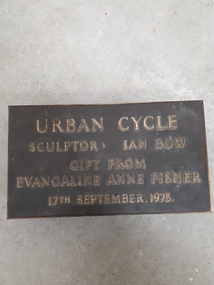
... of the local area. This plaque was placed near the sculpture... panel metal sculpture that follows the development of the local ...Eva Fisher was a valued member of the AFB and wished to commission a sculpture for the grounds in the front of Paterson Hall. Noted sculptor Ian Bow was commissioned and created Urban Cycle, a six panel metal sculpture that follows the development of the local area. This plaque was placed near the sculpture and removed when Paterson Hall was renovated.Digital image of metal plaqueUrban Cycle Sculptor: Ian Bow Gift from Evangeline Anne Fisher 17th September, 1975.association for the blind, eva fisher, ian bow -
 Vision Australia
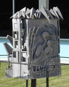
Sculpture - Object, Urban Cycle, 1975
... of the local area. Prior to receiving the commission, Ian Bow went... panel metal sculpture that follows the development of the local ...Eva Fisher was a valued member of the AFB and wished to commission a sculpture for the grounds in the front of Paterson Hall. Noted sculptor Ian Bow was commissioned and created Urban Cycle, a seven panel metal sculpture that follows the development of the local area. Prior to receiving the commission, Ian Bow went through a period of temporary vision loss, which gave him insight into how the sculpture could be appreciated by the blind and low vision community. The different stages are: Harmony - Two pelicans amongst reeds. Intrusion - Frog, kookaburra, mice, fish, lizard and butterfly. Expansion - Doors, windows and roofs under tree canopies. Industry - A factory with large chimney blowing smoke. Density - Multiple boxes, some with figures inside, are crowded beneath a bridge and dome. Decay - Boxes with broken doors and unfinished concrete. Renewal - A church with a Calvary cross over roughened surface.Heptagonal cast aluminium sculpture with seven panels arranged around a central metal pole.Thanks to the generosity of Evangeline Annie Fisher this sculpture, entitled 'Urban Cycle', was created by Ian Bow in 1975 and depicts stages of development of a city through the use of tactile forms. Further information is available at Reception. Vision Australia. Blindness, Low Vision, Opportunity.association for the blind, eva fisher, ian bow, sculpture -
 Melton City Libraries
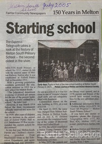
Newspaper, Melton Schools-150 years in Melton, 2005
Melton South "The establishment of a settlement of Melton South was induced by the opening of the railway in 1884. This subsequently prompted a number of industries, initially sawmills, and in the early twentieth century, chaff mills. This development coincided with the Exford ‘Closer Settlement’ estate at the beginning of the new century, boosting local population and produce, and the development of the chaff industry which employed many people in the Melton area. (Around 1912 the government had brought out English migrants to settle the Exford estate.) By c.1912 the small Melton Railway Station settlement had a boarding house (probably for chaff or sawmill employees), store, a small church and a hall. The Melton Valley Golf Club originated near the railway station in 1927 (in 1931 it moved to the present Melton links). In 1910 the community had built the large timber ‘Victoria Hall’, which became the focus of community life for several generations. In August of that same year AR Robertson MP and D McDonald applied for the establishment of a school on land set aside for that purpose by the Closer Settlement Board, near the Melton Railway Station settlement. District Inspector McRae recommended that a school for classes up to Grade 3 be established as an adjunct to the Melton State School. And so SS3717, ‘Melton Railway School’, was established in the leased Victoria Hall on 1st December 1911. Thomas Lang, head master at Melton since 1896, was in charge of both schools. As a ‘prep’ school only, it was necessary that the older Melton Railway Station settlement students travel to Melton SS430 at Unitt Street. Since 1912 local residents had been petitioning for the establishment of a separate school at Melton Railway Station on the grounds that it would be better if all children from the one home could attend the same school, and that the Victoria Hall was unsuitable as a school building. As a result an area of 2 acres - Allotment 8, Parish of Djerriwarrh, Exford Estate - was reserved for a State School on 4th March 1914. However the Department wrote that a school would not be established there in the near future, as ‘there is no likelihood in sight that the Railway Station settlement will increase in importance’. Parents persisted with their petitions to the Education Department, claiming that the Victoria Hall was too large, had no fireplace, that teachers were unable to use the wall for teaching aids, and that, being less than 20 metres away from a chaff mill employing 30 men, was too noisy. The turning point came when in 1920 the Hall Committee decided to increase its rent for the hall. In 1920 Head Teacher Lang advised the Education Department to discontinue SS3717 as an adjunct. The District Inspector supported this recommendation, and the schools separated in 1923. In April of that year 41 children, comprising Grades 1-8, moved into an almost completed brick building on the present site. On the 6th July 1923 the official opening of the school took place; after a ceremonial journey from the Hall to the school, speeches were given by the Hon AR Robertson and the Chief Inspector of Education. Everyone then journeyed back to Victoria Hall for a ‘bountiful repast’. (These dates are at odds with the date of 5th March 1925 given in Blake as the date the children occupied the new SS3717 brick school building. ) A teacher’s residence had been purchased for ₤500 in 1923, and the school’s name was changed to ‘Melton South’ in the same year. Even though the older Melton South pupils would no longer have to travel to the Unitt Street school, an additional brick room was still required at the Melton SS430 in that same year. In 1961 a new room was added to the school. In 1972, at the beginning of Melton’s boom as a satellite town, the number of enrolments was 224. The school has since shared in the exponential growth of the town of Melton, and at the time of its jubilee celebration (1983), 524 pupils were enrolled. Victoria Hall, neglected and vandalised, was demolished in 1992. It had been handed back to the Council on condition that it be replaced by a new hall, with the same name, and was commemorated by a plaque. Apart from the 1923 brick school building, and the railway station, none of the principal early Melton South public sites survive. Few early residential sites remain. (Further research will establish whether the house on the corner of Station Street and the railway line was the original teacher’s residence.)" Melton State School "On 17th May 1858 a State subsidised, combined Denominational School was opened by HT Stokes, with an attendance of about 30 children. This school was conducted in the wooden Melton Combined Protestant Church, situated on ‘a creek flat’ thought to be on the north side of Sherwin Street between Pyke and Byran Streets. It is likely that the Church had been established by 1855 and that the first minister was the Rev. Hampshire, who lived in Cambridge House on the Exford Estate. Ministers of the Protestant denominations were invited to hold services there. As there was only one resident Minister in the town (Presbyterian Mr J Lambie), laymen of the various denominations often spoke on Sundays. In 1863 this building was declared a Common School with the number 430. One of its first and most prominent headmasters was John Corr, who served from 1860 to 1864. Most of Mr Corr’s children also became teachers, including Joseph Corr, at the Rockbank school, and J Reford Corr and WS Corr, headmasters and teachers at numerous prestigious private secondary schools around Australia. John Corr purchased land alongside the school and elsewhere in and near Melton, became secretary and treasurer of the new Cemetery Trust, and by July 1861 was deputy registrar of births, deaths and marriages. He walked three miles every Sunday to teach at the Weslyan Sunday School he had established. Despite good reports from the Education Department Inspector, and burgeoning enrolments, the local school committee recommended the dismissal of, firstly, his wife (from the work mistress position), and then him from the headmaster position. Corr saw his dismissal as an attempt to redirect state aid for education from the Combined Protestant school to the support of the Free Presbyterian Minister Rev James Lambie (by one account the owner of the land on which the Common School was erected), whose son-in-law James Scott subsequently assumed responsibility for the school. Rev Lambie failed in his efforts to keep the existing school, which the Education Department Inspector and the majority of Melton citizens regarded as badly situated and badly built. Following a conditional promise of state aid, local contributors in 1868-69 raised ₤72.10.6 towards the cost of an iron-roofed bluestone rubble building 43 ft x 12 ft. This was erected on a new site of 1.5 acres (the present site). The State contributed ₤120 to the new school, which opened in 1870. A very early (c.1874) photograph of the school shows its headmaster and work mistress / assistant teacher (probably James Scott and his wife Jessie) and its (very young) scholars. Similar photos show pupils in front of the school in c.1903, and 1933. In 1877 a second bluestone room costing ₤297 was added and further land acquired from the Agricultural Society (who only needed it two days a year) to enlarge the schoolground to 3 acres. In the early 1880s an underground tank augmented the school water supply and in 1919 a five-roomed wooden residence was added. During this period the school correspondents often compained that the walls of the bluestone buildings were damp, affecting the plaster. In 1923 a brick room 26 ft 6 in by 24 ft with a fireplace and four rooms facing south, was added, and a corridor built to link the three buildings. This served adequately for the next 40 years. The school bell probably dates to 1883. The school also has a memorial gate (1951) to World War One ex-students, and an honour board to the 64 ex-students who served in the First World War. The school roll fell to 42 in the early post war-years, but was boosted by an influx of migrants, mainly from the UK, from the late 1960s. This presaged the boom in Melton’s development, and the corresponding growth of the school, with timber and temporary classrooms added to the previous masonry ones. An endowment pine plantation established in 1930 augmented the school’s fundraising activities when it was harvested in 1968. Part of the site was planted with eucalyptus trees in 1959. Famous ex-students of the early twentieth century included Hector Fraser (internationally successful shooter) and cyclist Sir Hubert Opperman". The Express Telegraph articles about the history of Melton South and Melton State Schoolseducation -
 Melton City Libraries
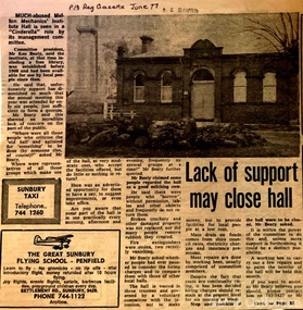
Newspaper, Lack of support may close hall, 1977
"The Mechanics Institute movement flourished in Victoria from 1839 to 1950. It was based on the development of Mechanics’ Institutes in Scotland and England from the 1820s, which were intended to educate and enlighten the working classes. The term ‘mechanic’ in those days meant an artisan, craftsman or working man, especially those who had moved from rural areas to work in new city factories during the Industrial Revolution. The early Institutes were usually equipped with a reading room, a library and a lecture room. Although enjoying mixed success in Britain, they contributed to the development of public education and library services. The movement was adopted more enthusiastically in the colonies. It began slowly in Victoria but its expansion after the gold rushes population influx was rapid, especially in rural areas. Every suburb and town wanted to have a Mechanics’ Institute. During the 1850s approximately forty Institutes were established, with even greater growth in the period 1860 to 1900. By 1900 there were 400 Institutes in Victoria. The establishment of a Mechanics’ Institute was often a great achievement for a local community, requiring organising committees to raise substantial funds for a building site (where this had not been granted by the Government), and the building. Once built, the committee then had to purchase books, provide a caretaker or librarian, and finance the ongoing use of and improvements to the building. ‘The history of many Institutes is a story of tremendous community effort, and often, financial difficulties’. In addition to being monuments to local enterprise and community life, the Mechanics’ Institutes played a vital role as an intellectual forum, and in contributing to an informed and participatory democracy in the late nineteenth and early twentieth centuries. They provided journals and other reading matter on local, state, national and international issues, and hosted of lectures and held debates about wider issues such as Federation, colonial nationalism, defence, female suffrage, the price of land and labour. With the development of the school and technical education in the latter part of the nineteenth century, the need for community technical and adult education declined. As a result of the introduction of government library grants in 1867, many Mechanics’ Institutes incorporated a free library in their buildings to finance collection of their books. By 1884-85, there were 257 free libraries in Victoria. However, government support and library grants dropped off in the 1890s depression. Entertainment took on a greater role in the 1890s, with the introduction of moving pictures, billiards rooms, games rooms (chess), concerts and dances. The First World War had a devastating impact on many rural communities, and some Mechanics’ Institutes were no longer viable. On the other hand the early twentieth century was also a time of agricultural development, and many country towns were growing in this period. The 1930s depression further limited growth of many libraries and reduced grants substantially. In response many Mechanics’ Institutes were renamed, for example as memorial halls, in order to retain and attract more patrons (eg at nearby Sunbury). The diminishing role for Mechanics’ Institutes and the preference for larger and better appointed halls (with supper rooms, cloak rooms etc) resulted in demolition of some small Institutes. The advent of cars, radios, and television also provided other opportunities for recreation, learning and entertainment. The greater role of municipalities in providing library services also eroded the need for free libraries. While over 500 Mechanics’ Institutes or halls are extant, very few of these retain their original role as ‘diffusers of useful knowledge’. Most are still available for community purposes, as venues for meetings, socials, civic occasions etc, while others are employed as museums, shops and theatres. Most buildings are on Crown land, and managed by a delegated committee of management, who are responsible for raising revenue to maintain aging buildings. Many of those which were originally established on private land, such as Melton, have since reverted back to the Crown, and municipal Councils. The most common Mechanics Institute building form is the simple weatherboard gable building with iron roofs, notable for their ‘honest simplicity’ rather than as ‘monuments of the ancients’. At the other extreme there are some magnificent two storeyed brick and stucco structures with elaborate ornamentation (as was apparently envisaged by some in Melton in 1905-10)". The future of Melton Mechanic Institute Gazette articlelocal architecture -
 Melton City Libraries
Photograph, Melton Railway Bridge, c.1884
"The Melton Viaduct, opened in 1886, is of State heritage significance as a very large and visually distinctive wrought iron, lattice girder trestle bridge over the Werribee River (now Melton Reservoir). It comprises 18.3 and 9.1 metre spans, in a generally alternate arrangement, of total length 375 metres, and standing 38 metres over the Werribee River. Wrought iron small section iron was used to build tension trussed trestle legs, which supported four lines of rivetted wrought-iron deck-type double lattice trusses. It has bluestone abutments and pier bases of coursed rock-faced bluestone with drafted margins. The larger half-piers, now usually submerged in the Melton Reservoir have sharp tapered cutwaters and curved coping at the tops. While designed to carry two rail tracks it has only ever been used as a single track line. Despite several alterations to its deck structure, it remains an outstanding example of a lighter structural design employing open metal trestle supports and metal truss girders. The direct Melbourne to Ballarat railway link of which the Melton viaduct was the major engineering work contributed significantly to the history and development of Victoria. This new link reflected Ballarat’s diversifying economy as well as the commercial and political influence of the metropolis. Construction of the bridge, and the associated large workers camp, were extensively photographed, documenting an important episode in local history. The railway enabled the development of new industries in the Melton area, notably the timber industry and a chaff industry of national importance, greatly facilitated the later transition of the Shire from a pastoral to a farming economy, and struck a major blow to Melton township’s era as a wayside town servicing Ballarat road (especially coach) traffic". Melton Railway Bridge being built across the Werribee Rivertransport -
 Canterbury History Group
Document - Planning for our future, City of Boroondara, 1/07/2014 12:00:00 AM
City of Boroondara paper describing the approval of the Victorian Government to approve new Residential Zones in some areas of Boroondara. Includes a map of the areas affectedboroondara, city of boroondara, amendment c199, residential development, victorian government, local laws, ross> coral -
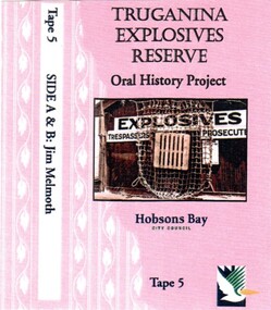 Truganina Explosives Reserve Preservation Society Inc (TERPS)
Digitised Oral History – Truganina Explosives Reserve - Tape 9 Andrew Shannon and Judy Hindle, 2018
The interviews were recorded in 2000 by Bronwen Gray and Alan Young for the production of Unreserved, Stories from Truganina Explosives Reserve, animated stories from past residents, workers and interested people of the Reserve (subject to copyright 2004). Judy Hindle and Andrew Shannon worked jointly on saving the Truganina Explosives Reserve from being sold for development by the State Government. Judy was an Altona resident and Andrew was an environment planner, first with Parks Victoria and then the local council. Their motivation was to not only save the site for open space but to capture what Judy described as the only in-tact historical site in the area. A primary source of information on memories of the Truganina Explosives Reserve and Altona,VictoriaDigital copy of original cassette recorded in 2000 and digitised in 2018chirnside, explosives, tin fence, coastal vegetation, parks victoria, joan kirner, cheetham wetlands, doug grant, gahnia, salt marsh, sand ridges, rob andrew, nessie hardy, aboriginal middens, altona, truganina swamp -
 Melton City Libraries
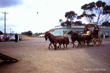
Photograph, Cobb & Co re-enactment, 1963
Augustus Shebler born in Berlin, Prussia in 1827 was a Melton resident started a store on the Flat at Bryan and Sherwin street in 1855. He built the Golden Fleece Hotel in 1865. He died at the Golden Fleece Hotel in 1908. The building, was demolished during the 1970s due to development in the area and was rebuilt in another location. The Watts and Jongebloed famlies are descendants of Shebler.Event took place on High Street Meltonlocal identities, local architecture -
 Wodonga & District Historical Society Inc
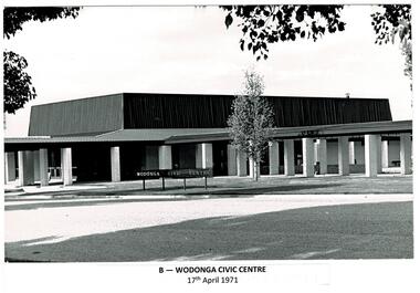
Photograph - Codling Collection 01 - Wodonga Civic Centre
Miss Olive Codling was a Foundation Member and a Life Member of the Wodonga Historical Society. Many of her prize-winning photos are held in the Society Collection. She also held a range of roles and committee positions in a wide range of Wodonga community organisations. These included the Horticultural Society, the Wodonga Arts Council, the Wodonga Camera Club and the Wodonga Lapidary Club. Wodonga Civic Centre - In the late 1960s the area in Wodonga between Hovell and Havelock Streets was zoned for civic purposes. By 1969 Melbourne architect Bruce Marshall had designed the civic centre which included a library, theatre and senior citizens' rooms. The main hall had a seating capacity of 1,000 people but could be divided by a sliding door. into smaller areas. It also included meeting rooms and kitchen facilities. The Civic Centre was officially opened by the Honorable Sir Henry Bolte, K.C.M.P., M.P., Premier of Victoria who was accompanied by the Honorable R. J. Hamer E.D., Minister for Local Government. The Shire President was Cr. James A. Terrill, J.P. This image records an important stage in the development of local government and civic buildings in Wodonga, Victoria.A series of black and white images showing the constriction and opening of the Wodonga Civic centre.wodonga businesses, high st wodonga, melba theatre -
 Wodonga & District Historical Society Inc
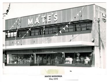
Photograph - Codling Collection 01 - Mates Wodonga
Miss Olive Codling was a Foundation Member and a Life Member of the Wodonga Historical Society. Many of her prize-winning photos are held in the Society Collection. MATE's WODONGA - T. H. Mate opened his first store in Albury in 1850. The company was sold to Burns Philp in 1946, although they continued trading as Mate’s. Burns Philp policy was to maintain the identity of stores they took over with the same staff and management. The Mate’s store in Wodonga was built by local builders A. B. and M. A. Chick. It was a 3 level development in High Street opposite Woodland Grove. It included a mezzanine eating area. Mate’s closed in 1976 when Burns Philp sold the business to Waltons. In 1987 they became Venture Stores. This building also later became Highpoint and Fosseys which closed in 2000. In 2023 it is the Gateway Health building.This photo collection is significant as it documents how the businesses and buildings in Wodonga have evolved and contributed to community throughout the 20th century.2 black and white images of the Mate's Store in Wodonga. Image 1 shows the completed building. Image 2 shows the store under construction. On image 1: Across the top of the building: "MATE'S" Above the door: "MATE'S A BURNS PHILP STORE" wodonga businesses, high st wodonga, mates wodonga -
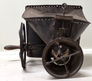 Wodonga & District Historical Society Inc
Functional object - Hand operated seed broadcaster
Seed broadcaster were used to distribute seed across a small area or to fill in patches where seeding has been missed. This method does not ensure a uniform distribution of seeds unless the person using the machine walks at a very measured pace. It also requires a lot of time and manual labour if used in larger areas. It was most used for planting cover crops, grains, grasses and similar plants that do not need to be in neat rows. The hand-crank broadcast seed spreader was invented in 1868 by Samuel S. Speicher (aka. Spyker) in Indiana, USA. By 1955 new developments included the invention of a seed broadcaster on wheels and these smaller spreaders started to disappear.This item is representative of agricultural machinery used on a local, national and international level in the late 19th and early 20th century.A metal hand seed broadcaster. A hopper at the top was the receptacle for seed. The wheel with a handle on the side when turned drives the cogs attached to an axle. This action rotates the attached spindle with blades to propel seed out the front of the broadcaster. The broadcaster would have had a shoulder strap and a bag of seed would have been added to the hopper and secured with twine through the holes around the top.agricultural tools, farm machinery -
 Wodonga & District Historical Society Inc
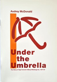
Booklet - Under the Umbrella - The Story of Age Concern Albury Wodonga Inc, Audrey McDonald, 1996
This book outlines the history and development of "Age Concern Albury Wodonga Inc." a not for profit organisation that operates in the Albury Wodonga area with some services provided operating across The Riverina Murray region. It provides services and social activities for frail aged people or people with disabilities and their carers. The objective of Age Concern is to lessen the mental and physical stress of growing older by advocating preparation and education of people approaching retirement as well as encouraging the provision of services within the community designed to improve the physical, mental and social well being of the aged.A small booklet of 70 pages including photos, interviews and text outlining the history of "Age Concern Albury Wodonga.non-fictionThis book outlines the history and development of "Age Concern Albury Wodonga Inc." a not for profit organisation that operates in the Albury Wodonga area with some services provided operating across The Riverina Murray region. It provides services and social activities for frail aged people or people with disabilities and their carers. The objective of Age Concern is to lessen the mental and physical stress of growing older by advocating preparation and education of people approaching retirement as well as encouraging the provision of services within the community designed to improve the physical, mental and social well being of the aged.aged concern albury wodonga, aged care, aged care services albury wodonga -
 Wodonga & District Historical Society Inc
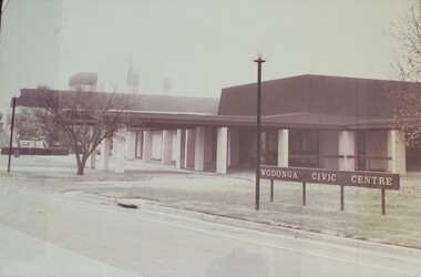
Photograph - Wodonga Civic Centre 1971
In the late 1960s the area in Wodonga between Hovell and Havelock Streets was zoned for civic purposes. By 1969 Melbourne architect Bruce Marshall had designed the civic centre which included a library, theatre and senior citizens' rooms. The main hall had a seating capacity of 1,000 people but could be divided by a sliding door. into smaller areas. It also included meeting rooms and kitchen facilities. The Civic Centre was officially opened by the Honorable Sir Henry Bolte, K.C.M.P., M.P., Premier of Victoria who was accompanied by the Honorable R. J. Hamer E.D., Minister for Local Government. The Shire President was Cr. James A. Terrill, J.P.This image records an important stage in the development of local government and civic buildings in Wodonga, Victoria.A black and white image of the Wodonga Civic Centre in a wooden frame.wodonga civic centre, wodonga history, wodonga local government -
 Wodonga & District Historical Society Inc
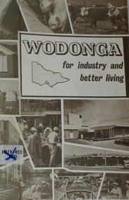
Booklet - Wodonga For Industry and Better Living, Wodonga Development Committee, c1960 - 1970
This publication was produced to promote the benefits of Wodonga for lifestyle and decentralised industry. In 1973 the Commonwealth, New South Wales and Victorian Governments agreed to the Albury-Wodonga Development Scheme, for a decentralised growth area. Before then the Wodonga Development Committee and the Shire Council promoted the town’s industrialisation. This booklet was published to encourage new investment in the Wodonga area prior to the convening of the Albury-Wodonga Development Scheme.A small booklet of 18 pages printed in black and white, including photos and promotional material about Wodonga and District.This publication was produced to promote the benefits of Wodonga for lifestyle and decentralised industry. In 1973 the Commonwealth, New South Wales and Victorian Governments agreed to the Albury-Wodonga Development Scheme, for a decentralised growth area. Before then the Wodonga Development Committee and the Shire Council promoted the town’s industrialisation. This booklet was published to encourage new investment in the Wodonga area prior to the convening of the Albury-Wodonga Development Scheme.wodonga promotions, albury wodonga, wodonga development committee -
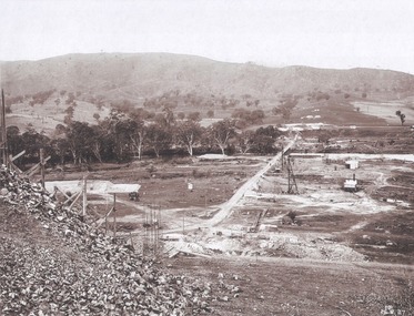
 Wodonga & District Historical Society Inc
Album - Hume Reservoir Australia Album - Driving first row of piles for coffer dam across the river, December 1925
This set of photos is from a leather bound album bearing the inscription "HUME RESERVOIR AUSTRALIA" plus 'The Rt. Hon. L. C. M. S. Amery, P. C., M .P.' all inscribed in gold. It was presented to The Rt. Hon. L. C. M. S. Amery, P. C., M. P, Secretary of State for Dominion Affairs on the occasion of his visit to the Hume Reservoir on 2nd November 1927. This album is of local and national significance as it documents the planning and development of the Hume Reservoir up to 1927. It was the largest water reservoir in the British Empire. The album records the pioneering engineering work that went into its construction.DEPARTMENT OF PUBLIC WORKS, N.S.W. RIVER MURRAY WATERS SCHEME. HUME RESERVOIR. 19. Driving first row of piles for coffer dam across the river. New South Wales. December 1925. Cofferdams are temporary structures used where construction is being carried out in areas submerged in water. They are most commonly used to facilitate the construction or repair of dams, piers and bridges. To divert the river, a Coffer Dam was built across the old bed above and below the Dam site and tying into the end of the concrete wall built inside the levee bank. This completely surrounded the remainder of the site of the Dam and south wing wall, including an area of 12½ acres. hume reservoir australia, river murray waters scheme, hume reservoir construction -
 Wodonga & District Historical Society Inc
Album - Hume Reservoir Australia Album - Excavations for foundations inside coffer dam, January 1927
This set of photos is from a leather bound album bearing the inscription "HUME RESERVOIR AUSTRALIA" plus 'The Rt. Hon. L. C. M. S. Amery, P. C., M .P.' all inscribed in gold. It was presented to The Rt. Hon. L. C. M. S. Amery, P. C., M. P, Secretary of State for Dominion Affairs on the occasion of his visit to the Hume Reservoir on 2nd November 1927. This album is of local and national significance as it documents the planning and development of the Hume Reservoir up to 1927. It was the largest water reservoir in the British Empire. The album records the pioneering engineering work that went into its construction.DEPARTMENT OF PUBLIC WORKS, N.S.W. RIVER MURRAY WATERS SCHEME. HUME RESERVOIR. 21. Excavations for foundations inside coffer dam. New South Wales. January 1927. Cofferdams are temporary structures used where construction is being carried out in areas submerged in water. They are most commonly used to facilitate the construction or repair of dams, piers and bridges. To divert the river, a Coffer Dam was built across the old bed above and below the Dam site and tying into the end of the concrete wall built inside the levee bank. This completely surrounded the remainder of the site of the Dam and south wing wall, including an area of 12½ acres. hume reservoir australia, river murray waters scheme, hume reservoir construction, coffer dam -
 Wodonga & District Historical Society Inc
Album - Hume Reservoir Australia Album - Bethanga Bridge Site, August 1927
This set of photos is from a leather bound album bearing the inscription "HUME RESERVOIR AUSTRALIA" plus 'The Rt. Hon. L. C. M. S. Amery, P. C., M .P.' all inscribed in gold. It was presented to The Rt. Hon. L. C. M. S. Amery, P. C., M. P, Secretary of State for Dominion Affairs on the occasion of his visit to the Hume Reservoir on 2nd November 1927. This album is of local and national significance as it documents the planning and development of the Hume Reservoir up to 1927. It was the largest water reservoir in the British Empire. The album records the pioneering engineering work that went into its construction.DEPARTMENT OF PUBLIC WORKS, N.S.W. RIVER MURRAY WATERS SCHEME. HUME RESERVOIR. 37. Bethanga Bridge Site. A bridge is being built to cross the Reservoir to serve a large area of country which will be cut off from its natural outlets by the submergence of existing bridges when the Reservoir is in being. The site of the bridge is nearly a mile up the Murray from the Hume Reservoir Quarry. Its length will be approximately half a mile. There will be nine spans of 269 feet with steel truss girders resting on concrete pillars. Some of the pillars are founded on rock while others will rest on nests of reinforced concrete piles. The foundations and concrete piers are in the hands of the Victorian Constructing Authority and the superstructure in those of the New South Wales Authority. August 1927.hume reservoir australia, river murray waters scheme, hume reservoir construction -
 Wodonga & District Historical Society Inc
Book - Time Running Out: Shaping Regional Australia's Future, Australia. Parliament. House of Representatives. Standing Committee on Primary Industries and Regional Services, 2000
This report is the result of and inquiry into infrastructure and the development of Australia's regional areas by the House of Representatives, Standing Committee on Primary Industries and Regional Services. The foreword to the Committee's report states that the title 'Time running out' reinforces the urgent need to firstly acknowledge the deficiencies in infrastructure that exist throughout regional Australia and secondly, the need to remedy that lack of infrastructure. Action is needed to ensure that many regional communities don't just survive but learn to thrive once again. Chapters focus on major issues of leadership and local skills; policy, planning and coordination; and finance and investment. Other chapters focus on particular sectors or issues including advanced telecommunications; information technology; transport (roads, rail, shipping, airports); energy (electricity, gas, renewable energy); education; water resources; and health.non-fictionThis report is the result of and inquiry into infrastructure and the development of Australia's regional areas by the House of Representatives, Standing Committee on Primary Industries and Regional Services. The foreword to the Committee's report states that the title 'Time running out' reinforces the urgent need to firstly acknowledge the deficiencies in infrastructure that exist throughout regional Australia and secondly, the need to remedy that lack of infrastructure. Action is needed to ensure that many regional communities don't just survive but learn to thrive once again. Chapters focus on major issues of leadership and local skills; policy, planning and coordination; and finance and investment. Other chapters focus on particular sectors or issues including advanced telecommunications; information technology; transport (roads, rail, shipping, airports); energy (electricity, gas, renewable energy); education; water resources; and health.infrastructure regional australia, regional planning australia -
 Wodonga & District Historical Society Inc
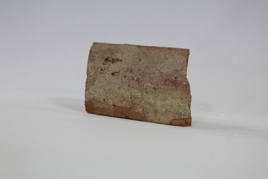
Functional object - Wodonga Station Platform Brick
The Wodonga rail line and railway station opened in November 1873 when the section of the line from Wangaratta was completed. The expansion of the railways to the northeast of Victoria occurred after the Victorian Government took over the railways in 1867 and the trains serviced large towns such as Seymour, Wangaratta and Wodonga, as well as smaller towns along the way. The original Wodonga Station, located in the middle of the city, was closed on 9 November 2008 as part of the Wodonga rail bypass project. The station platform was largely removed and the area has been redeveloped as part of the Junction precinct.This brick has local and state historical significance as the railways played a critical part in opening up the interior of Australia for commerce, transportation and settlement. It enabled Wodonga to develop as an important centre for social and commercial purposes.An old traditional brick with some joining mortar / concrete still attached. The brick formed part of the platform at the original Wodonga Railway Station prior to its demolition as part of the Wodonga bypass development.wodonga, railways, railway bypass, northeast victoria, vline -
 Wodonga & District Historical Society Inc
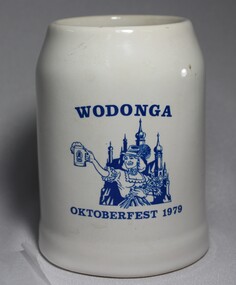
Memorabilia - Wodonga Oktoberfest Stein, c1979
Several German families arrived in Wodonga, usually via South Australia, in the late 1850 and 1860s. Some of the earliest settlers to arrive were the Haeusler, Schlink, Trudewind, Pfeiffer and Klinge families. Many of them had left from Prussia and Bavaria to escape religious persecution. They all became actively involved in the community and made outstanding and lasting contributions to the development of the town. In the years 1868-69 more settlers arrived from South Australia and other parts of Victoria. Among the names were Heckendorf, Mueller, Zeinert and Schubert. These families were instrumental in lobbying for the establishment of the St. John's Lutheran Church in Wodonga, the foundation stone being laid in 1874. By the 1890s to the early 1900s many other Germany names were added to the local community including Muller, Lange, Pumpa, Greschke, Lobbe, Posselt, Kreuger, Schuster, Pertzel, Star, Draper, Mueller, Semmler, Thiele, Terlich, Wegener, Schreiber and Draper. Germans continued to arrive in the area until 1914. In the great post-war migration that started through Bonegilla in December 1947, Germans were among the tens of thousands who arrived. Most of the migrants who settled in Wodonga at this time were born in Germany. According to the 2016 Census, Wodonga still has a larger percentage of people with German ancestry than most other rural communities in Victoria. The German Austrian Australian Club, Wodonga was originally formed in 1960 by immigrants to Australia, to provide a meeting place for refugees and immigrants from Europe. Oktoberfest has become a world-wide occasion for all people to share in the celebration of Bavarian traditions. The Wodonga Hospital approached the Club and asked for their involvement in holding an Oktoberfest to raise funds for the Hospital. These Fests took 11 months to organize and ended up raising over $27,000.00 for the Hospital. A large number of families of German origin have arrived in the Wodonga area from as early as the 1850s. They have made valuable and lasting contributions to the area in a range of fields including agriculture, local government, businesses, retail and medical services. Their contributions are recognised in several street names in Wodonga. A white china beer stein bearing the blue logo of the Wodonga 1979 Oktoberfest. Logo includes an image of a woman in German national costume.Above the image "WODONGA" Underneath the image "OKTOBERFEST 1979"wodonga, oktoberfest, german immigrants