Showing 54656 items
matching documents-maps
-
 4th/19th Prince of Wales's Light Horse Regiment Unit History Room
Booklet, Operations Military Training Pamphlet No 23 Part X The Infantry Division in the Advance 1941, 1941
Soft covered booklet dealing with the considerations of the advance of an Infantry DivisionNot to be published Document must not fall into enemy handsinfantry tactics, world war 2 -
 Victorian Aboriginal Corporation for Languages
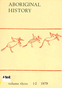
Periodical, Australian National University Department of Pacific and Southeast Asian History, Aboriginal history, 1979
b&w photographs, letters, document reproductions -
 Victorian Aboriginal Corporation for Languages
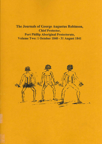
Book, Ian D Clark, The journals of George Augustus Robinson, Chief Protector, Port Phillip Aboriginal Protectorate : volume two : 1 October 1840 - 31 August 1841, 2000
The journals of George Augustus Robinson (1788-1866), the Chief Protector of Aborigines of Port Phillip from 1839- March 1850 are a rich source of historical and ethnohistorical information. His voluminous private papers and journals were acquired by the Mitchell Library in NSW in 1939. The publications of Robinson's journals is an important addition to the already published material, for they offer insights into the state of relations between Aboriginal people and Europeans in the districts visited.document reproductions, b&w illustrations, tablesgeorge augustus robinson, port phillip, colonisation -
 Victorian Aboriginal Corporation for Languages
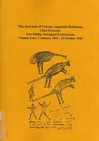
Book, Ian D Clark, The journals of George Augustus Robinson, Chief Protector, Port Phillip Aboriginal Protectorate : volume four, 1 January 1844 - 24 October 1845, 2000
The journals of George Augustus Robinson (1788-1866), the Chief Protector of Aborigines of Port Phillip from 1839- March 1850 are a rich source of historical and ethnohistorical information. His voluminous private papers and journals were acquired by the Mitchell Library in NSW in 1939. The publications of Robinson's journals is an important addition to the already published material, for they offer insights into the state of relations between Aboriginal people and Europeans in the districts visited.document reproductions, b&w illustrations, tablesgeorge augustus robinson, port phillip, colonisation -
Moorabbin Air Museum
Document (item) - GEC Avionics' Response To ASTA Request For Tender For An AGS And Jindivik FCC Volume 3 Part A AGS Technical Proposal
Document Number 230TP0369-03/92/3A -
 Melbourne Tram Museum
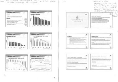
Document - Report, Yarra Trams, "100 years of electric trams in Melbourne", 2005 - 2006
Set of two presentations or printout of a PowerPoint presentation, 6 slides per sheet and two position descriptions. .1 - Three page report (part of a larger report - page 9 to 11) results of a survey of various routes, KPI's - surveys, customer feedback, and incidents, service delivery. .2 - four page report about the Love Your Trams campaign presented by Flash Group, the objective, concept, the message, graffiti reduction and messages from passengers and staff. .3 - Two page Yarra Tram position description for Customer Relations and Marketing Officer, Camberwell. .4 - ditto for Customer Relations Assistant Camberwell.On top of each document are notes in blue ink.trams, tramways, yarra trams, accidents, melbourne, depots, marketing, staff -
Port Melbourne Historical & Preservation Society
Map - Large map of Port Melbourne, British Chart, Japanese war-time map of Port Melbourne, c 1937
Jim Sinclair was born in Cruickshank Street, Port Melbourne in 1924. During World War II Jim found this map in a network of caves near Rabaul, Papua New Guinea. He remembers '"The Japanese] had linked just about every hill with a tunnel. Concreted. Most of them were packed with stuff. I used to wander through - being very careful too, mind you!. You didn't want yourself to get blown up. I found these maps. I thought that looks familiar! It's in English with Japanese stuff on it too."A large map of Port Melbourne with Japanese printed annotations with strategic infrastructure. Stamp on back explains age in Japanese.war - world war ii, port of melbourne, jim sinclair -
Kew Historical Society Inc
Book, Lansdowne, 100 Years Of Australians At War, 1999
400 p., [64] pages of plates : ill., maps, ports. ; 24 cm. non-fictionkorean war 1950-1953 - history, persian gulf war 1991 - history, south african war 1899-1902 - history, world war 1914-1918 - history, australia - armed forces - history, australia - history, military., world war 1939-1945 - history, wwi -
 Kew Historical Society Inc
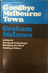
Book, Hamish Hamilton, Goodbye Melbourne Town, 1968
London, H. Hamilton, 1968 xii, 211 p. map. 23 cm. non-fictionmelbourne - history, graham mcinnes (1912-1970) -
 Kew Historical Society Inc
Book, Helen Baker, Historic Buildings: Windsor and Richmond, 1967
[Sydney], 1967 67 p. : illus., facsims., maps, plans ; 26 cm. non-fictionhistoric buildings - windsor (nsw), historic buildings - richmond (nsw) -
Kew Historical Society Inc
Book, Colin Jones, Ferries on the Yarra, 1981
Collingwood, Vic. : Greenhouse, 1981 108 pages : ill., map ; 26 cm. non-fictionferry services -- ferries -- melbourne -- yarra river, ferries -- victoria =- yarra river -- history, ferries -- victoria -- melbourne -- history. -
 B-24 Liberator Memorial Restoration Australia Inc
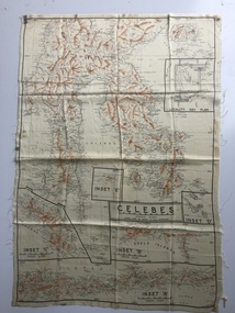
Australian World War II silk map of Celebes, 1940s
Silk and rayon maps were produced by Australia, Great Britain (some 1.75 million in total) and the United States (c.7.5 million) during World War II. They were issued to Allied military personnel as part of 'escape and evasion' kits.This silk map, one of relatively few produced in Australia (most Australian RAAF pilots and crew were issued with British and US maps), is an original map from World War II.An oblong, cream colour, single-sided map printed in black and white with brown contours, Celebes 'Prepared under the direction of RAAF Headquarters' Celebes (with Insets 'A' to 'E')world war ii, silk maps, australia, a185 -
 Bendigo Military Museum
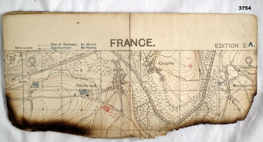
Map - TRENCH MAP WW1, 1918
Areas covered on this map, “Hamel, Mericourt, Proyart, Weincourt, Harbonnieres”. Item re William Alexander No 502 AIF. Refer Cat No 3746.3 for his service details.Trench map, France, Edition 2A, sheet 62D S.E, scale 1:20,000, trenches corrected to 22.4.1918, trenches in red. On outside in blue handwriting “62D S.E”map, trench, france -
 Kiewa Valley Historical Society
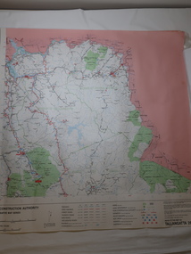
Map - Road Construction Authority 1986, Ref. Tallangatta 282008
Government authorities updated maps regularly.Historically of interest eg. 1. Pre dates the Alpine National Park. 2. 'Mt Beauty Estates' now known as Tawonga South. 3. Mt Niggerhead is named - It is now known as Mt Jaithmathang having been renamed in 2009.Colored map dated 1986 titled Road Construction Authority with an update of roads in the local Shires. It names places in the area and has a legion describing the rating of the roads and tracks. It also shows the main towns in the area and their roads.road construction authority, map of tallangatta area -
 Melbourne Tram Museum
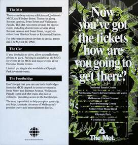
Pamphlet, The Met, "Now you've got the tickets how are you going to get there?", mid 1990s
... maps ...Pamphlet "Now you've got the tickets how are you going to get there?" published jointly by The Met and Sport and Recreation Victoria with a map of the major sporting venues in the city area and the Victorian Arts Centre. Published before the diversion of the Batman Ave tram line via Flinders St. Gives tips on parking, train/tram travel, and the MCG footbridge. The line was diverted via Flinders St on 6/6/1999 - see reference. yields information about the travelling to the major Melbourne sports venues.Pamphlet - 2 fold DL printed in colour with map.trams, tramways, the met, sporting venues, public transport, maps, batman ave, batman avenue -
 Young Christian Workers (YCW Australia) Archive and Research Centre
International Schedule 1965, Bangkok
From 1957, the International YCW held a world council every four years. This document is the proposed schedule for the Third World Council which was held in Bangkok in 1965.The document offers a glimpse into the workings of the YCW on a global scale. It also explores the international campaigns and the and proposes an agenda and schedule for the fourteen day meeting comprising young delegates from all over the world. Nine page typewritten and copied document on yellow paperycw, iycw, world council -
 Bendigo Historical Society Inc.
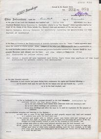
Document - MCCOLL, RANKIN AND STANISTREET COLLECTION: INDENTURE NORTH DEBORAH MINING COMPANY, 20th November, 1952
6 page document ' Gold Mining Lease Crown land Number 11307 Bendigo' plus map. Indenture document between Queen Elizabeth 11 and North Deborah Mining Company No Liability, Parish of Sandhurst, dated 20th November, 1952 re Vol 333, Folio 053. Land indicated by yellow on map and below ' a depth of one hundred and fifty feet from the surface of the land indicated by purple colour and delineated on the plan' Document signed by J. Stanistreet, Manager, North Deborah Mining Company No Liability. Map, fixed to document, heading ' Mining District of Bendigo, No. 11307, County of Bendigo, Parish of Sandhurst, Total area 13 acres 2 roods, 11 perches. Map shows large dam on Crown land, transmission line excised 150 ft., written on purple area. Underneath map ' provided that the dam indicated on the said plan is hereby reserved'.bendigo, mining, north deborah mining company -
 Greensborough Historical Society
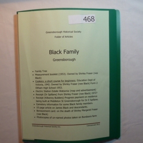
Folder, Black Family - Greensborough, 1900o
Contents: Family tree; small school books from family member; copy of map and advertisement for Watsonia Electric Station Estate; receipts; cemetery information; article on James Black and descendants; copies of un-named photos taken on Bundoora farm.The Black family owned a large portion of land from Greensborough to Watsonia. This collection is partly from family members.20-page plastic binder, green cover. Contains documents relating to the Black family of Greensborough and Watsonia.Collected by Greensborough Historical Society. Folder commenced 2012black family, shirley fraser, james black, watsonia electric station estate -
 Victorian Aboriginal Corporation for Languages
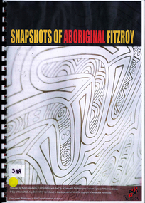
Book, Bunj Consultants, Snapshots of Aboriginal Fitzroy, 2004
Features artwork by VACL Project Officer Mandy Nicholson.maps, photographswurundjeri, carlton gardens, alexandria gardens, maysar, batman treaty, oral histories -
Victorian Aboriginal Corporation for Languages
Conference proceedings, Marleen Haboud, Endangered languages : voices and images, 2011
Linguistic and Sociolinguistic properties; sociolinguistics and endangered languages; Rights, identities and new technologies; New media cultures and endangered languages; Rebuilding peoples in Ecuador and revitalizing their languages Documentation - successful experience; Language rights of endangered languagesMaps, graphslanguage endangerment, worrorra, language technologies, documentation -
 Victorian Aboriginal Corporation for Languages
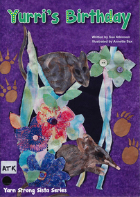
Book, Sue Atkinson, Yurri's birthday, 2013
Tonight would be a very special night for Yurri, it is her birthday. At midnight each of Yurri's friends arrive with a basket. Inside each basket is a gift for Yurri. Each illustrated basket has been made by women who live in Victoria and are passionate about the revival of basket coiling! Yurri's Birthday written by Sue Atkinson (Yorta Yorta) and illustrated by Annette Sax (Taungurung). This is the third book in the YSS series, giving young children insight into Indigenous Victorian culture. The Yarn Strong Sista series is supported by background notes and ideas for related activities.Illustrations, mapsyorta yorta, barmah forest, basket weaving, educational activities, language list -
 Victorian Aboriginal Corporation for Languages
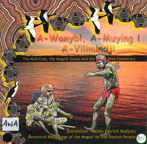
Book, Palibu Patrick Nudjulu, A-wanybi, A-muying i A-vilimindji = the mud crab, the magpie goose and the pied cormorant: ancestral knowledge of the Magati Ke Rak Naninh people, 2006
Story in Language and English with illustrationsillustrations, mapsmagati ke rak naninh people, storytelling, animals -
 Victorian Aboriginal Corporation for Languages
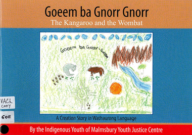
Book, Indigenous Youth of Malmsbury Youth Justice Centre, Goeem ba Gnorr Gnorr : the Kangaroo and the Wombat : a Creation story in Wathaurong Language, 2009
Creation story with word listmaps, illustrationswathaurong, yorta yorta, storytelling, word list -
 Victorian Aboriginal Corporation for Languages
Book, Barry J Blake, Case marking in Australian languages, 1977
Linguistic study using case markings. Glossary.Maps, tableslinguistics, case relations in languages, pama-nyungan languages -
 Victorian Aboriginal Corporation for Languages
Book, Annette Schmidt, The loss of Australia?s Aboriginal Language heritage, 1993
Overviews Aboriginal language situation; examines attitudes to language; analyses language maintenance and revival programs, bilingual education, effectiveness of funding and National Aboriginal Languages Program; availability of linguistic training, characteristics of language loss and the place of creoles in language programs.Maps, chartslanguage loss, language maintenance, reports -
 Victorian Aboriginal Corporation for Languages
Book, Julie Bishop, Aboriginal students and English language acquisition, 1993
Assisting educators in South Australia to respond to specific language and literacy needs and goals of Aboriginal students.maps, tablesnepabunna, raukkan, coober pedy, education, resource-based learning, literacy, carlton primary school, english language acquisition -
 Victorian Aboriginal Corporation for Languages
Book, Christine Walton, Language : maintenance, power and education in Australian Aboriginal contexts, 1990
Conference themes of language and power, language maintenance and language in education raised in an Aboriginal context; papers separately annotated.maps, tablesyolngu, yirrkala school, language maintenance, bilingualism, vernacular language -
 Victorian Aboriginal Corporation for Languages
Book, Tonya Stebbins, Fighting language endangerment : community directed research on Sm'algyax (Coast Tsimshian), 2003
Based on studies of the language of the Tsimshian people, who live on the northwest coast of British Colombia, Canada. It describes the peocess of community directed documentation for an endangered language based on the dictionary project.Maps, tableslanguage endangerment, tsimshian -
 Victorian Aboriginal Corporation for Languages
Book, Implementation Review Team on behalf of the Victorian Aboriginal Justice Forum, Victorian implementation review of the recommendations from the Royal Commission into Aboriginal Deaths in Custody : review report, 2005
maps, tablesaboriginal deaths in custody, criminal justice system -
 Victorian Aboriginal Corporation for Languages
Book, Board of Studies NSW, Aboriginal languages : advice on programming and assessment for stages 4 and 5, 2003
Includes Advice on Planning and Assessment, Samples on each stage, Sample Units of Work, useful Resources.maps, tableseducation, curriculum development