Showing 25584 items matching "plenty-township-estate"
-
 Eltham District Historical Society Inc
Book, Yarra Plenty Regional Library, Fine Spirit and Pluck: World War One Stories from Banyule, Nillumbik and Whittlesea, 2017 reprint (2016 first published)
Stories of involvement of people of Banuyle, Nillumbik and Whittlesea area in World War Iiv, 228 pages : illustrations, portraits ; 26 cmISBN 9780994609304world war i, banyule, nillumbik, whittlesea -
 Ringwood and District Historical Society
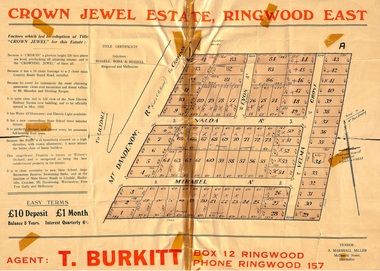
Memorabilia, History of "Jewel in the Crown" Estate, East Ringwood, Victoria, 1884-1947
Carter Real Estate Agents sold some of the subdivision in 1946-47. This information was tied in with the early orcharding families.Collection of notes, titles and maps of "Jewel in the Crown" subdivision - Mount Dandenong Road (formerly Oxford Road), Velma Grove, Valda Avenue, Mirabel Avenue. Genealogical charts of Meyland and Wigley families. 4 page history of the area compiled in 2004 by Richard Carter, Real Estate Agent. Registered Proprietors, Vendors, Property Title Holders and Transferees include: Herbert Edward WATSON, John Richard SHARP, Myrtle Evelyn BIRRELL, Marie Mathieson MUNRO, William Alex McCLELLAN, George Andrew GOODMAN, Joseph Tasman PEDRAZZI, Alexander ANDERSON, John Charles PATERSON, Eric William PHILLIPS, T.E.A. Co. Ltd., Florence Lavinia WYNARD, William John HARRIS, Lindsay and Hazel ALLNUTT, Douglas John RITCHIE, Eliza A.M. BOURBAND, Henrietta Irene COOK, Eric Edward COOK, Harold Thomas NICHOLLS, Stewart and Mary HIRD, Grace ROBINSON, Helen Rutherford GOOD, Henry Wyatt FARRELL, Irene Ann SMITH, Leslie Neil DOW, Helen Anne DOW, Frederick Ronald HOLDING, John Frederick McINTYRE, Horton Wilcox EDGE, Herbert James HARDINGHAM, Donald James ALLEN, Cyril Frederick WILLIAMS, Florence Sarah MAGGS, Maud Margaret PEARSON, Warwick Scott Holroyd MATTHEWS, Alice Eliza McCLEAVE, Leslie Archibald Charles HARRIS, Enid Beth HARRIS, Roy Victor DRAEGER, Elizabeth Ann STANDLEY, Charles Walter WATSON, Mabel Dorothy CARTER, Alan Garnett KELLY, Michael Vincent HARRIS, William Thomas Sylvester PROUD, Florence Blanche IVES, Douglas George PEARSON, Harry Clifford CLEGG, Dorothy Ellen Mary WHITE, Frederick Nathaniel EVANS, Madge EVANS, Leonard DUNSTAN, Violet Florence CONNELL, Valerie Jean Schimmelbusch, John Sydney COOK, William Donald THOMPSON, Ralph E RAUNSLEY, Murray McRae OSBORN, Francis William CLARKE, Alfred Daniel WILLIAMS, Harry Clifford CLEGG, Bernard Francis GARRY, Richard McKENZIE, Mignor Leonie WESTON, Idonea Moncrieffe DAVIS, Helen Marsden Rutherford GOOD, George SMART, Clement Henry DAVIS, Peter FINLAYSON, Elenor Leah HARVIE, Charles MEYLAND. -
 Whitehorse Historical Society Inc.
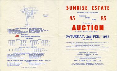
Document, Sunrise Estate, 1957
Auction brochure for 'Sunrise Estate' Brunswick Road, Mitcham, 85 sites, 2 February 1957.Auction brochure for 'Sunrise Estate' Brunswick Road, Mitcham, 85 sites, 2 February 1957. Agent Glide, Farrell & Co; Eric Weber & Co. Ltd. Includes train timetables and list of factories and schools in area..Auction brochure for 'Sunrise Estate' Brunswick Road, Mitcham, 85 sites, 2 February 1957. sunrise estate, mitcham, brunswick road, centre road, mcghee avenue, holly court, berry avenue, garden avenue, land subdivision -
 Whitehorse Historical Society Inc.
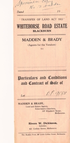
Document, Whitehorse Road Estate, n.d
Specimen copy of 'Particulars and Conditions and Contract of Sale'Specimen copy of 'Particulars and Conditions and Contract of Sale' for Whitehorse Road Estate, Blackburn. Agents: Madden & Brady for Land Investment Co Ltd. Described in Certificates of Title Vol 4351 Fol 870015 and Vol 4397 Fol879273.Specimen copy of 'Particulars and Conditions and Contract of Sale' whitehorse road estate, blackburn, land investment co. ltd., madden & brady, land sales -
 Kew Historical Society Inc
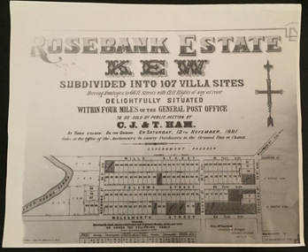
Plan - Subdivision Plan, Rosebank Estate, Kew
This work forms part of the collection assembled by the historian Dorothy Rogers, that was donated to the Kew Historical Society by her son John Rogers in 2015. The manuscripts, photographs, maps, and documents were sourced by her from both family and local collections or produced as references for her print publications. Many were directly used by Rogers in writing ‘Lovely Old Homes of Kew’ (1961) and 'A History of Kew' (1973), or the numerous articles on local history that she produced for suburban newspapers. Most of the photographs in the collection include detailed annotations in her hand. The Rogers Collection provides a comprehensive insight into the working habits of a historian in the 1960s and 1970s. Together it forms the largest privately-donated collection within the archives of the Kew Historical Society.Rosebank Estate (Kew). A photographic reproduction of a plan in the Vale Collection of the State Library of Victoria made for the historian Dorothy Rogers. This plan is a later version of the original subdivision plan after a number of lots had been sold.rosebank estate (kew), studley park, thomas ham, c.j. & t. ham, rosebank estate, kew, wills street, barry street, fellows street, redmond street, molesworth street, thomas wills, wills family -
 Greensborough Historical Society
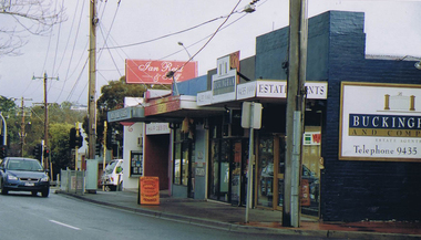
Photograph - Digital image, Frank Solomon, Grimshaw Street Estate Agents, 04/06/2010
View of real estate precinct, Grimshaw Street Greensborough. Buckingham Real Estate 104 Grimshaw Street.Digital copy of colour photographgrimshaw street greensborough -
 Kew Historical Society Inc
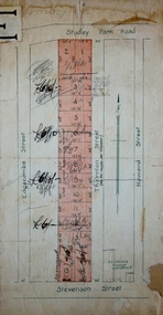
Plan - Subdivision Plan, Thornton Estate, 1918
The ‘Thornton Estate’ was the final subdivision of ‘Thornton’ in Studley Park Road. Thomas Cubitt Balmain originally owned Thornton, next to John Carson’s ‘Clutha’. Before its final subdivision, the Thomson family owned it. The Estate was a subdivision of 15 residential allotments running between Studley Park Road and Stevenson Street. The allotments faced these streets as well as Thornton Street, which the vendor undertook to make. Contemporary newspaper advertisements advised that ‘The estate possesses many advantages, notably its private and secluded, though convenient, position, splendid frontages and depths, and being close to the electric tram and Kew train, also within easy walking distance of the Victoria-street cable tram’. The terms offered purchasers were ten per cent deposit, with the balance to be paid in ten equal half-yearly payments at a rate of 5 per cent.subdivsion plans - kew, studley park, thornton estate -
 Kew Historical Society Inc
Plan - Subdivision Plan, Bonnie Doon Estate, c.1908
Pru Sanderson, in her groundbreaking ‘City of Kew Urban Conservation Study : Volume 2 - Development History’ (1988), summarised the periods of urban development and subdivisions of land in Kew. The periods that she identified included 1845-1880, 1880-1893, 1893-1921, 1921-1933, 1933-1943, and Post-War Development. These periods were selected as they represented periods of rapid growth or decline in urban development. An obvious starting point for Sanderson’s groupings involved population growth and the associated economic cycles. These cycles also highlighted urban expansion onto land that was predominantly rural, although in other cases it represented the decline and breakup of large estates. A number of the plans in the Kew Historical Society’s collection can also be found in other collections, such as those of the State Library of Victoria and the Boroondara Library Service. A number are however unique to the collection.The Kew Historical Society collection includes almost 100 subdivision plans pertaining to suburbs of the City of Melbourne. Most of these are of Kew, Kew East or Studley Park, although a smaller number are plans of Camberwell, Deepdene, Balwyn and Hawthorn. It is believed that the majority of the plans were gifted to the Society by persons connected with the real estate firm - J. R. Mathers and McMillan, 136 Cotham Road, Kew. The Plans in the collection are rarely in pristine form, being working plans on which the agent would write notes and record lots sold and the prices of these. The subdivision plans are historically significant examples of the growth of urban Melbourne from the beginning of the 20th Century up until the 1980s. A number of the plans are double-sided and often include a photograph on the reverse. A number of the latter are by noted photographers such as J.E. Barnes.The subdivision advertised as the Bonnie Doon Estate in Greensborough was first advertised in 1908. At that stage, the new subdivision included 15 allotments of between one and four acres. By the time the subdivision plan in the Kew Collection was created, only 12 lots of between ¾ and 2½ acres remained. Both the State Library and Kew plans emphasise the distance to the city being 13½ miles, which could be reached by train on weekdays and weekends. Unusually, the plan describes the suitability of lots as locations for ‘Week-end Homes’. Correspondingly, the train line is described as ‘The Holiday Resort for the Northern Suburbs’.bonnie doona estate, subdivision plans - greensborough -
 Kew Historical Society Inc
Plan - Subdivision Plan, Normanby Estate, East Kew, 1913
Pru Sanderson, in her groundbreaking ‘City of Kew Urban Conservation Study : Volume 2 - Development History’ (1988), summarised the periods of urban development and subdivisions of land in Kew. The periods that she identified included 1845-1880, 1880-1893, 1893-1921, 1921-1933, 1933-1943, and Post-War Development. These periods were selected as they represented periods of rapid growth or decline in urban development. An obvious starting point for Sanderson’s groupings involved population growth and the associated economic cycles. These cycles also highlighted urban expansion onto land that was predominantly rural, although in other cases it represented the decline and breakup of large estates. A number of the plans in the Kew Historical Society’s collection can also be found in other collections, such as those of the State Library of Victoria and the Boroondara Library Service. A number are however unique to the collection.The Kew Historical Society collection includes almost 100 subdivision plans pertaining to suburbs of the City of Melbourne. Most of these are of Kew, Kew East or Studley Park, although a smaller number are plans of Camberwell, Deepdene, Balwyn and Hawthorn. It is believed that the majority of the plans were gifted to the Society by persons connected with the real estate firm - J. R. Mathers and McMillan, 136 Cotham Road, Kew. The Plans in the collection are rarely in pristine form, being working plans on which the agent would write notes and record lots sold and the prices of these. The subdivision plans are historically significant examples of the growth of urban Melbourne from the beginning of the 20th Century up until the 1980s. A number of the plans are double-sided and often include a photograph on the reverse. The Normanby Estate, which was adjacent to Normanby Road, Kew East, included thirty-one lots for sale. Streets on the subdivision plan include Adeney Avenue, Park Hill Road, Normanby Road, Weir Street and Wharton Street. Cotham Road and its tramway are shown nearby. The plan is interesting as it shows Wharton Street, named after the architect and town planner George Wharton, who was the first chairman of the Municipality of Kew. The street was to later be renamed Cecil Street. Also shown are proposed ‘Municipal Gardens’ where Parkhill Drive is now located.subdivision plans - kew, normanby estate -
 Greensborough Historical Society
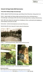
Document - Submission, Norm Colvin et al, Banyule Heritage Study 2020 Nominations - Plenty River railway bridge Greensborough, 2020
Part of the single track railway extension of 1902 from Heidelberg to Eltham, the Plenty River railway bridge Greensborough, was nominated for the Banyule Heritage Study 2020. This nomination was prepared by Norm Colvin & Anne Paul on behalf of the Greensborough Historical Society1 p. Text and photographshurstbridge rail line, plenty river, banyule heritage study 2020 -
 Greensborough Historical Society
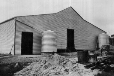
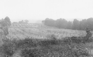
Photograph - Digital image, John McLaughlin's Plenty, 1932_
Part of a collection of photographs owned by Dorris McLaughlin who was born in Greensborough, in 1899 to John McLaughlin and Rosalie Ellen Whatmough. The collection contains photographs of friends and relatives from the Greensborough and Eltham areas. This photograph shows a farm building at Plenty.Digital copy of black and white photograph.dorris mclaughlin, john mclaughlin, plenty -
 Greensborough Historical Society
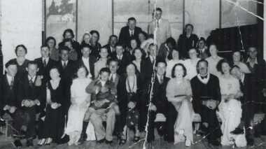
Photograph - Digital image, Lower Plenty Hall Group, 1940c
A large group of people at a function at Lower Plenty Hall. The Hall has now been demolished to make way for a car park. Photographs from the collection of Peter Blackbourn, a descendant of the Chapman Stock family. Annotations to photos by Peter Blackbourn.Digital copy of black and white photograph.peter blackbourn, lower plenty hall -
 Ringwood and District Historical Society
Photograph, Kingswood Grove Estate, 1959. Formerly the orchard of Jack Godbehear
Catalogue card reads, "Kingswood Grove Estate, 1959. Formerly the orchard of Jack Godbehear. Photo taken from the bottom of Lot 5, corner Warrandyte Rd. and Roseband Ave." -
 Greensborough Historical Society
Advertising Leaflet, 102c/116 Main Drive Macleod, 23/05/2018
102c/116 Main Drive Macleod, Studio apartment in secure complex. Sold May 2018 for $124,900Real estate advertising leaflet, 1 sheet, printed in colour.main drive macleod -
 Greensborough Historical Society
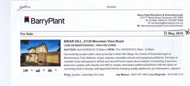
Advertising Leaflet, 2/129 Mountainview Road Briar Hill, 29/06/2018
2/129 Mountainview Road Briar Hill, 3 bedroom, 2 story home. Sold 29/06/2018 for $638.500, previously March 2014 for $475,000Real estate advertising leaflet, 1 sheet, printed in colour.mountainview road briar hill -
 Greensborough Historical Society
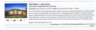
Advertising Leaflet, 1 High Street Watsonia, 02/06/2018
1 High Street Watsonia, 2 bedroom unit. Sold 02/06/2018 for $711,000, previously July 2013 for $450,000Real estate advertising leaflet, 1 sheet, printed in colour.high street watsonia -
 Greensborough Historical Society
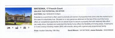
Advertising Leaflet, 17 French Court Watsonia, 19/05/2018
17 French Court Watsonia, 4 bedroom home. Sold 19/05/2018 for $941,000, previously April 1997 for $98,000Real estate advertising leaflet, 1 sheet, printed in colour.french court watsonia -
 Greensborough Historical Society
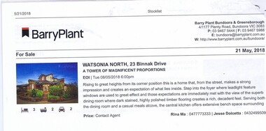
Advertising Leaflet, 23 Binnak Drive Watsonia North, 21/05/2018
23 Binnak Drive Watsonia North, 4 bedroom home. For sale 19/05/2018. Previous sale September 2015 for $918,000 and February 1985 for $35,000.Real estate advertising leaflet, 1 sheet, printed in colour.binnak drive watsonia north -
 Greensborough Historical Society
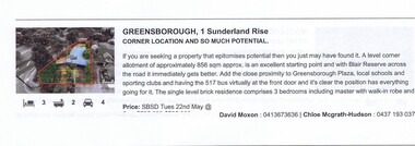
Advertising Leaflet, 1 Sunderland Rise Greensborough, 22/05/2018
1 Sunderland Rise Greensborough, 3 bedroom home. For sale by set date 22/05/2018. Previous sale April 2007 for $325,000 and October 1988 for $113,000.Real estate advertising leaflet, 1 sheet, printed in colour.sunderland rise greensborough -
 Greensborough Historical Society
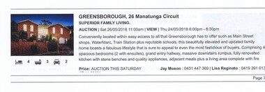
Advertising Leaflet, 26 Manatunga Circuit Greensborough, 26/05/2018
26 Manatunga Circuit Greensborough, 4 bedroom, 2 storey home. For sale by set date 26/07/2018. Previous sale August 1986 for $26,000.Real estate advertising leaflet, 1 sheet, printed in colour.manatunga circuit greensborough -
 Greensborough Historical Society
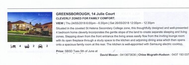
Advertising Leaflet, 14 Julie Court Greensborough, 26/05/2018
14 Julie Court Greensborough, 4 bedroom home. For sale by set date 05/06/2018, price not disclosed. Previous sale October 1996 for $210,000 and March 1987 for $132,000.Real estate advertising leaflet, 1 sheet, printed in colour.julie court greensborough -
 Greensborough Historical Society
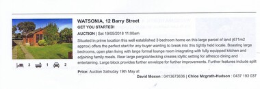
Advertising Leaflet, Barry Plant Bundoora, 12 Barry Street Watsonia, 19/05/2018
12 Barry Street Watsonia, 3 bedroom home. Auctioned 19/05/2018 for $740,000. Previous sale May 1995 for $100,000.Real estate advertising leaflet, 1 sheet, printed in colour.barry street watsonia -
 Greensborough Historical Society
Advertising Leaflet, 20 Edmund Rice Parade Watsonia North, 05/06/2018
20 Edmund Rice Parade Watsonia North, 5 bedroom, 2 storey home. Sale by set date 05/06/2018 price not disclosed. Previous sale September 2001 for $345,000 and December 1984 for $31,000..Real estate advertising leaflet, 1 sheet, printed in colour.edmund rice parade watsonia north -
 Ringwood and District Historical Society
Flyer, Auction Sale Advertisement - Ringwood Station Estate, Ringwood, Victoria - 1919
Folded double-sided brochure advertising auction of residential allotments on Saturday, 11 October, 1919, with town photographs including residence of Mr. and Mrs. Williams on the estate, location map, terms of sale, and summary of local features and services.Subdivision includes Bedford Road and Williams Grove (later Lena Grove). (Agents) Knight & Harwood, 315 Collins Street, Melbourne, Phones Central 10615, 10616, in conjunction with Godbehear & Co., Local Agents, Ringwood, Phone Ringwood 49. -
 Whitehorse Historical Society Inc.
Pamphlet - Advertising brochure, Kenmare Heights Estate, 1927
Clearing sale by public auction , Saturday 26/11/1927 of Kenmare Heights Estate Mont Albert, Situated between Belmore Road, Boundary Road, Strabane Avenue, Union Road and Dunloe Avenue. Advertising material and mapknight & harwood auctioneer, auctions, kenmare height estate, union road mont albert, belmore road, relowe crescent, whitehorse road, evalina street, francesca street, mozelle street, dunloe avenue -
Whitehorse Historical Society Inc.
Document, The Walker Estate Mitcham, 8/10/1938 12:00:00 AM
Executor's Realisation Auction of the Walker Estate.Executor's Realisation Auction of the Walker Estate of 12 building sites at 1 pm and the residence of E.E Walker at 3 pm, 8 Oct 1938Auctioneers: Edward Haughton Pty Ltd Drake & Co Solicitors: Gillott, Moir & AhernExecutor's Realisation Auction of the Walker Estate.walker estate, mitcham, walker, edgar edwardes -
 Eltham District Historical Society Inc
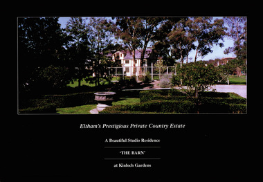
Document - Brochure, The Barn at Kinloch Gardens; Eltham's Prestigious Private Country Estate, 1998
Colour photograph of "The Barn" and surrounding gardens, part of the Kinloch Gardens Estate, sales materials produced by Elders Real EstateDigital file only; created from scan undertaken by EDHS of item on loanarthur street, elders real estate, eltham, houses, jelbart property, kinloch gardens, real estate agent, the barn, woodridge estate -
 Bayside Gallery - Bayside City Council Art & Heritage Collection
Map, H.B. Foot, Plan of the Brighton Estate containing 5120 acres, first special survey at Port Phillip, c. 1842
This plan records the Brighton Estate, also known as Dendy's Special Survey. In 1840 Henry Dendy, a farmer in Surrey, England acquired a "Special Survey" from the Commissioners for Land and Emigration which gave him the right to choose land in Port Phillip for the low price of £1 per acre for 5120 acres. Dendy appointed Jonathan Binns Were, as his agent, who later became a partner. Together, Dendy and Were decided on an area 5 miles south from Melbourne, bounded by North Road, East Boundary Road, South Road and to the west by Port Phillip Bay. Their Brighton Estate was first surveyed by T. S. Townsend in May 1841 and was re-surveyed by Robert Hoddle. Dendy and Were were making plans to sell the land and advertised a 30-guinea prize for the best subdivision which was to be divided into a village, marine residences, suburban and cultivation allotments, with the remainder being divided into country sections. The competition was won by H.B. Foot, who planned the village around a reserve and crescents and a 'green belt' forming the town boundary. brighton estate, dendy's special survey, special survey, henry dendy, jonathan binns were, w.b. were, survey, plan, map, brighton, george ward cole, baker's lithographer, hibernian, subdivision, town planning, cartographic material, h.b. foot -
 Greensborough Historical Society
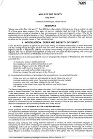
Article, Gary Vines, Mills of the Plenty River, by Gary Vines, 2017_10
Transcript of conference paper on flour mills on the Plenty River, including Arthur Sergeantson's Carome Mill, George Coulstock's Janefield Mill and Moses Thomas's Mayfield Mill. The paper was presented at the 19th Australasian Engineering Heritage Conference in Mildura, October 2017Transcript of conference paper, 26 pages, illus. (some col.), maps.plenty river, flour mills -
 Eltham District Historical Society Inc
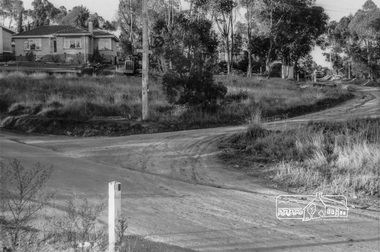
Photograph, Looking northeast up Alma Street from Para Road at intersection of Alma Street and Lees Road, Lower Plenty, c.July 1967, 1967
Packaged in "Filmpro King Size prints Definitely Better EST. 1918" envelope. Pencil notes: 36 shots $2.87 Eltham Shire J. McD and 19/7/67. Alma Street and Kett Street Lower Plenty c.July 1967.Black and white photographalma street, lees road, lower plenty, para road, houses, streets