Showing 173 items
matching residence registers
-
 Melton City Libraries
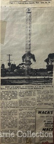
Newspaper, Melton Fire Station, 1974, 1975
In 1975 the Melton Fire Station opened in McKenzie Street. In the 1950s with the introduction two-way HF and later VHF very high frequency radio sets. Melton Rural Fire Brigade was part of the Bacchus Marsh Group. Radio sets where located in the Melton Fire Truck, and in the house of the Barrie family at Ferris Road. This was an ideal location to observe a 360 degree view in all directions when smoke appeared on the horizon. An antenna was erected beside the house. The set OX 7 was located in the kitchen and monitored 24 hours by the family. When an electrical fire occurred at the junction of the electricity to the house there was time to radio the fire station and summons the men working in the paddocks, thus saving the house from possible destruction. With the introduction of UHF – ultra high frequency Vinten Radios the signal was clearer and static and interference lessened and radio traffic became easier to read, and reduced noise levels in the household. In 1974 when the family moved to First Avenue, another antenna and a small building were erected adjacent to the residence and used to house the equipment, maps. Radio traffic consisted of regular schedule times and communication with adjoining groups of brigades such as Bacchus Marsh, Mt Macedon and Little River Groups. Many of the brigade and group base radios were situated in private residences and operated primarily by fire fighters wives who held the position of Communications Officer, either registered as a brigade member or informally.Regional News Gazette article about the construction of a new fire station in Melton and an Express article with brigade members at the opening of the station.emergency services -
 Melton City Libraries
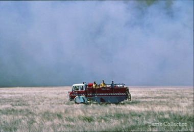
Photograph, Burning Off, Unknown
Many of the brigade and group base radios were situated in private residences and operated primarily by fire fighters wives who held the position of Communications Officer, either registered as a brigade member or informally. Edna Barrie was never registered as an operational brigade member but operated informally as an assistant to her husband Bon. She was however a member of the Melton Fire Brigade Ladies Auxiliary from its inception in 1968, a non-operational position. Edna kept up to date with radio procedure following the 1967 handbook; preparing maps, plotting compass points and taking notes on weather forecasts from the SA Border and Western District. Daily notes were taken in anticipation of fire warnings. These log books and daily radio traffic were incidental to the regular radio schedules. Emergency turnouts noted, burning off times and predicted location of smoke. In the summer fire season all TBF (total fire ban days were recorded.)CFA burning off dry grassemergency services -
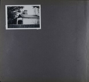
 Kew Historical Society Inc
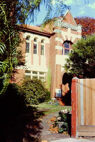
Slide - House, cnr Fellows and Barry Streets, 1979
One of a group of slides taken by members of the Society of built heritage in Kew in 1979-80. The selection of subject matter reflects the priorities of the period. The colour of some slides has degraded. This particular slide is of 'Fairholme' on the corner of Barry and Fellows Street. The building is listed by the National Trust (Victoria). The citation on the Historic Buildings Register states: 'Fairholme is of State architectural significance as a distinctive free Romanesque Revival residence. Built in two stages, 1889 for solicitor Edward Smart and early this century for importer, J K Meritt, the singular architectural character of Fairholme is achieved by combining window bays and groups of windows with a two-storey gabled porch. The deliberate and distinctively asymmetrical composition is emphasised by Art Nouveau pressed cement detailing (coprosma) on a bowed balcony and the two-storey timber verandah, which is typical of the Edwardian period. The architects were Reed, Henderson & Smart (1889) and C Gordon McCrae (c 1900-1). Internally a grand entry hall with inglenook, staircase and gallery follow the Arts and Crafts quality of the exterior. Classified: 17/03/1993'The slides represent a snapshot in time of built architecture in Kew, much of which has changed in the forty-plus period since they were created. 35mm colour transparency (slide) of 'Fairholme' (1889) on the north-east corner of the intersection of Fellows and Barry Streets, Kew. The photo was developed in May 1979.barry street -- kew (vic.), fellows street -- kew (vic.), historic houses -- kew (vic.), architects -- reed henderson & smart, architectural styles -- romanesque revival, j k merritt -
 Kew Historical Society Inc
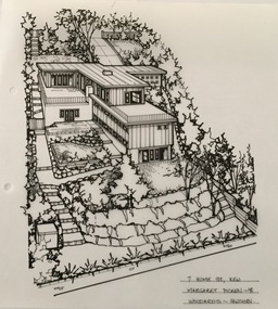
Drawing - Property Illustration, Margaret Picken, 7 Hume Street, Kew, 1998
After training as a Cartographic Draftsman within the mining industry, I worked as a property illustrator for real estate firms in the eastern suburbs of Melbourne for 23 years from 1983. I initially photographed houses with a Polaroid camera and made a 'thumbnail' sketch while there. The photos were used to scale off a sketch in pencil and then that sketch was overlaid with drafting film and the 'pen and ink' completed. The pens I used were the Rotring ‘Rapidigraph’ drafting pens. The ink was also made by Rotring (German).The film was ‘Rapidraw’, polyester drafting film, double matte. It takes a very fine line and doesn’t bleed. As well as house sketches, there were often floor plans and site plans ordered. Aerial sketches were ordered when the property needed an overall view. (Margaret Picken, 2020)The house at 7 Hume Street was designed in 1955 by the modernist architect Douglas Alexandra (1922-2000). Between 1951 and 1996, Alexandra completed a number of significant projects including a regional art gallery and library complex at Hamilton, Victoria (1958-59). The residence in Hume Street is included in the RAIA Victorian Chapter's 20th Century Buildings Register. The house, and another residence in Molesworth Street (1961), is one of his notable residential projects. The aerial property illustration of the house by Margaret Picken was commissioned by the real estate agent Woodards in 1998. Gift of Margaret Picken, 2020Pen and ink property illustration on drafting film of 7 Hume Street, Kew by Margaret Picken.7 HUME ST., KEW / MARGARET PICKEN ~98 / WOODARDS ~ HAWTHORN artist -- margaret picken 1950-, 7 hume street - kew (vic)., d.d. alexandra - architect, property illustrations -- buildings -- kew (vic.) -
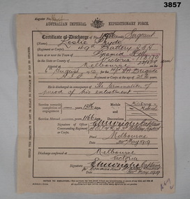 Bendigo Military Museum
Certificate - DISCHARGE CERTIFICATE WW1, 22.5.1919
Leslie PRYDE "MM". Refer Cat No 914 for his service history and award.A brief description of enlistment, service and discharge on both sides of the document. The document is a fawn colour, thicker than paper but able to be folded in 3 for postage. The front is divided into 3 sections, top being name, rank and serial number, age, enlistment date, unit and birth place. Centre is reason for discharge, service time, awards and decorations. Bottom is signed of by relevant person. The rear is dedicated to the individuals height, complexion, eye and hair colour, age on discharge and trade or calling prior to enlistment, intended place of residence. The person then signs the document. All entries on the form are hand written.On the front at top is a Register No: Unreadable On the rear are 2 numbers; “V/B No 41745 & No 124038”certificate, military history, numismatics, mm -
 Buninyong & District Historical Society
Photograph - Black and white photograph, Former Free Library Warrenheip Street Buninyong, 9 April 1994
Built in 1861 on land made available by Mr. Robert Allen. Grant received through municipal council and State Government. Building functioned as a library until 1926. Taken over by Buninyong Cemetery Trust and eventually fell into serious disrepair. Restored in the 1980s after great community effort, dedication and financial contributions.An important early building in the township noted for its unusual and individual classical facade of Oregon pine. Placed on Historical Buildings Register.Black and white photograph of Former Free Library built in1861. Warrenheip streetscape of former free library, currently Buninyong Information Centre, Eastern facade fully visible and Southern weatherboard side. Mature pine trees visible to the side and rear of building. Reading room on left of entrance door and former shop and residence on right.free library, information centre, mr. robert allen, buninyong cemetery trust, mechanics institutes -
 Glenelg Shire Council Cultural Collection
Souvenir - Tea Towel - Maretimo, Portland, n.d
From the National Trust register: Statement of Significance Maretimo, a 22 room single storey Australian Colonial Georgian style mansion set on a prominent bluff overlooking Portland harbour, was erected c. 1854 for John Norman McLeod. The design of Maretimo, which is constructed of basalt ashlar with fine-axed parapet entablature, delicate open timber work verandah and Regency interior, has been tenuously attributed to Adelaide architect James Barrow. Maretimo is rivalled only by the stylistically similar Henty residence, Burwsood of 1853 by James Barrow, as perhaps the finest Australian Colonial Georgian style residence erected within the first twenty years of settlement in Victoria. The residence, which was occupied for twenty years by distinguished English-born gentleman parliamentarian, pastoralist and former Van Deimen's Land settler, J H McLeod, is now notable for the disciplined facade and elegantly crafted interiors. Maretimo has been meticulously maintained and is presented in near perfect original condition. The interiors have been sensitively enhanced and redecorated.Linen souvenir tea towel 'Maretimo'. Green and black on cream. 'MARETIMO' at top, front view of Maretimo beneath, then map of locaion, then view from air. 'HISTORIC HOME PORTLAND, VICTORIA' beneath 'Pure Linen', bottom right.historic building, historic homestead, maretimo, henty, souvenir -
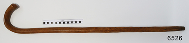 Flagstaff Hill Maritime Museum and Village
Accessory - Walking Stick, William Dale, early 1900's
In the words of the Donor, Betty Stone, "This walking stick was made by William Dale from wood obtained from his property Bluestone Quarries situated at Wangoom, Warrnambool. William Dale, the son of William Booth and Hannah (nee Broadbent) Dale was born on 8 July 1828 in Saddleworth, Yorkshire, England. He emigrated to Australia in 1852 and seven years later purchased twenty acres of land in the shire of Wangoom, Warrnambool where he operated a quarry known as The Dale Bluestone Quarries. According to family legend, when William and his wife Elizabeth (nee Chamberlain) first moved into their bluestone cottage on the property, it was surrounded by dense bush that abounded with wildlife. William Dale used this walking stick in his later years. Although physically bent after years of toil, his grandchildren remembered him wheeling his barrow and walking with his stick around the quarries when aged well over eighty years. William Dale died at his residence on 14 December 1913 aged 85 years." (Note: For additional information please refer to Betty Stone’s book “Pioneers and Places - A History of three Warrnambool Pioneering Families” ie. Chamberlain, Dale and Lees Families) This item is associated with the families of Chamberlain, Dale and Lees. These families are listed in the "Pioneers' Register" for Warrnambool Township and Shire, 1835-1900, published by A.I.G.S. Warrnambool Branch. The handmade walking stick was made from local resources.Walking Stick, polished wood with grain and knots showing. Brass tip, 'J' shaped handle. Made by William Dale in the early 1900's of wood from his property, "Dale Bluestone Quarries", Wangoom, Warrnambool. From the 'Chamberlain Dale and Lees Collection'.flagstaff hill, warrnaflagstaff hill, warrnambool, shipwrecked coast, flagstaff hill maritime museum, maritime museum, shipwreck coast, flagstaff hill maritime village, great ocean road, chamberlain, dale, lees, stone, betty stone, warrnambool pioneers, mbool, shipwrecked-coast, flagstaff-hill, flagstaff-hill-maritime-museum, maritime-museum, shipwreck-coast, flagstaff-hill-maritime-village, dale bluestone quarries, william dale, walking aid, walking stick, mobility aid -
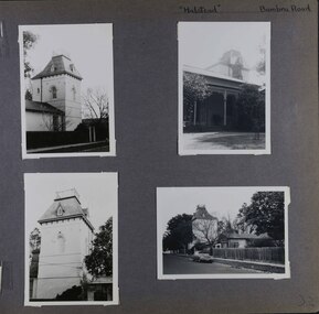 Glen Eira Historical Society
Album - Album page, Halstead, Bambra Road, Circa 1972
This photograph is part of the Caulfield Historical Album 1972. This album was created in approximately 1972 as part of a project by the Caulfield Historical Society to assist in identifying buildings worthy of preservation. The album is related to a Survey the Caulfield Historical Society developed in collaboration with the National Trust of Australia (Victoria) and Caulfield City Council to identify historic buildings within the City of Caulfield that warranted the protection of a National Trust Classification. Principal photographer thought to be Trevor Hart, member of Caulfield Historical Society. Most photographs were taken between 1966-1972 with a small number of photographs being older and from unknown sources. All photographs are black and white except where stated, with 386 photographs over 198 pages.From the Victorian Heritage Register Database - Citation for Halstead, 23 Bambra Road as at (as at 12/10/2020) https://vhd.heritagecouncil.vic.gov.au/places/276 Halstead is believed to be the oldest standing residence in Caulfield constructed in 1857 with subsequent additions during the 19th Century. The house was built for and owned by James Dickson, a stock agent, until his death in 1880. Although on a much reduced parcel of land, Halstead is one of the few remaining remnants of Caulfield when it was an area of mansion houses occupied by town residing squatters, professional and business men. It is important for its place in the socio-economic history of south eastern suburban Melbourne, the inland pattern of development stretching from Malvern through Murrumbeena. Architecturally the single storey building displays a history of alteration and addition. Its main front presents with a single storey cast iron verandah across the full width, including the two pavilion wings at each end. Located towards the rear on the Halstead Street side is the substantial three storey tower with its Mansard roof and cast-iron balustrade which makes the house clearly visible from Halstead Street and Bambra Road. Because of internal alteration the importance of the building relates to the exterior only of the main house. Halstead is believed to be the oldest standing residence in the city of Caulfield. https://vhd.heritagecouncil.vic.gov.au/places/43645 "Halstead" is regionally important as a surviving large villa from the early Victorian (1850's) period, offering insights into the lifestyles of the privileged in Caulfield at that time. The later tower is of architectural interest for its use of Medieval Romanesque enrichment.Page 32 of Photograph Album with four photographs of the exterior of this double storey house, focussing on different angles for the house's tower.Hand written: "Halstead" Bambra Road [top right] / 32 [bottom right] trevor hart, caulfield north, bambra road, 1850's, halstead, james dickson, mansion, villa residence, cast iron verandah, pavillion wings, halstead street, victorian, tower, balustrading, decorative brackets, mansard roof, brick, cast iron, slate roof, curved windows, single storey mansions, streetscapes, medieval romanesque style, slate roofs, gardens, cast iron work -
 Glen Eira Historical Society
Album - Album page, Halstead, Bambra Road, Circa 1972
This photograph is part of the Caulfield Historical Album 1972. This album was created in approximately 1972 as part of a project by the Caulfield Historical Society to assist in identifying buildings worthy of preservation. The album is related to a Survey the Caulfield Historical Society developed in collaboration with the National Trust of Australia (Victoria) and Caulfield City Council to identify historic buildings within the City of Caulfield that warranted the protection of a National Trust Classification. Principal photographer thought to be Trevor Hart, member of Caulfield Historical Society. Most photographs were taken between 1966-1972 with a small number of photographs being older and from unknown sources. All photographs are black and white except where stated, with 386 photographs over 198 pages.From the Victorian Heritage Register Database - Citation for Halstead, 23 Bambra Road as at (as at 12/10/2020) https://vhd.heritagecouncil.vic.gov.au/places/276: Halstead is believed to be the oldest standing residence in Caulfield constructed in 1857 with subsequent additions during the 19th Century. The house was built for and owned by James Dickson, a stock agent, until his death in 1880. Although on a much reduced parcel of land, Halstead is one of the few remaining remnants of Caulfield when it was an area of mansion houses occupied by town residing squatters, professional and business men. It is important for its place in the socio-economic history of south eastern suburban Melbourne, the inland pattern of development stretching from Malvern through Murrumbeena. Architecturally the single storey building displays a history of alteration and addition. Its main front presents with a single storey cast iron verandah across the full width, including the two pavilion wings at each end. Located towards the rear on the Halstead Street side is the substantial three storey tower with its Mansard roof and cast-iron balustrade which makes the house clearly visible from Halstead Street and Bambra Road. Because of internal alteration the importance of the building relates to the exterior only of the main house. Halstead is believed to be the oldest standing residence in the city of Caulfield. https://vhd.heritagecouncil.vic.gov.au/places/43645: "Halstead" is regionally important as a surviving large villa from the early Victorian (1850's) period, offering insights into the lifestyles of the privileged in Caulfield at that time. The later tower is of architectural interest for its use of Medieval Romanesque enrichment.Page 33 of Photograph Album with one landscape photograph of the exterior of Halstead, taken from the street.Hand written: 33 [bottom left] trevor hart, caulfield north, bambra road, 1850's, halstead, james dickson, mansion, villa residence, cast iron verandah, pavillion wings, halstead street, victorian, tower, balustrading, decorative brackets, mansard roof, brick, slate roof, curved windows, single storey mansions, cast iron work, medieval romanesque style, slate roofs, gardens -
 Flagstaff Hill Maritime Museum and Village
Furniture - Screen, Thomas Hope, 1905-1913
The fire screen was part of the original furnishings of the Lighthouse Keeper's Quarters in Merri Street, Warrnambool. It was made by Lighthouse Keeper, Thomas Hope. Thomas served two terms as an assistant lighthouse keeper in Warrnambool. His first term was from 1905 to 1907. He later returned from 1910 to 1913, when he was appointed as Keeper five months after the untimely death of his predecessor Peter Quinn. Woodworking was one of Thomas Hope’s hobbies, and the three-panel fire screen he made as a lighthouse keeper is now in the Flagstaff collection and is displayed in the Lighthouse Keeper’s Cottage. Thomas Hope 1857 - 1928 Thomas James Hope was born in Camden, Surrey, England in 1857. His father, also called Thomas, was reputed to be a member of the Royal Family, and Thomas Hope Junior his illegitimate son. Thomas was subsequently brought up on the estate of the Earl of Hopetoun in Somerset and it was thought that Thomas was the Earl’s grandson. Against the wishes of those in charge of Thomas, he joined the navy at an early age, seeing much of the world until he settled in New Zealand at the age of twenty-four. After some years in New Zealand, he came to Australia to live. One of the jobs Thomas Hope had prior to becoming an assistant lighthouse keeper in 1896 was as a cook in the Lunatic Asylum at Sunbury, Victoria. He served as an assistant keeper at Shortlands Bluff, Gabo Island, Split Point and Warrnambool, retiring in 1918. He bought a house in Nicholson St, Warrnambool and died in March 1928. He is buried in the Warrnambool cemetery. Thomas Hope is recorded in family history as being of short stature and, not surprisingly given his alleged aristocratic connections, possessed a beautiful speaking voice. He and his wife Elizabeth nee Waters, whom he married in New Zealand, had six children (Thomas, killed in World War One), Ellen (Nell), Nora (who was married at the Warrnambool lighthouse keepers cottage), William (who died in Warrnambool), Marion and Alan. Joseph Hoover (Dec 29, 1830, to Aug 7, 1913) Joseph Hoover, the printer of the pictures on the screen, was born in Baltimore, of Swiss-German heritage. He was trained as an architectural woodturner. In 1856 Hoover moved to Philadelphia and began producing elaborate wooden frames in his wood-turning and framing business. By 1865 Hoover had started to produce popular prints for publishers and artists, which included noted Philadelphia artist James F. Queen. In the 1880s Hoover set up a complete plant specialising in chromatography, the process of producing colour prints from lithographic plates. The coloured prints he produced were affordable to business and private customers. In 1893 his son Henry L., a trained lithographer, joined the company as overseer and it was called J. Hoover & Son. It became one of the largest in America by the turn of the century. Hoover won a medal for Excellence for his Chromolithographs of James Queen’s works. In 1904 Joseph’s other son, Joseph W, joined the business as a partner and the company was called Jos. Hoover & Sons. Hoover died of a heart attack in 1913. He was survived by his wife and six children: two sons who were also his business partners, and four daughters. The firm continued in production until around 1985. Hoover’s prints included scenes, still life and landscapes of America and other locations. They were sold in America and overseas to countries including Canada, Germany, Mexico and England. The three-panelled screen in the Lighthouse Keeper’s Cottage was made by the Assistant Lighthouse Keeper, Thomas Hope during one of his two terms at the Lighthouse Keepers' Quarters. It is the only object in the collection known to be connected to Hope. The Lighthouse Keeper's Cottage is part of the Lady Bay Lighthouse Complex, which is listed on the Victorian Heritage Register for being of historical, scientific (technological) and architectural significance to the State of Victoria.Fire screen comprising three black wood framed panels hinged together. Each panel contains a glass-encased print depicting a rural landscape. Ornate stencil cut wood edging and quilt-inspired parquetry sits above each panel. The central panel is taller than those either side. Screen is lined in black-painted cardboard.Printed at the base of each of the three prints “COPYRIGHT 1896 BY J. HOOVER & SON, PHILAD’’A.”flagstaff hill, warrnambool, shipwrecked coast, flagstaff hill maritime museum, firescreen, thomas hope junior, ellen (nell) hope, nora hope, william hope, marion hope, alan hope, jos. hoover & sons of philadelphia, lighthouse keeper, assistant lighthouse keeper, carved screen, merri street, lighthouse keeper's cottage, lighthouse residence, lighthouse, wood carving, lighthouse complex, lady bay lighthouse, fire screen -
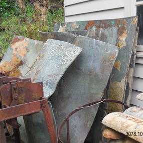 Flagstaff Hill Maritime Museum and Village
Functional object - Copper Sheet, circa 1878
In 1984 the Commonwealth Government made available to Flagstaff Hill a collection of lead ingots and copper sheets recovered from the wreck-site of the LOCH ARD. They were presented to the Warrnambool City Council by the Hon. Tom Uren MHR, Minister for Territories and Local Government: “The Commonwealth recognises that shipwrecks like the LOCH ARD are our national heritage with important educational, recreational and tourist applications” (The Standard, Tuesday 8 May 1984). The LOCH ARD was wrecked in 1878. Unsuccessful salvage operations were then undertaken with the 90 ton paddle steamer NAPIER. In sudden bad weather this vessel too was sunk. The precise position of the LOCH ARD in the exposed and dangerous waters off Mutton Bird Island became lost to memory. The underwater location of the LOCH ARD was rediscovered in 1967 by a Warrnambool skindiver, Stan McPhee. In the two years following his find, the vessel was systematically pillaged by unauthorised salvagers. This led to the State and Federal Governments’ intervention in 1969. A roundup and seizure of recovered lead ingots and copper sheets was conducted by Commonwealth and Victorian Police. Offenders were charged and convicted. The “repossessed loot of the Tassie Boys” was placed into secure storage (Jack Loney, 1978, Wrecks & Reputations). The LOCH ARD manifest of cargo lists “Pig lead 50 tons, 994 pig & 37 rolls” and “Copper 33 plates, 53 bolts”. While the lead ingots have been subsequently described as “ballast”, the copper sheets are unlikely to have been associated with the ship’s normal complement in that way. Similar product lines in the cargo manifest are “Bar and rod iron 102 tons”, “Plate iron 3 tons” and “Zinc 12 tons”. These raw materials were used by colonial artisans such as blacksmiths and metal smelters to fashion, and repair, agricultural implements and industrial machinery. Copper was valued for its non-corrosive properties and its malleability, or ease of working. Both these qualities were useful, for example, in laying underground gas pipes that supplied lighting to residences, businesses and streetscapes in the mid-nineteenth century. As the nineteenth century progressed, the metal was also increasingly valued for its conductivity, with copper wiring linking colonial communities to each other, and the wider world, via the Telegraph system. The average weight of the copper sheets is 216 kilograms, calculated by "volume 0.1936m³ X Cu density 8930kgs/m³".The shipwreck of the Loch Ard is of significance for Victoria and is registered on the Victorian Heritage Register ( S 417). Flagstaff Hill has a varied collection of artefacts from Loch Ard and its collection is significant for being one of the largest accumulation of artefacts from this notable Victorian shipwreck. The collections object is to also give us a snapshot into history so we can interpret the story of this tragic event. The collection is also archaeologically significant as it represents aspects of Victoria's shipping history that allows us to interpret Victoria's social and historical themes of the time. The collections historically significance is that it is associated unfortunately with the worst and best-known shipwreck in Victoria's history. Large heavy sheets or panels of copper metal raised from the wreck of the LOCH ARD. The 10 sheets are of roughly similar dimensions and rectangular shape. They bear signs of prolonged submersion in seawater, with various degrees of limestone accretion, adhered marine growth, and green oxidisation. Three of the sheets are severely buckled, demonstrating the force of underwater explosives used in their salvage. One sheet appears cut or severed in a diagonal line downwards from its top left hand corner. One sheet has a 10cm X 10cm square cut out of its top right hand corner. All sheets are in sturdy, stable condition. No maker’s marks are visible.flagstaff hill, warrnambool, shipwrecked coast, flagstaff hill maritime museum, flagstaff hill maritime village, great ocean road, loch line, loch ard, captain gibbs, eva carmichael, tom pearce, glenample station, mutton bird island, loch ard gorge, sailing ship, copper sheet, manutacturing materials, metal imports, muntz -
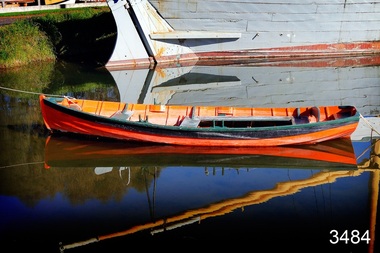 Flagstaff Hill Maritime Museum and Village
Vehicle - Vessel - Dinghy, Proudfoot's Boat, c. 1885
This boat or dinghy is one of a few remaining boats made for Proudfoot’s Boathouse, 2 Simpson Street Warrnambool, on the Hopkins River, in about 1885. It was one of many rowing, fishing, sailing and picnic boats that were available to hire. Proudfoot’s Boathouse, a beautiful Victorian Period building, was designed, built and established by Thomas Proudfoot. He applied to build a boat jetty in 1885. He died in 1900 and his wife Catherine took over, running it for many years. Later her son Bruce and after that her granddaughter Ena Hunt and her husband took over; it remained in the family until 1979. Proudfoot’s was a very popular tourist destination for visitors coming from Melbourne to fish and row and enjoy afternoon tea. The buildings, including the ‘U’ shaped jetty and tearooms, were restored and modified in the 1990s by the Warrnambool Sports Club, under the control of the Warrnambool City Council. The dinghy was brought to Flagstaff Hill in about 1992 and restored to its original condition and painted in traditional paint colours of orange with dark green gunnel and black and gold pinstripes. Since that time it has been painted by Flagstaff Hill's boatbuilder.This dinghy, Proudfoot’s Boat, is significant for its association with Proudfoot’s Boathouse, which is listed on the Victorian Heritage Register, VHR H0620. “Proudfoot's Boathouse on the Hopkins River near Warrnambool is an outstanding example of a late-19th century boathouse complex with associated residences and jetties. Thomas Proudfoot first applied for a jetty licence in 1885 with a view to establishing a boating business on the Hopkins River. The early single-storey sections are thought to date from this period. The two storey second stage probably dates from 1893 when additions were constructed. The entire complex was designed and built by Proudfoot himself. The business remained in the Proudfoot family until 1979. The buildings were modified in the 1990s in the process of creating a sporting club on the site. Proudfoot's Boathouse is of architectural, historical and social significance to the State of Victoria. Proudfoot's Boathouse is of architectural significance as perhaps the finest example of a 19th-century boathouse in Victoria. Although recent modifications have reduced the intactness of the buildings, many original features remain. The beautifully ornamented buildings still provide an attractive instance of 19th-century leisure facility architecture. Proudfoot's Boathouse is of historical significance as an example of late-Victorian recreational and tourist facilities. Boathouses were popular 19th-century tourist and recreational attractions, providing refined and healthy activity. This boathouse shows the early realisation of the tourism and leisure potential of seaside towns such as Warrnambool, a potential that has become increasingly important as port uses have ceased and other industries have been subjected to financial pressure. Proudfoot's Boathouse is of social significance because it illustrates the continuity of the attraction of this kind of leisure facility. Although the glory days of the boathouse were in the 19th century, those that survive continue to be well patronised. Proudfoot's Boathouse has been an important recreational facility and attraction for tourists flocking to the Hopkins River, one of the State's most popular boating and fishing resorts, since 1885.” (Statement of Significance is from the Victorian Heritage Register)Wooden vessel or boat, called a dinghy, known as Proudfoot’s Boat. Paint work is orange with dark green gunnel and black stripe. The rowboat is propelled by oars and has two pair of thole set into the gunnel (gunwale) to hold the oars in place and to serve as a fulcrum when rowing. The boat is dated around 1885. flagstaff hill, warrnambool, shipwrecked coast, flagstaff hill maritime museum, maritime museum, shipwreck coast, flagstaff hill maritime village, great ocean road, small marine vessel, dinghy, proudfoot's boat, proudfoot's boathouse, picnic boat, orange and black boat -
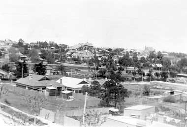 Surrey Hills Historical Society Collection
Photograph, Surrey Hills looking south-east from the steeple of Holy Trinity Church, 1921
The property in the foreground is 'Edgeware' at 171 Union Road, a house built by the Zeplin family. It became the home / residence of Dr Percy Liddle and later Dr James Landells Blakie. By the time this photo was taken Dr Blakie had moved across the road to 174 Union Road. In the background behind the 2 houses in the foreground is the Surrey Hills Stationmaster's house, sitting behind a picket fence. The Alan Holt register gives a build date of c1915 for this house, which fits stylistically. The first stationmaster was probably Michael Ginnane, who stayed in the area after he retired, moving to 1 Russell Street. This property was listed as 8 Bedford Avenue, the only house on the south side of the road. It was demolished in c1972 to make way for widening of the rail track with a third line. The photographer Norman Carter took many photos of Surrey Hills and Mont Albert from the 1920s, in particular of events and activities associated with the Church of England.Black and white photo taken from the steeple of Holy Trinity Church looking across housing towards the railway line and Albany / Windsor Crescents and on towards Canterbury Road. Surrey Hills Primary School and St Stephens Presbyterian Church feature prominently on the horizon. The stationmaster's cottage is centre left adjacent to a large conifer-like tree, with a white fence delineating the railway yards.On back of original: "6-11-21" and in a different hand in biro: "from tower of Holy Trinity Church"albany crescent, windsor crescent, st stephens presbyterian church, surrey hills primary school, railways, stationmasters' houses, bedford avenue, norman carter, edgeware, dr percy liddle, dr james blakie -
 Bendigo Historical Society Inc.
Administrative record - Lands Office Bendigo - Residence area applications
... Office Residence area licenses Application Register part 2, land ...Green and red hardbound book. It contains handwritten details of applications of residence area licenses under part II of the land's act 1869. It covers the period from 02-11-1881 to 25/11/1881.Application Register part 2, land act 1869 on the spine. On the first page in pencil: Soloman Paul, Hill Street Sandhurst.land office, residence area licenses -
 Bendigo Historical Society Inc.
Administrative record - Electoral Roll, 1915
Voting registers, or electoral rolls, are a census of those who were eligible to vote. They are valuable because a country-wide census was not taken until 1911. Early electoral rolls give an individual name, residence, status of property occupation/ownership, and the rate value of the property. Electoral rolls are arranged by electoral district and subdistrict. Name, Address, Occupation and gender for thirteen subdivisions (Bendigo, Carisbrook, Castlemaine, Eaglehawk, Elmore, Golden Square, Heathcote, Maldon, Marong, Maryborough, Raywood, Sandhurst East & Strathfieldsaye). Electoral rolls were published by each state during election years..Electoral Roll for the Commonwealth Division of Bendigo, State Assembly District of Bendigo, and State Electoral Province of Bendigo for 1952 (made up to 8th September 1952). Includes Name, Address, Occupation and gender for thirteen subdivisions (Bendigo, Carisbrook, Castlemaine, Eaglehawk, Elmore, Golden Square, Heathcote, Maldon, Marong, Maryborough, Raywood, Sandhurst East & Strathfieldsaye). Assembled and bound with string, and a red light-card cover.Stamped on cover as owned by Harold Curnow, Accountant and Auditor, Colonial mutual Building, View Street, Bendigo.electoral rolls, voting in bendigo -
 Bendigo Historical Society Inc.
Administrative record - Electoral Roll, 1915
Voting registers, or electoral rolls, are a census of those who were eligible to vote. They are valuable because a country-wide census was not taken until 1911. Early electoral rolls give an individual name, residence, status of property occupation/ownership, and the rate value of the property. Supplementary Electoral Rolls are arranged by electoral district and subdistrict. Name, Address, Occupation and gender for thirteen subdivisions. Electoral rolls were published by each state during election years.Supplementary Electoral Roll for the Commonwealth Division of Bendigo, State Assembly District of Bendigo, and State Electoral Province of Bendigo for 1952 (made up to 16th May 1952). Includes Name, Address, Occupation and gender for thirteen subdivisions. Assembled and bound with staples, and a light green card cover and pages.Stamped on cover as owned by Harold Curnow, Accountant and Auditor, Colonial mutual Building, View Street, Bendigo.electoral rolls, voting in bendigo -
 Bendigo Historical Society Inc.
Administrative record - Electoral Roll, 1915
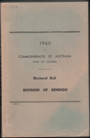
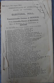
Voting registers, or electoral rolls, are a census of those who were eligible to vote. They are valuable because a country-wide census was not taken until 1911. Early electoral rolls give an individual name, residence, status of property occupation/ownership, and the rate value of the property. Electoral Rolls are arranged by electoral district and subdistrict. Name, Address, Occupation and gender for thirteen subdivisions. Electoral rolls were published by each state during election years.Electoral Roll for the Commonwealth Division of Bendigo, State Assembly District of Bendigo, and State Electoral Province of Bendigo for 1960 (made up to 23rd September 1960). Includes Name, Address, Occupation and gender for thirteen subdivisions. Assembled and bound with string, with a faded light green card cover..electoral rolls, voting in bendigo -
 Bendigo Historical Society Inc.
Administrative record - Electoral Roll, 1915
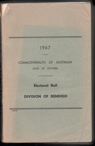
Electoral Roll for the Commonwealth Division of Bendigo, State Assembly District of Bendigo, and State Electoral Province of Bendigo for 1967 (made up to 22nd June 1967). Voting registers, or electoral rolls, are a census of those who were eligible to vote. They are valuable because a country-wide census was not taken until 1911. Early electoral rolls give an individual name, residence, status of property occupation/ownership, and the rate value of the property. Electoral Rolls are arranged by electoral district and subdistrict. Name, Address, Occupation and gender for thirteen subdivisions. Electoral rolls were published by each state during election years. Electoral Roll for the Commonwealth Division of Bendigo, State Assembly District of Bendigo, and State Electoral Province of Bendigo for 1967 (made up to 22nd June 1967). Includes Name, Address, Occupation and gender for thirteen subdivisions. Assembled and bound with string, with a faded light green card cover..electoral rolls, voting in bendigo -
 Bendigo Historical Society Inc.
Administrative record - Electoral Roll, 1915
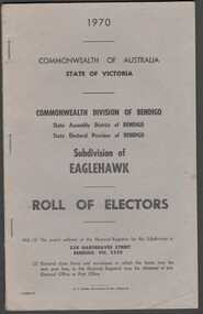
Electoral Roll for the Commonwealth Division of Bendigo, State Assembly District of Bendigo, and State Electoral Province of Bendigo Subdivision of Eaglehawk for 1970 (made up to 2nd January 1970). Voting registers, or electoral rolls, are a census of those who were eligible to vote. They are valuable because a country-wide census was not taken until 1911. Early electoral rolls give an individual name, residence, status of property occupation/ownership, and the rate value of the property. Electoral Rolls are arranged by electoral district and subdistrict. Name, Address, Occupation and gender for thirteen subdivisions. Electoral rolls were published by each state during election years. Electoral Roll for the Commonwealth Division of Bendigo, State Assembly District of Bendigo, and State Electoral Province of Bendigo, Subdivision of Eaglehawk for 1970 (made up to 2nd January 1970). Includes Name, Address, Occupation and gender for thirteen subdivisions. Assembled and bound with staples, with a light grey card cover..electoral rolls, voting in bendigo -
 Bendigo Historical Society Inc.
Administrative record - Electoral Roll, 1915
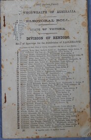
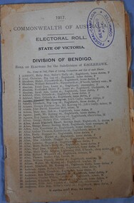
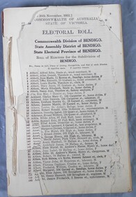
Voting registers, or electoral rolls, are a census of those who were eligible to vote. They are valuable because a country-wide census wasn't taken until 1911. Early electoral rolls give an individual’s name, residence, status of property occupation/ownership, and the nature of the rateable property. Electoral rolls are arranged by electoral district and subdistrict. Electoral rolls were published by each state during election years.Commonwealth of Australia Electoral Roll, State of Victoria, Division of Bendigo, 1915 (Second Print). Roll of electors for the Sub Division of Eaglehawk. Includes Name, Address, Occupation and gender. Assembled and fastened with two large staples.electoral rolls, voting in bendigo -
 Bendigo Historical Society Inc.
Administrative record - Electoral Roll, 1915
Voting registers, or electoral rolls, are a census of those who were eligible to vote. They are valuable because a country-wide census wasn't taken until 1911. Early electoral rolls give an individual’s name, residence, status of property occupation/ownership, and the rate value of the property. Electoral rolls are arranged by electoral district and subdistrict. Electoral rolls were published by each state during election years.Commonwealth of Australia Electoral Roll, State of Victoria, Division of Bendigo, 1917. Roll of electors for the Sub Division of Eaglehawk. Includes Name, Address, Occupation and gender. Assembled and fastened with two large staples.electoral rolls, voting in bendigo -
 Bendigo Historical Society Inc.
Administrative record - Electoral Roll, 1915
Voting registers, or electoral rolls, are a census of those who were eligible to vote. They are valuable because a country-wide census wasn't taken until 1911. Early electoral rolls give an individual’s name, residence, status of property occupation/ownership, and the rate value of the property. Electoral rolls are arranged by electoral district and subdistrict. Electoral rolls were published by each state during election years.. Commonwealth of Australia Electoral Roll, State of Victoria, Division of Bendigo, 1941. Roll of electors for the Commonwealth Division of Bendigo, State Assembly of Bendigo and Roll of electors for the Subdivision of Bendigo. Includes Name, Address, Occupation and gender. Assembled and fastened with string.electoral rolls, voting in bendigo -
 Bendigo Historical Society Inc.
Administrative record - Electoral Roll, 1915
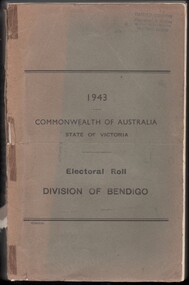
Voting registers, or electoral rolls, are a census of those who were eligible to vote. They are valuable because a country-wide census wasn't taken until 1911. Early electoral rolls give an individual’s name, residence, status of property occupation/ownership, and the rate value of the property. Electoral rolls are arranged by electoral district and subdistrict. Electoral rolls were published by each state during election years... Commonwealth of Australia Electoral Roll, State of Victoria, Division of Bendigo, 1943 (made up to December 1942). Roll of electors for the Commonwealth Division of Bendigo, State Assembly of Bendigo and Roll of electors for the Subdivision of Bendigo. Includes Name, Address, Occupation and gender. Assembled and bound with string.Stamp of owner Harold Curnowelectoral rolls, voting in bendigo -
 Bendigo Historical Society Inc.
Administrative record - Electoral Roll, 1915
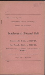
Voting registers, or electoral rolls, are a census of those who were eligible to vote. They are valuable because a country-wide census was not taken until 1911. Early electoral rolls give an individual’s name, residence, status of property occupation/ownership, and the rate value of the property. Electoral rolls are arranged by electoral district and subdistrict. Electoral rolls were published by each state during election years...Supplemental Electoral Roll for the Commonwealth Division of Australia Electoral Roll, State Assembly District of Bendigo, and Supplementary Roll of Electors for the Subdivision of Bendigo, 1943 (made up to May 1943). Includes Name, Address, Occupation and gender. Assembled and bound with string.Stamp of owner Harold Curnowelectoral rolls, voting in bendigo -
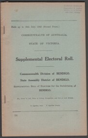 Bendigo Historical Society Inc.
Administrative record - Electoral Roll, 1915
Voting registers, or electoral rolls, are a census of those who were eligible to vote. They are valuable because a country-wide census was not taken until 1911. Early electoral rolls give an individual’s name, residence, status of property occupation/ownership, and the rate value of the property. Electoral rolls are arranged by electoral district and subdistrict. Electoral rolls were published by each state during election years. Supplemental Electoral Roll for the Commonwealth Division of Australia Electoral Roll, State Assembly District of Bendigo, and Supplementary Roll of Electors for the Subdivision of Bendigo, 1943 (made up to July1943). Includes Name, Address, Occupation and gender. Assembled and bound with string.Stamp of owner Harold Curnowelectoral rolls, voting in bendigo -
 Bendigo Historical Society Inc.
Administrative record - Electoral Roll, 1915
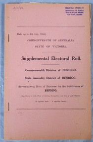
Voting registers, or electoral rolls, are a census of those who were eligible to vote. They are valuable because a country-wide census was not taken until 1911. Early electoral rolls give an individual’s name, residence, status of property occupation/ownership, and the rate value of the property. Electoral rolls are arranged by electoral district and subdistrict. Electoral rolls were published by each state during election years.. Supplemental Electoral Roll for the Commonwealth Division of Australia Electoral Roll, State Assembly District of Bendigo, and Supplementary Roll of Electors for the Subdivision of Bendigo, 1944 (made up to July 1944). Includes Name, Address, Occupation and gender. Assembled and bound with staples, pink cover.Stamp of owner Harold Curnowelectoral rolls, voting in bendigo -
 Bendigo Historical Society Inc.
Administrative record - Electoral Roll, 1915
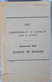
Voting registers, or electoral rolls, are a census of those who were eligible to vote. They are valuable because a country-wide census was not taken until 1911. Early electoral rolls give an individual name, residence, status of property occupation/ownership, and the rate value of the property. Electoral rolls are arranged by electoral district and subdistrict. Electoral rolls were published by each state during election years... Supplemental Electoral Roll for the Commonwealth Division of Australia Electoral Roll, State Assembly District of Bendigo, and Supplementary Roll of Electors for the Subdivision of Bendigo, 1947. Includes Name, Address, Occupation and gender. Assembled and bound with staples, grey/brown cover.Stamp of owner Harold Curnowelectoral rolls, voting in bendigo -
 Bendigo Historical Society Inc.
Administrative record - Electoral Roll, 1915
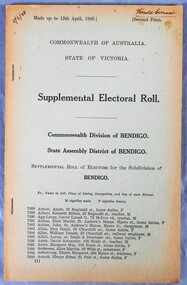
Voting registers, or electoral rolls, are a census of those who were eligible to vote. They are valuable because a country-wide census was not taken until 1911. Early electoral rolls give an individual name, residence, status of property occupation/ownership, and the rate value of the property. Electoral rolls are arranged by electoral district and subdistrict. Electoral rolls were published by each state during election years. Supplemental Electoral Roll for the Commonwealth Division of Australia Electoral Roll, State Assembly District of Bendigo, and Supplementary Roll of Electors for the Subdivision of Bendigo, 1948. Includes Name, Address, Occupation and gender. Assembled and bound with staples, faded green cover.Harold Curnow on front coverelectoral rolls, voting in bendigo -
 Bendigo Historical Society Inc.
Administrative record - Electoral Roll, 1915
Voting registers, or electoral rolls, are a census of those who were eligible to vote. They are valuable because a country-wide census was not taken until 1911. Early electoral rolls give an individual name, residence, status of property occupation/ownership, and the rate value of the property. Electoral rolls are arranged by electoral district and subdistrict. Electoral rolls were published by each state during election years..Electoral Roll for the Commonwealth Division of Bendigo, State Assembly District of Bendigo, and State Electoral Province of Bendigo for 1948 (made up to November 1951). Includes Name, Address, Occupation and gender. Assembled and bound with string, no cover.electoral rolls, voting in bendigo