Showing 1700 items matching "maps and documents"
-
 Bendigo Historical Society Inc.
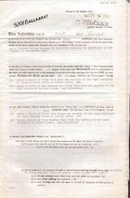
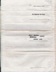
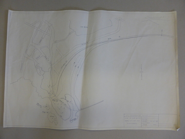
Document - MCCOLL, RANKIN AND STANISTREET COLLECTION: INDENTURE GOLD MINING LEASE 9201 BALLAARAT
6 page document plus map: indenture, gold mining lease dated 9th August 1960, between the Crown and North Deborah Mining Company, carrying on operations in the Parish of Moorarbool West . Key on map indicates depth to which land may be excised. On map: Mining District of Ballarat, County of Grant, Parish of Moorarbool West. Total area: 285 acres 1 rood, 20 perches. Vol 334, Fol 202.bendigo, mining, deborah gold mines -
 Bendigo Military Museum
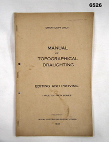
Document - Royal Australian Survey Corps - Manual of Topographical Draughting - Editing and Proving 1949, Royal Australian Survey Corps, 1949
This Draft document is part of the Topographical Drafting Manual produced by the Royal Australian Survey Corps in 1949. This document covers the guidelines for Editing and Proving (quality control) of the 1 Mile to 1 Inch map series that was widely produced by the Corps over Australia.A 10 x page foolscap sized buff coloured covered document, stapled and two hole punchedStamped on cover "E Comd Field Survey Unit"royal australian survey corps, rasvy, fortuna, army survey regiment, army svy regt, asr -
 Bendigo Historical Society Inc.
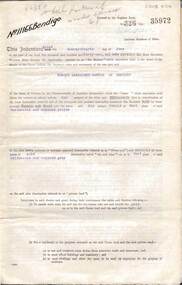
Document - MCCOLL, RANKIN AND STANISTREET COLLECTION: SOUTH DEBORAH GOLD MINES NL GOLD LEASE DOCUMENT, 14/1/1941
Document: McColl, Rankin and Stanistreet - South Deborah Gold Mines NL. Gold mining lease document. No. 11141, Vol. 325, Fol. 35893. Lease adjoins Railway Reserve, Breen Street. Attached to plan with pin piece of paper, written in pencil ' application Atherton 14/4/46 - consent refused - hand drawn map with Honeybone Street.organization, mining, south deborah gold mines nl, mccoll, rankin and stanistreet, south deborah gold mines nl, gold mining lease documents -
 Bendigo Historical Society Inc.
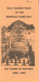
Document - BENDIGO CEMETERIES COLLECTION: SELF GUIDED TOUR BENDIGO CEMETERY DOCUMENT
BHS CollectionYellow trifold document: Self Guided tour of the Bendigo Cemetery, 145 Years of History 1858 - 1993. Document contains a map of a section of the Bendigo Cemetery, 29 graves are numbered and described. E.g. J.C.T. Ballerstedt, Quartz Reefer, Robert Clark 8 hour day pioneer, Giuseppe Favaloro restaurateur. Hitching rail outside cemetery gates is noted.bendigo, cemetery, bendigo cemetery tour -
 Ballarat Tramway Museum
Document, "The Geelong Tramways, A Brief History", late 1950s
... maps ...Document titled "The Geelong Tramways, A Brief History" - by an unknown author, though the map is similar to the one provided in item 9810, in a paper published by the Geelong Historical Society, Investigator magazine, written by John Moore. The article or document looks at the early development of Geelong trams, the start of services, services and operations during the twenties, and thirties, and closure. Notes the appeal by the Barwon Apex Club for the display of a bogie tram. Has a diagrammatic map of the Geelong system on the last page.Yields information about Geelong tramway history and fund raising for the preservation of a bogie tram.Document - 7 quarto pages, stapled in the top left hand corner.tramways, geelong, maps, history, apex club -
 Bendigo Historical Society Inc.
Document - MCCOLL, RANKIN AND STANISTREET COLLECTION: INDENTURE, GOLD MINING LEASE CROWN AND RONALD ALEXANDER RANKIN, BENDIGO, 24th June 1941
6 page document, Gold Mining Lease 11166, plus map. Indenture between Crown (King George VI) and Ronald Alexander Rankin of Bendigo, dated 24th June, 1941. Map No. 11166 Bendigo, Mining District of Bendigo, Parish of Sandhurst, County of Bendigo. Map shows lease 11166 marked in yellow with shaft, ore bins and tramway marked. Belle Vue Road , Adam Street and Griston Street shown on map. ( Golden Gully area) Dams indicated on lease holdings. Other lease holdings: 1675 T.L.9858, 10990, 11013, 11062, 11165, 11063 (void) 1172 W.R. (dam thereon) 9882 (void). Some residential lots marked along Belle Vue Road, and Adam Street. On bottom of map 21.8.41 in pencil. On last page of document : North Deborah Mining Company now the proprietor of the within described estate by transfer registered on 11th November 1914.bendigo, mining, north deborah lease, belle vue road, adams street, griston street, golden gully, ronald alexander rankin, north deborah mine. -
 Bendigo Historical Society Inc.
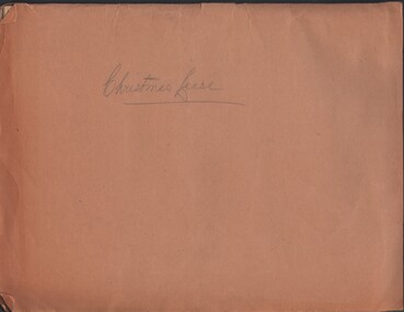
Document - MCCOLL, RANKIN AND STANISTREET COLLECTION: CHRISTMAS LEASE DOCUMENTS, 1941
Documents: folder contains - 'Consent to the Inclusion of Certain Lands in a Mining Lease', forms for Lease No. 11106, Map of No. 11106, List of land owners re: Lease 11106, Blank consent forms, Lease 11106 was below the 400foot level.MCCOLL RANKIN AND STANSISTREETorganization, business, gold mining, mccoll rankin and stansistreet, christmas gold mine. -
 Bendigo Historical Society Inc.
Document - MCCOLL, RANKIN AND STANISTREET COLLECTION: NORTH VIRGINIA GMC N L - TITLE DEED, 22/8/1950
Document. Coarse cream coloured paper typed but with hand written dates. Assistant Registrar of Titles. Made out to North Virginia Gold Mining Co. Has 2 maps. No 11261 Bendigo. Vol 331 Fol 36452McColl, Rankin & Stanistreetorganization, business, north virginia gmc n l, mccoll, rankin & stanistreet, north virginia gmc n l, gold mining, title deed -
 Clunes Museum
Map - MAPS/ DOCUMENTS, CIRCA 1857
COLLECTION OF DOCUMENTS (COPIES OF10 MAPS AND DIAGRAMS OF TOURAAL PURCHASED UNDER PREEMPTIVE RIGHT BY DONALD CAMEROM 17TH FEBRUARY, 1857. COUNTY OF TALBOT - GOLDFIELD'S SURVEY PLAN NO.1 CLUNES COUNTY OF TALBOT. GLENDONALD - CRESWICK/CLUNES.local history, mining -
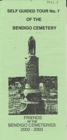 Bendigo Historical Society Inc.
Document - BENDIGO CEMETERIES COLLECTION: SELF GUIDED TOUR NO. 7 DOCUMENT
BHS CollectionGreen trifold document: Self Guided Tour No. 7 of the Bendigo Cemetery, friends of the Bendigo Cemeteries 2002 - 2003. Theme is tombstones erected not by family but by public subscriptions or through societies. Numbered map showing described grave sites.Friends of Bendigo Cemeteries 2002bendigo, cemetery, bendigo cemetery tour -
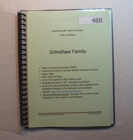 Greensborough Historical Society
Folder, Grimshaw Family, 1849o
Passenger indexes; maps; mortgage document 1873 Grimshaw and Britnell; history of Aaron and Joshua Grimshaw; Greensborough murder: transcript of the trial of Josiah Grimshaw for the murder of John Mitchell.History of the origins of this Greensborough family.20-page plastic binder, spiral bound, clear cover. Contains documents relating to the Grimshaw family.Collected by Greensborough Historical Society. Folder commenced 2012.grimshaw family -
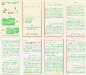 Melbourne Tram Museum
Pamphlet, Melbourne & Metropolitan Tramways Board (MMTB), "Short Trips around Melbourne and Suburbs by Bus and Tram", mid 1960's
Pamphlet titled "Short Trips around Melbourne and Suburbs by Bus and Tram", two colour printed document folded into 8 on buff coloured paper, featuring 14 various trips around Melbourne, with a detailed description of each route, time, fare and notes. On reverse side is a detailed map of the MMTB tram and bus routes - from map date document mid to late 1960's - old route numbers eg 4D and Point Ormond and Footscray have closed. See also Reg Item 1508 for an earlier version.trams, tramways, mmtb, map, tourist trips, fares, routes -
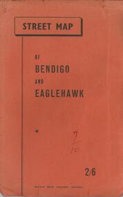 Bendigo Historical Society Inc.
Document - BENDIGO TOURISM BROCHURES COLLECTION: MAP OF BENDIGO AND EAGLEHAWK
Document. Orange covered booklet containing fold-out Street Map of Bendigo and Eaglehawk. Four page index of street names pasted inside back cover. Printed on front cover 2/6, ''Bolton Bros. Printers- Bendigo.document, memo, bendigo tourism brochures -
 Bendigo Historical Society Inc.
Document - MCCOLL, RANKIN AND STANISTREET COLLECTION: CENTRAL NELL GWYNNE, March - April 1943
Document. Manila folder & 4 letters, 1 map The 4 letters pertain to an application by the Commonwealth of Australia to the lands Depart. For sale of an area of 8 acres 0 roods 31 perches now comprising the garden of Fortuna to unlimited depth.McColl, Rankin & Stanistreetorganization, business, central nell gwynne, mccoll, rankin & stanistreet, central nell gwynne gmc, south nell gwynne, gold mining, dept of mines -
 Bendigo Historical Society Inc.
Document - BENDIGO EASTER FAIR COLLECTION: BENDIGO EASTER FAIR PROCESSION SCHEDULE AND RULES
Three pages document titled: Bendigo Easter Fair Society Easter Fair Processions detailing the schedule of event for Easter Saturday, Easter Monday and Easter Tuesday. The procession rules on the second page and map of the procession route on the third page.event, easter fair, bendigo easter fair -
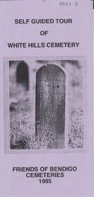 Bendigo Historical Society Inc.
Document - BENDIGO CEMETERIES COLLECTION: SELF GUIDED TOUR WHITE HILLS CEMETERY DOCUMENT
BHS CollectionLilac coloured trifold document: Self guided tour of White Hills Cemetery, Friends of Bendigo Cemeteries 1995. Map with numbered grave sites e.g. Large Jewish section with over 80 known burials. Graves of Afghan traders,Friends of Bendigo Cemeteries, 1995bendigo, cemetery, white hills cemetery tour -
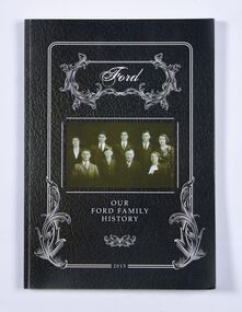 Ballan Shire Historical Society
Book - Book, Ford - Our Ford Family History, 2015
A history of the Ford Family and descendants, pioneer settlers of the Morrisons/Meredith area in Victoria. Contains photographs, family trees, documents, newspaper cuttings, maps, narratives etc. Black and white only.This book is significant in that it contains valuable historic information on the Ford and Brawn families. The publication is private and intended for the information and interest of family members and others researching the family.Book, soft cover, perfect bound, with a leather look cover and a photograph of family members with a scrollwork surround.ford, brawn, bant -
 Bendigo Military Museum
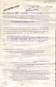
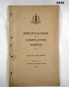
Document - Australian Survey Corps - Specifications of Compilation Sheets 1 Mile to 1 Inch Series 1948, Army Survey Corps, 1948
This document is the Australian Survey Corps - Specifications of Compilation Sheets 1 Mile to 1 Inch Series published in 1948. This map series was widely produced by the Australian Survey Corps across Australia.A foolscap sized 7 x page buff coloured card covered document, stapled and two holed punched. Cover has Australian Survey Corps badge and text.royal australian survey corps, rasvy, fortuna, army survey regiment, army svy regt, asr -
 Bendigo Historical Society Inc.
Document - ALBERT RICHARDSON COLLECTION: NEW RED, WHITE AND BLUE CONSOLIDATED MINE, GOLDEN SQUARE
Two-page document plus map showing location of the New Red, White and Blue Consolidated mine on the Sheepshead Line of Reef. Information on the mine is given in the following areas: location plant, early history, its role as a leading mine, its prominence, its closure, gold production. References are provided. Document forms part of research referred to in Albert Richardson's paper 2264.70.bendigo, mining, new red white and blue mine -
 Bacchus Marsh & District Historical Society
Map, Plan of Survey of Part of Crown Allotment 9, Parish of Korkuperrimul, 1890
This map documents a transfer of an allotment of land in Clarke Street Bacchus Marsh in 1890. Clarke Street is located on the eastern side of Bacchus Marsh not far from Main Street and Crook Street. It is now known as Candeloro Street. The map indicates J. Booth as the owner of the land and H. Simpson as the occupier. Next to this allotment is a an allotment of land owned by J. Elmore,Single page map showing Crown allotment 9, Parish of Korkuperrimul, County of Bourke. Scale 100 feet to inch. Part of a set of maps which are pasted into a bound volume containing 76 maps or plans in total. High resolution digital image stored on BMDHS computer network. At bottom of map: I hereby certify that I have made this survey expressly for the purpose of an application under the Transfer of Land Statute that this plan is correct. Barry B???, Lic. Surveyor, 16.10.90bacchus marsh victoria maps, clarke street bacchus marsh maps -
 Orbost & District Historical Society
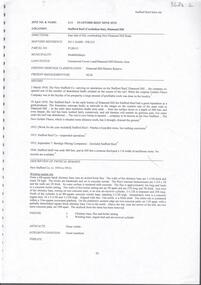
book / document, Far East Gippsland Tourism Strategy Oct 1987, October 1987
The project team for this document comprised E. Beacham, T. Claridge, B. Ebbs, C. Wilso. and J. Cristofaro.This booklet is a useful refernce tool.A document of 86 pp, titled Far East Gippsland Tourism Strategy Study Interim Report October 1987. it has a cream cover and black binding with a b/w photograph of four people in a bushland setting. It contains fold-out maps.tourism-east-gippsland -
 Bendigo Historical Society Inc.
Document - STAFFORD REEF MINE SITE, DIAMOND HILL
One page document describing the Stafford Reef Mine Site, Diamond Hill, Site 4.11, prepared by David Bannear. Information includes the map/grid references of the site and an overview of the history of the Stafford Reef Mine. The physical remains of the mine are described..bendigo, mining, stafford reef mine -
 Bendigo Historical Society Inc.
Document - MCCOLL, RANKIN AND STANISTREET COLLECTION: GOLDEN CARSHALTON NO LIABILITY, 1949
Documents: Gold Mining Lease No. 11257 FOL.36397 Bendigo 16/8/1949. Golden Carshalton N\L Map of Bendigo Sandhurst Lease No 11257 showing the Carshalton Mines Ltd New Main Shaft, Hansel Mundy Shaft.MCCOLL RANKIN AND STANSISTREETorganization, business, gold mining - legal, mccoll rankin and stansistreet. golden carshalton n\l. mundy shaft. -
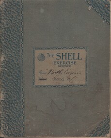 Bendigo Historical Society Inc.
Document - MCCOLL, RANKIN AND STANISTREET COLLECTION: NORTH VIRGINIA GMC N L - CROSS SECTION PLAN OF THE MINE, 1942 1947
Document. Grey/green exercise book with 'North Virginia GMC NL. Book contains hand drawings of shafts and their metalurgical content at every depth. Symbols have been used to indicate different metals and earth. 2 maps loose in the book.McColl, Rankin & Stanistreetorganization, business, north virginia gmc n l, mccoll, rankin & stanistreet, north virginia gmc n l, gold mining, cross section plan of the north virginia -
 Bendigo Historical Society Inc.
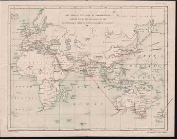
Document - KELLY AND ALLSOP COLLECTION: MAP OF P & O SHIPPING ROUTES
Document. KELLY & ALLSOP COLLECTION. Map of Europe, Africa and Asia showing the shipping routes of the Peninsular & Oriental Steam Navigation Co. Routes highlighted in red. Produced by Nissen & Arnold, Fenchurch St., London. Date estimated as early 20th century.Nissen & Arnoldbusiness, stockbroker, kelly & allsop, kelly & allsop collection, p & o map, shipping routes, nissen & arnold. -
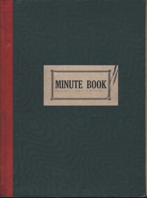 Bendigo Historical Society Inc.
Document - MCCOLL, RANKIN AND STANISTREET COLLECTION: FORBES CARSHALTON GMC N/L - MINUTE BOOK, 1939 - 1947
Document. Minute book. Dark green cover with red binding. Label minute book white black lettering Dated October 1939 - August 1947. Written and typed letters (receipts) in rear. Map of Forbes Carshalton shaft inside cover.McColl, Rankin & Stanistreetorganization, business, forbes carshalton gmc n/ll, mccoll, rankin & stanistreet, forbes carshalton gmc n/l, gold mining, minutes -
 Warrnambool and District Historical Society Inc.
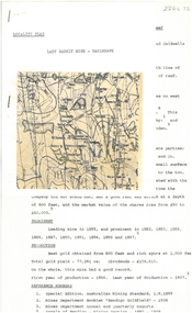
Map, Soil conservation authority:plan of high water marks at Lady Bay Warrnambool, 1984
This map documents the changing state of Lady Bay from around 1870 until 1976. It depicts the changing high water mark over that period and the main outlet of the Merri River in 1872 and 1976.This map provides a useful and significant insight into the ever changing face of Lady Bay from the 1870’s through to 1980’s. Cream paper map drawn with black ink showing Lady Bay and South Warrnambool section of Warrnambool. In lower RH corner Soil conservation AuthorityPlan of High water marks at Lady Bay Warrnambool. Drawn P.D. 19.1/84. Scale 1:3600. Written on back in black pencil: Lady Bay Historical HWM lady bay map, merri river 1872- 1976, merri river 1872- 1976, history of warrnambool -
 Ballarat Tramway Museum
Document - Guide Book/notes, Tramway Museum Society of Victoria (TMSV), "Guide for Delegates interested in trams", 1970
Demonstrates notes prepared by the TMSV for tours of the Ballarat and Melbourne systems and the nature of the notes.Five page spirit duplicated notes to act as a guide to visitors to the International Convention of Railway Modellers, Melb. 1970. Index, history of TMSV, map of Malvern depot, model trams, exhibition notes, place of Melb. Tram interest, notes and map on Ballaarat. Missing is pages 6, 7, and 8 - noted in index on page 1. Pdf image of document added 31/10/2013.trams, tramways, melbourne, ballarat, tmsv, model tramways -
 Melbourne Tram Museum
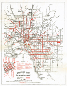
Map, Melbourne & Metropolitan Tramways Board (MMTB), "Tramway Map of Melbourne and Suburbs", c1939
Folded map (4 x 2) by Melbourne and Metropolitan Tramways Board, c1939, of Melbourne tramways, showing tram routes (cable, electric and VR), bus routes, railway lines, major points of interest and major streets. No printing or information on the rear. Once part of another document with remnants of glue on the rear top left hand edge. See Reg Item 801 for a 1927c map.trams, tramways, map, mmtb, vr, cable trams -
 Bendigo Historical Society Inc.
Document - MCCOLL, RANKIN AND STANISTREET COLLECTION COLLECTION: CENTRAL NAPOLEON GOLD MINING CO. N.L, 30th October 1939
Document: Gold Mining Lease crown Land No 11016 Bendigo, Entered in the register book Vol. 324 fol. 35754, Embossed seals of Central Napoleon Gold Mining Co N.L. and Kin g George VI, Map: Mining District of Bendigo, County of Bendigo, Parish of Sandhurst, located at Harvey & Inglis Streets, During the reign of King George VI (document orignally had Edward VIII).organization, business, industry - mining, mccoll rankin & stanistreet, mining, gold mining, central napoleon