Showing 67509 items
matching shire-of-orbost
-
 Orbost & District Historical Society
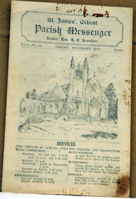
newsletter, St James, Orbost Parish Messenger November, 1933, November 1933
St. James' Anglican Church, Orbost, was conceived and built as a memorial to the men 'who served and suffered during the Great War' as noted on the foundation stone. The Right Reverend GH Cranswick, DD, Bishop of Gippsland, laid the stone on 1 October 1927. This parish newsletter was published regularly to inform church members of all the latest news, events and information.For many years the Anglican people of Orbost have enjoyed the fellowship of the church and the children, in particular, were socially and spiritually involved. This item is reminiscent of the first half of the 20th century when church-going was more common.A four page newsletter titled, Parish Messenger for Orbost, November 1933, Vol 6 -No 83. It lists the services, times, meetings and news. The rector at the time was Rev. K.E. Hamilton.st-james-anglican-church church newsletter -
 Orbost & District Historical Society
book, Match Record Book, 13.1.1965 - 12.5. 1973
The Orbost Rifle Club existed in the early 20th century. (There are records from 1900). It folded in the late 1970's.Target shooting is one of the oldest organised sports in Australia. Records date back to the British Marines at Sydney Cove in 1788. The Victorian Rifle Association (VRA) was formed in 1860. One of the most important adjuncts to the militia system from 1903 to the re-organisation of 1912 was the role played by the Rifle Club movement in Australia. At the time, these clubs were seen as the reservoir of manpower for a potential guerrilla force should any invasion occur. For Australia, the invasion fear was uppermost in the minds of the population. So important were the rifle clubs for the defence of Australia that the Commonwealth provided the training staff, rifles and ammunition so the clubs could function. Members were drilled, wore uniforms and practised all the basic skills of soldiering as well as target shooting. The Orbost Rifle Club was active during this period A grey cardboard covered book with a red spine. It contains hand-written match records of the members of the Orbost Rifle Club.records orbost-rifle-club shooting -
 Tarnagulla History Archive
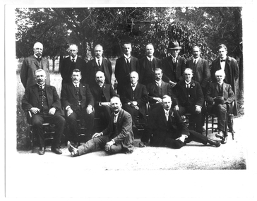
Photograph of group of men, probably Shire of Bet Bet Council, circa 1920s, circa 1920s
... Photograph of group of men, probably Shire of Bet Bet...Shire of Bet Bet, Victoria, Australia ...Murray Comrie Collection. This photograph taken after the amalgamation with the Borough of Tarnagulla Council in 1915. Middle row, fourth from left is Walter (Wattie) Corrie, the Tarnagulla Baker, fourth from left is James Duggan, Tarnagulla Agent. Shire of Bet Bet Proclaimed Sept 20, 1864 Re-defined Feb 10, 1891 Tarnagulla Borough united Oct 1915 Dunolly Borough united Nov 1, 1921 Re subdivision from 5 to 3 ridings Oct 1952Monochrome photograph of a group of men assembled in rows for a photograph. No caption or explanation accompanies photograph. Probably depicts members of the Shire of Bet Bet Council in the 1920s. Location and names unknown. Walter Martin is sitting in the middle of the middle row. He was the Tarnagulla baker at the time of the photo. To the right of him in the photo is James Duggan, Tarnagulla dealer and agent. tarnagulla, council, bet bet shire, local government, councillors, mayor, shire -
 Orbost & District Historical Society
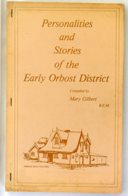
books, Gilbert, Mary, Personalities and Stories of the Early Orbost District, 1981?
... Personalities and Stories of the Early Orbost District ...This is the second edition of "Personalities and Stories of Early Orbost which was collected and compiled by Mary Isabelle Gilbert. Mary Isabelle Gilbert was born in 1905 in Orbost, Australia. She was born to John Gilbert and Annie Cameron Gilbert, and had seven sisters and one brother. Four siblings died at a young age. .She was a teacher historian loved and respected by her family and the wider community.This is a useful research tool on the history of Orbost.Two copies of a 141 pp soft covered book titled "Personalities and Stories of the Early Orbost District". It has a light brown cover and is stapled. On the front cover below the title is a sketch of the Orbost Bean Factory in dark brown print. It contains personal reminiscences of early Orbost. There are also some b/w photographs and sketches.2267.1 - "Len and Mary Best Wishes Mary Gilbert" hand-written in blue pen. 2267.2 - in pencil on front cover "Ron Cameron".history-orbost gilbert-mary book-personalities-and-stories-of-early-orbost -
 Lakes Entrance Historical Society
Book, Mc Lennan Jennifer A, The Memorial Church of St James Orbost A History, 1981
... The Memorial Church of St James Orbost A History ...A history of St James Anglican Church Orbost Victoria from the beginnings in 1884 until 1981. Reference is made to early families, serving priests and church members and Organisations. Illustrated with photographs.religion, settlers -
Southern Sherbrooke Historical Society Inc.
Newsletter, "Shire of Yarra Ranges Community Bulletin", June 1999 (exact)
... "Shire of Yarra Ranges Community Bulletin"...Shire of Yarra Ranges, Victoria, Australia ...Free newsletter distributed to residents of the Shire of Yarra Ranges, detailing activities, etc.shire of yarra ranges -
 Eltham District Historical Society Inc
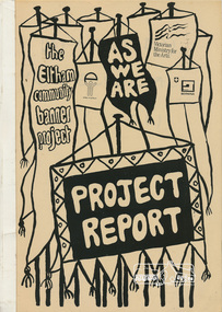
Book, Jacky Talbot, The banner habits of the Eltham tribes : Eltham Shire "as we are" Community Banner Project report / by Jacky Talbot, 1987
... The banner habits of the Eltham tribes : Eltham Shire "as...Victoria. Ministry of the Arts. ...Also titled: Eltham Shire "As We Are"The 'As We Are' Community Banner Project was the first major Community Arts project initiated and co-ordinated through the resources of the Shire of Eltham. It was originally conceived and inspired by a local textile artist, Tracey Naughton, who, together with the Community Services Manager of this local government council, made the idea a very concrete and flourishing reality. As the following report reveals, the project grew from the original fourteen or so intending participant groups to fifty-seven banners; expressions of those diverse groups' interests and identities. As a first major project it was rightly felt by Tracey Naughton, who became the Shire's first Community Arts Officer in March 1985, that it should be fully documented, so that an appraisal of the extensive growth of this community arts development process could be assessed. Given the time and money available to do this the writer, Jacky Talbot, and her advisors, decided it was appropriate to select fifteen or twenty banners for detailed analysis. This was done by taping interviews with members of the chosen groups. The groups were chosen to cover all ages participating, from the toddlers in the Playhouse to our grand elder citizens in their Nursing Horne, and to cover a wide range of different types of groups - schools, scouts, churches, youth issue based, and the numerous women's groups of various combinations, localities and concerns. ·. Some groups who presented their banners for the culminating highlight of this project - the Exhibition, held at the Eltham Community Centre on October 9th, 1986, had no contact with the Shire or project co-ordinator, but heard about the project through the local news' networks or other participants. The extent of community participation was enormous. It involved hundreds and hundreds of people. It changed some people's lives, enlivened others. As a first step on a new road its success is notable. The 'As We Are' Community Banner Project took place in the Shire of Eltham and neighbouring environs for approximately 12 months, from October 1985. Paperback; 68, [10] leaves : ill. ; 30 cm. Two copiesflags, emblems, banners, eltham, shire of eltham, community -
 Greensborough Historical Society
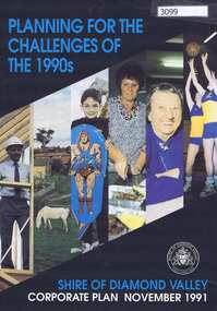
Pamphlet, Planning for the challenges of the 1990s: Shire of Diamond Valley Corporate Plan, 1991_11
... Planning for the challenges of the 1990s: Shire of Diamond...Shire of Diamond Valley ...Shire of Diamond Valley Corporate Plan 1991. Includes Shire map and statistics with plans for services to the community.16p. text and coloured photographsshire of diamond valley -
 Orbost & District Historical Society
ledger book, 7.7.1968 - November 1973
Orbost Aero Club began in 1969 with Basil Dowie as Chair, David Nixon as Secretary/Treasurer. The group went into recess from 1977-1991 closing in 1997. The mid 1960s were boom years in flying training in Australia and the number of Aero Clubs grew rapidly. The Club played a significant role in the establishment of the small airport at Marlo and in the ongoing operation and development of the airport over the years particularly for patient transfer by aerial ambulance. The Orbost Aero Club Club played a significant role in the establishment of the small airport at Marlo and in the ongoing operation and development of the airport over the years.A brown covered ledger book used by the Orbost Aero Club. The book is a Collins' Analysis Book 6' Series. It contains hand-written records of monies received from membership of the Orbost Aero Club.Stamped with Marlo Flying Cluborbost-aero-club -
 Greensborough Historical Society
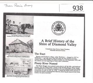
Article, Shire of Diamond Valley, A brief history of the Shire of Diamond Valley by Irene Turvey, 1837o
... A brief history of the Shire of Diamond Valley by Irene...Shire of Diamond Valley ...This brief history discusses the Shire of Diamond Valley. The Shire of Diamond Valley was a Local Government Area located about 20 kilometres northeast of Melbourne. The shire covered an area of 74.38 square kilometres and existed from 1964 until 1994.This article includes some images of early building in the Shire of Diamond Valley.Photocopied article. 4 pages text and illus.On front page "from Rosie Bray"shire of diamond valley, irene turvey -
 Eltham District Historical Society Inc
Document, Carlotta Kellaway, Shire of Eltham Heritage Study 1992 Volume 2 (draft): Background History - Themes identified by this study, Bibliography (pages 201-289), 1992
... Shire of Eltham Heritage Study 1992 Volume 2 (draft...Shire of Eltham / Nillumbik Shire Council ...Shire of Eltham Heritage Study 1992 prepared by David Bick and Carlotta Kellaway; Garden Evaluation by John Patrick and Planting Evaluation by Ken Wallace Volume One: Recommendations, Conservation Areas, Identified Places Volume Two: Environmental History and Bibliography Volume Three: Culturally Significant Themes and the Evaluations of the Individually Identified Places that Illustrate the ThemesProvides the foundation for future planning assessments in the Shire of Eltham.90 A4 pages (double sided), contyained in black PVC 2-ring binder.background history, carlotta kellaway, conservation areas, culturally significant themes, david bick, garden evaluation, heritage study, identified places, john patrick, ken wallace, planting evaluation, recommendations, shire of eltham heritage study -
 Eltham District Historical Society Inc
Document, Carlotta Kellaway, Shire of Eltham Heritage Study 1992 Volume 1: Recommendations Identified Places, 1992
... Shire of Eltham Heritage Study 1992 Volume 1...Shire of Eltham / Nillumbik Shire Council ...Shire of Eltham Heritage Study 1992 prepared by David Bick and Carlotta Kellaway; Garden Evaluation by John Patrick and Planting Evaluation by Ken Wallace Volume One: Recommendations, Conservation Areas, Identified Places Volume Two: Environmental History and Bibliography Volume Three: Culturally Significant Themes and the Evaluations of the Individually Identified Places that Illustrate the ThemesProvides the foundation for future planning assessments in the Shire of Eltham.167 A4 pages (double sided), spiral bound with clear pastic front cover and black card end cover.background history, carlotta kellaway, conservation areas, culturally significant themes, david bick, garden evaluation, heritage study, identified places, john patrick, ken wallace, planting evaluation, recommendations, shire of eltham heritage study -
 Eltham District Historical Society Inc
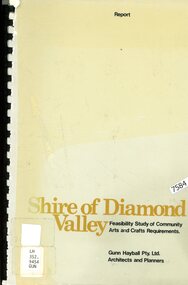
Book - Report, Gunn Hayball Pty Ltd Architects and Planners, Shire of Diamond Valley, Feasibility Study of Community Arts and Crafts Requirements, 1977
... Shire of Diamond Valley, Feasibility Study of Community...The Shire of Diamond Valley ...This report was prepared in response to a brief issued by the Shire of Diamond Valley to investigate the requirements for arts/crafts in the Shire and suggest options available in satisfying those requirements.Ex Yarra Plenty Regional Library - Local History, Dewey labels and catalogue stamp inside rear covershire of diamond valley, community arts and crafts, feasibility study -
 Greensborough Historical Society
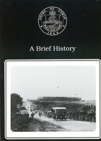
Booklet, Shire of Corio, A Brief history of the Shire of Corio, 1980s
... A Brief history of the Shire of Corio...Shire of Corio ...History of Shire of Corio, a local government area between Geelong and Werribee. The Shire included all of Geelong's northern suburbs and existed from 1861 to 1993.12 p., printed in green on white paper, photographs, stapled.geelong, shire of corio, werribee -
Clunes Museum
Document, TALBOT - CLUNES SHIRE, MUNICIPAL EMERGENCY MANAGEMENT PLAN - SHIRE OF TALBOT AND CLUNES (DRAFT)
... MUNICIPAL EMERGENCY MANAGEMENT PLAN - SHIRE OF TALBOT AND ...THIS PLAN HAS BEEN PREPARED AT THE DIRECTION OF THE COUNCIL OF THE SHIRE OF TALBOT & CLUNES...DOCUMENTS COLLATED IN A GREEN PLASTIC BINDER WITH A CLEAR PLASTIC COVER (UNDATED)non-fictionTHIS PLAN HAS BEEN PREPARED AT THE DIRECTION OF THE COUNCIL OF THE SHIRE OF TALBOT & CLUNES...local history, government, local government, council, essential services -
 Greensborough Historical Society
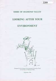
Booklet, Natural Environmental Protection Panel of the Shire of Diamond Valley, Looking after your environment, 1994_09
... Natural Environmental Protection Panel of the Shire of...Shire of Diamond Valley, Victoria, Australia ...This booklet outlines the advantages of using native plants in the garden and lists environmental groups and council services in the Shire of Diamond Valley.12 p. green text and line drawings on white paper.shire of diamond valley, native plants -
 Heidelberg Golf Club
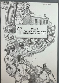
Book, Shire of Eltham, Draft conservation and heritage strategy of the Shire of Eltham, 1990c
... Draft conservation and heritage strategy of the Shire of...Shire of Eltham ...Draft conservation and heritage strategy of the Shire of Eltham.43 p., illus.Draft policy for discussioneltham, shire of eltham, conservation -
 Orbost & District Historical Society
accounts book, June 30 1956
The Orbost Rifle Club existed in the early 20th century. (There are records from 1900). It folded in the late 1970's.Target shooting is one of the oldest organised sports in Australia. Records date back to the British Marines at Sydney Cove in 1788. The Victorian Rifle Association (VRA) was formed in 1860. One of the most important adjuncts to the militia system from 1903 to the re-organisation of 1912 was the role played by the Rifle Club movement in Australia. At the time, these clubs were seen as the reservoir of manpower for a potential guerrilla force should any invasion occur. For Australia, the invasion fear was uppermost in the minds of the population. So important were the rifle clubs for the defence of Australia that the Commonwealth provided the training staff, rifles and ammunition so the clubs could function. Members were drilled, wore uniforms and practised all the basic skills of soldiering as well as target shooting. The Orbost Rifle Club was active during this period.A grey covered bookj with a light brown fabric spine. The front has a white sticker label with "Orbost Rifle Club" handwritten in ink. It contains accounts and a trophy list.orbost-rifle-club accounts-book -
 Eltham District Historical Society Inc
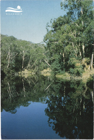
Postcard - Photograph, Shire of Nillumbik, Yarra River, southern boundary of the Shire of Nillumbik, c.2010
... Yarra River, southern boundary of the Shire of Nillumbik...Shire of Nillumbik ...Nillumbik Shire Council c.2010 Arts Environment Heritagepostcard, birrarung, shire of nillumbik, yarra river -
 Marysville & District Historical Society
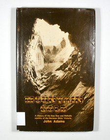
Book - Hardback book, Mountain Gold-A History of the Baw Baw and Walhalla country of the Narracan Shire, Victoria, 1980
... Mountain Gold-A History of the Baw Baw and Walhalla country...Shire of Narracan ...A history of the Baw Baw and Walhalla country of the Narracan Shire, VictoriaHardback. Brown dust cover. Photograph on front cover looks out from the entry of a mine onto the front of a building which has a hill to the side of it. The back cover has a photograph of the side of a hill with some trees on it.G&V THOMAS Stamp of the Marysville & District Historical Society Inc / P.O. Box 22 / Marysville 3779gold, gold field, gold miner, gold mining, gold town, walhalla, baw baw, gippsland, victoria, australia, history -
 Eltham District Historical Society Inc
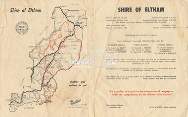
Document - Pamphlet, Shire of Eltham, December 1962
... Shire of Eltham...Shire of Eltham ...This pamphlet was issued for the information of ratepayers, with the compliments of the Eltham Shire Council. Subjects of information included: Shire statistics and history Members of Council 1962-63 Bushfires Dogs Rates Works Programme Shire Offices Town Planning Map of Shire of Eltham with Bushfire area outlined in redbushfires, charis pelling, charles m. a. pelling, councillors, dogs, eric dudley butler, eric percival harmer, franklin william nankervis, george l. cresp, leslie christopher docksey, m.b. watson, map, maxwell alexander spence, rates, raymond clive duncan, rodney d. quin, shire of eltham, shire offices, town planning, works programme -
 Greensborough Historical Society
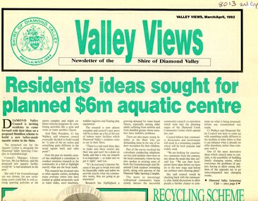
Newspaper - Newsletter, Shire of Diamond Valley, Valley Views: Newsletter of the Shire of Diamond Valley. March/April 1993, 1993_03
... Valley Views: Newsletter of the Shire of Diamond Valley...Shire of Diamond Valley ...Local news from the Shire of Diamond Valley 1993. Includes plans for a swimming pool for the Civic area; extension to the Diamond Valley Library; extended hours for Maternal and Child Health centres; entertainment in the Shire; radio station Plenty Valley fm; and, treatment for headlice.Newspaper, 8p., green and black text, black and white images. 2 copiesshire of diamond valley, swimming pools greensborough, diamond valley library, plenty valley fm -
 Orbost & District Historical Society
folder, 1962-1968
Orbost Aero Club began in 1969 with Basil Dowie as Chair, David Nixon as Secretary/Treasurer. The group went into recess from 1977-1991 closing in 1997. The mid 1960s were boom years in flying training in Australia and the number of Aero Clubs grew rapidly. The Club played a significant role in the establishment of the small airport at Marlo and in the ongoing operation and development of the airport over the years particularly for patient transfer by aerial ambulance. The Orbost Aero Club Club played a significant role in the establishment of the small airport at Marlo and in the ongoing operation and development of the airport over the years. A manila folder containing plans for Marlo Aerodrome.On label on front - MARLO/ORBOST AERODROME PLANSorbost-aero-club marlo-airport -
 Greensborough Historical Society
Book - Feasibility Study, Gunn Hayball Pty Ltd, Shire of Diamond Valley: Feasibility study of community arts and crafts requirements, 1977, 1977_
... Shire of Diamond Valley: Feasibility study of community...Shire of Diamond Valley ...An investigation into the need for, and availability of art and craft activities in the Shire of Diamond Valley in 1977.68 pages text and black and white line drawings and tables. Black plastic binding. non-fictionshire of diamond valley, leisure activities, art and craft -
 Greensborough Historical Society
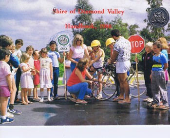
Booklet, Shire of Diamond Valley Handbook 1986, 1986_
... Shire of Diamond Valley Handbook 1986...Shire of Diamond Valley ...Guide to services provided by Shire of Diamond Valley. The Shire of Diamond Valley was a Local Government Area located about 20 kilometres northeast of Melbourne. The shire covered an area of 74.38 square kilometres and existed from 1964 until 1994. . Cover illustration of Bike Education program sponsored by Shire of Diamond Valley in local schools.Annual guide to services in Shire of Diamond Valley32 pages, col illus., maps. (3 copies)shire of diamond valley, greensborough, handbooks -
 Greensborough Historical Society
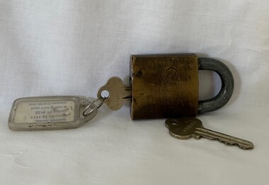
Functional object - Padlock and Keys, Lockwood, Shire of Diamond Valley padlock and key and master key, 1960s
... Shire of Diamond Valley padlock and key and master key ...Shire of Diamond Valley ...Shire of Diamond Valley Master Key and padlock and key, used by Shire staff between 1964 and 1994.Lockwood padlock and two keysshire of diamond valley, keys, padlocks -
 Orbost & District Historical Society
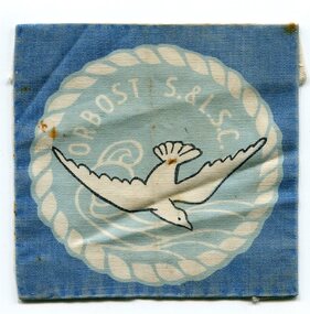
folder of documents, 1961 - 1962
The first swimming competition was conducted by the Swimming Club at the Orbost Swimming Pool not long after its construction. The results were hand-written on a cardboard sheet pinned up on a notice board. One of the events held was a crazy diving display performed by Neil Rodwell and Malcolm Corner in which they rode bikes off the diving platform.The opening of the Orbost Swimming Pool was a significant event in Orbost's development. The construction of the pool was community driven and the swimming club played a crucial role in helping young people learn about water safety away from rivers.A manila folder of documents related to the Orbost Amateur Swimming and Life Saving Club. It contains the constitution, rules of competition, competition results and a cloth badge- a white silver gull inside a pale blue circle on a darker blue background with ORBOST S & LSC below. Documents are handwritten and typed.orbost-swimming-club sport-swimming leisure-club -
Glenelg Shire Council Cultural Collection
Uniform - Glenelg Shire Council Name Badge - Karl Hatton, Glenelg Shire Council badge, 1995
In use by Council 1995-March 2006 Karl Hatton used to manage the Portland Arts Centre and is now part of the Portland CEMA groupGlenelg Shire Council badge bearing the name "Karl Hatton"Front: KARL HATTON Glenelg Shire Council Back: (no inscriptions) -
 Orbost & District Historical Society
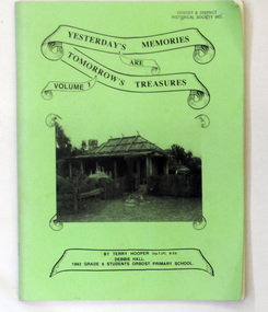
book, Yesterday's Memories are Tomorrow's Treasures Volume 1, 1992
This booklet was the result of a class project at Orbost Primary School. It was created by the year 6 students assisted by Terry Hooper, teacher, and Debbie Hall, a local historian. 2227.1 was owned by Ruth Legge and 2227.2 by Jean RalstonThis booklet is a useful research tool.Two copies of a 100 pp light green paper covered magazine/booklet titled "Yesterday's Memories are Tomorrow's Treasures". The print on the front cover is black and has a black/white photograph of the Slab Hut (Orbost Visitor Information Centre) below the title which is inside a scroll border, The booklet contains b/w photographs and details of the history of Orbost.2227.1 : on contents page - "Ruth 1992" 2227.2 has autographs inside the back cover. book orbost-history orbost-primary-school -
 Greensborough Historical Society
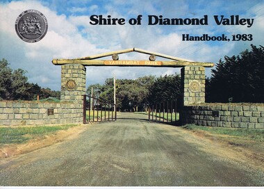
Book, Shire of Diamond Valley Handbook 1983, 1983_
... Shire of Diamond Valley Handbook 1983...Shire of Diamond Valley ...Guide to services provided by Shire of Diamond Valley. The Shire of Diamond Valley was a Local Government Area located about 20 kilometres northeast of Melbourne. The shire covered an area of 74.38 square kilometres and existed from 1964 until 1994.Annual guide to services in Shire of Diamond Valley32 pages, col illus., maps. Cover illustration of the bluestone gateway, main entrance to Yarrambat Park, opened 1982.shire of diamond valley, greensborough, handbooks