Showing 2027 items matching "planning document"
-
 Eltham District Historical Society Inc
Film - Video (VHS), Jenni Mitchell, Demolition of the Shire of Eltham Offices, 1996
Poor video quality (noise and interference), edited raw footage with music and some commentary by Merv Hanna. A video documenting the demolition of the Shire of Eltham offices at 895 Main Road Eltham under the direction of the Commissioners appointed for the new Shire of Nillumbik and some of the communities activities surrounding the event. The building was demolished exactly 25 years after the southern wing housing Engineering and Planning on the upper level and the Eltham Library on the ground level was opened in celebration of the Shire of Eltham's centenary. Video has lots of distortion and noise, and sections of clips dubbed over. Immediate initial footage of Jenni Mitchell talking about asbestos claims in the Shire Offices (Sigmund Jorgensen standing behind her) advising Council did a review of the building several years previously and had been cleared of health problems. Cuts to group of people standing outside front door of offices but possibly voice dub over not related ? Then the date 27 Jul 1996 on a scene flashes on screen immediately followed by an edited clip intro of title and credits with classical music track. It then opens with Jenni Mitchell driving to the Shire Offices on Saturday 27 July 1996 at 11.00am. Footage of Main Road past Pitt Street, Alistair Knox Park then entering Shire Office driveway which is fenced off and contractor signs hanging up. Scenes at rear of building showing some internal demolition has commenced. View of the Administration wing. More clips of road driving, Alistair Knox Park, Eltham Library and visitor car park for Shire Offices. Cuts to a group of people standing in access to visitor carpark with new Eltham Library in background, one being immediate former Shire of Eltham President, John Graves. Scenes of people looking through chain link fence and security guard checking front door. John Graves being filmed that someone informed him the Shire was offering the building to the Community Health Centre for $2.3 million and that if they had been offered a price of $1.1 for what it apparently was sold for they would have snapped it up. View of truck loaded with brick rubble literally struggling to ascend the hill of Library Place to exit into Main Road. Cuts to a scene looking at Eltham War memorial Hall through the Memorial Gate, then the Shillinglaw trees and large banner sign ‘Delta Demolitions’ hanging on office façade. Views of front door, old library and bluestone wall. Scene (31 Jul 1996) filmed at night of several white crosses with “RIP Community” and “RIP Democracy”. Scene (1 August 1996) again driving along Main Road towards the Shire Offices then scenes of the offices showing substantially more demolition to exterior, groups of people standing on footpath outside watching, Delta heavy demolition machines, woman holding sign “Democracy where have you gone …”, the odd person in full protection gear and breathing apparatus hand carrying materials out to place on rubbish pile in front of people standing on footpath watching (with no protection) and then stamping on it to break it creating dust, security person in hard hat (no other protection) wandering around, many groups standing around watching, news film crew, person standing on roadside edge holding signs facing traffic stating “Pirate Planning” and “ Grant us your ears” also sign on back of parked car “Elthams High Jacks”, another sign “Community Democracy”, views of crosses in Main Road median strip “RIP Community”, groups of people on footpaths and reporters conducting interviews, footage of unknown person standing with Jenni Mitchell and Sigmund Jorgensen advising people have the right to protest, Jenni Mitchell urging people to ask questions of local MP and Council and Sigmund Jorgensen referring to the three historic Shillinglaw trees with demolition machinery operating in background, Jenni Mitchell and others installing more crosses in median strip; demolition machines operating inside and outside the building, more views of onlookers including Sigmund Jorgensen then Police approaching on footpath, workers and machinery continuing to operate, views of the old library being demolished, the former Community Services department, security personnel. Scene (2 August 1996) more heavy demolition machinery in operation smashing building up, people standing around southern wing watching, view overlooking Eltham Library of train pulling in to Eltham station. Scene (7 August 1996) more heavy demolition and people wandering around with only hard hat protection, no dust protection, comments from one operator dumping a bin of material stating “wait till there’s a Hungry Jack’s here, you’ll be laughing, fuel, videos, hamburgers. You’ll be up with the rest of the world soon, you’ll have electricity and everything here, ha ha ha ha”, more heavy machinery demolition and breaking up of materials, view of Hitachi train going by and Administration wing, view inside the front door opening of the staircase leading to upper level, person walking around operating heavy machinery with a hose spraying rubble (no protective gear other than hard hat interspersed with edit cuts of meeting of Commissioners and independent observers on panel as well as members of the community in public gallery. Nillumbik Shire CEO Barry Rochford addressing the meeting., Chief Commissioner Don Cordell directly addressing Jenni Mitchell with respect to permission to take photographs, Barry Rochford continues to address the question asked of Council about the valuation of the former Shire of Eltham Office building/site, public gallery calling out asking why was building demolished, what was the urgency. Scene (14 August 1996) views of southern wing, previous single demolition operator again mocking people filming, operators working in and around building, Shillinglaw trees and largely demolished front, heavy demolition equipment at work, piles of building rubble, hose spraying water over rubble, large trucks arriving for rubble removal and loading of truck. Scene (21 August) more of the same, building virtually down, Shillinglaw trees standing tall and alone, water spraying on rubble and wattle in bloom. Cuts to Council meeting with public onlookers. Barry Rochford walks out, Wayne Phillips addresses meeting explaining one or two people shouting, members of the community challenging Council (Commissioners) about why due process appear to have been subverted. Former Shire President Robert Marshall in public audience, cuts back to Shire office carpark entrance site and sign hung on fence in front of library “Think Again!” and people standing around observing awaiting a protest demonstration erecting a large sign on stilts stating “Shell No!”, people singing a revised version of God Save the Queen (God Save Us All), Sigmund Jorgensen in attendance, Jenni Mitchell, Sigmund Jorgenson and others address the protest crowd, followed by people mingling, music being played then people standing around the cleared site circumference all with arms linked (video very broken up with noise) then chants “Save the Gateway” and “No Shell for Eltham” and more music and singing “Put up a parking lot”. The crowd then proceeds to walk along the footpath of Main Road. Scene (15 Sep 1996) meeting at Montsalvat in Great Hall addressed by Sigmund Jorgensen discussing a recently published list of the Commissioner’s to senior Council Officers of banned Nillumbik people, others encouraging people to view proposed plans for the site and lodge objections. Specific issues regarding asbestos claims are also addressed. Harry Gilham addresses the meeting on the subject of the Eltham War Memorial and Memorial Gardens and how Council believe a roundabout in the vicinity is of greater importance. Views of various artworks on display (for auction) and music performance in the Barn Gallery. Meeting addressed by Sigmund Jorgensen discussing an appeal against Council granting a permit to Dallas Howgate to develop the site and that the Minister has called the matter in to be decided by the governing council. This is followed by an auction of paintings.Hi-Tech Ultra High Grade Video Cassette E-180 VHS dubbing of (poor quality) edited raw footage with some music from Star Wars and commentary by Merv Hannan Converted to MP4 file format 0:30:26, 2.6GBOn label " Merv's Demolition tape No. 2 Copy"video recording, 895 main road, alistair knox park, artworks, auction, barn gallery, barry rochford, community health centre, dallas howgate, delta demolitions, demolition, don cordell, eltham, eltham library, eltham shire office, eltham war memorial, eltham war memorial gate, eltham war memorial hall, great hall, harry gilham, jenni mitchell, john graves, library place, main road, memorial gardens, mervyn hannan, montsalvat, pitt street, protest, robert marshall, roundabout, shell oil, shillinglaw trees, sigmund jorgensen, sign, wayne phillips -
 Eltham District Historical Society Inc
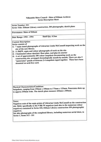
Document - Folder, Markby, Dorothy
Dorothy Markby was a volunteer at organisations in Kangaroo Ground and Jagajaga: Kangaroo Ground Primary School Parents Committee, Eltham High School Committee, Kangaroo Ground Rural Fire Brigade auxiliary, Planning Committee for kindergarten at Kangaroo Ground, Lifeline, Do Care, Rosanna Indoor Bowls Committee, Rosanna Fire Station Community House Committee, and member of Eltham Historical Society. Contents Photocopy, no date, of a page from an unidentified document listing volunteers: Maria Long, Dorothy Marby andFrances(?) McIntyreNewspaper clippings, A4 photocopies, etcdorothy markby, kangaroo ground primary school parents committee, eltham high school committee, kangaroo ground rural fire brigade auxiliary, kangaroo ground kindergarten, lifeline, do care, rosanna indoor bowls committee, rosanna fire station community house committee, eltham historical society, maria long, frances mcintyre -
 Eltham District Historical Society Inc
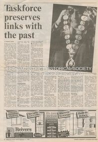
Document - News Clipping, Natalie Town, Taskforce preserves links with the past, Diamond Valley News, September 11, p8, 1996
About former Shire / City council memorabilia. On the reverse side an article "Timing was the problem: chief" regarding Nillumbik CEO Barry Rochford dismissing claims that coulcil failed to follow correct statutory procedure when announcing the release of development plans for thje former Eltham Shire Office site in which developer Dallas Howgate intended to build a service station, convenience store, fast food outlet and community facilities including an information desk and meeting area.895 main road, barry rochford, bev marshall, dallas howgate, eltham shire office, nillumbik shire council, banyule city council, city of heidelberg, david hay, heidelberg historical society, honour board, joint memorabilia taskforce, mayoral chain, peter williams, roma o'callaghan, shire of diamond valley, shire of eltham -
 Eltham District Historical Society Inc
Document - Sales Brochure, Dallas Price Homes Pty Ltd, Eltham Hub: A Unique New Entry To Eltham's Town Centre; the facts about this multi purpose development, 1996
Produced by Contour Consultants Australia Pty Ltd on behalf of Dallas Price Homes Pty Ltd as part of the planning process for redevelopment of the former Eltham Shire Office site at 895 Main Road. In 1963 the Shire of Eltham purchased the Shillinglaw property of approximately 2 acres in Main Road, Eltham for the widening of Main Road and as a site for new Council offices. This land, which contained the Shillinglaw Cottage (c1878-80), was the remaining section of the Shillinglaw family holding that originally comprised 30 acres, being Lot 90 of Holloway's 1851 subdivision. Eltham Council intended to demolish this cottage, but through extensive community action it was saved, funds were raised, and it was relocated to the current site adjacent to the Eltham Library. The new Eltham Shire Offices opened in 1965 were designed to ensure retention of the three Italian Cypress trees that were located outside the Shillinglaw Cottage. In 1971 the building was extended at the southern end to provide additional space, including for the Eltham Library and Council's Engineering Department. Renovations were undertaken to the offices during 1987. The Victorian State Government commenced to restructure local government in 1994, which resulted in the establishment of the Shire of Nillumbik and the cessation of the Shire of Eltham. This new Nillumbik Shire Council was headed by government appointed commissioners, who decided in 1995 to put the former Eltham Shire offices on the market. Eventually in June 1996 the property was sold for $1.1 million and the building was subsequently demolished. A planning application for the site was then submitted to Nillumbik Shire Council in September 1996 for construction of a 24-hour service station, convenience store, cafe/takeaway food premises, a retail facility and community facility. There were many objections to this proposed development and in controversial circumstances a planning permit was granted by the Nillumbik Shire Council commissioners. After protracted actions involving a planning panel and a planning advisory committee, established by the Minister for Local Government, the proposal was eventually rejected as not satisfying the requirements of the planning scheme. In December 1997 the purchaser withdrew from the contract of sale, just prior to Council announcing a withdrawal from the contract. While there have been a number of possible development proposals considered by subsequent Nillumbik Shire Councils, this site has remained vacant since July 1996. TIMELINE (Prepared by Jim Connor, Eltham District Historical Society- March 2018- Based on press, council and personal records) June 1996 - Eltham Shire offices sold to Dallas Price Homes for $1.1 million. July 1996 - Shire office building demolished against community's wishes. Council claimed building riddled with asbestos. September 1996 - Planning application submitted to Nillumbik Shire Council to construct on the site a 24 hours Shell service station, convenience store, Hungry Jacks café/takeaway food premises, a retail facility and community facility. 213 objections and petition of over 1400 signatures received. Minister for Planning and Local Government orders an independent investigation into valuation and sale. 9 October 1996 - Permit granted by Nillumbik Shire Council commissioners, in controversial circumstances. A Planning Special Committee consisting of 3 commissioners and 3 community representatives considered 32 community objections. One commissioner declared a potential conflict of interest so only 2 commissioners were able to vote. After hearing all objections, the community representatives moved a foreshadowed motion to refuse a permit. The commissioners then closed the meeting, formerly opened a council meeting (for about a minute) and approved the application. October 1996 - Community members appealed planning decision to Administrative Appeals Tribunal. November 1996 -Minister for Planning and Local Government Robert McClelland calls appeal in and directs MT to refer this 'major policy issue' to the Governor in Council. February 1997 - Planning panel (Dimity Reed and Margaret Pitt) established to consider submissions. March 1997 - New council elected with five councillors. April 1997 - Three of the five new councillors vote to fight Commissioner's decision to grant a permit. April 1997 - Planning panel (Dimity Reed and Margaret Pitt) conducts hearings at Nillumbik Shire offices. June 1997 -Planning panel rejected Dallas Price Homes proposal as being 'totally inappropriate' for the site and recommends the site be rezoned for 'public purposes'. July 1997 - Dallas Price Homes threatened to sue Council and individual councillors. October 1997 - Report released of an Advisory Committee (Paul Jerome) established by the Minister for Planning and Local Government. Committee considered Dallas Price Homes proposal and an alternative concept plan proposal by Council for a gallery, workshop, offices and cinema community-based development. Advisory Committee recommended Dallas Price Homes proposal be rejected as not satisfying the requirements of the planning scheme and recommended further testing of the financial viability of Council's proposal. December 1997 - Dallas Price Homes withdrew from the contract of sale, just prior to Council announcing a withdrawal from the contract, which expired on 28th November and was not renewed by either side, after previously being extended twice pending a decision by the Minister. Council had to pay developer $58,000 for demolition costs. February 1998 - Dallas Price Homes application rejected by Planning and Local Government Minister. October 1998 - Nillumbik Councillors suspended and an Administrator appointed (until March 1999). The demolition of the former Shire of Eltham offices and proposed sale and development driven by the Commissioners for Nillumbik Shire Council brought the community together in substantial protest at the infrigement of ratepayers democratic say in local government and ciommunity assets combined with protests about inappropraite development of Eltham's Gateway. This issue led to the formation of the Eltham Community Action Group which still operates strongly today (2023) on behalf of the community to ensure appropriate development within the community.895 main road, commissioners, dallas price homes, development application, eltham hub, hungry jacks, nillumbik shire council, re-zoning, shell service station, town planning, eltham gateway, eltham gateway action group, eltham shire offices, shillinglaw cottage, shillinglaw farm, shillinglaw trees, jim connor collection -
 Eltham District Historical Society Inc
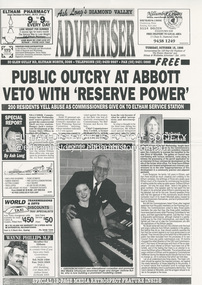
Document - News Clipping, Advertiser, Public Outcry at Abbott Veto with 'Reserve Power; 200 residents yell abuse as commissioners give ok to Eltham service station; Advertiser, Tuesday, October 15, p1, 1996
Nillumbik Commissioners used 'reserve power's to permit a controversial Shell service station and Hungry Jackls restaurant development at the former Eltham Shire Office site at 895 Main Road. More than 200 people attended the Council meeting in the public gallery and protested at the decision. 32 personal submissions were made to Council's Planning Special Committee meeting whose members vioted 3-2 against the development. The Committee consisted of the three Nillumbik Commissioners and three community members (Jim Connor, Bronwyn South and Janet Mattiske). Chief Commissioner Don Cordell, a former Shell employee excused himself from voting and the three communbity memebrs voted against the submission. The other two commissioners, Vin Heffernan and Kevin Abbott voted against it. They then immediately closed the meeting and opened a Council meeting lasting just seconds to use special reserve powers to overturn the decision. The demolition of the former Shire of Eltham offices and proposed sale and development driven by the Commissioners for Nillumbik Shire Council brought the community together in substantial protest at the infrigement of ratepayers democratic say in local government and ciommunity assets combined with protests about inappropraite development of Eltham's Gateway. This issue led to the formation of the Eltham Community Action Group which still operates strongly today (2023) on behalf of the community to ensure appropriate development within the community.895 main road, commissioners, dallas price homes, development application, eltham hub, hungry jacks, nillumbik shire council, re-zoning, shell service station, town planning, eltham gateway, eltham gateway action group, eltham shire offices, shillinglaw farm, shillinglaw trees, jim connor collection, dallas howgate, frank burgoyne, robert marshall, nillumbik planning special committee, jim connor, bronwyn south, janet mattiske, don cordell, vin heffernan, kevin abbott -
 Eltham District Historical Society Inc
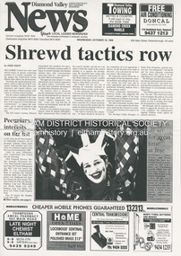
Document - News Clipping, Jodie Guest, Shrewd tactics row, Diamond Valley News, October 15, p1, 1996
Nillumbik Commissioners used 'reserve power's to permit a controversial Shell service station and Hungry Jackls restaurant development at the former Eltham Shire Office site at 895 Main Road. More than 200 people attended the Council meeting in the public gallery and protested at the decision. 32 personal submissions were made to Council's Planning Special Committee meeting whose members vioted 3-2 against the development. The Committee consisted of the three Nillumbik Commissioners and three community members (Jim Connor, Bronwyn South and Janet Mattiske). Chief Commissioner Don Cordell, a former Shell employee excused himself from voting and the three communbity memebrs voted against the submission. The other two commissioners, Vin Heffernan and Kevin Abbott voted against it. They then immediately closed the meeting and opened a Council meeting lasting just seconds to use special reserve powers to overturn the decision. The demolition of the former Shire of Eltham offices and proposed sale and development driven by the Commissioners for Nillumbik Shire Council brought the community together in substantial protest at the infrigement of ratepayers democratic say in local government and ciommunity assets combined with protests about inappropraite development of Eltham's Gateway. This issue led to the formation of the Eltham Community Action Group which still operates strongly today (2023) on behalf of the community to ensure appropriate development within the community.895 main road, commissioners, dallas price homes, development application, eltham hub, hungry jacks, nillumbik shire council, re-zoning, shell service station, town planning, eltham gateway, eltham gateway action group, eltham shire offices, shillinglaw farm, shillinglaw trees, jim connor collection, dallas howgate, nillumbik planning special committee, jim connor, bronwyn south, janet mattiske, don cordell, vin heffernan, kevin abbott -
 Eltham District Historical Society Inc
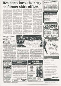
Document - News Clipping, Jodie Guest, Residents have their say on former shire offices, Diamond Valley News, October 16, p9, 1996
Nillumbik Commissioners used 'reserve power's to permit a controversial Shell service station and Hungry Jackls restaurant development at the former Eltham Shire Office site at 895 Main Road. More than 200 people attended the Council meeting in the public gallery and protested at the decision. 32 personal submissions were made to Council's Planning Special Committee meeting whose members vioted 3-2 against the development. The Committee consisted of the three Nillumbik Commissioners and three community members (Jim Connor, Bronwyn South and Janet Mattiske). Chief Commissioner Don Cordell, a former Shell employee excused himself from voting and the three communbity memebrs voted against the submission. The other two commissioners, Vin Heffernan and Kevin Abbott voted against it. They then immediately closed the meeting and opened a Council meeting lasting just seconds to use special reserve powers to overturn the decision. Community residents who made submissions included Russell Yeomans speaking on behalf of the Eltham Gateway Action Group and Eltham District Historical Society, Des Ryan on belaf of Eltham Senior Citizens, Angela Newhouse, others on behalf of Our Lady Help of Christians Primary School and Judge Book Village, Tom Munro, Ian Jennings, Margartet Ball a fifth generation descendant of the Shillinglaw family, one of the early settlers of the area and owner of the land that was sold to Council, Frank Burgoyne who said "there will be a lot of creaking and rumbling in the cemetery if this goes through. So many old people who have done so much for Eltham are buried up there and it is up to us to pass on what they left to the younger generation. Eltham is a beautiful spot; why louse it up?" A second article "Anger over reserve power" by Laeta Antonysen provides commentary from the three Planning Special Committee community members, former Eltham Shire Councillor Jim Connor, Bronwyn South and Janet Mattiske about the process that took place and the first time use of the spoecial reserve power to overturn the decision of the committee. Barry Rochford, Nillumbiuk CEO defends the use of the power.The demolition of the former Shire of Eltham offices and proposed sale and development driven by the Commissioners for Nillumbik Shire Council brought the community together in substantial protest at the infrigement of ratepayers democratic say in local government and ciommunity assets combined with protests about inappropraite development of Eltham's Gateway. This issue led to the formation of the Eltham Community Action Group which still operates strongly today (2023) on behalf of the community to ensure appropriate development within the community.895 main road, commissioners, dallas price homes, development application, eltham hub, hungry jacks, nillumbik shire council, re-zoning, shell service station, town planning, eltham gateway, eltham gateway action group, eltham shire offices, shillinglaw farm, shillinglaw trees, jim connor collection, dallas howgate, nillumbik planning special committee, jim connor, bronwyn south, janet mattiske, don cordell, vin heffernan, kevin abbott, russell yeomans, eltham district historical society, eltham senior citizens, des ryan, our lady help of christians primary school, judge book village, angela newhouse, tom munro, ian jennings, margaret ball, shillinglaw cottage, frank burgoyne, andrew biasci, barry rochford -
 Eltham District Historical Society Inc
Document - News Clipping, Advertiser, Planning Committee closed by Commissioners, Advertiser, October 29, p5, 1996
Nillumbik Commissioners used 'reserve power's to permit a controversial Shell service station and Hungry Jack's restaurant development at the former Eltham Shire Office site at 895 Main Road. More than 200 people attended the Council meeting in the public gallery and protested at the decision. 32 personal submissions were made to Council's Planning Special Committee meeting whose members vioted 3-2 against the development. The Committee consisted of the three Nillumbik Commissioners and three community members (Jim Connor, Bronwyn South and Janet Mattiske). Chief Commissioner Don Cordell, a former Shell employee excused himself from voting and the three communbity memebrs voted against the submission. The other two commissioners, Vin Heffernan and Kevin Abbott voted against it. They then immediately closed the meeting and opened a Council meeting lasting just seconds to use special reserve powers to overturn the decision. Subsequent to this the Commissioner run Council held a special meeting on Wednesday, October 23, 1996 where Commissioners Kevin Abbott and Vin Heffernan thanked all three community members of the Planning Special Committee and advised that their powers had been revoked. The article includes a joint statement from all three sacked members in which they state they have been able to bring a community perspective to the planning applications placed befopre the committee which has resulted in modifications to planning decisions. The members stated that "unfortunately, despite our best efforts to express considered apolitical opinions, it appears the Commissioners believe that any dissenting comment is politically motivated, and should therefore be disregarded." "We feel sad that this situation exists even though we have done everything possible tio represent the views of our community, whilst maintaining the integrity of the planning process."The demolition of the former Shire of Eltham offices and proposed sale and development driven by the Commissioners for Nillumbik Shire Council brought the community together in substantial protest at the infrigement of ratepayers democratic say in local government and ciommunity assets combined with protests about inappropraite development of Eltham's Gateway. This issue led to the formation of the Eltham Community Action Group which still operates strongly today (2023) on behalf of the community to ensure appropriate development within the community.895 main road, commissioners, dallas price homes, development application, eltham hub, hungry jacks, nillumbik shire council, re-zoning, shell service station, town planning, eltham gateway, eltham gateway action group, eltham shire offices, shillinglaw farm, jim connor collection, dallas howgate, nillumbik planning special committee, jim connor, bronwyn south, janet mattiske, don cordell, vin heffernan, kevin abbott -
 Eltham District Historical Society Inc
Document - News Clipping, Jodie Guest, Council axes planning body after split on shire office site, Diamond Valley News, October 30, p3, 1996
Nillumbik Commissioners used 'reserve power's to permit a controversial Shell service station and Hungry Jack's restaurant development at the former Eltham Shire Office site at 895 Main Road. More than 200 people attended the Council meeting in the public gallery and protested at the decision. 32 personal submissions were made to Council's Planning Special Committee meeting whose members vioted 3-2 against the development. The Committee consisted of the three Nillumbik Commissioners and three community members (Jim Connor, Bronwyn South and Janet Mattiske). Chief Commissioner Don Cordell, a former Shell employee excused himself from voting and the three communbity memebrs voted against the submission. The other two commissioners, Vin Heffernan and Kevin Abbott voted against it. They then immediately closed the meeting and opened a Council meeting lasting just seconds to use special reserve powers to overturn the decision. Subsequent to this the Commissioner run Council held a special meeting on Wednesday, October 23, 1996 where Commissioners Kevin Abbott and Vin Heffernan thanked all three community members of the Planning Special Committee and advised that their powers had been revoked. The article includes a joint statement from all three sacked members in which they state they have been able to bring a community perspective to the planning applications placed befopre the committee which has resulted in modifications to planning decisions. The members stated that "unfortunately, despite our best efforts to express considered apolitical opinions, it appears the Commissioners believe that any dissenting comment is politically motivated, and should therefore be disregarded." "We feel sad that this situation exists even though we have done everything possible tio represent the views of our community, whilst maintaining the integrity of the planning process."The demolition of the former Shire of Eltham offices and proposed sale and development driven by the Commissioners for Nillumbik Shire Council brought the community together in substantial protest at the infrigement of ratepayers democratic say in local government and ciommunity assets combined with protests about inappropraite development of Eltham's Gateway. This issue led to the formation of the Eltham Community Action Group which still operates strongly today (2023) on behalf of the community to ensure appropriate development within the community.895 main road, commissioners, dallas price homes, development application, eltham hub, hungry jacks, nillumbik shire council, re-zoning, shell service station, town planning, eltham gateway, eltham gateway action group, eltham shire offices, shillinglaw farm, jim connor collection, dallas howgate, nillumbik planning special committee, jim connor, bronwyn south, janet mattiske, don cordell, vin heffernan, kevin abbott -
 Eltham District Historical Society Inc
Document - Building Plan, J.M. Harcourt, 22 Peter Street, Eltham, c.1946
... 22 Peter Street, Eltham Document Building Plan J.M. Harcourt ...Pise or Adobe Brick Cottage for Mr D. Sawer in Peter St., Eltham Design and drawings by J.M. Harcourt, Clay Nuneham, Eltham. The cottage at present day 22 Peter Street was built circa 1946. Also Drawing of planned carport and future extension for 22 Peter Street, Eltham22 peter street, building plans, clay nuneham, d. sawer, eltham, j.m. harcourt design, adobe house, j.m. harcourt designc.1946, pise house -
 Eltham District Historical Society Inc
Photograph - Digital Photograph, Marguerite Marshall, Neil Douglas house, Bend Of Islands, 3 October 2006
Mud brick house first owned by naturalist and artist Neil Douglas and Helen (Abbie) Heathcote at the Bend of Islands. They were original residents in the 1970s. This house is on the Victorian Heritage Database and is considered locally significant. Covered under Heritage Overlay, Nillumbik Planning Scheme Published: Nillumbik Now and Then / Marguerite Marshall 2008; photographs Alan King with Marguerite Marshall.; CoverThis collection of almost 130 photos about places and people within the Shire of Nillumbik, an urban and rural municipality in Melbourne's north, contributes to an understanding of the history of the Shire. Published in 2008 immediately prior to the Black Saturday bushfires of February 7, 2009, it documents sites that were impacted, and in some cases destroyed by the fires. It includes photographs taken especially for the publication, creating a unique time capsule representing the Shire in the early 21st century. It remains the most recent comprehenesive publication devoted to the Shire's history connecting local residents to the past. nillumbik now and then (marshall-king) collection, bend of islands, neil douglas house, neil douglas -
 Eltham District Historical Society Inc
Photograph - Digital Photograph, Marguerite Marshall, Post Office, Hurstbridge, 27 September 2007
The Post Office building was built in 1918 by printer, Robert Charles Harris, owner of The Evelyn Observer newspaper. In 2007 a Post Office, cafe and giftshop operated from here. Covered under Heritage Overlay, Nillumbik Planning Scheme. Published: Nillumbik Now and Then / Marguerite Marshall 2008; photographs Alan King with Marguerite Marshall.; p13This collection of almost 130 photos about places and people within the Shire of Nillumbik, an urban and rural municipality in Melbourne's north, contributes to an understanding of the history of the Shire. Published in 2008 immediately prior to the Black Saturday bushfires of February 7, 2009, it documents sites that were impacted, and in some cases destroyed by the fires. It includes photographs taken especially for the publication, creating a unique time capsule representing the Shire in the early 21st century. It remains the most recent comprehenesive publication devoted to the Shire's history connecting local residents to the past. nillumbik now and then (marshall-king) collection, hurstbridge, post office, post office cafe -
 Eltham District Historical Society Inc
Photograph - Digital Photograph, Alan King, Ore crusher, Golden King mine, Yarrambat, 22 January 2008
Prior to 1929 Yarrambat was known as Tanck's Corner or Reynold's Corner after Frederick Tanck who owned land north of Ironbark Road at the corner of Yan Yean Road, and Thomas Ryenolds who owned the property opposite. Tanck's Corner was at the centre of gold bearing country. Gold was mined here until 1984 when the last operating mine, the Golden King mine in North Oatlands Road closed. It was owned by the Clayton family and in the 1960s was the only private family gold mine in Victoria. Larger mines had their own batteries and stampers to process the ore. Covered under Heritage Overlay, Nillumbik Planning Scheme. Published: Nillumbik Now and Then / Marguerite Marshall 2008; photographs Alan King with Marguerite Marshall.; p23This collection of almost 130 photos about places and people within the Shire of Nillumbik, an urban and rural municipality in Melbourne's north, contributes to an understanding of the history of the Shire. Published in 2008 immediately prior to the Black Saturday bushfires of February 7, 2009, it documents sites that were impacted, and in some cases destroyed by the fires. It includes photographs taken especially for the publication, creating a unique time capsule representing the Shire in the early 21st century. It remains the most recent comprehenesive publication devoted to the Shire's history connecting local residents to the past. nillumbik now and then (marshall-king) collection, battery, clayton family, gold mining, golden king mine, ore crusher, tancks corner. reynolds corner, yarrambat -
 Eltham District Historical Society Inc
Photograph - Digital Photograph, Alan King, Pigeon Bank, one of the Nillumbik shire's oldest farm dwellings, 6 February 2008
In 1848, Francis Rogerson form Dumfriesshire, Scotland purchased 80 acres of land at Kangaroo Ground on which he built a two-roomed bark hut. He named the property afterr the many Bronzewings and Wonga Pigeons in the area. Ewen Hugh Cameron moved to Pigeon Bank the same year he was elected to Parliament as the Member for Evelyn. At the time he moved in, Pigeon Bank had six rooms and the present water well. He made further extensive additions and lived there until his death in 1915. Covered under Heritage Overlay, Nillumbik Planning Scheme. Published: Nillumbik Now and Then / Marguerite Marshall 2008; photographs Alan King with Marguerite Marshall.; p27This collection of almost 130 photos about places and people within the Shire of Nillumbik, an urban and rural municipality in Melbourne's north, contributes to an understanding of the history of the Shire. Published in 2008 immediately prior to the Black Saturday bushfires of February 7, 2009, it documents sites that were impacted, and in some cases destroyed by the fires. It includes photographs taken especially for the publication, creating a unique time capsule representing the Shire in the early 21st century. It remains the most recent comprehenesive publication devoted to the Shire's history connecting local residents to the past. nillumbik now and then (marshall-king) collection, ewen hugh cameron, francis rogerson, kangaroo ground, kangaroo ground-warrandyte road, pigeon bank -
 Eltham District Historical Society Inc
Photograph - Digital Photograph, Alan King, Original Kangaroo Ground Primary School No. 2105 building, Eltham-Yarra Glen Road, Kangaroo Ground, 28 December 2007
Kangaroo Ground's first school began in 1851 with 22 pupils from the district's ten families. It was a single room school located further south on the site, which also served as a Presbyterian church. The first teacher was Andrew Ross. The school building was used as a Post Office between 1854 and 1858 and during 1857 also served as a Court of Petty Sessions. With a growing farming community, a new building was warranted and the original Sate School No. 352 was closed and a new building, State School No. 2105 was oipened October 1, 1878. A residence for Head Teacher Henry Wallace School was erected in 1879 attached to the left of the school building. That residence is now home to the Andrew Ross Museum, which opened in 1993. Covered under Heritage Overlay, Nillumbik Planning Scheme. Published: Nillumbik Now and Then / Marguerite Marshall 2008; photographs Alan King with Marguerite Marshall.; p35This collection of almost 130 photos about places and people within the Shire of Nillumbik, an urban and rural municipality in Melbourne's north, contributes to an understanding of the history of the Shire. Published in 2008 immediately prior to the Black Saturday bushfires of February 7, 2009, it documents sites that were impacted, and in some cases destroyed by the fires. It includes photographs taken especially for the publication, creating a unique time capsule representing the Shire in the early 21st century. It remains the most recent comprehenesive publication devoted to the Shire's history connecting local residents to the past. nillumbik now and then (marshall-king) collection, kangaroo ground, eltham-yarra glen road, kangaroo ground primary school no. 2105, kangaroo ground state school, state school no. 2105 -
 Eltham District Historical Society Inc
Photograph - Digital Photograph, Alan King, Eltham Hotel, cnr Main Road and Pitt Street, 28 December 2007
The Eltham Hotel is the oldest continually operating hotel in the Eltham district. Initially referred to as the Little Eltham Hotel, it has been known as the Eltham Hotel since the mid-1850s through to the present except for a brief period as the Eltham Tavern in the late 1980s. The original hotel opened in 1854 by Richard Warren was built by Benjamin Oliver Wallis. The Fountain of Friendship Hotel on the opposite side of Maria Street (Main Road) opened shortly after. The hotel was a well-known resting place for gold diggers during the gold rush at Woods’ Point and Warren would buy the gold from the diggers. Warren ran into financial difficulties and determined to return to England. Wallis bought the hotel in 1861 and ran it till 1886 when he sold it to Christopher Watson Snr. When Christopher Watson Snr died a year after purchase, his son Christopher took over until his death in 1909 when it passed to wife Emily and then their youngest son, Herbert James (Jim) Watson in 1915. In July 1925, Jim Watson demolished the original building and, in its place, erected a modern hotel which remains the foundation of the present-day Eltham Hotel. Covered under Heritage Overlay, Nillumbik Planning Scheme. Published: Nillumbik Now and Then / Marguerite Marshall 2008; photographs Alan King with Marguerite Marshall.; p41This collection of almost 130 photos about places and people within the Shire of Nillumbik, an urban and rural municipality in Melbourne's north, contributes to an understanding of the history of the Shire. Published in 2008 immediately prior to the Black Saturday bushfires of February 7, 2009, it documents sites that were impacted, and in some cases destroyed by the fires. It includes photographs taken especially for the publication, creating a unique time capsule representing the Shire in the early 21st century. It remains the most recent comprehenesive publication devoted to the Shire's history connecting local residents to the past. nillumbik now and then (marshall-king) collection, eltham, eltham hotel, main road, pitt street -
 Eltham District Historical Society Inc
Photograph - Digital Photograph, Alan King, Jarrold Cottage, 701 Main Road, Eltham, 29 January 2008
Jarrold Cottage or White Cloud is known by many to be associated with the Skipper family, and has been since 1944 when Lena Skipper, wife of Mervyn Skipper purchased the cottage. She purchased it from the Estate of Thekla Jarrold who had died in March of the previous year. By the time Thekla died, she had lived in the Jarrold Cottage for 50 years. Thekla Alvenia Sissilia Ellian married John William Jarrold in 1888 at Clifton Hill. They started their family there but when John’s father William (who was married to Hannah Coleman) died in 1893 the family moved to Eltham. William had married Hannah Coleman in 1856 at his home in Eltham. William had arrived in the colony in 1848 so it is believed the Jarrold Cottage goes back at least to 1856 and possibly early 1850s. For a short period of time the cottage was rented to the Police as a temporary Police Station whilst a new and more permanent station was built further up the hill in 1859. The cottage was originally located closer to the Diamond Creek but was subject to flooding so was relocated to its present position on top a mound of rubble placed there from the nearby quarry next to the Dalton Street school (on Main Road). By 1916, John Henry Clark, a photographer who took many early photos of Eltham relocated from Fitzroy to Eltham and boarded with recently widowed Thekla Jarrold and her family. He changed professions from photographer to boot and harness maker around 1931 and Thekla had a small bootmakers shop built ifor him in the corner of her property next to the family home. J.H. Clark remained living at the property until his death in December 1956. At some stage after Clark's death, Lena Skipper is recorded living at the property having relocated from Montsalvat following the death of her husband Mervyn. The property continues to remain within the Skipper family as of 2023. Covered under Heritage Overlay, Nillumbik Planning Scheme. Published: Nillumbik Now and Then / Marguerite Marshall 2008; photographs Alan King with Marguerite Marshall.; p47This collection of almost 130 photos about places and people within the Shire of Nillumbik, an urban and rural municipality in Melbourne's north, contributes to an understanding of the history of the Shire. Published in 2008 immediately prior to the Black Saturday bushfires of February 7, 2009, it documents sites that were impacted, and in some cases destroyed by the fires. It includes photographs taken especially for the publication, creating a unique time capsule representing the Shire in the early 21st century. It remains the most recent comprehenesive publication devoted to the Shire's history connecting local residents to the past. nillumbik now and then (marshall-king) collection, bootmaker's shop, hannah coleman, jarrold cottage, john henry clark, john william jarrold, lena skipper, police station, thekla alvenia sissilia jarrold (nee ellian), white cloud cottage, william jarrold -
 Eltham District Historical Society Inc
Photograph - Digital Photograph, Alan King, Former bootmaker's shop, Main Road Eltham, 29 January 2008
The former bootmaker's shop is one of only three remaining original shops from the early 20th century in what was once Little Eltham, the others being the present day Cafe Zen-Den at 736 Main Road and the former Burgoyne General Store and Post Office, present-day San Antonio Barbershop at 820 Main Road. Jarrold Cottage or White Cloud is known by many to be associated with the Skipper family, and has been since 1944 when Lena Skipper, wife of Mervyn Skipper purchased the cottage. She purchased it from the Estate of Thekla Jarrold who had died in March of the previous year. By the time Thekla died, she had lived in the Jarrold Cottage for 50 years. Thekla Alvenia Sissilia Ellian married John William Jarrold in 1888 at Clifton Hill. They started their family there but when John’s father William (who was married to Hannah Coleman) died in 1893 the family moved to Eltham. William had married Hannah Coleman in 1856 at his home in Eltham. William had arrived in the colony in 1848 so it is believed the Jarrold Cottage goes back at least to 1856 and possibly early 1850s. For a short period of time the cottage was rented to the Police as a temporary Police Station whilst a new and more permanent station was built further up the hill in 1859. The cottage was originally located closer to the Diamond Creek but was subject to flooding so was relocated to its present position on top a mound of rubble placed there from the nearby quarry next to the Dalton Street school (on Main Road). By 1916, John Henry Clark, a photographer who took many early photos of Eltham relocated from Fitzroy to Eltham and boarded with recently widowed Thekla Jarrold and her family. He changed professions from photographer to boot and harness maker around 1931 and Thekla had a small bootmakers shop built ifor him in the corner of her property next to the family home. J.H. Clark remained living at the property until his death in December 1956. At some stage after Clark's death, Lena Skipper is recorded living at the property having relocated from Montsalvat following the death of her husband Mervyn. The property continues to remain within the Skipper family as of 2023. Covered under Heritage Overlay, Nillumbik Planning Scheme. Published: Nillumbik Now and Then / Marguerite Marshall 2008; photographs Alan King with Marguerite Marshall.; p47This collection of almost 130 photos about places and people within the Shire of Nillumbik, an urban and rural municipality in Melbourne's north, contributes to an understanding of the history of the Shire. Published in 2008 immediately prior to the Black Saturday bushfires of February 7, 2009, it documents sites that were impacted, and in some cases destroyed by the fires. It includes photographs taken especially for the publication, creating a unique time capsule representing the Shire in the early 21st century. It remains the most recent comprehenesive publication devoted to the Shire's history connecting local residents to the past. nillumbik now and then (marshall-king) collection, bootmaker's shop, jarrold cottage, john henry clark, lena skipper, thekla alvenia sissilia jarrold (nee ellian), white cloud cottage, shops -
 Eltham District Historical Society Inc
Photograph - Digital Photograph, Marguerite Marshall, Souter House, 23 Falkiner Street, Eltham, 20 June 2008
Originally built in the 1850s by Charles Souter from earth excavated from his property. It was a forerunner for a building style that was later to be synonymous with Eltham. The house is historically significant as the oldest mud brick building in the Shire of Nillumbik, as one of less than half a dozen buildings from the 1850s that survive in the Shire. It underwent several additions and alterations between c.1950s-1980s. It is also significant for its associations with Mervyn Skipper from the well-known Eltham family who was one of the founders of the artist's colony at Montsalvat. The house is architecturally significant because its north section was designed by the noted 'Eltham-style' architect, Alistair Knox, and the two long Oregon beams supporting the main floor were added by the noted 'Eltham-style' builder, Horrie Judd who built the southern room. A onetime tenant in the house, Judd built many Eltham houses and was a major builder of Montsalvat. The 1934 flood destroyed the south wall and the house remained unoccupied for some time. Sonia Skipper, one of Montsalvat’s builders who also worked for Alistair Knox oversaw rebuilding it. She employed landscape designer Gordon Ford, artist Peter Glass and Tim Burstall. The house originally had a cellar for making and storing wine, reputedly the first made in the district according to Alistair Knox in his book ‘We are what we stand on’ (p33). Water would seep into the cellar so Sonia’s father and then owner of the house, Mervyn Skipper bulldozed a channel outside to divert it. The Brocksopp family purchased the house in 1950 and added an outside door to the cellar and converted it into a gallery. Covered under Heritage Overlay, Nillumbik Planning Scheme. Published: Nillumbik Now and Then / Marguerite Marshall 2008; photographs Alan King with Marguerite Marshall.; p51This collection of almost 130 photos about places and people within the Shire of Nillumbik, an urban and rural municipality in Melbourne's north, contributes to an understanding of the history of the Shire. Published in 2008 immediately prior to the Black Saturday bushfires of February 7, 2009, it documents sites that were impacted, and in some cases destroyed by the fires. It includes photographs taken especially for the publication, creating a unique time capsule representing the Shire in the early 21st century. It remains the most recent comprehenesive publication devoted to the Shire's history connecting local residents to the past. nillumbik now and then (marshall-king) collection, eltham, falkiner street, mud brick building, mudbrick houses, souter house -
 Eltham District Historical Society Inc
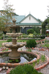
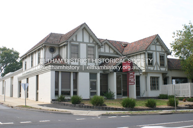
Photograph - Digital Photograph, Alan King, Former Police Residence, 728 Main Road, Eltham, 28 December 2007
The institutions of law and order in Colonial Victoria included the police, courts and prisons. The 1852 report of the Snodgrass Select Committee appointed to "identify the policing needs of the colony” noted there existed seven independent police forces that did not co-operate or regularly communicate. Following the committee's report all these police entities were merged into the Victoria Police, founded on 8 January 1853, to implement law and order responsibilities throughout the Colony of Victoria. The Eltham Courthouse (1860) and adjacent Police Residence (1859) formed a justice precinct established in the immediate aftermath of the 1852 police inquiry and the effects of the gold rush. The physical presence of these buildings, in the centre of the early Eltham township, defined centralised control over law and order. In the early days the Police Constable in charge would conduct his duties travelling around the district by horse; a stable was located at the rear of the residence. At times the horse would be grazed on the paddocks across the road. Horseshoes were forged by the blacksmith beside the Courthouse on the high side of “Policeman’s Hill”. Along with the stable, there was a two-cell bluestone lockup where prisoners were held awaiting trial in the adjacent Courthouse. Their meals were usually provided by the policeman’s wife or from the hotel just up the road. With the arrival of the railway in 1902 the town centre gradually shifted towards the railway station. The Police Station and operations were moved into the town centre in 1961 to a renovated house in Pryor Street, which was later replaced by the current Police Station. From 1961-1981 the residence was occupied by the Vermin and Noxious Weeds Destruction Section of the Department of Crown Lands and Survey. Prior to August 1967 the former Police Station was dragged to the rear of Police Residence to make way for the construction of a driveway and access from Main Road. The building was placed on the site of a former Scullery and modified for Lands Department use. In 1981 the Shire of Eltham took over management of the former Police Residence in Eltham. It remained unoccupied for a period whilst its future was discussed in Council. It was then used for a community job creation scheme until 1985. In 1985 the Shire of Eltham Parks and Environment occupied the residence. Council improved the driveway but later added a second rear access from Brougham Street due to the dangerous nature of the Main Road entrance. Additionally, a rear toilet facility between the Police Residence and the relocated former Police Station, which was doubling up as a lunchroom. Council also commenced discussions to re-establish a replica Police Station. Around November 1986 the former Police Station was demolished; believed to have been suffering termite damage. About 1989, after some years of discussion, a replica Police Station was built, based on photographs, to act as a lunchroom and meeting room for the Parks and Environment staff and volunteers doing community service. In 1996 Eltham District Historical Society held discussions with Nillumbik Shire Council commissioners throughout the year regarding a home for the Society. A proposal was put forward by the Society in October to occupy the former Police Residence. In March 1997 Eltham District Historical Society gained access to former Police Residence and on July 12, 1998, moved into its Local History Centre. In July 2018, Eltham District Historical Society gained access to the replica Police Station (which had been used as a music library and storage for the Eltham Concert Band) for use as part of regular heritage tours for schools and community-based groups. Covered under Heritage Overlay, Nillumbik Planning Scheme. Published: Nillumbik Now and Then / Marguerite Marshall 2008; photographs Alan King with Marguerite Marshall.; p65This collection of almost 130 photos about places and people within the Shire of Nillumbik, an urban and rural municipality in Melbourne's north, contributes to an understanding of the history of the Shire. Published in 2008 immediately prior to the Black Saturday bushfires of February 7, 2009, it documents sites that were impacted, and in some cases destroyed by the fires. It includes photographs taken especially for the publication, creating a unique time capsule representing the Shire in the early 21st century. It remains the most recent comprehenesive publication devoted to the Shire's history connecting local residents to the past. nillumbik now and then (marshall-king) collection, eltham, main road, eltham district historical society, eltham justice precinct, little eltham, local history centre, police residence, police station -
 Eltham District Historical Society Inc
Photograph - Digital Photograph, Alan King, St Margaret's Anglican Church, Pitt Street, Eltham, 30 January 2008
St Margaret’s Church of England was officially opened on December 12, 1861. It is the oldest intact church building in Eltham. At the time it was known as Christ Church until its consecration in 1871, when it was completely free of debt (£1,700 for the church and parsonage) despite the district’s poverty. This was largely due to the free labour and materials, including locally made bricks donated by local artisans and others. The church is historically significant because it is the oldest church in the former Shire of Eltham and has associations with the philanthropist and founder of Brighton, Henry Dendy (who donated the land on which the church is built), the architect Nathaniel Billing and the prominent local builder, George Stebbing. The church is architecturally and aesthetically significant because it is constructed in the Gothic Revival style with several stained-glass windows of various dates and is also a very early use of polychromatic brickwork in Victoria. Billing was one of the first Melbourne architects to employ polychromatic brickwork and an important early architect. The rear wall was intended to be temporary. A major feature of the design is the large buttresses with long, steeply graded upper faces. The overall design is well proportioned with the surface brick patterns relieving an otherwise austere design. The church is spiritually and socially significant because it has been an important place of worship for the people of Eltham for almost 150 years. The land on which the buildings stand was donated by Henry Dendy. Dendy arrived in Melbourne in 1841 after purchasing in England eight square miles at Brighton under the system of "special surveys". After this land passed out of his hands, Dendy moved about Victoria, visited England, then returned to settle in Eltham where he purchased a flour mill. Dendy chaired the meeting held in 1860 “for the purpose of devising such means as may be expedient for the establishment of a Church of England in the township of Eltham”. He became chairman and treasurer of the church committee. Unlike the establishment of many early churches in Victoria where a vicar was appointed to a parish and later a permanent church was constructed, the population at Eltham initiated action to build a church. The nearest church at that time was at Heidelberg and the Eltham settlement was part of the parish of St Johns Heidelberg. Isolation and the tedious, time consuming journey between Heidelberg and Eltham resulted in the Eltham community taking its own action. The original vicarage (Dendy House) at the rear of the church is also an important part of the cultural significance of this place because it is connected to the church and the development of the Eltham area. Together, the church and the vicarage are aesthetically significant because they form a significant streetscape feature. The mud-brick community hall designed by Robert Marshall was added in 1978. In 2014 the original temporary rear wall was removed as part of a modern extension designed by Architects Atelier Wagner and constructed by Conrad Construction and Management. Covered under Heritage Overlay, Nillumbik Planning Scheme. National Trust of Australia (Victoria) State significance Victorian Heritage Published: Nillumbik Now and Then / Marguerite Marshall 2008; photographs Alan King with Marguerite Marshall.; p67This collection of almost 130 photos about places and people within the Shire of Nillumbik, an urban and rural municipality in Melbourne's north, contributes to an understanding of the history of the Shire. Published in 2008 immediately prior to the Black Saturday bushfires of February 7, 2009, it documents sites that were impacted, and in some cases destroyed by the fires. It includes photographs taken especially for the publication, creating a unique time capsule representing the Shire in the early 21st century. It remains the most recent comprehenesive publication devoted to the Shire's history connecting local residents to the past. nillumbik now and then (marshall-king) collection, eltham, st margaret's anglican church, st margaret's church, christ church -
 Eltham District Historical Society Inc
Photograph - Digital Photograph, Alan King, Former St Andrews State School No. 128 building, 23 January 2008
In 1858 the Caledonia Common School No.128 opened at Queenstown, about 1.6km upstream on Diamond Creek from the present site of the old St Andrews school. The school was renamed Queenstown Common School No. 128 in 1867. In 1882, due to declining numbers of pupils at Smiths Gully and increasing numbers in Queenstown the school was moved from a leased building, owned by Head Teacher Robert Harris, into a new larger building on the corner of School and Heidelberg-Kinglake roads which incorporated the original single room school building, which had been moved from Smiths Gully, and included a teacher’s three-roomed residence. In 1887 the school was replaced by the Queenstown State School No. 128. The school and town were renamed St Andrews in 1952. In 1983 a new school was built, 500 metres south of the old school and the old school became the St Andrews Community Centre. Of significance is the c1887 school building (including part of the c1876 Smith's Gully school moved to the site and incorporated into the c1887 school building), the c1911 new room, the c1929 cloakroom, the c1930 renovations, the c1956 new infant room; the c1961 office and storeroom, as well as the c1950 Himalayan Cedar tree and the entire site to the title boundaries. The school building is historically significant for its links with the early settlement of the area and because its use of materials from the former Smith's Gully State school illustrates the common 19th and early 20th century practice of relocating State school buildings based on need. The school building is historically and socially significant because it served the local community, as a school, from 1887 to the late 1970s/early 1980s and because since then it has been used for other community purposes. Covered under Heritage Overlay, Nillumbik Planning Scheme. Published: Nillumbik Now and Then / Marguerite Marshall 2008; photographs Alan King with Marguerite Marshall.; p69This collection of almost 130 photos about places and people within the Shire of Nillumbik, an urban and rural municipality in Melbourne's north, contributes to an understanding of the history of the Shire. Published in 2008 immediately prior to the Black Saturday bushfires of February 7, 2009, it documents sites that were impacted, and in some cases destroyed by the fires. It includes photographs taken especially for the publication, creating a unique time capsule representing the Shire in the early 21st century. It remains the most recent comprehenesive publication devoted to the Shire's history connecting local residents to the past. nillumbik now and then (marshall-king) collection, st andrews, queenstown state school no. 128, smiths gully state school -
 Eltham District Historical Society Inc
Photograph - Digital Photograph, Alan King, Wellers Restaurant, 150 Eltham-Yarra Glen Road, Kangaroo Ground, 23 January 2008
Originally Wellers Hotel, it was constructed by Edward Weller in 1872. Following his death in 1883 it was taken over by his widow, Mary Weller. The hotel was delicensed in 1909 and converted to a private residence. Around 1920 William Pitman bought the property, succeeded by his son Vernon who coined the term Pittman's Corner. Vernon and Isabel Pitman owned the house form 1945-1973. Following Vernon's death, Isabel remained there till her death in 1983. The property was converted to a restaurant in 1984 by owners Robert and Kath Hendry who undertook extensive renovations in 1988. Shawn and Stephanie Wolfe purchased the property from the Hendrys in 2003 and introduced live entertainment with many famous bands and entertainers from the 1960s, 1970s and 1980s performing there, including James Reyne, Daryl Barithwaite, Brian Cadd and Billy Thorpe. In 2014 the Wolfe's sold the property and the entire contents were sold at auction. New (local ) owners Gregory Anderson, Craig Jones and Steve Gist refurbished the property and relaunched it as Fondata 1872 in 2017. Covered under Heritage Overlay, Nillumbik Planning Scheme. Published: Nillumbik Now and Then / Marguerite Marshall 2008; photographs Alan King with Marguerite Marshall.; p87This collection of almost 130 photos about places and people within the Shire of Nillumbik, an urban and rural municipality in Melbourne's north, contributes to an understanding of the history of the Shire. Published in 2008 immediately prior to the Black Saturday bushfires of February 7, 2009, it documents sites that were impacted, and in some cases destroyed by the fires. It includes photographs taken especially for the publication, creating a unique time capsule representing the Shire in the early 21st century. It remains the most recent comprehenesive publication devoted to the Shire's history connecting local residents to the past. nillumbik now and then (marshall-king) collection, eltham-yarra glen road, fondata 1872, kangaroo ground, wellers restaurant, billy thorpe, brian cadd, craig jones, daryl barithwaite, edward weller, gregory anderson, hotels, james reyne, kath hendry, mary weller, restaurants, robert hendry, shawn wolfe, stephanie wolfe, steve gist -
Eltham District Historical Society Inc
Document - Folder, Marshall, Robert
Robert Marshall grew up on a small farm in Panton Hills in the 1950s and became an architect, designing in an Australian style, sometimes working with Alistair Knox. Marshall first stood for local council in 1974, having to overcome a childhood stutter by relaxation techniques. He was active in the formation of Nillumbik shire; after 20 years as councillor, he was elected president for 1978 and 1979. In February 1997, his adopted son Stewart Anthony Marshall died as the result of a drug mix-up. He lived in St Andrews and his business was in Hurstbridge. Contents Newspaper article: "Rob Marshall: fist of steel in a glove of green", The Valley Voice, 24 January 1979, describing Robert Marshall's childhood and his thoughts about house design and conservation. Newspaper article: "Councillor marshals energy for next round", Diamond Valley News, no date, Robert Marshall plans to stand again for council after the amalgamation of council, describing. his vision for the district citing Alistair Knox and Don Maling as pioneers. Newspaper article: "...and your new shire president", Diamond Valley News, March 1997, Former Eltham councillor Robert Marshall elected Nillumbik Shire president. Newspaper article: "Drug mix-up led to death: court told", unknown newspaper, 28 May 1997, Report of Coroners Court hearing into death of Stewart Anthony Marshall, Robert Marshall's son. Newspaper article: "Shire chief set to pay outstanding rate bill", Diamond Valley News, 30 July 1997, Robert Marshall had not paid rates in protest during government-appointed commissioners were in power but was paying off the debt. Newspaper article: "An architect for a better way of life", Diamond Valley News, 11 August 1981, Describing Robert Marshall's travels after qualifying as an architect, his early life and his philosophy on conservation. Newspaper article: "He presides over the city's last green belt. But was does Robert Marshall make the State Government see red?" The Age, 10 January 1998, Describing dispute between Nillumbik Shire president Robert Marshall and CEO Barry Rochford, and Rochford's termination package and Marshall's environmental campaigns including the old Eltham Shire Office site. Newspaper letter: "For good governance", letter from Robert Marshall, following his defeat at recent council election after 25 years in local government, comments on his actions as president and wishes new councillors well. Newspaper clippings, A4 photocopies, etcrobert marshall, panton hills victoria, alistair knox, stewart anthony marshall, ross ray qc, vauclause hospital, benny monheit, adam bernhaut, geoff pittaway, metropolitan ambulance service, ambulance service victoria, eltham gateway action group, barry rochford, eltham shire offices site, frank lynch, eltham chamber of commerce, barry miller, rob maclellan planning minister, green wedge, don maling -
 Eltham District Historical Society Inc
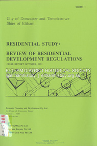
Document - Book, Econsult Planning and Development Pty Ltd, Residential Study: Review of Residential Development Regulations; Final Report; Volumes 1 and 2, October 1991
... Document Book Econsult Planning and Development Pty Ltd ...Report by Consultants Econsult Planning & Development produced under the Steering Committee guidance of the City of Doncaster and Templestowe and the Shire of Eltham recognising a lack of diversity in housing stock to meet changing housing needs. The Study objectives are: *To provide for a wide variety of housing choices and lot sizes *To make housing more accessible taking into account the Australian Model Code *To maintain residnetial amenity by taking into account significant local features *To prepare guidelines and policities which consider slope, lot, size, location, availability of services and significant vegeation. *To determine the housing types and lot sizes, required by new residents in different locationsresidential development, housing -
 Eltham District Historical Society Inc
Document - Series Listing, Fraser Faithfull et al, Series 20: Eltham Library construction, 350 photographic negatives, 2000
Series consists of I) 9 B&W negatives of the library under construction, with Librarian Linda McConnell on site. 2) 24 colour negatives depicting the interior of the new library. 3) A set of approximately 320 colour negatives documenting month-by-month progress in construction of the library. These negatives are arranged chronologically. 4) A supplementary page contains a number of negatives of sketch plans of the new library.shire of eltham archives, series listing -
 Eltham District Historical Society Inc
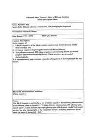
Document - Series Listing, Fraser Faithfull et al, Series 21: Eltham Library construction, 300 photographs, sketch plans, 2000
... on the site. 3) 3 laminated colour sketches: floor plan, roor plan ...Series consists of I) 7 sepia toned photographs or Librarian Linda McConnell inspecting work on the site orthe new library. 2) 11 B& W, sepia and colour photographs or work on the site. 3) 3 laminated colour sketches: floor plan, roor plan & exterior 4) A set or approximately 280 colour snapshots documenting work on the construction site, arranged chronologically month-by-month. There are also 5 "panorama" panels or between 2-4 snapshots taped together. These have been mounted on acid-free card.shire of eltham archives, series listing -
 Eltham District Historical Society Inc
Document - Folder, Victoria Archaeological Survey, 1982-1990
sites, structures, archaeological significance, victoria archaeological survey -
Eltham District Historical Society Inc
Document - Folder, McFarland, Sue
Sue McFarland, Eltham potter, won Box Hill Institute of TAFE's 2004 Teacher of the Year. Contents Newspaper article: "Potter plans for Japan show," Diamond Valley Leader, 30 March 2005, reports Sue McFarland's award and plans.Newspaper clippings, A4 photocopies, etcsue mcfarland -
 Eltham District Historical Society Inc
Photograph - Digital Photograph, Marguerite Marshall, Avenue of Honour, Main Road, Eltham, 20 April 2008
The suggestion of an Avenue of Honour may have been originally put forward by Lady Irvine who was a member of the Welcome Home Committee. The Avenue of Honour was established to memorialise all those from Eltham who enlisted (some of whom were still fighting overseas at the time), similarly as the Shire of Eltham (Soldiers) Memorial Park was in tribute to all from the Shire who enlisted. The twenty-seven names of those killed from Eltham were engraved on the Eltham War Memorial Obelisk unveiled in 1919 at the corner of Main Road and Bridge Street. From an article in the Heidelberg News and Greensborough, Eltham and Diamond Creek Chronicle, September 22, 1917, p. 2, it was reported: Some few weeks ago a public meeting was held in the Eltham Rechabite Hall for the purpose of forming a committee to make necessary arrangements for the return of our brave lads from the front, with the result that the following officers were elected, viz., Sir William Irvine. president; Cr. R. D. Taylor, vice-president; Rev. T. W. Sapsford, secretary; Mr R. E. Gilsenan, treasurer; with a very strong committee of local residents. Lady Irvine then suggested that it would be nice to plant an Avenue of Honor, which was carried out in a very cheerful and spirited manner on Saturday afternoon. Cr Taylor and Mr R. E. Gilsenan occupied themselves during the fore-forenoon in getting the lining-out and other preliminaries ready, but shortly after one o'clock the willing workers could be seen wending their way towards the township, with picks, shovels. &c., on their shoulders, and in a very short time the gang at work was in appearance a very lively and pretty sight, the only thing that was missing was the camera, to have had a few snapshots taken. A little after 3 o'clock Sir William and Lady Irvine, and Mr W. Gray and family, arrived by motor. Cr Taylor then explained that their object in gathering together so hurriedly to plant the avenue was on account of the lateness of the season, and being offered 100 trees, free of charge, by Cr. Wm. G. Gray; of Allwood Nursery, Hurst's Bridge (for which the committee are deeply grateful to him and the public highly appreciate his generous offer). Sir Wm. Irvine then spoke at some length on the ravages of this cruel war, and the good that must result therefrom in bringing all closer together; he also referred to our brave lads who were fighting for us, and thought it was for those at home to show their appreciation by planting the Avenue of Honor. Lady Irvine thou proceeded to plant the first tree, which was an English oak: Sir William following by planting a Spanish chestnut; and Mrs W. G. Gray a sycamore. After that the gathering refired to the entrance of Mr R. E. Gilsenan's green paddock to partake of refreshments, which the ladies had kindly provided for the willing band of workers. Work was again taken to in earnest, and the planting finished, all being satisfied that they had done good work. At the Eltham Shire Council’s monthly meeting held May 6, 1918, Cr. Gray promised to give Council £20 to £25 worth of trees if the Council would plant and guard them. His desire was that a tree be planted in the name of every soldier lad who has gone to the front. Each tree was later adorned with a brass plaque with the name of a soldier and a wooden tree guard placed around them. Over the years many trees died, and following roadworks were replanted on a new alignment. Nillumbik Shire Council is continuing this process of replanting trees in a new alignment to move them away from overhead power lines and to clear the VicRoads reserve. Covered under Heritage Overlay, Nillumbik Planning Scheme. Published: Nillumbik Now and Then / Marguerite Marshall 2008; photographs Alan King with Marguerite Marshall.; p119This collection of almost 130 photos about places and people within the Shire of Nillumbik, an urban and rural municipality in Melbourne's north, contributes to an understanding of the history of the Shire. Published in 2008 immediately prior to the Black Saturday bushfires of February 7, 2009, it documents sites that were impacted, and in some cases destroyed by the fires. It includes photographs taken especially for the publication, creating a unique time capsule representing the Shire in the early 21st century. It remains the most recent comprehenesive publication devoted to the Shire's history connecting local residents to the past. nillumbik now and then (marshall-king) collection, avenue of honour, main road, eltham