Showing 290 items
matching mapping
-
 Ballarat Heritage Services
Photograph - Colour, Stonework and well, Old Sarum, England, English Heritage Site, 2016, 01 November 2016
William the Conqueror inherited Old Sarum from the last Saxon king of England. It was an ideal site for a royal castle. It was here in 1070 that William paid off his army after a long and bitter campaign in northern England. It was here in 1086 that he called together all the major landholders in England so they could swear allegiance to him. It was a crucial moment. The Domesday Book was being written, a threatened Viking invasion had only just been averted and William's eldest son was in armed rebellion. Old Sarum was an important place where this Norman king of England held power. In 1794 the Ordnance Survey set out to check the accuracy of the first mapping of Southern England, which had begun ten years earlier. From a point just below Old Sarum Lieutenant William Mudge laid out a base-line 36,574 feet (11,253 metres) long. From each end of the line the positions of distant places were plotted using a huge theodolite made in 1791 by Jesse Ramsden. The accuracy of the process, which was repeated all over England, depended on Jesse Ramsden's craftsmanship and on William Mudge's surveying skill in setting out this first base-line from Old Sarum. The nearer end of Mudge's line is marked by an inscribed stone beside the modern A345 at Old Sarum. ordnance survey, william mudge, jesse ramsden, william the conqueror, old sarum, saxon, 1086, england -
 Ballarat Heritage Services
Photograph - Colour, Stonework, Old Sarum, England, English Heritage Site, 01 November 2016
William the Conqueror inherited Old Sarum from the last Saxon king of England. It was an ideal site for a royal castle. It was here in 1070 that William paid off his army after a long and bitter campaign in northern England. It was here in 1086 that he called together all the major landholders in England so they could swear allegiance to him. It was a crucial moment. The Domesday Book was being written, a threatened Viking invasion had only just been averted and William's eldest son was in armed rebellion. Old Sarum was an important place where this Norman king of England held power. In 1794 the Ordnance Survey set out to check the accuracy of the first mapping of Southern England, which had begun ten years earlier. From a point just below Old Sarum Lieutenant William Mudge laid out a base-line 36,574 feet (11,253 metres) long. From each end of the line the positions of distant places were plotted using a huge theodolite made in 1791 by Jesse Ramsden. The accuracy of the process, which was repeated all over England, depended on Jesse Ramsden's craftsmanship and on William Mudge's surveying skill in setting out this first base-line from Old Sarum. The nearer end of Mudge's line is marked by an inscribed stone beside the modern A345 at Old Sarum. ordnance survey, william mudge, jesse ramsden, william the conqueror, old sarum, saxon, 1086, england -
 Ballarat Heritage Services
Photograph - Colour, Sign Explaining toilets, Old Sarum, England, English Heritage Site, 01/11/2016
William the Conqueror inherited Old Sarum from the last Saxon king of England. It was an ideal site for a royal castle. It was here in 1070 that William paid off his army after a long and bitter campaign in northern England. It was here in 1086 that he called together all the major landholders in England so they could swear allegiance to him. It was a crucial moment. The Domesday Book was being written, a threatened Viking invasion had only just been averted and William's eldest son was in armed rebellion. Old Sarum was an important place where this Norman king of England held power. In 1794 the Ordnance Survey set out to check the accuracy of the first mapping of Southern England, which had begun ten years earlier. From a point just below Old Sarum Lieutenant William Mudge laid out a base-line 36,574 feet (11,253 metres) long. From each end of the line the positions of distant places were plotted using a huge theodolite made in 1791 by Jesse Ramsden. The accuracy of the process, which was repeated all over England, depended on Jesse Ramsden's craftsmanship and on William Mudge's surveying skill in setting out this first base-line from Old Sarum. The nearer end of Mudge's line is marked by an inscribed stone beside the modern A345 at Old Sarum. Colour photograph of a sign explaining toilets at Old Sarum, English Heritage Siteordnance survey, william mudge, jesse ramsden, william the conqueror, old sarum, saxon, 1086,, england -
 Ballarat Heritage Services
Photograph - Colour, Old Sarum, England, 2017, 01 November 2016
William the Conqueror inherited Old Sarum from the last Saxon king of England. It was an ideal site for a royal castle. It was here in 1070 that William paid off his army after a long and bitter campaign in northern England. It was here in 1086 that he called together all the major landholders in England so they could swear allegiance to him. It was a crucial moment. The Domesday Book was being written, a threatened Viking invasion had only just been averted and William's eldest son was in armed rebellion. Old Sarum was an important place where this Norman king of England held power. In 1794 the Ordnance Survey set out to check the accuracy of the first mapping of Southern England, which had begun ten years earlier. From a point just below Old Sarum Lieutenant William Mudge laid out a base-line 36,574 feet (11,253 metres) long. From each end of the line the positions of distant places were plotted using a huge theodolite made in 1791 by Jesse Ramsden. The accuracy of the process, which was repeated all over England, depended on Jesse Ramsden's craftsmanship and on William Mudge's surveying skill in setting out this first base-line from Old Sarum. The nearer end of Mudge's line is marked by an inscribed stone beside the modern A345 at Old Sarum. ordnance survey, william mudge, jesse ramsden, william the conqueror, old sarum, saxon, 1086, england -
 Ballarat Heritage Services
Photograph - Photograph - Colour, Old Sarum, England, 2016, 01/11/2016
William the Conqueror inherited Old Sarum from the last Saxon king of England. It was an ideal site for a royal castle. It was here in 1070 that William paid off his army after a long and bitter campaign in northern England. It was here in 1086 that he called together all the major landholders in England so they could swear allegiance to him. It was a crucial moment. The Domesday Book was being written, a threatened Viking invasion had only just been averted and William's eldest son was in armed rebellion. Old Sarum was an important place where this Norman king of England held power. In 1794 the Ordnance Survey set out to check the accuracy of the first mapping of Southern England, which had begun ten years earlier. From a point just below Old Sarum Lieutenant William Mudge laid out a base-line 36,574 feet (11,253 metres) long. From each end of the line the positions of distant places were plotted using a huge theodolite made in 1791 by Jesse Ramsden. The accuracy of the process, which was repeated all over England, depended on Jesse Ramsden's craftsmanship and on William Mudge's surveying skill in setting out this first base-line from Old Sarum. The nearer end of Mudge's line is marked by an inscribed stone beside the modern A345 at Old Sarum. Colour photograph of Old Sarum, England.ordnance survey, william mudge, jesse ramsden, william the conqueror, old sarum, saxon, 1086, england -
 Ballarat Heritage Services
Photograph - Colour, Earth Banks, Old Sarum, England, 01 November 2016
William the Conqueror inherited Old Sarum from the last Saxon king of England. It was an ideal site for a royal castle. It was here in 1070 that William paid off his army after a long and bitter campaign in northern England. It was here in 1086 that he called together all the major landholders in England so they could swear allegiance to him. It was a crucial moment. The Domesday Book was being written, a threatened Viking invasion had only just been averted and William's eldest son was in armed rebellion. Old Sarum was an important place where this Norman king of England held power. In 1794 the Ordnance Survey set out to check the accuracy of the first mapping of Southern England, which had begun ten years earlier. From a point just below Old Sarum Lieutenant William Mudge laid out a base-line 36,574 feet (11,253 metres) long. From each end of the line the positions of distant places were plotted using a huge theodolite made in 1791 by Jesse Ramsden. The accuracy of the process, which was repeated all over England, depended on Jesse Ramsden's craftsmanship and on William Mudge's surveying skill in setting out this first base-line from Old Sarum. The nearer end of Mudge's line is marked by an inscribed stone beside the modern A345 at Old Sarum. ordnance survey, william mudge, jesse ramsden, william the conqueror, old sarum, saxon, 1086, england -
 Ballarat Heritage Services
Photograph - Colour, Dorothy Wickham, Earth Banks, Old Sarum, England, 2016, 01 November 2016
William the Conqueror inherited Old Sarum from the last Saxon king of England. It was an ideal site for a royal castle. It was here in 1070 that William paid off his army after a long and bitter campaign in northern England. It was here in 1086 that he called together all the major landholders in England so they could swear allegiance to him. It was a crucial moment. The Domesday Book was being written, a threatened Viking invasion had only just been averted and William's eldest son was in armed rebellion. Old Sarum was an important place where this Norman king of England held power. In 1794 the Ordnance Survey set out to check the accuracy of the first mapping of Southern England, which had begun ten years earlier. From a point just below Old Sarum Lieutenant William Mudge laid out a base-line 36,574 feet (11,253 metres) long. From each end of the line the positions of distant places were plotted using a huge theodolite made in 1791 by Jesse Ramsden. The accuracy of the process, which was repeated all over England, depended on Jesse Ramsden's craftsmanship and on William Mudge's surveying skill in setting out this first base-line from Old Sarum. The nearer end of Mudge's line is marked by an inscribed stone beside the modern A345 at Old Sarum. King William devised the Domesday Book, considered to be the first listing of land owners in England. Among the names is that of D'Arques, from Normandy, France. Descendants of this family later emigrated from England and settled in Victoria, Australia under the surname 'Dark'. ordnance survey, william mudge, jesse ramsden, william the conqueror, old sarum, saxon, 1086, england -
 Ballarat Heritage Services
Photograph - Colour, Earth Banks, Old Sarum, England, 2016, 01 November 2016
William the Conqueror inherited Old Sarum from the last Saxon king of England. It was an ideal site for a royal castle. It was here in 1070 that William paid off his army after a long and bitter campaign in northern England. It was here in 1086 that he called together all the major landholders in England so they could swear allegiance to him. It was a crucial moment. The Domesday Book was being written, a threatened Viking invasion had only just been averted and William's eldest son was in armed rebellion. Old Sarum was an important place where this Norman king of England held power. In 1794 the Ordnance Survey set out to check the accuracy of the first mapping of Southern England, which had begun ten years earlier. From a point just below Old Sarum Lieutenant William Mudge laid out a base-line 36,574 feet (11,253 metres) long. From each end of the line the positions of distant places were plotted using a huge theodolite made in 1791 by Jesse Ramsden. The accuracy of the process, which was repeated all over England, depended on Jesse Ramsden's craftsmanship and on William Mudge's surveying skill in setting out this first base-line from Old Sarum. The nearer end of Mudge's line is marked by an inscribed stone beside the modern A345 at Old Sarum. ordnance survey, william mudge, jesse ramsden, william the conqueror, old sarum, saxon, 1086, england -
 Ballarat Heritage Services
Photograph - Photograph - Colour, Castle toilets, Old Sarum, England, 2016, 01/11/2016
William the Conqueror inherited Old Sarum from the last Saxon king of England. It was an ideal site for a royal castle. It was here in 1070 that William paid off his army after a long and bitter campaign in northern England. It was here in 1086 that he called together all the major landholders in England so they could swear allegiance to him. It was a crucial moment. The Domesday Book was being written, a threatened Viking invasion had only just been averted and William's eldest son was in armed rebellion. Old Sarum was an important place where this Norman king of England held power. In 1794 the Ordnance Survey set out to check the accuracy of the first mapping of Southern England, which had begun ten years earlier. From a point just below Old Sarum Lieutenant William Mudge laid out a base-line 36,574 feet (11,253 metres) long. From each end of the line the positions of distant places were plotted using a huge theodolite made in 1791 by Jesse Ramsden. The accuracy of the process, which was repeated all over England, depended on Jesse Ramsden's craftsmanship and on William Mudge's surveying skill in setting out this first base-line from Old Sarum. The nearer end of Mudge's line is marked by an inscribed stone beside the modern A345 at Old Sarum. Colour photographs of Castle toilets at Old Sarum, England. The toilets are constructed of stone. ordnance survey, william mudge, jesse ramsden, william the conqueror, old sarum, saxon, 1086, england, subjects, toilets -
 Ballarat Heritage Services
Photograph - Colour, Toilets, Old Sarum, England, English Heritage Site, 2016, 01 November 2016
William the Conqueror inherited Old Sarum from the last Saxon king of England. It was an ideal site for a royal castle. It was here in 1070 that William paid off his army after a long and bitter campaign in northern England. It was here in 1086 that he called together all the major landholders in England so they could swear allegiance to him. It was a crucial moment. The Domesday Book was being written, a threatened Viking invasion had only just been averted and William's eldest son was in armed rebellion. Old Sarum was an important place where this Norman king of England held power. In 1794 the Ordnance Survey set out to check the accuracy of the first mapping of Southern England, which had begun ten years earlier. From a point just below Old Sarum Lieutenant William Mudge laid out a base-line 36,574 feet (11,253 metres) long. From each end of the line the positions of distant places were plotted using a huge theodolite made in 1791 by Jesse Ramsden. The accuracy of the process, which was repeated all over England, depended on Jesse Ramsden's craftsmanship and on William Mudge's surveying skill in setting out this first base-line from Old Sarum. The nearer end of Mudge's line is marked by an inscribed stone beside the modern A345 at Old Sarum. ordnance survey, william mudge, jesse ramsden, william the conqueror, old sarum, saxon, 1086, england -
 Ballarat Heritage Services
Photograph - Colour, Stonework, Old Sarum, England, English Heritage Site, 2016, 01 November 2016
William the Conqueror inherited Old Sarum from the last Saxon king of England. It was an ideal site for a royal castle. It was here in 1070 that William paid off his army after a long and bitter campaign in northern England. It was here in 1086 that he called together all the major landholders in England so they could swear allegiance to him. It was a crucial moment. The Domesday Book was being written, a threatened Viking invasion had only just been averted and William's eldest son was in armed rebellion. Old Sarum was an important place where this Norman king of England held power. In 1794 the Ordnance Survey set out to check the accuracy of the first mapping of Southern England, which had begun ten years earlier. From a point just below Old Sarum Lieutenant William Mudge laid out a base-line 36,574 feet (11,253 metres) long. From each end of the line the positions of distant places were plotted using a huge theodolite made in 1791 by Jesse Ramsden. The accuracy of the process, which was repeated all over England, depended on Jesse Ramsden's craftsmanship and on William Mudge's surveying skill in setting out this first base-line from Old Sarum. The nearer end of Mudge's line is marked by an inscribed stone beside the modern A345 at Old Sarum. ordnance survey, william mudge, jesse ramsden, william the conqueror, old sarum, saxon, 1086, england -
 Ballarat Heritage Services
Photograph - Colour, looking from Stonework towards earth mounds, Old Sarum, England, English Heritage Site, 2016, 01 November 2016
William the Conqueror inherited Old Sarum from the last Saxon king of England. It was an ideal site for a royal castle. It was here in 1070 that William paid off his army after a long and bitter campaign in northern England. It was here in 1086 that he called together all the major landholders in England so they could swear allegiance to him. It was a crucial moment. The Domesday Book was being written, a threatened Viking invasion had only just been averted and William's eldest son was in armed rebellion. Old Sarum was an important place where this Norman king of England held power. In 1794 the Ordnance Survey set out to check the accuracy of the first mapping of Southern England, which had begun ten years earlier. From a point just below Old Sarum Lieutenant William Mudge laid out a base-line 36,574 feet (11,253 metres) long. From each end of the line the positions of distant places were plotted using a huge theodolite made in 1791 by Jesse Ramsden. The accuracy of the process, which was repeated all over England, depended on Jesse Ramsden's craftsmanship and on William Mudge's surveying skill in setting out this first base-line from Old Sarum. The nearer end of Mudge's line is marked by an inscribed stone beside the modern A345 at Old Sarum. ordnance survey, william mudge, jesse ramsden, william the conqueror, old sarum, saxon, 1086, england -
 Ballarat Heritage Services
Photograph - Colour, Looking from Stonework towards people walking on earth mounds, Old Sarum, England, English Heritage Site, 2016, 01 November 2016
William the Conqueror inherited Old Sarum from the last Saxon king of England. It was an ideal site for a royal castle. It was here in 1070 that William paid off his army after a long and bitter campaign in northern England. It was here in 1086 that he called together all the major landholders in England so they could swear allegiance to him. It was a crucial moment. The Domesday Book was being written, a threatened Viking invasion had only just been averted and William's eldest son was in armed rebellion. Old Sarum was an important place where this Norman king of England held power. In 1794 the Ordnance Survey set out to check the accuracy of the first mapping of Southern England, which had begun ten years earlier. From a point just below Old Sarum Lieutenant William Mudge laid out a base-line 36,574 feet (11,253 metres) long. From each end of the line the positions of distant places were plotted using a huge theodolite made in 1791 by Jesse Ramsden. The accuracy of the process, which was repeated all over England, depended on Jesse Ramsden's craftsmanship and on William Mudge's surveying skill in setting out this first base-line from Old Sarum. The nearer end of Mudge's line is marked by an inscribed stone beside the modern A345 at Old Sarum. ordnance survey, william mudge, jesse ramsden, william the conqueror, old sarum, saxon, 1086, england -
 Ballarat Heritage Services
Photograph - Colour, Stairs, Old Sarum, England, English Heritage Site, 2016, 01 November 2016
William the Conqueror inherited Old Sarum from the last Saxon king of England. It was an ideal site for a royal castle. It was here in 1070 that William paid off his army after a long and bitter campaign in northern England. It was here in 1086 that he called together all the major landholders in England so they could swear allegiance to him. It was a crucial moment. The Domesday Book was being written, a threatened Viking invasion had only just been averted and William's eldest son was in armed rebellion. Old Sarum was an important place where this Norman king of England held power. In 1794 the Ordnance Survey set out to check the accuracy of the first mapping of Southern England, which had begun ten years earlier. From a point just below Old Sarum Lieutenant William Mudge laid out a base-line 36,574 feet (11,253 metres) long. From each end of the line the positions of distant places were plotted using a huge theodolite made in 1791 by Jesse Ramsden. The accuracy of the process, which was repeated all over England, depended on Jesse Ramsden's craftsmanship and on William Mudge's surveying skill in setting out this first base-line from Old Sarum. The nearer end of Mudge's line is marked by an inscribed stone beside the modern A345 at Old Sarum. ordnance survey, william mudge, jesse ramsden, william the conqueror, old sarum, saxon, 1086, england -
 Ballarat Heritage Services
Photograph - Colour, Public toilets hidden in earth mound, Old Sarum, England, English Heritage Site, 2016, 01 November 2016
William the Conqueror inherited Old Sarum from the last Saxon king of England. It was an ideal site for a royal castle. It was here in 1070 that William paid off his army after a long and bitter campaign in northern England. It was here in 1086 that he called together all the major landholders in England so they could swear allegiance to him. It was a crucial moment. The Domesday Book was being written, a threatened Viking invasion had only just been averted and William's eldest son was in armed rebellion. Old Sarum was an important place where this Norman king of England held power. In 1794 the Ordnance Survey set out to check the accuracy of the first mapping of Southern England, which had begun ten years earlier. From a point just below Old Sarum Lieutenant William Mudge laid out a base-line 36,574 feet (11,253 metres) long. From each end of the line the positions of distant places were plotted using a huge theodolite made in 1791 by Jesse Ramsden. The accuracy of the process, which was repeated all over England, depended on Jesse Ramsden's craftsmanship and on William Mudge's surveying skill in setting out this first base-line from Old Sarum. The nearer end of Mudge's line is marked by an inscribed stone beside the modern A345 at Old Sarum. ordnance survey, william mudge, jesse ramsden, william the conqueror, old sarum, saxon, 1086, england -
 Ballarat Heritage Services
Photograph - Colour, Entrance to Public toilets hidden in earth mound, Old Sarum, England, English Heritage Site, 2016, 01 November 2016
William the Conqueror inherited Old Sarum from the last Saxon king of England. It was an ideal site for a royal castle. It was here in 1070 that William paid off his army after a long and bitter campaign in northern England. It was here in 1086 that he called together all the major landholders in England so they could swear allegiance to him. It was a crucial moment. The Domesday Book was being written, a threatened Viking invasion had only just been averted and William's eldest son was in armed rebellion. Old Sarum was an important place where this Norman king of England held power. In 1794 the Ordnance Survey set out to check the accuracy of the first mapping of Southern England, which had begun ten years earlier. From a point just below Old Sarum Lieutenant William Mudge laid out a base-line 36,574 feet (11,253 metres) long. From each end of the line the positions of distant places were plotted using a huge theodolite made in 1791 by Jesse Ramsden. The accuracy of the process, which was repeated all over England, depended on Jesse Ramsden's craftsmanship and on William Mudge's surveying skill in setting out this first base-line from Old Sarum. The nearer end of Mudge's line is marked by an inscribed stone beside the modern A345 at Old Sarum. ordnance survey, william mudge, jesse ramsden, william the conqueror, old sarum, saxon, 1086, england -
 Ballarat Heritage Services
Photograph - Colour, Masons' Marks, Old Sarum, England, English Heritage Site, 2016, 01 November 2016
William the Conqueror inherited Old Sarum from the last Saxon king of England. It was an ideal site for a royal castle. It was here in 1070 that William paid off his army after a long and bitter campaign in northern England. It was here in 1086 that he called together all the major landholders in England so they could swear allegiance to him. It was a crucial moment. The Domesday Book was being written, a threatened Viking invasion had only just been averted and William's eldest son was in armed rebellion. Old Sarum was an important place where this Norman king of England held power. In 1794 the Ordnance Survey set out to check the accuracy of the first mapping of Southern England, which had begun ten years earlier. From a point just below Old Sarum Lieutenant William Mudge laid out a base-line 36,574 feet (11,253 metres) long. From each end of the line the positions of distant places were plotted using a huge theodolite made in 1791 by Jesse Ramsden. The accuracy of the process, which was repeated all over England, depended on Jesse Ramsden's craftsmanship and on William Mudge's surveying skill in setting out this first base-line from Old Sarum. The nearer end of Mudge's line is marked by an inscribed stone beside the modern A345 at Old Sarum. ordnance survey, william mudge, jesse ramsden, william the conqueror, old sarum, saxon, 1086, england -
 Ballarat Heritage Services
Photograph - Colour, Masons' Marks, Old Sarum, England, English Heritage Site, 01 November 2016
William the Conqueror inherited Old Sarum from the last Saxon king of England. It was an ideal site for a royal castle. It was here in 1070 that William paid off his army after a long and bitter campaign in northern England. It was here in 1086 that he called together all the major landholders in England so they could swear allegiance to him. It was a crucial moment. The Domesday Book was being written, a threatened Viking invasion had only just been averted and William's eldest son was in armed rebellion. Old Sarum was an important place where this Norman king of England held power. In 1794 the Ordnance Survey set out to check the accuracy of the first mapping of Southern England, which had begun ten years earlier. From a point just below Old Sarum Lieutenant William Mudge laid out a base-line 36,574 feet (11,253 metres) long. From each end of the line the positions of distant places were plotted using a huge theodolite made in 1791 by Jesse Ramsden. The accuracy of the process, which was repeated all over England, depended on Jesse Ramsden's craftsmanship and on William Mudge's surveying skill in setting out this first base-line from Old Sarum. The nearer end of Mudge's line is marked by an inscribed stone beside the modern A345 at Old Sarum. ordnance survey, william mudge, jesse ramsden, william the conqueror, old sarum, saxon, 1086, england -
 Ballarat Heritage Services
Photograph - Colour, Masons' Marks, Old Sarum, England, English Heritage Site, 2016, 01 November 2016
William the Conqueror inherited Old Sarum from the last Saxon king of England. It was an ideal site for a royal castle. It was here in 1070 that William paid off his army after a long and bitter campaign in northern England. It was here in 1086 that he called together all the major landholders in England so they could swear allegiance to him. It was a crucial moment. The Domesday Book was being written, a threatened Viking invasion had only just been averted and William's eldest son was in armed rebellion. Old Sarum was an important place where this Norman king of England held power. In 1794 the Ordnance Survey set out to check the accuracy of the first mapping of Southern England, which had begun ten years earlier. From a point just below Old Sarum Lieutenant William Mudge laid out a base-line 36,574 feet (11,253 metres) long. From each end of the line the positions of distant places were plotted using a huge theodolite made in 1791 by Jesse Ramsden. The accuracy of the process, which was repeated all over England, depended on Jesse Ramsden's craftsmanship and on William Mudge's surveying skill in setting out this first base-line from Old Sarum. The nearer end of Mudge's line is marked by an inscribed stone beside the modern A345 at Old Sarum. ordnance survey, william mudge, jesse ramsden, william the conqueror, old sarum, saxon, 1086, england -
 Ballarat Heritage Services
Photograph - Colour, Masons' Marks, Old Sarum, England, English Heritage Site, 2016, 01 November 2016
William the Conqueror inherited Old Sarum from the last Saxon king of England. It was an ideal site for a royal castle. It was here in 1070 that William paid off his army after a long and bitter campaign in northern England. It was here in 1086 that he called together all the major landholders in England so they could swear allegiance to him. It was a crucial moment. The Domesday Book was being written, a threatened Viking invasion had only just been averted and William's eldest son was in armed rebellion. Old Sarum was an important place where this Norman king of England held power. In 1794 the Ordnance Survey set out to check the accuracy of the first mapping of Southern England, which had begun ten years earlier. From a point just below Old Sarum Lieutenant William Mudge laid out a base-line 36,574 feet (11,253 metres) long. From each end of the line the positions of distant places were plotted using a huge theodolite made in 1791 by Jesse Ramsden. The accuracy of the process, which was repeated all over England, depended on Jesse Ramsden's craftsmanship and on William Mudge's surveying skill in setting out this first base-line from Old Sarum. The nearer end of Mudge's line is marked by an inscribed stone beside the modern A345 at Old Sarum. ordnance survey, william mudge, jesse ramsden, william the conqueror, old sarum, saxon, 1086, england -
 Bendigo Military Museum
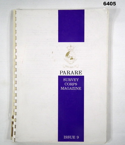
Magazine - "Parare" Survey Corps Magazine Issue 9, Royal Australian Survey Corps, 1993
An annual magazine published for release on RASvy Corps birthday 1st July. All units with RASvy Corps are invited / expected to submit an article depicting their activities over the preceding years 1991 to 1993. 4Fd Svy Sqn Adventure training list pages 7, 8. Army Map Depot - Unit Ski Day, pages 20, 21. The William Patton Expedition - Locating his grave as part of the " Burke and Wills " expedition, list of personnel involved - page 43. 8 Fd Svy Sqn - names mentioned and photo - page 50. 4 Fd Svy Sqn (1992) names mentioned page 69. The G Res manning list on page 70. Names mentioned in "Unit sports pages 73, 74. Exercise Kokoda Cartographer July 1992 list of participants on Page 78. Iraq - The Gulf War, Topographic Support page 52. Adelaide (4 Fd Svy Sqn) 1992 page 65. 8 Fd Svy Sqn manning wind down list pages 89-90. Military Geographic Information Pilot Project page 92. Royal Australian Survey Corps Aerial photography Team personnel list page 95. Operation Belama 92 Team list page 96. Long term Schooling attendees and promotions, page 105. Litho Sqn Postings in and out pages 116-117. Special awards SGT Durrant page 113, SSGT SR Hill page 114. RASvy completes 1:50,000 scale mapping of the Pilbara Region page 121. 1st Topo Svy Sqn personnel mentioned on page 122. A4 sized booklet with soft glossy card covers, paper pages held together with a plastic spiral binder.army survey regiment, army survey regt, fortuna, royal australian survey corps, rasvy, asr -
 Bendigo Military Museum
Photograph - Photographic Technicians performing tasks at the Army Headquarters Survey Regiment, c1960s
These eight photographs were most likely taken in the 1960s in Lithographic Squadron at the Army Headquarters Survey Regiment, Fortuna, Bendigo. Although Photo .1P is not annotated the remainder have the name of the technicians written on the back. The equipment operated by the technicians is the KLIMCH Commodore camera. The main tasks undertaken by the technicians were most likely enlargements and reductions of map reproduction material. The KLIMSCH Commodore camera was introduced in 1953 and was the largest in the Southern Hemisphere. It was replaced with a new model of the same size in 1979. The new model with its computer-based interface provided productivity gains with improved speed and its consistent results led to less wastage in time and materials. Its variomat lens system provided improved retention of map feature linear weights during the camera reduction process. The typed description pasted on the back of photo .5P states “Cpl R. MacKenzie of Bentley, Perth (WA) of the AHQ Survey Regt, located at “Fortuna”, Bendigo, (Vic). Has been in the Army for 5 years. He removes the lens cap from the 70 inch F16 lens of the giant KLIMSCH camera used in map making for the Army. The camera which was specially made for the Army in Germany is fully automatic and power operated. It is claimed to be one of the biggest automatic cameras of its type in the world. It was made to the specifications of the Aust Army Survey Corps to assist in the production of the very high standard maps for the Army. The AHQ Survey Regt also assists Commonwealth and other Govt departments in the printing of maps required other than for Army needs. The KLIMSCH camera is used for cartographic mapping photography.” This is a set of photographs of technicians operating photographic reproduction equipment at the Army Headquarters Survey Regiment, Bendigo c1960s. The photographs were printed on photographic paper and are part of the Army Survey Regiment’s Collection. The photographs were scanned at 300 dpi. .1) - Photo, black & white, c1960s, Les ‘Snow’ Taylor, Lithographic Squadron .2) - Photo, black & white, c1960s, Les ‘Snow’ Taylor, Lithographic Squadron .3) - Photo, black & white, c1960s, John Rolfe, Lithographic Squadron .4) - Photo, black & white, c1960s, John Rolfe, Lithographic Squadron .5) - Photo, black & white, c1960s, CPL R. MacKenzie, Lithographic Squadron .6) - Photo, black & white, c1960s, unidentified, Lithographic Squadron .7) - Photo, black & white, c1960s, George Graham, Lithographic Squadron .8) - Photo, black & white, c1960s, L to R: Bill Snelson, George Graham, Lithographic Squadron.1P – no annotation .2 to .4 – personnel names (less rank) annotated on back. .5 – name and rank annotated on back, with detailed typed description .6 to .8 – personnel names (less rank) annotated on back. royal australian survey corps, rasvy, army survey regiment, army svy regt, fortuna, asr, litho -
 Federation University Historical Collection
Booklet, Eugene Kneebone, Explore Discover Apply: University of Ballarat Research Report, 2007, 2007
University of Ballarat is a predecessor institution of Federation University AustraliaPredominantly white and gold soft covered book outlining Research at the University of Ballarat. It includes information on: * Institute for Regional and Rural Research and Innovation * Centre for Regional Innovation and Competitiveness * Teaching to Global Citizenship * Older BLokes and Their Sheds: Community based Men's Sheds in Australia * Education and Re-education in Child Sexual Abuse * Water Demand Management and Climate Change * An Indigenous History of Stonington * Key Drivers of Change in Adult and Community Education * Benchmaking Research * Training for Child Protection * Grabbing a Lifeline to Better Health * Enhancing Nurse Preparation for health care practice * ACT for depression in adolescence * FRom Pokies to Peremptory PErsonal Pleasures * Worksafe Awards * Mineral Sands that are not sinking * Rising Generation Inspired by Trace Elements * Environmental Research from Namibia to Ballarat * Evaluation of VicHealth Sport & Physical Activity Programs * A good Hard Look at Sports Grounds * Preventing Knee Injuries inn Community Australian Football * WIDCORP Beyond the Pipelines *Woodside Energy Ltd Optimizes its Production * Australian Defence Force Seeks Best Fit * Mapping Augmentation Structures Images include: David Battersby, Wayne Robinson, Joel Epstein, Georgina Tsolidis, Barry Golding, Caroline Taylor, Julian Lowe, Laura Kostanski, Ian D. Clark, Jessie Harman, Patrick White, Angela Murphy, Katrina Brown, John McDonald, Robert Watson, Sally Wellard, Louise Hayes, Stephen Cowley, Susan Leggett, Steve Hall, Stafford McKnight, Larissa Koroznikova, Patrick Graz, David Stratton, Andrew Stranieri, John Yearwood widcorp, water in drylands collaborative research project, eugene kneebone