Showing 215 items
matching flora and fauna
-
 Eltham District Historical Society Inc
Photograph - Digital Photograph, Alan King, Kinglake National Park, 27 March 2008
Fern gullies around Jehosaphat Gully Covered under National Estate. Published: Nillumbik Now and Then / Marguerite Marshall 2008; photographs Alan King with Marguerite Marshall.; p125 The magnificent Kinglake National Park, fringing Nillumbik’s north, is the largest national park close to Melbourne. Thanks to the vision and hard work of a band of local people, the park was created from what was rapidly becoming degraded land. Seeing a threat to Kinglake’s indigenous flora and fauna, several prominent local people campaigned for a national park, which was established in 1928.1 Since then, the park has grown through donations and acquisitions of land, from around 13,800 acres of land (5585ha) to 22,360 hectares. The Sugarloaf and Everard Blocks – of almost 8000 hectares – stand in Nillumbik and the park extends into Mitchell and Murrundindi Shires and the City of Whittlesea. Mt Everard commemorates William Hugh Everard, State member for Evelyn when the park was established. Before 1928, European settlers had degraded the Kinglake area, which was named after the celebrated English author and lawyer, Alexander William Kinglake. Remains of gold shafts and diggings in the park are reminders of Kinglake’s first settlers, who hoped to strike it rich at the gold diggings. But like other gold fields in this shire, they proved not very lucrative and soon timber cutting replaced mining in importance. However, before long, the accessible timber supply ran out, so in the 1920s agriculture took over – particularly potatoes and berry fruits – which involved large-scale clearing.2 The park’s instigator was retired Melbourne University Professor of Music, William Laver.3 As chair of the Kinglake Progress Association he began negotiations to have crown lands on the southern scarp of the Great Dividing Range reserved as a national park. Even before the park was proclaimed, from 1927, KPA members cut tracks to the major scenic points. Professor Laver was one of several people who gave land for the park, donating around 50 acres (20ha), including the Jehosaphat Gully.4 Laver chaired the park’s first Committee of Management, which raised money to employ a ranger and provide facilities, including tracks and roads for fire protection vehicles, toilets and shelters. The committee charged fees for firewood collection, some grazing of livestock, and visitor entrance, and obtained small State Government and Eltham Shire grants. In 1957 the State Government provided revenue for national parks. Then, in 1975, the State Government took over the management and the Committee of Management became an advisory committee, which disbanded in 1978. Originally, the park covered crown land in the Shires of Eltham and Whittlesea; then Wombelano Falls in Yea and other areas were added. In 1970 the park extended into the Shires of Eltham, Healesville, Whittlesea and Yea.5 Bush fires have been an ongoing problem. In 1939 hundreds of eucalypts and acacias had to be sown around the Jehosaphat Gully to rejuvenate the forest. To manage bushfires, the Committee of Management, then the State Government, worked closely with the Forestry Commission, shire councils and local fire brigades. Early national parks focussed on recreation. But by the 1980s, conservation, education and scientific research became more important, playing a vital role in preserving representative samples of the natural environment. Each year many thousands of people use the park’s extensive network of walking tracks amongst the protected plant and animal life as well as camping, cycling and horse riding. The park, along the slopes of the Great Dividing Range, has lookouts revealing magnificent views of the Melbourne skyline, Port Phillip Bay, the Yarra Valley and the You Yangs. Vegetation in the Masons Falls area includes messmate forest, Austral grass-trees, ferns and Hazel Pomaderris. In spring, orchids, lilies, everlasting daisies, correas, grevillea and heath appear. Around Jehosaphat Gully are wet and dry forest, fern gullies and banksia. Animal life includes wallabies, kangaroos, koalas, echidnas, possums, gliders and bandicoots. Male lyrebirds can be heard mimicking in the Jehosaphat Gully, particularly in the Everard Block in winter.This collection of almost 130 photos about places and people within the Shire of Nillumbik, an urban and rural municipality in Melbourne's north, contributes to an understanding of the history of the Shire. Published in 2008 immediately prior to the Black Saturday bushfires of February 7, 2009, it documents sites that were impacted, and in some cases destroyed by the fires. It includes photographs taken especially for the publication, creating a unique time capsule representing the Shire in the early 21st century. It remains the most recent comprehenesive publication devoted to the Shire's history connecting local residents to the past. nillumbik now and then (marshall-king) collection, kinglake national park, jehosaphat gully -
 Eltham District Historical Society Inc
Photograph - Digital Photograph, Alan King, Diamond Creek, Barak Bushlands, Eltham, 2008
A habitat corridor and it strengthens the community. Published: Nillumbik Now and Then / Marguerite Marshall 2008; photographs Alan King with Marguerite Marshall.; p185 Barak Bushlands lie west of the Diamond Creek on the corner of Falkiner Street and busy, noisy Main Road. They form part of an important habitat corridor linking the Yarra River to the Kinglake National Park.1 Manna Gums, tawny frogmouths and platypuses are some of the indigenous plants and animals that have made their home there. The bushlands are the result of more than nine years of hard work by the local community with the Nillumbik Council, to transform a degraded flood plain into this refuge of natural beauty. In 1997, shortly after moving into the new Riverside Estate on Falkiner Street, Eltham, several residents noticed the sorry state of the Diamond Creek and surrounding area. Part of it was used as a cow paddock and although small patches of vegetation survived, the area was infested with weeds, rabbits, rubbish and drainage from the housing estate. At various times the 4.4 hectares had been used as a market garden and for shire stock piles. The residents began to restore the area by revegetating land along the Diamond Creek. In 1998 they established the Friends of the Diamond Creek Falkiner Street Reserve2 and 35 families joined from the 90-house Estate. Carolyn Mellor, as the Friends’ Land Manager, undertook a four-year horticulture course to guide this massive project for a volunteer organisation. Since 1999, she has been the Friends’ President. In 1999 the Friends urged the Nillumbik Council to undertake a feasibility study into establishing a wetland system and urban forest. Work began in 2002 with Nillumbik Council funding the project, supplemented by government grants. The Friends also received grants from Melbourne Water and Parks Victoria. Aided by the Friends and other community members, the Council created the Barak Bushlands consisting of a forest, a wetland, a bridge, a path and open space. The beautiful wetland treats most of the estate’s stormwater runoff. Storm water is filtered through plants in the wetland ponds then is released slowly into the billabong, before flowing into the Diamond Creek. The wetland also helps to minimise flooding and the improved water quality provides a flora and fauna habitat. The Friends and other volunteers planted more than 27,000 plants, more than one third of which they grew from seeds they collected at Lower Eltham and Wingrove Parks. Eltham High School students planted thousands of these through a Year Eight program introduced for this purpose. Other groups who assisted were: Green Corps, local Scouts and Guides – 2nd Montmorency, 1st Diamond Creek and 1st Eltham Cub Packs, Eltham College students, Eltham East Primary School, Landcare members, Eltham Lions Club and the Eltham Baptist Church. To maintain enthusiasm for the mammoth task, the Friends and other volunteers ‘adopted’ trees to water and wrote their names on the stakes. In 2004, to recognise the area’s original occupiers, the reserve was named Barak Bushlands. William Barak, who lived from 1824 to 1903, was the last chief of the Yarra Yarra tribe of the Wurundjeri-willam people. Traces of these original inhabitants remain in scar trees (bark sections removed to make a shield or canoe). That same year the Friends’ group was a finalist in the prestigious Federal Government, Banksia Environmental Awards. The Friends have also participated in Clean Up Australia, removing tonnes of rubbish and regularly testing the billabong, wetland and creek, for pollutants. For years the Friends, together with the Australian Platypus Conservancy, have tagged, measured and checked the health of platypuses from the Diamond and Mullum Mullum Creeks. With Latrobe University the Friends have conducted night walks to view owls, possums, bats and sugar gliders. Challenges for the council and the Friends continue with a large rabbit population, some vandalism, weed eradication and maintenance. However, thanks to this community effort, locals can now escape confined urban living on small blocks of land and enjoy the beauty of indigenous plants and animals. Working together has also strengthened the local community,This collection of almost 130 photos about places and people within the Shire of Nillumbik, an urban and rural municipality in Melbourne's north, contributes to an understanding of the history of the Shire. Published in 2008 immediately prior to the Black Saturday bushfires of February 7, 2009, it documents sites that were impacted, and in some cases destroyed by the fires. It includes photographs taken especially for the publication, creating a unique time capsule representing the Shire in the early 21st century. It remains the most recent comprehenesive publication devoted to the Shire's history connecting local residents to the past. nillumbik now and then (marshall-king) collection, barak bushlands, diamond creek (creek), eltham -
 Federation University Historical Collection
Document - Reports, Martin Westbrooke, Nanya Station
Nanya Station, owned and managed by the University of Ballarat (now Federation University Australia), was purchased with assistance from the Department of Environment and Heritage Government Caring for our Country program. Nanya Station is located in the Scotia country, west of the Darling Ana-Branch in far western New South Wales and consists of the Nanya Western Lands Pastoral Lease 3281 – Perpetual Leasehold Lot 1244 in Deposited Plan 762778, Parish of Winnebaga, County of Tara and part of Lot 1242 County of Windeyer. Nanya is within the tribal area of the Danggali Aboriginal people, a sub-group of the Barkindji. Many Aboriginal sites have been recorded adjacent to major rivers in the region providing evidence that these areas supported a large population. The Scotia region has one of the shortest stock grazing histories of western NSW. Along with five other Scotia properties, Nanya was created as a pastoral lease in 1927. The first European settlement on the land followed exploration of the area by Sturt and Eyre. In 1854, the Lake Victoria lease which encompassed this area comprised 465,000ha.included Scotia blocks 1, 2, 3 and 4, Amoskeag and Winnebaga which formed the area known as the Scotia. It was described as a region of thick mallee scrub, interspersed with bluebush flats and Belah woodland. In the 1920s artesian water was found and the dry Scotia country was surveyed and divided into six Homestead leases allocated by ballot (Withers 1989). All properties were approximately 30,000ha, with a recommended stocking level of 3,000 sheep. Winnebaga (renamed Nanya) was taken up by Gordon Cumming. He initially dug a dam near the southeast corner of the property. A larger ground tank and rudimentary dwelling at the site of the present complex was later established. An adjacent area was cleared and cropped to provide feed for the horses used in digging the earth tanks. The ruins of the original building are located between the shearing shed and Homestead Tank. A cottage was built in the 1930s and a more substantial Red Gum framed homestead in the early 1950s. The lease was held by Mr Gordon Cumming until 1984 when it was purchased by Mr Norm Scadding as an extension to the adjacent lease, Belvedere. It was sold in 1995 to Mr Rob Taylor of Waikerie then in 1999 to BeMax Pty. Ltd., a sand mining company. These last three owners all permitted use of the property by the University for teaching and research. The Centre for Environmental Management at the University of Ballarat had been involved in studies of flora and fauna in western New South Wales since 1988. Studies became concentrated on the Scotia region with its variety of intact ecosystems due to a short pastoral history. Of particular significance is a system of natural salt lakes of which the most extensive is the Scotia Discharge Complex located on Nanya Station. An extensive vegetation survey of the Scotia region Westbrooke et al. 1998) highlighted the significance of the area both in terms of the range of communities in relatively intact condition and the occurrence of species and communities of restricted distribution. Nearly 400 species were recorded of which nine had either not previously been recorded or have restricted distribution in western NSW. Twenty-two plant communities occur on Nanya Station of which two, Halosarcia lylei low open shrubland and Hemichroa diandra/Halosarcia/Frankenia low open shrubland, are dominated by species not previously recorded from NSW. H. lylei and Acacia loderi shrublands are listed as endangered under the NSW Threatened Species Conservation Act. As noted, the area has a relatively short grazing history and, due to the presence of large areas of mallee with a Triodia understorey and restricted water supplies, stocking rates have been low. The diversity of ecosystems in relatively intact condition and extensive areas of old growth mallee made Nanya a highly significant refuge for biological diversity. This factors led to the purchase of Nanya Station by the University of Ballarat in 2004 with the assistance of the Department of Environment and Heritage for the purposes of conservation, research and education. In 2010 the southern paddocks of Nagaella Station (10,000ha.) which lie along the northern boundary, were purchased with the assistance of Lower Murray Darling Catchment Management Authority and added to the Nanya lease to provide complete protection for the communities of the Nanya Discharge Complex and further high quality Malleefowl habitat. Four digital reports documents relating to Federation University's Nanya Station, Western New South Walesnanya station, scotia country, pastoral lease, winnebaga county, darling ana-branch, martin westbrooke, environmental education, nagaella station, lower murray darling catchment management authority, conservation research education, ian gribble, pat prevett, ian henderson, danggali -
 The Beechworth Burke Museum
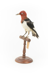
Animal specimen - Red Headed Woodpecker, Trustees of the Australian Museum, 1860-1880
Red Headed Woodpeckers can be found in Southern Canada and a large portion of the United States of America, generally migrating to the south if they originated in the northern regions. Their habitat is open forests or savannahs. They are classed as omnivores, finding food from pecking at wood or in flight. The Red Headed Woodpecker is threatened in Canada and some areas of the United States due to deforestation, lack of deadwood for nesting, competition with other birds, and a lack of food. They are an important part of the ecosystem, controlling insect populations and pollinating flora. Red Headed Woodpeckers typically have a beautiful, vibrant red neck and head, a stark white chest, black back, and black wings with white secondary remiges. They have a large chisel-like beak, suitable for foraging for their food. Their heads are rounded and they have short tails. This specimen is part of a collection of almost 200 animal specimens that were originally acquired as skins from various institutions across Australia, including the Australian Museum in Sydney and the National Museum of Victoria (known as Museums Victoria since 1983), as well as individuals such as amateur anthropologist Reynell Eveleigh Johns between 1860-1880. These skins were then mounted by members of the Burke Museum Committee and put-on display in the formal space of the Museum’s original exhibition hall where they continue to be on display. This display of taxidermy mounts initially served to instruct visitors to the Burke Museum of the natural world around them, today it serves as an insight into the collecting habits of the 19th century.This specimen is part of a significant and rare taxidermy mount collection in the Burke Museum. This collection is scientifically and culturally important for reminding us of how science continues to shape our understanding of the modern world. They demonstrate a capacity to hold evidence of how Australia’s fauna history existed in the past and are potentially important for future environmental research. This collection continues to be on display in the Museum and has become a key part to interpreting the collecting habits of the 19th century.This Red Headed Woodpecker is a small to medium-sized bird found in North America. This specimen is tricoloured: it has a red head and neck, a white chest, a black back, and black wings with white secondary remiges. It has a large chisel-like beak. This specimen has pest or humidity damage on the neck and head area. This specimen is standing on a wooden mount with a swing tag attached to it's leg.Swing-tag: 151a. Unnamed / Catalogue page, 60 /taxidermy mount, taxidermy, animalia, burke museum, beechworth, australian museum, skin, reynell eveleigh johns, bird, red headed woodpecker -
 Kiewa Valley Historical Society
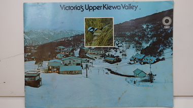
Booklet - SEC x2, 1. Victoria's Kiewa Valley 2. Victoria's Upper Kiewa Valley, No. 2 is dated October 1978
The State Electricity Commission of Victoria built the Kiewa Hydro Electric Scheme and was keen to promote tourism in the area. The booklet includes Facilities, Falls Creek Ski Resort, the Kiewa Works Area, the Three Floras of Bogong, the Geology of the Kiewa area, the Bird and Animal life of Bogong and the Kiewa Hydro Electric Scheme. The colored photos and the map on the back appeal to the reader/tourist.The SECV promoted tourism in the Kiewa Valley especially the area of the Kiewa Hydro Electric Scheme. This booklet is attractive and informative with a lot of detail. This proved to be the early stages of tourism in the area in what is now a very popular tourist destination and the main industry for the Upper Kiewa Valley.Blue cover with photo of Falls Creek at night. Title in black print at the centre top under which is an insert photo of a blue wren and SEC logo in white towards the top far right. Back cover is light green with a tourist map of the area. The text is complimented with brightly colored photos throughout.state electricity commission of victoria; kiewa hydro electric scheme; tourism; bogong; flora; fauna; geology; -
 Kiewa Valley Historical Society
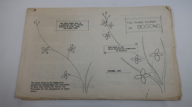
Mills Collection of Papers, 1. Unknown 2. October 1964. 3. Unknown SECV. 4. June 1963. 5. Unknown, Victorian Dept of Education. 6. Unknown SECV
Catelogue of flora and fauna of the 1960s in the Kiewa Region.A collection of papers including: 1. Three poems. 2. The ''Three Floras of Bogong'Oct 1964. 3. 'SEC Bird Life within and adjacent to the Kiewa Works area' recorded between 1963 and 1964. 4. 'General Geology of the Kiewa Area' June 1963. 5. Victorian Department of Agriculture, 'Tobacco', Notes for Students/Geology/Maize Culture/The Buffalo Dam Project/Stamped with 'Hoys Passenger Service Pty Ltd'. 6, SEC Kiewa Region, Forestry and Conservation.No. 5. - Stamped with 'Hoys Passenger Service Pty Ltd'flora, bogong, birds, geology, kiewa valley, tobacco, forestry and conservation, secv -
 Kiewa Valley Historical Society
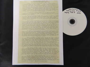
Diary Extract - Trip to Bogong High Plains Xmas 1934 & DVD photos, original diary 1934
The Melbourne Women's Walking Club enjoyed bush walking as a hobby travelling to the north east of Victoria, using pack horses and camping on a 9 day hike. One of the woman, 'Bill' describes each day in detail - what they did, where they went and what they saw giving an insight into walking and the Bogong High Plains in the mid 1930's before the Kiewa Hydro Electric Scheme opened up the area. The diary mentions a photo being taken by Mr Blackwell on the 9th day, New Year's Eve 'from a lovely bush track from which, looking back at intervals we got our final glimpse of Fainter. 5 miles from from our destination'.Historic: This extract from the diary of 'Bill', a member of the Melbourne Women's Walking Club gives an insight into walking in the mid 1930's and describes the Bogong High Plains as it was then before it was opened up with a road built during the Kiewa Hydro Electric Scheme. It describes the area in summer including the flora & fauna, cattle grazing & cattlemen, the huts, the gauges set up by the State Electricity Commission of Victoria, the people working up there, the weather and the lifestyle of the walking group - their food, duties, swimming etc.. Six double sided typed photocopied yellow pages describing the Melbourne Women's Walking Club trip to the Bogong High Plains at Christmas in 1934. Also one page photocopied of the programme for Year 1934-35 with an arrow pointing to the above trip and a page with a photocopied sepia photo of the "Melbourne Women's Walking Club / Bogong High Plains / Dec. 1934. DVD 12 photos of the trip arrow showing trip from Programme. Title of photo "Melbourne Women's Walking Club / Bogong High Plains / Dec. 1934melbourne women's walking club. bogong high plains. camping. pack horses. cattlemen's huts. -
 Eltham District Historical Society Inc
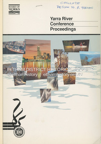
Book, Melbourne Metropolitan Board of Works, Yarra River Conference Proceedings, 1991
Conference staged by the Board of Works to present a range of papers examining the river's environment, recreational uses, natural resources, development, commerce and land use. Conference delegates included representatives from Eltham Shire Council and was held in April 1991. Session 1 Heritage and Environment: Flora and fauna / Paul Gullan. -- Geology and topography / Brian Finlayson. -- Aboriginal culture / Margaret Gardiner. Session 2 History. Session 3: Management plans and policies : overview of responsibilities / Dr Colin Leigh. --Role of the media / Peter Cole-Adams. -- Urban development / Paul Jerome. -- Port of Melbourne area / Leigh McKay. -- Recreation / Ken Marriott. Session 4: Perspectives - the current view. Session 5: Issues, challenges, potential solutions.non-fictionConference staged by the Board of Works to present a range of papers examining the river's environment, recreational uses, natural resources, development, commerce and land use. Conference delegates included representatives from Eltham Shire Council and was held in April 1991. Session 1 Heritage and Environment: Flora and fauna / Paul Gullan. -- Geology and topography / Brian Finlayson. -- Aboriginal culture / Margaret Gardiner. Session 2 History. Session 3: Management plans and policies : overview of responsibilities / Dr Colin Leigh. --Role of the media / Peter Cole-Adams. -- Urban development / Paul Jerome. -- Port of Melbourne area / Leigh McKay. -- Recreation / Ken Marriott. Session 4: Perspectives - the current view. Session 5: Issues, challenges, potential solutions.yarra river, melbourne -
 Greensborough Historical Society
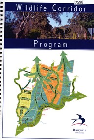
Book, Rik Brown, Wildlife corridor program, 1998
Banyule City Council's program to protect and re-establish wildlife corridors and habitat links within Banyule55 p. black and white illustrations, spiral bindingnative flora, native fauna, banyule city council -
 Greensborough Historical Society
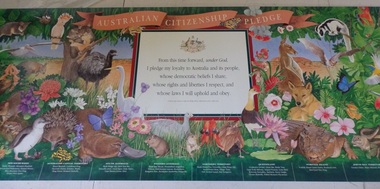
Poster, Australian Citizenship Pledge, 1993_
This poster represents the pledge taken by new Australian citizens during the citizenship ceremony.Poster, colour illustrations.flora and fauna, ceremonies, states, territories, emblems, australian citizenship -
 Kiewa Valley Historical Society
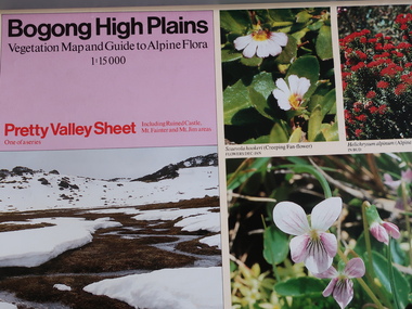
Posters - 5 in series - Published by the Victorian Conservation Trust 1980
Series of five includes: Bogong High Plains - Pretty Valley Sheet, Rocky Valley Sheet and Bogong Sheet. The Hotham Sheet is in the tube but not photographed. The Spion Kopje Sheet is not included. The Victoria Conservation Trust published the posters in 1980Bogong High PlainsThere are 4 sheets - Hotham not photographed. The Victoria Conservation Trust published this series of the Bogong High Plains in 1980. All coloured, glossy and two sided.flora and fauna, bogong high plains, victoria conservation trust -
 Kiewa Valley Historical Society
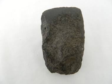
Axe Head, Before European settlement
This item was used well before European settlement and clearly demonstrates the development of the local Aboriginal tribes, Dhudhuroa and Yaitmathang in the use of a cutting /chopping implement, made from Mount William sourced material i.e. greenstone. This item was probably traded at the Bogong Mountain tribal yearly summer ceremoniesThe significance of this item places it at the fore front of human development in this region. The period when this tool was manufactured represents the time when the natural landscape had not been altered and the natural vegetation, fauna and flora, had not been subjected to imported species.This also proves that local tribes did live in this area and or the Bogong High Plains.Small ground edge stone axe head. Leading cutting edge very smooth and chiseled to a fine edge. Weight is, for its size fairly heavy. It is made from Greenstoneaboriginal tool stone ground-edge axe indigenous tool -
 Red Cliffs Military Museum
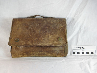
Satchell (leather), (estimated); World War 2
This item of meorabilia was made by J.G.Murphy while he was hospitalised in the Middle East during the 2nd World War. He later became President of the Red Cliffs RSL and a Life Member of the League for service rendered.Brown leather satchell,embossed with Australian flora and forna, front, back and under flap, there is a carry handle on the top. The front features two Kookaburra like birds, under the flap is a Kangaroo and butterfly and folliage on the back. The seams and handle are hand sewn with 2.5mm leather lacing, and there are press studs to hold the flap closed. There are two internal pockets, stitched with fine cotton thread and the stitching is only visable from the inside. satchell leather, embossed leather, native flora, native fauna, past rsl president, j g murphy, hand made leather work, middle east hospital craft, past presidents, life members, rsl, middle east -
 Bendigo Historical Society Inc.
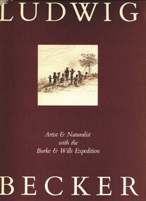
Book - LUDWIG BECKER, ARTIST AND NATURALIST WITH THE BURKE & WILLS EXPEDITION, c1979
Ludwig Becker. Artist & Naturalist with the Burke & Wills Expedition. Brown Dust jacket and clear plastic jacket. Publisher: Melbourne University Press, Carlton. Edited with an Introduction by Marjorie Tipping. Sketches & paintings. Markings/Inscriptions: Bendigo Historical Society stamp. Book signed by Marjorie Tipping. 21st Birthday gift card (business card size): With all Best Wishes on this most important occasion, H C Lee-Archer, Nov 1979. Pres RHSVMarjorie Tippingbook, burke & wills, ludwig becker, burke & wills expedition, h c lee-archer rhsv, australia history, flora fauna -
 Bendigo Historical Society Inc.
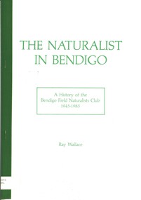
Book - THE NATURALIST IN BENDIGO - HISTORY OF BENDIGO FIELD NATURALISTS CLUB 1945 - 1985, 1985
The Naturalist in Bendigo. 59 pages with photos and illustrations. Preface by Professor R.W. Home. A history of the Bendigo Field Naturalists Club.Ray Wallacebendigo, clubs, bendigo field naturalist club, bendigo field naturalists club, flora and fauna, natural history. -
 Bendigo Historical Society Inc.
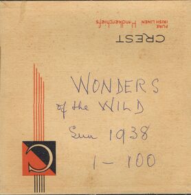
Newspaper - LYDIA CHANCELLOR COLLECTION: WONDERS OF THE WILD
A handkerchief box containing 'The Sun-News Pictorial,' cuttings on 'The Wonders of the Wild.' These clips contain photos of Insects, flora, birds, fish, lizards, snakes, trees, marine animals. In serial form 1-100. Dated 1938.Wonders of the Wild. Sun 1938. 1-100place, land, wildlife, lydia chancellor, collection, wildllife, australian flora, australian fauna, plants, animals, australian plants, australian animals, australian wildlife, marine life, australian marine life, australia, sciences -
 Bendigo Historical Society Inc.
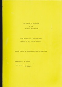
Book - THE EFFECTS OF RECREATION ON THE WHIPSTICK FOREST PARK, 1983
The Effects of Recreation on the Whipstick Forest Park a Social Science III B research paper Bachelor of Arts (Social Science) Bendigo College of Advanced Education. 51 pages with maps.Anne Butlerbook, bendigo, whipstick, whipstick forest, land conservation, flora & fauna. -
 Nillumbik Shire Council
Public Art: Helen BODYCOMB (b.1964, South Australia) and Enver CAMDAL (Lives and works Turkey), Enver Camdal et al, Nest (Location: Roundabout, Main and Luck Street, Eltham), 1997
Commissioned by Nillumbik Shire Council - 1997 The selection panel in the commissioning process to this 'extraordinary acquisition' was Rhonda Noble, Director of La Trobe University Museum of Art, Jeph Neale, Eltham Roundabout Advisory Group, Chris Marks, NSC Curator of Collections, Geoff Glynn, NSC Manager of Infrastructure Development.'Nest' highlights the indigenous flora and fauna of the Shire. The stiff, coarse grass used to create the nest is indigenous to the area and the eggs are like those of the spotted quail thrush, a ground-nesting bird of the Shire. The circular flow or placement of the eggs recalls the revolution of the seasons and nesting cycles. There is a tall light pole above the eggs, shining down at night. The effect is of a giant incubator. Enrichment and nurturing of the larger environment can be associated with this sculpture. This work resembles a large bird's nest, with three egg-like forms of fibreglass covered in a pebble render, set on sand. The nest is positioned within the paved boundary of the roundabout. The nest shape has been created out of stiff, coarse indigenous grass, periodically trimmed so the view is not obstructed. The eggs are a brown-speckled, creamy yellow colour. The three eggs are arranged in a ring, with the narrow end of each pointing to the large end of the next, in a circle that mimics the flow of traffic. N/Apublic art, nest, eggs, eltham, ekphrasis2017, mosaic, pebbles, roundabout, spotted quail thrush -
 Nillumbik Shire Council
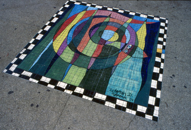
Floor mosaic: Deborah Halpern (b.1957 Melb.), Deborah Halpern, The Spirit of Nillumbik (Mosaic), Location: Eltham Town Square - Main St, Eltham, 2001
In October 2000, Council invited three artists from the region (Deborah Halpern, Matcham Skipper, Tony Trembath) to submit designs for a sculpture / public art work for the Eltham Town Square. The commission was paid for by supermarket giant Safeway (Woolies) as part of its supermarket permit, which required them to contribute to beautification work in the Town Square. This is the second of three parts. The 'Spirit of Nillumbik' is a celebration of the artistic spirit of Eltham and surrounding communities. Each area is identified through the flora and fauna represented in the panels. The work honours the many creative artists and architects, past and present, who have built homes and shaped lives and livelihoods with their unique creative spirit. Halpern describes her work as a public expression of their individual and collective visions. Halpern acknowledges these contributions to our hand-made history and the influence they have on the character and identity of Eltham and Nillumbik. Square floor mosaic. Black and white chequered border. Multicoloured coiled snake intercepted with six multicoloured peaks. Made up of small mosaic tiles and hand painted. Hand painted artist signature bottom right hand side. 'Deborah D. Halpern '01'eltham, halpern, mosaic, snake, square, laurence, painted, tiles, spirit, nillumbik -
 Nillumbik Shire Council
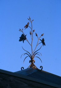
Sculpture (finial): Malcolm Laurence (b.1974 Melb), Malcolm Laurence, Chocolate Lilies: The Spirit of Nillumbik Location: Eltham Town Square - Main St, Eltham, 2001
In October 2000, Council invited three artists from the region (Deborah Halpern, Matcham Skipper, Tony Trembath) to submit designs for a sculpture / public art work for the Eltham Town Square. The commission was paid for by supermarket giant Safeway (Woolies) as part of its supermarket permit, which required them to contribute to beautification work in the Town Square.This is the third of three parts. The 'Spirit of Nillumbik' is a celebration of the artistic spirit of Eltham and surrounding communities. Each area is identified through the flora and fauna represented in the panels. The work honours the many creative artists and architects, past and present, who have built homes and shaped lives and livelihoods with their unique creative spirit. Halpern describes her work as a public expression of their individual and collective visions. Halpern acknowledges these contributions to our hand-made history and the influence they have on the character and identity of Eltham and Nillumbik.Realistic depiction of 'chocolate lilies' in wrought iron (three flowers in bloom, four large buds and six small buds). Chocolate lilies are indigenous to Nillumbik.N/A -
Koorie Heritage Trust
Document - Printed Sheets, Beaglehole, J. C, The Endeavour Journal of Joseph Banks 1768-1771 Volume II
Figs.; maps; footnotes; 21 cm.australia-east coast (nsw) fauna and flora., australia-exploration. -
Koorie Heritage Trust
Book, Beauglehole, A. C, The Distribtion and Conservation of Vascular Plants in the South Gippsland area, Victoria, 1984
i-iii; 90 P.; fold-out map on end-cover; tables; maps; ill.; appendices.21 cm.south gippsland, vic.-fauna and flora. -
 Bendigo Historical Society Inc.
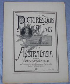
Journal - Picturesque Atlas of Australasia
The Picturesque Atlas of Australasia was released in 42 supplements between 1886 and 1889 and attracted over 50,000 subscribers. Produced by the Picturesque Atlas Publishing Company in Wynyard Square, Sydney. The company was established in 1885. Edited by Andrew Garran. For detailed information search the website of the National Library of Australia. Thirty-three parts. Volume 9 to Volume 42. Volumes 1 - 8 and 28 are missing. Light tan coloured covers have a printed central rectangular double border. The title and publication information and illustrations are printed inside the border. The illustrations included are Captain Cook, a sailing ship and a sprig of wattle. The pages include many black and white illustrations. Volume 16 Separate map of Fiji. This Volume covers Bendigo as one of Victoria's country towns Volume 27 Includes separate Railway, Postal and telegraph map of Queensland. Volume 42 This last Volume contains a Miscellaneous section at the back with an Editorial Postscript and two maps - Australia and The Solar System.australasia, flora and fauna, subscription, history, exploration -
 Mrs Aeneas Gunn Memorial Library
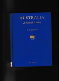
Book, T. Nelson and sons, Australia : a general account - history, resources, production, social conditions, 1929
Outline of geography, European exploration and settlement, economic development, social condition, flora and fauna; includes a brief general account of Aboriginal culture.Index, Ill, maps, p.272.non-fictionOutline of geography, European exploration and settlement, economic development, social condition, flora and fauna; includes a brief general account of Aboriginal culture.australia - social life and customs, australia - history -
 Mrs Aeneas Gunn Memorial Library
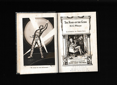
Book, HG Wells, The food of the gods, 1904
Published in 1904, this forgotten classic is sci-fi and dystopia at its best, written by the creator and master of the genreFollowing extensive research in the field of growth, Mr. Bensington and Professor Redwood light upon a new mysterious element, a food that causes greatly accelerated development. Initially christening their discovery The Food of the Gods, the two scientists are overwhelmed by the possible ramifications of their creation. Needing room for experiments, Mr. Besington chooses a farm that offers him the chance to test on chickens, which duly grow monstrous, six or seven times their usual size. With the farmer, Mr. Skinner, failing to contain the spread of the Food, chaos soon reigns as reports come in of local encounters with monstrous wasps, earwigs, and rats. The chickens escape, leaving carnage in their wake. The Skinners and Redwoods have both been feeding their children the compound illicitlytheir eventual offspring will constitute a new age of giants. Public opinion rapidly turns against the scientists and society rebels against the world's new flora and fauna. Daily life has changed shockingly and now politicians are involved, trying to stamp out the Food of the Gods and the giant race. Comic and at times surprisingly touching and tragic, Wells' story is a cautionary tale warning against the rampant advances of science but also of the dangers of greed, political infighting, and shameless vote-seeking. Collapse summaryIll, p.311.fictionPublished in 1904, this forgotten classic is sci-fi and dystopia at its best, written by the creator and master of the genreFollowing extensive research in the field of growth, Mr. Bensington and Professor Redwood light upon a new mysterious element, a food that causes greatly accelerated development. Initially christening their discovery The Food of the Gods, the two scientists are overwhelmed by the possible ramifications of their creation. Needing room for experiments, Mr. Besington chooses a farm that offers him the chance to test on chickens, which duly grow monstrous, six or seven times their usual size. With the farmer, Mr. Skinner, failing to contain the spread of the Food, chaos soon reigns as reports come in of local encounters with monstrous wasps, earwigs, and rats. The chickens escape, leaving carnage in their wake. The Skinners and Redwoods have both been feeding their children the compound illicitlytheir eventual offspring will constitute a new age of giants. Public opinion rapidly turns against the scientists and society rebels against the world's new flora and fauna. Daily life has changed shockingly and now politicians are involved, trying to stamp out the Food of the Gods and the giant race. Comic and at times surprisingly touching and tragic, Wells' story is a cautionary tale warning against the rampant advances of science but also of the dangers of greed, political infighting, and shameless vote-seeking. Collapse summary science fiction - england, artificial foods -
Friends of Ballarat Botanical Gardens History Group
Work on paper - Two Talks by Peter Butters, Yuille's Swamp and Our Botanical Gardens
Both articles give valuable brief histories of Lake Wendouree and Ballarat Botanical Gardens.These 2 articles explain how Lake Wendouree and the Ballarat Botanical Gardens came to be highly regarded for leisure time activities, for the study of flora and fauna and the parks and gardens.The 1st article, Yuille's Swamp is 31/2 pages of print with Peter Butters name added on p.4. The 2nd article, Our Botanical Gardens, is also 31/2 pages of print with Peter Butters name added on p.4.With the 1st article "Roy and then Peter Butters Talk, Guiding Group, 24/9/97" is written in blue biro, top righthand corner. Nothing is written in longhand on the 2nd article.john garner, doctor john garner, ballarat botanical gardens, friends of ballarat botanical gardens, yuille's swamp, lake wendouree, black swamp, tourism, eugene von guerard, gnarr creek, ballarat water supply, gong reservoir, view point, trams, fry's mill, .mining, english birds, acclimatization society, fish, carp, cormorants, reeds in lake wendouree, acquatic sports, steam boats, george longley, marble statues, trees, fernery, john garner collection, gardens, ballarat -
 Phillip Island Conservation Society Inc.
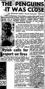
Work on paper - newspaper cutting photocopy, "THE PENGUINS/ - IT WAS CLOSE" & "Rylah calls for/report on fires"
Short tailed shearwaters and Little Penguins, nesting in burrows on the coast during the warmer months of the year, are extremely vulnerable to fires. Phillip Island had a history of fires on foreshores – either deliberately or accidentally lit. This article describes 2 accidentally lit fires on consecutive days at the Phillip Island Penguin Parade rookeries during the height of the breeding and tourist season in January 1967. The vital importance of volunteers such as the country Fire authority members and the local surfing community, is alluded to in this article by well-known naturalist and author from the time, Graham Pizzey. The Victorian government’s chief secretary, Arthur Rylah, reported here seeking an investigation into the fires at what he terms: “one of the best conservation projects we have done”, was a prominent Victorian politician for many years.This article is significant for demonstrating a growing awareness of the vulnerability of ground nesting birds, of the importance in volunteers such as members of the local country Fire authority and Phillip Island surfing community partnering with wildlife management bodies to protect ground nesting birds, in particular the Penguin and short tailed shearwater rookeries at the Phillip Island Penguin Parade and other parts of Phillip Island. The article also reflects the growing awareness by the Victorian government of the importance of the Phillip Island Penguin Parade to the Victorian tourism economy. Written by naturalist Graham Pizzey, wrote regularly for the Melbourne Herald, the article is another example of how this journalist frequently emphasised Phillip Island’s flora and fauna in his newspaper column.Photocopy made in 1980s of newspaper cutting. Black print and black and white images of original photograph of author Graham Pizzey within the article.5/1/67little penguins, fairy penguins, eudyptula minor, phillip island penguin parade, graham pizzey, penguin rookery, penguin behaviour, phillip island tourist attractions, short tailed shearwaters, phillip island conservation society, arthur rylah, victorian government, phillip island cfa, phillip island surfers, fires on foreshores -
 Phillip Island Conservation Society Inc.
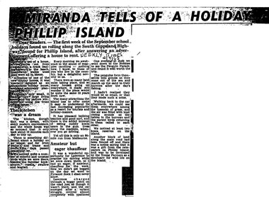
Work on paper - Photocopy of newspaper cutting, Herald and Weekly times, "MIRANDA TELLS OF A HOLIDAY ON/ PHILLIP ISLAND"
Miranda was a very popular journalist of this era, whose homely style appealed to many readers, especially women, her main audience in her writing. Here she talks about renting a new demonstration holiday home (probably a Coldon Home), which, although small, had a 'dream kitchen'. She describes the birds and walk through the wattle to the beach, but also the many blocks for sale and wonders what the island will be like in 10 years time from their visit. Her son drove them to Pyramid Rock where they almost got bogged on the road. They visit the usual spots, which she describes with a combination of curiosity and enjoyment. She also mentions another block fenced off on the main road which was a gift from the ratepayers of Phillip Island, and which the Young Farmers were to plant out for koala trees.This article is significant because thousands of Weekly Times newspaper readers read Miranda’s letter article without fail each edition. She describes renting a house for a holiday, which indicates the move away from family holidays in guest houses. She also describes some of the rough roads in parts of the island at the time. She concentrates on the island’s natural attractions rather than man- made tourist attractions, which is also significant in letting us see why people would visit Phillip Island in that era. Miranda also predicts the explosion of the holiday home owner market which took place soon after, and continues today though in a more controlled way.Photocopy of newspaper article cut out from full page. Cutting has three columns of text, no images. Black text on white paper. Dark areas due to poor photocopyingWEEKLY TIMES / 2/9/65phillip island, miranda, weekly times newspaper, holiday home, phillip island flora and fauna, pyramid rock, phillip island pengiun parade, young farmers, phillip island beaches, cuddly koala bears, phillip island housing estate land sales -
 Wodonga & District Historical Society Inc
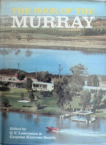
Book - The Book of the Murray, Lawrence, G. V.; and Smith, Graeme Kinross, 1975
This book contains contributions from 16 writers who have first-hand knowledge of the Murray River area. It provides a comprehensive picture of the river in all its aspects. It gives a fascinating look at one of Australia's most important geographical and historical features. Contributors and chapters in this book are: - 1. Past, Present and Future – G. V. Lawrence 2. The Structure of the Murray – Edmund D. Gill 3. Seeing the Murray – Graeme Kinross Smith 4. The Mountains at the Source – Elyne Mitchell 5. The Explorers – Leigh Betheras 6. The Irrigators – G. Arch Grosvenor 7. Murray Water Conservation – W. G. L. Harrison & K. E. Johnson 8. The Murray River Steamers – Ian Mudie 9. Pioneer Days: A Story of Seventy Years Ago – Dorothy Roysland 10. Birdlife of the Murray Valley – John Eckert 11 .Aborigines in the Murray Valley, How We Learned the Story – H. A. Lindsay, The Aboriginal Occupation – Norman B. Tindale 12. Fish of the Murray River – John S. Lake 13. Native Plants of the Murray Valley – J. H. Willis 14. Murray Wildlife – K. N. G. SimpsonThis publication has a hard cover with blue boards and a pictorial dust jacket. It consists of 264 pages.This book contains contributions from 16 writers who have first-hand knowledge of the Murray River area. It provides a comprehensive picture of the river in all its aspects. It gives a fascinating look at one of Australia's most important geographical and historical features. Contributors and chapters in this book are: - 1. Past, Present and Future – G. V. Lawrence 2. The Structure of the Murray – Edmund D. Gill 3. Seeing the Murray – Graeme Kinross Smith 4. The Mountains at the Source – Elyne Mitchell 5. The Explorers – Leigh Betheras 6. The Irrigators – G. Arch Grosvenor 7. Murray Water Conservation – W. G. L. Harrison & K. E. Johnson 8. The Murray River Steamers – Ian Mudie 9. Pioneer Days: A Story of Seventy Years Ago – Dorothy Roysland 10. Birdlife of the Murray Valley – John Eckert 11 .Aborigines in the Murray Valley, How We Learned the Story – H. A. Lindsay, The Aboriginal Occupation – Norman B. Tindale 12. Fish of the Murray River – John S. Lake 13. Native Plants of the Murray Valley – J. H. Willis 14. Murray Wildlife – K. N. G. Simpsonmurray river, australian geography, settlement on the murray river, native plants, aborigines in the murray valley, murray valley flora and fauna -
 Wodonga & District Historical Society Inc
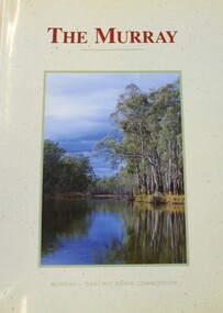
Book - THE MURRAY, Norman Mackay and David Eastburn, 1990
A study of the Murray River system, commissioned by the Murray Darling Basin Commission and published in 1990. This book provided a starting point for the understanding needed to make sustainable development og the Murray-Darling system an achievable goal. It provides a basis for action to halt futher degradation of the River and to rehabilitate its damaged environment. The picture that emerges from this volume is of a river in decline but not yet beyond saving. It covers topics such as groundwater and salinity, the associated fauna and flora, the surrounding environment, and the human impact. Illustrated with maps, diagrams and colour photographs. Includes a glossary and an index.non-fictionA study of the Murray River system, commissioned by the Murray Darling Basin Commission and published in 1990. This book provided a starting point for the understanding needed to make sustainable development og the Murray-Darling system an achievable goal. It provides a basis for action to halt futher degradation of the River and to rehabilitate its damaged environment. The picture that emerges from this volume is of a river in decline but not yet beyond saving. It covers topics such as groundwater and salinity, the associated fauna and flora, the surrounding environment, and the human impact. Illustrated with maps, diagrams and colour photographs. Includes a glossary and an index.upper murray region, murray river ecology, stream ecology murray river